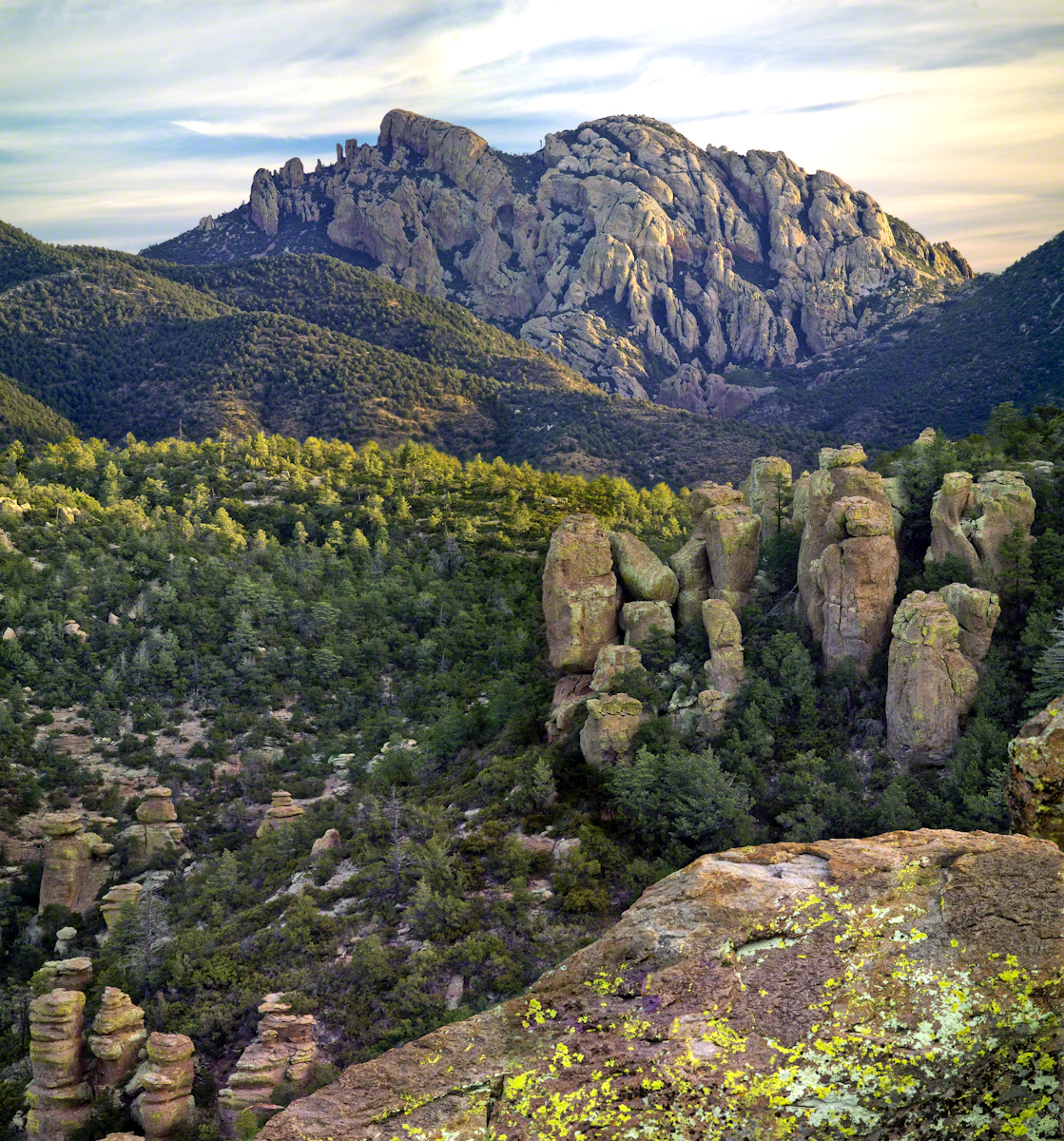
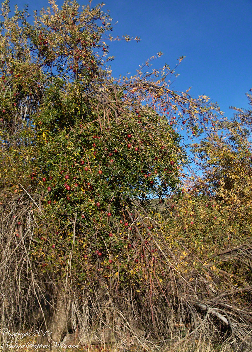
From 2004 through 2011 I visited Arizona every Autumn, October or November. As a University of Arizona Alumni Board member for the College of Agriculture and Life Sciences we had a meeting during “homecoming” and a fund raising event. I’d come early or stay later for getting acquainted with Arizona, more than was possible as an undergraduate. In 2007 I camped for several days Chiricahua National Monument of the remote south eastern corner of the state.
The park empties out this time of year, for some reason. The weather is perfection with clear skies, moderate daytime temperatures, cool nights. This time of year the Arizona White Oak acorns ripen and fall. The campground has aluminum picnic tables, the falling acorns made a loud plunks throughout the night. This would annoy some people. Me, it is a great memory.
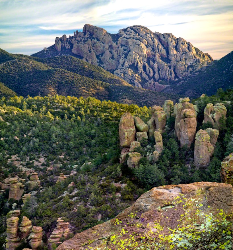
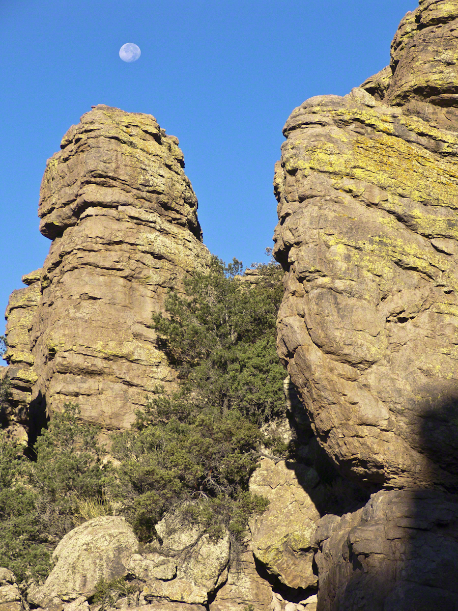
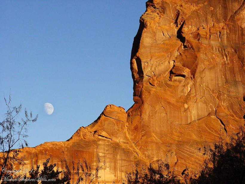
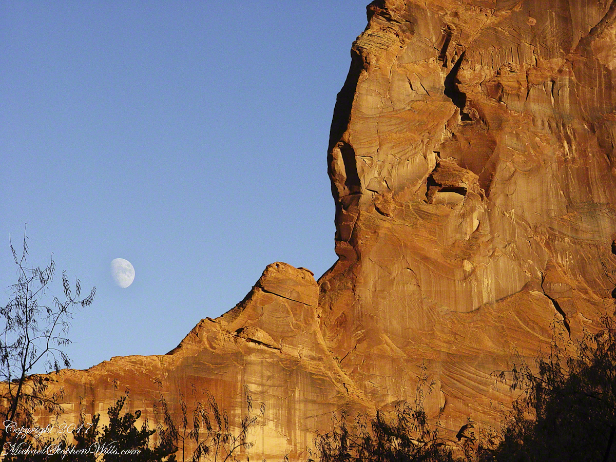
The following two images are great memories from my first morning.
Click any photograph for my Online gallery.
These formations hovered over the trail on my first morning. The rising full moon was an unplanned bonus.
I experimented this trip with a breakfast of granola with dried whole milk. It was delicious (for me) and got me out on the trail quickly. This first morning I clicked my hiking poles together to scare away bears as I walked in the pre-dawn dark. The preparation and extra effort paid off with this photograph.
Click any photograph for my Online gallery.
I met one hiker who was a harbor pilot from Hamburg, Germany. He came just to view a particular rock formation that was, literally, the rubber bath duck. It is several miles to the site, a moderate hike with significant elevation gain. He took his snapshot with a little camera and was on his way.
The following is my masterpiece from the trip. Imaging the effect of seeing this image on settlers. That same first day I turned a corner and there this was…it took a few minutes to comprehend what I saw, it was so incredible and, for me, unexpected. It first, the only perception is a huge rock dome of rough rock, then, slowly, the image of a native American profile forms in the mind. Cochise Dawn
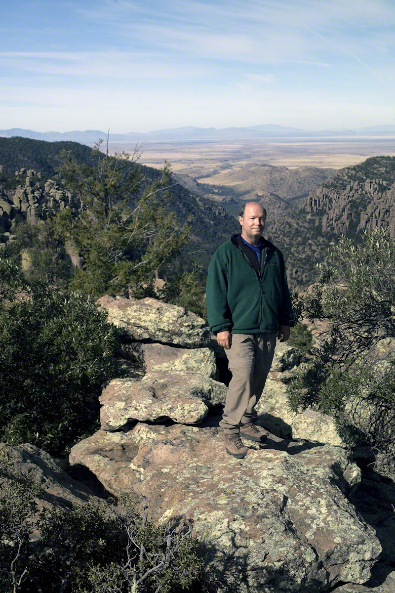
During the session for Cochise Dawn I turned the camera for the view northwest and did a self portrait. In the distance are the Galiuro Mountains and Wilderness. Tucked alongside is the Aravaipa Canyon Wilderness, hosting one of the few perennial streams of Arizona.
Copyright 2017 Michael Stephen Wills All Rights Reserved
In my post Canyon of Music, Wind, Light I shared a different photograph of this beetle crawling on sandstone, naming it as a “dung beetle”. I had assumed it was one from once having seen a beetle in an Arizona desert pushing a ball of dung around. This morning, to confirm my assumption, I searched for images of “Arizona Dung Beetle” and was dismayed to find this beetle shares no characteristics with the photographs. Absent smoking gun evidence, sadly lacking in this photograph, I have to admit my “dung beetle” attribution is in error.
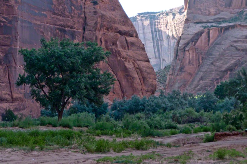
Supporting the beetle, the luminous surface of the red sandstone named “de Chelly,” sunlight reflects from durable remnants of the ancestral Rocky Mountains wore to these bits of rock, piled to mountainous dunes by the winds of tens of thousands years, polished to smoothness each against the others.
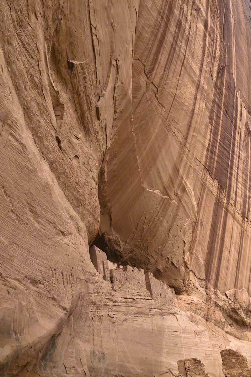
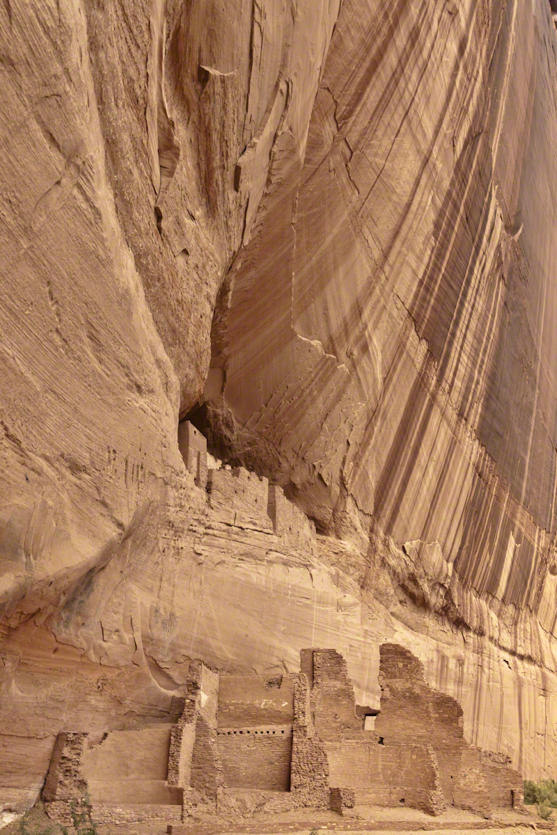
Mysterious abrasion and grooves in a de Chelly sandstone cliff, Canyon de Chelly.
The above photograph is a detail from the brightly lit cliff of the following photograph. The desert varnish and underlying rock was weathered over thousands of years, the sand grains falling to the canyon floor.
The soil of the canyon is composed of these bits of the ancestral Rocky Mountains. What appears to be a white road in the above photograph is not man-made, it is the dried bed of a stream. When a waterway is dry like this, only flowing with rains, it is called a wash. When water fills the wash of the Canyon Del Muerto, the polished sand granules become a dangerous morass, sucking down horses, people, anything unlucky enough to step into it. Every movement, struggling for freedom, pulls the victim deeper down until the wet sand closes over the head and suffocation and death ensues.
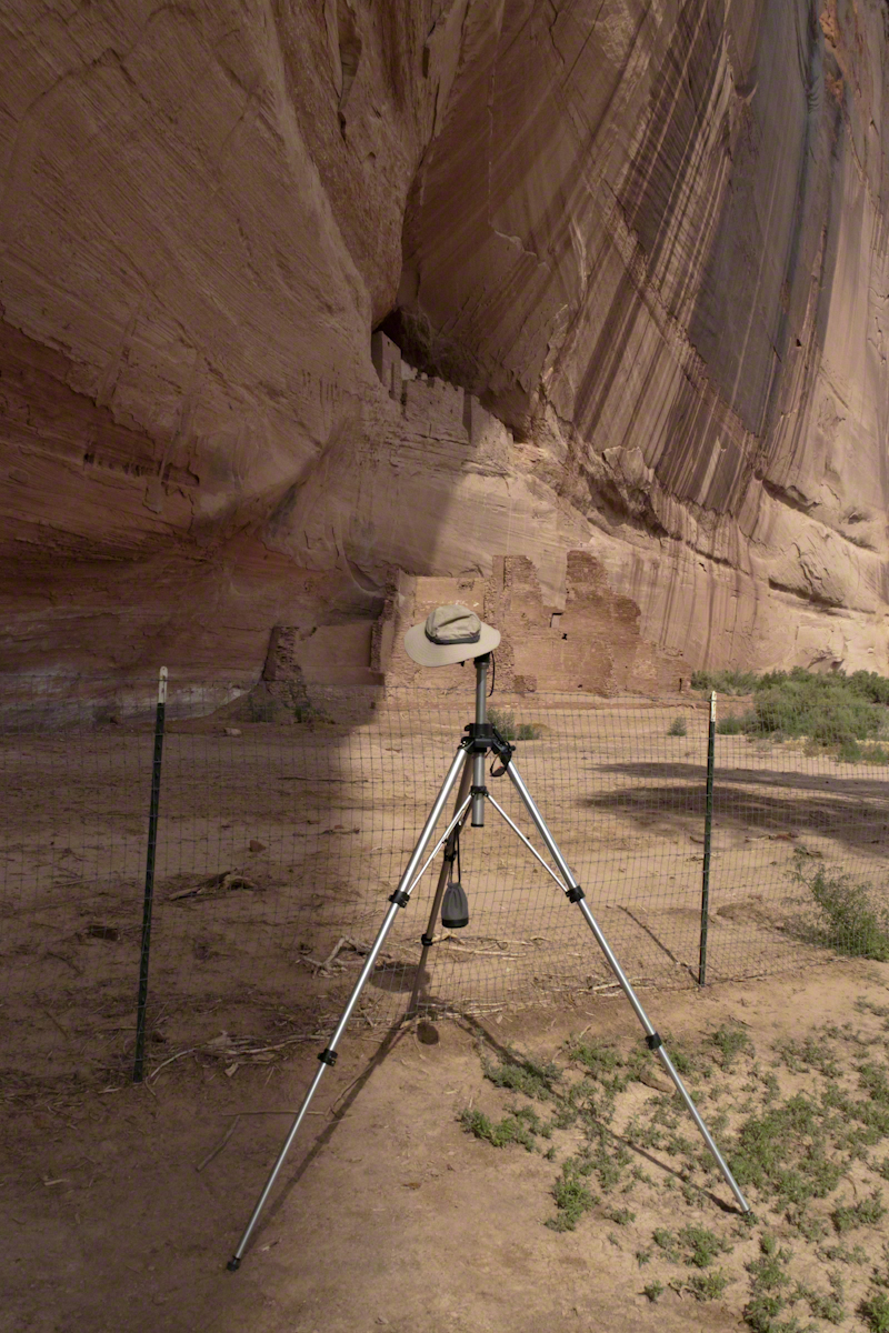
Stairs cut into the sandstone cliff of Canyon de Chelly
The waters Canyon De Chelly National Monument naturally form a vast Y into the Defiance Plateau, naturally because two major streams merge into one canyon a few miles above Chinle. On both our guided trips, heading east from Chinle there is a branch. On the right De Chelly canyon continues. On the left is Canyon Del Muerto. The photos in this post are all from “The Canyon of the Dead”, what the name means translated into English.
No, it is not named this because of the quicksand. Conditions for quicksand are present throughout canyons of the southwest. It is history of human occupation for which this canyon was named. I will cover it in a future posting. For now, I will say the above views are from the spot featured in “Family Trek.”
My first visit, in 2003, while my son Sean climbed the rocks with our guide, I was left to document the wondrous surroundings. The above shallow cave is reached by that stairway carved into the precipitous ledge. The access to the cave is via those naturally occurring ridges of the cross bedded sandstone. It is another example of De Chelly sandstone formed from the windblown edge of a monstrous ancient sand dune.
A solid block of De Chelly sandstone formed from the central bulk of a sand dune.
Here is another example of rock formed from the solid body of the sand dune, that unbroken and un-striated cliff. Below is the cross-bedded, windblown sand.
Autumn lights up the floor of Canyon De Chelly, the foliage rivals the cliffs for wonder at this time.
As we proceeded generally east from the climbing spot of “Family Trek”, driving by the golden cottonwood foliage I asked the guide to stop for these photographs.
Canyon walls
Soon the cliffs hid the sun.
Notice the modern water distribution system (pipe) at the foot of cliff on right. These vast tracks of shadow adjacent to bright sunlight are a fact of life for canyon dwellers, a source of joy and wonder.
The canyon here is rather like the Narrows of Zion, without the water.
These photographs were taken the last days of August 2021, the 26th and 27th, while exploring Burlington County, New Jersey, with my sister. I will be writing about our Thursday and Friday for awhile, starting with today’s installment.
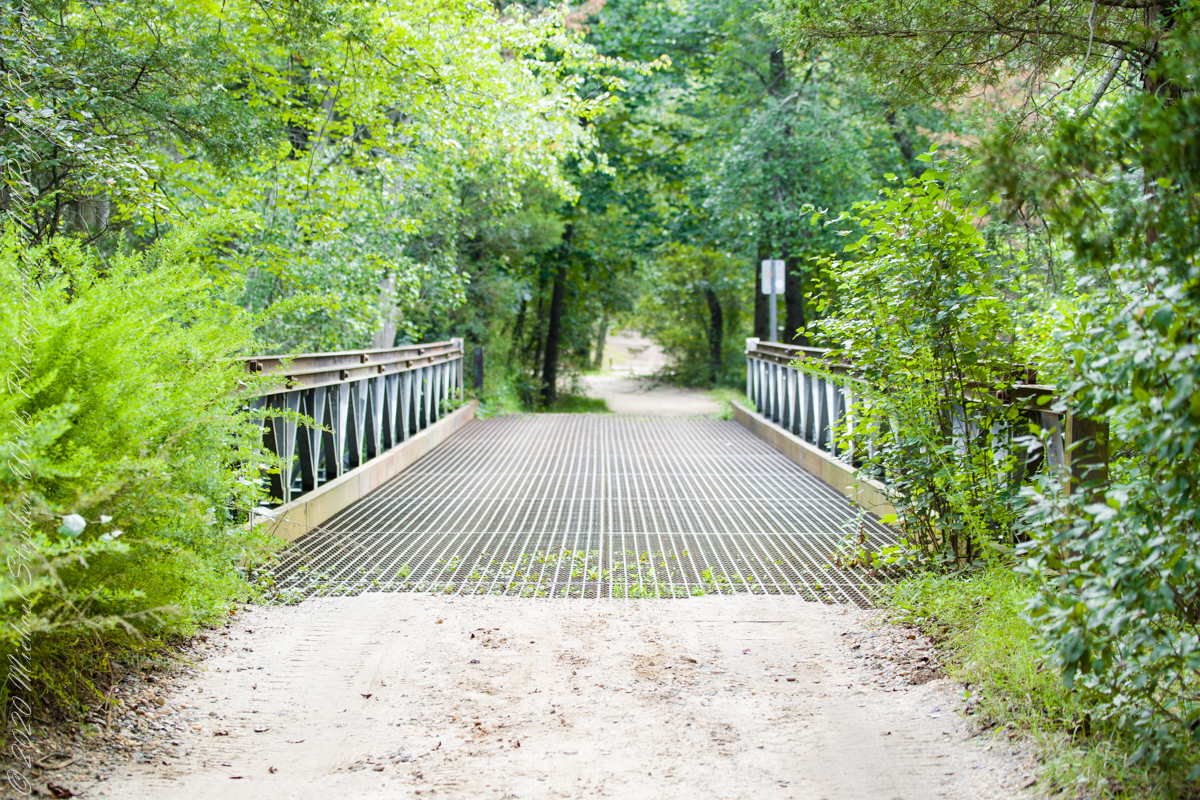
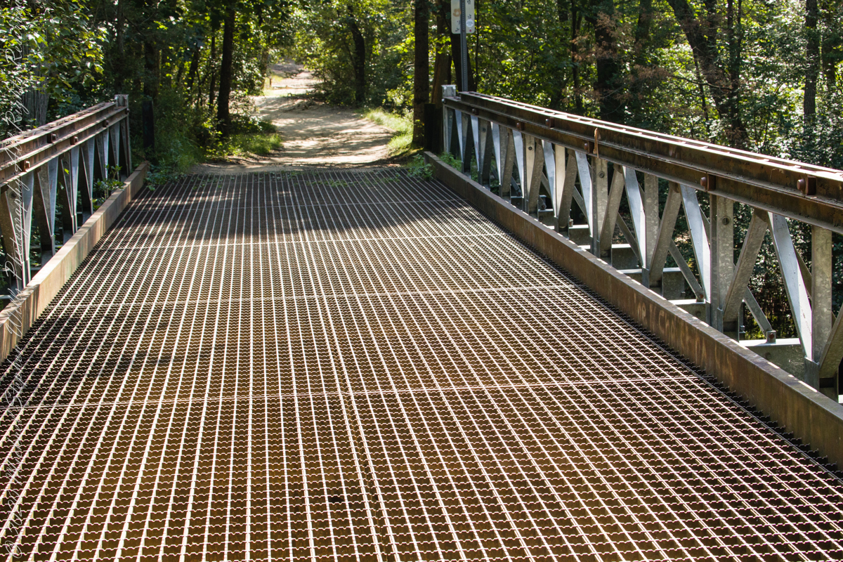
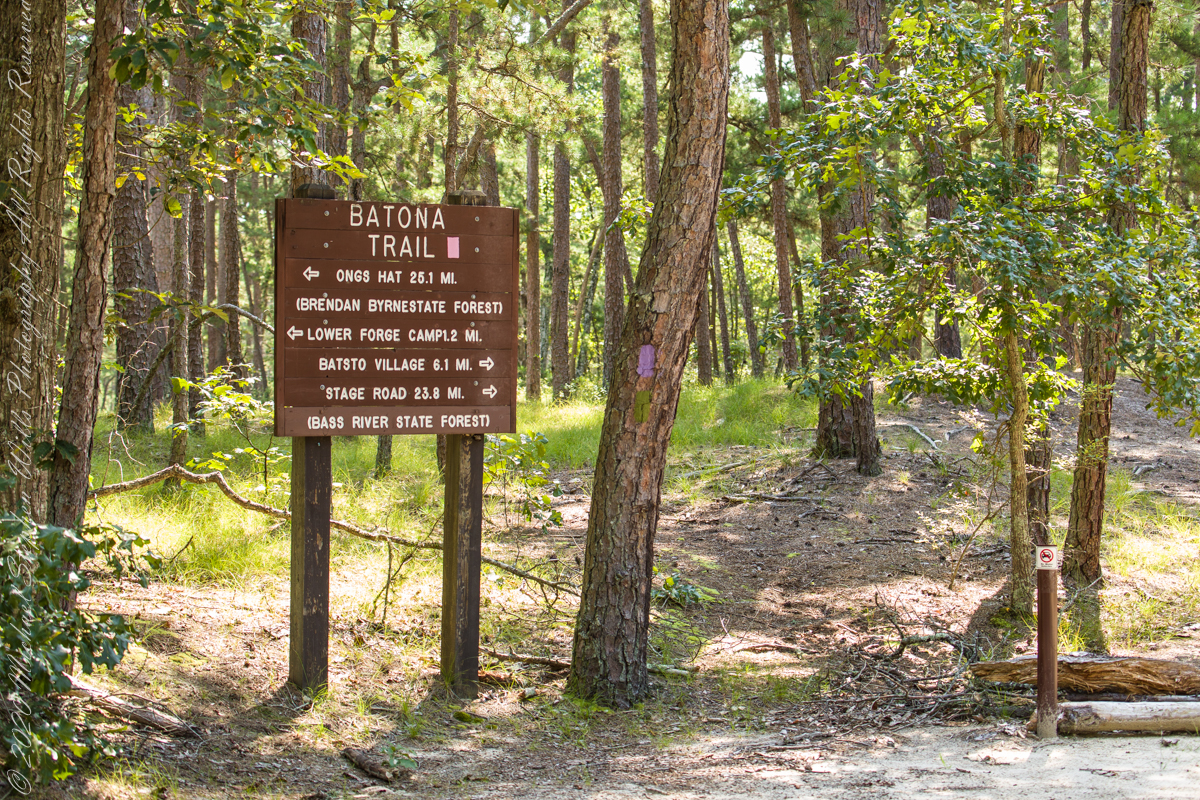
Quaker Bridge Road traverses the wilderness of Wharton State Forest with a beginning off Route 206, Atsion Mansion. Our planning included Jeep Wrangler rental, only high-clearance 4-wheel vehicles are appropriate, the road surface is humpy sand, water filled holes abound. Still, sitting there at the start, with Atsion Mansion house in view, I waited awhile until a high clearance tour bus packed with adventurers, kayaks passed into the pines and out of sight. We proceeded an uneventful ~4 miles to Quaker Bridge at a stately 5 miles per hour, invoking four-wheel drive low gear a mile or so in.
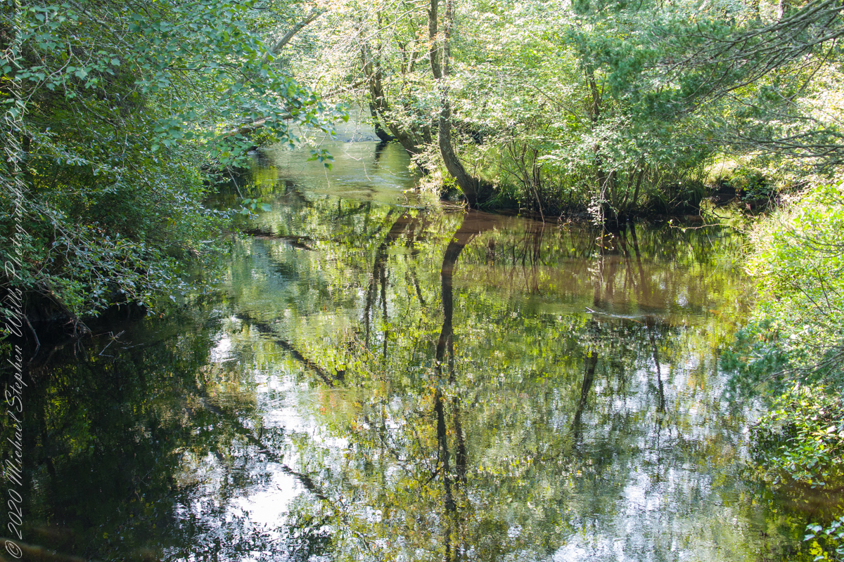
Here is Quaker Bridge over Mullica River today, facing East.
Mullica River from Quaker Bridge facing downstream
Quaker Bridge road was a well traveled main route through the Pines for almost a hundred years with an inconvenient crossing of The Mullica at this point. During the year 1774, some sa 1772, West Jersey Quakers travelling to the Little Egg Harbor Yearly Meeting, started “a day early”, built a bridge. From a c.1940 photograph it is clear in that “day” they felled large trees for pilings, smaller trees, pines and cedars, for the other bridge elements. Since then, the crossing has been called “Quaker Bridge.”
Over time, the east side became a resting place, with at least one Inn/Tavern. Here is the east side today.
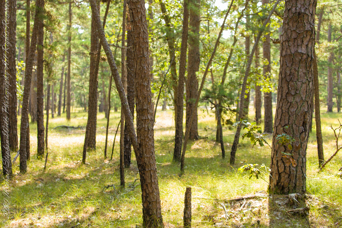
Even without hospitality and bustling humanity, after 4 miles of dreary road from Atsion this spot carries a sense of lightness, the well spaced straight pines over several acres conveying peace and rest. Over 35 miles from the ocean, the white sand presents as beach. There is a reason for this feeling, a 15 million year reason.
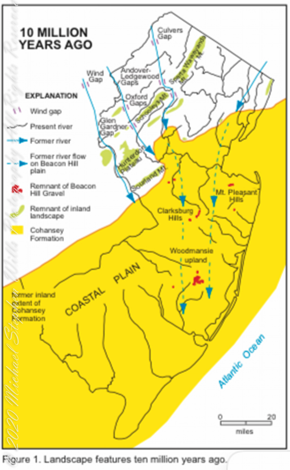
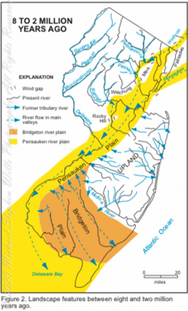
Visual presentation of Pinelands geologic origins, from New Jersey Geologic Survey, Scott Stanford author, 2005.
Between 15 and 10 million years ago the earth climate turned colder, so much water evaporated from the oceans to fall as snow and ice in the polar regions ocean levels fell 150 to 250 feet. As the ocean fell away, over eaons, mountains to the west were ground down, pulverized by the elements to flow, gather on the exposed plain. The white “beach” sand we see today, at Quaker Bridge and other Pinelands places, are surfaces of this “Cohansey” sands and clay ranging in thickness from 25 feet in the west to more than 300 feet at the Atlantic Ocean.
Over millions of years the land raised to become the drainage patterns we see today. The renewable resources of “bog iron” and water spring from this history.
Visual presentation of Pinelands geologic origins, from New Jersey Geologic Survey, Scott Stanford author, 2005.
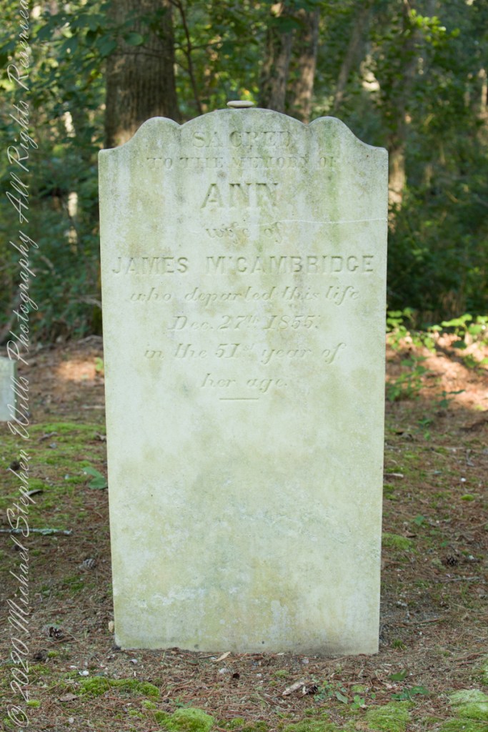
Standing there I imagined Great Great Grandmother Ann (Milley) McCambridge resting on the journey from the McCambridge home near Speedwell. I placed the pebble, collected from Long Island Sound, on Grandmother Ann’s headstone the evening of August 26th. Click this link for more about Ann McCambridge.
Sacred to the Memory of ANN wife of James McCambridge who departed this life December 27th 1855 in the 51st year of her age.
Reference
I found Quaker Bridge background in “Heart of the Pines, ghostly voices of the Pine Barrens” by John E. Pearce, pp 748 – 750, Batsto Citizens Committee, 4110 Nesco Road, Hammonton, N.J. 08037-3814.
November 2003 my son, Sean, and I drove up route 191 from the Petrified Forest National Part to arrived at Chinle on a November afternoon. In 2003 my photography kit included a Sony Point and Shoot 5 MP camera with filters, an over the shoulder (purse type) bag and an inexpensive “Kmart” tripod.
We found the White House trailhead, hiked down essentially alone as the sun set at 5:20 pm. At that time, a thick stand of Russian Olive trees choked the wash. We stopped at this point in the gathering dark. I took this distant shot of the White House Ruin against the Russian Olive autumn foliage. A stand of Cottonwoods growing near the canyon wall had yet to turn their brilliant yellow. At that time, the White House Ruin was painted white.
When Pam and I visited July 2008, in the intervening 4 years, 9 months the Russian Olives were removed as an invasive species, the ruin was no longer white.
There is one highway headed south in the Four Corners region of Northern Arizona, the same route 191 Sean and I took. In 2008 Pam and I came from Colorado south on 191, also arriving late afternoon.
That July day the sun set 8:33 pm as the Navajo Reservation observes daylight savings time. My goal was to photograph the White House Ruin I missed in 2003. We arrived at the trail head. My photography kit was expanded from 2003, now included a Kodak DSC Pro slr/C, the “C” meaning “Canon” lens mounting, a Sony 700 alpha slr (I only use a variable lens), Manfrotto tripod with hydrostatic ball head, and the backpack style Lowe camera case. With the tripod it is over 25 pounds.
With this on my back I was prepared to boogie down the trail. At the height of tourist season there were many more people at the trailhead. Pam, being a friendly person, started a conversation while I ploughed ahead along the flat canyon rim. It is solid red sandstone, beautiful, generally level with enough unevenness to require attention. When Pam saw how far ahead I was she tried to catch up, tripped, fell hard.
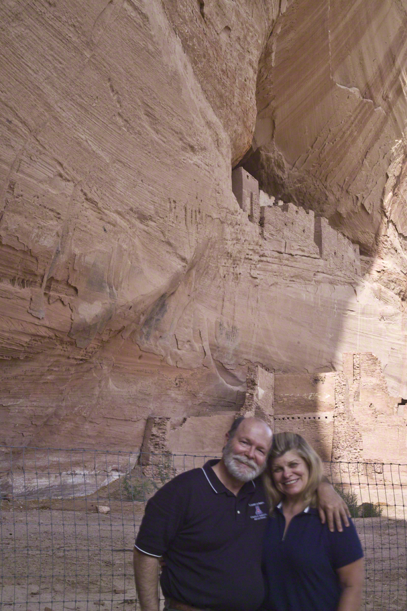
I backtracked to Pam and we pulled it together. She thought, maybe, the fall broke a rib. We descended, slowly, together. Here we are in front of the ruin. The sun, low in the sky, is moving below the south canyon wall. This is a perfect time and I used both cameras.
Mike and Pam Wills with the White House Ruin, Canyon de Chelly, July 2008
The sweep of cliff and desert varnish was my intent to capture. Here it is through the Canon 50 mm lens.
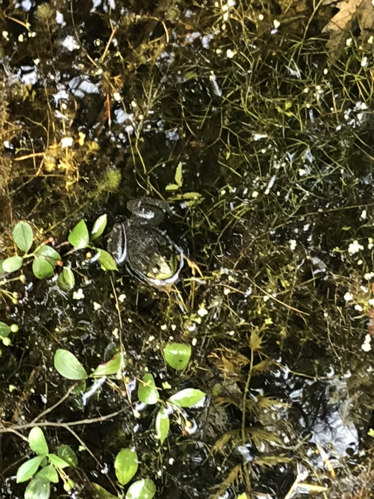
Wednesday last, grandson Sam, three years old at the time, and I wandered the landscape, catching the sights of summer. Eventually, we visited Sapsucker Woods, a Cornell University nature preserve. There, a boardwalk over the swamp is a proven venue for frog spotting and, this day, we had some success.
We found this cooperative golden-eyed beauty calmly squatting and croaking.
In this 30 second clip, reflected light off the water surface captures proto-croaks that did not quite escape from the source. There is a successful and full croak finale.
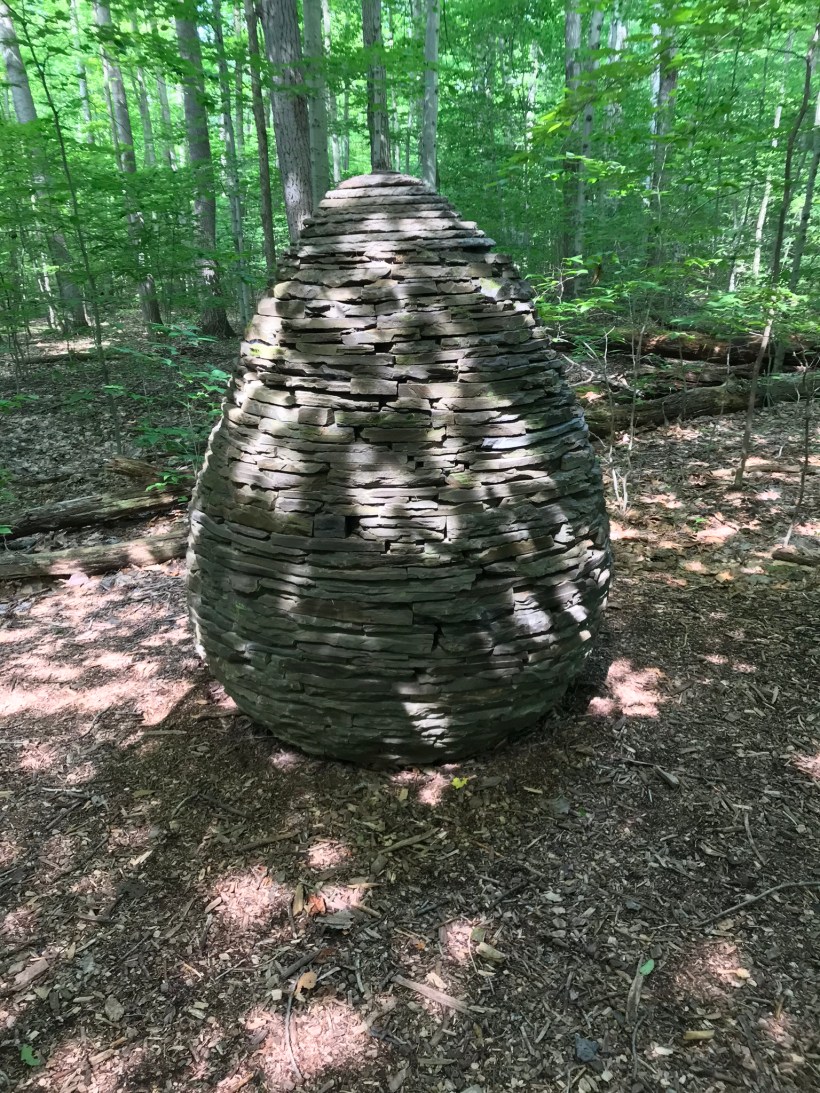
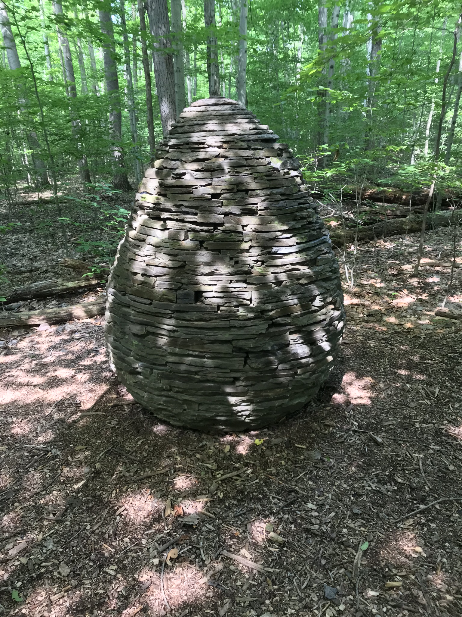
Off the boardwalk, we took a short detour to view an elaborate cairn built of local rock by a famous artist. The dappled sunlight across the surface is especially enjoyable.
The Sapsucker Cairn, Andrew Goldsworthy
At the furthest extent of the preserve is this pond where the residents were notably raucous in this 30 second clip.
About this time the mosquitoes descended for a determined attack on Sam’s legs. “Itchy,” he said. Myself, protected by deet, they left alone. Sam’s Mom prepared him for the trip with natural mosquito repellent that was not up to the task. Next time we visit, Sam will wear long pants and sleeves fortified with deet.
Just before picking Sam up for a quick retreat, I caught this turtle encrusted in duckweed sunning on a narrow branch. The head is retracted for the moment, can you imagine someone wading through that muck to place a rock? It is possible, but I witnessed the head, so am absolutely sure.
Special thanks to blogger shoreacres for the identification of duckweed. In my original posting I called it algae.
In the nature of fame, today Watkins Glen is the best known of the Finger Lakes State Parks. The International Speedway of that name enhanced and amplified name recognition during the post war years. Founded in 1948, the course used public roads of the town until the inevitable happened, an accident and the death of a seven year old child in a group of sidewalk spectators when a racer lost control.
The glen predates the race by 12,000+ years formed at that time from glaciation using materials from distant eons . Watkins Glen was known as a tourist attraction from the 19th century for the resort hotel on the south gorge rim, acquired and developed by New York State in the first years of the 20th century.
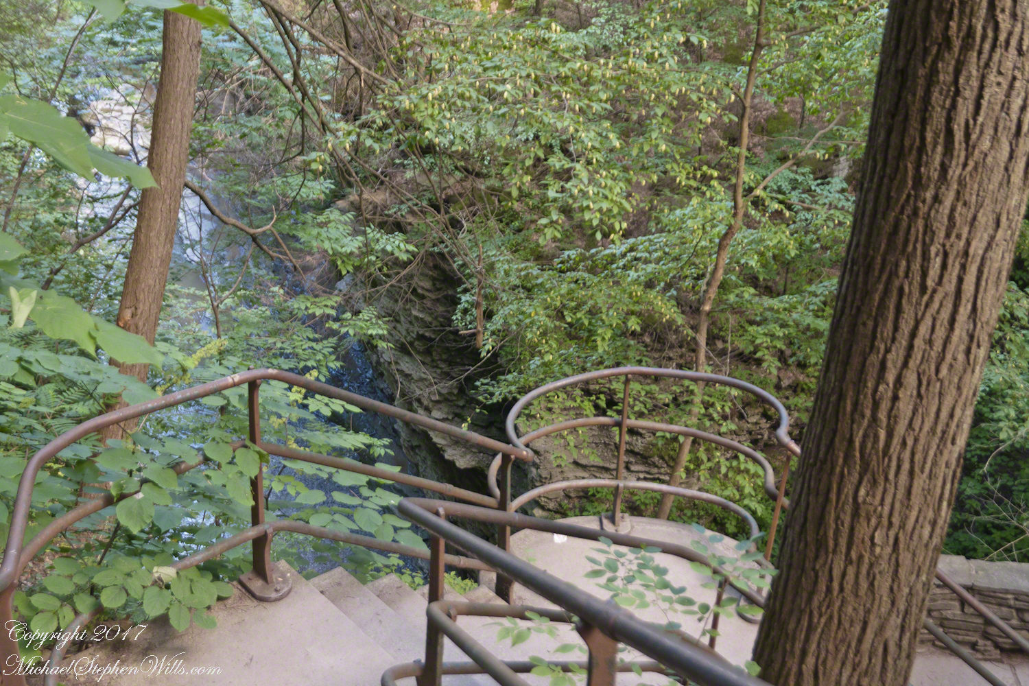
From a gate off “Lovers Lane” a sturdy flight of concrete steps with custom made handrails lead to an observation platform over the gorge. This feature will be known to many future generations……
…….the fine grained concrete is worthy of a Roman wall, the heavy iron handrails were built to specification as flowing curves unlike what is done today: built as modules and accommodated on site.
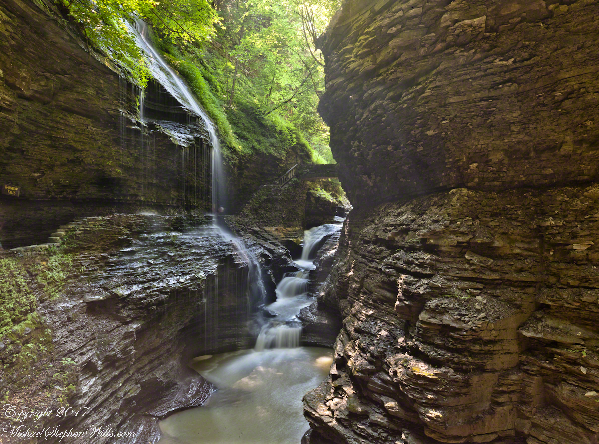
In the 20th century the fame of Watkins Glen attracted the road race, the popularity of racing enhanced park attendance. Today, the gorge trail of crowded summer weekends. On Tuesday, August 1, 2017 Pam packed a picnic lunch and we made a late start for a weekday visit. The upper entrance is enhanced by mature trees, oak, elm, hemlocks. We had our picnic under these on a moldy picnic table enhanced with a green striped table cloth and fresh coffee.
Pam is my personal photographer. Here is an example of her work.
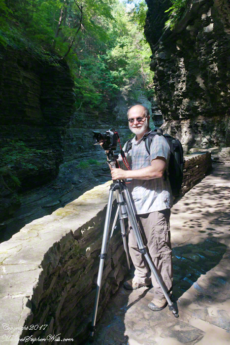
To give me my due, I did the driving and carried the 30+ pound pack into the gorge.
Pam captured me in position downstream from Rainbow Falls with a Manfrotto tripod with hydrostatic ball head on which is mounted a Canon EOS 1Ds Mark III and Canon EF 24mm f1.4 II USM lens, Tiffen nd 0.9 filter.
It was coming up to 4 pm eastern daylight savings time, the sun still high overhead. I needed to carefully choose a position for a frame in the wide angle lens without hot spots. Here are two results.
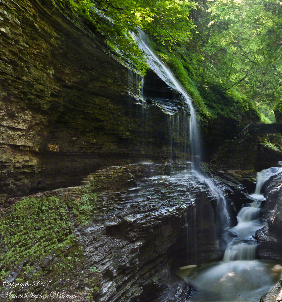
The sun was just of the gorge rim, to the right. Rainbow Falls forms from the tributary to Glen Creek cascading over the gorge walls.
Visitors walk under the falls where falling water eroded the soft, underlying stone to form an overhang.
Copyright 2021 Michael Stephen Wills All Rights Reserved
To close our time on the Tain Way I offer a poem written and presented to the congregation of the First Unitarian church of Ithaca New York 25 years ago, 1992. Interspersed are final photographs from our walk on the Tain Way of 2014.
The poem content is not directly biographical / confessional although it draws upon my experience as a single parent in the 1980’s through 1990’s.
A Poem Read To The Congregation
I
a crisis threatened an Irish village men women children filled the meeting place everyone participated especially the infants
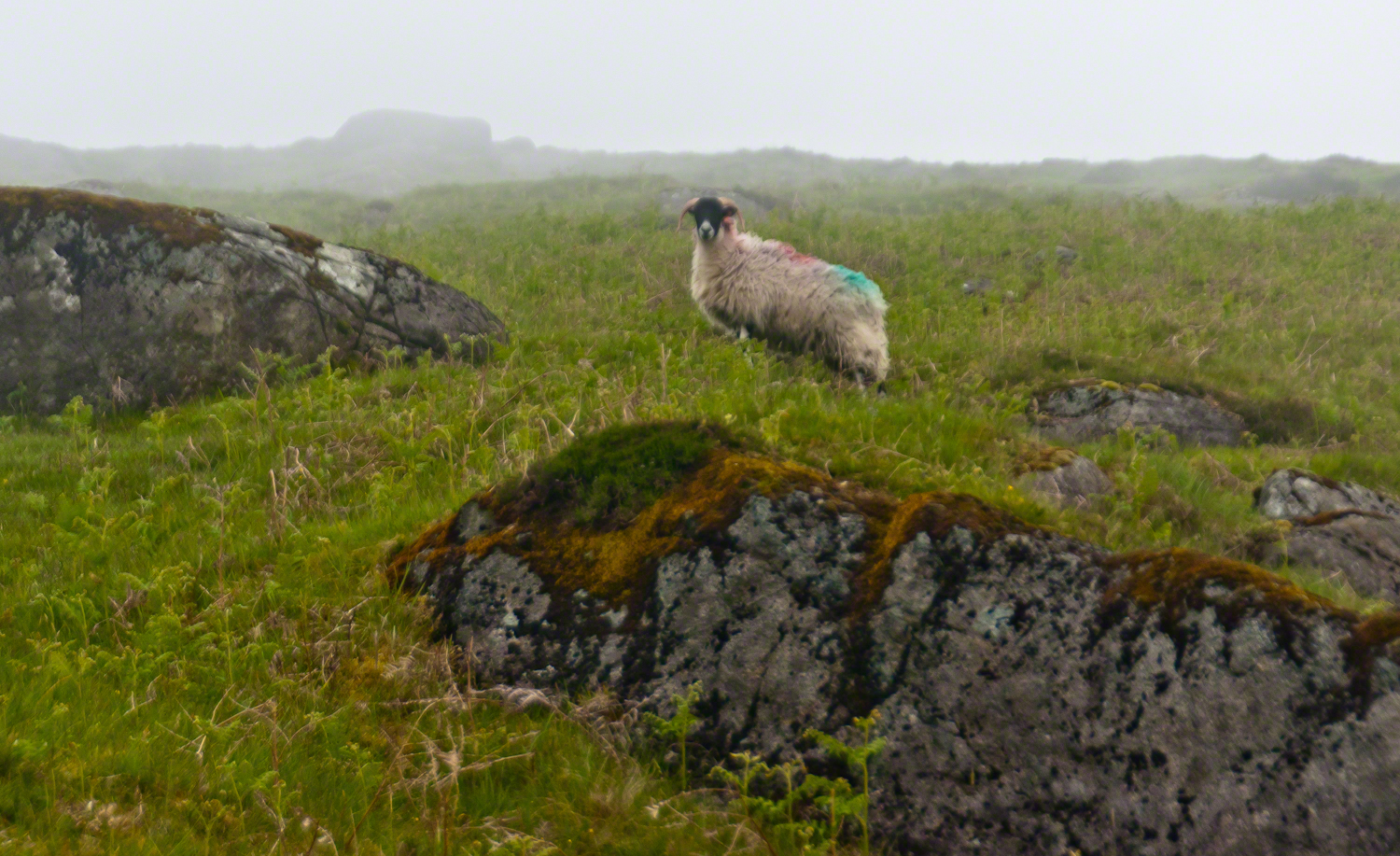
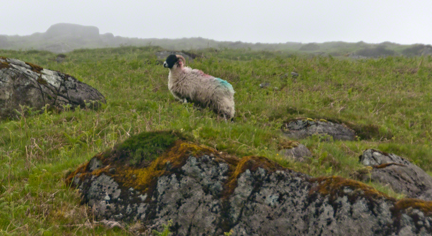
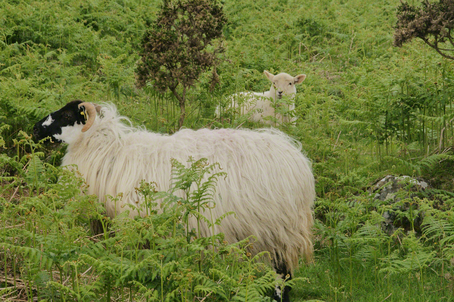
The Tail Way descends from Goliyn Pass to the northeast, passing among commons grazing. I attempted to identify the breed of this ram, but gave up. I can say sheep on the Cooley Peninsula are primarily bred for meat and there are black faced breeds known for meat production.
The flocks of County Louth commonly carry paint brands to identify ownership. Paint branding lessens wool value. This is less of an issue if the livestock are primarily raised for meat.
in spite of it all a plan was arrived at after the vote from the back of the room a man called out
….you know the type…
THIS WILL BE OUR PLAN UNTIL WE FIND OUT WHAT IT IS.
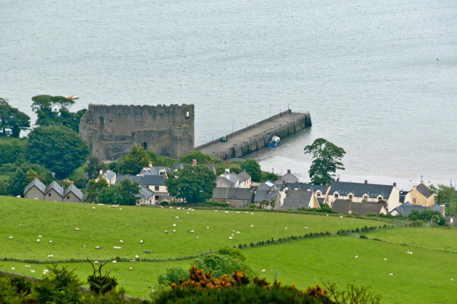
The ancient portion of Carlingford. I called the top of the castle “battlements” in the loose sense, as the ruin now longer has a walkway.
II
my son John and I have a photo of him at 5 years washing dishes standing on a chair up to his elbows in rubber gloves the caption reads “Two Men On Their Own.”
i had agreed to accept a divorce from helen only if john was left with me
one night in particular stands out from that time i did not sleep for planning what john and I would do
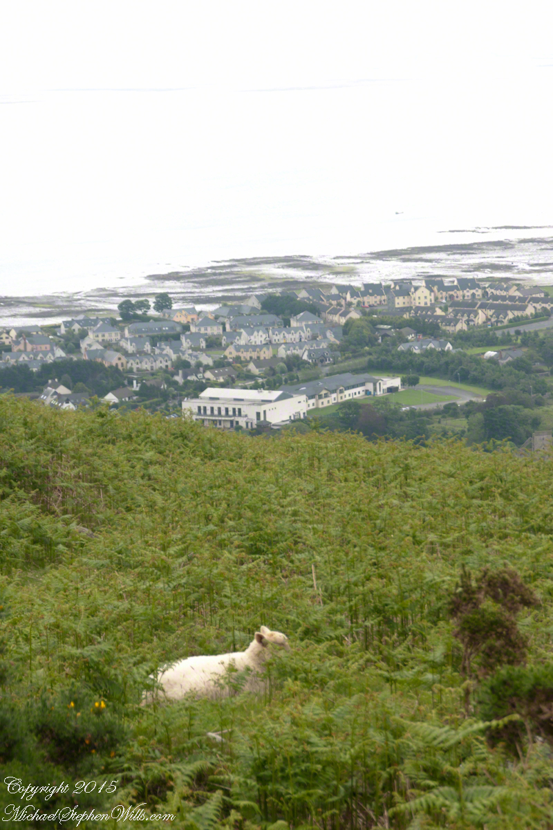
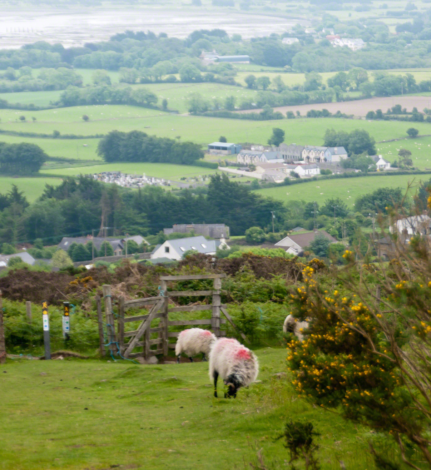
Unbranded, perfect white marks this lamb among an extensive fern bed. Tain Way steepens on approaching Carlingford. Below is the residential Carlingford, the Greenore road running to the right. The large structure with two rows of dark windows is the Four Seasons Hotel where a substantial brunch is served Sundays.
III
seven years passed not a long time since then we’ve moved found another a better life
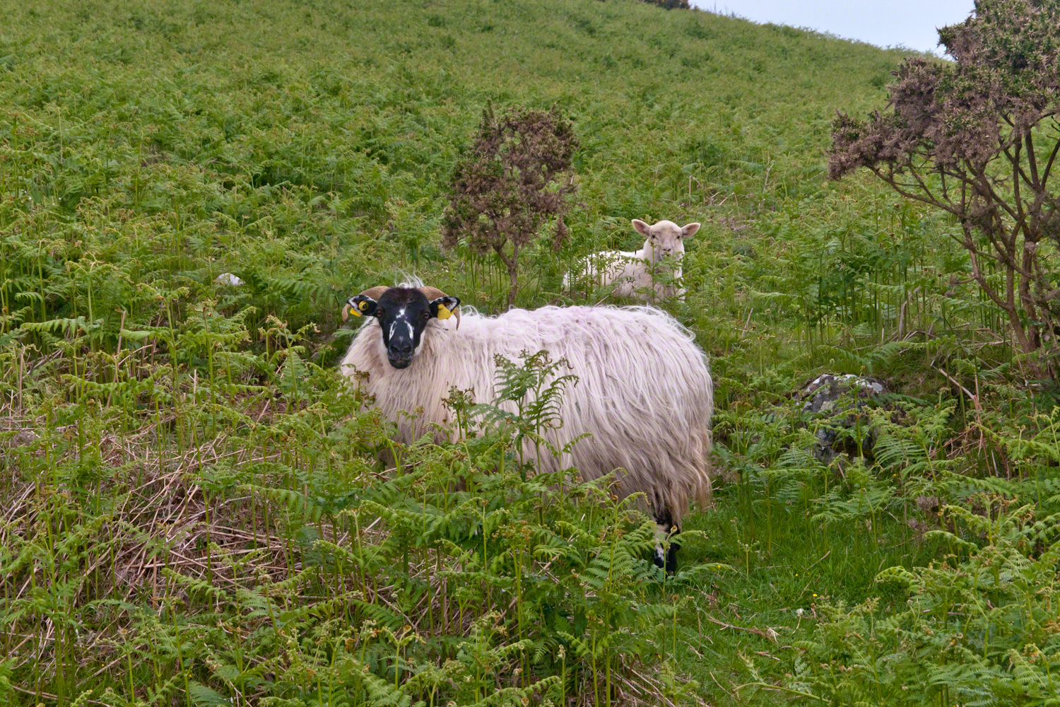
We descended below the ridge to pass into excellent pasturage. The growth of fern hides a lush grass pasture.
raising John alone was not part of the plan Its been just john and me helen gave birth to john to have a part of me in case of loss i felt the same way and she understood
a welcome feminine voice in our home “Little House on the Prairie” and “Little House in the Big Woods” twice.
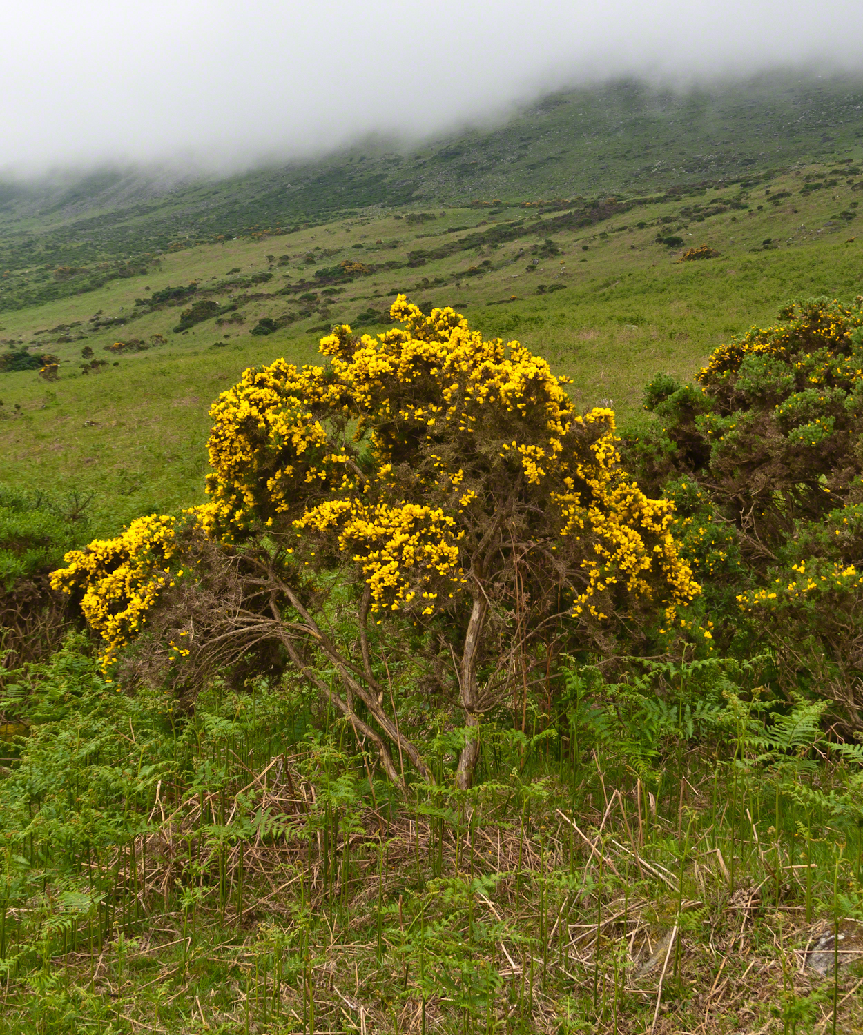
Plants and livestock on these slopes of Slieve Foy contend with adverse conditions in the form of a constant east wind. The stress is evident in the stressed trunk, although this species thrives in this environment, as seen in the strength of bloom and the yellow patches on the slopes, all of which are gorse. Gorse flowers are edible; the entire plant can be used as fodder when crushed to the consistency of moss. In Scotland there’s a museum with a roundish boulder called a Whin Stone.
V
Here is an excerpt from a newspaper article by Wilder called “HOME” that has an emotional resonance for me dated 1923 Wilder was in her 50’s.
Out in the meadow, I picked a wild sunflower, and as I looked into its golden heart, such a wave of homesickness came over me that I almost wept. I wanted Mother, with her gentle voice and quiet firmness; I longed to hear Father’s jolly songs and to see his twinkling blue eyes; I was lonesome for the sister with whom I used to play in the meadow picking daisies and wild sunflowers.
Across the years, the old home and its love called to me, and memories of sweet words of counsel came flooding back. I realize that’s all my life the teaching of these early days have influenced me, and the example set by Father and Mother has been something I have tried to follow, with failure here and there, with rebellion at times; but always coming back to it as the compass needle to the star.
So much depends upon the homemakers. I sometimes wonder if they are so busy now with other things that they are forgetting the importance of this special work. Especially did I wonder when reading recently that there was a great many child suicides in the United States during the last year. Not long ago we had never heard of such a thing in our own country, and I am sure there must be something wrong with the home of a child who commits suicide.
The trail detours around sheep pasture just before descending to the outskirts of Carlingford.
VI
we give so much to our children what’s left over though is ours
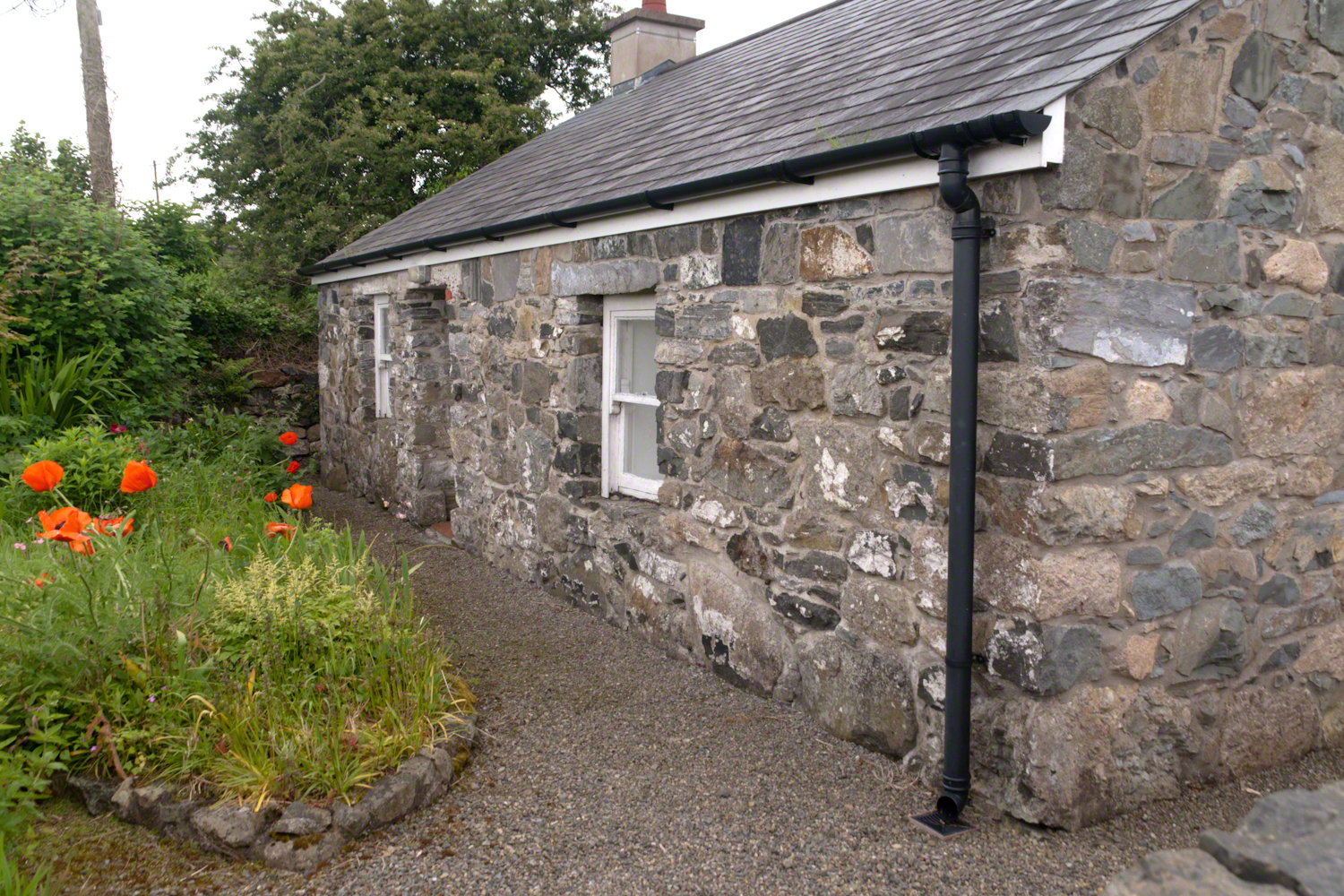
The first Carlingford home passed by the trail is a solid fieldstone home with a slate roof fronted by a natural garden featuring red poppies.
William Carlos Williams wrote it is difficult to get the news from poems yet men diet miserably every day for lack of what is found there
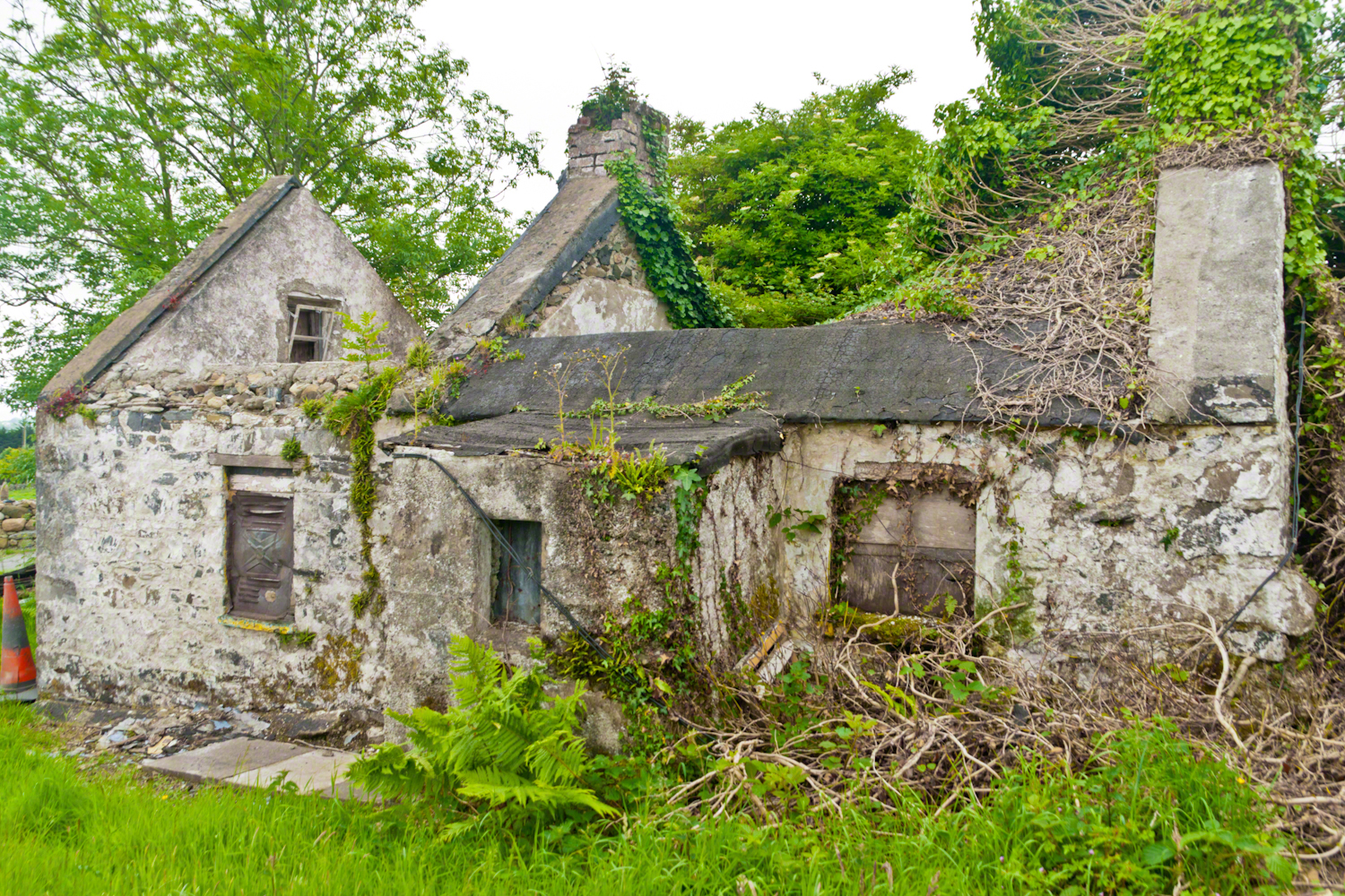
This ruin lies off the Tain Way as it descends through the outskirts of Carlingford town. Constructed of stones, mortar and what looks to be concrete. Long slate slabs protect the eves. It’s been abandoned for an age. What a story it must have, long slow and full of life.
it is not difficult to understand this to live it is another matter
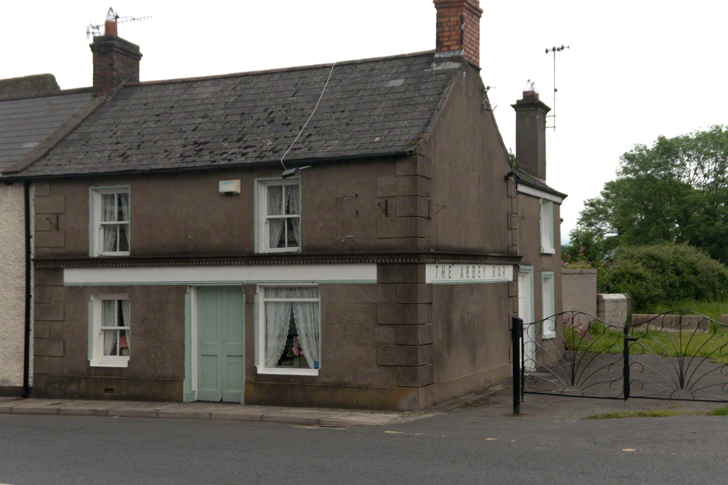
Named for the Carlingford Priory, a nearby ruin, the Abby Bar is located on Dundalk Street (R173), Liberties of Carlingford, Carlingford, Co. Louth, Ireland. Liberties of Carlingford might be called greater Carlingford in the USA.
you have to live it in order to have something left over
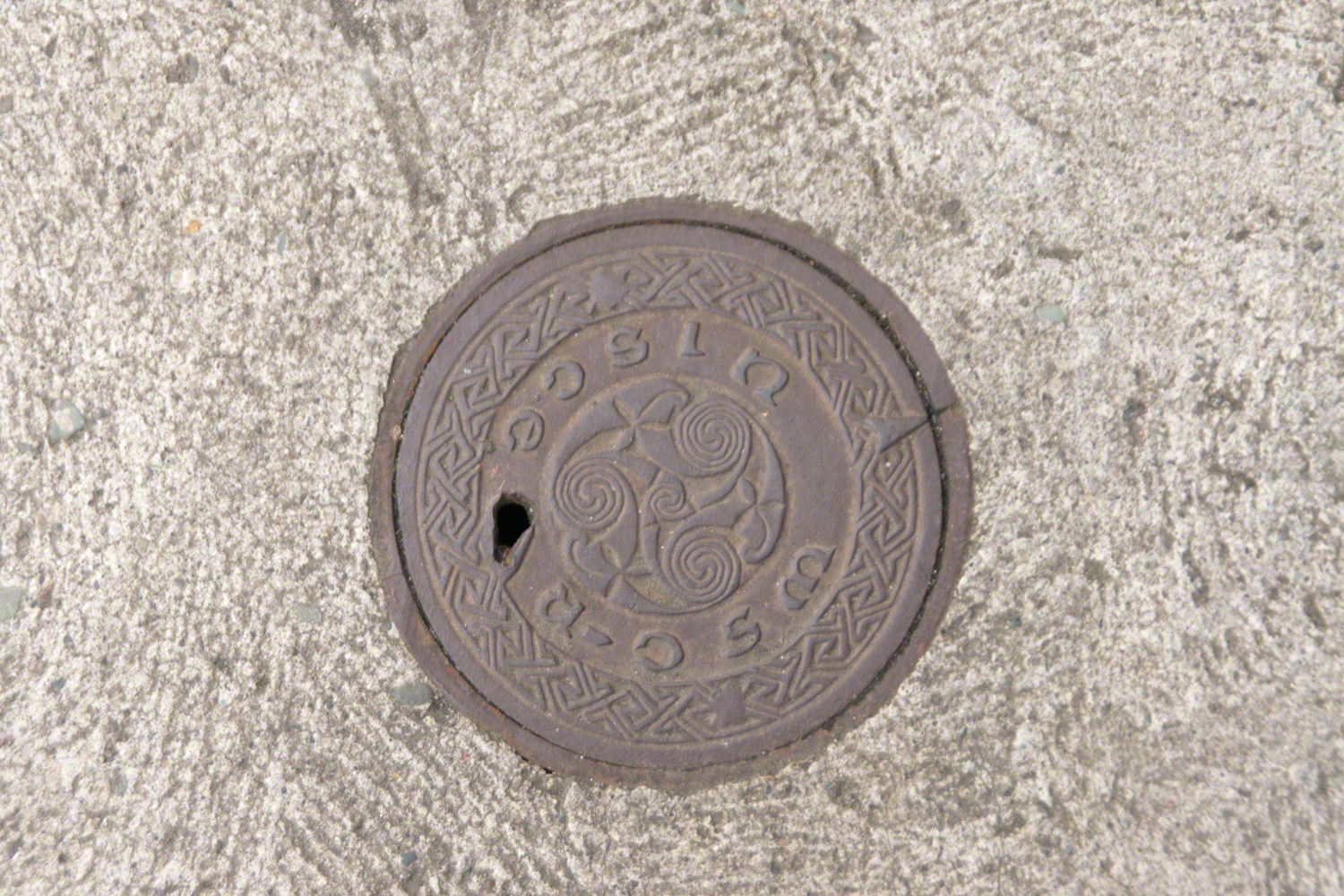
A metal cover, about 8 inches in diameter located in the sidewalk on the left side of The Abby Bar on Dundalk Street, Carlingford. The triple spiral triskelion symbol has become a Christian symbol of faith for Celtic Christians around the world, a visual representation of the Trinity (Father, Son, Holy Spirit) and eternity. In Ireland, the symbol acquired its Christian meaning prior to the 5th century. The triskelion predates Christina and even Celtic culture as petroglyphs of the astronomical calendar at the megalithic tomb Newgrange (3,200 BC). The symbol is associated with Neolithic cultures throughout Western Europe.
VII
never the less my emotional resonance in reading that piece “Home”
Caring touches to a well-tended home entrance along the Tain Way, Carlingford, County Louth, Ireland.
did not come from the sentiments Wilder so skillfully evoked though I shared them it was that sharp part
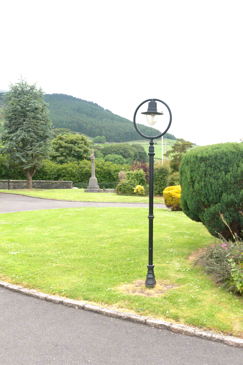
Lamp post on Church of Saint Michael grounds.
i did not agree with it lacking a reason and so must have re-read “Home” fifty times a hundred who knows
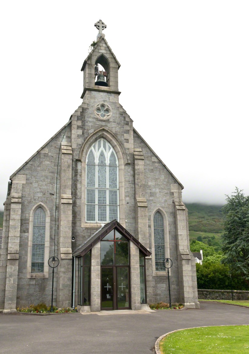
The Church of Saint Michael is a Roman Catholic Church on Dundalk Street (R173), Carlingford.
so committed to speak today and began to write something was bound to shake loose
then those lines form Deuteronomy gave themselves to me
Before you this day is set good and evil, life and death. Choose life, that both you and your descendants might live.
“Home” was a twist of these lines
as long ago as 1923 Wilder was experiencing our present contemplating the unthinkable
Wilder held her own experience as a shield and denied such a tragedy could ever touch her
for me the result is a beautiful poisoned apple innocently offered by a treasured friend
Pam Wills and Sean Mills on the grounds of the Church of Saint Michael, Dundalk Road (R176), Carlingford.
Imagine walking across the ranch house ruin towards where I described the former pond. Looking to the east and north from the elevation you see this sight.
In the near distance a grass pasture slopes into Reavis Creek. The creek has flowing water in all but the longest dry seasons. By the way, the trail from Pine Creek is on the slopes of that conical feature in the distance, to the left.
Click any photograph for a larger version.
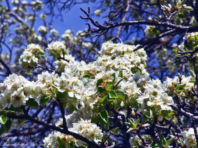
Looking from the former house site towards the Arizona Trail running beneath the distant red rock ridge. Not the fence rails on the left and apple trees in bloom.
From the ruin, walk down the Arizona Trail, south, for a few hundred feet and turn left into the fields to encounter the same apple tree, and a close up of pure white apple blossoms.
Portrait of a Blooming Apple Tree
At Rest and History
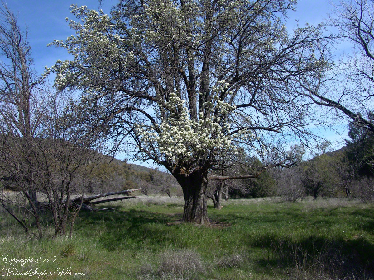
This tree is an outlier of a thick stand of several hundred trees to the north. The Searcher and I rode into the middle of the grove for a rest and chat. The horses were allowed to graze in the abundant new grass brought on by the winter rains.
The Searcher told me the story of the valley and that it was a man named Clemans who planted 600+ apple trees, trees in bloom all around us. The Reavis Valley was long a site of agriculture, starting in the 19th century with Elisha Reavis, who passed away in 1896 and is buried on the slopes of White Mountain, and continued with a series of ranchers and entrepreneurs in the 20th: John Fraser, William Clemans, who planted the trees, and John A. “Hoolie” Bacon, then Bacon’s son-in-law Floyd Stone who sold the land to the U.S. Department of Agriculture in 1967.
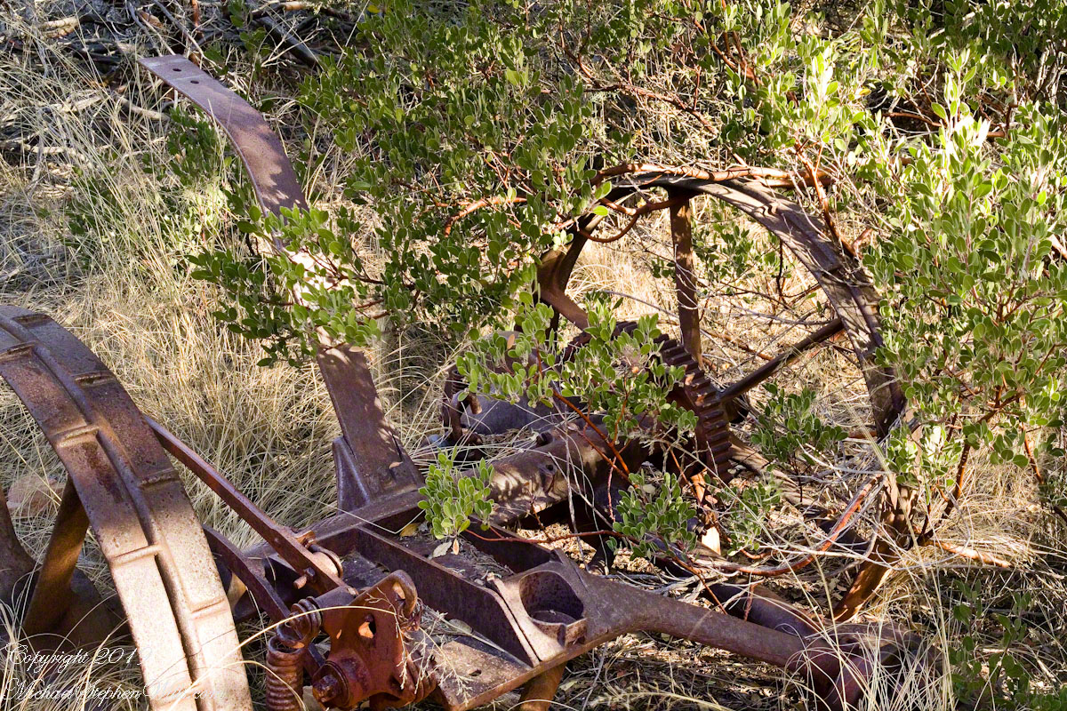
We talked about some earthwork I noticed, in the southern part of the valley. It was part of a water system that diverted Reavis creek flow at the head of the valley to the ranch house. We decided that strange hexogonal structure on the elevation above the house ruin was the site of water storage. At that location the structure would provide a pressure feed for the house and much else.
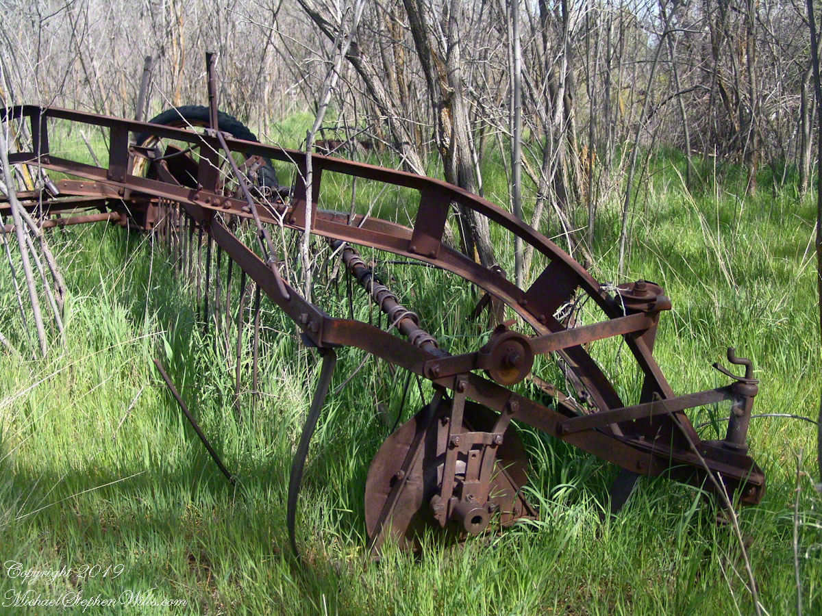
Abandoned Hay Rake
A mix of winter rains and fertile soil were exploited in the Reavis Valley for a handful of decades, the enterprise now is set aside. This abandoned hay rake and chassis, used to harvest grass in seasons past, is evidence of the work. The apple trees produce to this day without irrigation.
The Searcher touched upon the subject of the “Circlestone” ruin he mentioned on our morning ride. He had never been there, but mentioned some books on the subject. It is a wide circle of rough stone wall enclosing mysterious structures. At this point, I was hooked, and decided to check Circlestone on a later trip. Here are some photographs from one of those trips, in November 2006.
Reavis Ranch Apple Orchard Tree
Reavis Ranch Apples Yellow
Reavis Ranch Apples Red
In my next post The Searcher and I return to Pine Creek, Colorado gives me some trouble and we visit a stand of wild oats in the Reavis Gap.
Driving from the Petrified Forest National Park my son, Sean, and I arrived at Chinle, Arizona the evening of Monday, November 2, 2003. No time to rest or eat after checking into the Best Western he and I reached the White House overlook and trail head with the sun low in the sky, the sun sets 6:45 pm these last few days of Daylight Savings. The Navajo Reservation observes Daylight Savings, so the click jumps crossing the border from Arizona to Reservation.
I was 50 at the time and with Sean graduated from SUNY Maritime and fresh from a tour at sea we made good time to the canyon floor. I wanted to catch the White House in the setting sun.
One morning, 14 years later, I published a fine art photograph from that trip.
Looking along the canyon, over thick stands of Russian Olives, I caught the risen moon, in gibbous phase, against a mid-canyon freestanding fin of red sandstone of the southern canyon wall. Today, those trees are gone, removed as an invasive species.
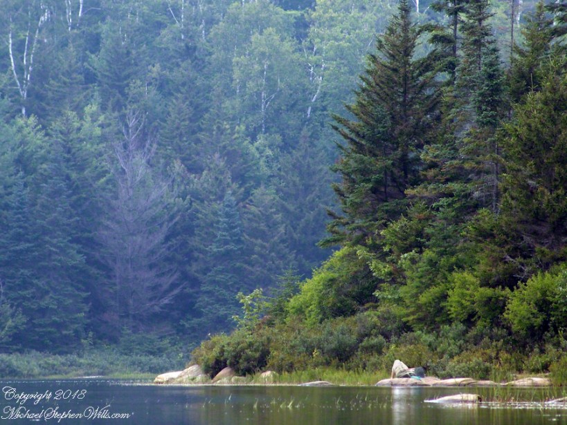
One weekend my nephew Chris and I backpacked to Peaked Mountain Pond, the Adirondacks wilderness, in the rain. My son, Sean, was to meet us later. The constant rain made the easy trek into a slog. Our attitude improved after the tents setup and the fire. The skies clear to a brilliant display of the Milky Way away from light pollution.
Peaked Mountain in the light of an August dawn taken from the west pond shore. Siamese Ponds Wilderness, Adirondack Park, New York State. At 2,919 feet, Peaked Mountain is a modest height though it rises an impressive 675 feet in 0.4 mile.
Looking north across Peaked Mountain Pond from the west shore shortly after dawn.
Click the photograph to visit my Fine Art Gallery
We used the canoe as a punt, using a solid branch to push around the shallow pond for short distances, after bailing.
Click the photograph to visit my Fine Art Gallery
Mid-morning, we headed up the trail to the peak. I caught this orb-weaver spider web on the way.
Click the photograph to visit my Fine Art Gallery
…and a detail. Technically, this is a macro. Did not wait around for the owner.
Click the photograph to visit my Fine Art Gallery
Later, in the afternoon, Chris caught some Zzzzz’s in a time out from water gathering. We pumped water through a filter, this is necessary throughout New York State to avoid giardia infection.
Click the photograph to visit my Fine Art Gallery
The ultimate in peace and tranquility, though disturbing a hornet pollinator can lead to excitement. This water lily bloom was caught with a tripod mounted long lens. Look closely for the hornet at work inside the flower. HHealthy water lily leaves are the epitome of tranquility because they are always clean, giving the illusion of tranquility. Scientists study water lily leaves to learn how the leaf surface sheds dirt. Imagine self-cleaning cloths.
Correction: it is the Lotus leaf, not lily pad, that is self cleaning.
Looking for the perfect photo for your web site and blog?
Browse my reasonably priced stock photography. This blog features seven (7) photographs I published today to Getty Istock and my Fine Art gallery.