Back To School, Uruguay

A late summer Friday evening

Since 1877 primary education in Uruguay is universal, compulsory and free. These days students receive free education through university, literacy is the highest in South America at 95%, equally for males and females.

These photographs are from a cruise around South American my wife, Pam, and I enjoyed February / March 2016 on the Oceania ship Regatta. This was the evening of February 26, 2016, a Friday, in the city Montevideo, Uruguay.

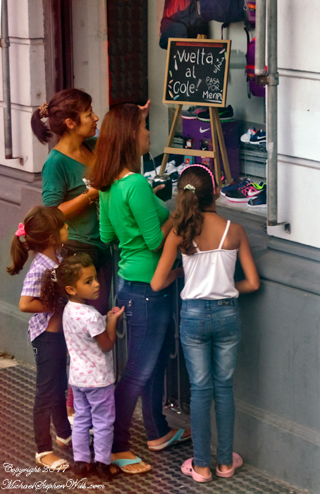
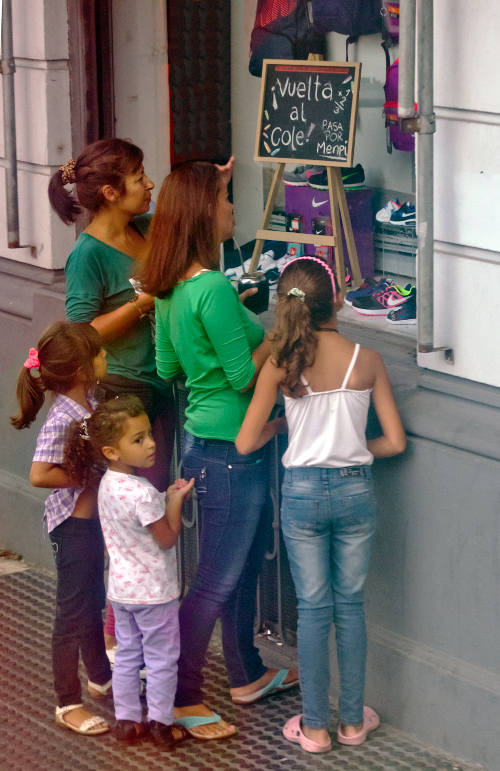
This image is the theme of this blog, “back to school”. On Avenue Gral Eugenio Garzon of the Colon neighborhood of Montevideo a mother and four daughters discuss a shop window featuring “back to school” clothing and necessaries. The children range in age from pre-school to teen. This is evidently a serious discussion about preparing for the school year which starts in March for Uruguay.

A government program launched in 2007 expands Information and Communication technologies in primary schools with these goals:
— To distribute technology,
— To promote knowledge,
— To generate social equity.

Called Ceibal, after a tree native to Uruguay, the program was a success. From 2009 – 2012 450,000 laptops, popularly named “”ceibalitas”, were delivered to children coordinate with teacher training and a monitoring and evaluation model for assessing the impact nationally. Ceibal is the acronym for “Conectividad Educativa de Informática Básica para el Aprendizaje en Línea” (Educational Connectivity/Basic Computing for Online Learning in English).

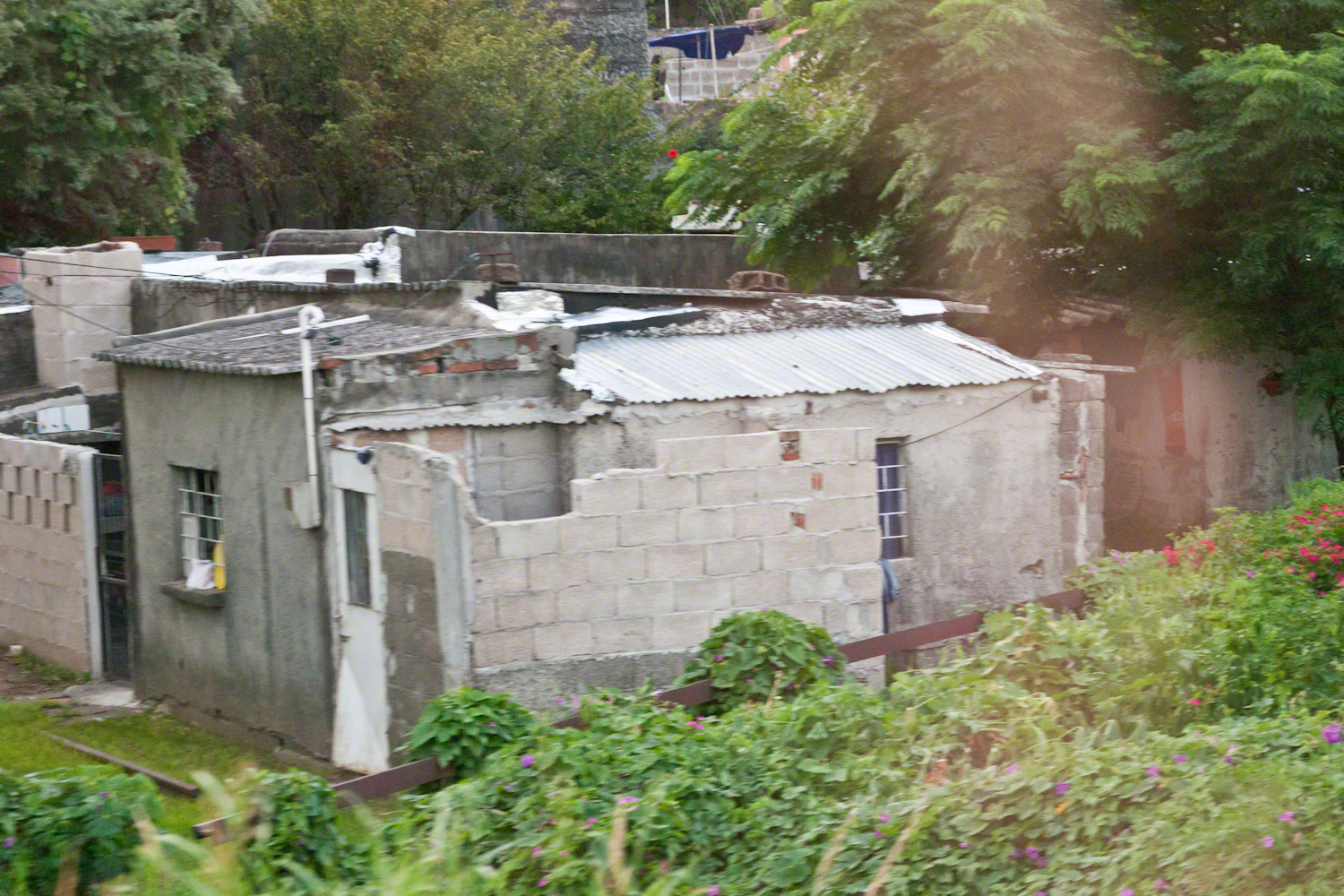
These photographs build on the theme of the positive influence education has on the lives of Uruguayans, many of whom live in poverty.

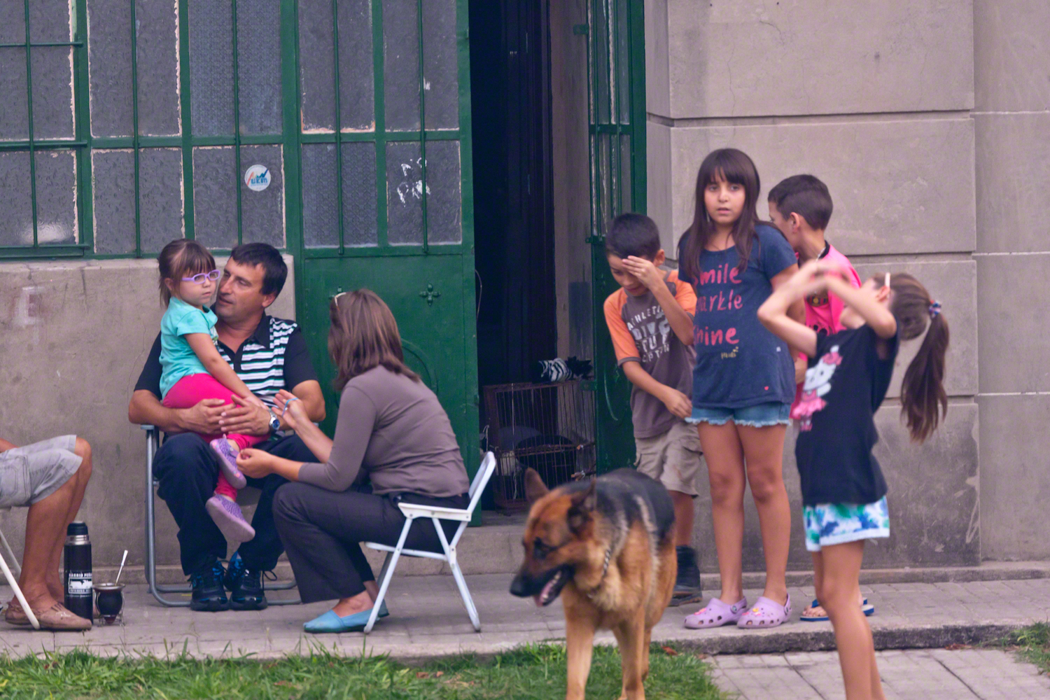
A family gathering in their yard on Avenue Gral Eugenio Garzon, enjoying a cool late summer evening.

Back To School -- CLICK ME!!!!

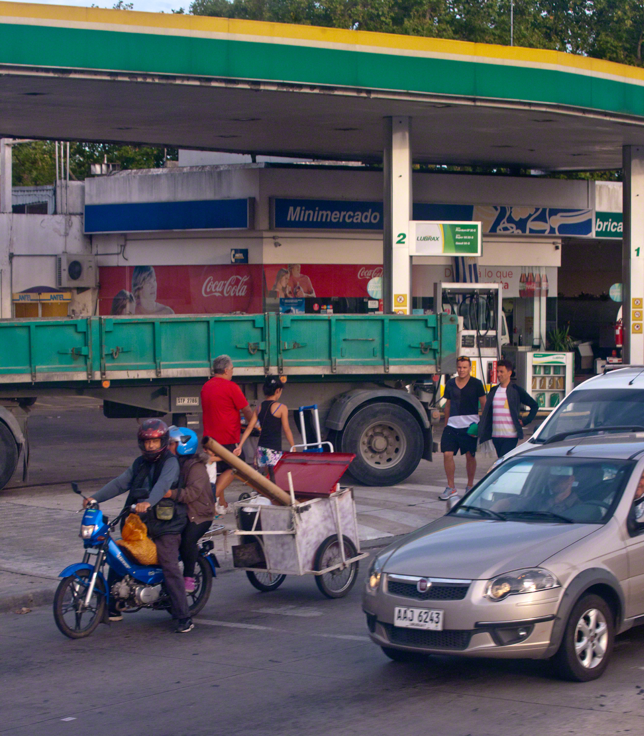
Traffic and a gas station. People were out and about, walking and conversing. There is a makeshift trailer attached to the motorcycle, behind is a large truck.

Back To School -- CLICK ME!!!!

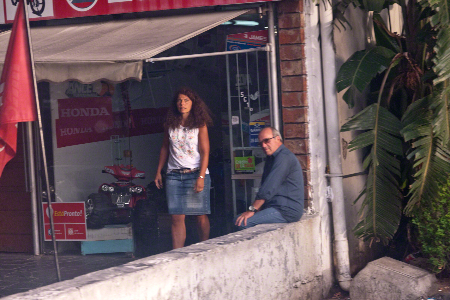
Storefront with customer and man loitering on wall. A mini-Honda all terrain vehicle is on display.

Back To School -- CLICK ME!!!!

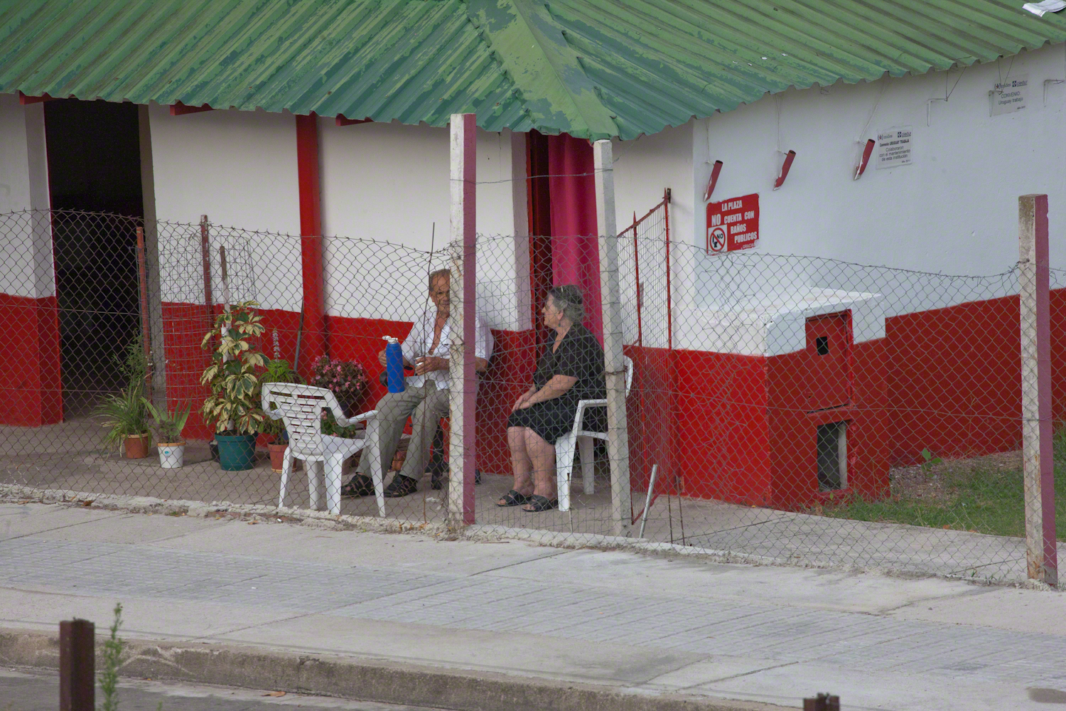
Mate is a beverage enjoyed throughout South America. Here companions enjoy a warm summer evening with a thermos of hot water and mate gourd behind a restaurant, their view across the train tracks and the Colon rail station is of a playground and playing fields.

Back To School -- CLICK ME!!!!

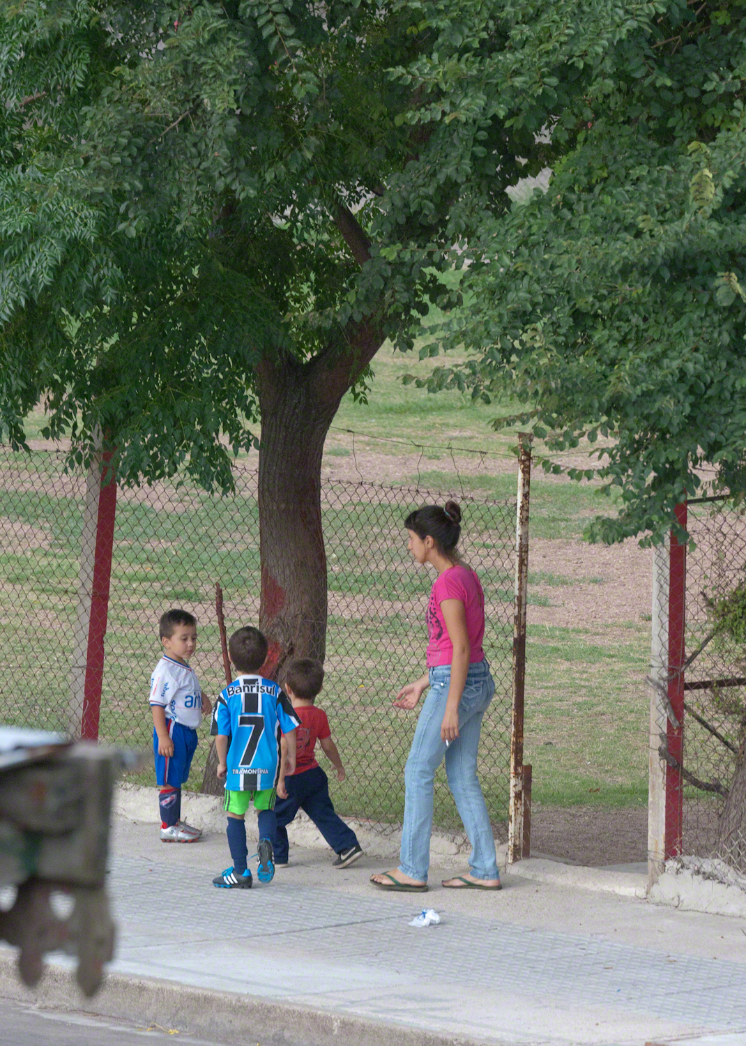
A family of very young soccer players coming from practice with teammates. The sponsors of lucky number 7 are the bank Banrisul and Tramontina, a kitchenware manufacturer.

Back To School -- CLICK ME!!!!

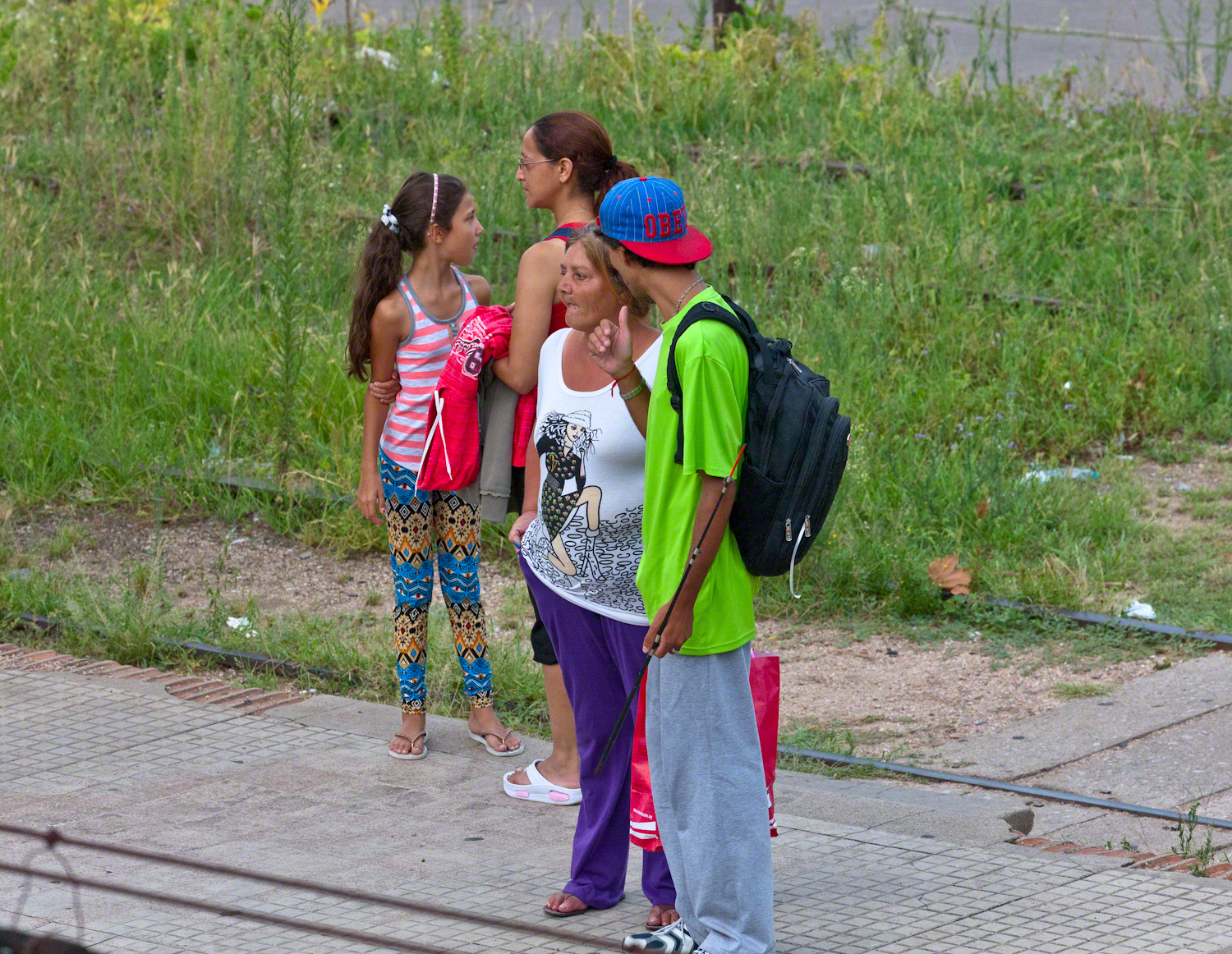
We waited to board an historic train and shared the station with Montevideans waiting for a passenger train. Here are two families: a mother and pre-teen daughter colorfully dressed, a grandmother and grandson. Behind them are the playing fields and playground.

Back To School -- CLICK ME!!!!

A passenger train heading north passed while we waited for our ride to begin. Curiosity shines from this child’s eyes.

Back To School -- CLICK ME!!!!

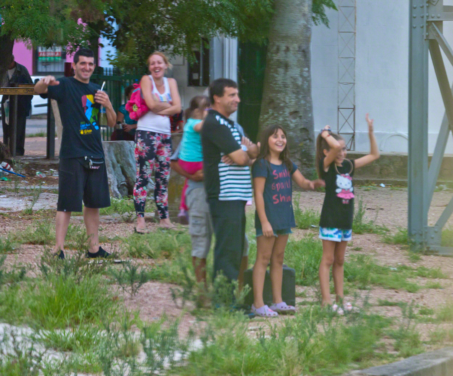
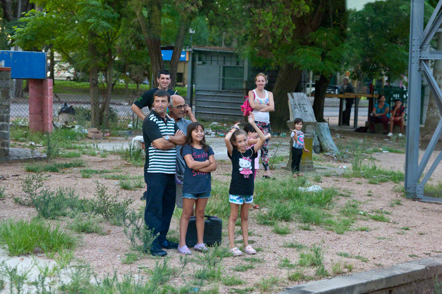
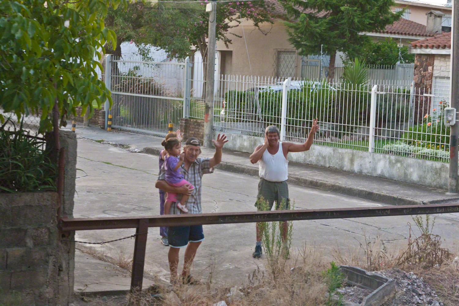
Happy families greeted us with waves and smiles during our trip to downtown Montevideo.

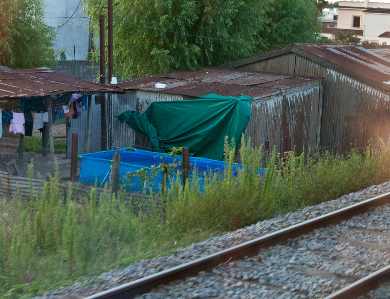
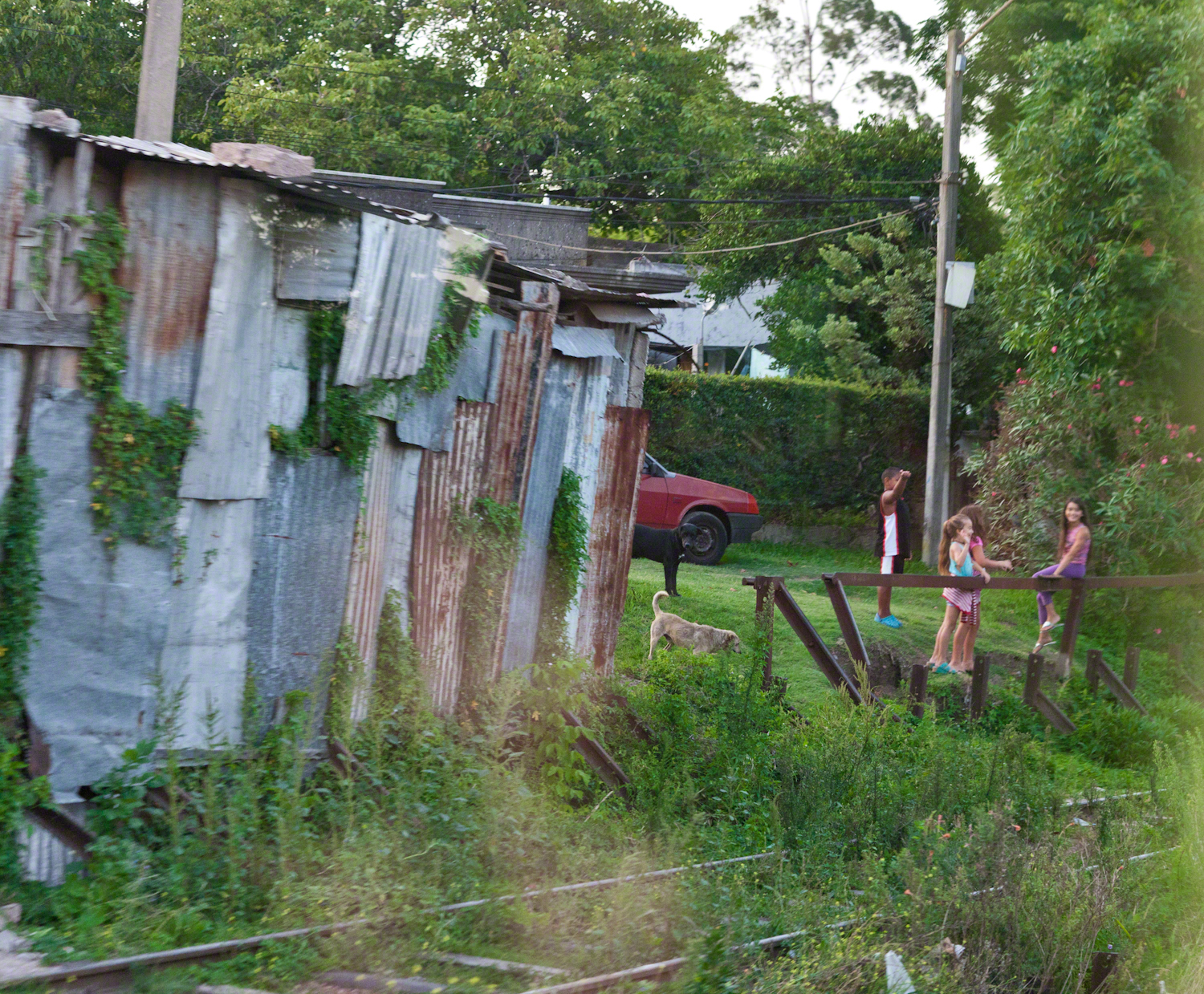
Some of the homes along the rail line. Pools such as that are popular in cities. We saw a great many on the streets in Lima, Peru.

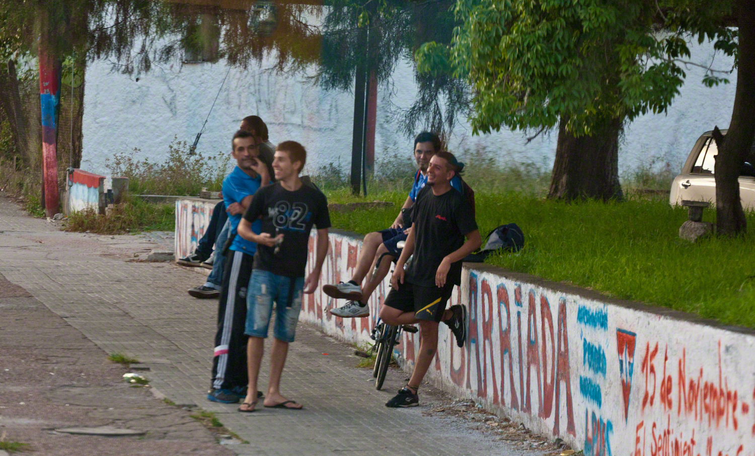
Reaction to the historic train from a group of young men.

Back To School -- CLICK ME!!!!

Curious playmates gather at the end of the road.

Back To School -- CLICK ME!!!!

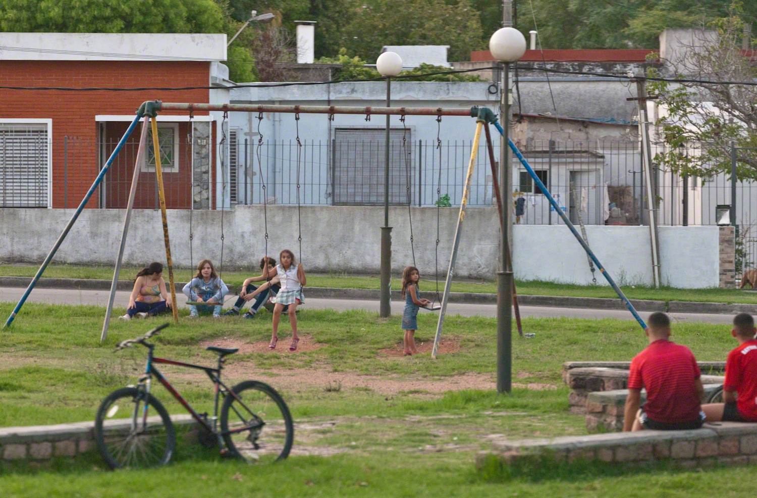
A well attended playground.

Back To School -- CLICK ME!!!!

Copyright 2021 Michael Stephen Wills All Rights Reserved

Hag’s Chair or Mass Rock?

Ancient Tradition

Part of our day in County Meath, Ireland  
Click the photograph to open a new window/tab of my Online Gallery.

Known as the Hag’s Chair in some contexts, K29 or the Mass Rock, in others, set as a Cairn T, Loughcrew kerbstone thousands of years ago the carved symbols on front, rear and seat are very worn. There is no surviving record to inform us of the stone’s purpose. The upper side appears carved to enhance the form as chair.   Set to the north of Cairn T, not in front of the entrance as with Newgrange, even this is a mystery.  It is the third largest curbstone.

Hag's Chair– CLICK ME!!!!

The popular name refers to the hill itself, “The Hill of the Witch” (In Irish, Sliabh na Caillí).   In lore sites such as this are associated with The Others (“fairies”), living lives parallel to ours.

Tradition holds that, during times of the Penal Laws, Catholics gathers on for Mass using this curbstone as the altar.   By this it is known as the Mass Rock.

Click for another Ireland posting

Copyright 2021 Michael Stephen Wills All Rights Reserved

Pinelands Connections II

Hotel Keepers

“There are many hundreds of miles of unpaved roads through the pines–two tracks in the sand, with underbrush growing up between them. Hunters use them, and foresters, firefighters, and woodcutters A number of these sand roads have been there, and have remained unchanged, since before the American Revolution. They developed, for the most part, as Colonial stage routes, trails to charcoal pits, pulpwood-and-lumber roads, and connecting roads between communities that have disappeared from the world. In a place called Washington, five of these roads converge in the forest, as if from star points, and they suggest the former importance of Washington, but all that is left of the town is a single fragment of a stone structure..” From The New Yorker magazine, November 26, 1967, “Profiles, The Pine Barrens I” creative non-fiction by the great John McPhee.

……continued from “Pinelands Connections I.

That “single fragment of a stone structure” of 1967 may be all that’s left of the hotel run by Great-Great Grandparents George and Mary (Delette

U.S Census for Washington township, Burlington County, New Jersey, August 24, 1850 Nine (9) children living: William Henry and Aaron, both 16 though not twins. William Henry, born late in the year 1833, October 16, leaving Aaron with a birthday before the census date, making his birth year 1834. My great grandfather, George, 14 years. James (12), Moses (10), Mary Ann (8), Amos (6), Martha Jane (4), John Bishop (2).

After this post was originally published I had a breakthrough, the identification of the Buttonwood Hill Tavern, Crowleytown as the hotel run by George and Mary Wills on the 1850 census.

Reference
I found this information in the book “Heart of the Pines, ghostly voices of the Pine Barrens” by John E. Pearce, Batsto Citizens Committee, 4110 Nesco Road, Hammonton, N.J. 08037-3814.
Click me for Pinelands Connections III

Copyright 2021 Michael Stephen Wills All Rights Reserved

Farmland Southeast of Carlingford

Beauty of the Cooley Peninsula, County Louth, Ireland

I offer here a continuation of descriptions of a 2014 walk on the Tain Way, an appreciation of the lore and beauty of Ireland.

Descending the Tain Way from the ridge of Golyin Pass the sweep of Cooley Peninsula spread before us. Louth is the smallest of the Irish Republic counties, a peninsula which is mountainous where it is not farmland, one exception being Carlingford with the most people, population 1,405 in 2016.

Residential Carlingford continues along the Greenore Road, farmland adjoins then continues southeast along the Cooley Peninsula margin, the Irish Sea beyond. Greenore Town and deep water port on upper left.  These photographs are views from the Tain Way on the slopes of Slieve Foye, the highest mountain of County Louth.

Greenore Town and Deepwater Port
Click this link for my Ireland gallery of Fine Art Photography.

Wander through the place names: Chapel Hill, Liberties of Carlingford, Moneymore, Leminageh, Crossalaney, Mullatee, Millgrange, Ramparts, Muchgrange, Ballyamony, Mullabane, Petestown, Ballagane, Willville, Whites Town.


There is a deepwater port on Carlingford Lough adjacent to and part of Greenore Town. The port employed Cousin John Mills years ago, supplementing his farm income. Across the lough is Greenecastle, Newry in Northern Ireland.

Greenore Town and Deepwater Port

The Irish Sea opens on the far side of Greenore with the Isle of Man about 52 miles east and a little north.

Visit the opening chapter of our time on the Tain Way

Click link for the next posting of this series, “Leprechaun Rock along the Tain Way”

Copyright 2021 Michael Stephen Wills All Rights Reserved

Irish Emigrant Experiences

Cobh Heritage Center

Continuing from the “Queenstown Glamor” of the SS Servia these are exhibits of what it was like to emigrate from Ireland in the 19th century.

Copyright 2021 Michael Stephen Wills All Rights Reserved

Ithaca Pottery National Historic Place

finding a suppressed location

Wiki Loves Monuments was a contest that closed September, 2017.

Click for Wiki Loves Monuments 2017 contest

The National Register of Historic Places, online, lists the Ithaca Pottery Site(# 79001635) as “address restricted”.   There is no photograph published for the site either on the register or Wikipedia.  Here is an opportunity and a mystery.  Where is the suppressed location of this historic place?  There is the opportunity of completing the record by capturing a photograph.

There is another online reference listing the site as 423 E. Lincoln Street.  The site is “I Love the Finger Lakes”,

I researched the physical location of the site and found it to be in a historically industrial area of Ithaca, close to Ithaca Falls.  The correspondence I found online named Ezra Cornell as the owner when the pottery concern was active.  He donated the land for Cornell University and the location is consistent with his ownership.  There is a large wooded lot behind the building.

Last week I visited the address and guess the best light was the morning, returned yesterday to acquire the photograph.  There was a knoll across Lake Street that gave this view.  There are conflicting elements in this photograph:  the far hills are beautiful, the pole with wires very difficult to remove.  Also, the address is not visible.

Ithaca Pottery from the Knoll
Click link for my fine art gallery.

The street passing left to right is Lake Street.  Crossing lake street I took several shots, negotiating the light traffic to eventually stand in Lake Street for this shot.

Ithaca Pottery from Lake Street

In preparation for shooting, I mounted the Canon EF 70-300mm f/4-5.6L IS USM lens on the Canon EOS-1Ds Mark II body.  This shot was at 70mm, 1/200 second, ISO 1,000, f/7.1.   I hated the power lines and could not avoid them from any acceptable angle.

The only solution was to spend hours in Photoshop to achieve the result in the header.

Copyright 2021 Michael Stephen Wills All Rights Reserved

Loughan Bay Ruins, County Antrim

Deserted Cottages above the Irish Sea

We pulled off the side of Torr Road for this fine view on the way to Torr Head to take in this view of the Irish Sea.  The steeply rising distant headland is the Mull of Kintyre. Loughan an Lochan, County Antrim, Northern Ireland.

Michael Wills – CLICK ME for my Getty Portfolio.

We parked on a turnout above the Loughan Cottages, near this farmer’s sheep pen.  He drove up in a huge tractor and conversed with Pam while I was below shooting the cottages. He made a good impression.

Loughan Bay Farmer – CLICK ME for my Getty Portfolio.

Roofless walls of a cottage more substantial than the other deserted ruins above Loughan Bay, with two fireplaces a walled porch with a view. A number of outbuilding foundations lay around. The integrity of the walls, chimneys and gables speaks to the quality of construction. A freighter in the North Channel of the Irish Sea is visible in the distance above the upper ridge. Beyond is the island of Islay, Scotland, about 30 miles distant. Loughan an Lochan, County Antrim, Northern Ireland.

I am happy to report a series of thirteen (13) photographs of these ruins were accepted for publication by Getty.  You can click any of the photographs in this posting for my Getty portfolio.

Loughan Cottages Ruins above Crockan Point – CLICK ME for my Getty Portfolio.

The land slopes steeply to a rocky beach.

Ruin Above Loughan Bay – CLICK ME for my Getty Portfolio.

A thick growth of ferns, grass on the gable was once a home with a view of Scotland’s Mull of Kintyre 13 miles across the North Channel of the Irish Sea.  The Isle of Sanda just visible on the right of the far gable.  A landform named Alisa Crag is just visible in the distance, to the left of the nearest gable. 

Single Room Loughan Bay Cottage – CLICK ME for my Getty Portfolio.

Please browse my reasonably priced stock photography. License a photograph, download and use it for your website or blog. Click this link to browse all my Getty IStock Photography offerings.

Or click this link or any photograph or this link to select a print with custom framing from my “Ireland” Fine Art Gallery.

Interested in learning more about this site?  I have a series of postings on Loughan Bay.  Click for the first posting in this series.

Copyright 2021 Michael Stephen Wills, All Rights Reserved.

Queenstown Glamour

The SS Servia, a notable transatlantic ocean liner, features in the movie “Far and Away.”

Nothing so grand as the SS (or HMS) Servia carried my ancestors from Ireland to America. This ship model, created for the 1992 film “Far and Away” is on display within Cobh Heritage Center. Said by some to be the first true transatlantic ocean liner. Launched in 1881 as luxury transportation by the Cunard Line of today’s Queen Mary. Last year, we enjoyed the arrival of Cunard’s Queen Victoria to Cape Canaveral. (Click the link for my blog of the event, one of the last cruise ships to sale during the pandemic of 2020).

It is notable the model played a small role in the film, yet is an incredible accomplishment. By the way, from 1849 to 1920 Cobh was known as “Queenstown” in honor of a visit by Queen Victoria. The Irish Free State returned the name to the original.

References

SS Servia – Wikipedia

Far and Away – Wikipedia

Copyright 2021 Michael Stephen Wills All Rights Reserved

Peter’s Mesa Sunset

Can You Find the Eye of the Needle?

Peter’s mesa is at the center of Superstition Wilderness treasure legends. I was a member of an expedition to the top of the Mesa March 2008. This is a sunset view, looking south, southwest. Light raking across the desolation and an approaching storm behind Miner’s Needle create a fascinating spectacle. Ancient volcanism, apparent throughout the Superstition Wilderness, is here seen in the texture, form and type of rock as well as the mineral deposits. Miner’s Needle, like Weaver’s Needle (no seen in this view), are eroded volcanic summits. Look closely for the “eye” of Miner’s Needle, backlit by the storm cloud itself lit by the setting sun. To this day, hopeful prospectors search for gold nuggets around the Needle. There is one form of volcanism present today as an eerie rumble or hiss, similar to an enormous distant jet engine. We heard now and then during our two days on the mesa, louder and closer than a overhead plane could produce. The view includes many notable Sonoran desert plants. Many young Saguaro cactus are in the form of green poles and, on the rim of the ravine running left to right below the closer ridge, an excellent specimen with multiple arms. Catching the dramatic light, on the ridge is a tall single flower of an Agave, known as the “Century Plant” it flowers once in a long life and dies.

Click this link or the photograph for my Online Gallery
Peter's Mesa -- CLICK ME!!!!

Peters Mesa is named after “Old Pete” Gottfried Petrasch, father of Hermann and Rhiney Petrasch. Old Pete worked for Jim Bark for awhile in the 1890s doing odd jobs. Irregular employment gave Pete and Sons time to s searched for the Lost Dutchman Mine in the years following the death of the source of the legend, the “Dutchman” Jacob Waltz. The Petrasches were one of the first groups to search for the mine, and gold in general. They covered almost the entire Superstition range in their combined searches.

On our first day on the Mesa we came across the remains of one of these camp, on the top of Squaw Canyon. This was only deplorable junk a presumably disappointed bunch of searchers were too lazy to cart out. That March, we were lucky to find the remants of winter rains in the form of a meager trickle at the bottom of a shallow draw off Peter’s Mesa trail up from La Barge canyon. We had a good time of it until the trip was cut short by a storm front and torrential rains. We were back in Apache Junction before they hit.
This panorama is from our last evening on the Mesa. As the sun set I put the Kodak DSLR with a 50 MM lens on a Manfrotto tripod and hiked a mile higher onto the mesa for a view of Miner’s Needle. I quit only after the last light was extinguished by the approaching front. My reward for persistence was this dramatic light ennobling a craggy desolation. This is a composite of several images, combined using Photoshop. I have since invested in a Canon 24 mm wide angle lens.

Here is another Superstition Wilderness Episode

Copyright 2017 Michael Stephen Wills All Rights Reserved

Coolcreen View Six

Happy Saint Patrick’s Day 2021 “No Snakes”

Number six of six from the Kerry County side on the descent Healy Pass, R574. Here we move away from, say goodbye (hopefully, for now) to these marvelous views, our first sight of County Kerry.

Two more strange, conical hills come into view, repeating those in the distance. These have a long story.

Beara Peninsula, Coolcreen townland, County Kerry, Republic of Ireland.

You can easily view a higher resolution versions by clicking on the photograph to open a browser tab.

Click photograph for a larger version.

Copyright 2021 Michael Stephen Wills All Rights Reserved