On our way to Fjord Tempanos and the Iceberg Glacier…..
Background: on a ship, facing the bow (front), starboard is right and port is left).
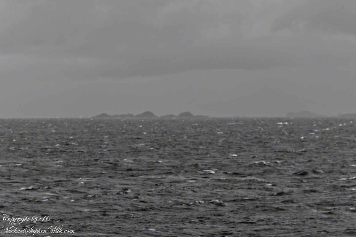
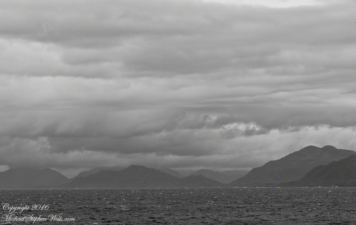
In the 8 miles from Tarn Bay and Sombrero Island lands press closer, higher, islands increase in number. This is a listing of some of the islands we passed. These names reflect the history of Chile, the waves of immigrants touch the land with memories. After some of the names, below, I provide in parentheses the derivation.
On starboard was the northern Wellington Archipelago (English General): Pinochet (the Chilean dictator), Penguin, Juan Stuven (Spanish and German), Chang (the far east), Millar (German).
On port, the names have a military flavor: Zealous, Scout, Scylla (Sea Monster of Greek mythology), Alert, Orlebar (British Officer Augustus Orlebar).
These port side island names reflect what is on the minds of mariners as navigational options narrow with the channel. Innumerable channels, points, mid-channel islets, all looking very much the same, a potentially confusing jumble. Chilean maritime law demands ships have on board, working from the bridge, a certified Chilean maritime pilot to transverse the country’s dangerous channels and fjords. The combination of stopping distance (multiple nautical miles) and the loss of steering when a ship moves slowly make it essential to know, exactly, the route ahead. It was a Chilean maritime pilot who help keep us safe.
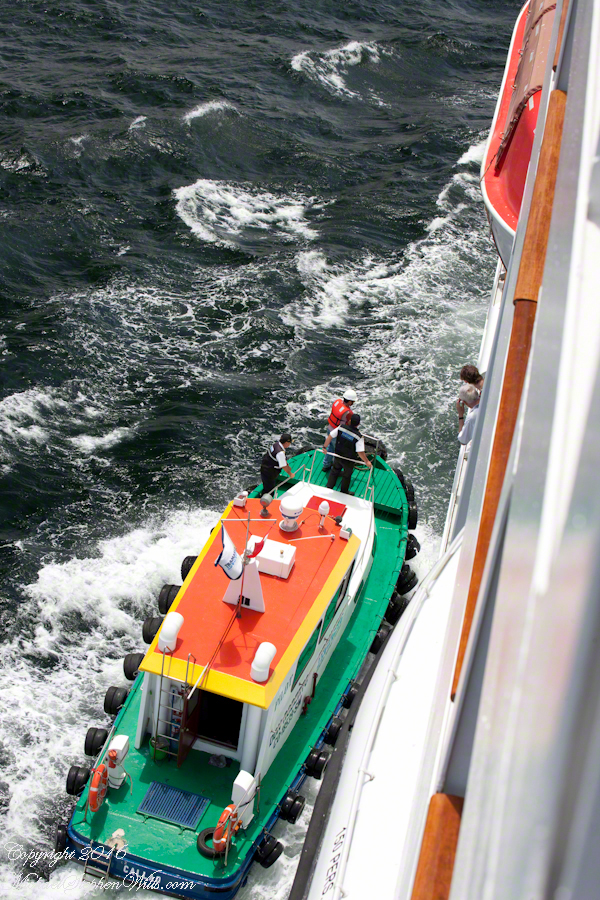
A great personal hazard for pilots is boarding the ship from the pilot boat. From our stateroom terrace we observed fast pilot boats in all seas approach the Regatta miles from port, the pilot on the bow, pull up alongside. Without a harness, the pilot transfers from boat to ship. We observed this several times from our stateroom veranda.
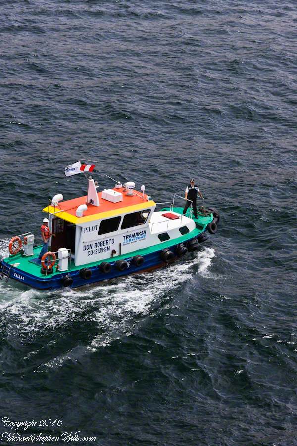
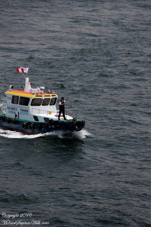
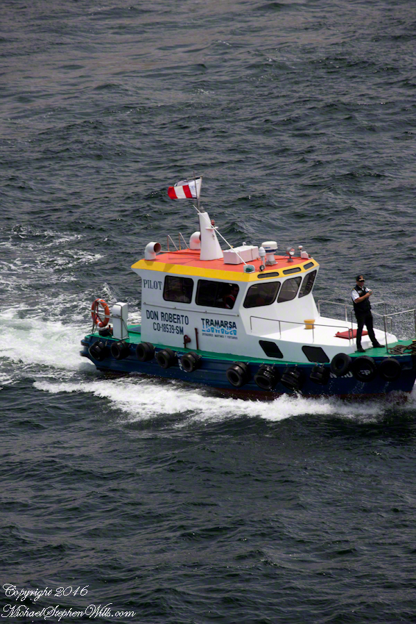
Here are shots of the pilot boat approaching the Regatta off the Peruvian port of Matarani. The boat was mirrored by the colorfully painted houses of Peru.
A fast pilot boat from Matarani approaches the Oceania Regatta. On the bow, the pilot will transfer from boat to ship. On board he will work with the Regatta crew to safely navigate the approach to the Matarani harbor and dock. The whiteness on the land is diatomaceous earth.The whiteness on the land is diatomaceous earth.
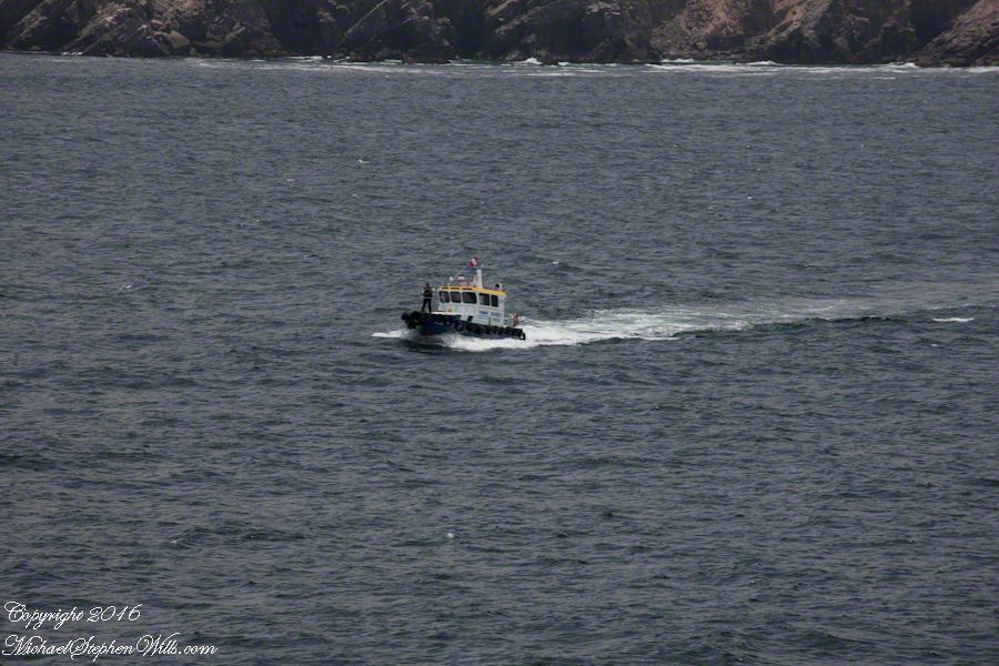
A cautious approach. In the third shot the boat turns to slowly approach the Regatta.
Alongside, boat crewmembers joint Don Roberto on the bow to assist in the transfer. I am not sure which of the two blue uniformed persons was “our” pilot.
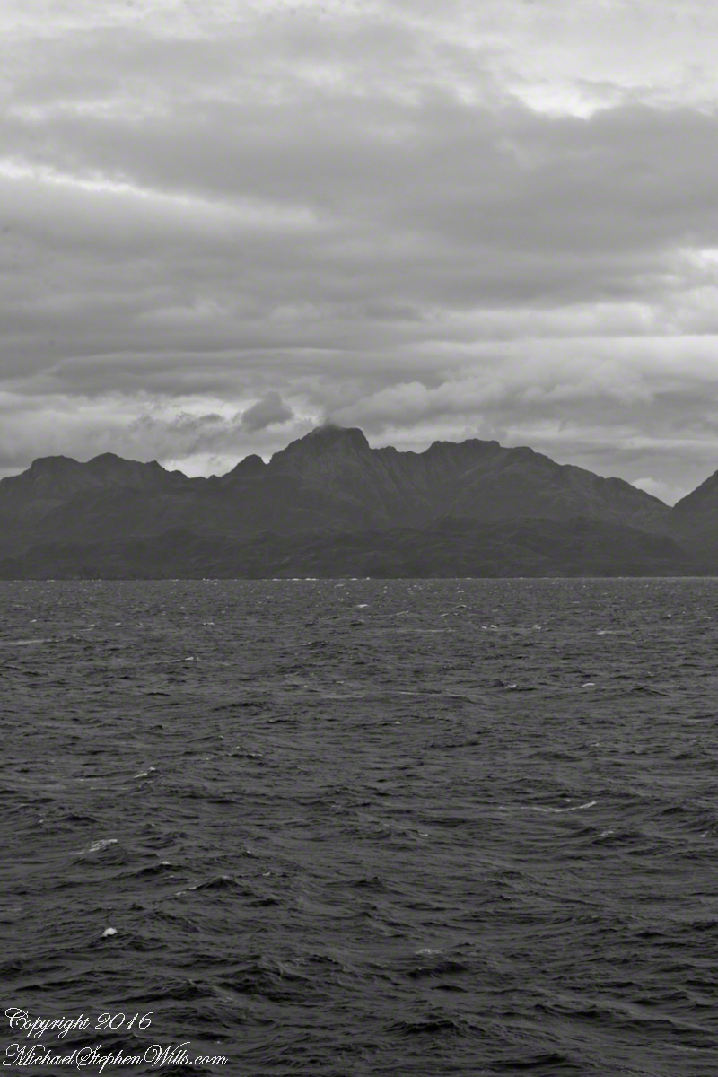
I did not capture the boarding of the pilot who served the Regatta through the Chilean Fjords. Was is at Puerto Montt? Puerto Chacobuco? I am not sure. I do know a maritime pilot was on board as the channel narrowed to 2 miles, named Scout Channel were we passed Scout Island. I was facing generally east from our port side stateroom veranda while capturing these photographs as the Regatta headed south.
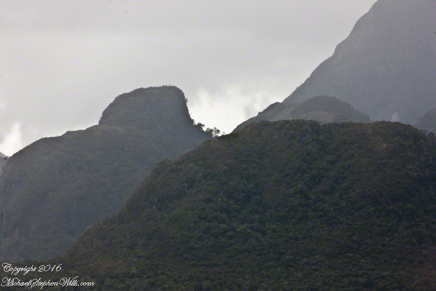
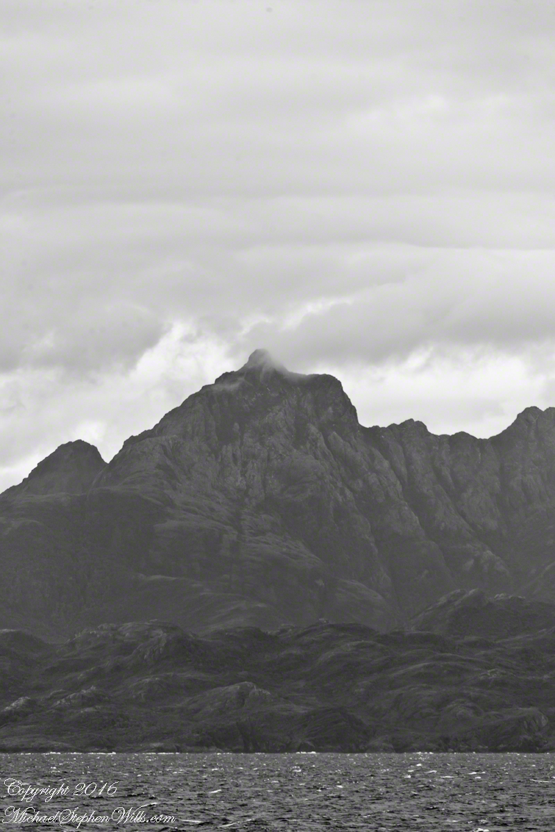
Scout Island. The water is Scout Channel
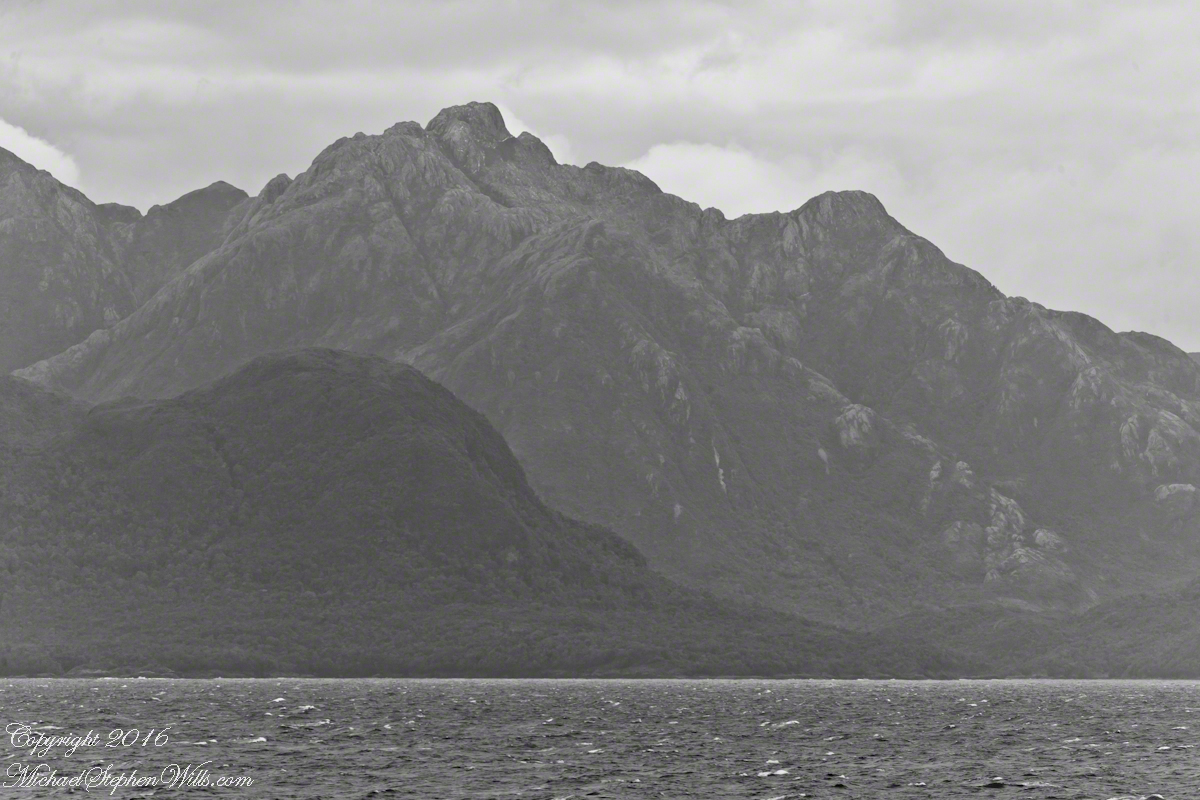
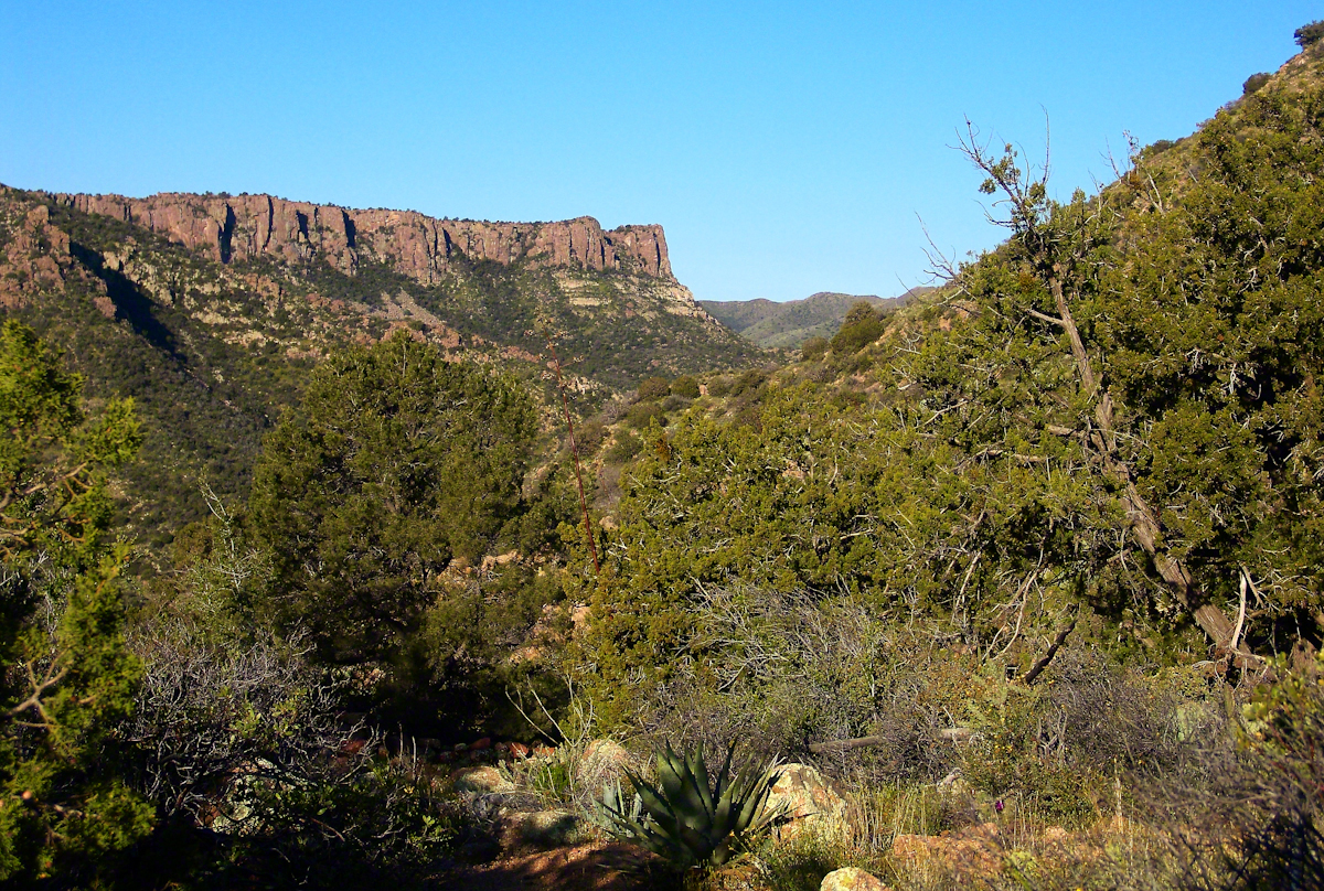
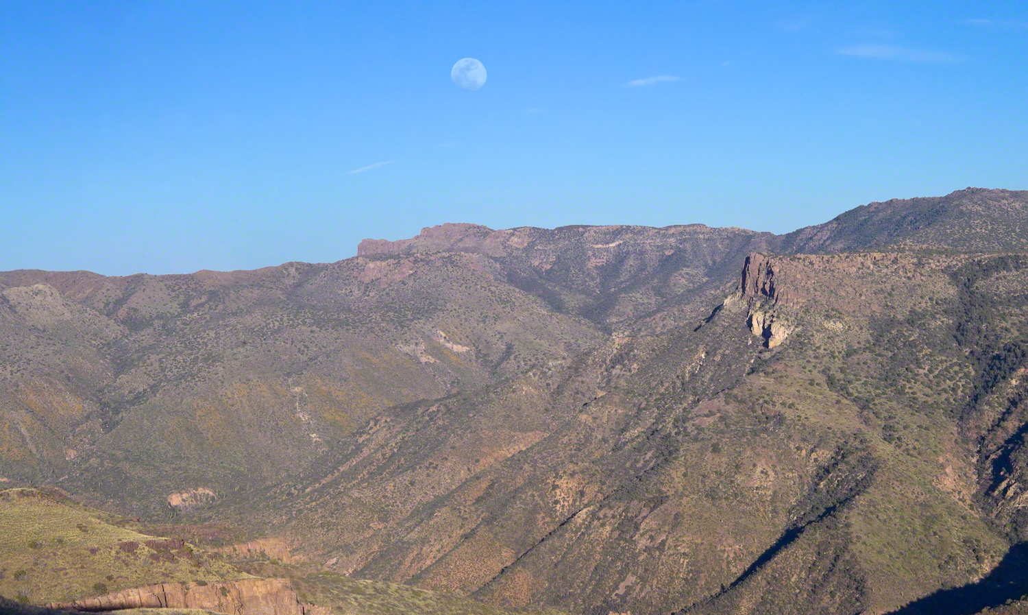
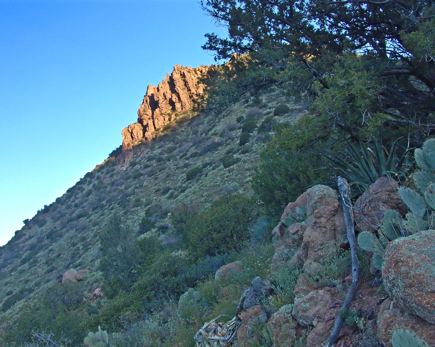
The peak on Scout Island is about 2,100 feet. The smaller peaks in front are about 1,200 and 1,500 feet. All rise straight up from Scout channel.
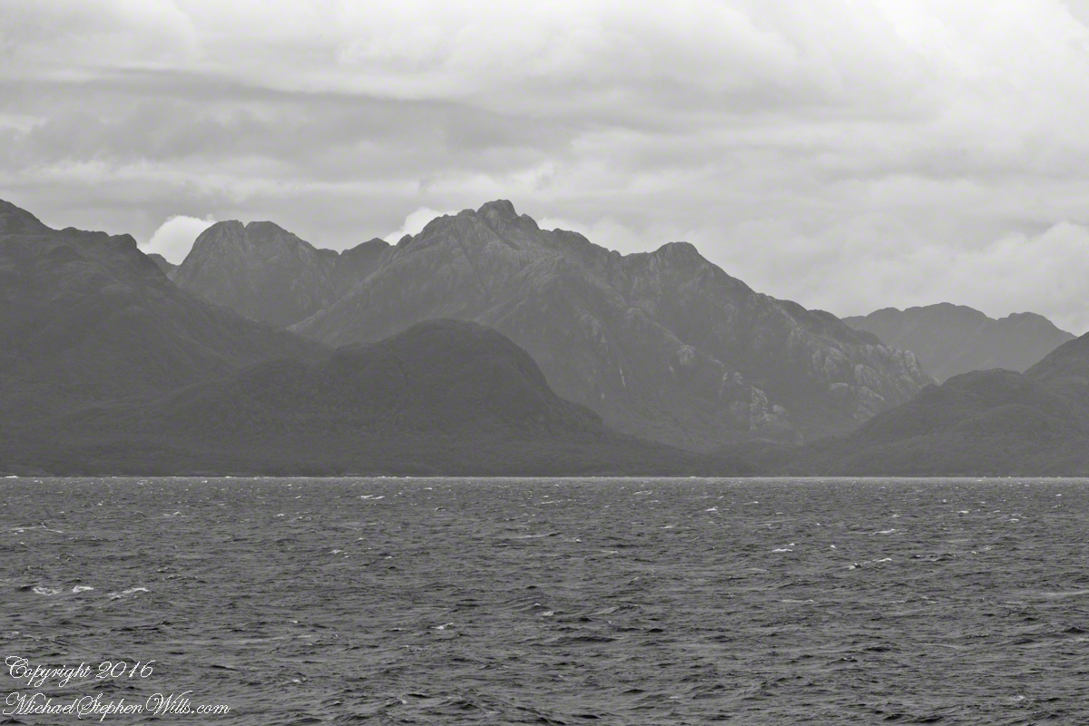
Scout Island lies on the Scout CanalLying just south of Scout Island, Scylla Island is between our ship, in the Scout Canal, and the Kruger Canal. The Kruger is short, between Islands Scout, Orebar, Zealous, Porcia and Tito.Islet Alert is between Canal Scout and Canal Kruger. On the far left there are waves breaking on Pilot Point of Orebar Island, marking the northern end of a small bay, named Hale. You can see the bay behind Islet Alert. On the far left there are waves breaking on Pilot Point
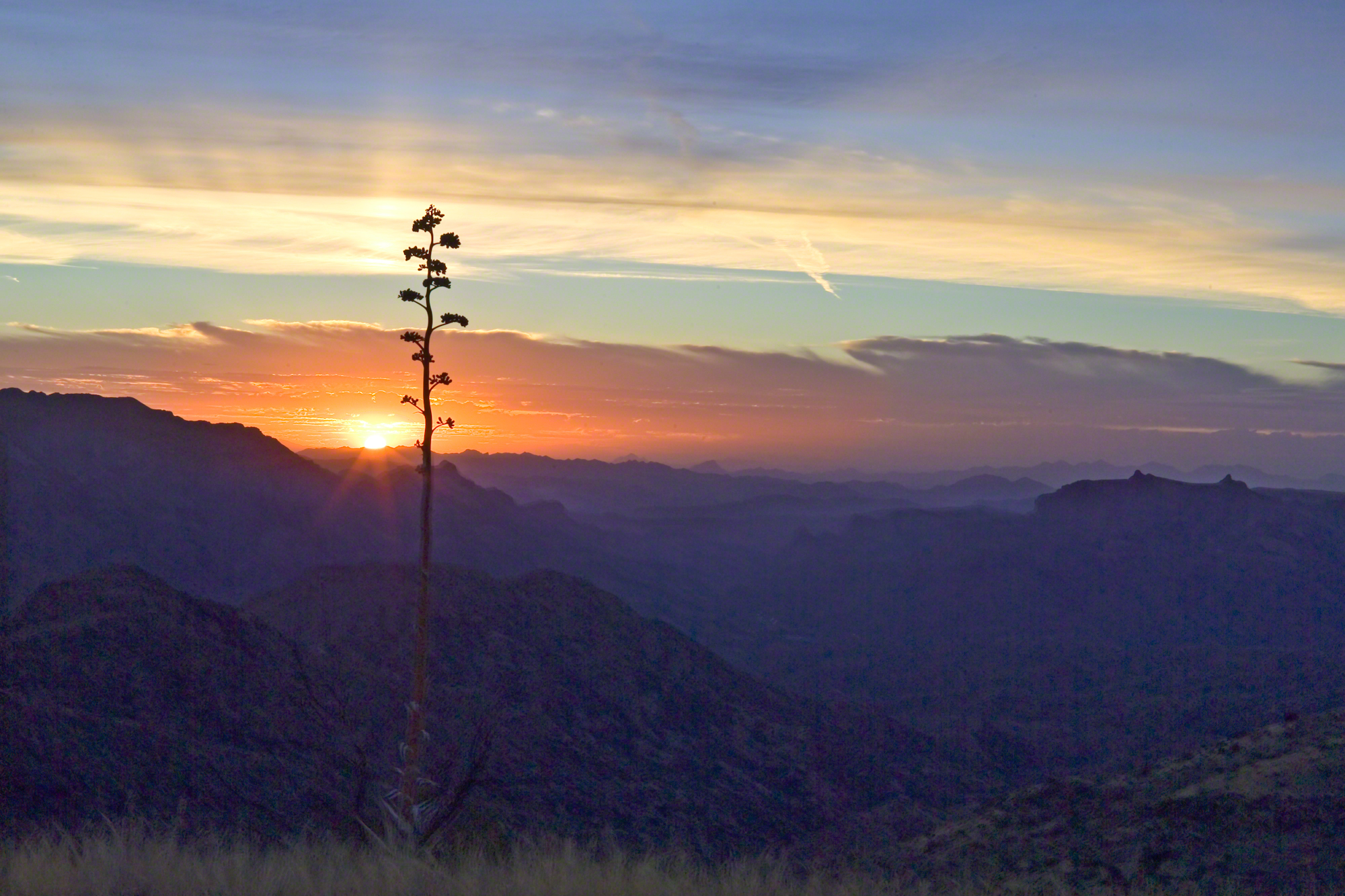
In English the Gulf of Penas means “Gulf of Distress.” Open to the storms of the western pacific ocean, ships seeking refuge sail this body of water to reach the shelter of the bays around the entrance of the Messier Channel.
Stargazing Chileans named the channel after Charles Messier (1730 – 1870), author of a catalog of 110 visually diffuse celestial objects such as the Great Cluster of Hercules, the Crab Nebula of Taurus, the Ring Nebula of Lyra. As Messier catalog objects these are listed on star charts as M13,M1,M57.
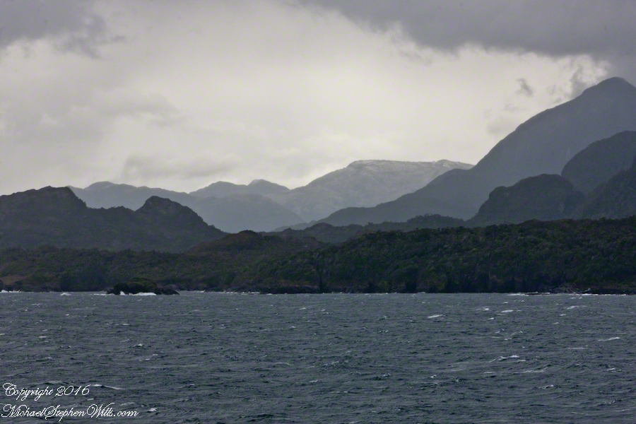
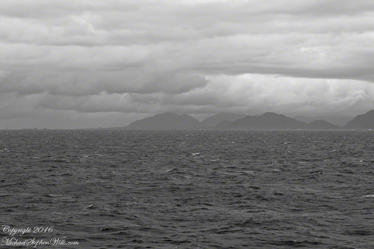
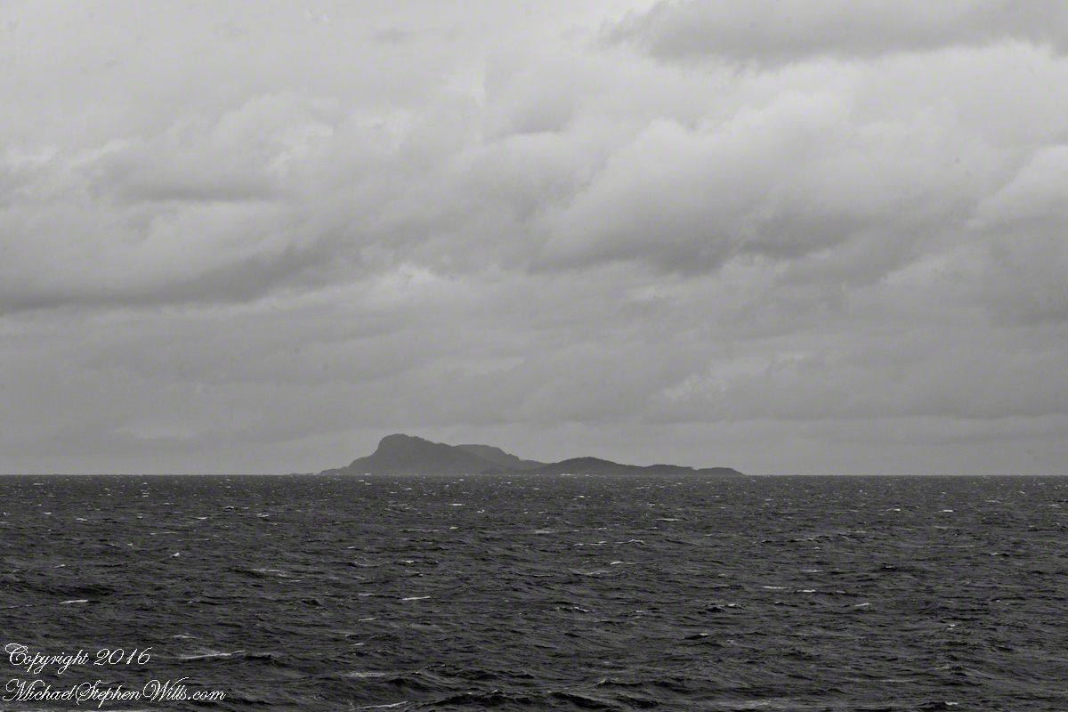
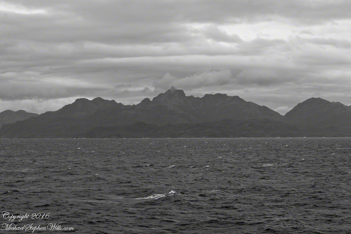
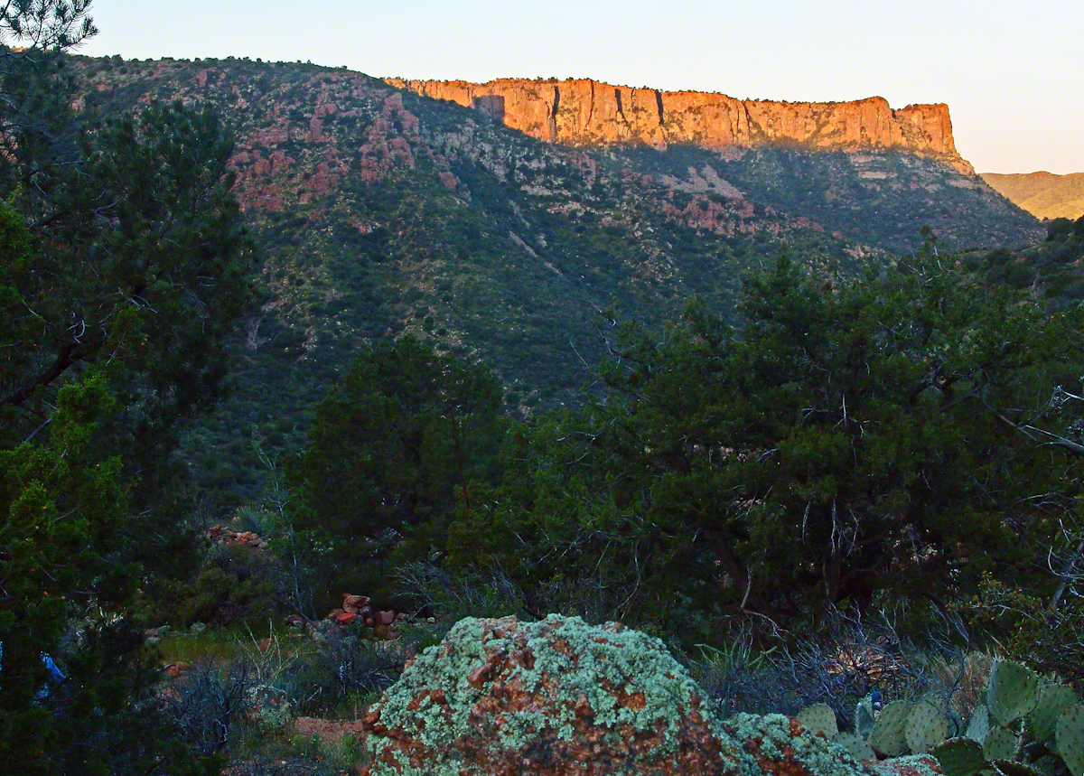
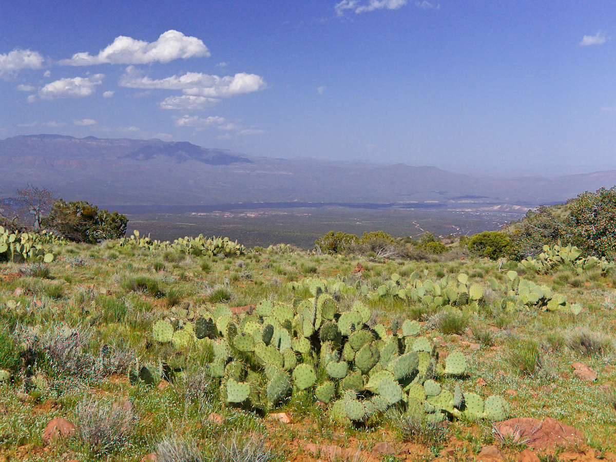
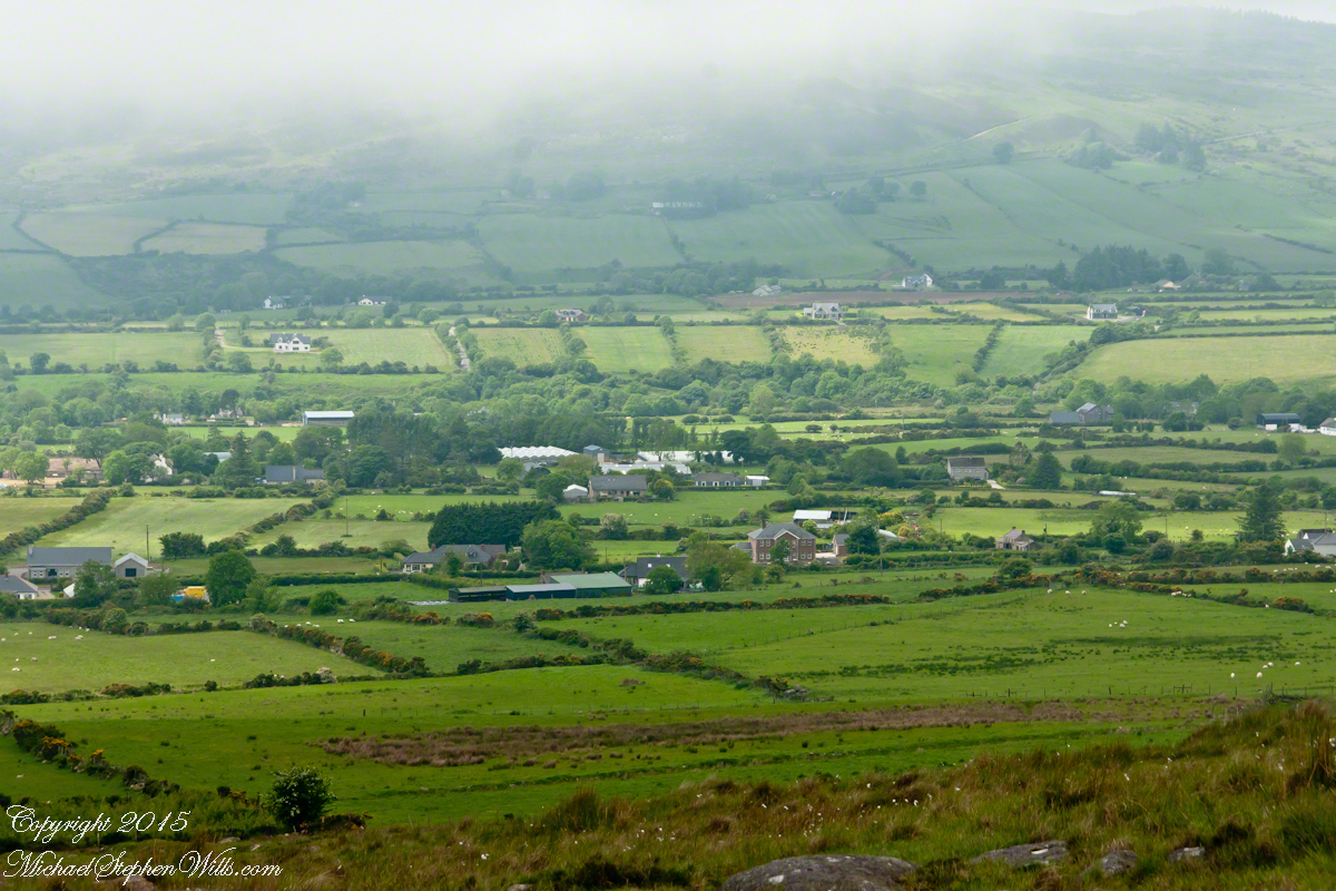
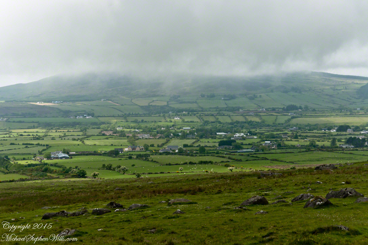
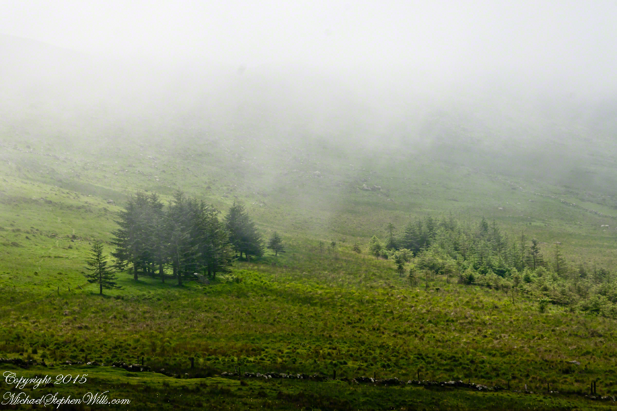
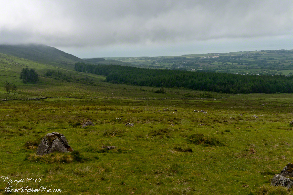
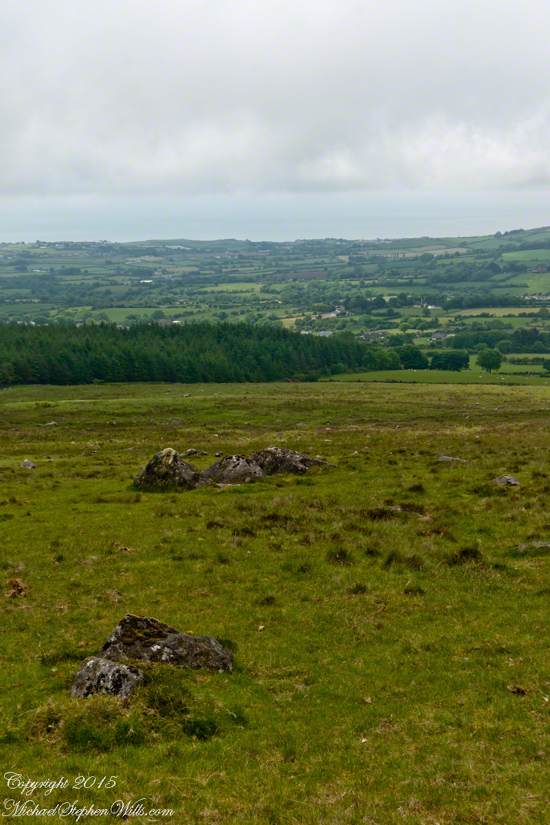
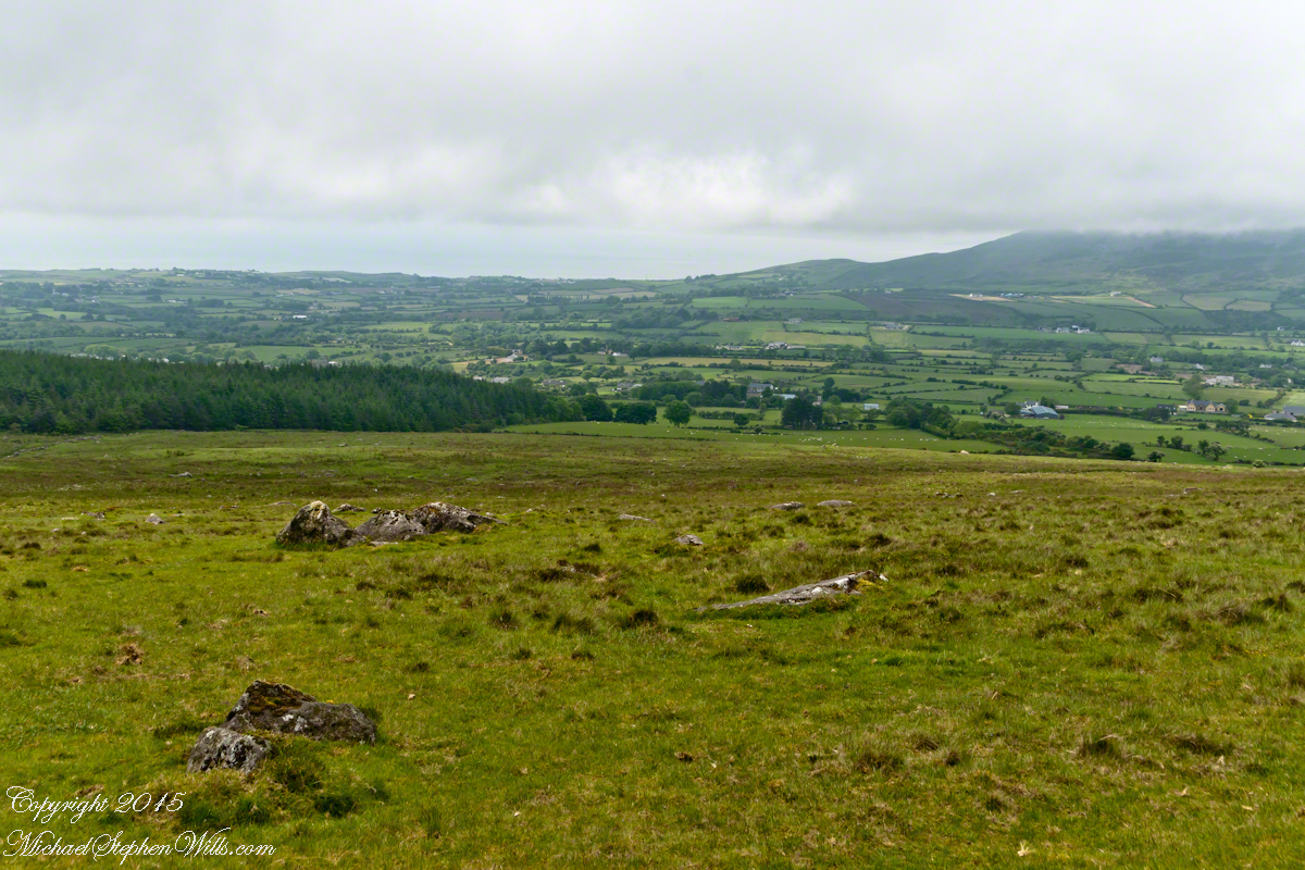
The Larenas and Fresia peninsulas of Aisen Province, Chile, on the southeastern shores of the gulf are seen here as we approach the Messier Channel. The shore is dotted with islets and islands. The Chilean pilot who came aboard at Puerto Chacobuco is earning his salary, keeping us safe. To reach the channel we pass through Tarn Bay, generally north to south. The southern margin of the bay is marked by Sombrero Island, the subject of my next blog.
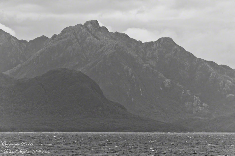
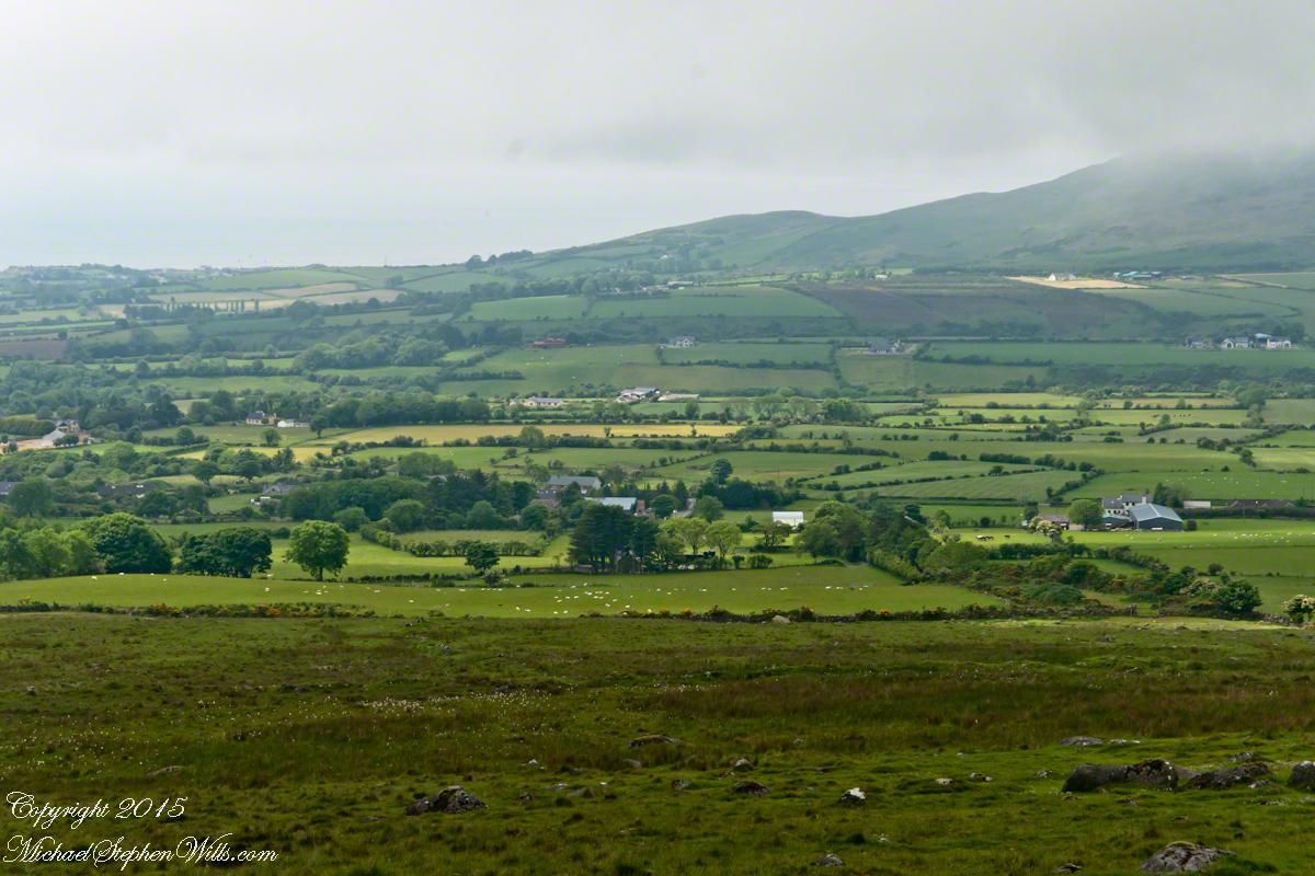
Larenas Peninsula and Merino IsletsClose-up of the Merino IsletsAyautau IslesThe Northern Patagonian Ice Fields lay to the east and north of these mountains of the Larenas Peninsula.High Ridge of the Larenas PeninsulaLarenas Peninsula High Ridge 2Larenas Peninsula High Ridge Close 3The craggy heights of the Larenas Peninsula are in the rear. On the right are Fresia Point (of the eponymous peninsula) and the entrance to Fjord Eloisa.Larenas Peninsula High Ridge Closer 5
Copyright 2022 Michael Stephen Wills All Rights Reserved
In this Part 03, some contemporaneous people are introduced, more information on the environment provided, some previous residents named and imagined.
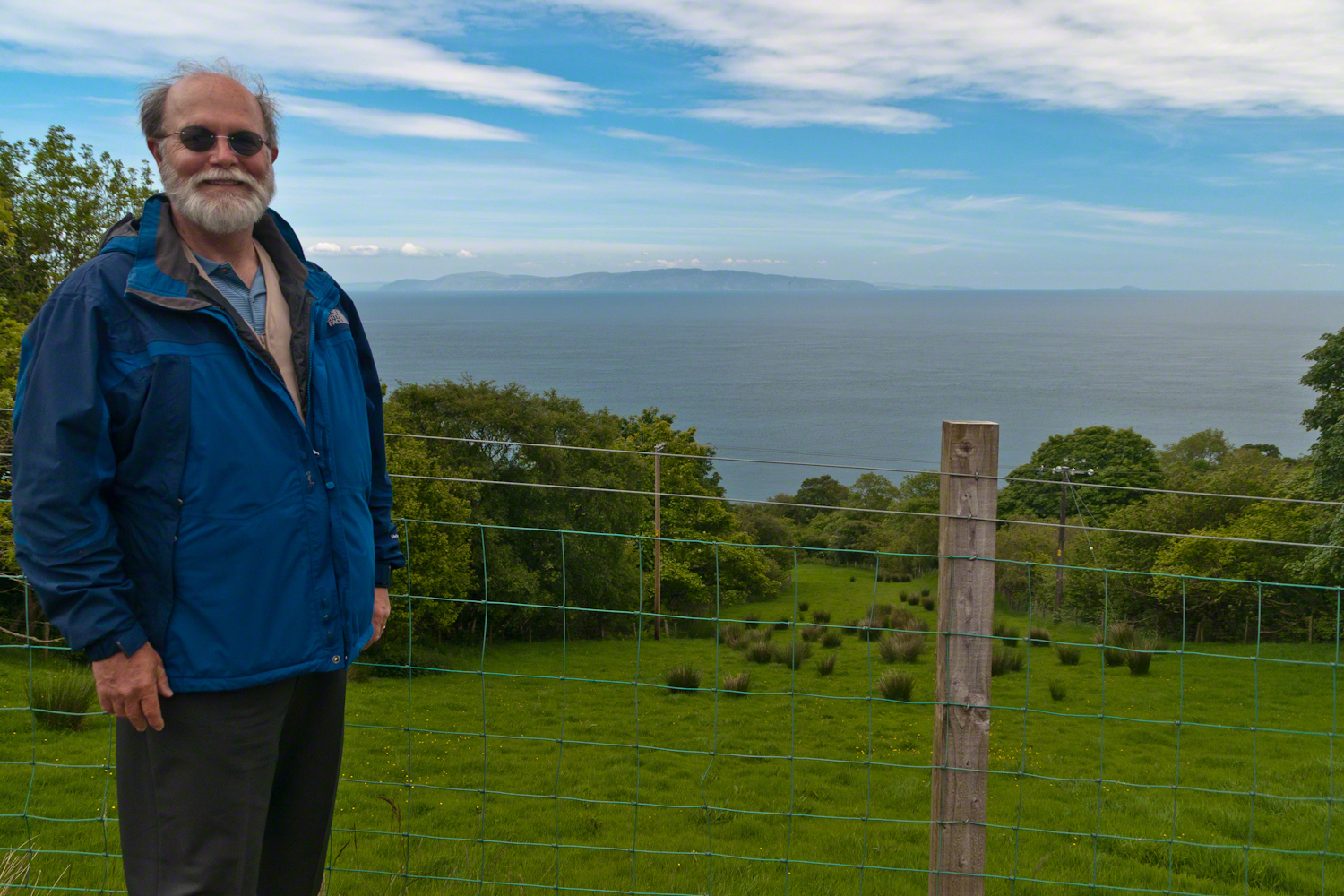
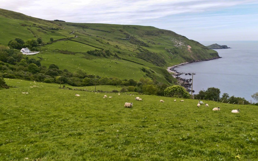
On the way to Torr Head we stopped at this spot in Coolranny Townland to take in this view of the Irish Sea. The land overlooks Loughan Bay toward the Mull of Kintyre and Sanda Island, Scotland. County Antrim, Northern Ireland. Coolranny borders Loughan Townland on the east.
To understand the full beauty of a place, it is necessary to live it, to experience the seasons, approach the land from different aspects; pass the same place many time, noticing overlooked features, enjoying old favorites. We did our best in this single day and took the exploration of this Antrim County coast slow, savoring all the views we noticed as this is a once in a lifetime experience. Imagine our amazement to find Scotland so close at hand. In the past, on a fine day the trip across the North Channel, up eastern Kintyre peninsula shores to Campbeltown at the head of Campbeltown Loch, was easier than a land crossing to a closer town.
I picked Campbeltown because my great great grandfather, a sea captain, emigrated from Scotland to County Louth where my great grandmother, Anne Campbell, married John Mills. In this way Captain Campbell escaped persecution for his Roman Catholic faith.
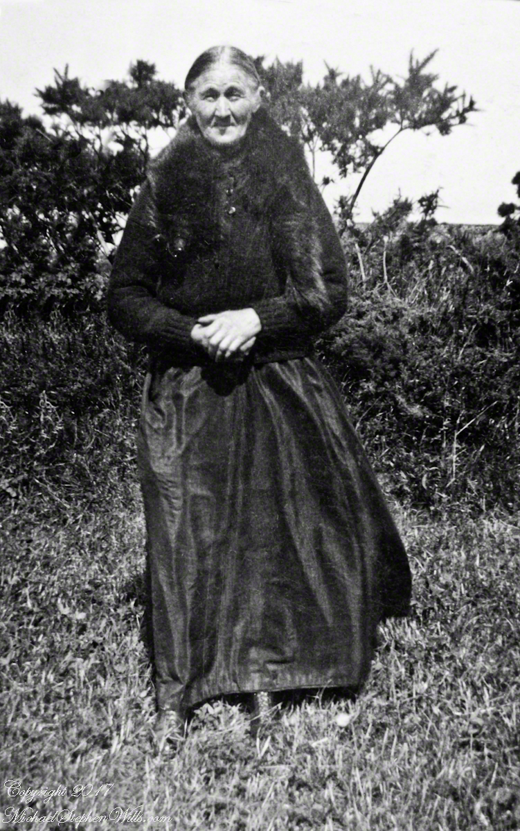
Late in her life, Anne Mills posed for this portrait. I can tell great grandmother Mills is facing north from these clues:
— the press of the eternal east wind on her dress, against her left left and flowing away from the right.
— the sun shadow on her cheek. It was around noon. With the sun, at this latitude, in the south the shadow from her right cheekbone is darker than the left.
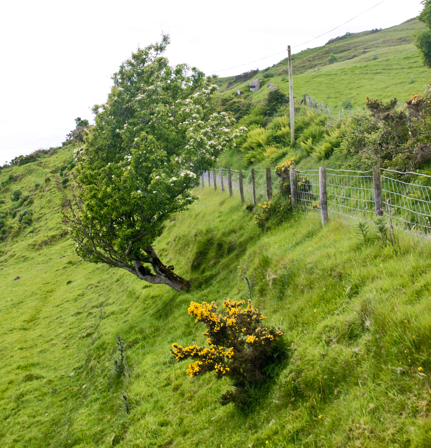
Rowan Tree directional growth from a constant east wind, County Antrim on the Torr Road nort of Cushenden.
A few miles before Loughan Bay, at Coolranny, are informative placards describing the area. I thought the white flowering trees, or shrubs, on the slopes were Hawthorn. On revisiting my capture of the placards I learned these are a different plant named Rowan Tree, aka Mountain-ash. This wind stressed specimen is an typical example of Rowans on this coast, stunted and little more than a bush. This individual is slanted westward from a constant and stiff east wind, as with Anne Mills’ portrait. Residents, past and present, of this coast know this damp, persistent wind well. Note the lack of blossoms on the east side, blossoms that ripen to small dark red fruit called poms (also called rowans). The leaves turn red in the fall. More time, for the fruit to form and leaves to turn, was necessary for me to be certain my identification of this, as a Rowan, is correct.
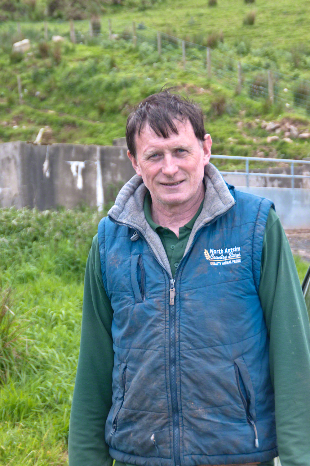
We parked on a turnout above the Loughan Cottages, near this farmer’s sheep pen. He drove up in a huge tractor and conversed with Pam while I was below shooting the cottages. He made a good impression.
On this day, Friday, June 6, 2014 I did two rounds of shooting the cottages. The first, handheld, with a Sony Alpha 700. Upon returning to the car for the Canon, Pam was talking to a friendly sheep farmer who pulled up in a large tractor pulling a tank. It turned out we parked below the turnout for his sheep enclosure built on the hill west of Torr Road. His flocks grazed the surrounding land. He and I talked, too briefly, about the hard lives of the people who lived here.
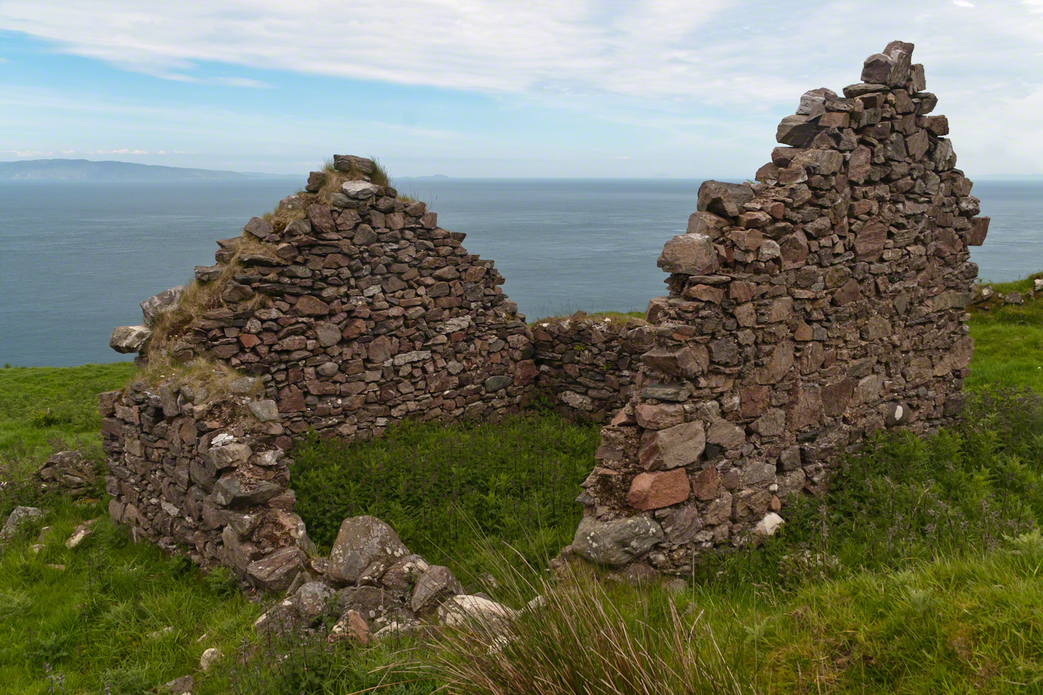
The Coolraney placard, up the road, claimed the cottages were deserted in the 19th century. I found evidence, in the 1901 Irish Census, of three Roman Catholic families, 19 men, women, children, living on Loughan Townland. In Part 02 of this series, setting the stage, Loughan is sized at 112 acres, a single photograph captures Loughan entire. These families had nowhere else to live, in Loughan, other than the cottages.
The smallest, and poorest, the poorest of the poor, family was 32 year old Mary Corbit and her two children, 10 year old Mary and Robert, 2 years. The Corbit family lived in a one room, stone walled, house with a wood or thatch roof. Unlike the other families they had no outbuildings, structures to house livestock or to support a farm operation. The house owner was Marj Delargy.
Here is a single room house among the ruins, four low walls, the east/west with intact gables, the stones collected from the hillside. The west wall higher up the slope, the floor now thick with fern.
Little Mary most certainly took care of Robert for part of the day. Did Mary, with Robert along, gather rowans, and other forage?
A thick growth of ferns, grass on the gable was once a home with a view of Scotland’s Mull of Kintyre 12 miles across the Irish Sea. The Isle of Sanda just visible on the right of the far gable. Alisa Crag just visible in the distance, to the left of the nearest gable.
Mary Corbit: head of household, occupation laborer. There is a footnote to Mary’s “Marriage” entry as Married, “husband at sea.” The “C” of her census signature exactly like my mother signed her name Catherine.
Mary Corbit and her children were not listed in Loughan Townland for the 1911 Census.
For me, the romance of a place is settled in exact knowledge as much as a feeling. Starting with a recollection of the ruined cottages making such an impression we found a parking place and hiked into them loaded with photography equipment, three years later returning to use the photographs, bringing back a rush of memories and feelings, it is a matter of using the set of photographs from that day to build the location.
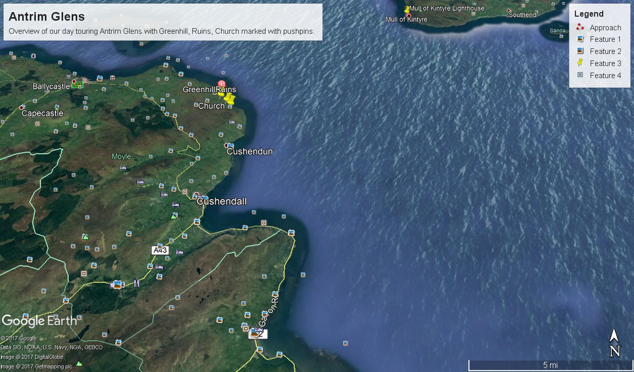
This much I knew, going in: we were touring Antrim Glens entering at Cushendall, after visiting Glenariff Forest Park, proceeding up the coast through Cushendun to Torr Head. A fortuitous encounter with a village of abandoned farm cottages (“ruins”) happened somewhere in between.
Click any image for larger view in a new browser tab. If you are in WordPress Reader, open the post to use this feature.
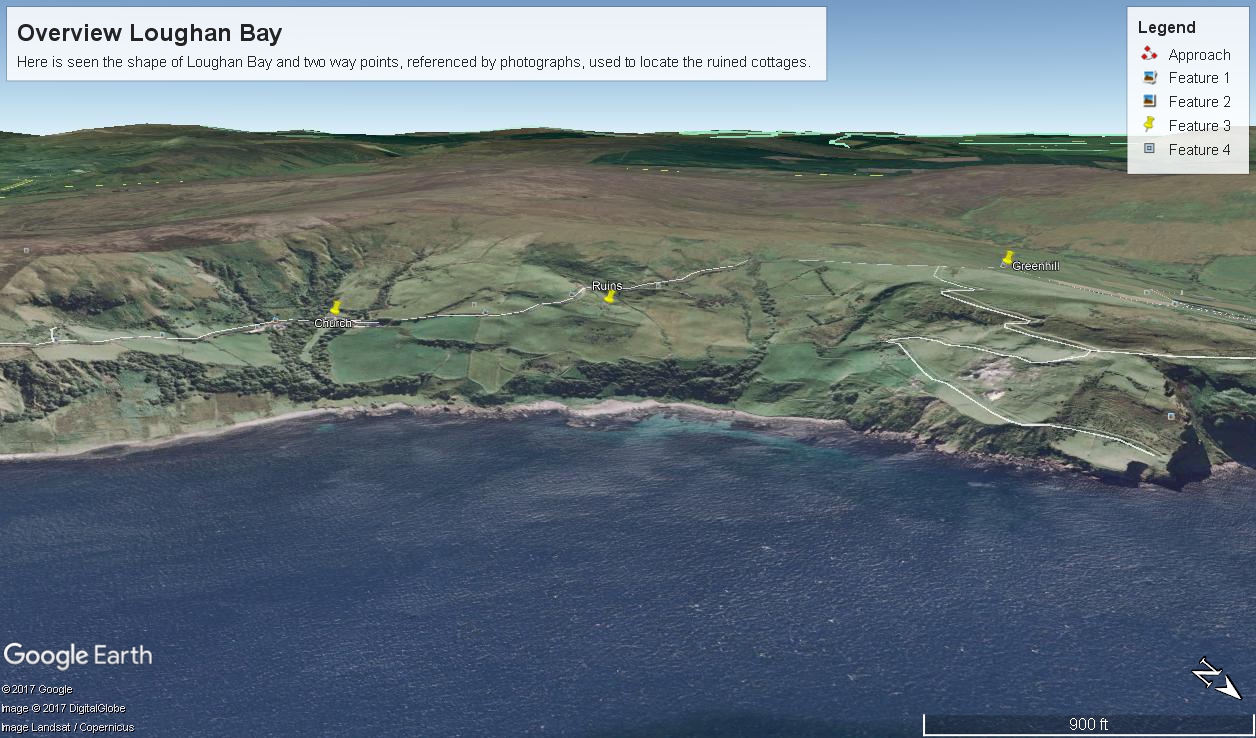
There was a photograph of a notable church prior to the ruins and a fine view, from a place named Greenhill, afterwards.
Here is a picture of the terrain with the three pushpins:
A fine church just off Torr Road, to the west. I found the location in Google Maps, marked as “church”. Google earth showed buildings at the location, this set the “church” pushpin. Associated with the church, using the date/time stamp, were images of signage naming Coolranny townland.
A sign identifying a location as “Greenhill” was after. Neither Google Maps or Earth lists this as a place. It took hours searching web sites of Irish townlands before I found the reference. Greenhill is not a townland; it was listed as a place on one of the maps. Just above the notation was Torr Road, two unique bends in the road. I used these bends to identify the turnoff where I photographed the “Greenhill” sign.
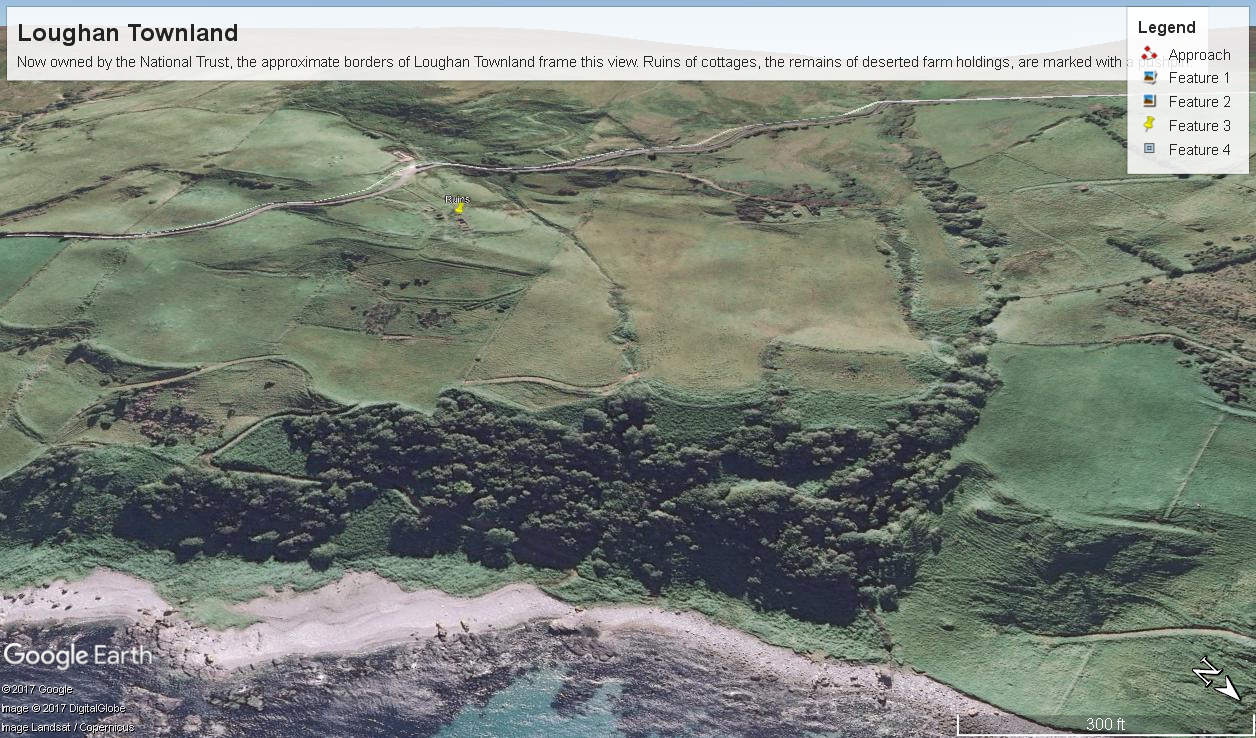
For reasons to be explained later, it is important to know the name of the ruin townland. The place name sign presented in post 1 was a clue (“Loughan an Lochan” — or Loughan Bay), as well at the web site (see link below) listing Irish townlands. The web site map names “Loughan Bay.”
With this information I was able to peruse Google Earth, found the turnoff and the ruins!
See the above Google Map image sized to approximate the Loughan townland boundaries.
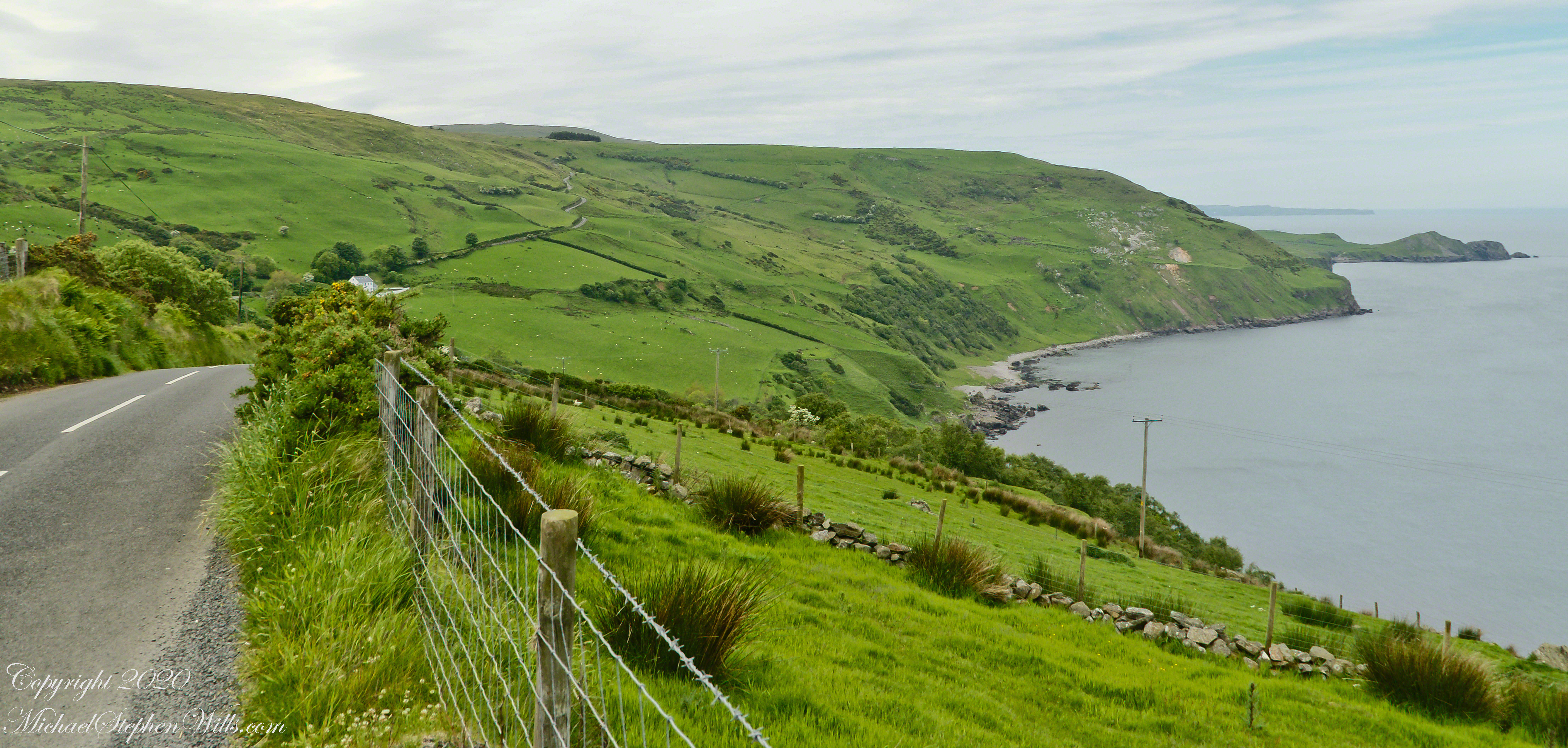
The scenery was jaw dropping lovely the entire time, so I captured view and view. Here are two landscapes time stamped just prior to the church, views including Coolranny and Loughan townlands with Torr Head in the distance.
That is Torr Road….
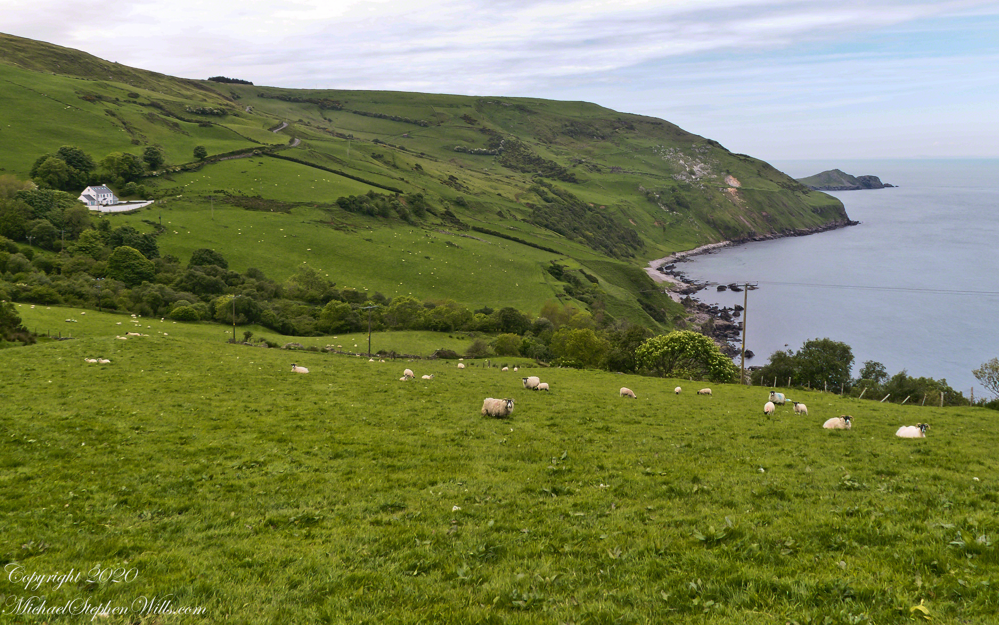
T
……a bit further along. It is possible to locate the ruin site from the Google Earth picture. There is a signature grove of bushes on the slope below the ruin site, sandy beach along shore. In the landscapes, Loughan Bay is cradled in a curve of coast.
To close our time on the Tain Way I offer a poem written and presented to the congregation of the First Unitarian church of Ithaca New York 25 years ago, 1992. Interspersed are final photographs from our walk on the Tain Way of 2014.
The poem content is not directly biographical / confessional although it draws upon my experience as a single parent in the 1980’s through 1990’s.
A Poem Read To The Congregation
I
a crisis threatened an Irish village men women children filled the meeting place everyone participated especially the infants
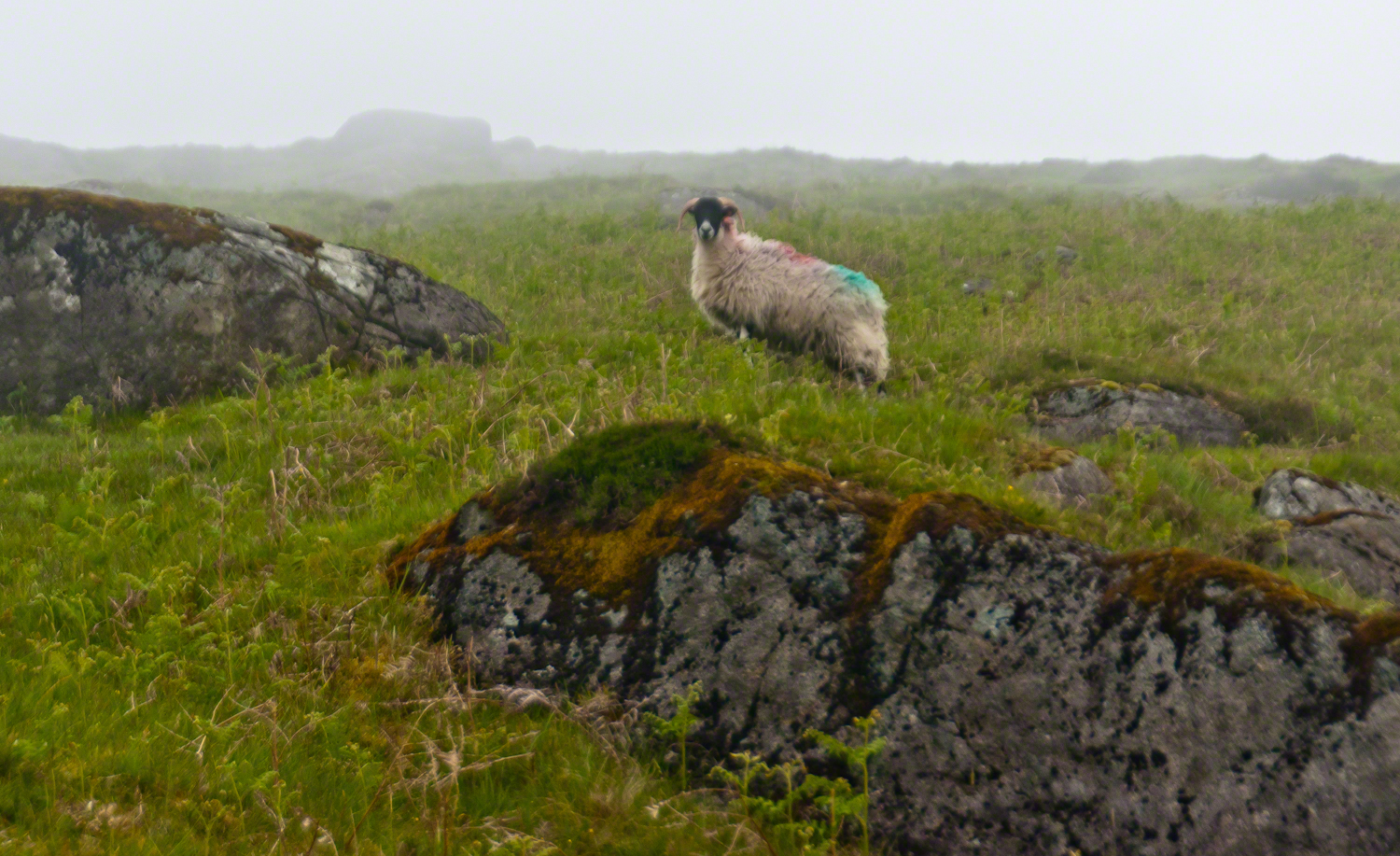
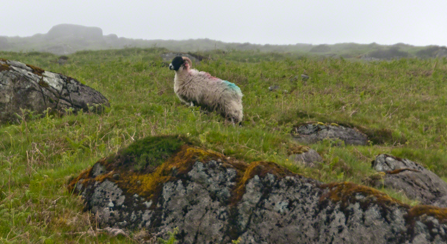
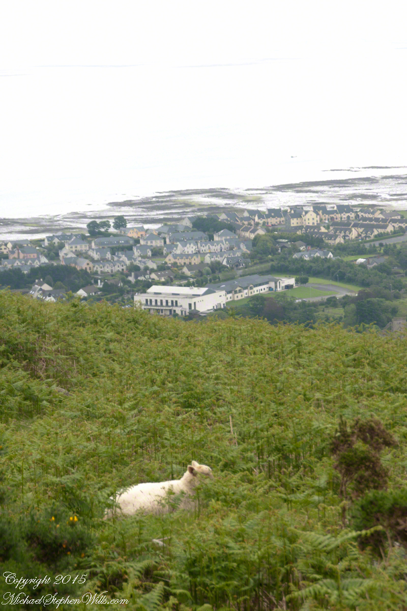
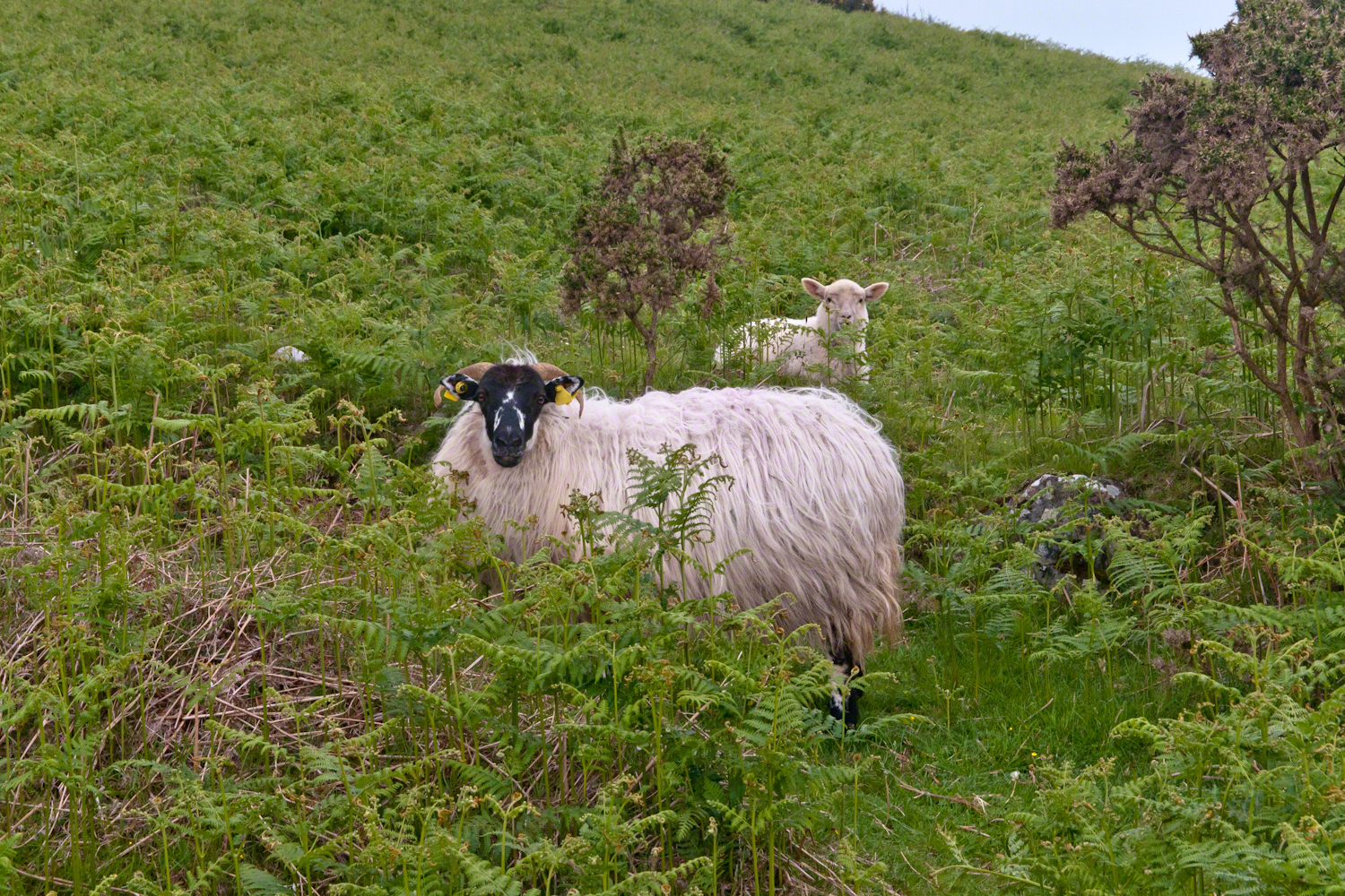
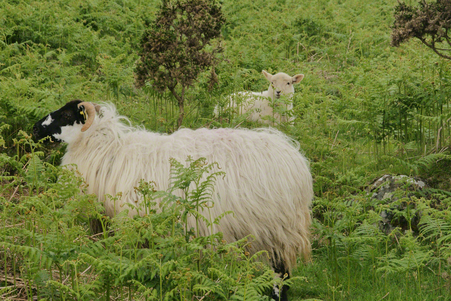
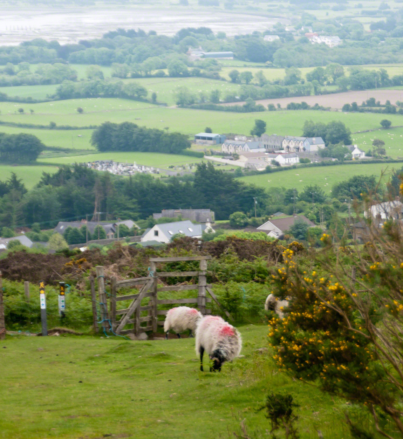
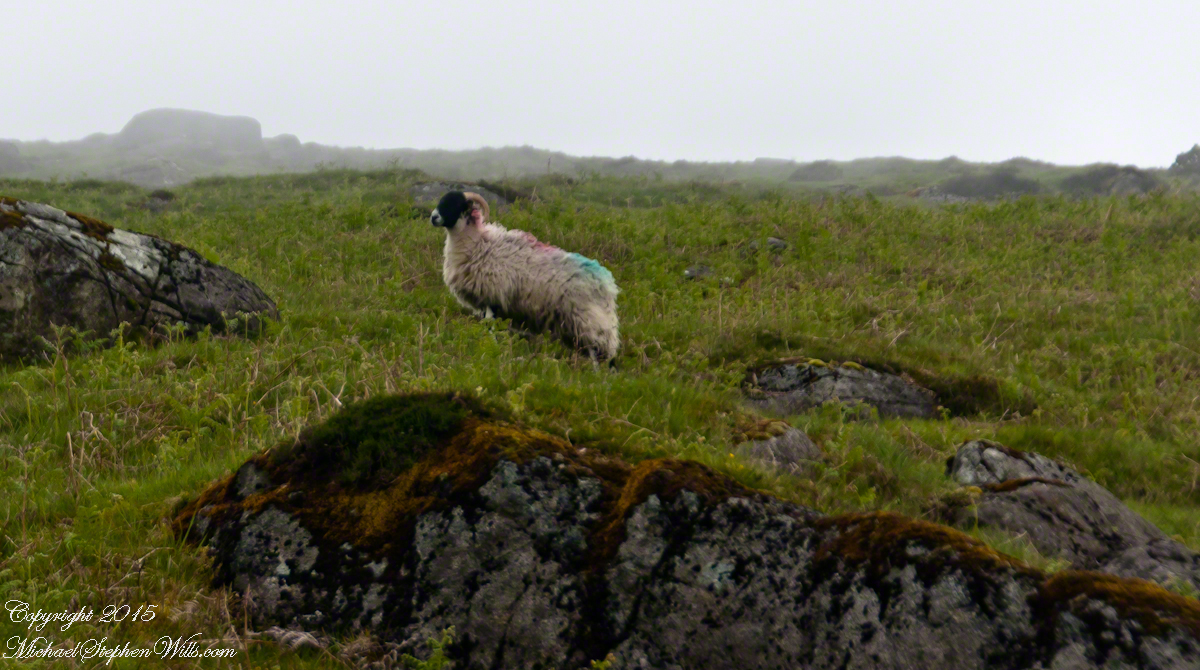
The Tail Way descends from Goliyn Pass to the northeast, passing among commons grazing. I attempted to identify the breed of this ram, but gave up. I can say sheep on the Cooley Peninsula are primarily bred for meat and there are black faced breeds known for meat production.
The flocks of County Louth commonly carry paint brands to identify ownership. Paint branding lessens wool value. This is less of an issue if the livestock are primarily raised for meat.
in spite of it all a plan was arrived at after the vote from the back of the room a man called out
….you know the type…
THIS WILL BE OUR PLAN UNTIL WE FIND OUT WHAT IT IS.
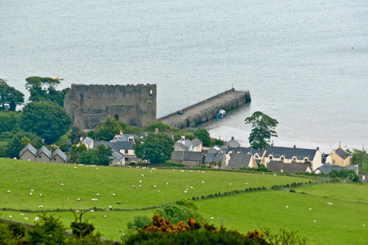
The ancient portion of Carlingford. I called the top of the castle “battlements” in the loose sense, as the ruin now longer has a walkway.
II
my son John and I have a photo of him at 5 years washing dishes standing on a chair up to his elbows in rubber gloves the caption reads “Two Men On Their Own.”
i had agreed to accept a divorce from helen only if john was left with me
one night in particular stands out from that time i did not sleep for planning what john and I would do
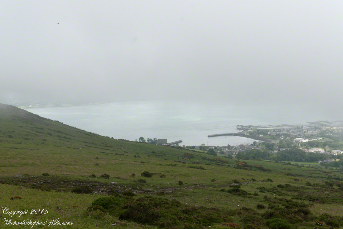
Unbranded, perfect white marks this lamb among an extensive fern bed. Tain Way steepens on approaching Carlingford. Below is the residential Carlingford, the Greenore road running to the right. The large structure with two rows of dark windows is the Four Seasons Hotel where a substantial brunch is served Sundays.
III
seven years passed not a long time since then we’ve moved found another a better life
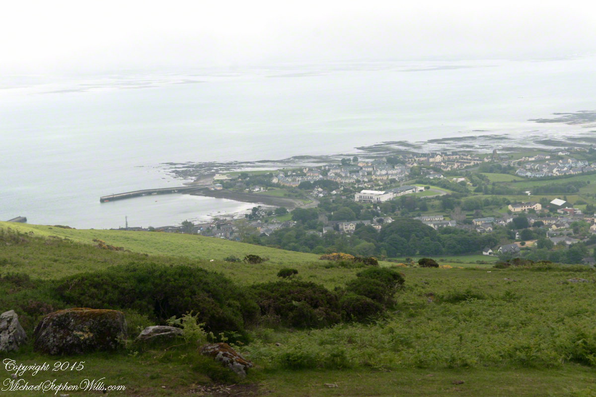
We descended below the ridge to pass into excellent pasturage. The growth of fern hides a lush grass pasture.
raising John alone was not part of the plan Its been just john and me helen gave birth to john to have a part of me in case of loss i felt the same way and she understood
a welcome feminine voice in our home “Little House on the Prairie” and “Little House in the Big Woods” twice.
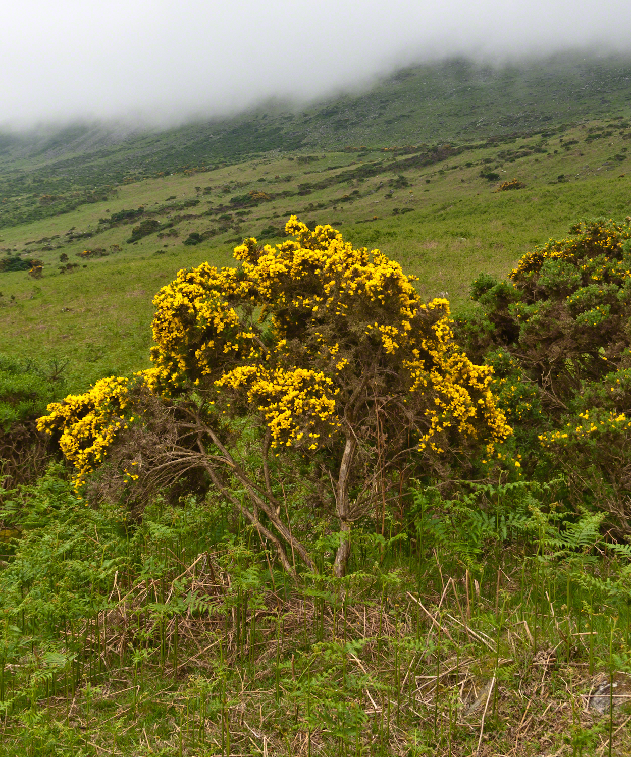
Plants and livestock on these slopes of Slieve Foy contend with adverse conditions in the form of a constant east wind. The stress is evident in the stressed trunk, although this species thrives in this environment, as seen in the strength of bloom and the yellow patches on the slopes, all of which are gorse. Gorse flowers are edible; the entire plant can be used as fodder when crushed to the consistency of moss. In Scotland there’s a museum with a roundish boulder called a Whin Stone.
V
Here is an excerpt from a newspaper article by Wilder called “HOME” that has an emotional resonance for me dated 1923 Wilder was in her 50’s.
Out in the meadow, I picked a wild sunflower, and as I looked into its golden heart, such a wave of homesickness came over me that I almost wept. I wanted Mother, with her gentle voice and quiet firmness; I longed to hear Father’s jolly songs and to see his twinkling blue eyes; I was lonesome for the sister with whom I used to play in the meadow picking daisies and wild sunflowers.
Across the years, the old home and its love called to me, and memories of sweet words of counsel came flooding back. I realize that’s all my life the teaching of these early days have influenced me, and the example set by Father and Mother has been something I have tried to follow, with failure here and there, with rebellion at times; but always coming back to it as the compass needle to the star.
So much depends upon the homemakers. I sometimes wonder if they are so busy now with other things that they are forgetting the importance of this special work. Especially did I wonder when reading recently that there was a great many child suicides in the United States during the last year. Not long ago we had never heard of such a thing in our own country, and I am sure there must be something wrong with the home of a child who commits suicide.
The trail detours around sheep pasture just before descending to the outskirts of Carlingford.
VI
we give so much to our children what’s left over though is ours
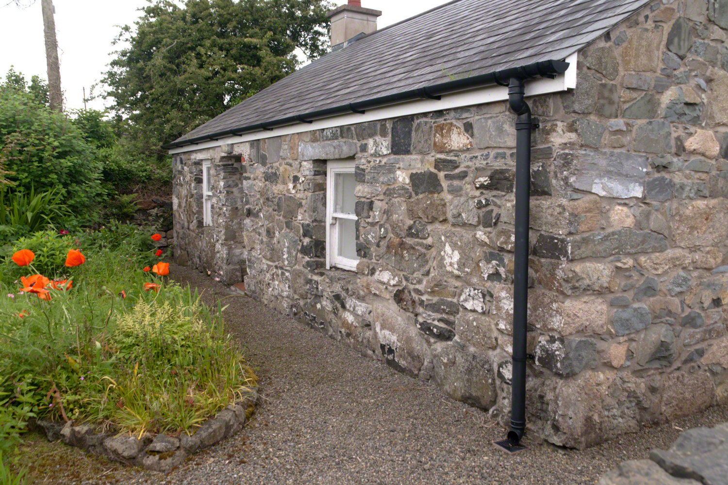
The first Carlingford home passed by the trail is a solid fieldstone home with a slate roof fronted by a natural garden featuring red poppies.
William Carlos Williams wrote it is difficult to get the news from poems yet men diet miserably every day for lack of what is found there
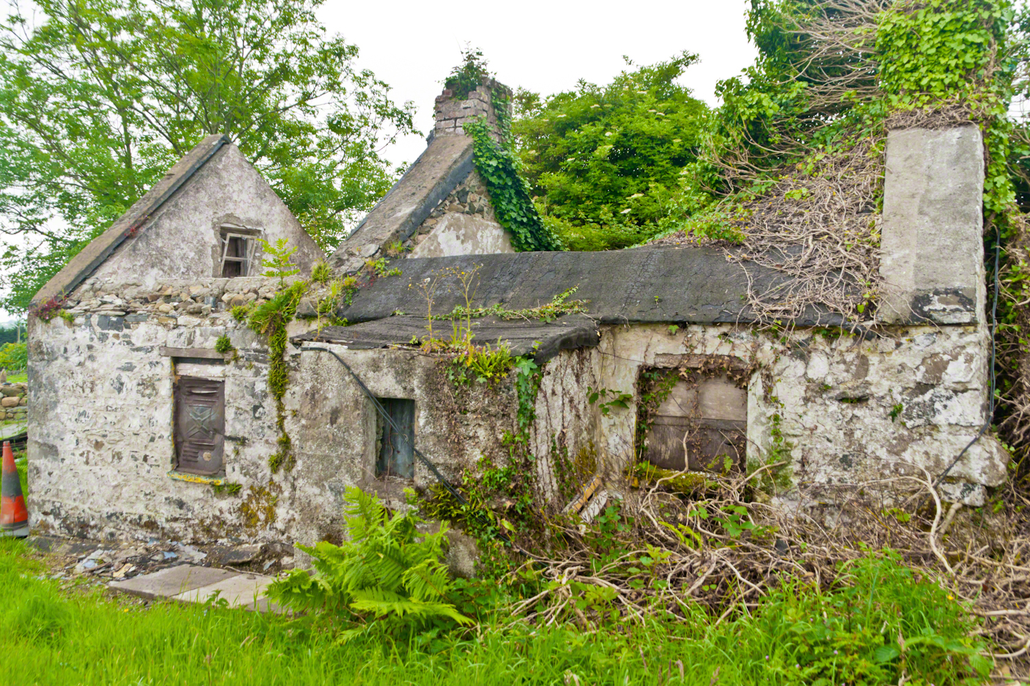
This ruin lies off the Tain Way as it descends through the outskirts of Carlingford town. Constructed of stones, mortar and what looks to be concrete. Long slate slabs protect the eves. It’s been abandoned for an age. What a story it must have, long slow and full of life.
it is not difficult to understand this to live it is another matter
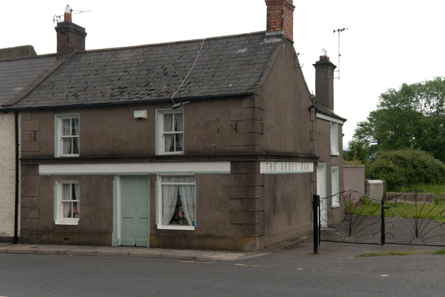
Named for the Carlingford Priory, a nearby ruin, the Abby Bar is located on Dundalk Street (R173), Liberties of Carlingford, Carlingford, Co. Louth, Ireland. Liberties of Carlingford might be called greater Carlingford in the USA.
you have to live it in order to have something left over
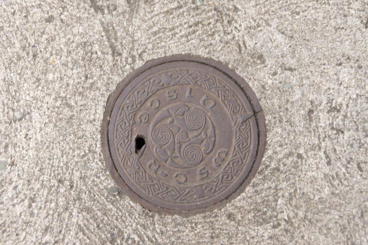
A metal cover, about 8 inches in diameter located in the sidewalk on the left side of The Abby Bar on Dundalk Street, Carlingford. The triple spiral triskelion symbol has become a Christian symbol of faith for Celtic Christians around the world, a visual representation of the Trinity (Father, Son, Holy Spirit) and eternity. In Ireland, the symbol acquired its Christian meaning prior to the 5th century. The triskelion predates Christina and even Celtic culture as petroglyphs of the astronomical calendar at the megalithic tomb Newgrange (3,200 BC). The symbol is associated with Neolithic cultures throughout Western Europe.
VII
never the less my emotional resonance in reading that piece “Home”
Caring touches to a well-tended home entrance along the Tain Way, Carlingford, County Louth, Ireland.
did not come from the sentiments Wilder so skillfully evoked though I shared them it was that sharp part
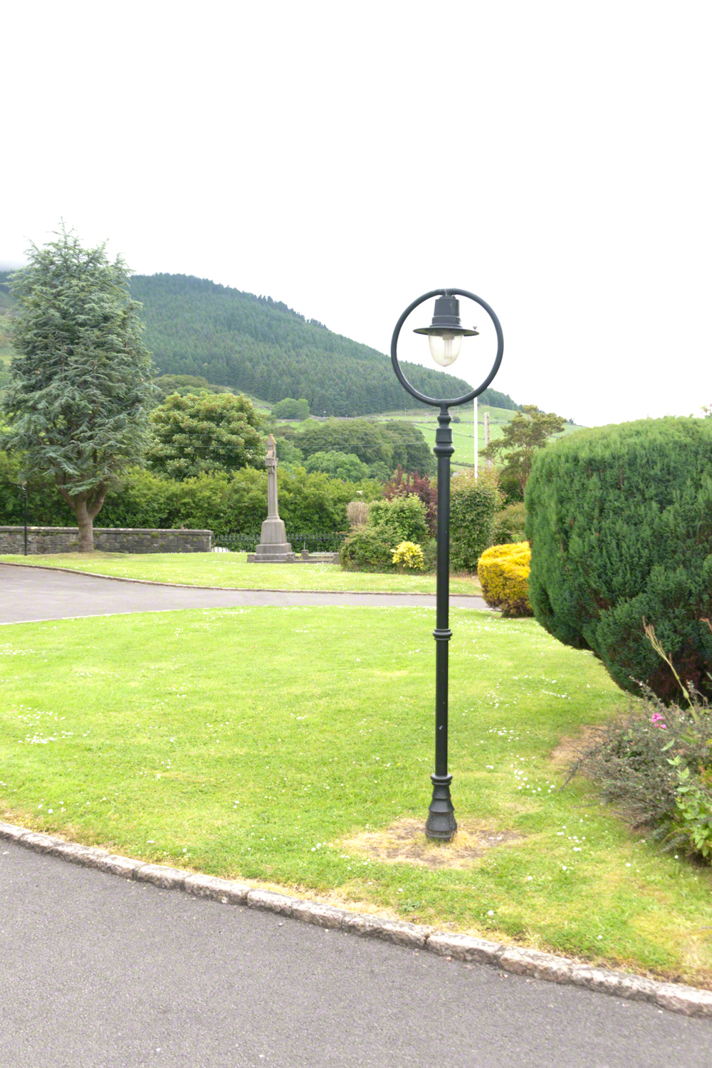
Lamp post on Church of Saint Michael grounds.
i did not agree with it lacking a reason and so must have re-read “Home” fifty times a hundred who knows
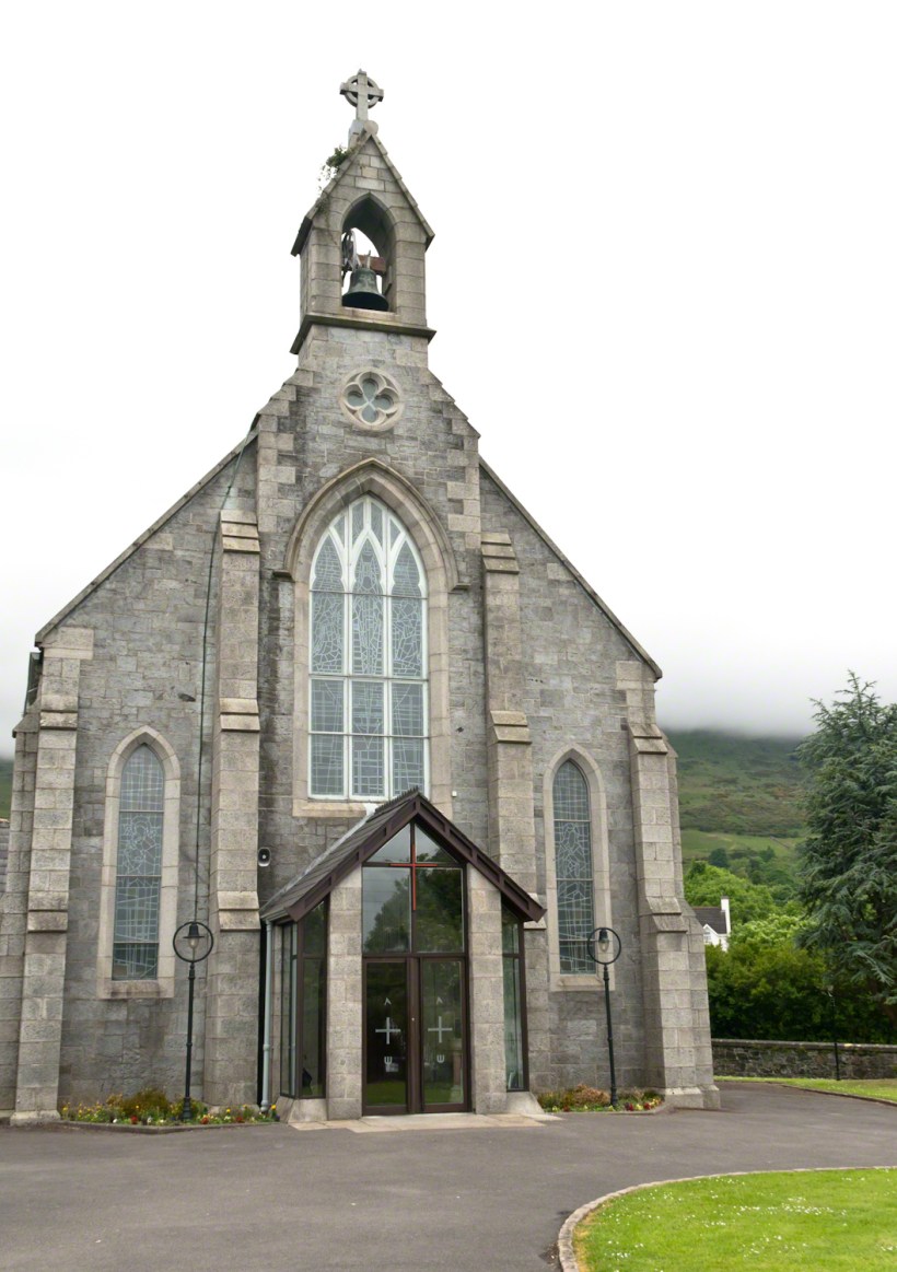
The Church of Saint Michael is a Roman Catholic Church on Dundalk Street (R173), Carlingford.
so committed to speak today and began to write something was bound to shake loose
then those lines form Deuteronomy gave themselves to me
Before you this day is set good and evil, life and death. Choose life, that both you and your descendants might live.
“Home” was a twist of these lines
as long ago as 1923 Wilder was experiencing our present contemplating the unthinkable
Wilder held her own experience as a shield and denied such a tragedy could ever touch her
for me the result is a beautiful poisoned apple innocently offered by a treasured friend
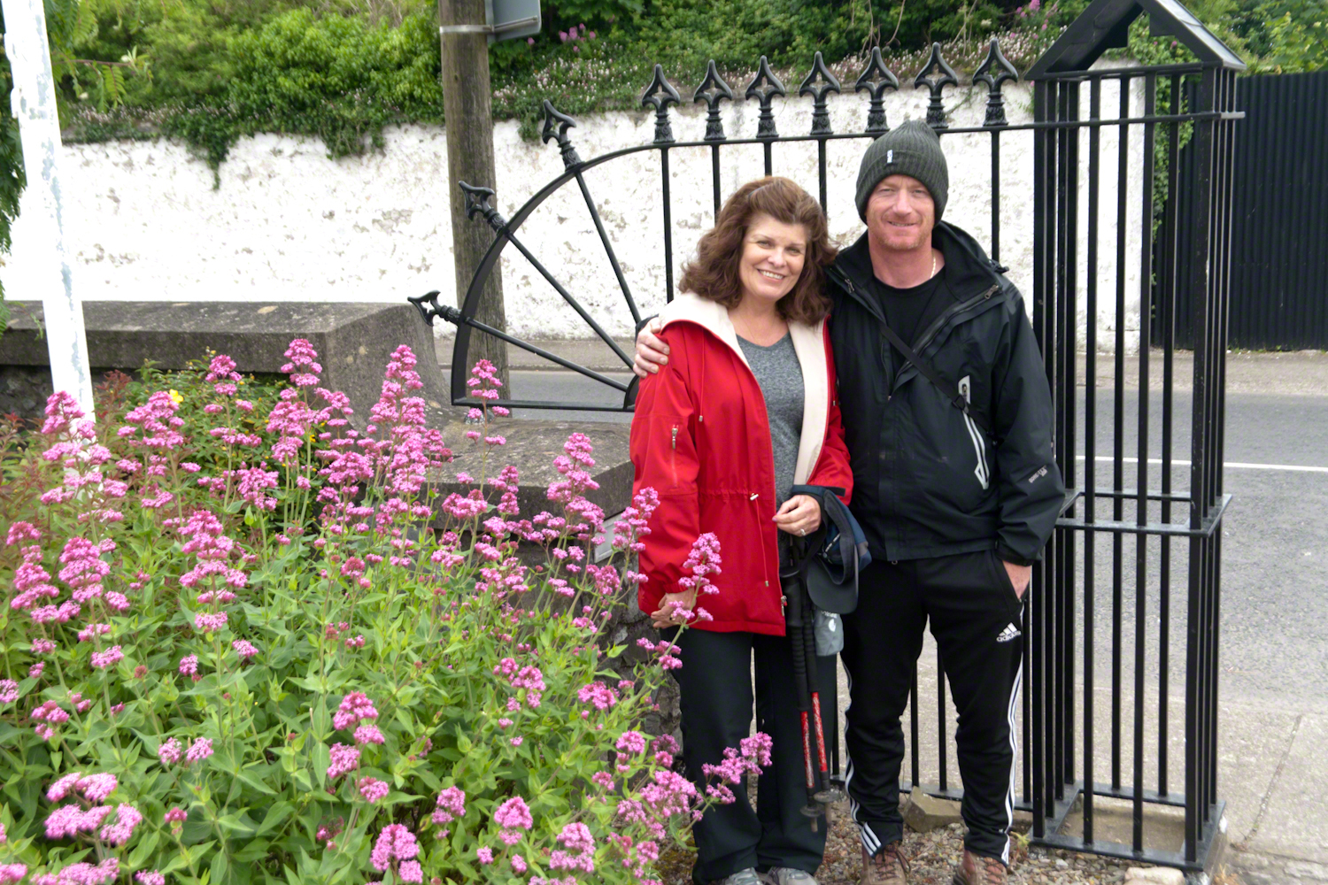
Pam Wills and Sean Mills on the grounds of the Church of Saint Michael, Dundalk Road (R176), Carlingford.
Imagine a bowl with steep sides, rough and sharp in places.
Look along the bottom and see a silver stream, sparkling and singing through rocks.
A figure is clinging to the upper side, almost to the rim.
The figure is me in the setting of my blog, “A Dry Piece of Paradise”. Here is my view from that spot.
View from the rim of Nameless Canyon
Hiking along this bowl rim I came to a clearing in the juniper and Manzanita bushes, with a fire ring and pile of roughly broken wood with outstanding views on all sides. This tradition of leaving wood is a welcome intrusion of human kindness and sympathy in this wilderness. We gather wood for total strangers, people we will never meet, to potentially save them in a rainy, cold darkness.
At noon Pine Creek was two miles ahead as I looked into a steep descent, a wide canyon and open range of low oaks, almost shrubs, and small juniper trees. Later, well along the trail, I stepped over Walnut Spring, a silent thread of water through a thin blaze of trees, yellow flowers and continued toward Reavis Gap and Pine Creek on Oregon Ed’s recommendation.
“Even a blind man could find water there this year,” Ed claimed.
Ed’s van was parked at the Superstition Wilderness Tule trailhead when my sister dropped me off the morning before. She noted the van thickly coated with dust over grey primer with an Oregon license plate and changed her plan to accompany me the first mile or so for fear the van’s owner was lurking inside.
It was just as well Diane stayed behind because I met Ed two miles up the trail that first day. From the start, Ed was too outgoing and his pack more empty than light. He chatted me up on how “blue my shirt was”, seen from above, about his trips from Oregon to Arizona a few times a year, about his claim to be returning from a five day round trip to Tortilla Flats.
Ed’s good news about how the usual springs were flowing was welcome. Then, Ed expected me to give him some water for this information. This expectation of his was irrational, given his reports of good water sources. Plus, Ed was only a few miles from his van showed no physical signs of needing water.
I was to discover, a few hours in the direction he claimed to have walked, a flowing stream.
Ed’s attitude changed upon his spotting my .45 in a tactical holster strapped to my leg. Thirty seconds later he was heading down the trail. I had no water to spare and was relieved I didn’t need to escort Diane back to her car. Maybe Ed was an anti-gun advocate, but my conclusion was he had some lurking to do, back at the van.
While planning this trip I imagined “Reavis Gap” to be a narrow trail between towering peaks. While walking under the water heavy pack I elaborated on this expectation, but coming on the gap I walked through and into the reality of this photograph, taken from a point looking over the gap and down into Two Bar trail. This was the site of my first meeting with “The Searcher.”
North from Reavis Gap
“The Gap” itself is a high, narrow ridge over a 7,000 foot high valley with peaks, ridges and the occasional hoodoo. That rock formation in the mid-distance includes a hoodoo. It was this hoodoo that introduced me to the gap, being what I saw first high above in the distance from Walnut Spring, a silent thread of water through a thin blaze of cottonwood trees and yellow flowers.
Here’s a link to a video I did of a vast field of Wild Oats which covered Reavis Gap that season.
I first saw the “The Searcher” on that high, narrow ridge above Two Bar trail. I guessed he was a mounted park ranger; from the wide brimmed hat he was holding and the loose fitting shirt. From a half mile away his golden brown mount was standing steady, apparently at rest. Walking up that long, moderate grade my feet hurt and the 70+ pound pack, heavy with water, was chafing. Eager to climb the steep ridge ahead, between me and Pine Creek, I passed the signpost marking the juncture of Two Bar and Reavis Ranch trails and headed up that rocky ridge.
The clatter of horse hooves came up behind much sooner than expected. Turning, I came upon the unexpected site of two horses. The mounted stranger was not a park ranger, but a well dressed cowboy on a western saddle, riding a buckskin gelding.
Behind them, on a lead, was a brown and white pinto loaded with panniers.
I was polite and climbed up on the rocks, off the path, to let them by.
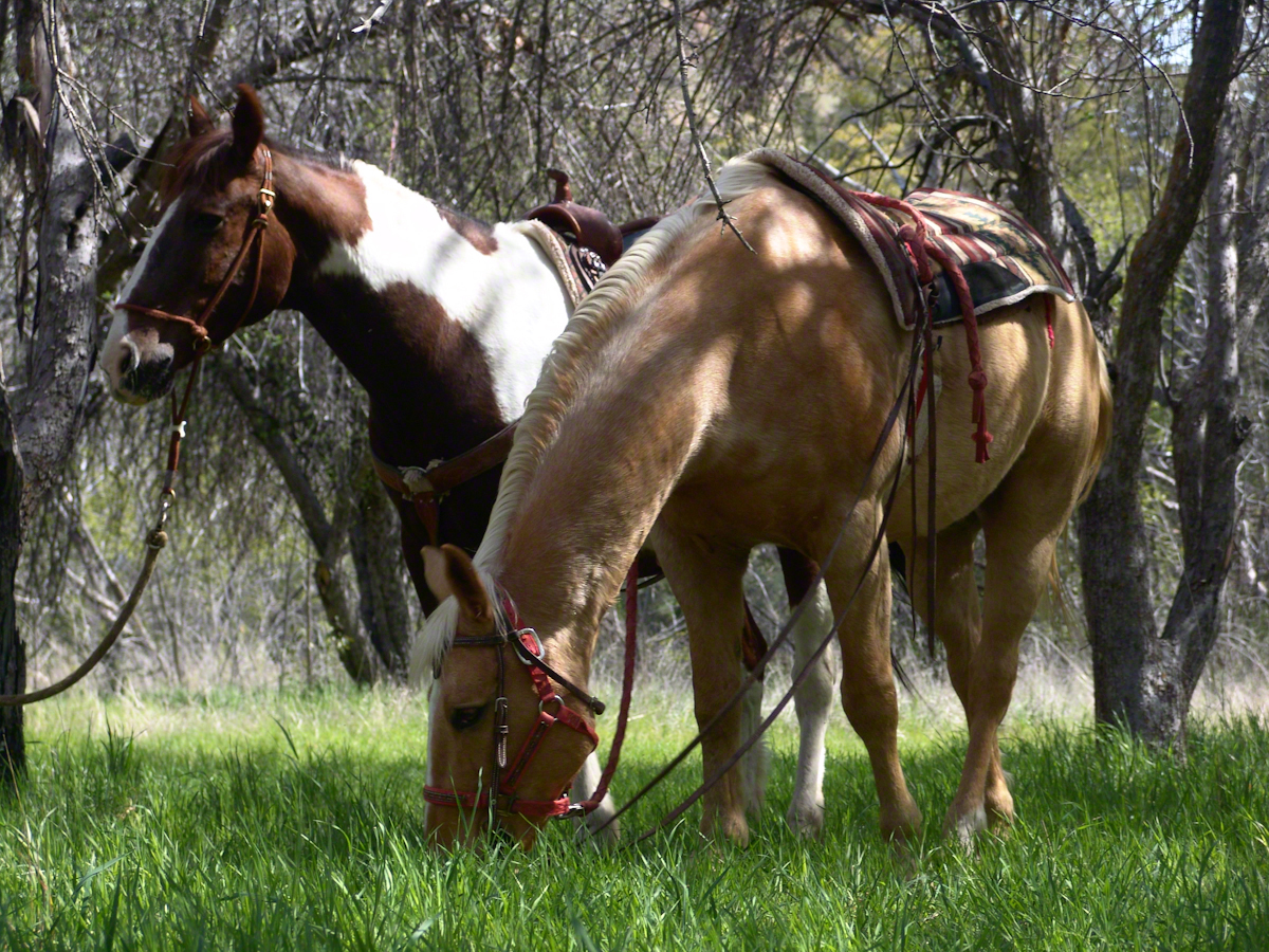
Here’s a photograph of these horses, taken a few days later.
“Colorado and Nugget, grazing at Reavis Ranch”
Enjoying the lush grass of the Reavis Ranch apple orchard, Colorado and Nugget graze.
Our chat was brief, but practical and meaningful: where we came from and conditions along the way. The stranger, who I came to call “The Searcher”, inquired about conditions in the very steep bowl behind Two Bar Mountain. He planned to camp overnight and do a Two Bar Mountain daytrip the next day, but would not if the trail was washed out by that spring’s heavy rains.
I replied the trail was obliterated in spots and even though I could pass his horses might not get by. His reply, “If you got up, so can they.” And with that he gave the buckskin a nudge and they were soon out of sight, over the ridge.
Fifteen minutes later this was my view of Pine Creek, a valley of steep sides sloping to a stream of cool water with mountains and sheer cliffs on all sides. Part of The Arizona Trail.
From a vantage point overlooking Reavis Gap tot he north. This is the view of Pine Creek, to the south.
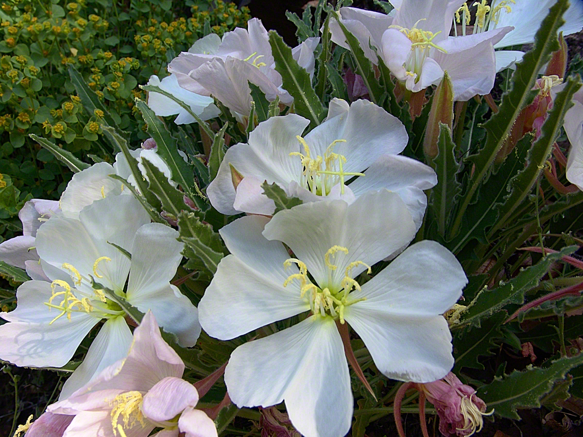
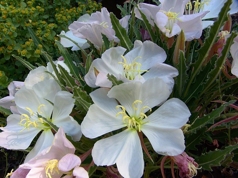
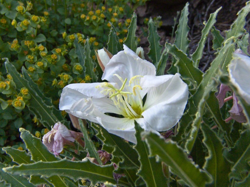
Just before reaching Pine Creek I passed a southeast facing bank sheltering a garden of tufted evening primrose and a member of the crassulaceae family both in flower. The white flower is the primrose and the yellow the crassulaceae. I was so moved by the beauty of this patch, after trekking for seven hours through endless rocks, cactus, juniper and oak, I unloaded my pack and captured this shot. As the name suggests, the flower is an evening bloom that wilts in the day’s heat. That’s why the flower is a bit floppy in this late afternoon photograph.
Note flower b
The crassulaceae is a succulent, similar to a kalanchoe, with tiny flowers composed of tiny yellow balls.
In future chapters you’ll see more of Pine Creek, visit the wilderness apple orchard at Reavis Ranch, learn more about The Searcher and an ancient, circular, rock wall on a peak overlooking Reavis Gap.
Here is a gallery of photographs from this post for you to flip through. Enjoy!!
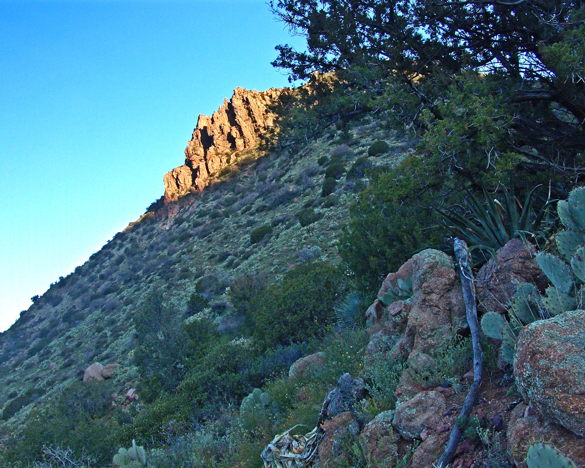
Superstition Wilderness, Arizona
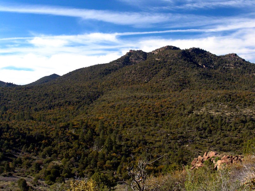
The Arizona Trail passes this spot in the remote eastern Superstition Wilderness. This is the view of my path up from Nameless Canyon. In the distance is the Four Peaks Wilderness Area.
Enjoying the lush grass of the Reavis Ranch apple orchard, Colorado and Nugget graze.
From a vantage point overlooking Reavis Gap tot he north. This is the view of Pine Creek, to the south.
Pine Creek of the remote eastern Superstition Wilderness hosts this wild Tufted Evening Primrose.
This primrose growing in the remote eastern Superstition Wildreness is drooping at day’s end. These flowers rely on the hawk moth for pollination.
Rocks such as this are a favorite perch for leprechauns to rest and contemplate the works of man who have invaded their world. Inhabitants of Carlingford who wander Slieve Foye have come upon them often enough, their stories and certitude in the existence of the Little People are resistant to manifold doubters with their reasons and arguments.
Kevin Woods, aka McCoillte, was a doubter until worked on a stone wall on property he owned on Ghan Road, Carlingford. His belief did not arise on the discovery of the leather purse, covered with ages of dust and lime, nor with the gold coins inside. McCoillte pocketed the coins for luck. As luck would have it, McCoillte loved to walk on Slieve Foye. It was on one such walk he and his dog encountered Little People who paralyzed them to escape. His unexplained absence led to troubles with the wife.
This experience brought McCoillte around to enough of a belief that he, with lots of help, succeeded in petitioning the E.U. European Habitats directive to recognize leprechauns a protected species. According to a page on the Celtic Times web site, “The E.U. sent Madame Isobel Jeanne from Fecamp in Brittany France to Carlingford with the official letter declaring Carlingford Mountain (Note: otherwise known as Slieve Foye) protected, on the grounds that they could not prove or disprove their existence.” The page is titled “The Carlingford Leprechaun.” Google “Last Leprechauns” learn more about McCoillte’s stories.
I came upon this rock on June 9, 2014 on a day my cousin Sean Mills invited us to walk the Tain Way over Slieve Foye. It was such a finely shaped piece of what I suppose to be granite, the view of Carlingford, the lough and farmland so compelling, I spent time composing this landscape.
You can make out “King John’s Castle” just over the ridge and its yellow flowering gorse, on the margin of the blue lough. It is the boxy, grey structure; crenellations are visible on high resolution versions of the image. Carlingford is known for the castle, the popular name is for the English monarch who spent time there, although it was built by another.
A hellish shriek assaulted the cold 3 am darkness.
The scream was instantly recognizable. Anything but terrified, after a confused scramble I reinserted the pin into a personal security device hung from my backpack. Wrapped in a silly waffle weave blanket, tossing restless in the cold, the pin lanyard hung up then pulled free. Several minutes had passed with that sound flowing out over the canyon, calling all carnivores to breakfast.
I had drifted off with the wind shaking my tent like a drunken prankster and now all was totally and absolutely quiet. In spite of the cold, the inadequate blanket and the imaginary creatures looking for the source of that scream, the next two hours sped by in a fitful doze.
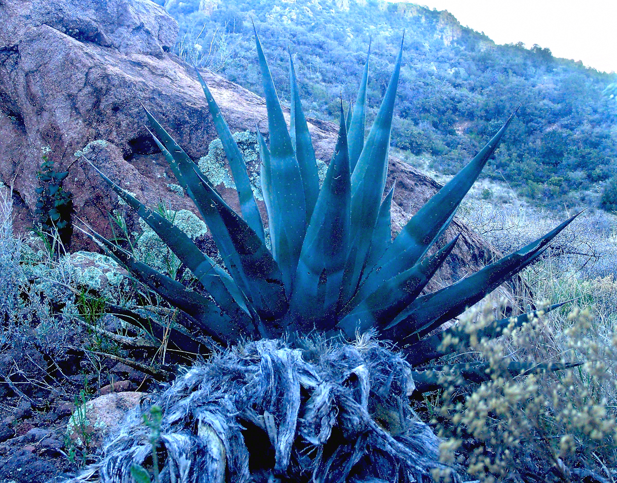
Agave Heart
At 5 am I crawled out to find the thinnest crescent moon imaginable gracing the eastern sky, kept company by a century plant silhouetted against the early dawn light.
Click any photograph for a higher resolution image.
These stalks raise the golden flowers of this agave 10 to 15 feet above the green prickly rosette. Century plant stalks can be seen throughout the Superstitions, even at the high elevations among towering Ponderosa Pine.
Here is an agave in predawn light I caught on the next day, in Pine Creek canyon.
Agave in PreDawn Light
The leaves are used as needle and thread with the very sharp tip as the needle and the long leaf fibers, when properly dried and shredded, as thread. These leaves guard the agave heart from the harvest. A poke from an agave spike can be deep and painful.
The young shoots of the stalks are a succulent delicious treat raw. Roasted, the agave heart is a fresh, somewhat sweet delight. The earliest residents of this desert left numerous roasting pits on the mountain slopes, located where the agave still grows.
Dawn and the Pretty Hedgehogs
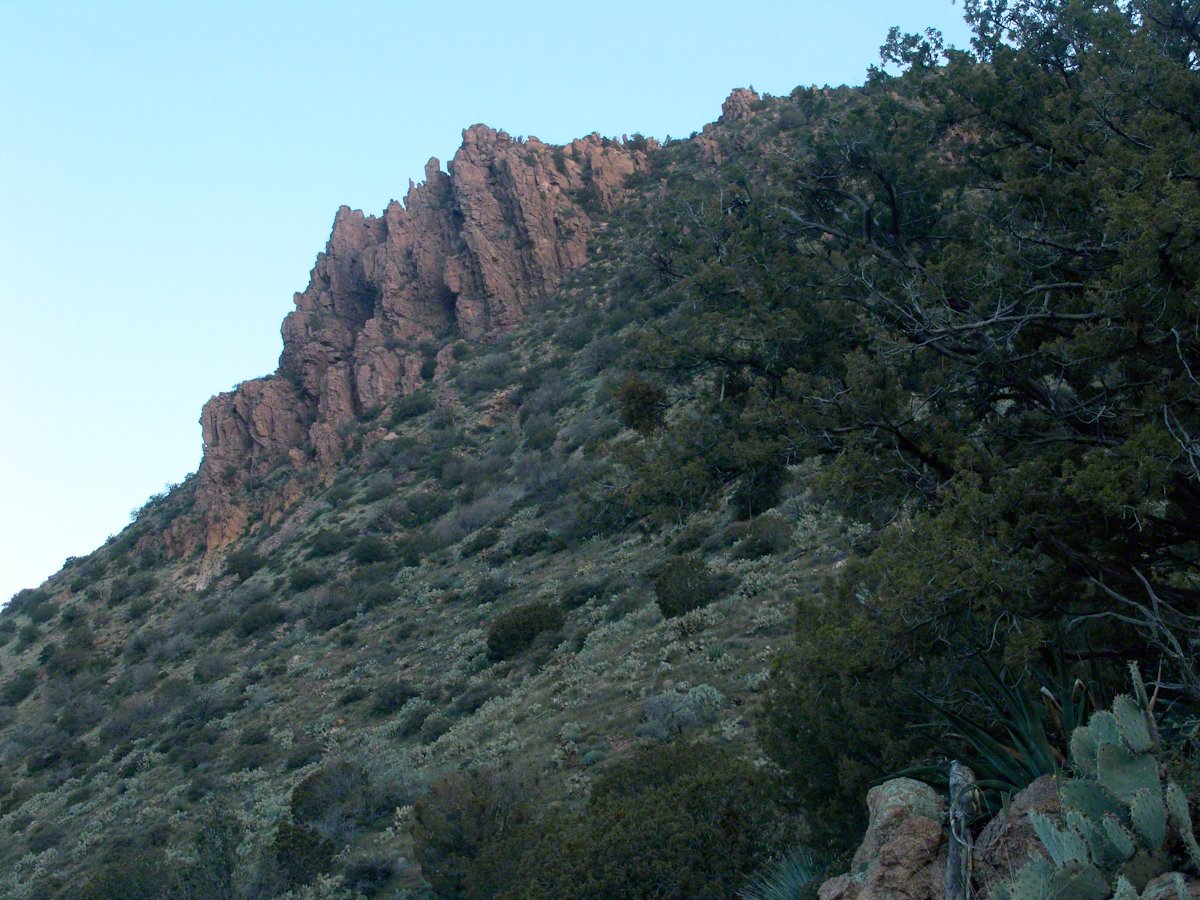
Although cold, the still dry air felt marvelous and even distant objects appeared absolutely clear. In this environment the spread of sun with its rising is a ritual. Here’s a photograph of the canyon walls a few minutes before the sun reached them.
Slopes of Two Bar Mountain in PreDawn Light
And, a few minutes later, as the sun passed the ridges of Two Bar Mountain.…
Dawn on the Slopes of Two Bar Mountain
By the way, that’s a desiccated agave stalk to the lower right, on the rocks.
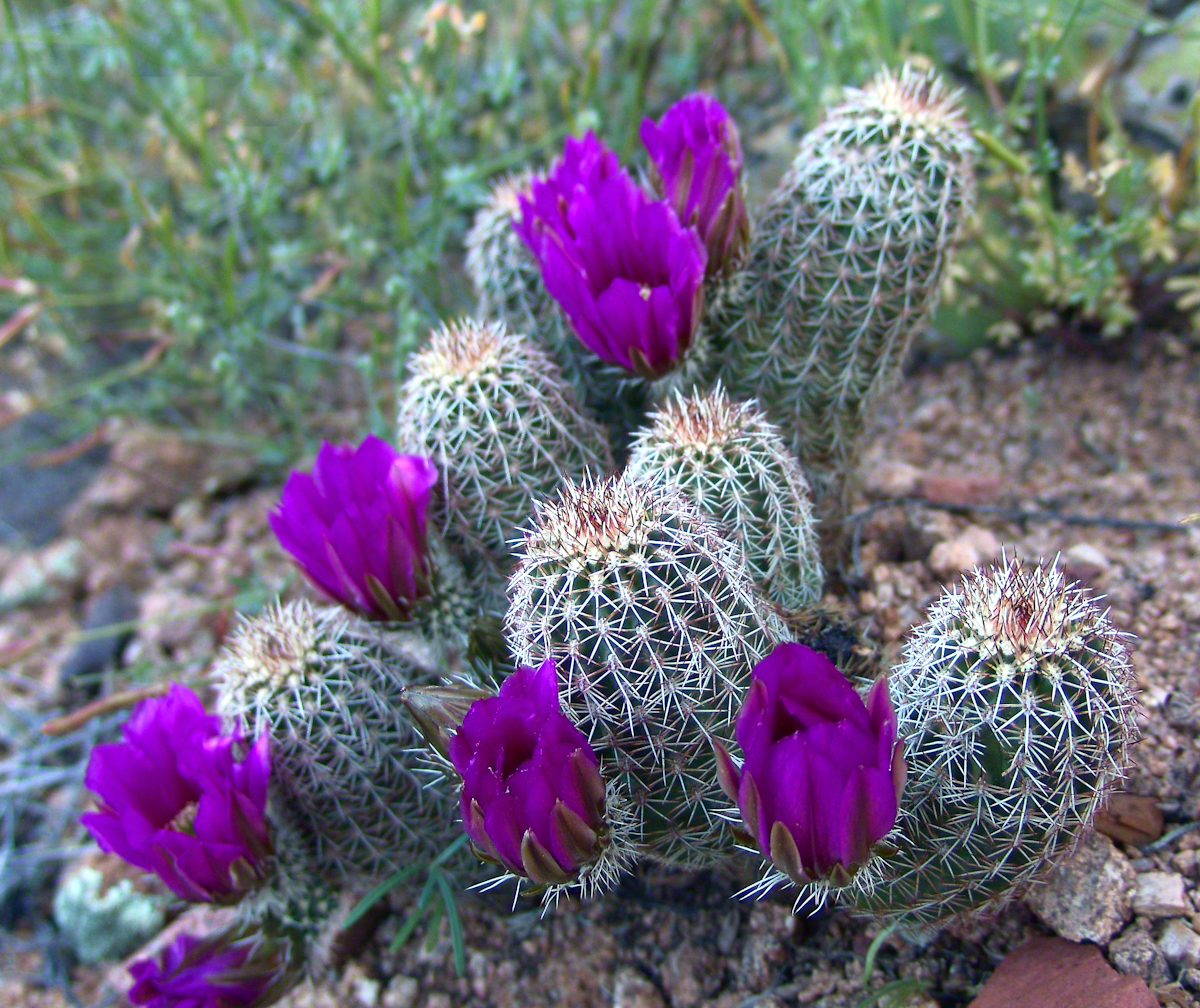
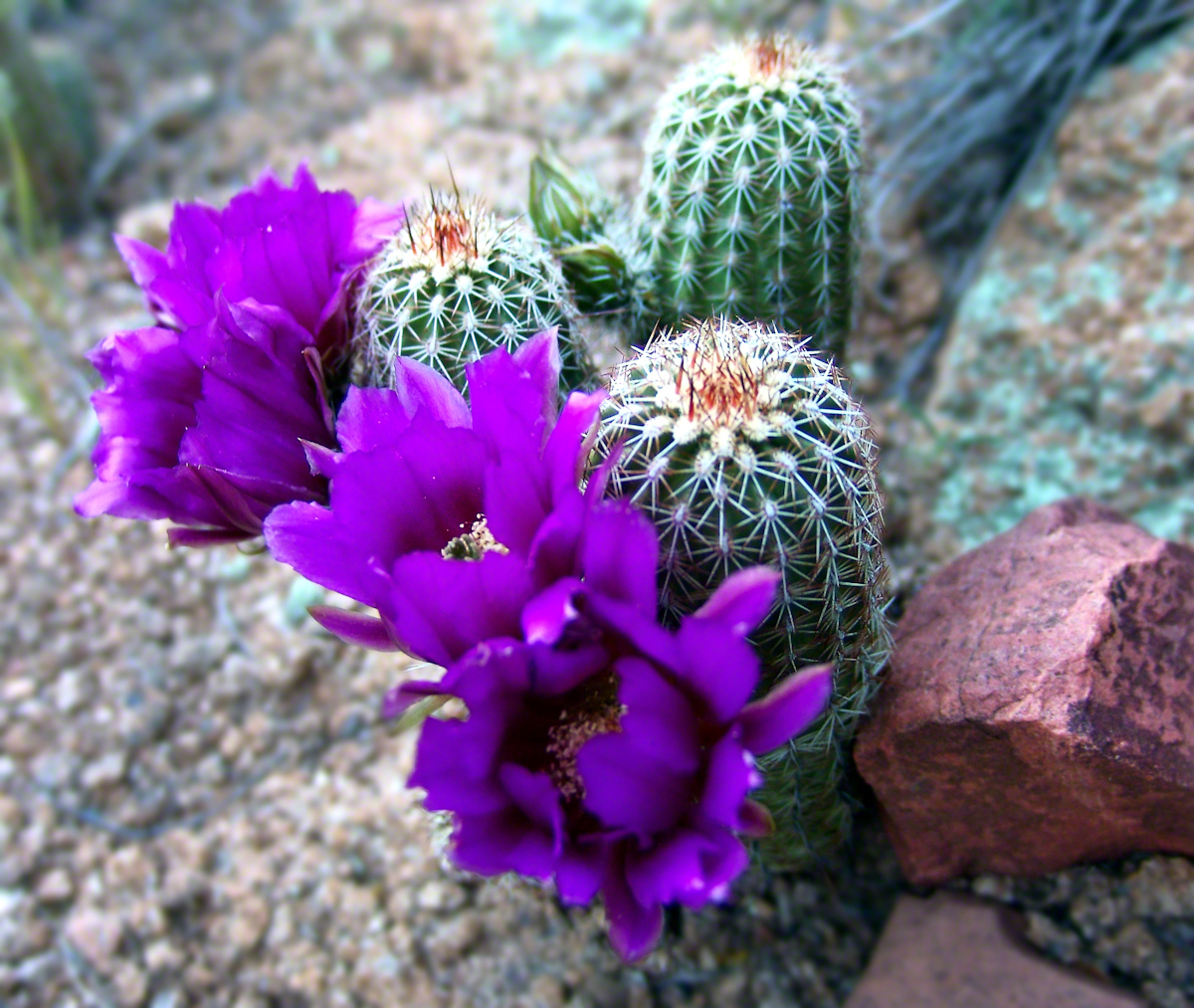
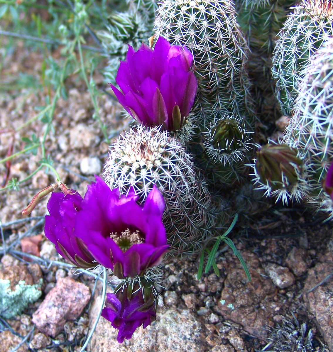
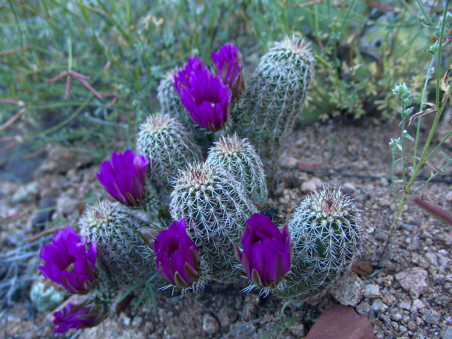
At my feet, spread at intervals on the brown red broken rock, small Hedgehog cacti bloomed lavender.
Lavender Hedgehog BlossomsLavender Hedgehog BlossomsLavender Hedgehog Blossoms with Buds
Cacti, such as the blossoming lavender Hedgehog seen above, require a space which enjoys full sunlight for most of the day. The thick grown of juniper trees limited sunlight and compete with the cacti for water. This image will give you an idea of the extent of the juniper growth.
Nameless Canyon in the Dawn
Looking into Nameless Canyon
In the above photograph you are looking west over a canyon that is unnamed on maps. The dramatic flat ridge bathed in light is a landmark marking the canyon of Reavis Falls, on the far side in this view. Make your way down the canyon where is joins Reavis Creek, turn left and the falls are a few miles upstream. This is NOT the easiest path to the falls.
As the sun rose I needed to prepare for the day’s trekking, but took one more portrait of this lovely nameless canyon traversed by an almost non-existent path.
Nameless Canyon Morning
This season, a cold stream ran at canyon bottom. Flowing among the rocks the water produced peals of a crystal bell, but this was not my last memory of this place.
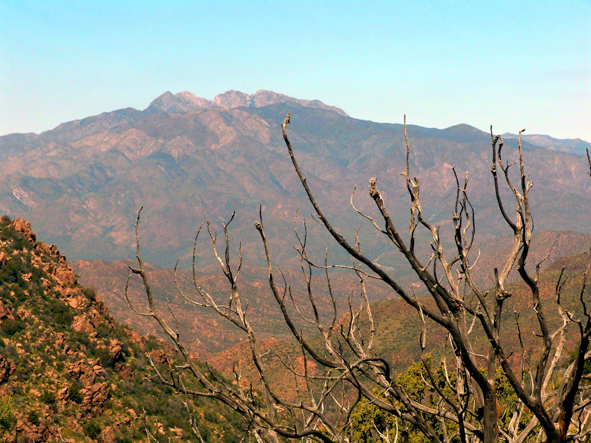
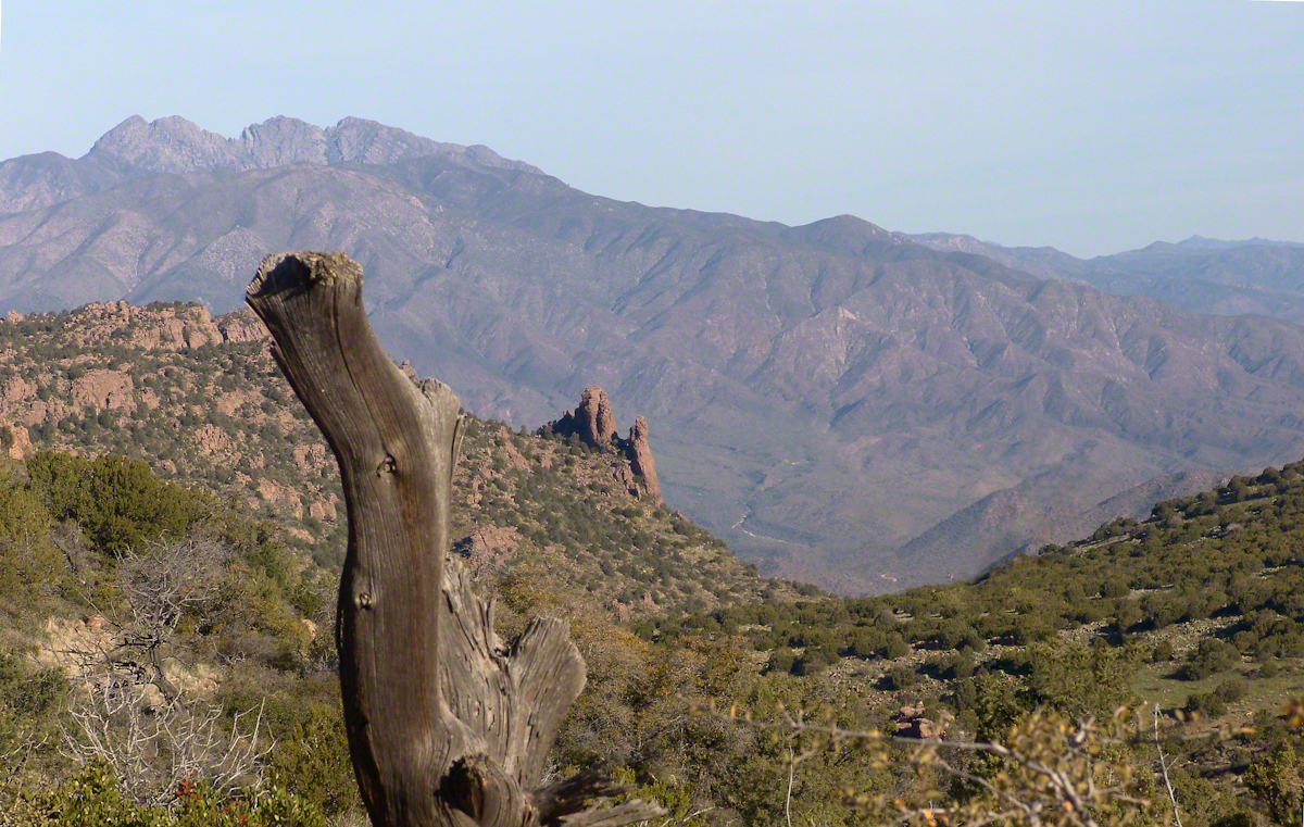
In the “Nameless Canyon Morning” image, on the left there is the almost vertical (no exaggeration) canyon wall I climbed in 4.5 hours that morning. It traversed 800 feet altitude in less than a mile. The path was substantially longer because it followed the contour lines of the land in long loops called switchbacks. As I proceeded up the canyon wall, to the southeast, above the opposite canyon wall, the memorable Four Peaks gradually appeared. Here’s the view from my lunchtime perch…..
Four Peaks from Nameless Canyon
This view looks over the basin of Reavis Creek and includes the, out of sight, 140 foot high Reavis Fall, the highest free fall in Arizona.
The four mile climb up the 2,000 foot eastern Superstition Wilderness bajada and escarpment consumed the morning and much of the afternoon. It was the 80 pound backpack that did it. Ten days of supplies, tent, equipment and 3.5 gallons (28 pounds) of water; enough food for a trek across the Superstition Wilderness, water enough for two days. One day in, one day out if the water could not be replenished. Mine was a water commitment, enough water storage to allow two days to trekking to another source.
Two Bar Mountain from Tule Canyon trail with corral made from mesquite trunks and barbed wire. Yucca and prickly pear in foreground.
Here the canyon rim view from atop the escarpment…..
Here I found the huge mountain lion track in the dry mud from the spring rain, where water pooled and the cat drank.
…over trail 122, the Tule Canyon Trail, looking out from the wilderness. Tule Canyon trail is very lightly used and only present in the form of occasional cairns. There is a red rock cairn in the midground. Theodore Roosevelt Lake of the Salt river is in the distance, as is the dirt road to the trail head. A settlement is visible, on the right.
A rancher formed a cattle watering hole by damming an ephemeral stream and that day the pool held some water. Shortly after a rain a large mountain lion had approach the pool for a drink, leaving a footprint in the now dry mud.
I knew a mountain lion attack was improbable: I ran more risk of being run down on a New York City sidewalk by a madman or, even more so, of having a heart attack. Still, during my brief lunch I faced east, looking over Apache Lake for the possibility of a cat leaping up from the canyon. On all other sides was an open area until, a quarter-mile uphill, there was a thick growth of Manzanita reaching to the ridge.
After that climb to the escarpment rim I was in a race to reach a safe campsite at an unknown location, the other side of Two Bar ridge, before sunset at 6:46 pm mountain time. Yes, the time was exact to the minute. If sunset found me on the mountain side or ridge, rapid fall of darkness would force me to set camp.
The following photograph was taken the winter of February 2006 from a campsite below Castle Dome on Reavis Ranch Trail. A red line, starting to the left, is Trail 119, my path along Two Bar mountain ridge, beneath the mountain peaks, with switchbacks into a nameless canyon.
Overview of my path to the nameless canyon behind Two Bar Mountain.
Ahead of me was a 400 foot ascent in a half mile to Two Bar Ridge, two miles along the glorious ridge providing endless views to the west and northwest. An 800 foot descent to a nameless canyon below Two Bar Mountain. This left no time for photography!!
This photograph, taken 4 miles to the west and 10 months later, is similar to what I enjoyed, and dreaded, that day. A flowering century plant stalk grows at the end of the plant’s long life, usually 10 – 30 years. After death, the plant is reborn through suckers from its roots.
A Superstition Wilderness Sunset from a February 2006 backpack.
My hope was to find some flat terrain in that canyon, for a camp site. If only there was time enough to reach it. My progress was bedeviled by sudden gusts of wind, grabbing like a large cat, throwing off-balance.
The west wind was whipping the bushes as I entered the Manzanita. Here is a photo of the plant from a later backpack to the Rincon Mountain Wilderness. Yes, the trunk is a dark, rich red. “Manzana” is apple is spanish, the plan is named “Little Apple” for the small green fruits much loved by bears.
A mature Manzanita growing along the Miller Trail of the Rincon Mountain Wilderness. There is an enlargement of the flowers, to the right.
Manzanita leaves were thick around me snapping in the wind, making it seem at all moments a large creature was moving. The trail was difficult and several times I needed to turn back to find it, all the while climbing continuously.
On ridge was the highest point for a hundred or more miles to the west, so the wind was free to run which it did in huge gusts. You can get an idea of the openness from the Superstition sunset photo. For awhile the Manzanita acted as protection, then I descended along the west face of the Two Bar Mountain ridge.
Two Bar Mountain and Ridge from Lime Mountain with rising moon.
My hat tie-down were tested on that two miles of ridge, the brim was molded around the right side of my head. The backpack acted as a sail so that it was taken in the wind gusts, affecting my balance.
On mountain trails the path is full of stones of all sizes and, aside from the occasional rattlesnakes, critter scat or, at lower elevations, Gila monsters, it is the rock that forces hikers to look four steps ahead, planning moves carefully to avoid falls. The 80 pound backpack, wind, rocks, high perch and, not forgetting the prickly pear cactus and jumping cholla, all slowed me to less than a mile an hour. I was jumpy walking through that Manzanita and this slowed me down more.
Trail 122 joins Trail 119 on Two Bar Ridge. On the ridge a substantial barbed wire fence separates federal land from the working ranch. Where the trails crosses, the fence has a break. The hiker needs to wend through a simple maze impassable to cattle.
Of all the trail, this is the most clearly marked. Fences have deep historical significance for the western United States. Range wars were fought between men who had different beliefs about land use and ownership. Many historians associate the building of barbed wire fences with the passing of the Old West.
Up until the fence, cattle grazing visibly damaged the land and plants. After the fence, the land was free to become as it was since the beginning of time. Up here, there’s wonderful grass that was, in this season after heavier than normal winter rains, was lush and green.
The trail followed the fence for a ways, then descends steeply into a fold of the land, leaving me in shade as the sun, low in a cloudless sky, raked over the mountainside with a brilliant golden light. The Two Bar Mountain and Ridge with Moon photograph, above, gives an idea of the effect.
Below, the canyon floor seemed a mass of prickly pear cactus groves. I decided the lower canyon wall was the best choice for camp…as unlikely as that sounds.
Here, the trail was anything but straight and almost invisible, descending in looping curves called switchbacks.
Here’s a photo from the following morning. I found a small shelf on a ridge overlooking the canyon floor, amongst wonderful shrubby Juniper trees. Tiny hedgehog cactuses were covered in lavender blooms. There is a decrepit stalk of a Century (yucca) plant lying over the rock.
Morning view from my camp in a nameless canyon below Two Bar Mountain.
On approaching the shelf, the air turned suddenly cold as the sun fully set and the wind gained even more in strength flowing up the canyon and over Two Bar Mountain. Stony ground made it impossible to stake the tent, instead I used small boulders to fix the corners and sides of the tent. Once inside, I was grateful for an excellent mat to protect me from the small jagged stones at one with the ground. The tent walls held back the wind. I forgot to back an excellent sleeping bag for the trip. Instead of buying one in Phoenix, my sister lent me a light waffle weave blanket. “What was I thinking???” It was a restless, cold night. The sun was very welcome the following day.
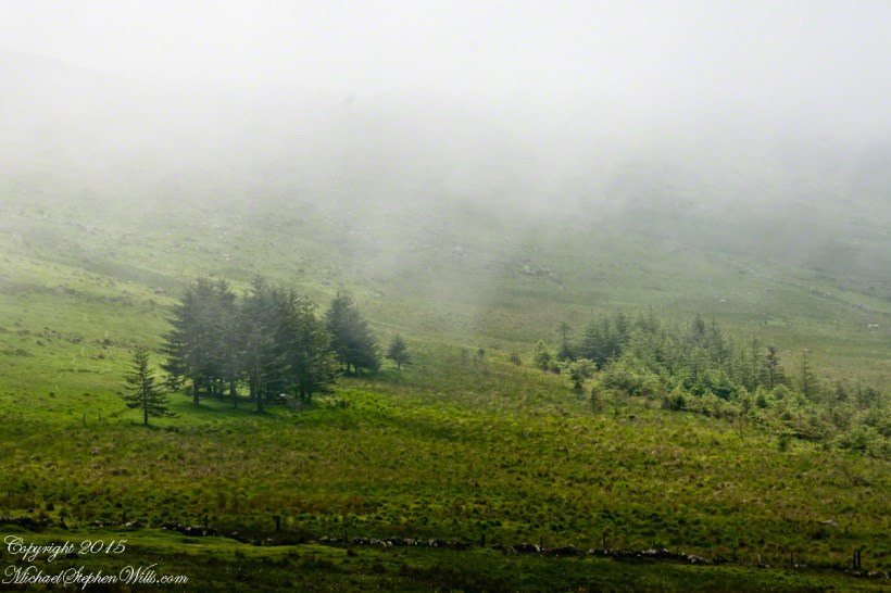
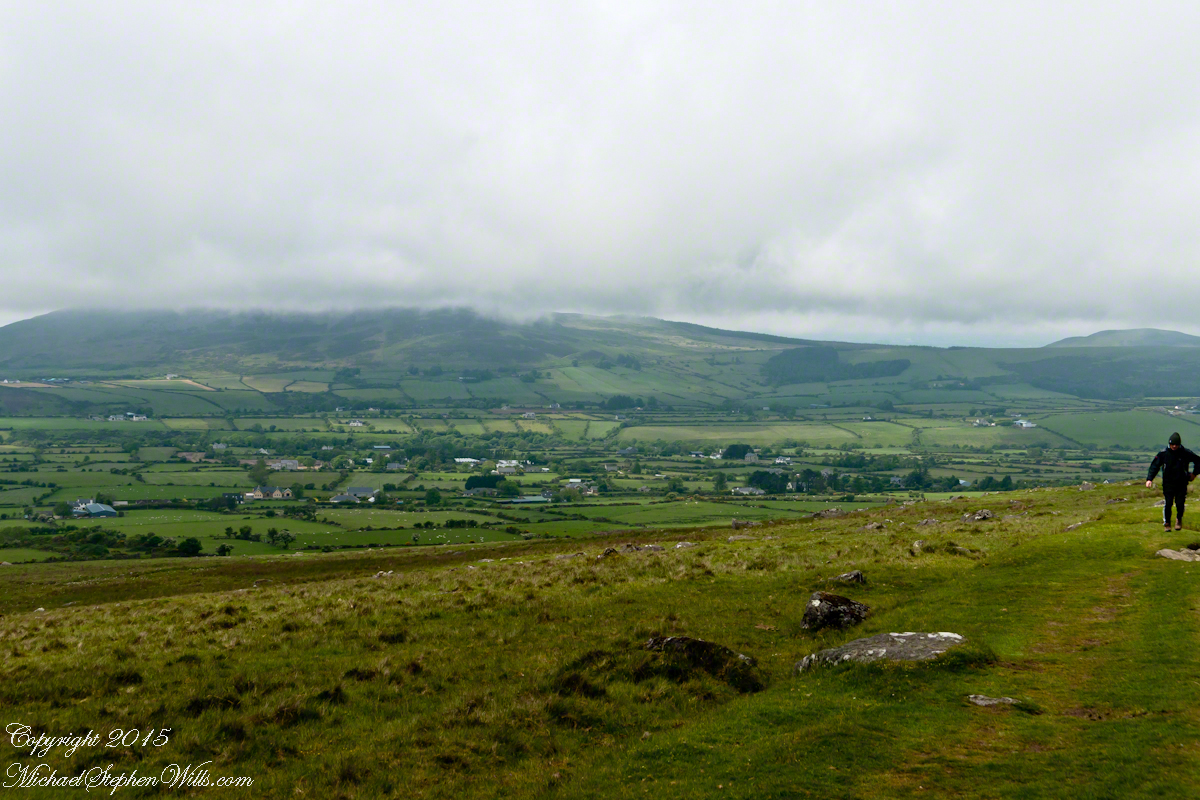
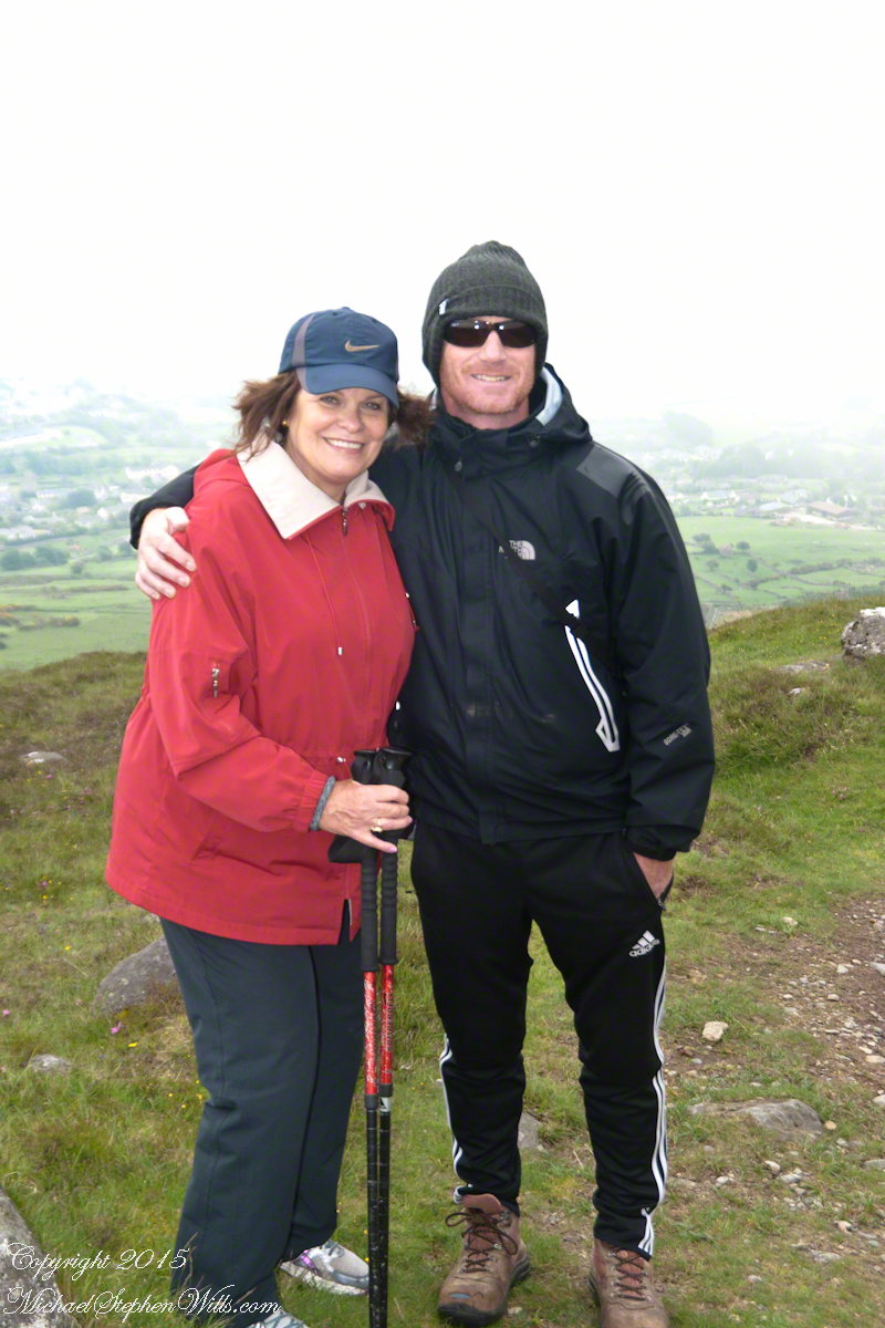
We did not climb so much as ascend, with effort, the flank of Slieve Foy, a peak of the Cooley Mountains, County Louth, Ireland. The group being cousin Sean, my wife, Pam, and myself.
The ridge of Golyin Pass loomed in the mist where the path dissolved in low cloud. Sean pointed above, to the right to Barnavave, also know as Maeve’s Gap for the queen who came from the west of Ireland to take Donn Cúailnge, the Brown Bull of Cooley, by force of arms with an army behind her.
A modern rendering of Donn Cúailnge. See link at the bottom of this posting for more information.
When cousin Sean named Cú Chulainn, the champion of Maeve’s opponents, the Ulstermen, he recalled a story once lost, Táin Bó Cúailnge. A hospitable siege different from Maeve’s and mist are part of the story of the recovery of this tale.
A gathering of 150 poets, 100 pupils, and attendants strained the patience and wealth of Guaire Aidne mac Colmáin, King of Connacht, when it extended to a year and four months.
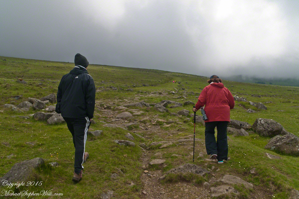
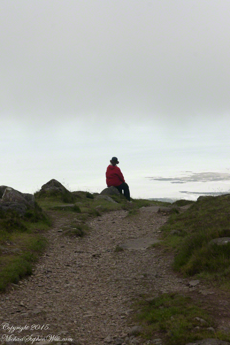
Our first and only encounter with fellow hikers. In the distance two figures appear over the next ridge, a mother and young daughter. She greeted us and challenged Sean to his knowledge of the area. Sean acquitted himself well and we continued.
On that 16th month, the king challenged the leader of his guests to the telling of a tale. Guaire demanded Seanchan Torpest, the chief poet of Connacht, to recite the whole of Táin Bó Cúailnge, known in English as the Cattle Raid of Cooley or The Táin (Cattle Raid).
Click a gallery pic for a larger view.
In this way the king was relieved of his guests: the book of the Táin was lost before their lifetimes, rumored to be abroad. Abashed at his failure, Seanchan Torpest withdrew. Fellow poets and followers trailed out from the castle.
Seanchan Torpest regrouped the host (an opened question is who then supported them) in conference to construct Táin Bó Cúailnge. It was a false hope as the gathering discovered while each poet knew a part of the whole, most of the story was lost. His honor, reputation and self-esteem in tatters the Chief Poet of Connacht, set off with Murgen, his son, and second cousin Eimena to return the Táin to Ireland.
Into mists such as those Pam, Sean and I ascended, the travelers soon were lost and separated.
Magically, Murgen finds the grave of the Uncle of Cú Chulainn in the mists, there to meet the shade of that enormous man, Fergus mac Róich is his name. In the Táin, as related in whole by Fergus to Murgen, Fergus was led by circumstances to ally with Maeve, to guide her army against the Ulstermen. As a deposed king, traitor to Ulster and Uncle to the champion Cú Chulainn, Fergus knew the tale entire.
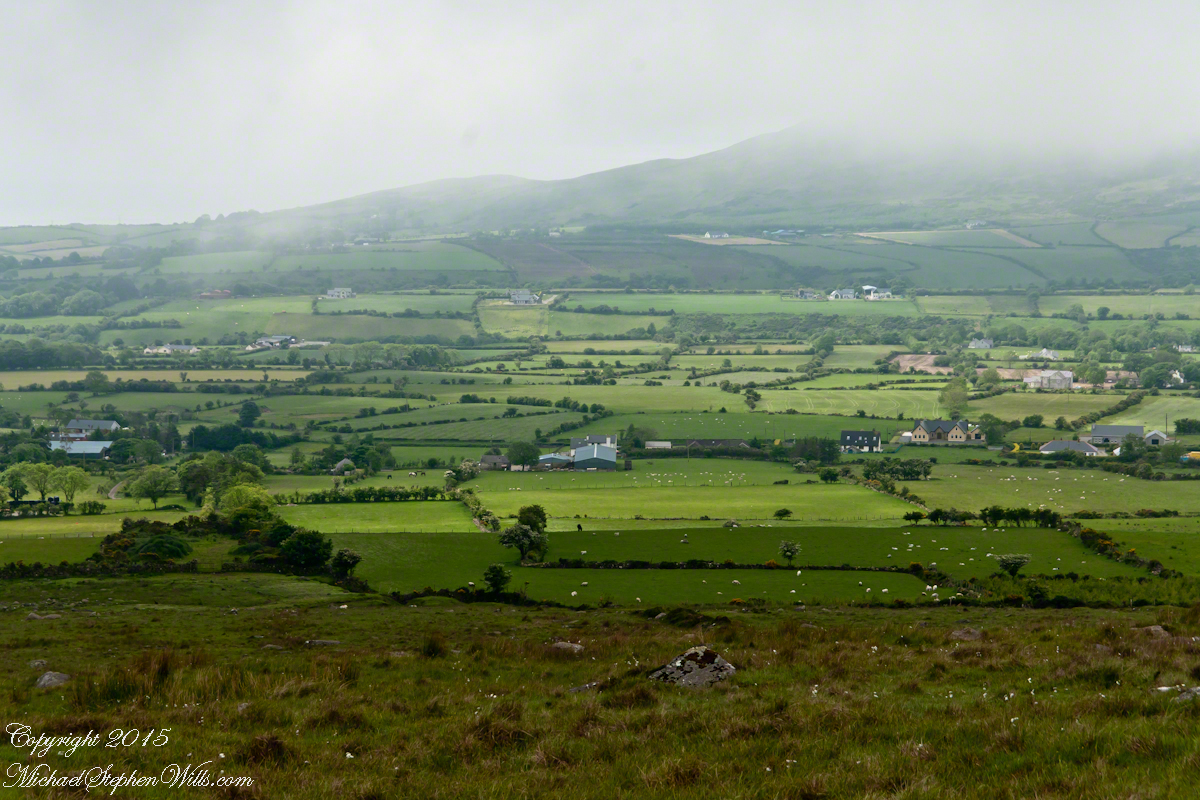
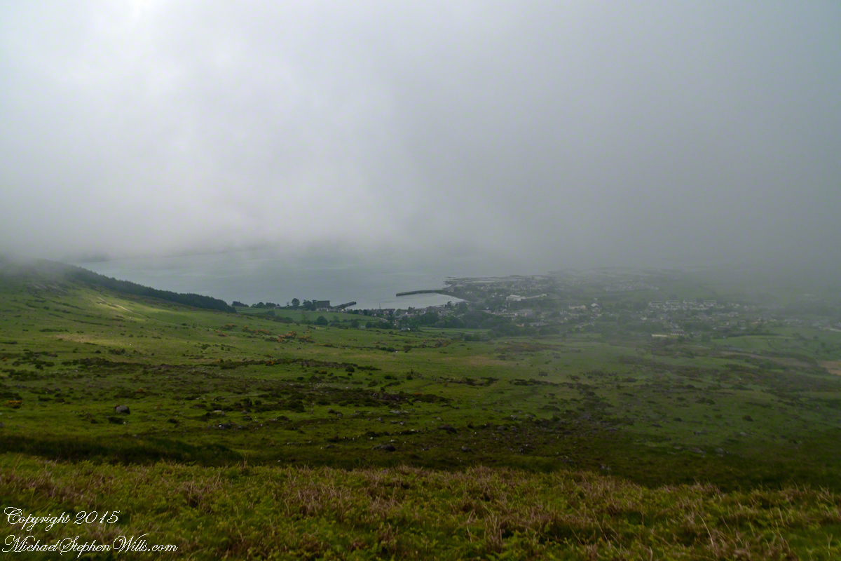
View as we approached Goliyn Pass
It was from the mists that Murgen emerged, found his father and cousin, and returned together without the book, but with possession of the substance of the Táin.