On the Tain Way, repost
A place of myth and wonder on foot and approachable
A place of myth and wonder on foot and approachable
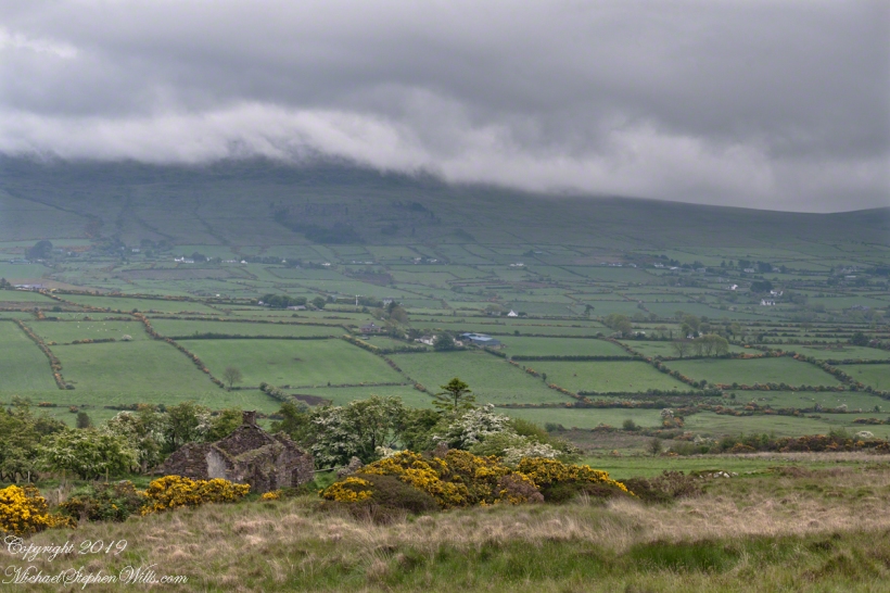
A Cooley Peninsula Valley on a May Morning
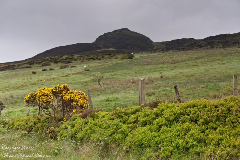
On the northeast slope of Slievenaglogh peak (Irish: Sliabh na gCloch) on the road from Mullaghattin Townland to Riverstown. This day I swapped lenses and took in the same general direction for each. This is the first and last of a series using the Canon EF 50mm f/1.4 USM lens and I pulled in the shots from the Canon 24mm f1.4 L II USM lens, published in previous posts.

Here we look northeast from the Slievenaglogh Townland over the valley between Slievenaglogh and Slieve Foy peaks. Slieve Foy is the far ridge lost in clouds.
This is the first and last of a series using the Canon EF 50mm f/1.4 USM lens.


The view includes Little River, Castletown River, Ballycoly and Glenmore Townlands. Adjacent is a sheep pasture with a farm ruin behind the yellow flowered gorse (Whin bush, scientific name Ulex).

Early morning, late May 2014.
Gone too soon
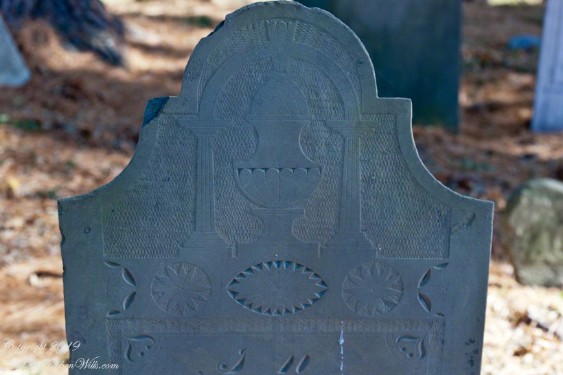
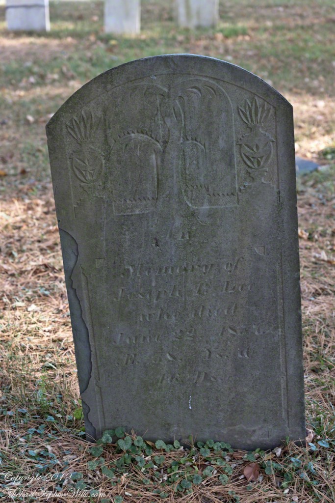
Joseph P. Lee, a middle aged gentleman with carvings of a mature willow flanked by urns. In the intervening 162 years the upper layers of slate flake at the edges.
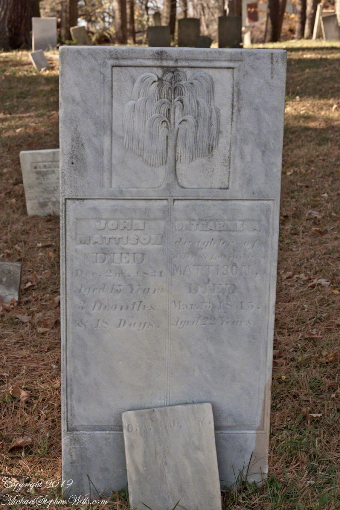
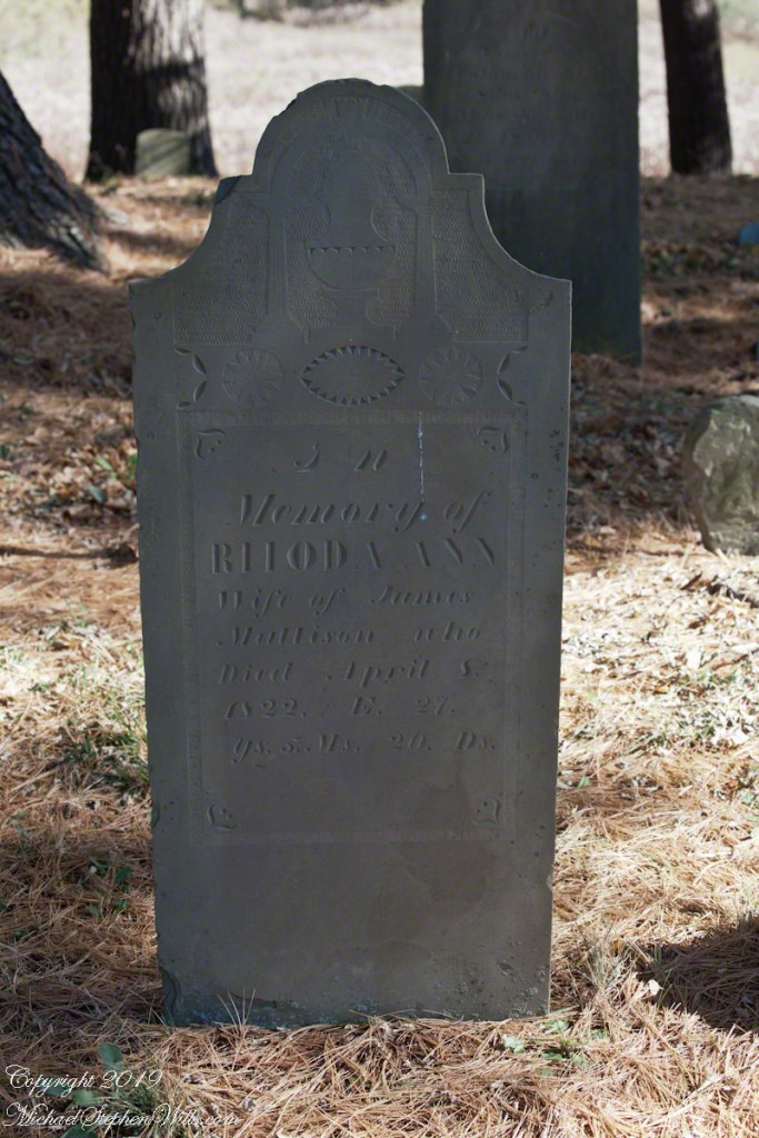
Rhoda Ann Mattison, a wife who died too young. What was the relationship of James and Rhoda to Catherine and John?

The carving is a pineapple (for hospitality) set in a elegant vase on a plinth flanked by ionic columns, a simple arch (banded to imply a rainbow?) surmounts all. Cross hatching implies space. An implied eternal banding of stylized leaves as starbursts.
I brought out the characteristic slate coloring. There is evidence of ware from the intervening 197 years, though the carving is surprising crisp.


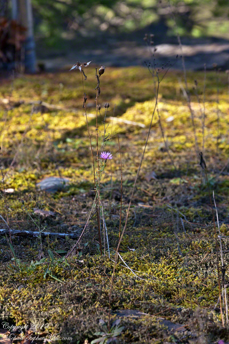
The tenacity of Ironweed resonates with the human spirit.
A lone sprig of Ironweed hangs on from a cliff edge moss carpet off the South Rim Trail, Taughannock Falls New York State Park, Finger Lakes Region.


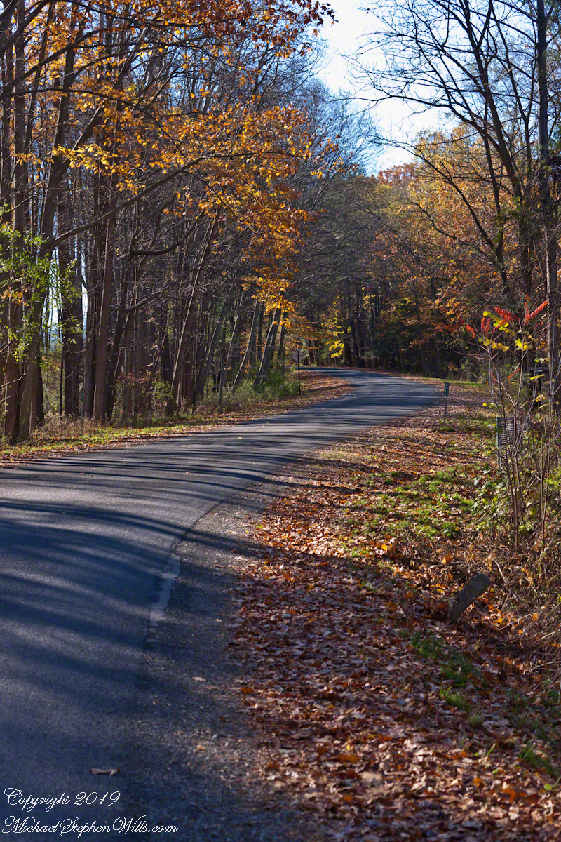
Northern Latitude
Early November on Gorge Road, Finger Lakes Region, New York State. At this month and latitude (42 north) there are long shadows throughout the day. The South Rim Trail of Taughannock Falls State Park briefly emerges from the wooded cliff to this portion of the road that parallels the gorge, descending to Cayuga Lake shores.


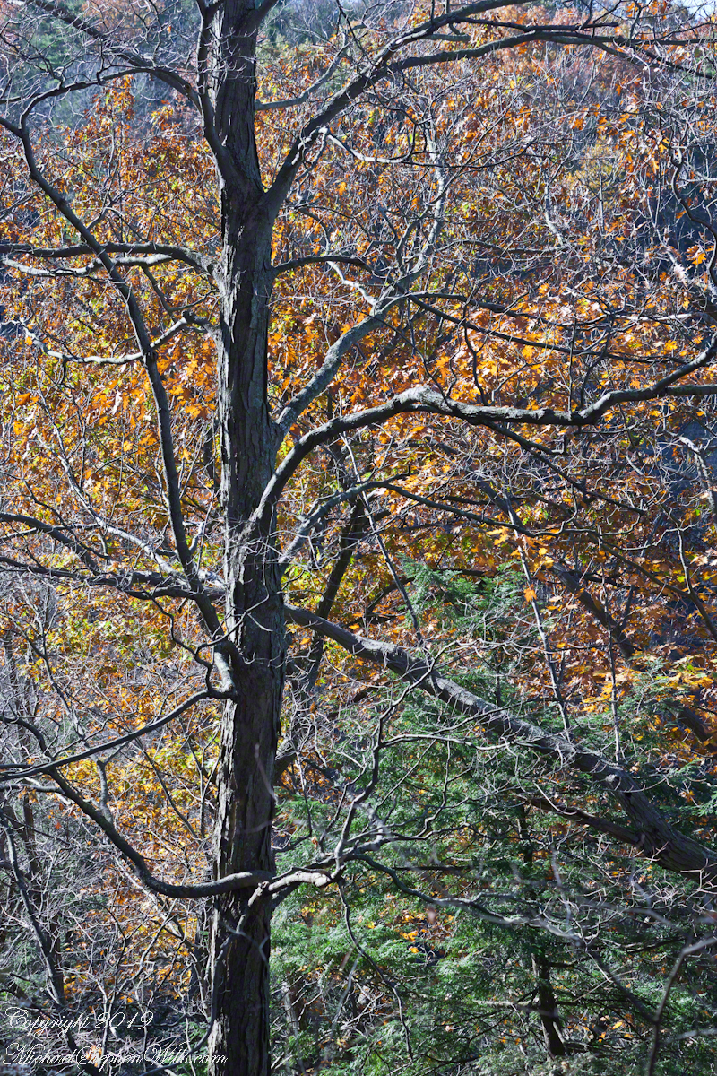
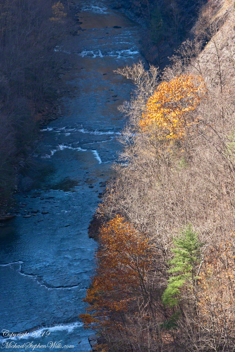
Bird’s Eye View
Early November trees, Taughannock Gorge, Finger Lakes Region, New York State walking the South Rim Trail we are among the upper reaches of trees clinging to the steep gorge walls.
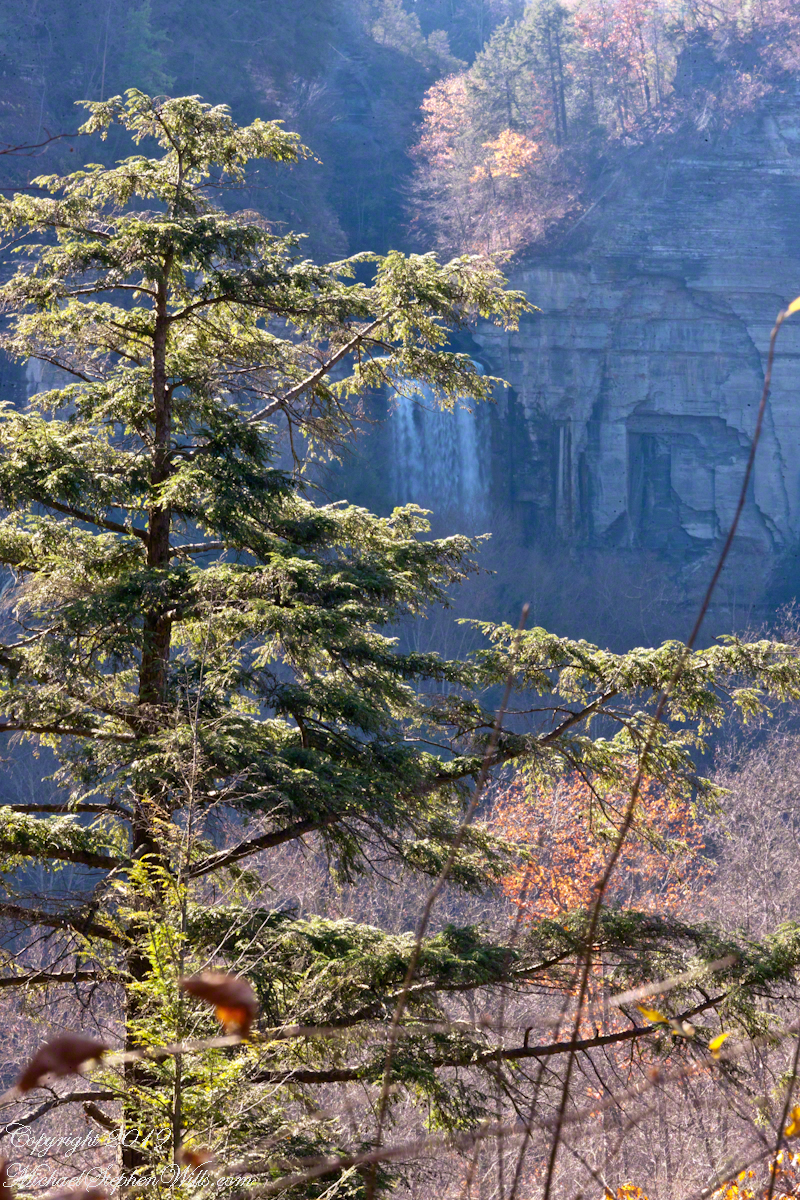
I am fascinated by this vantage from the South Rim trail. It is possible because the gorge bends almost 90 degrees, the gorge walls fall away to reveal the 215 foot waterfall.

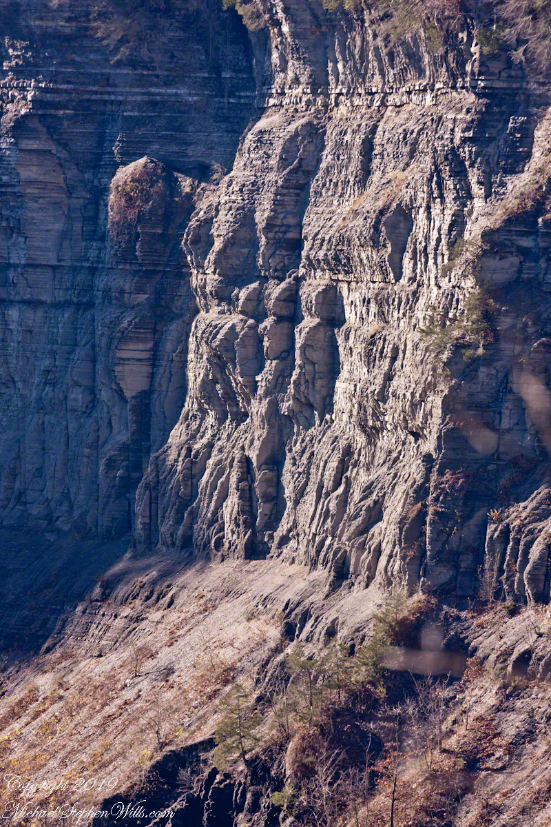
On viewing this photograph my wife, Pam, noticed the shapes eroded from the sedimentary rock of Taughannock gorge. These layers of shale, sandstone, siltstone formed at the bottom of a broad, shallow sea over 380 million years ago. Differential wearing of these rock layers, clearly visible in this photograph, resulted in these formations, including the three sisters and overhangs.


View from The Bend
Oaks are the last to release leaves, seen here on an early November afternoon.
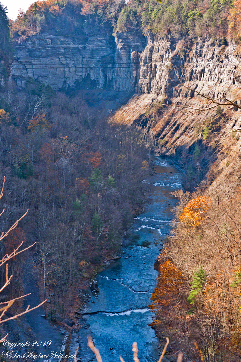
Standing on the South Rim trail where the gorge bends almost 90 degrees, changing from a northern to eastern flow. The creek is flowing toward the camera, the falls out of view, upper left. Lower left two people walk the 3/4 mile trail of the falls.
