Climbing Piestewa Peak: Multicultural Pilgrimage to a Phoenix Desert Dawn

In the cool predawn, strangers from every background climb a stone stairway above Phoenix, trading city lights for desert silence as sunrise spills gold across Piestewa Peak.

Arriving at 5 am there is a line of trucks and cars and Piestewa Peak parking almost full when I grab a spot in the predawn darkness. The desert air has that deep, merciful coolness it offers before sunrise, edged with the long-remembered scent of creosote. Car doors close with soft thuds, headlamps blink on, and a loose procession of strangers begins to funnel toward the trailhead like pilgrims, even now white and red headlamps sprinkle the upper slopes.

At first the climb exists only in a narrow cone of light, my lamp illuminates the scant gravel, uneven steps, and each scuff of boot or shoe sounds loud in the hush. Somewhere below, the city hums, but here the conversation is mostly breath and the occasional murmur of greeting as we fall into the rhythm of the climb.

My beam catches a young couple just ahead, their hands knotted together. They speak Spanish, laughing quietly as they miss a step and bump shoulders. Behind me an older man in a Veterans cap leans heavily on trekking poles, his companion—maybe daughter, maybe friend—matching her shorter stride to his with patient care. A group of women in bright leggings and braided hair moves past us in a burst of energy, their languages overlapping—English, maybe Vietnamese, something I cannot place—like the weaving of a rug. A man passes me, a drum on his back. Piestewa draws them all, before dawn, to this rib of stone in the center of the Phoenix basin.

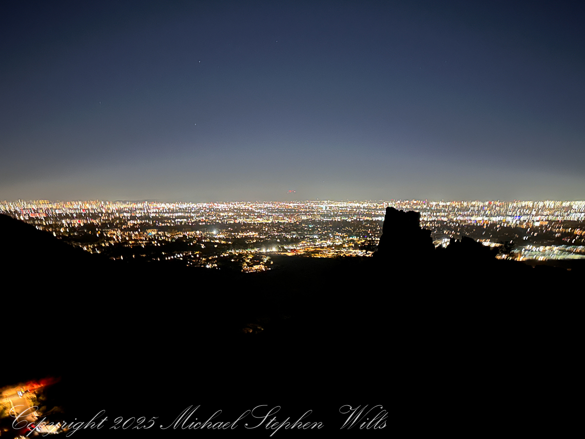
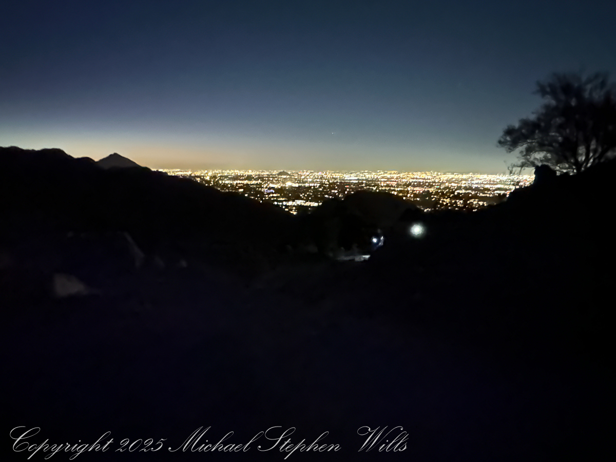
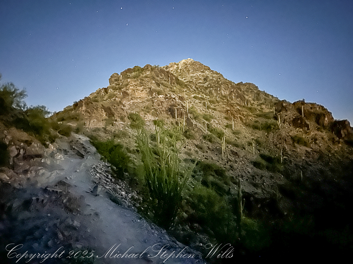
As I stop to rest myself and turn off my headlamp, ahead the trail tilts steeper the steps fade to rock, irregular and unforgiving: a stairway carved from ancient volcanic bones. With my dark adaptation, surfaces reflect star and city light, leading the eye down the ridge toward the dark quilt of neighborhoods below. Later, captured in the photograph, those steps will twist away like a stone dragon’s spine, the city waking beyond in soft pastels. Now they are simply work for legs and lungs.

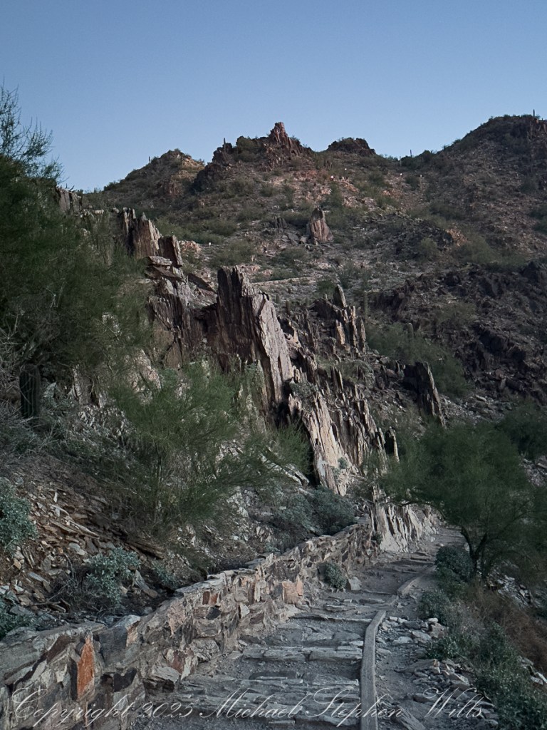
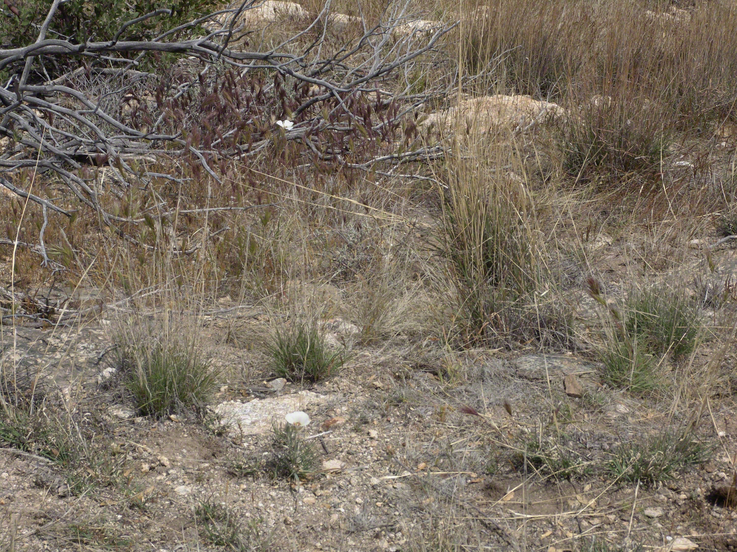
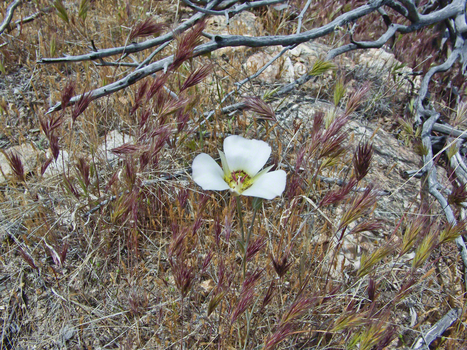
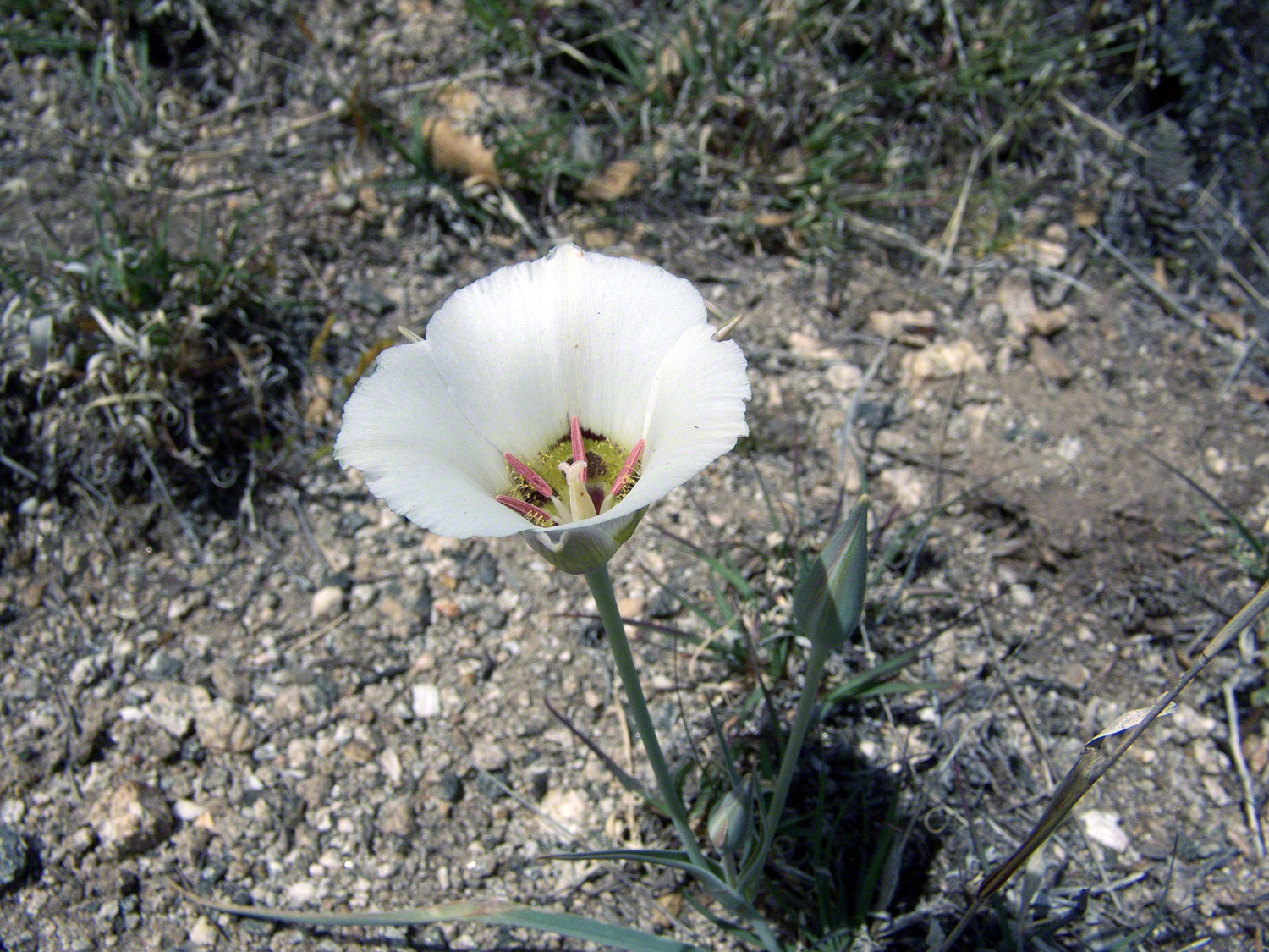
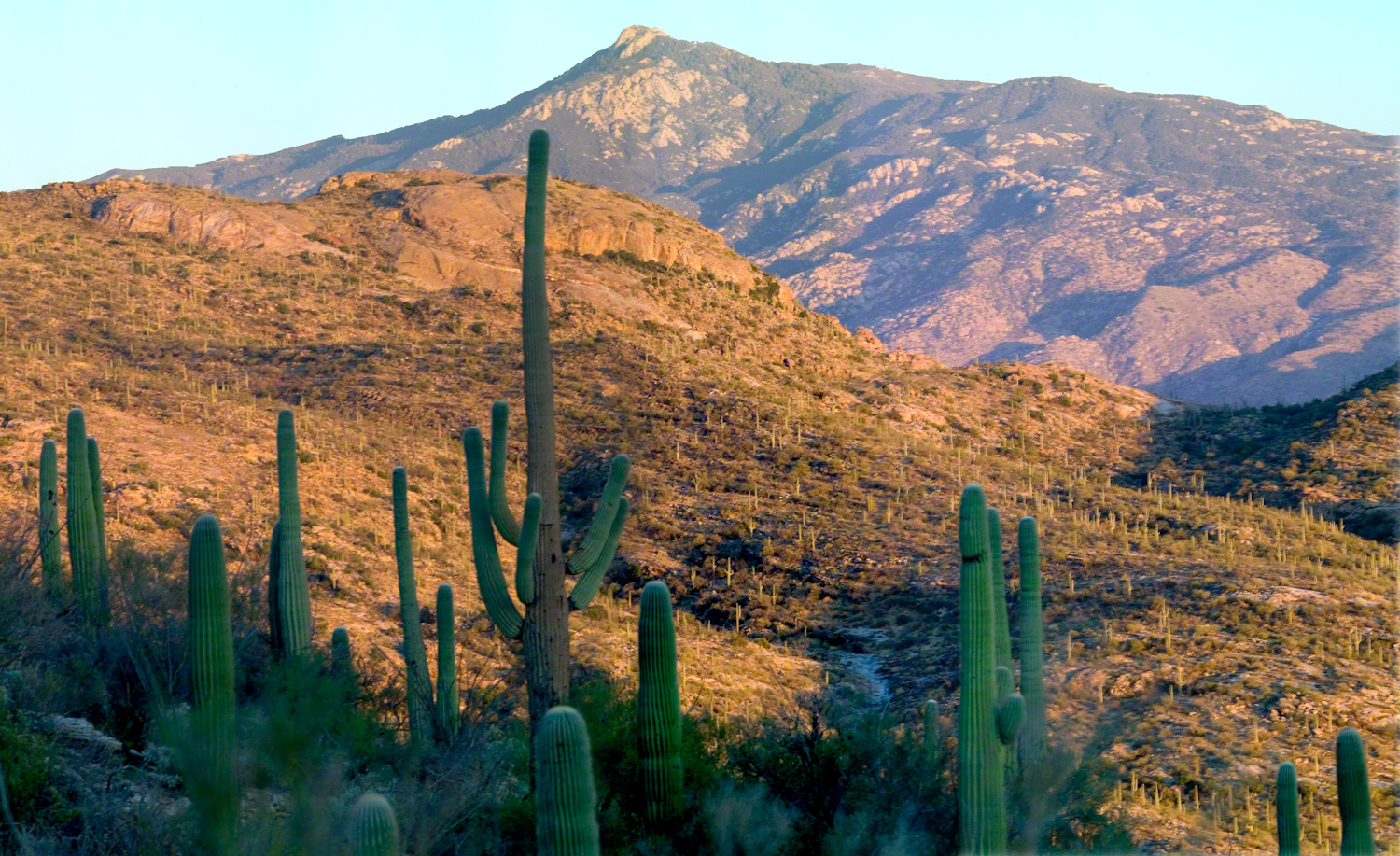
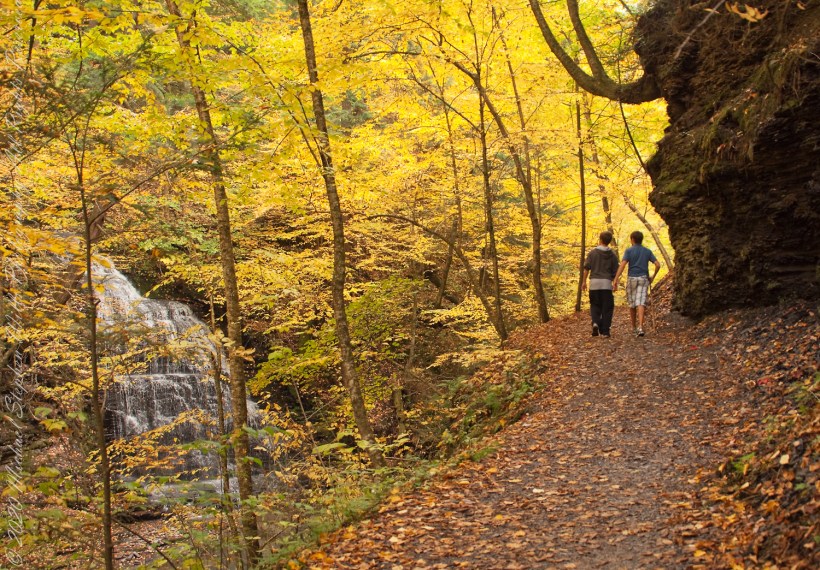
The desert plants materialize around us as shapes before they acquire color. Saguaros stand like sentinels along the slopes; their arms lifted in silhouette. Ocotillo rise as witchy bundles of sticks, each spine leafed out from October rains the leaves catching a little light. On a small plateau a family has paused; the father adjusts a tiny headlamp on his son, no more than six, who is insisting, with fierce determination, that he can carry his own water. “Almost there, campeón,” his father says, and the child straightens like a soldier.

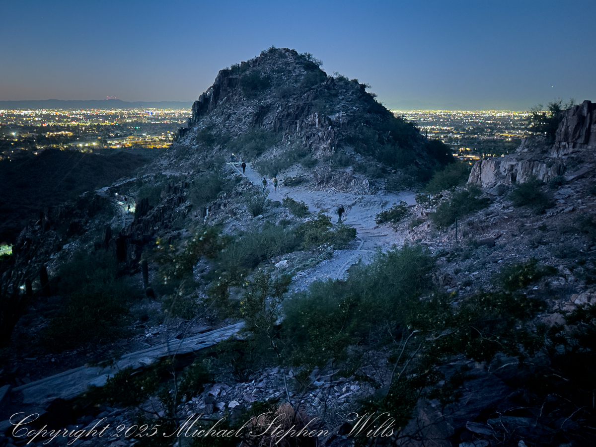
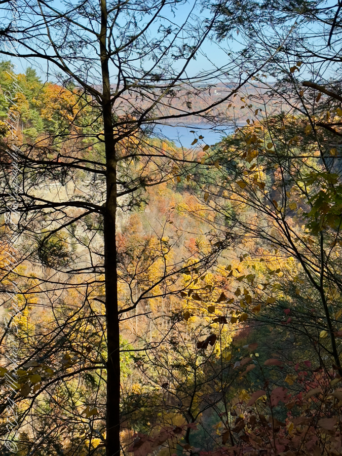
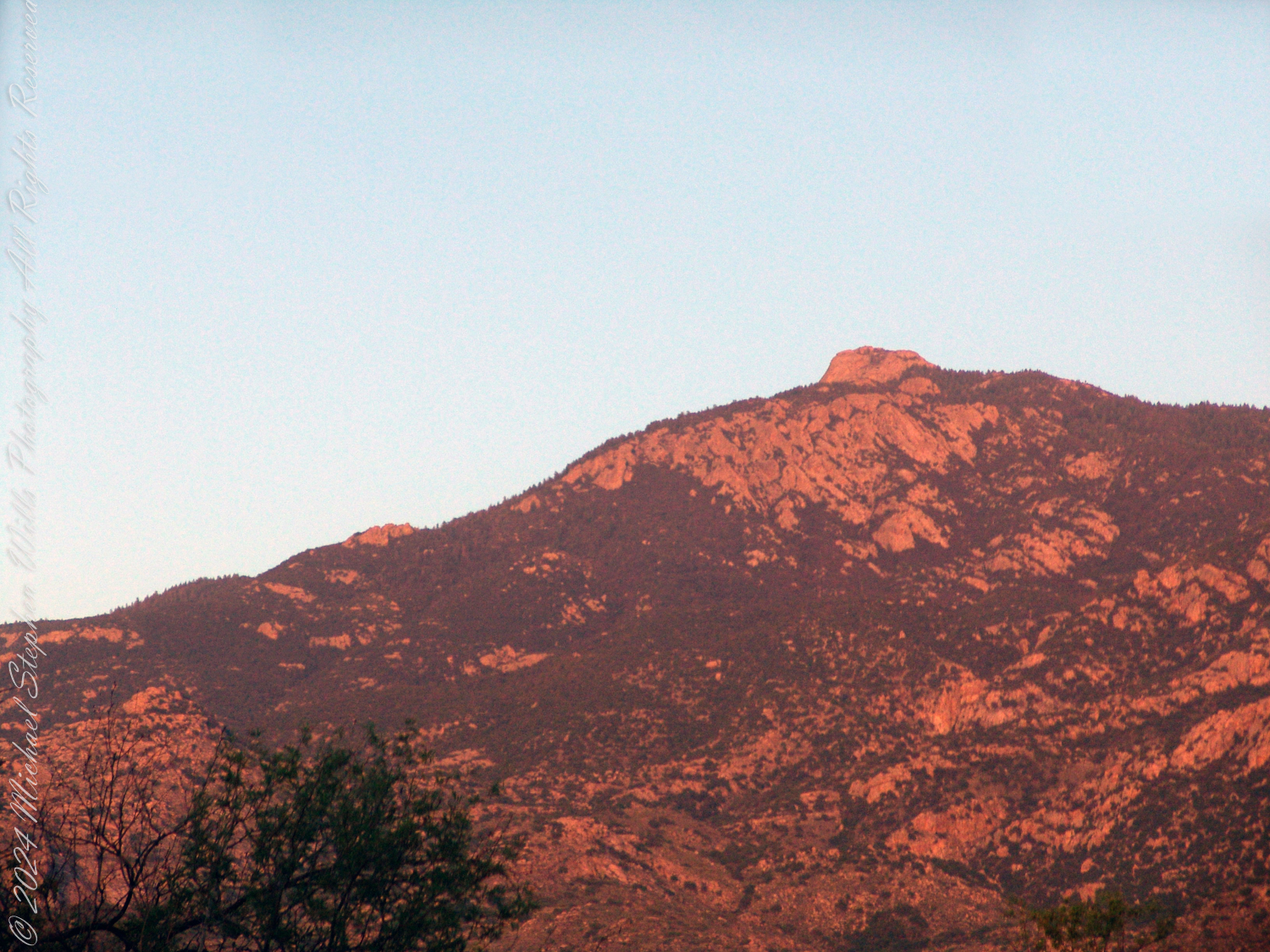
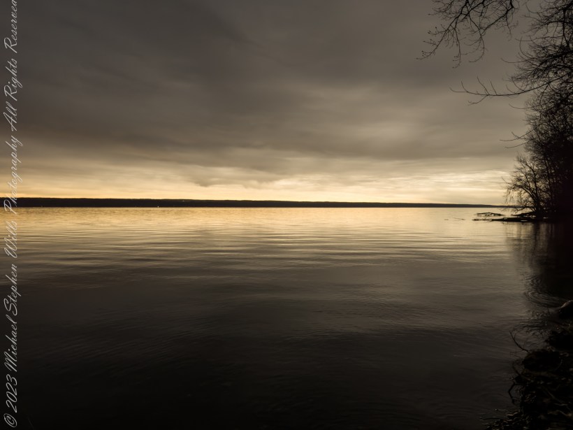
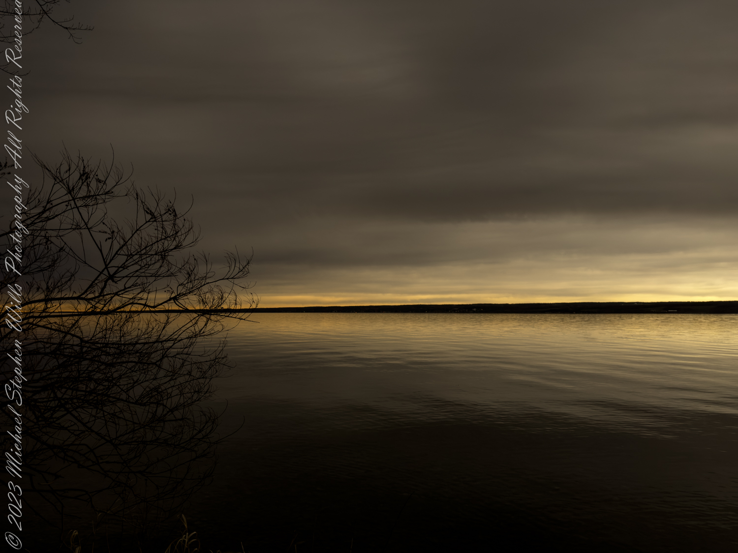
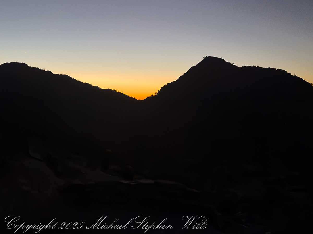
The dark begins to soften at the edges. Over the eastern horizon a thin band of orange appears, a delicate seam between night and day. In one direction, the city stretches out in a glittering net of streetlights, the squares of parking lots and subdivisions catching the last of the darkness. In the other, the mountains are still black cutouts, their profiles sharp as paper against a gradually brightening sky. One of my images will hold that moment: the jagged ridge of Piestewa in shadow, the valley below already spangled with light, a single towering saguaro rooted at the cliff’s edge like a punctuation mark.

November 2025 while visiting Pam’s family in Phoenix

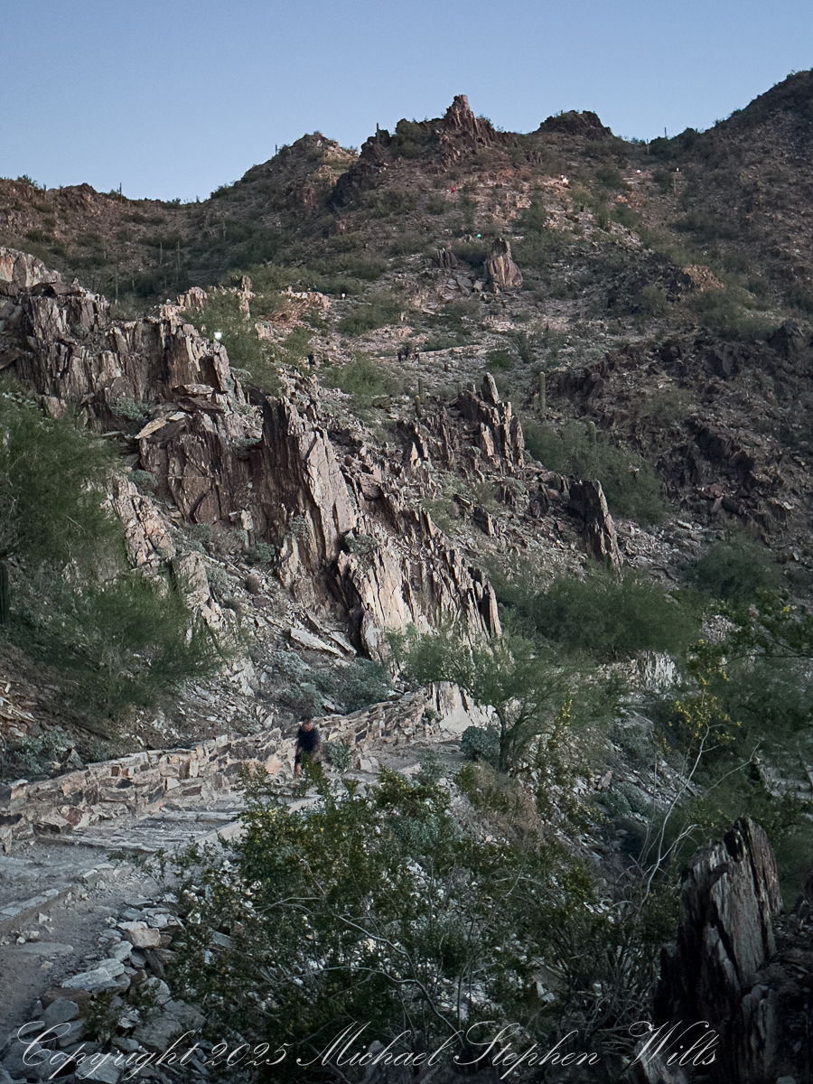
Higher up, the trail narrows and the rock turns rougher. We fall into single file, strangers linked by a line of effort. A runner comes flying down, feet barely touching stone, breath steady and controlled. “On your left,” he calls, and we part for him like water. A woman with a hijab tucked neatly under her ball cap leans against the retaining wall, stretching a calf muscle, her friend counting in accented English: “Ten more seconds, you can do it.” Near one bend a hiker pauses to press a hand against the rock face, whispering a quiet prayer in a language I do not recognize. It is a small, intimate moment, gone almost before I register it.

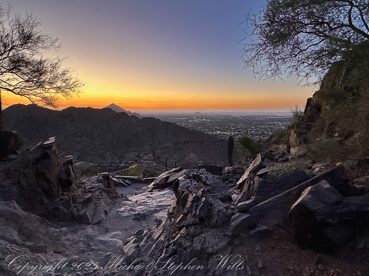
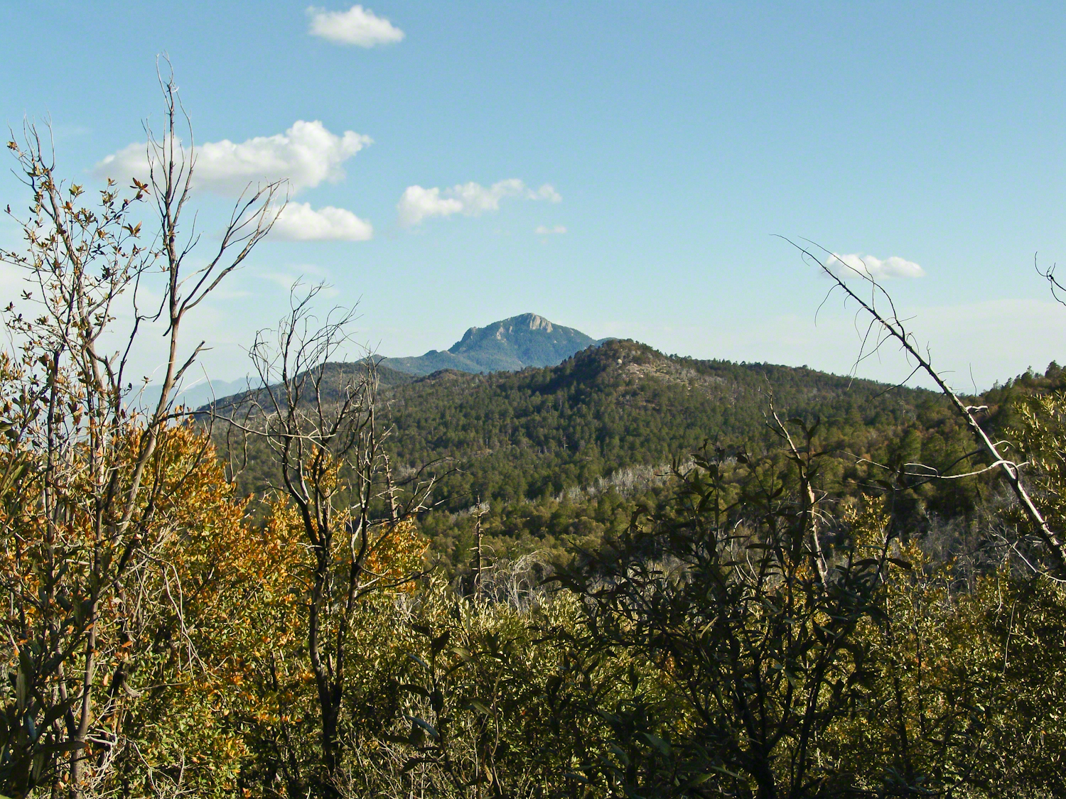
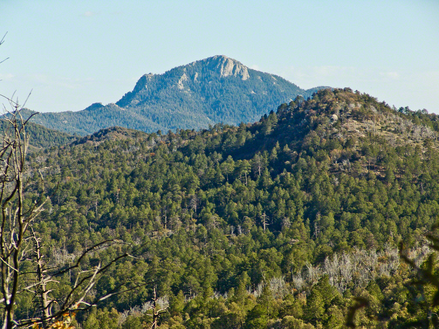
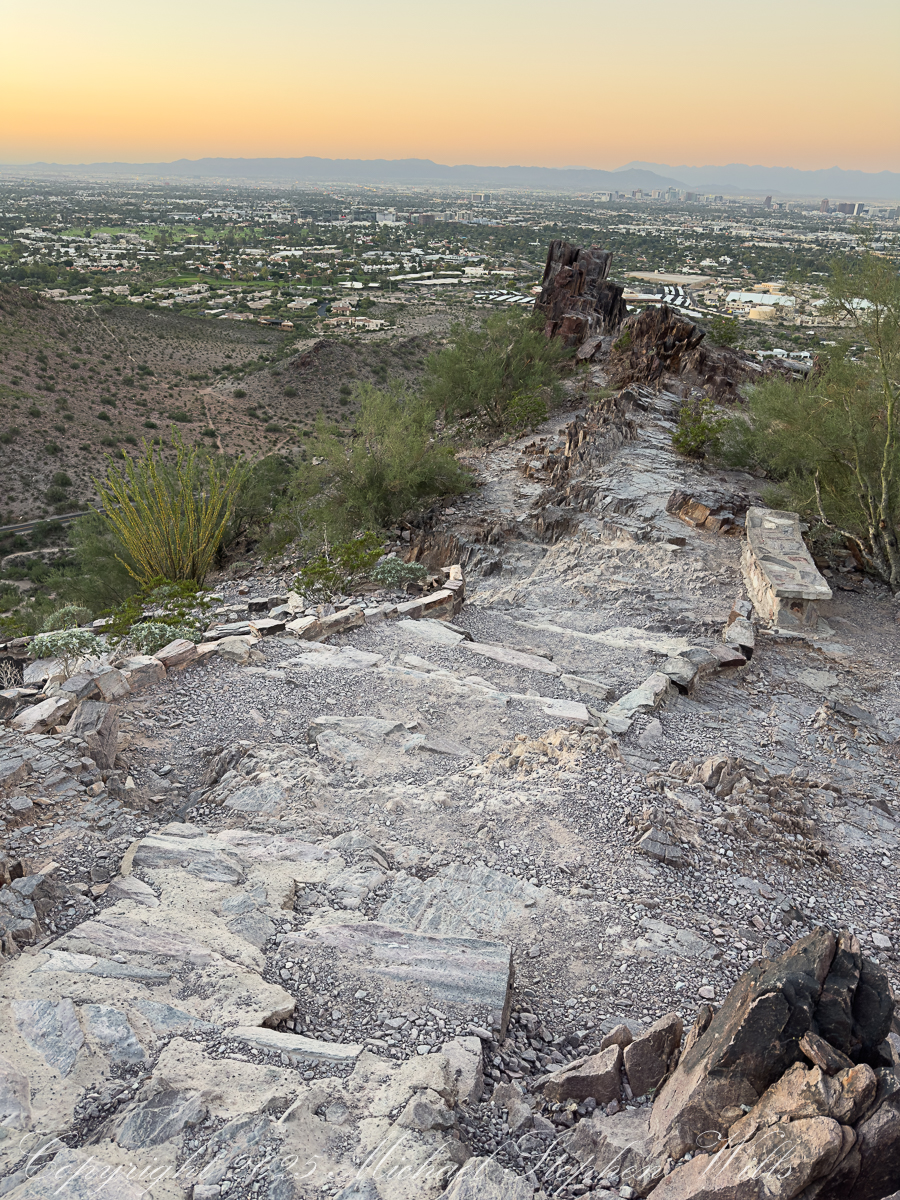
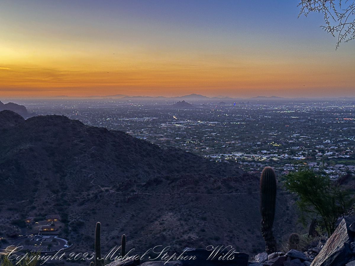
The last push to the saddle is steep, the steps uneven, the sky now a cascade of colors—copper, rose, faint lavender melting into a high dome of blue. The silhouettes of distant ranges sharpen: the Estrellas?, the Superstitions?, low ridges whose names I do not know. On the horizon, the first thin line of sun breaks free, setting fire to the edges of clouds. In another photograph, framed by dark rock and desert trees, that sunrise becomes a golden portal at the end of a shadowed corridor of stone.

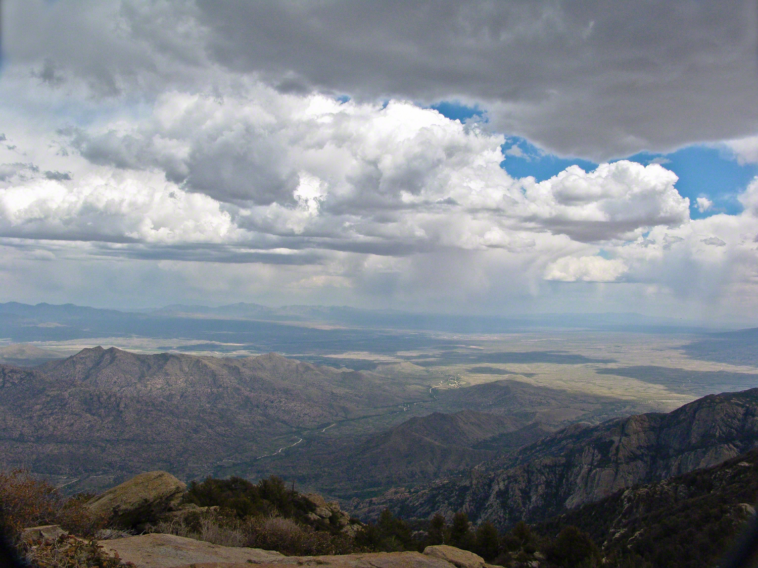
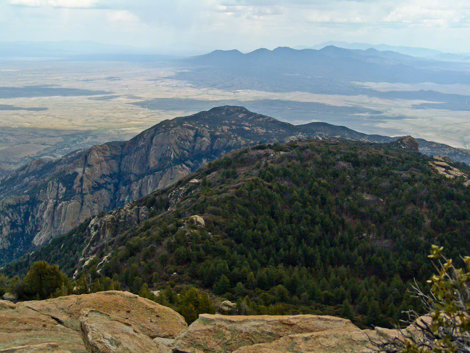
We reach a broad ledge just shy of the summit as the light finally spills over us. People are already gathered there: a trio of college students taking selfies, a pair of retirees sharing thermos coffee, a solitary man sitting cross-legged with eyes closed, face open to the warmth. The city below is suddenly transformed. The carpet of lights dims, replaced by the clear geometry of streets and rooftops, golf courses and parking lots, all laid out like a model at our feet. The mountains that hem the basin—once anonymous shapes—now reveal their ridges and ravines in sharp relief.

For a few minutes conversation dies away. Everyone seems to feel the same thing: that fragile instant when the sun clears the horizon and the desert shifts from silver-blue to gold. The rocks around us, sharp and broken in the photographs, glow honey-colored. Saguaros catch light on their spines, each thorn a tiny ember. Even the dusty air seems to shimmer.

Down below, a new wave of hikers starts up the trail, latecomers walking into full daylight. We, the predawn climbers, share a small, quiet complicity. We have seen the city from the backside of night, watched the day arrive from a perch of jagged stone. Piestewa Peak has turned us, for an hour or two, into a single, breathing organism: many hearts, one climb, all of us stitched together by the steep path and the slow unveiling of the sun.

Enter your email to receive notification of future postings. I will not sell or share your email address.

Taughannock Falls State Park: A Geological and Ecological Marvel

Taughannock Falls, a majestic 215-foot waterfall, showcases nature’s beauty and power, intertwining geological history with vibrant ecosystems in New York.


Introduction
Nestled in the heart of the Finger Lakes region of New York, Taughannock Falls stands as a testament to the delicate balance of power and beauty in nature. This iconic waterfall plunges 215 feet—one of the tallest single-drop waterfalls east of the Rocky Mountains—into a gorge whose story is written in stone. The park surrounding this natural wonder offers a symphony of sights, from towering cliffs to lush greenery, inviting visitors to explore its ancient secrets and vibrant life.

View of taughannock Falls from the South Rim Trail. Taughannock Falls New York State Park, Trumansburg, Tompkins County, Finger Lakes Region

A Story Written in Stone
The rocks of Taughannock Falls tell a story that stretches back 380 million years to the Devonian Period, a time when the region was submerged beneath a shallow inland sea. Layer upon layer of shale, sandstone, and limestone formed as sediment settled to the ocean floor, preserving the fossils of marine life that once thrived here. These rocks have endured the passage of eons, but the gorge itself is a far more recent creation.

Limestone Steps on the South Rim Trail descend to the gorge floor.

It was the retreat of the mighty Laurentide Ice Sheet, approximately 10,000 years ago, that set the stage for Taughannock’s grandeur. As glaciers melted, torrents of water carved the U-shaped valleys that now cradle the Finger Lakes. Taughannock Creek, a tributary of Cayuga Lake, began its work, etching its path through ancient rock, sculpting the gorge we see today. In just 10,000 years—a fleeting moment in geological time—the relentless force of water carved its way 3/4 of a mile upstream, creating the awe-inspiring chasm and waterfall that continue to evolve even now.

Taughannock Creek carved this landscape over thousands of years.

The Gorge’s Living Tapestry
Beyond its geological wonders, Taughannock Falls State Park bursts with life. Along the North and South Rim Trails, Eastern Hemlocks (Tsuga canadensis) stand tall, their evergreen branches weaving shadows that dance across stone stairways and forest floors. These silent sentinels are habitats for myriad creatures and protectors of the delicate ecosystem.

Wildflowers were planted by park staff at the Falls Overlook. The bright yellow of Black-eyed Susans (Rudbeckia hirta) and the vibrant purple of Coneflowers (Echinacea purpurea) attract bees and butterflies, their nectar fueling the intricate web of life that thrives here. Along the trail, on the forest floor, mosses and ferns cling to rocks, softening the edges of the gorge with their verdant touch.

Cone Flowers
Cone Flowers gone to seed
From a walk around Taughannock Falls State Park “Rim Trails” October 22nd, 2024. Trumansburg, Tompkins County, Finger Lakes Region, New York State.

The Fall’s Eternal Dance
At the heart of the park is the waterfall itself, its roar both a hymn and a whisper of time’s passage. The view from the North Rim Trail reveals the waterfall framed by steep cliffs, their striations like pages in a book written by water, wind, and time. The plunge pool below, shimmering in sunlight, seems almost sacred—a place where the forces of nature meet in harmony.

Viewed from the North Rim Trail on a summer morning. Taughannock Falls New York State Park, Trumansburg, Tompkins County, Finger Lakes Region

Even as we marvel at its beauty, the falls are a reminder of the earth’s constant transformation. Each drop of water that cascades down the cliff face carries away tiny fragments of rock, continuing the slow, deliberate work of reshaping the land. What we witness today is but one moment in an ongoing process—a fleeting glimpse of a masterpiece in progress.

A Place of Wonder
To stand at the edge of Taughannock Falls is to feel both small and connected. The cliffs, formed over hundreds of millions of years, whisper of ancient seas and forgotten worlds. The gorge, carved in the blink of an eye by geological standards, speaks to the power of water and time. And the vibrant life that fills the park reminds us of nature’s resilience and beauty.

As the sun filters through the trees, illuminating the mist that rises from the falls, it’s easy to believe that this place holds magic. Perhaps it’s in the way the water sparkles like diamonds in the sunlight or the way the breeze carries the scent of pine and earth. Or maybe it’s in the knowledge that here, in this park, we are witnesses to a story billions of years in the making.

Conclusion
Taughannock Falls State Park is a place of wonder where geology, ecology, and history converge. It invites us to reflect on the immense forces that shape our world and to cherish the fleeting beauty of each moment. Whether you come to marvel at the towering waterfall, walk among the hemlocks, or simply stand in awe of the gorge, Taughannock Falls leaves an indelible mark on the heart—a reminder of nature’s power, resilience, and enduring grace.

Enter your email to receive notification of future postings. I will not sell or share your email address.

A Journey Through Autumn Colors at Taughannock Falls

Taughannock Falls State Park offers stunning autumn views, vibrant colors, and serene natural beauty.

As I set foot on the Falls Overlook at Taughannock Falls State Park, I was greeted by a symphony of autumn colors in their full glory. The vibrant oranges, reds, and yellows of the trees framed the scene, setting the stage for a perfect fall day. I lingered, taking in the view of cars nestled among the foliage, their colors almost merging with the rich autumn hues surrounding them. The sign for the “Falls Overlook” hinted at the journey ahead.

The overlook offered a breathtaking view, a gentle reminder of nature’s power as Taughannock Falls cascaded far below, framed by rugged cliffs and vibrant trees. Through gaps in the golden leaves, I could catch glimpses of the waterfall, a delicate white ribbon against the slate-gray rock. The sunlight filtered through the canopy, casting dappled shadows and illuminating leaves like stained glass, painting the landscape in a thousand shades.

I began my ascent up the North Rim Trail, where the path twisted beneath a tunnel of golden branches. The trail was carpeted with leaves, crunching underfoot with each step. The air was crisp, filled with the earthy scent of decaying leaves and moist earth. Sunlight poured through gaps in the canopy, lighting up patches of ferns and casting long shadows on the rocky path. Here and there, the yellow and brown hues gave way to a burst of crimson, the leaves vivid and almost glowing in the sunlight.

The trail led me along the cliff’s edge, where the river carved its path below. Pausing on the footbridge to the south rim, a former railroad, I looked out over the gorge, admiring the mosaic of colors stretching as far as the eye could see. In the distance, the sound of the falls drifted up to me, a soft, continuous roar that lent the forest an almost mystical air. It was hard not to feel a sense of awe at the raw beauty of the scene.

Eventually, I made my way down the South Rim Trail. There were ample distractions from the glorious foliage. A lone mushroom, golden and nestled in a bed of moss, caught my eye—a small reminder of the forest’s quiet life. I bent down to examine it, marveling at its delicate cap and the way it seemed to glow against the lush green moss. The trees here were denser, casting cool shadows that contrasted with the sun-drenched north side. The leaves here were thicker underfoot, their earthy scent more pronounced, grounding me in the moment.

As I reached the lower section of the trail, I noticed an old stone staircase winding up through the trees to the north rim—a relic from another time, adding a touch of mystery to the path. Each step was worn smooth by countless feet, each one a reminder of the generations that had walked these trails before me. The stairs climbed through a cathedral of trees, each trunk tall and straight, as if standing guard over the trail.

On my way around I passed by a historical marker, a blue and yellow sign commemorating the camp site of Captain Jonathan Woodworth, a Revolutionary soldier who camped here in June 1788. It was a reminder that these trails, this land, had been cherished long before my steps fell upon it.

After reaching the base of the South Rim Trail, I looped back up the North Rim. The trail now felt familiar, yet the changing light gave it a new character. The sun was lower, casting a golden glow across the tops of the trees.

As I returned to my starting point, the sun cast a soft, warm light across the landscape, bathing the park in an ethereal glow. With one last look over the falls and the vivid tapestry of trees, I felt a sense of gratitude. Taughannock Falls State Park in autumn is an experience, one that leaves an indelible mark, reminding us of the beauty and timelessness of the natural world.

On the drive home I paused to admire a neighbor’s maple tree’s full autumn glory.

Enter your email to receive notification of future postings. I will not sell or share your email address.

Nature’s Role in Recovery: October at Treman Park

Pam’s recovery from hip replacement unfolds in Upper Robert H. Treman State Park, intertwining personal resilience with nature’s healing beauty.

On a crisp October afternoon, October 3, 2024, Pam and I reveled in Upper Robert H. Treman State Park, a serene oasis nestled in Tompkins County. This visit was particularly special for us, a step in Pam’s recovery from her August hip replacement. I remember the sound of her hiking pole tapping the ground as we walked together, feeling grateful for her progress since surgery. The air was cool, and the leaves, turning gold and orange, whispered in the breeze, providing the perfect backdrop for our outing that day.

Our path followed the creek, the same creek that winds through the heart of the park, framed by layers of stone and lush vegetation. In one of the first photos I took that day, you can see the creek reflecting the soft autumn light, its bed dotted with rocks and fallen branches. The vibrant greens of the undergrowth juxtaposed with the golden leaves made the scene feel timeless, as though nature itself was participating in Pam’s recovery, offering healing in its quiet, enduring beauty.

The view upstream just before the creek enters The Gallery. Robert H. Treman State Park, Enfield, Tompkins County, Finger Lakes Region, New York State.

We paused to take in the quiet hum of life around us. There was a sense of history in the park that seemed to blend with our personal story. As we wandered deeper, we reached the foundation of the old Budd House, its stone blocks now barely a shadow of the past but still carrying echoes of life lived long ago. The placard described Charles Budd, a village blacksmith and postmaster, and his wife, Deborah, who continued to serve the community after his passing. Standing there, I reflected on how these stones, much like Pam’s journey, represented resilience and the passage of time.

Site 2: The Budd House The stone blocks set in the lawn here outline the subsurface remains of the home of Charles Budd and his family. Budd was the village blacksmith and postmaster. Before the Industrial Revolution introduced cheap, mass-produced goods, blacksmiths crafted all manner of metal implements, re-shoed horses, and repaired carriages. Below to the left is a photo of a blacksmith shop in Tompkins County. As the Enfield Falls postmaster, Charles Budd ran the post office out of the parlor (similar to a living room) of his house. He held this position until his death in 1896. His wife, Deborah Budd, then faithfully served as postmaster until the post office closed in 1902. Did you know? Step into the foundation outline. The size of the Budd House is typical for a 19th century middle-class house. How many rooms of your home would fit in the footprint of the Budd’s entire house? In the 19th century, rural community members picked up their mail once a week at post offices like Budd’s. These post offices were closed with the United States Postal Service’s transition to “rural delivery”—the nationwide delivery of mail directly to everyone’s doorstep. We still enjoy this service over 100 years later. In the 19th century, voluminous mail-order catalogues by companies like Sears & Roebuck and Montgomery Ward sold everything from clothing to home and farm supplies to buyers across the nation. Packages took days or weeks to arrive, and customers would have eagerly checked with postmasters to see if their order had been delivered. This excitement and anticipation are reflected in the musical number “The Wells Fargo Wagon” in the Broadway musical The Music Man set in 1912 Iowa. A free walking tour brochure, Archaeology in the Park, is available on the main floor of the Old Mill. Upper Treman. Robert H. Treman State Park, Enfield, Tompkins County, Finger Lakes Region, New York State.

As we stood by the foundation, we met another couple. The woman shared her own story of recovery, a tale of resilience that resonated deeply with us. She had fallen and suffered a spinal injury, becoming paralyzed from the neck down, while traveling. Thanks to surgery and rehabilitation, she regained full mobility. There was a moment of understanding and connection between us. We offered to take a photo of them, and they returned the favor, capturing the two of us—Pam leaning lightly on her cane, smiling, surrounded by trees whose leaves were beginning to fall. That picture, one of my favorites from the day, symbolizes not just Pam’s strength but also the support and shared experiences that come with recovery.

We are taking a walk through upper Treman Park during Pam’s recovery from hip replacement. This was taken by a couple we met.

The park offered us a space for reflection and a sense of continuity. The trees, some towering over us with roots gripping the earth, had seen many seasons of change, and now they watched over us as we walked beneath them. In the clearing where picnic tables stood, we sat for a while, simply absorbing the moment. The afternoon light filtered through the branches, casting long shadows on the grass.

One of the final photos I took that day captures the creek from another angle. The water, calm and clear, reflects the yellow hues of the trees, while the rocks and roots along the bank seem frozen in time. It’s a peaceful image, one that reminds me of the quiet strength that Pam has shown throughout her recovery.

Here Fish Creek, a tributary of Enfield Creek joins the flow just below the pavilion of Upper Treman.

We left the park that day feeling both uplifted and grounded, the layers of history and personal resilience blending seamlessly into the natural landscape. Upper Robert H. Treman had become had become a part of Pam’s recovery story, a testament to the healing power of both nature and community.

Enter your email to receive notification of future postings. I will not sell or share your email address.

Exploring Rincon Peak: Hiking Adventures in Arizona

As we stood atop Rincon Peak, the sky darkened with the approach of a sudden thunderstorm. Below us, the San Pedro River valley sprawled, with the Mae West Peaks to the left and the legendary Dragoon Mountains straight ahead. This photograph captures that exhilarating moment—standing on the summit with the world at our feet and the wild Arizona sky closing in. Curious about how we got there and our race against nature’s fury? Join me on the blog to delve into the full adventure and explore more stunning images from the heart of the Rincon Wilderness.

The Rincons are one of 42 Sky Island mountains isolated from each other due to gradual warming and drying climate changes since the last ice age, 10,000 years ago. While this marvelous environment of oak and pine forests is accessible only on foot and with significant effort, it is visible from every point of the Tucson valley, home to a million inhabitants.

The name ‘Rincon,’ Spanish for ‘corner,’ reflects the mountains’ shape as they enclose a space on the west and northwest. This area, formerly used for ranching, is now being developed for tract housing. In contrast, the mountains themselves are preserved as wilderness, with parts designated within the Saguaro National Park and the Coronado National Forest.

In the past 51 years, I have been lucky enough to visit the Rincon Wilderness interior four times, shouldering different style backpacks onto the mountain and walking in different boots. My first trip was during college in the 1970s, when a party of six of us left from the end of Speedway, heading up the Douglas Springs trail. The climb was an exercise in desert survival that several friendships did not survive, replaced by new friends met on Mica Mountain. I have no photographs from that experience, only memories and the backpack.

Decades later, reconnecting with Arizona in 2004—thirty-one years after that first experience—I took no chances. This time, my attempt on Rincon Peak was a success. I reduced risk and effort, though not eliminating them, by hiring a guide for the four-day trip. We reached Rincon Peak via the Turkey Creek Trail out of Happy Valley, climbing a mountain buttress with views that widened and lengthened with every step.

Capturing these moments, I took several photographs during that experience. Two years later I added a landscape of the peak at sunset.

Along the Turkey Creek trail, Sego Lilies bloomed among a stricken oak and drying grasses, offering a vivid glimpse into the region’s delicate ecosystem. It is the winter rains that trigger such a bloom.

Sego Lilies -- CLICK ME!!!!

Enthralled by their beauty, we paused while I unpacked my gear to photograph the Sego Lilies growing along the trail.

Sego Lilies -- CLICK ME!!!!

When we reached Deer Head Spring at the top of Turkey Creek Trail on April 27, 2004, it was a moist spot with no accessible water. With only about a gallon of water each remaining, we pressed ahead to Heartbreak Ridge and climbed into Happy Valley Saddle, where, thankfully, the creek—though low and full of algae—was usable. It was here that I caught my first glimpses of Rincon Peak, looking across the aptly named Heartbreak Ridge and Happy Valley Saddle.

Distant View of Rincon Peak-- CLICK ME!!!!
Telephoto view of Rincon Peak -- CLICK ME!!!!

From Rincon Peak, the view to the south was breathtaking. The white rocks at the lower right formed the Valley of the Moon wall. Below lay the San Pedro River valley, with the Mae West Peaks at the left margin and the Dragoon Mountains with Cochise Stronghold at the center. I took this photograph around 12:30 PM on April 28, 2004, just as a thunderstorm was approaching.

View from Rincon Peak -- CLICK ME!!!!

Rotating the camera to the south-southwest, the view stretched over the Valley of the Moon to the eastern Tucson Valley and the Sky Islands of the Whetstone Mountains (Apache Peak), with the Santa Ritas behind them. In this vast landscape, the works of man are overpowered by sky, rock, and distance.

View from Rincon Peak -- CLICK ME!!!!

We made a hasty departure ahead of the thunderstorm. Attempting the peak that day had been a touch-and-go decision, but we reached the summit with moments to spare.

On the morning of April 29, 2004, the day after reaching Rincon Peak, I set up my tripod near our Happy Valley Saddle camp. In the serene early morning sunlight, I captured images of Rincon Peak, reflecting on the previous day’s ascent.

Rincon Peak from Happy Valley Saddle, dawn -- CLICK ME!!!!

On the day we descended to the X9 Ranch via the Rincon Creek trail, we were granted a unique opportunity. My guide’s grandfather had a homestead at the X9, and his access to the trailhead through private lands opened this ro ute for us. That evening, I took a photograph of the sunset on Rincon Peak from the X9 Ranch, looking east from the ‘Rincon’—the corner formed by the massifs of Rincon Peak, Mica Mountain, and Tanque Verde Ridge.

The X9 ranch sits in the Rincon (spanish for corner) made by the massifs Rincon Peak, Mica Mountain and Tanque Verde ridge.

Two years later, on the evening of November 2, 2006, I climbed the Tanque Verde trail in Saguaro National Park East for about 30 minutes to reach a vantage point of Rincon Peak. Intending to capture the peak bathed in golden light, I waited until just before the sun set behind the Tucson Mountain. Afterwards, I raced the sun hiked back to the car. In my hurry, I tripped on a stepped turn and dove headfirst into a large prickly pear cactus. It was a very painful experience. Large spines pierced my face, while tiny, pesky spines covered my chest and back. The large spines, not being barbed, came out easily, but I needed to visit a physician to remove the rest.

Click me for a framed version of this photograph
Rincon Peak from the X9 Ranch-- CLICK ME!!!!

Enter your email to receive notification of future postings. I will not sell or share your email address.

Exploring Lime Hollow: Nature Walks with My Grandsons

Enjoy a memorable visit to Lime Hollow Nature Preserve by a grandfather and his grandsons, exploring nature, observing wildlife, and connecting through shared experiences, fostering curiosity and appreciation for the environment.

The October sunlight was gentle as we entered Lime Hollow Nature Preserve from Gracie Road, my grandsons, Sam and Rory, bursting with excitement beside me. Sam, the eldest, took the lead, confidently striding ahead along the Sunset Trail while Rory, his younger brother, stayed close to my side, his eyes wide with wonder at the forest around us.

Descent to the Pond


The trail wound through the woods, dappled with the golds and reds of early autumn. Sam spotted a squirrel darting between trees, and Rory pointed to the sky, “Look, Grandpa, a woodpecker!” I smiled at their enthusiasm, feeling grateful for these moments of connection to nature and family.

We descended toward the pond via the Pond View Trail, the sound of trickling water drawing us closer. As we approached, the landscape opened up, revealing the calm, reflective surface of the water, bordered by reeds swaying in the light breeze. I remembered bringing the boys here last spring, how different the pond looked then—brimming with life as frogs leapt from the banks and dragonflies zipped across the water’s surface. Today, the scene was quieter, but no less magical.

Rory, ever the adventurer, crouched by the pond’s edge, watching for frogs. Sam, too, paused to observe but soon grew restless, his curiosity pushing him onward. “Come on, Grandpa! Let’s see what’s next!” His voice echoed through the trees as he darted back onto the trail, Rory quick to follow.

Encounter with the Giant Fungus


The path led us deeper into the forest, and soon we turned onto the Brookside Trail, which merged with the High Ridge Trail. Here, the air grew cooler under the dense canopy of trees, and the forest floor softened beneath our feet with layers of leaves. It was then that we stumbled upon the most magnificent sight of the day: an enormous bracket fungus, its wide, layered shelves clinging to the trunk a hoary snag.

Rory gasped in delight, running over to inspect it more closely. “Look how big it is!” he exclaimed, his small hands hovering just above its ridged surface. Sam, never one to be outdone, knelt beside it, carefully touching the spongy layers. “It’s a staircase for squirrels,” he said, grinning up at me.

Turkey Tail bracket fungus (Trametes versicolor) is a common wood decay fungus found on dead and decaying hardwoods. Named for its concentric, colorful bands resembling a turkey’s tail, it plays a vital role in forest ecosystems by breaking down lignin, facilitating nutrient recycling. It’s also valued for its medicinal properties. Lime Hollow Nature Center, Cortland, Cortland County, New York State. Finger Lakes Regions

As I watched them, I couldn’t help but think back to all the times I had wandered these trails alone before they were born. Now, these woods had become a classroom for them—full of discoveries that sparked their curiosity and wonder. It was a beautiful moment of generational connection, this passing on of my love for the natural world to Sam and Rory.

Fascinating Beech Tree Roots


On the way out, we took the Brookside / Pond View / Sunset trails once again, but this time, this intricate network of roots from a massive beech tree fascinated us. The roots twisted and coiled across the path like veins, in our imaginations the gnarled shapes snagged our feet. Sam, ever the explorer, stepped cautiously along the roots, balancing himself as if walking a tightrope. Rory followed suit, his giggles filling the air.

An American beech (Fagus grandifolia). These trees are quite common in northeastern forests.
The beech tree is known for its smooth smooth, gray bark, which can become marked with scars or etchings as the tree ages. Additionally, its leaves are typically dark green, with serrated edges, and turn yellow to bronze in the fall, often staying on the tree through winter. Lime Hollow Nature Center, Cortland, New York State

“These roots are older than us,” I told them. “Beech trees can live for hundreds of years. Just think, this tree has seen many more seasons than we ever will.”

Sam’s eyes widened at the thought, while Rory gave the tree a gentle pat, as if to thank it for its wisdom. I marveled at how something as simple as a root system could captivate their imaginations and bring the lesson of time and growth to life.

Reminiscing on the Chicago Bog

In the 1830’s there was a village named Chicago along Gracie Road, which gives it the name we have today. The Chicago Bog is home to many carnivorous plants, including sundew, the pitcher plant, and more. The deepest depth of the bog is about 7.2 ft. The bog is along the Phillips Memorial Trail, which can be found on Gracie Road. Lime Hollow Nature Center, Cortland, New York


As we walked, my mind wandered back to a visit we had made to the Chicago Bog just a year before. I remembered the day clearly—how we had trekked through the wetland on a warm June afternoon, the ground soft beneath our feet, alive with the buzzing of insects and the vibrant green of new growth.

The chalk-fronted corporal (Ladona julia) is a skimmer dragonfly found in the northern United States and southern Canada.
Juveniles of both sexes are light reddish brown, with white shoulder stripes and a black stripe down the middle of the abdomen. As they mature, males develop a white pruinescence on the top of the thorax and at the base of the abdomen, while the rest of the abdomen turns black. Females become almost uniformly dark brown, with a dusting of gray pruinescence near the base of the abdomen; a few develop the same color pattern as the males.
Chalk-fronted corporals often perch horizontally on the ground or on floating objects in the water, flying up to take prey from the air. They are gregarious for dragonflies, and are commonly seen perching in groups. They readily approach humans to feed on the mosquitoes and biting flies that humans attract.

It was there, by the edge of the bog, that we had encountered a dragonfly, a Chalk-fronted Corporal, resting on a fallen log. Its dark, iridescent wings shimmered in the sunlight, and Sam had been mesmerized by its delicate beauty. He had asked so many questions that day—about how dragonflies flew, what they ate, and where they lived. I had done my best to answer, but truth be told, I learned as much as he did in that moment.

Nearby, a meadow of buttercups had stretched out before us, their yellow blooms dancing in the breeze. Rory had run through them, his laughter ringing out as he tried to catch a butterfly that flitted between the flowers. The memory of that field of gold still brought a smile to my face as we made our way through Lime Hollow today.

A Day to Remember


As we neared the end of our hike, the afternoon light filtering through the trees, I couldn’t help but feel a sense of contentment. These outings with Sam and Rory had become more than just walks in the woods—they were opportunities to share, to learn, and to make memories that I knew would last a lifetime.

“Grandpa, can we come back?” Rory asked, his face flushed with excitement.

“Of course,” I said, smiling. “We’ll always have time for another adventure.”

Twilight Serenade: Experiencing the Eclipse Amidst Nature’s Splendor

Step into the enchanting world of the VanRiper Conservation Area during a total solar eclipse. Witness nature’s grand spectacle, where daylight fades into an ethereal twilight, and the cosmos whispers secrets to those who listen.

Standing within the serenity of the VanRiper Conservation Area, we had the rare privilege to witness a celestial marvel—the total solar eclipse. The coordinates, 42°43’8.62″N 76°45’30.41″W, marked not a unique vantage point on the southern edge of the total eclipse zone. Here, the total eclipse enveloped the sky for an awe-inspiring 50 seconds, a fleeting yet unforgettable spectacle that we were fortunate enough to experience.

The VanRiper Conservation Area served as a magnificent backdrop to this astronomical event. Known for its diverse habitats, including wetlands, forests, and meadows, the area is a haven for wildlife and a sanctuary for those who seek solace in nature; a place where the sky seems vast, unobstructed by the trappings of urban life, offering a clear canvas for the eclipse to paint its momentary magic.

13:38:07, 39 minutes 41 seconds before the moon’s edge touched the sun. From the shoreline of VanRipen Conservation Area, Town of Romulus, Seneca County, Finger Lakes Region, New York State

As the time for the eclipse approached, a thick blanket of clouds enveloped the sky, obscuring our view of the sun entirely. This unexpected veil not only robbed us of the celestial spectacle but also intensified the darkness, casting a deeper shadow over the landscape and amplifying the surreal, twilight ambiance.

As the moon began its slow sweep over the sun, an eerie twilight descended upon the conservation area. The temperature dropped noticeably, a testament to the sun’s masked radiance. The birds, momentarily confused by the sudden dusk, fell silent, heightening the surreal atmosphere. This was the moment I had been waiting for, the total eclipse, where day momentarily turns to night, and the ordinary becomes extraordinary.

15:21:37, 56 seconds to totality. From the shoreline of VanRipen Conservation Area, Town of Romulus, Seneca County, Finger Lakes Region, New York State

Positioned on the southern edge of the total eclipse zone, I observed a fascinating phenomenon: the southern side of the horizon retained a brighter hue compared to the north, which veiled itself in deeper shades of twilight. This luminous gradient painted across the sky was a direct consequence of our location’s proximity to the eclipse’s path of totality.

In this captivating 4-minute YouTube video, you’re whisked away to the shores of Cayuga Lake, beneath a cloudy sky, on the day of the Total Eclipse, April 8, 2024 viewed from the VanRiper Conservation Area Cayuga Lake Shoreline in the town of Romulus, Seneca County of the Finger Lakes of New York State. As the moon dances across the sun at 5 times normal speed you witness the gradual darkening of the lake. On the opposite shore, the town of Aurora lights wink with the total eclipse of the sun. In normal time Loons herald the Sun’s return with a bright and eerie serenade, a natural symphony celebrating light’s triumph over darkness. Join us on this remarkable journey, where day turns to night and back again, all within the embrace of the Finger Lakes Region.

The totality lasted for a mere 50 seconds, when time seemed to stand still, yet it was a period rich with emotion and wonder. To witness the total eclipse was to see the universe align in a rare spectacle of shadow and light, a reminder of our place in the cosmos.

Reflecting on the experience, the VanRiper Conservation Area was a portal to a deeper understanding and appreciation of the natural world. Its untouched Cayuga Lake shoreline provided a setting for observing the eclipse with a reminder of the beauty and fragility of our planet.

As the eclipse passed and daylight returned the silence was filled with Loon calls, a celebration of life and the return of light. The solar eclipse was a convergence of time, place, and celestial mechanics, offering a spectacle for the eyes, a moment of introspection about our existence in this vast universe: a reminder of the ephemeral nature of life and the enduring awe of the cosmos. In the heart of the conservation area, I stood at the crossroads of science, nature, and spirituality, left to reflect on the dance of shadows and light.

Copyright 2024 Michael Stephen Wills All Rights Reserved

Ephemeral Waterfall

Fillmore Glen State Park in Moravia, New York, offers a changing landscape that serves as a living canvas, with the ironically named Dry Creek feeding its lush greenery. The ebb and flow of water from the creek creates a dynamic setting. Seasons dramatically alter the scenery, from tranquil springs to vibrantly colored autumns, beautifully captured through fine art photography.

Continue reading “Ephemeral Waterfall”