Ithaca Pottery National Historic Place

finding a suppressed location

Wiki Loves Monuments was a contest that closed September, 2017.

Click for Wiki Loves Monuments 2017 contest

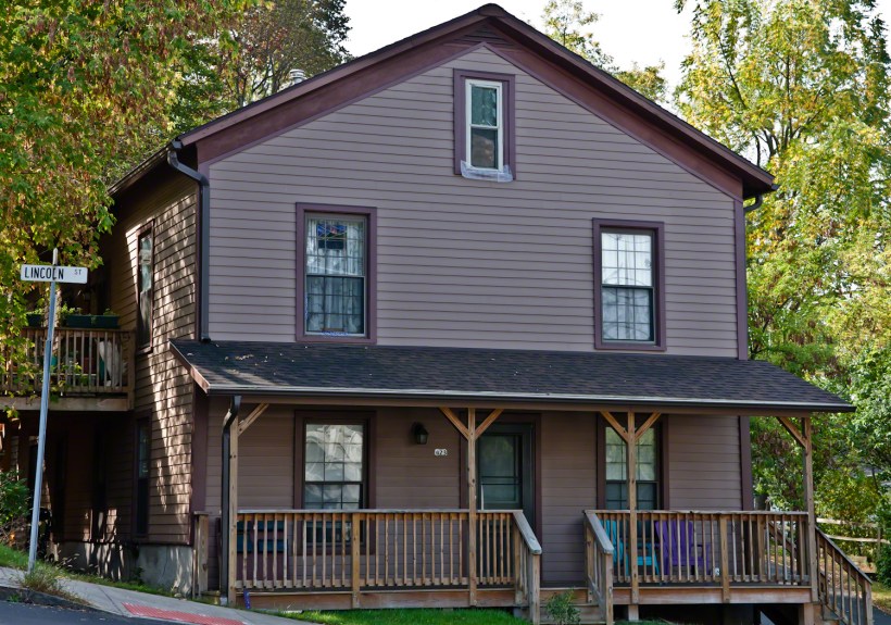
The National Register of Historic Places, online, lists the Ithaca Pottery Site(# 79001635) as “address restricted”.   There is no photograph published for the site either on the register or Wikipedia.  Here is an opportunity and a mystery.  Where is the suppressed location of this historic place?  There is the opportunity of completing the record by capturing a photograph.

There is another online reference listing the site as 423 E. Lincoln Street.  The site is “I Love the Finger Lakes”,

I researched the physical location of the site and found it to be in a historically industrial area of Ithaca, close to Ithaca Falls.  The correspondence I found online named Ezra Cornell as the owner when the pottery concern was active.  He donated the land for Cornell University and the location is consistent with his ownership.  There is a large wooded lot behind the building.

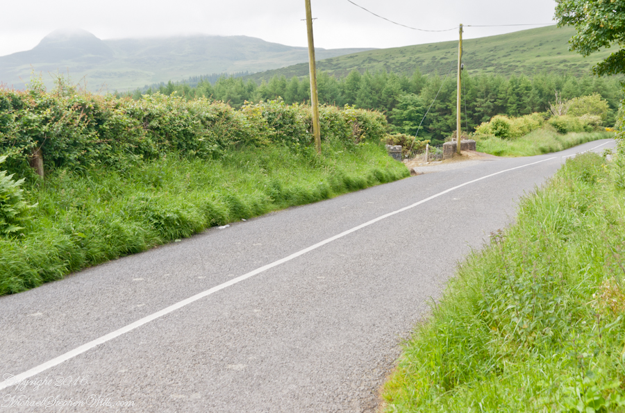
Last week I visited the address and guess the best light was the morning, returned yesterday to acquire the photograph.  There was a knoll across Lake Street that gave this view.  There are conflicting elements in this photograph:  the far hills are beautiful, the pole with wires very difficult to remove.  Also, the address is not visible.

Ithaca Pottery from the Knoll
Click link for my fine art gallery.

The street passing left to right is Lake Street.  Crossing lake street I took several shots, negotiating the light traffic to eventually stand in Lake Street for this shot.

Ithaca Pottery from Lake Street

In preparation for shooting, I mounted the Canon EF 70-300mm f/4-5.6L IS USM lens on the Canon EOS-1Ds Mark II body.  This shot was at 70mm, 1/200 second, ISO 1,000, f/7.1.   I hated the power lines and could not avoid them from any acceptable angle.

The only solution was to spend hours in Photoshop to achieve the result in the header.

Copyright 2021 Michael Stephen Wills All Rights Reserved

Loughan Bay Ruins, County Antrim

Deserted Cottages above the Irish Sea

We pulled off the side of Torr Road for this fine view on the way to Torr Head to take in this view of the Irish Sea.  The steeply rising distant headland is the Mull of Kintyre. Loughan an Lochan, County Antrim, Northern Ireland.

Michael Wills – CLICK ME for my Getty Portfolio.

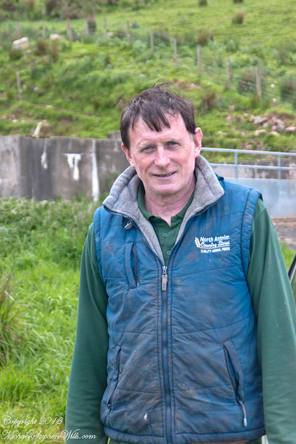
We parked on a turnout above the Loughan Cottages, near this farmer’s sheep pen.  He drove up in a huge tractor and conversed with Pam while I was below shooting the cottages. He made a good impression.

Loughan Bay Farmer – CLICK ME for my Getty Portfolio.

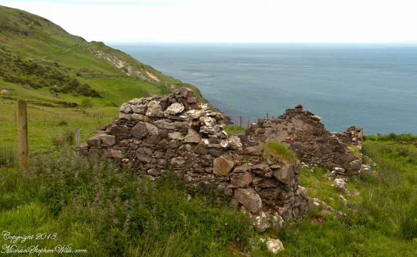
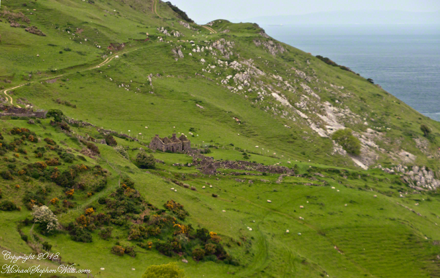
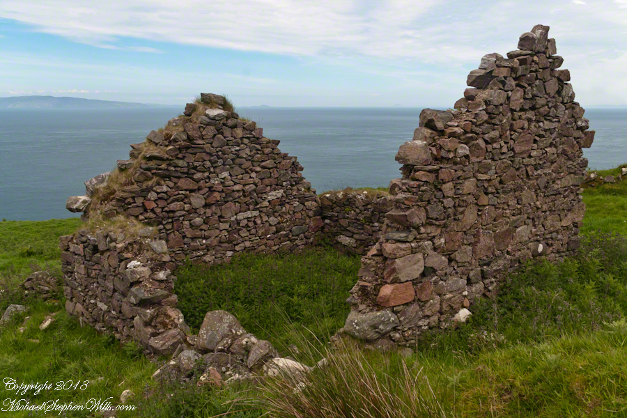
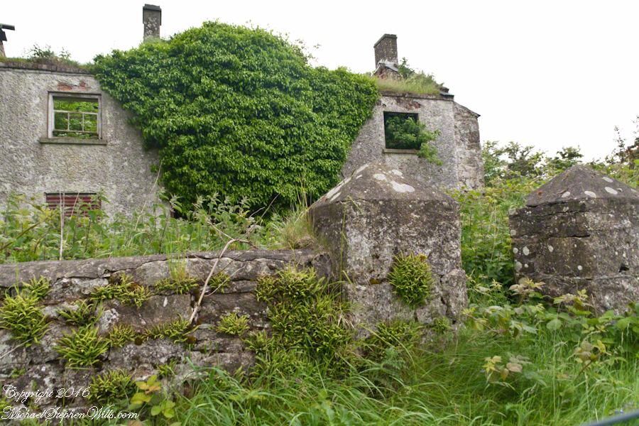
Roofless walls of a cottage more substantial than the other deserted ruins above Loughan Bay, with two fireplaces a walled porch with a view. A number of outbuilding foundations lay around. The integrity of the walls, chimneys and gables speaks to the quality of construction. A freighter in the North Channel of the Irish Sea is visible in the distance above the upper ridge. Beyond is the island of Islay, Scotland, about 30 miles distant. Loughan an Lochan, County Antrim, Northern Ireland.

I am happy to report a series of thirteen (13) photographs of these ruins were accepted for publication by Getty.  You can click any of the photographs in this posting for my Getty portfolio.

Loughan Cottages Ruins above Crockan Point – CLICK ME for my Getty Portfolio.

The land slopes steeply to a rocky beach.

Ruin Above Loughan Bay – CLICK ME for my Getty Portfolio.

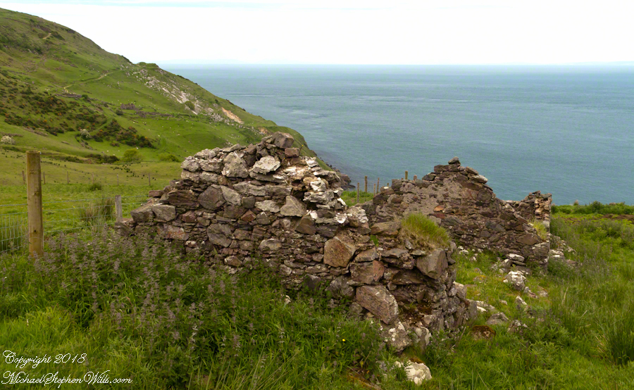
A thick growth of ferns, grass on the gable was once a home with a view of Scotland’s Mull of Kintyre 13 miles across the North Channel of the Irish Sea.  The Isle of Sanda just visible on the right of the far gable.  A landform named Alisa Crag is just visible in the distance, to the left of the nearest gable. 

Single Room Loughan Bay Cottage – CLICK ME for my Getty Portfolio.

Please browse my reasonably priced stock photography. License a photograph, download and use it for your website or blog. Click this link to browse all my Getty IStock Photography offerings.

Or click this link or any photograph or this link to select a print with custom framing from my “Ireland” Fine Art Gallery.
Interested in learning more about this site?  I have a series of postings on Loughan Bay.  Click for the first posting in this series.

Copyright 2021 Michael Stephen Wills, All Rights Reserved.

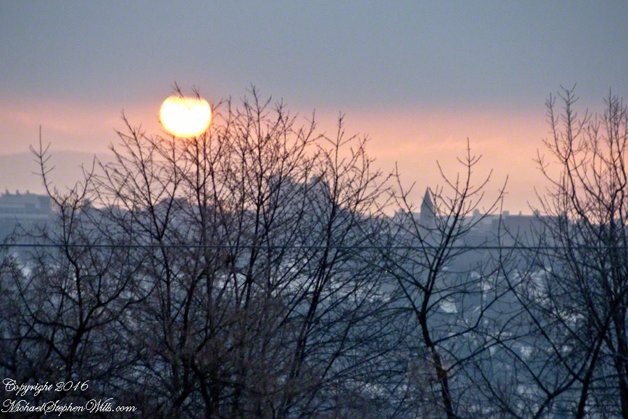
Red Sun over Cornell University

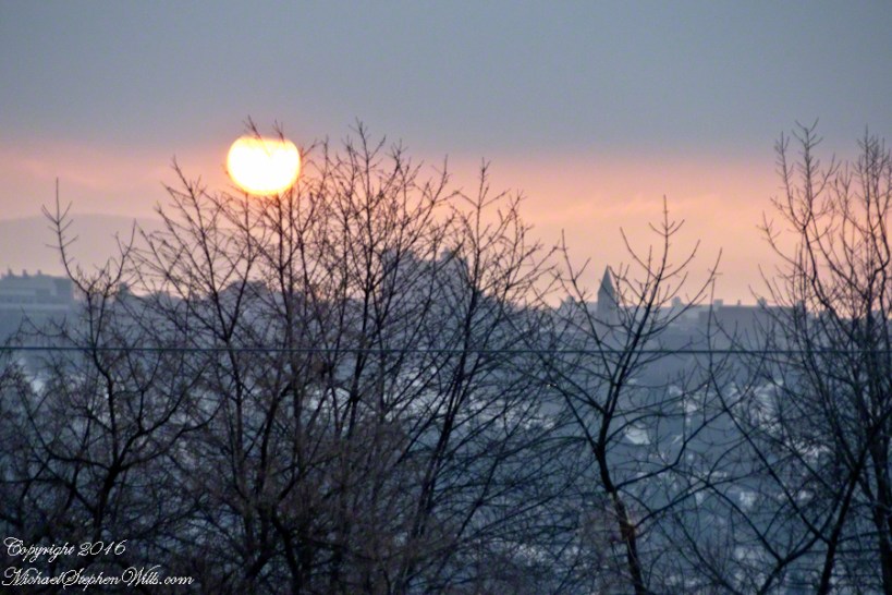
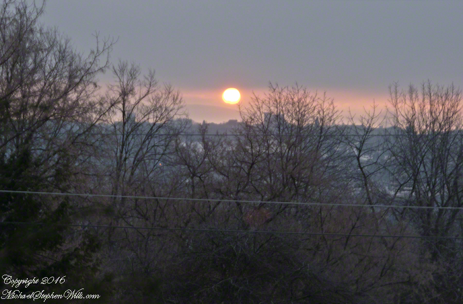
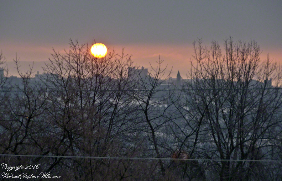
On this spring equinox morning a huge sun, filtered by morning clouds, hangs over East Hill and Cornell University. Taken from our home on West Hill, looking across the valley and Ithaca, New York.

The temperature is a balmy 18 degrees F.

Click the pic to visit my online gallery
Red Sunrise Over Cornell– CLICK ME!!!!


Red Sunrise Over Cornell– CLICK ME!!!!


Can you pick out these Cornell landmarks?
— Jenny McGraw Tower
— Lib Slope still covered in snow from last week’s storm.
— the looming fortress shape of Bradford Hall.

Red Sunrise Over Cornell– CLICK ME!!!!


Copyright 2021 All Rights Reserved Michael Stephen Wills

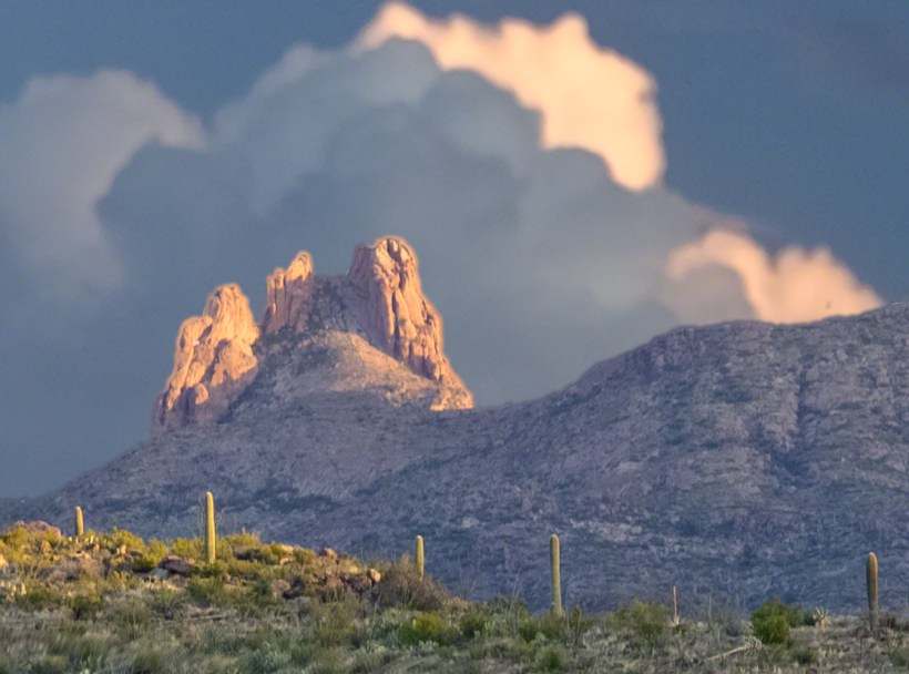
Peter’s Mesa Sunset

Can You Find the Eye of the Needle?

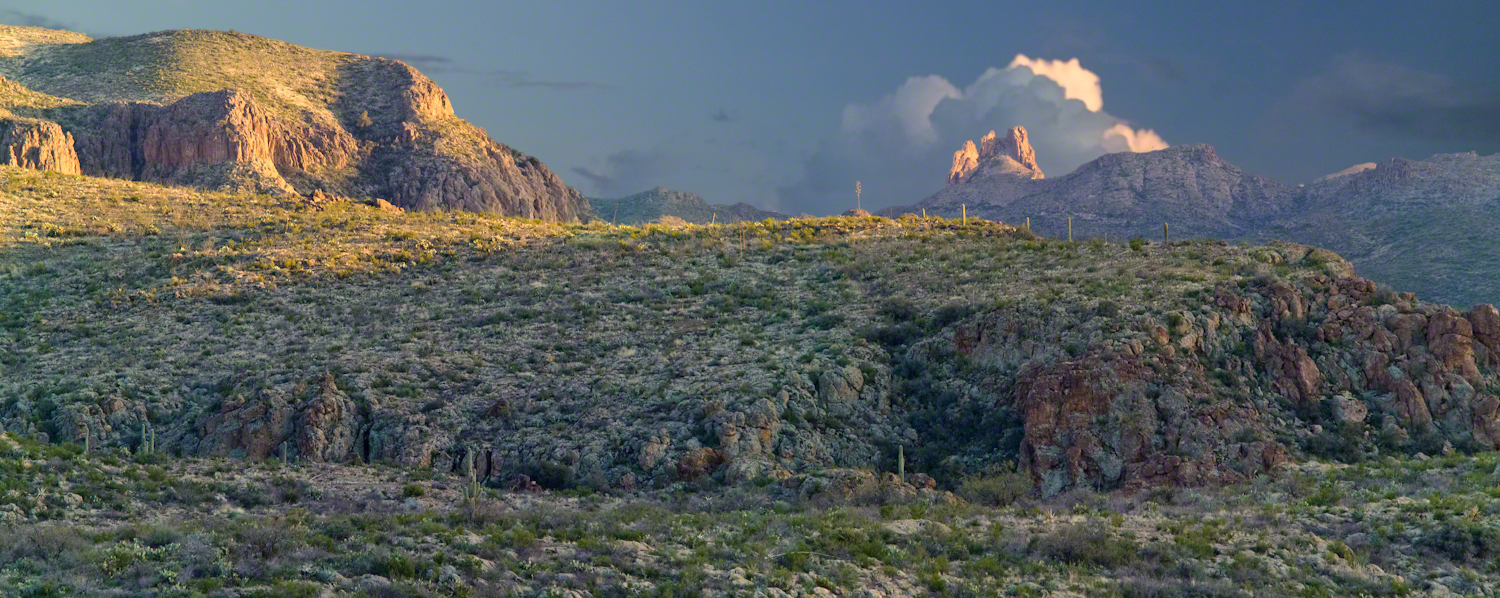
Peter’s mesa is at the center of Superstition Wilderness treasure legends. I was a member of an expedition to the top of the Mesa March 2008. This is a sunset view, looking south, southwest. Light raking across the desolation and an approaching storm behind Miner’s Needle create a fascinating spectacle. Ancient volcanism, apparent throughout the Superstition Wilderness, is here seen in the texture, form and type of rock as well as the mineral deposits. Miner’s Needle, like Weaver’s Needle (no seen in this view), are eroded volcanic summits. Look closely for the “eye” of Miner’s Needle, backlit by the storm cloud itself lit by the setting sun. To this day, hopeful prospectors search for gold nuggets around the Needle. There is one form of volcanism present today as an eerie rumble or hiss, similar to an enormous distant jet engine. We heard now and then during our two days on the mesa, louder and closer than a overhead plane could produce. The view includes many notable Sonoran desert plants. Many young Saguaro cactus are in the form of green poles and, on the rim of the ravine running left to right below the closer ridge, an excellent specimen with multiple arms. Catching the dramatic light, on the ridge is a tall single flower of an Agave, known as the “Century Plant” it flowers once in a long life and dies.

Click this link or the photograph for my Online Gallery
Peter's Mesa -- CLICK ME!!!!

Peters Mesa is named after “Old Pete” Gottfried Petrasch, father of Hermann and Rhiney Petrasch. Old Pete worked for Jim Bark for awhile in the 1890s doing odd jobs. Irregular employment gave Pete and Sons time to s searched for the Lost Dutchman Mine in the years following the death of the source of the legend, the “Dutchman” Jacob Waltz. The Petrasches were one of the first groups to search for the mine, and gold in general. They covered almost the entire Superstition range in their combined searches.

On our first day on the Mesa we came across the remains of one of these camp, on the top of Squaw Canyon. This was only deplorable junk a presumably disappointed bunch of searchers were too lazy to cart out. That March, we were lucky to find the remants of winter rains in the form of a meager trickle at the bottom of a shallow draw off Peter’s Mesa trail up from La Barge canyon. We had a good time of it until the trip was cut short by a storm front and torrential rains. We were back in Apache Junction before they hit.
This panorama is from our last evening on the Mesa. As the sun set I put the Kodak DSLR with a 50 MM lens on a Manfrotto tripod and hiked a mile higher onto the mesa for a view of Miner’s Needle. I quit only after the last light was extinguished by the approaching front. My reward for persistence was this dramatic light ennobling a craggy desolation. This is a composite of several images, combined using Photoshop. I have since invested in a Canon 24 mm wide angle lens.

Here is another Superstition Wilderness Episode

Copyright 2017 Michael Stephen Wills All Rights Reserved

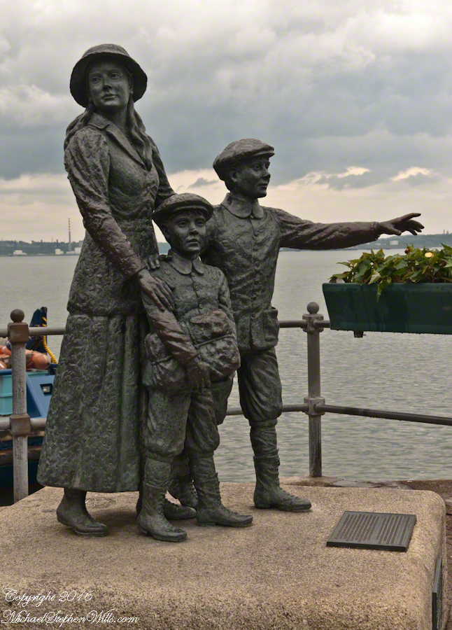
Annie Moore and her brothers

A statue of Annie Moore and her brothers quayside, Cóbh, County Cork, The Republic of Ireland

Click the photograph for my online gallery.
Annie, Anthony and Phillip Moore Statue, Cóbh– CLICK ME!!!!

On May 29, 2014, Pam and I had the emotionally moving experience of visiting the Cóbh Heritage Centre. This statue stands outside the centre, on the quay from which thousands of Irish emigrated from what was then Queenstown. My father’s mother, Elizabeth Wills née Duffy, departed from here on April 28, 1898.

These are the words on the plaque:

‘Annie Moore and her brothers, Anthony and Phillip, embarked from this town on December 20, 1891, on the S.S. Nevada. Annie was the first person to be admitted to the United States of America through the new immigration center at Ellis Island, New York, on January 1, 1892. This sculpture was unveiled by the President of Ireland, Mary Robinson, on February 9, 1993. It was erected by Cóbh Heritage Trust Ltd. and is dedicated to all who emigrated from Ireland.
This sculpture won the Zeneca Ireland Ltd. Commemorative Sculpture Award. A statue of Annie Moore was also erected at Ellis Island, New York. The commemoration of Annie Moore at New York and at Cóbh was initiated by the Irish American Cultural Institute. This sculpture is the work of Jeanne Rynhart of Bantry.'”

Click to visit the previous post in this series, “The Old Aghameen School.”

Copyright 2021 Michael Stephen Wills All Rights Reserved

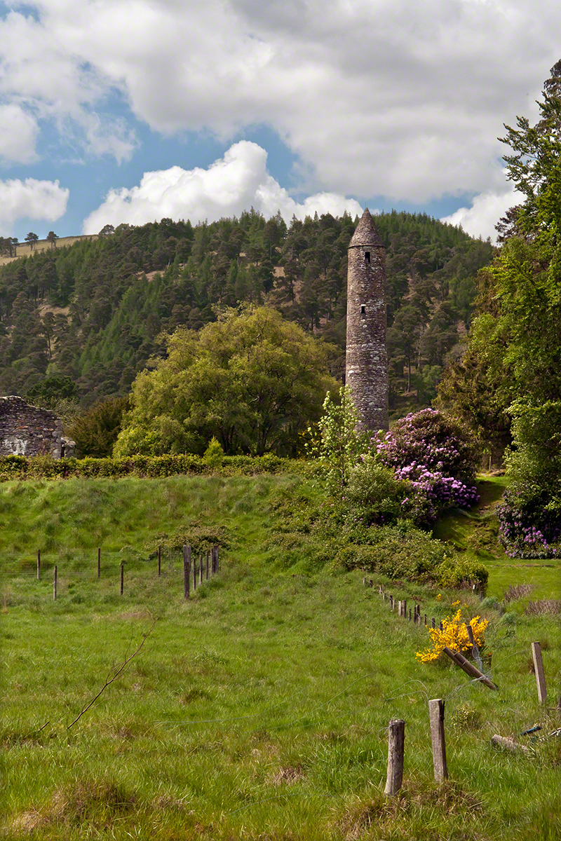
The Cloigtheach of Glendalough

A fine round stone tower of mica slate and granite

Cloigtheach is the Irish language name for a round stone tower.  The word’s literal meaning is “Bell House.”  This fine example of mica slate and granite is found in the Glendalough valley of County Wicklow, Ireland.

The sun was past noon when we arrived at this glacial valley of the Wicklow mountains.  In the few hours available I shot the tower from numerous angles and chose this because the tower is placed in the larger natural environment, viewed as a singular object apart from the monastic city the tower is placed among.

The Cloigtheach of Glendalough– CLICK ME!!!!

Saint Kevin founded a monastic settlement within Glendalough valley almost 1,500 years ago, in the late 6th century A.D. As a religious center the monastery flourished for 600+ years, becoming a monastic city. Destroyed by English forces in 1398, it was disestablished at that time. Still, Glendalough served as a pilgrimage destination through the intervening centuries. The surviving buildings date from the 10th through 12th centuries.

Rebuilding and restoration efforts began 1876, including the roof of this tower using original stones. At 30.48 meters (100 feet) tall the Cloigtheach of Glendalough is the landmark by which the site is known.

Enter your email to receive notification of future postings. I will not sell or share your email address.

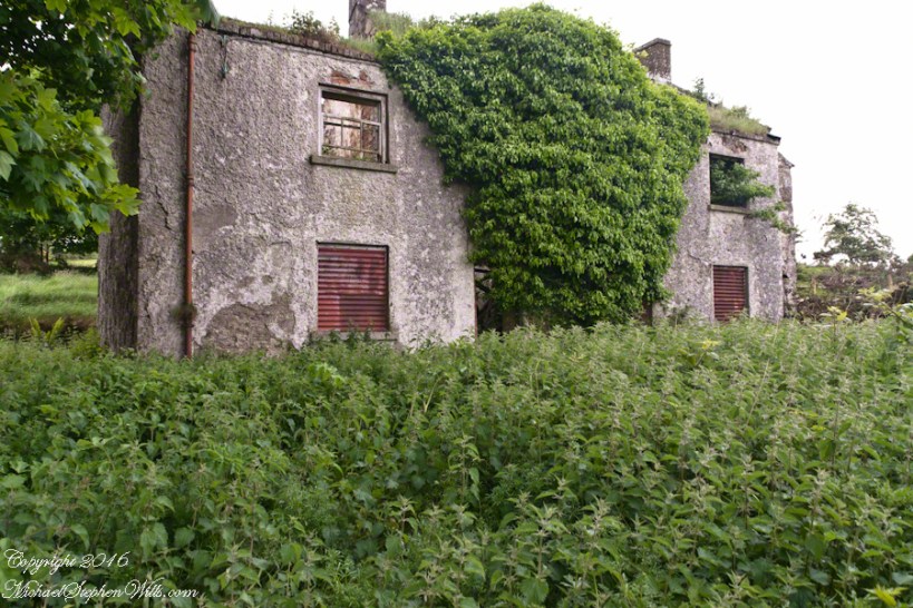
Irish Countryside: the Old Aghameen School

A schoolhouse ruin on the Cooley Peninsula near the Tain trail

Click any photograph to visit my online gallery

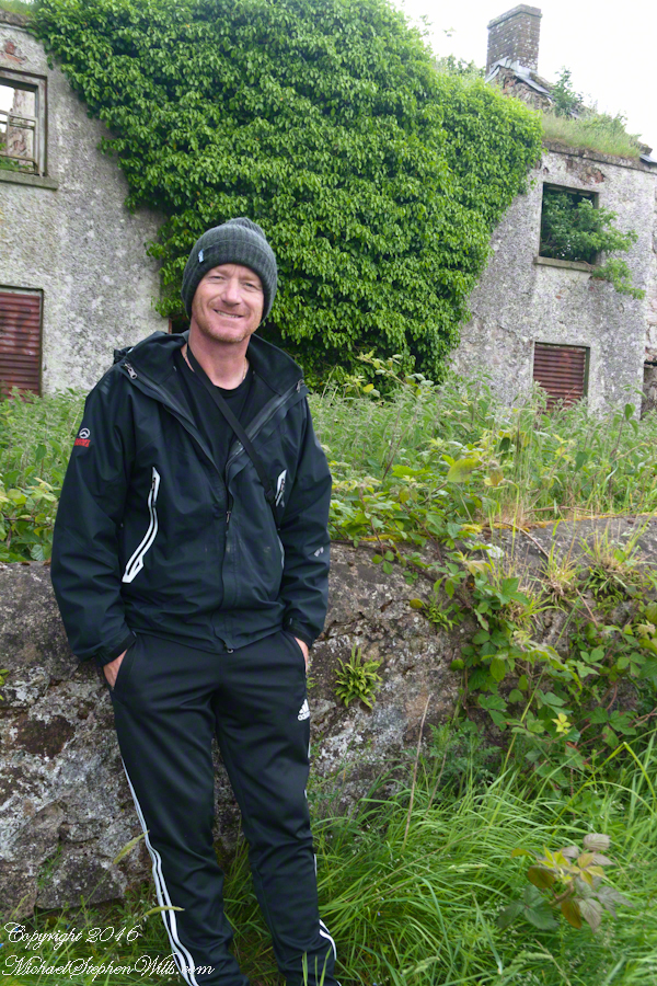
On Monday, June 9, 2014 John Mills, the first cousin of my mother, Catherine Wills nee McArdle, showed us the ruin of the schoolhouse used in the 1930 / 1940’s and which he attended as would Catherine if her parents hadn’t emigrated to Canada in the 1920’s.  Free public schooling was mandated in Ireland from 1831 and by the 1850s most Irish parishes had a schoolhouse, such as this in Ballymascanlon civil parish, as part of the National Schools.  When this piece was first published, Malachy Mills (a cousin), left a comment and clue…the name is Aghameen School.  The following information spooled out from that.

There is an Irish language site, Duchas.ie, with listings for Aghameen, a Louth township, the very one of the school and, very rightly, it is the name of the school.  There is even information from a teacher, Bean Ui Riada, who taught there 1937 – 1938, and posted information about local place names and legends.  Here is the link to his postings.  I learned from him that Aghameen is An tÁth Mín in Irish and means “field of the mountain meadow.”  You can see from the photographs the site is on the side of a mountain, pine forests all around.

Throughout her life my Mother had correspondence with her cousins who learned how to write in this very school.

The school existed at least since 1842. In private communication arising from this blog posting I learned a friend’s great, great grandfather, Denis Joseph Doherty, came from Donegal in that year to teach in the school and married a fellow teacher, Margaret Kane who was the girl’s school teacher. They raised a family while living at the school until moving to Jenkinstown. Margaret was from Jenkinstown, not far away and also on the Cooley Peninsula. They are Malachy Mills’ great, great, great grandparents through his mother.

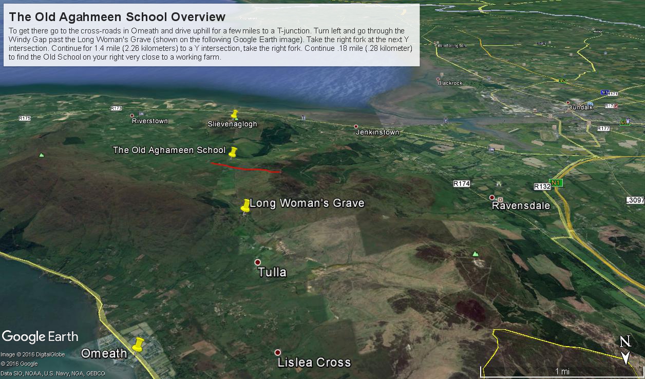
Aghameen School is located on the Cooley Peninsula, County Louth, shown in the following Google Earth Image

Schoolhouse Ruin Overview from Omeath– CLICK ME!!!!

This is the exact location:
Latitude 54° 2’17.83″N
Longitude 6°16’3.08″W

To get there go to the cross-roads in Omeath and drive uphill for a few miles to a T-junction. Turn left and go through the Windy Gap past the Long Woman’s Grave (shown on the following Google Earth image). Take the right fork at the next Y intersection. Continue for 1.4 mile (2.26 kilometers) to a Y intersection, take the right fork. Continue .18 mile (.28 kilometer) to find the ruin is on your right.

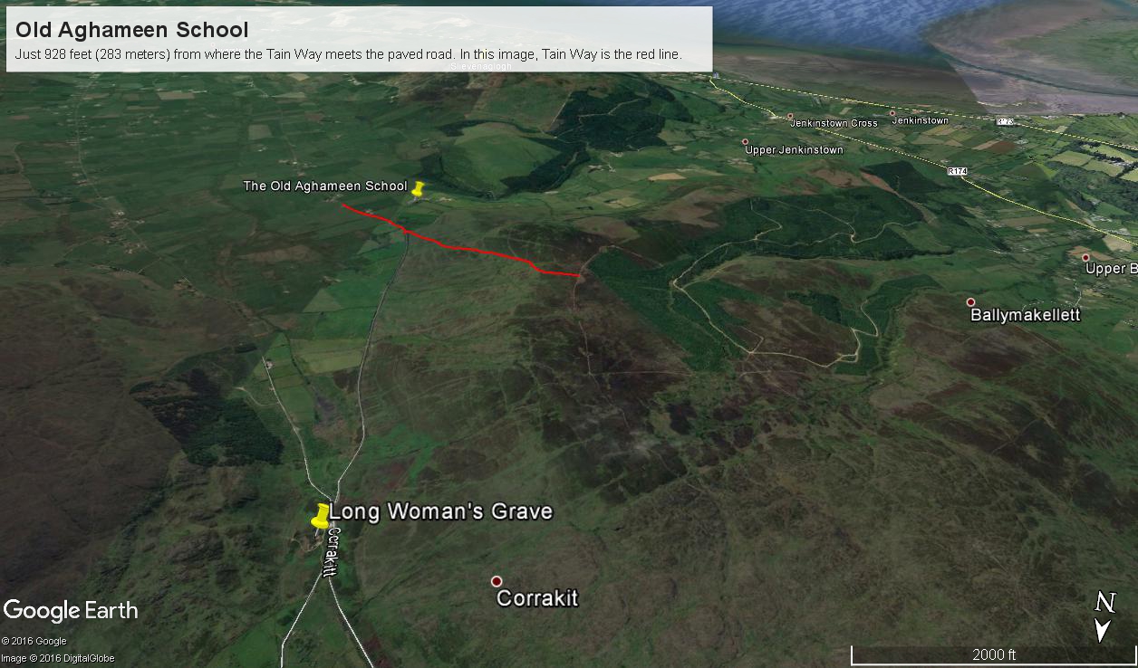
Aghameen Schoolhouse Location– CLICK ME!!!!

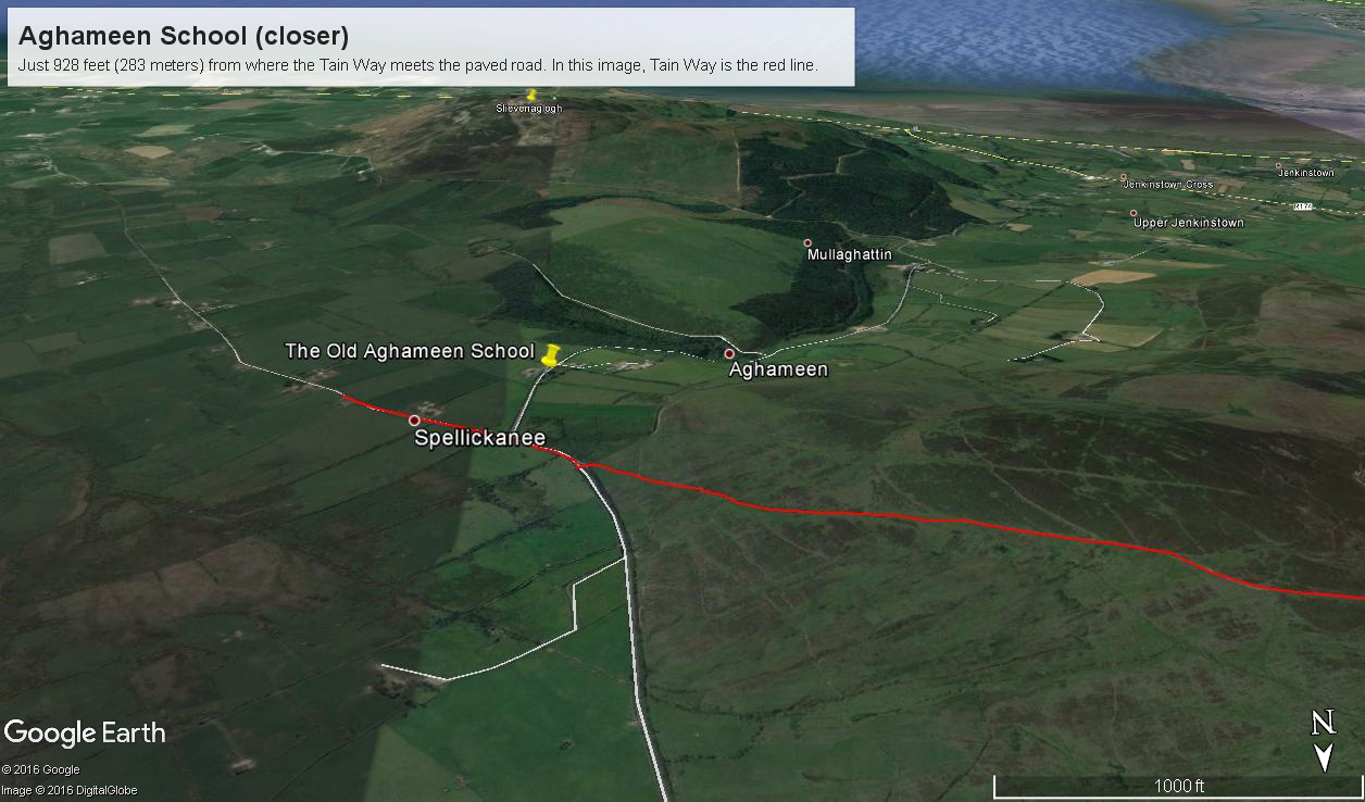
I marked the a portion of the Tain Way with a red line where it passes near the Old Schoolhouse.

Aghameen Schoolhouse Location closer– CLICK ME!!!!

This is the road as viewed from the ruin looking south…..

Schoolhouse Ruin stone fence– CLICK ME!!!!

….and the distant view of the uniquely shaped peak Slievenaglogh to the southeast. Slievenaglogh in Irish is Sliabh na gCloch and means mountain of rocks. There is an identically named peak in the Mourne Mountains, to the north across Carlingford Loch. Slievenaglogh of Cooley Peninsula is an interesting element of south view from this valley.

Schoolhouse Ruin stone fence– CLICK ME!!!!

The ruin itself. Schoolhouse Ruin stone fence– CLICK ME!!!!

…behind a stone fence and gate posts.

Schoolhouse Ruin stone fence– CLICK ME!!!!

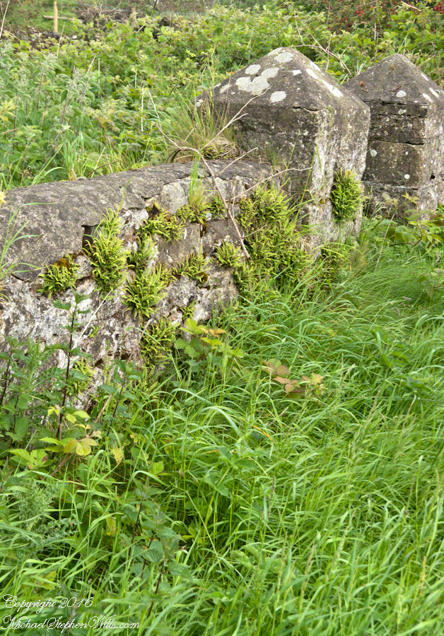
Overgrown with ferns, moss, grass…..

Schoolhouse Ruin stone fence– CLICK ME!!!!

…the ever present lichen.

Schoolhouse Ruin stone fence– CLICK ME!!!!

John’s son, Sean Mills, was with us.  That day, Sean lead us on Tain Way over the Golyin Pass over Slieve Foy with Carlingford as the destination.  Indeed, the Tain Way passes a few feet from this spot, being a loop of the Cooley peninsula. The Way is a two day walk, our starting point was a few miles from the schoolhouse.

Click for the previous posting in this series, “Happy Saint Patrick’s Day 2017”.

Click for the next posting in this series, “Annie Moore and her brothers”.Click for the next posting in this series, “Annie Moore and her brothers”.

Schoolhouse Ruin stone fence– CLICK ME!!!!

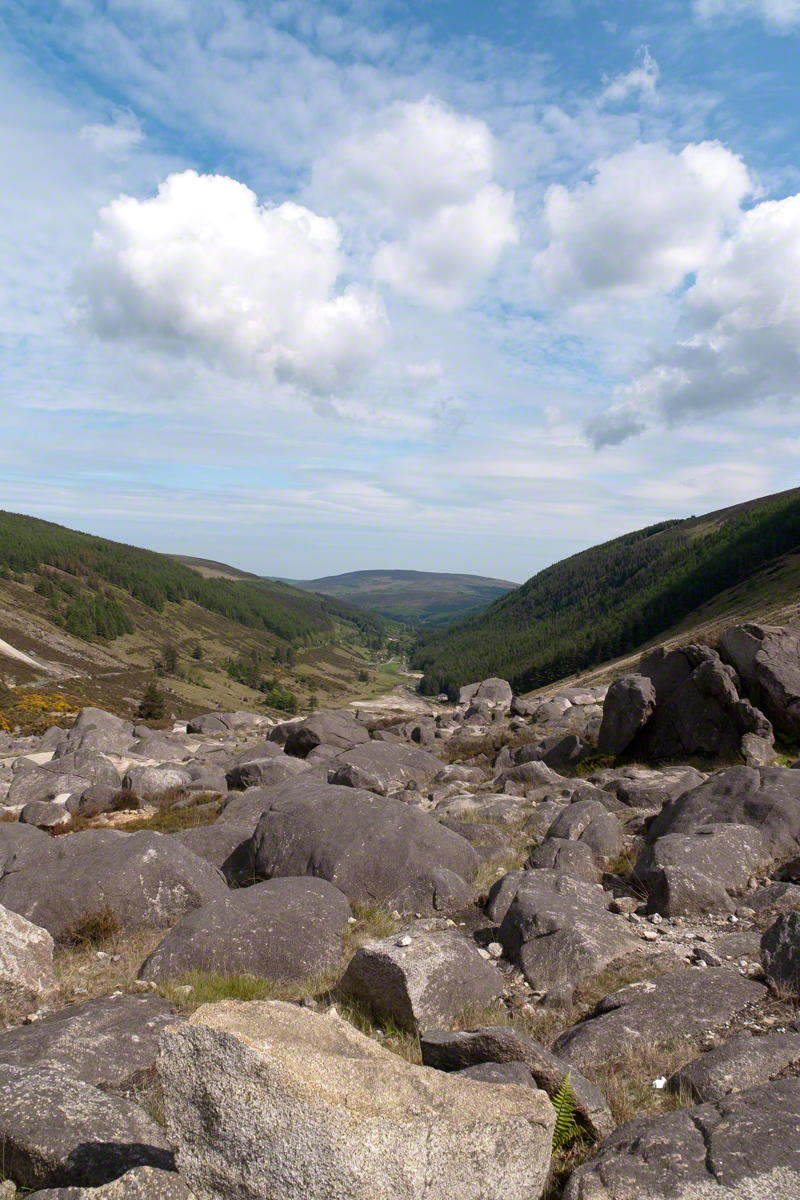
Glendalough View near Turlough Hill

An exceptional vista on a May afternoon

Head west from the Monastic City at the foot of the valley, climb pass the waterfalls to reach this east facing viewpoint.

I am standing near the path pilgrims from the west of Ireland travelled to the Glendalough holy sites.

Also, at my feet are “sun stones” a white quartz used by the builders of the Newgrange monument of the Boyne River Valley.

Click the link for my online gallery of Irish theme.
Click link for another Ireland Story “On the Tain Way.”

Copyright 2021 Michael Stephen Wills

Ice Bells

Noticing small miracles, taking the time and effort to capture them…..

These icicles were formed along Fall Creek during the coldest months of February in the Finger Lakes Region of New York State.

The transient nature of these forms is suggested by the thinness of the pedicle joining each bell to the ice lobe of the ledge. Note the golden crystals in the ice lobe.

A visualization of the symbolic power of the numeral three, reflected on itself.  Question: what do “threes” mean to you?

Captured with the Sony DSLR-A700, DT 16-105mm F3.5-5.6 lens, hoya circular polarizing filter, mounted on the Manfrotto tripod with ball head.

Click the photograph for my online gallery Ice Bells listing.

Inisheer Welcomes the 2014 Gaeltacht Irish Football champions

Inisheer Welcomes Their Champions

After we passed the Killeany bouy on our ferry trip, on the Queen of Aran, (click the link to see this posting) from the harbor of Inis Mor to Doolin, the ship made four, yes four, dockings before arriving at Doolin: three on Inis Meáin and one on Inisheer.

A few days prior the Gaeltacht held the annual Irish football championship the weekend of May 21 through June 1 in Moycullen, County Galway. It was the Three Aran Islands (Oileaín Árann) team who won the 2014 championship. Sunday, June 1, the weekend of their victory, the cup was presented to Inis Mór, the largest Aran island and the one furthest into Galway Bay.

Click the link for my Getty IStock photography of the Aran Islands

The team on Monday, June 2, the day of our trip, was on Inis Meáin, in celebration mode.  Some of them were waiting for the ferry when we pulled into the dock of Inis Meáin, the second largest Aran island between the other two.

The first of the previous three photographs is of the waiting team members who boarded and we left for Inisheer Island, the smallest of the three and the closest to Galway City.  The Queen of Aran was well out of the harbor when I imagine the radio in the pilot house said, “Come back, there are more team members on the dock.”  So we turned around, docked and several more came on board.

In way once again, well away from the harbor, the ferry turned around for a second time for a third landing at the  Inis Meáin dock.  With the full compliment of champions on board the ferry turned out of the harbor a third and final time for the last leg of with Silver Cup’s tour of the islands.

The population of Inisheer is about 250 souls.  It seemed all were waiting to greet the team.

Click the link for my Getty IStock photography of the Aran Islands

A large bon fire blazed as the Queen of Aran approached.

People lined the dock from beginning to end.

Calling out, waving their arms.

Click the link for my Getty IStock photography of the Aran Islands

Standing and smiling.  Here is a flock of fans, from Galway apparently, very pleased at the sight.

The team was on the upper ferry deck.  I turned around and was lucky enough to capture the team captain (Not sure, but who else would it be?) holding the silver cup for all to admire.  Theirs for a year.

The crowd welcomed their own back home.

Click the link for my Getty IStock photography of the Aran Islands

Surrounded the team and walked them grandly to town.

Enter your email to receive notification of future postings. I will not sell or share your email address.