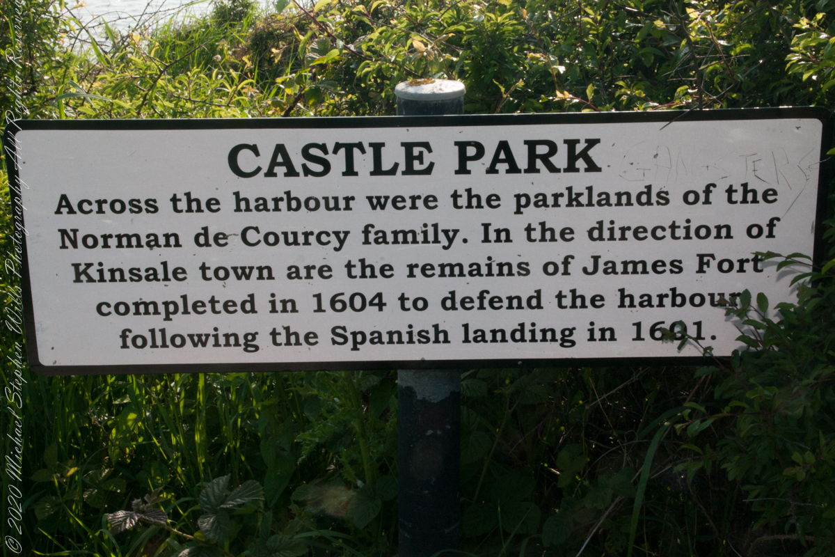
As Pam and I past the scenes of bucolic reverie this sign drew us back to the past. The reference to de Courcy is as a family of invading Normans. John de Courcy, without the King’s permission, launched an 1176 AD invasion of northeastern Ireland, what is now County Down, as an ultimately failed land grab. The history is murky, though apparently John de Courcy’s son Miles acquired the land referred to in the placard through the English King Henry II, awarded to Miles’ thieving, murderous Norman father-in-law Milo de Cogan in the 13th Century. Much later, the old (James) and new (Charles) Forts were constructed to defend Kinsale harbor.
Click any pic for a larger view, in a new tab, or a slide show. When using WordPress Reader, you need to open the post first.
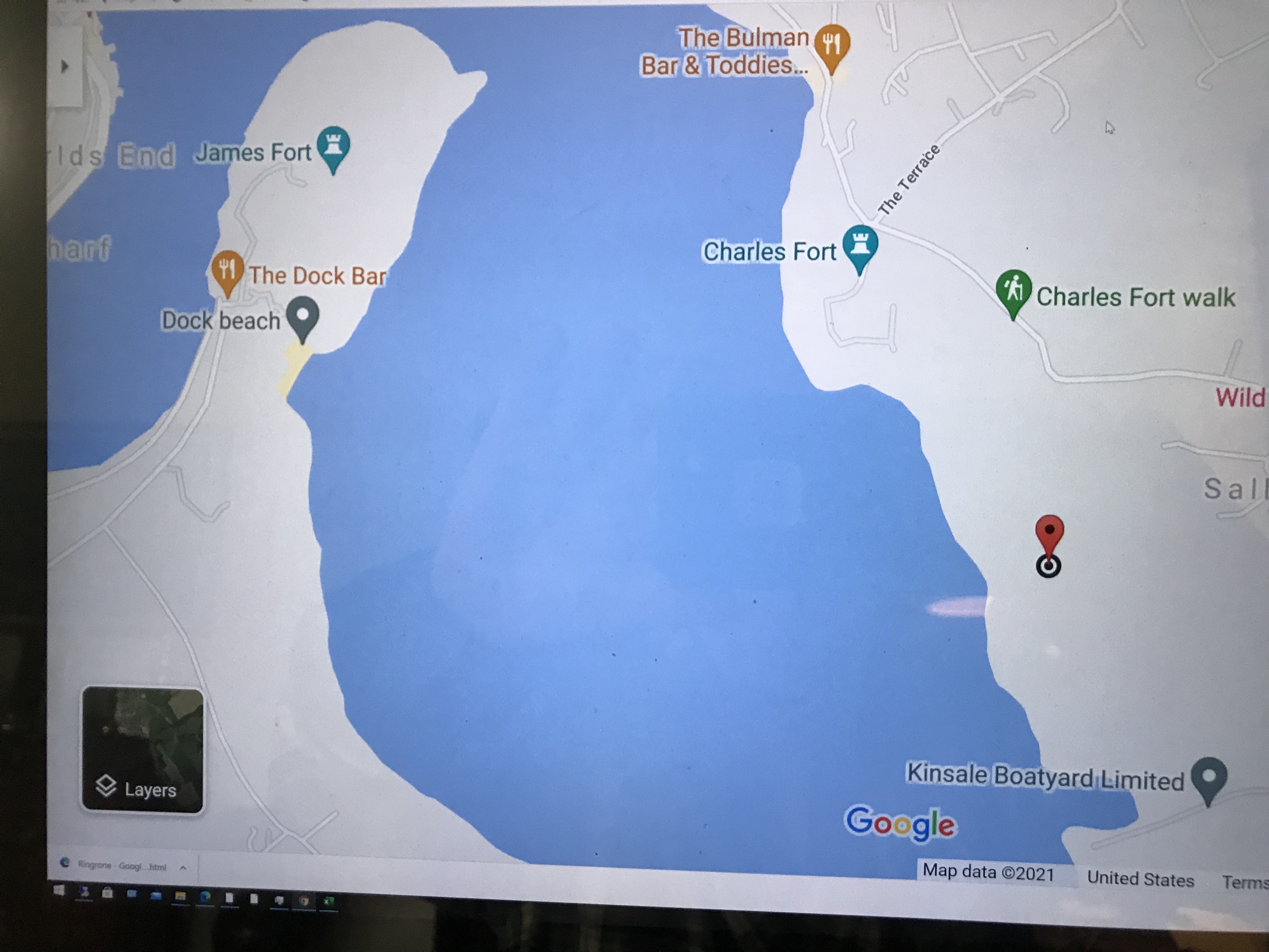
Here is a Google Maps screen capture showing the relationship of our position (the unnamed red drop-pin) on the right, Charles and James Forts and the de Courcy family parklands, the large blank area below the pin named “Dock beach.”
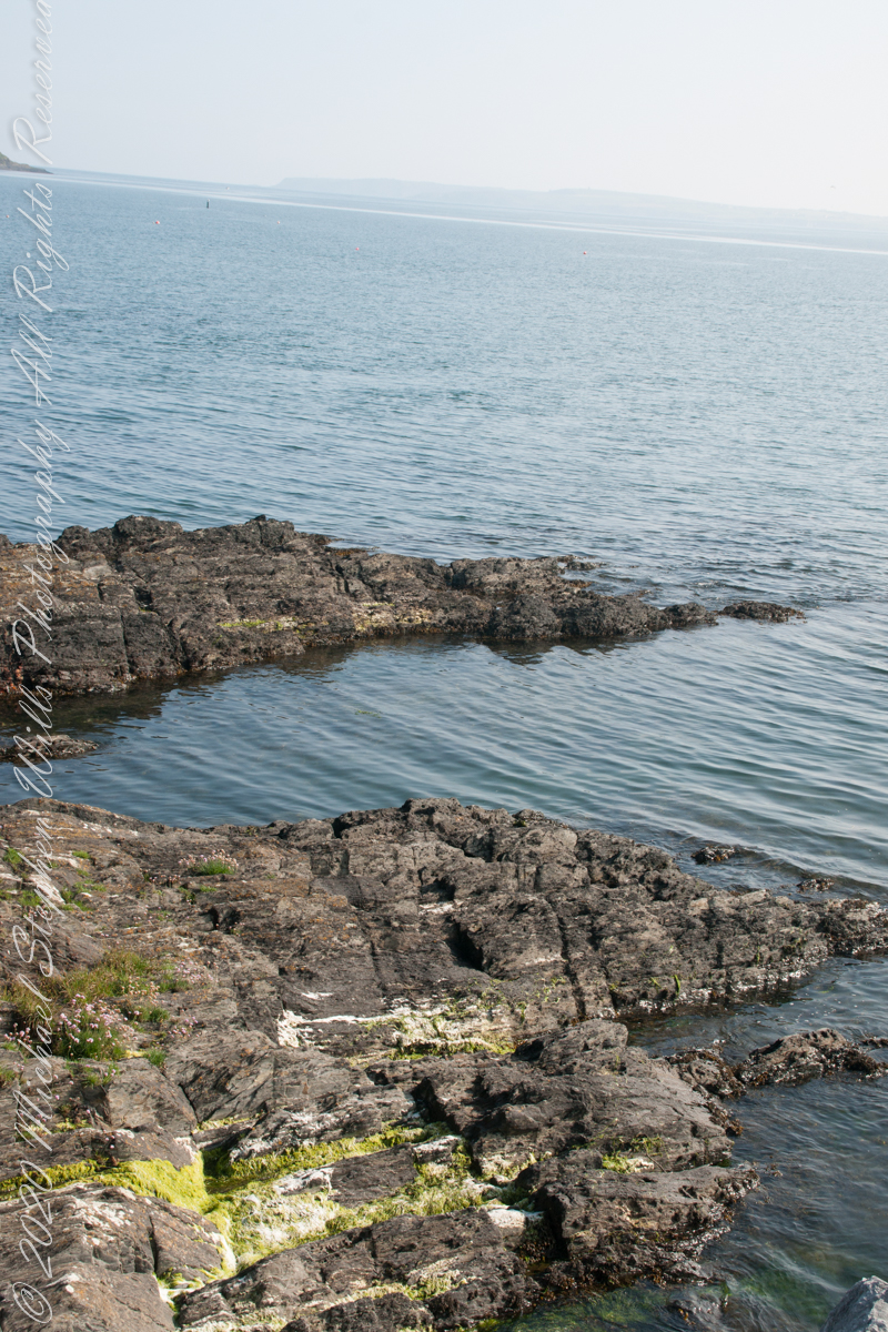
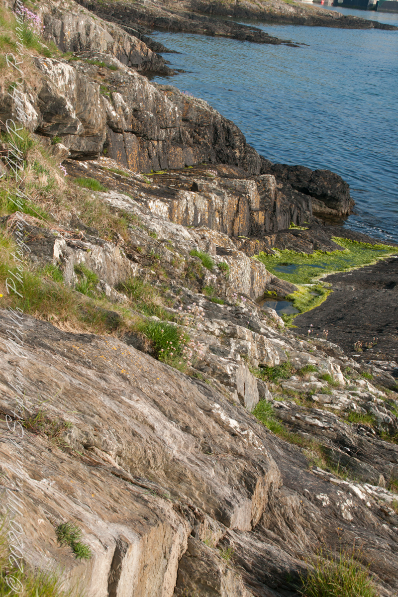
Here are the views looking toward the Celtic Sea, the Old Head of Kinsale and the cliffs at our feet.
Looking toward the Old Head of Kinsale in the far distance
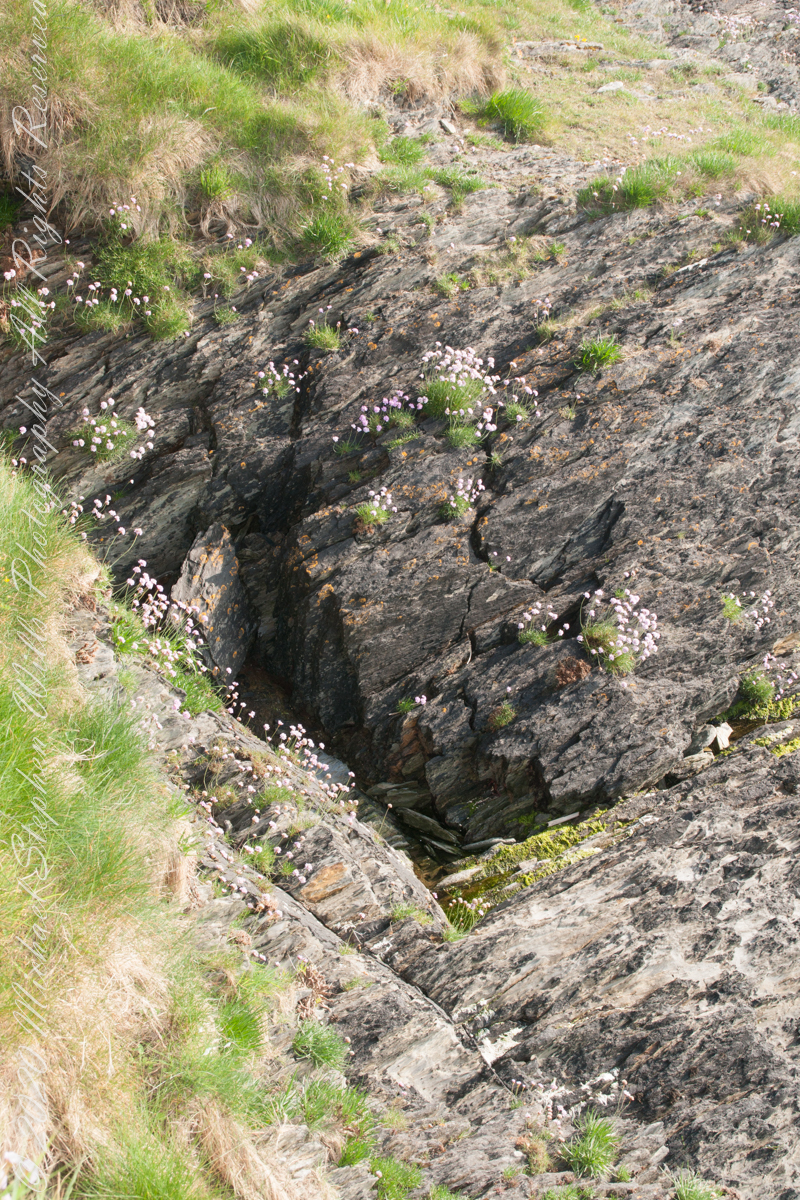
Rocky Cliffs at our feet
Cliff and Sea Pink
More Sea Pink decorating the rocks.
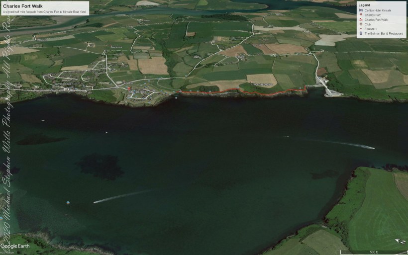
Here is a Google Earth view of our walk, the red line. The view is looking east from above the former “de Courcy family parkland.”
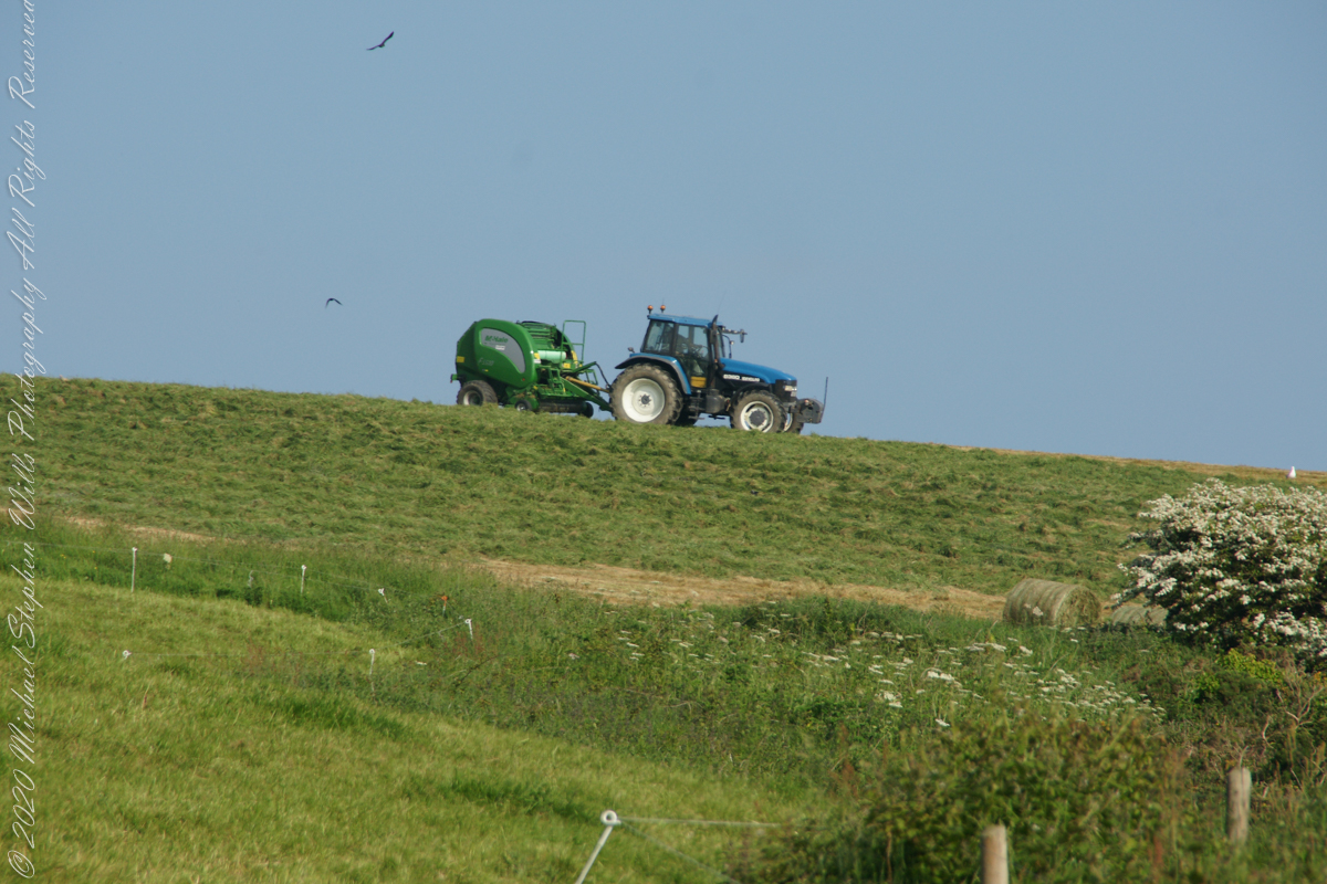
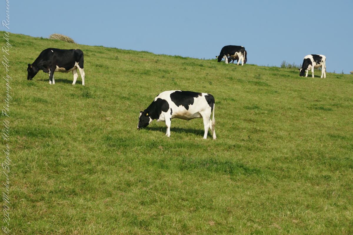
A half mile footpath, marked in red, leads from Charles fort along the shoreline cliffs, surmounted by working farmland.
Copyright 2021 Michael Stephen Wills All Rights Reserved
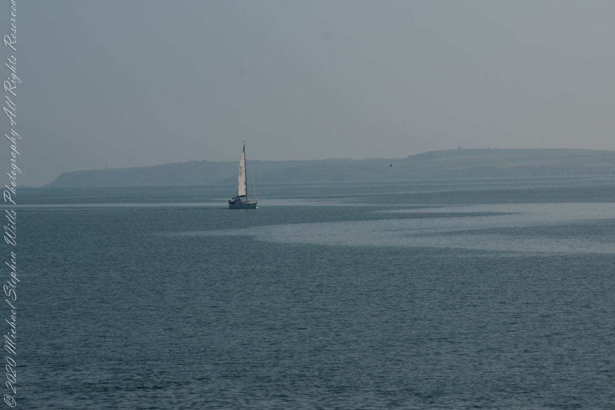
As Pam and I continued down the half mile “Sallyport” footpath, marked in red on the Google Earth view provided at the end of this post, we enjoyed the view across the Celtic Sea toward the distant Old Head of Kinsale and this sailboat headed to port.
Click any pic for a larger view, in a new tab, or a slide show. When using WordPress Reader, you need to open the post first.
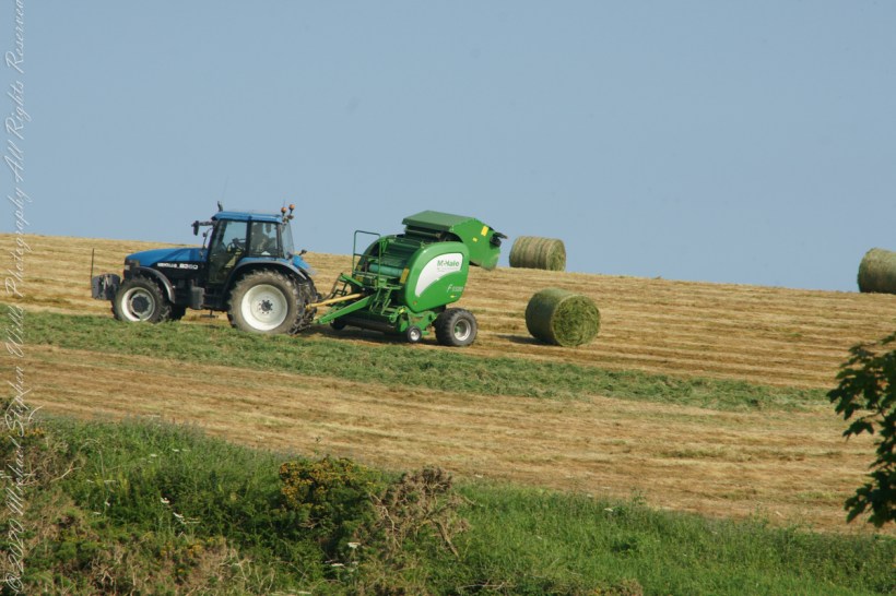
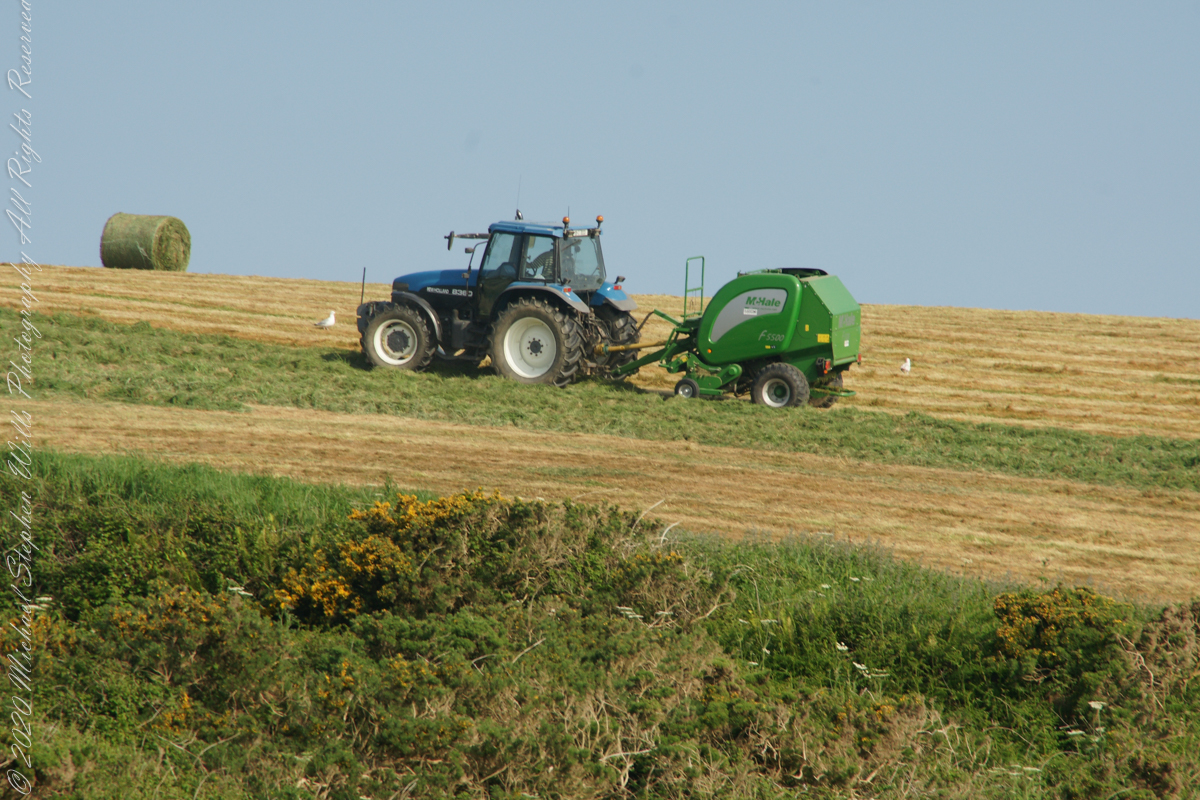
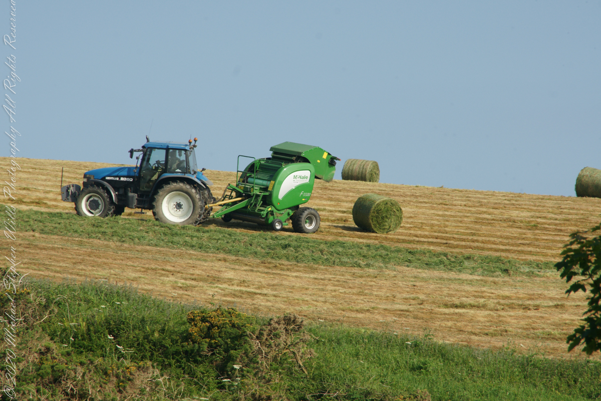
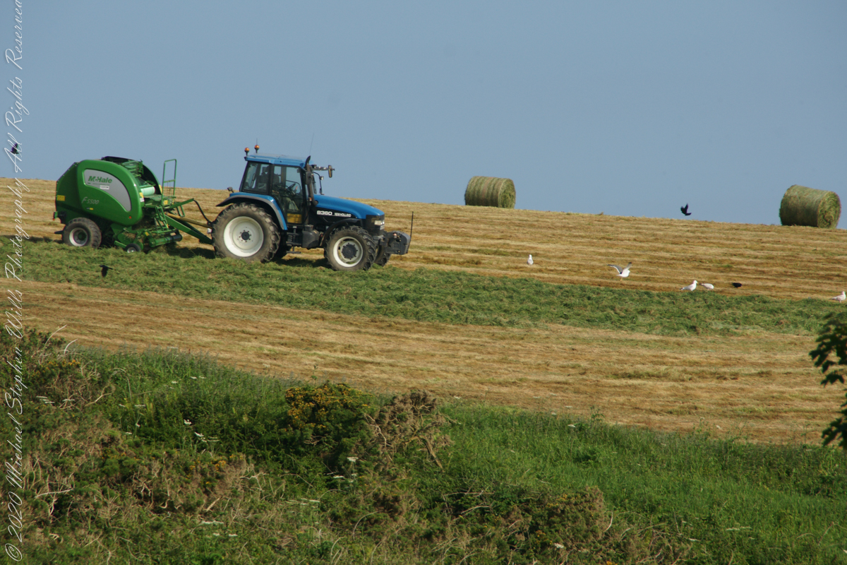
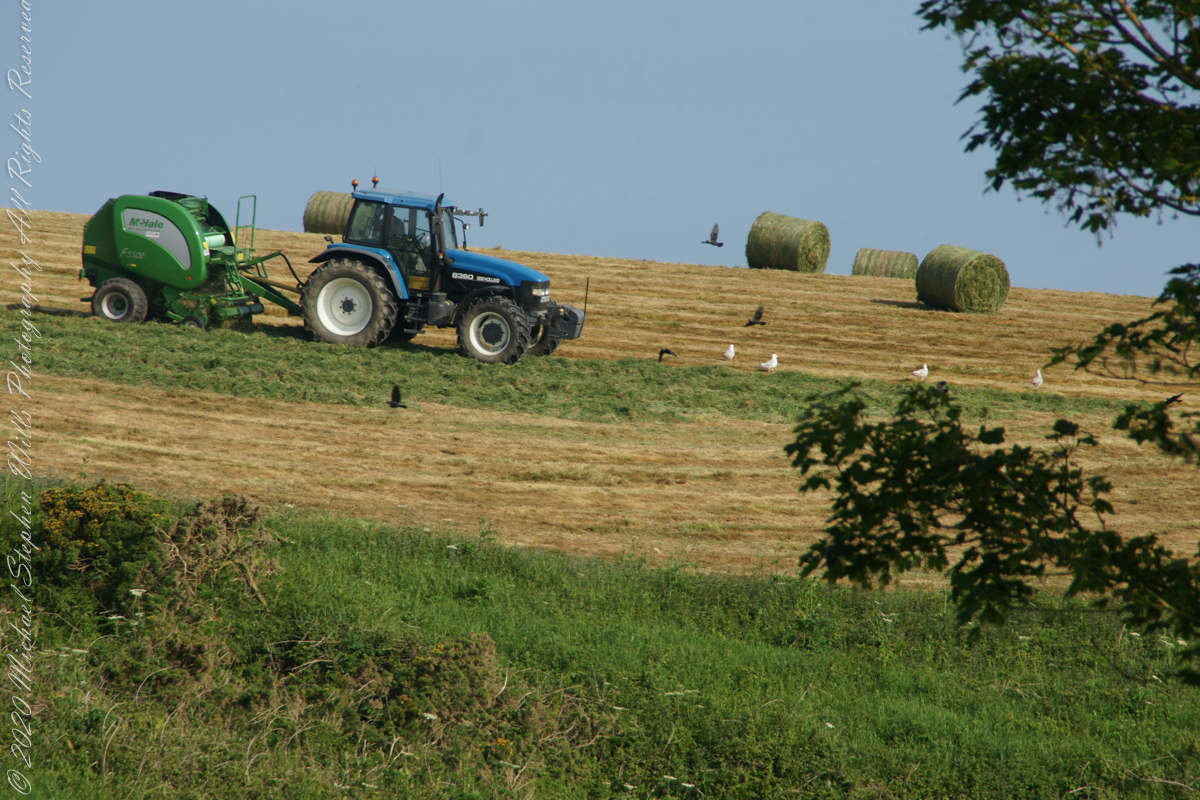
Landward, we enjoyed watching the progress of a farmer rolling hay bales while cows munched fresh green grass.
A half mile footpath, marked in red, leads from Charles fort along the shoreline cliffs, surmounted by working farmland.
Copyright 2021 Michael Stephen Wills All Rights Reserved
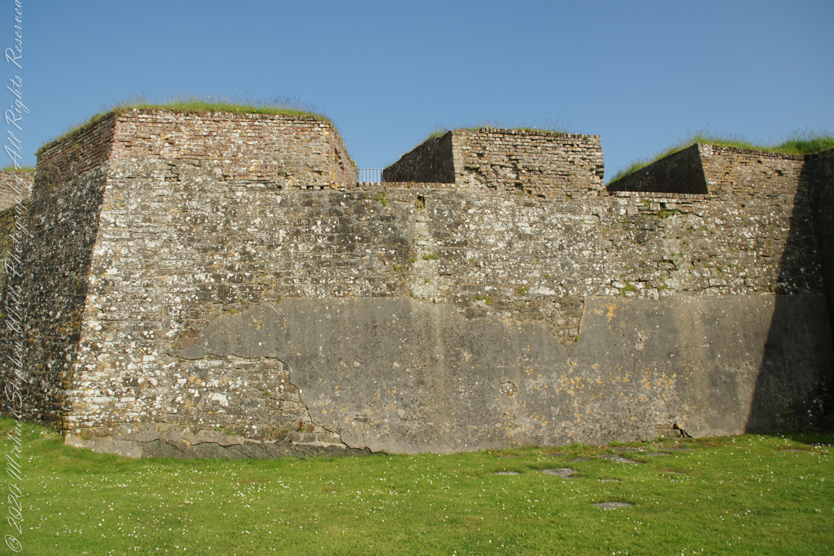
A “dun” is a larger fortification, few and far between on the island of Ireland. We saw one on the Arran Islands, from the Iron Age, Dun Angus, Charles Fort, or Dún Chathail in Irish, is from historical ages.
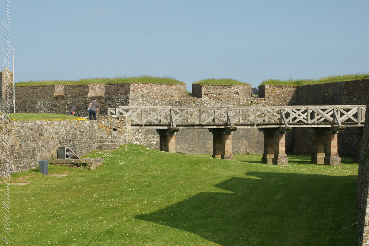
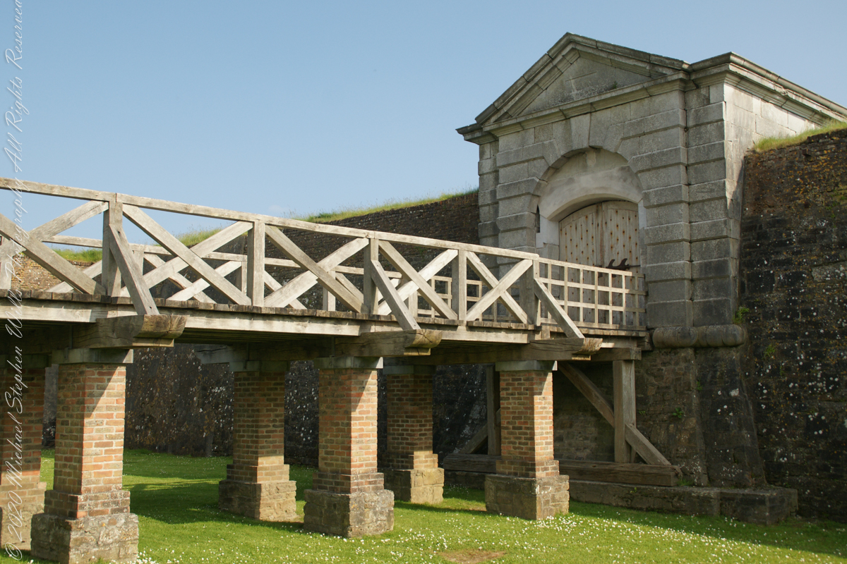
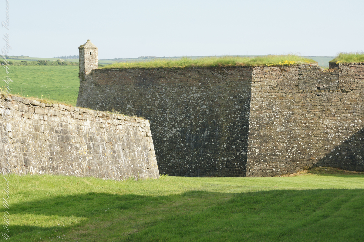
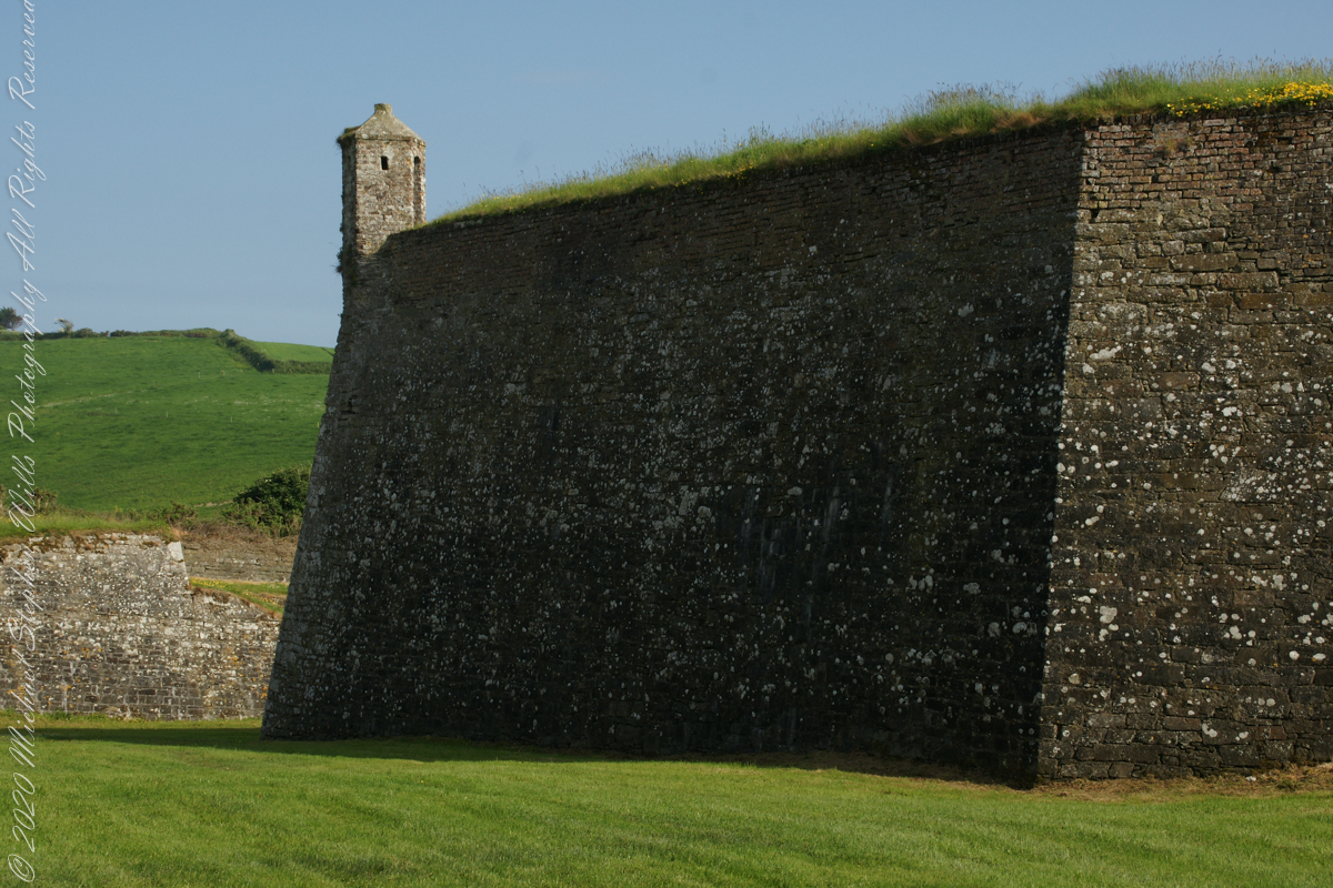
A cannot tell from my slide show, but the walls are star shaped with many salients, giving more positions to defend the walls.
Steps to bridge across defensive ditch
Bridge and gate to fort enclosure, closed this late in day
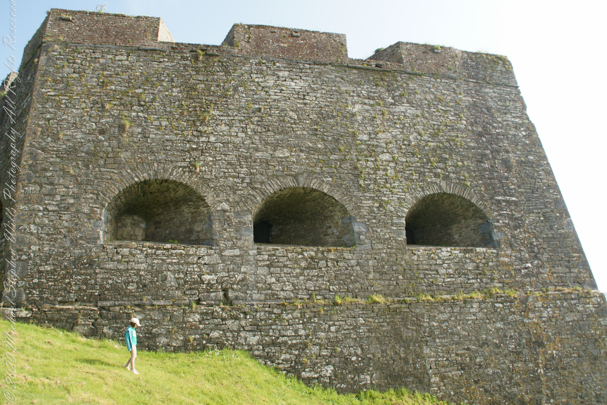
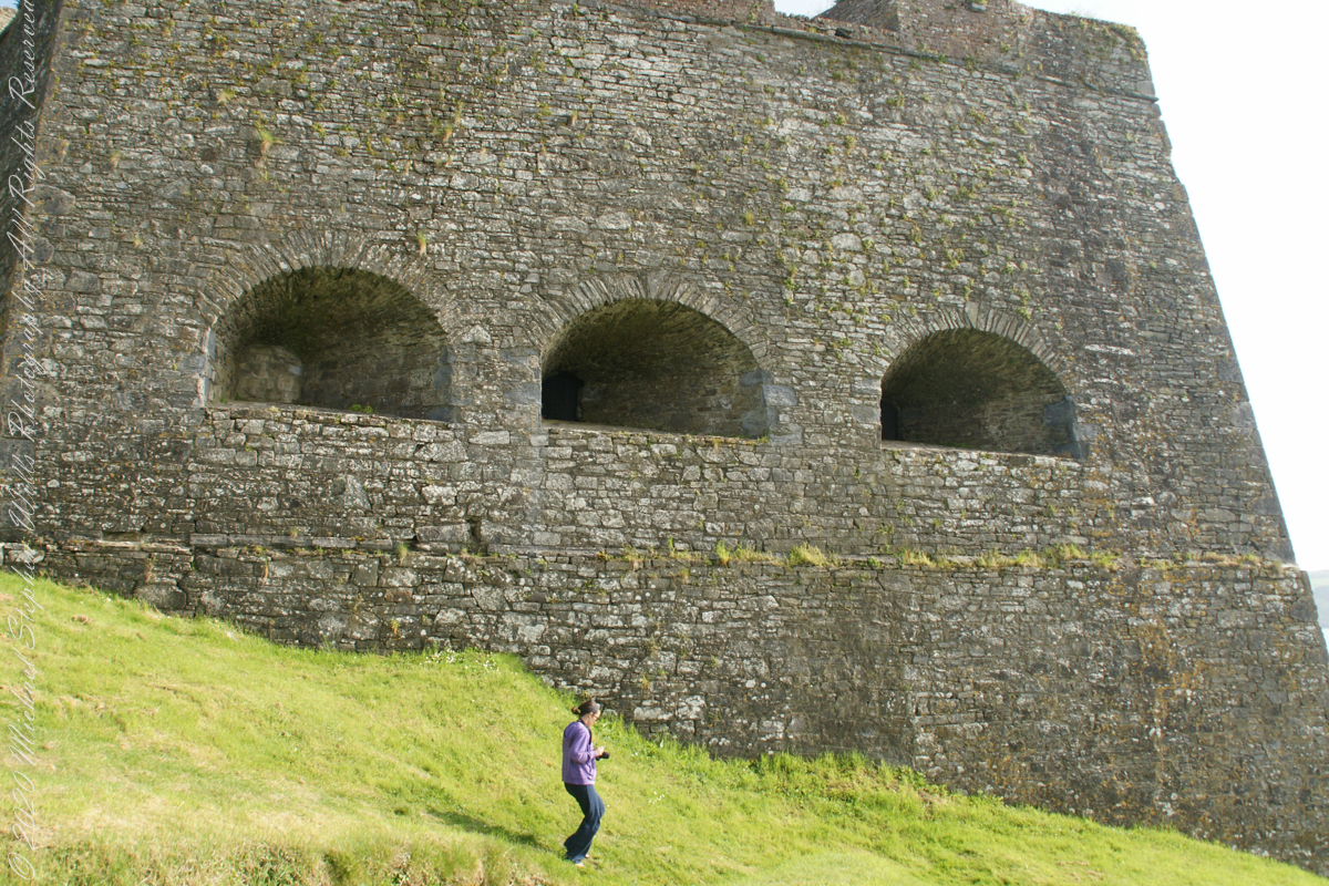
Embrasures
An opening in the fort walls which cannons can be fired. They were often flared outward to enlarge the field of fire.
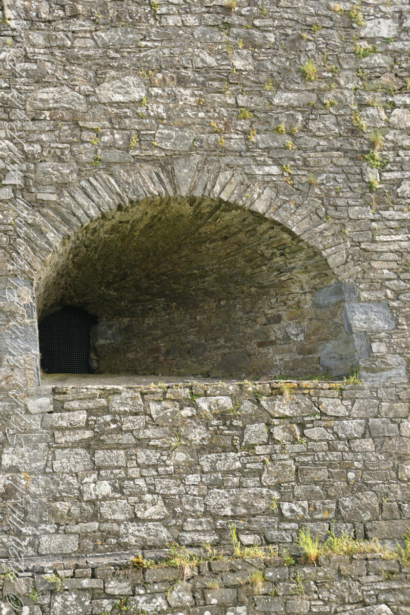
Close-up of gun port
Crenellations
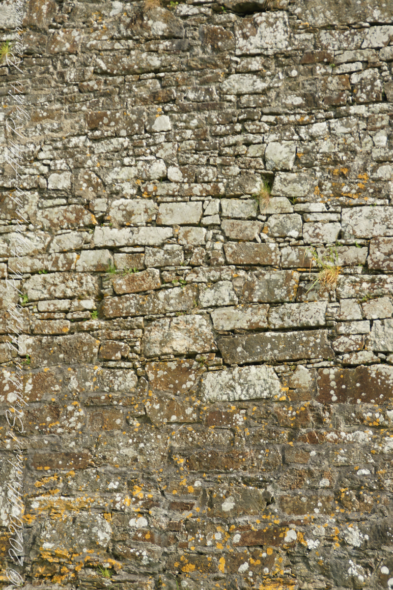
Tightly joined masonry
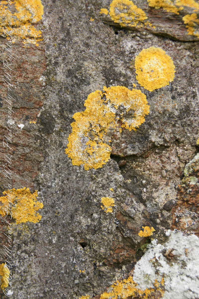
lichen
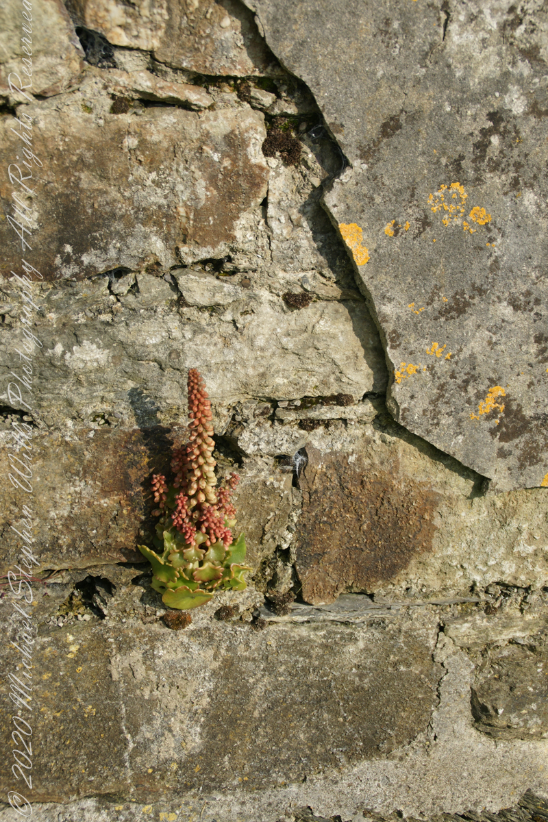
life has its way
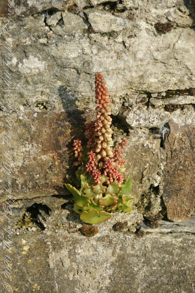
seems to be a succulent
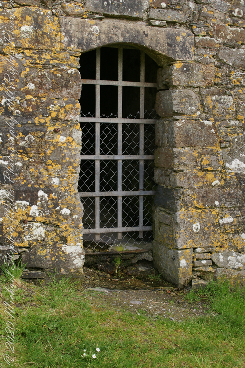
a doorway here seems a bad idea, but what do I know?
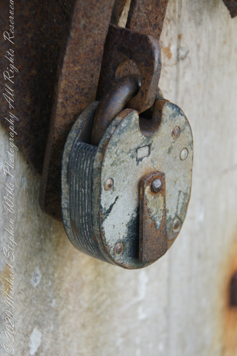
A pulley at first glance, look again and it is a lock
beneath the walls
Down to the Sallyport and the next post
References
“Charles Fort” – wikipedia
Copyright 2021 All Rights Reserved Michael Stephen Wills
To close our time on the Tain Way I offer a poem written and presented to the congregation of the First Unitarian church of Ithaca New York 25 years ago, 1992. Interspersed are final photographs from our walk on the Tain Way of 2014.
The poem content is not directly biographical / confessional although it draws upon my experience as a single parent in the 1980’s through 1990’s.
A Poem Read To The Congregation
I
a crisis threatened an Irish village men women children filled the meeting place everyone participated especially the infants
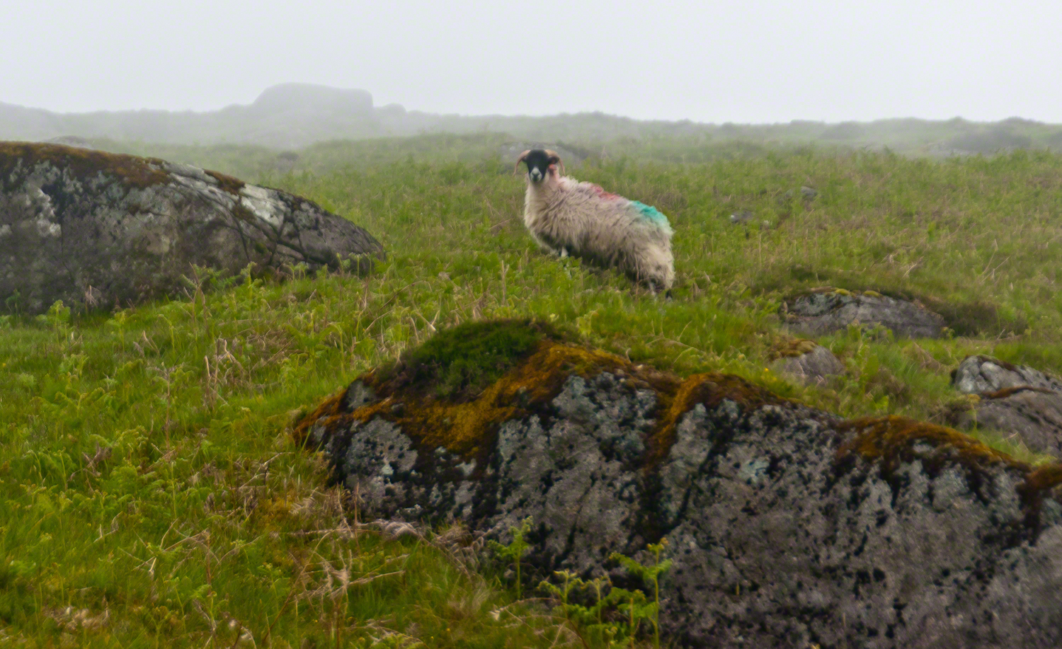
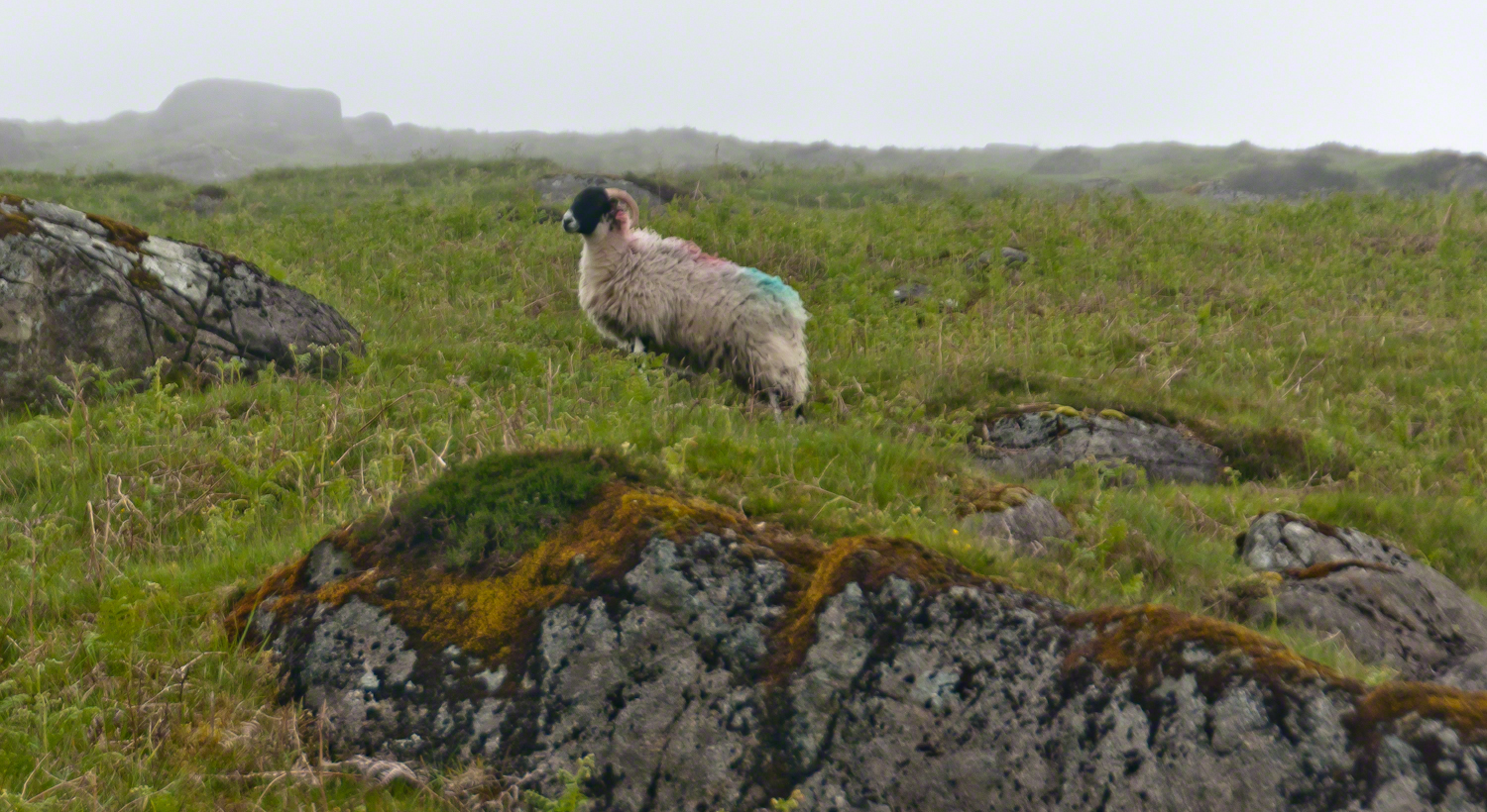
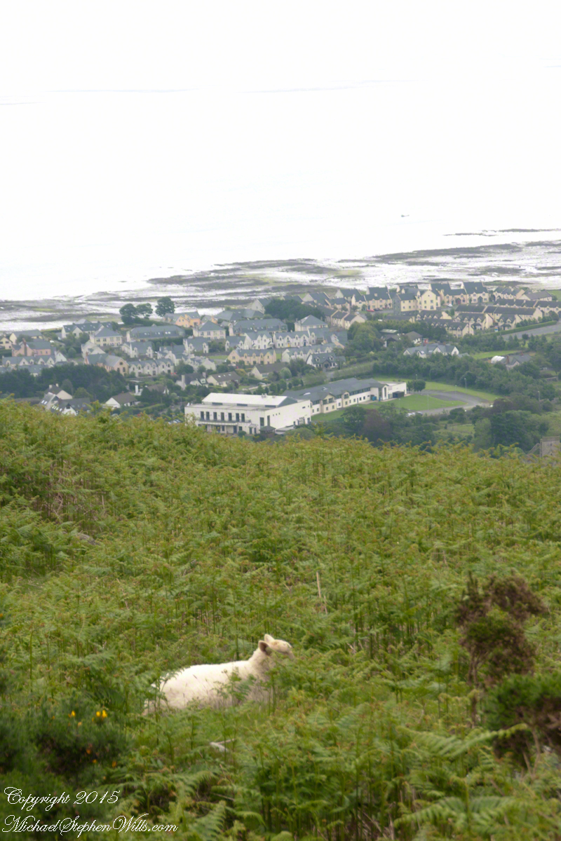
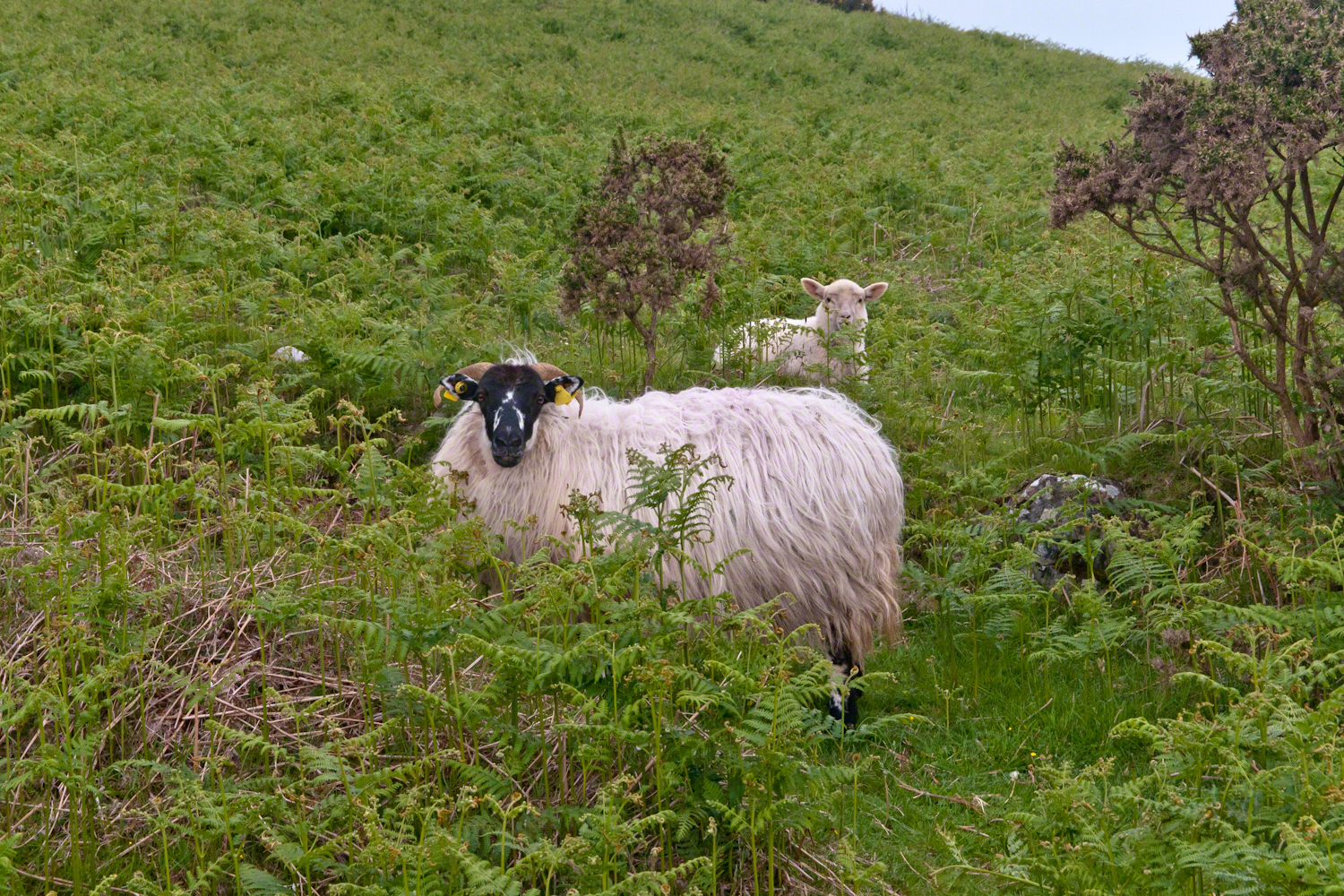
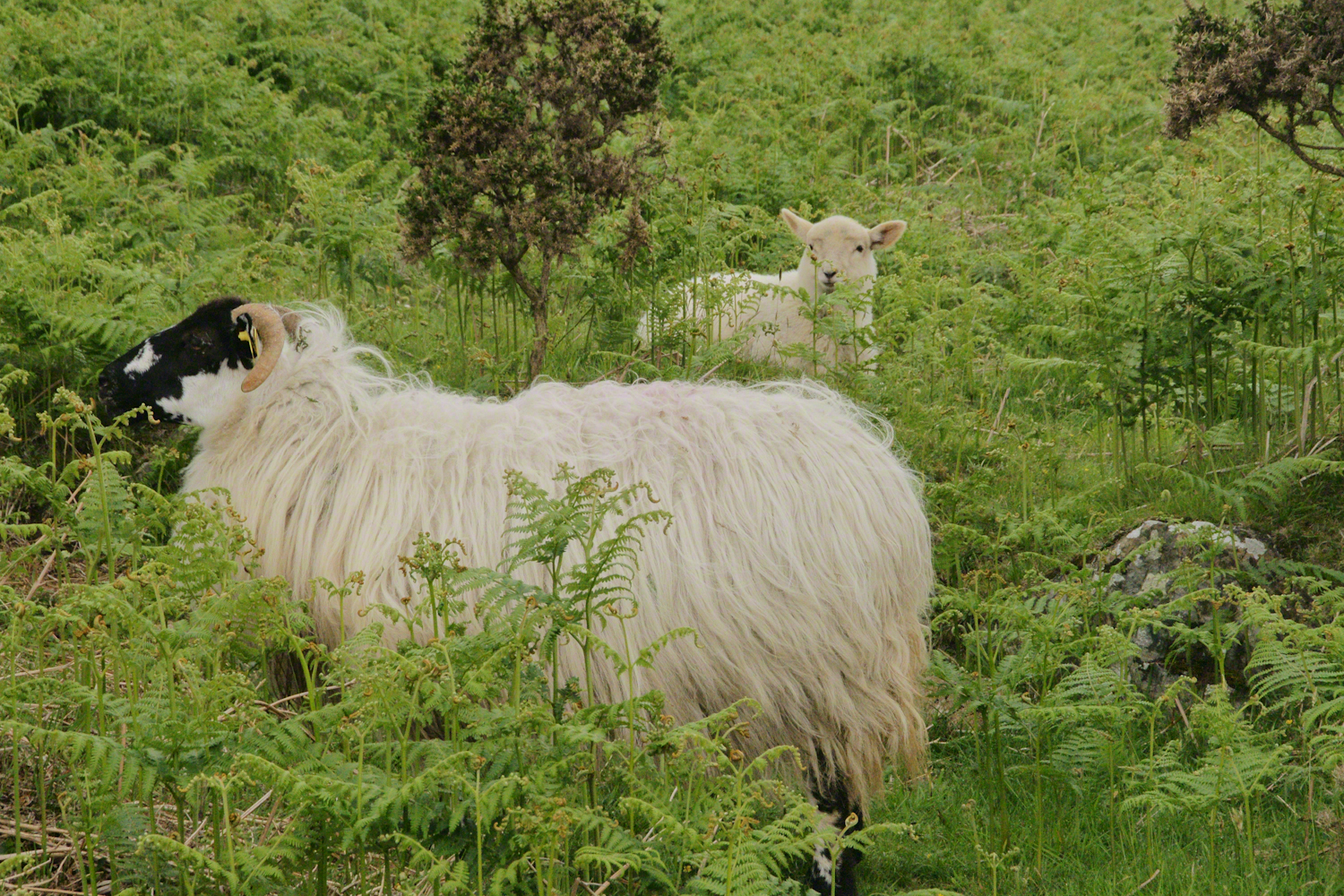
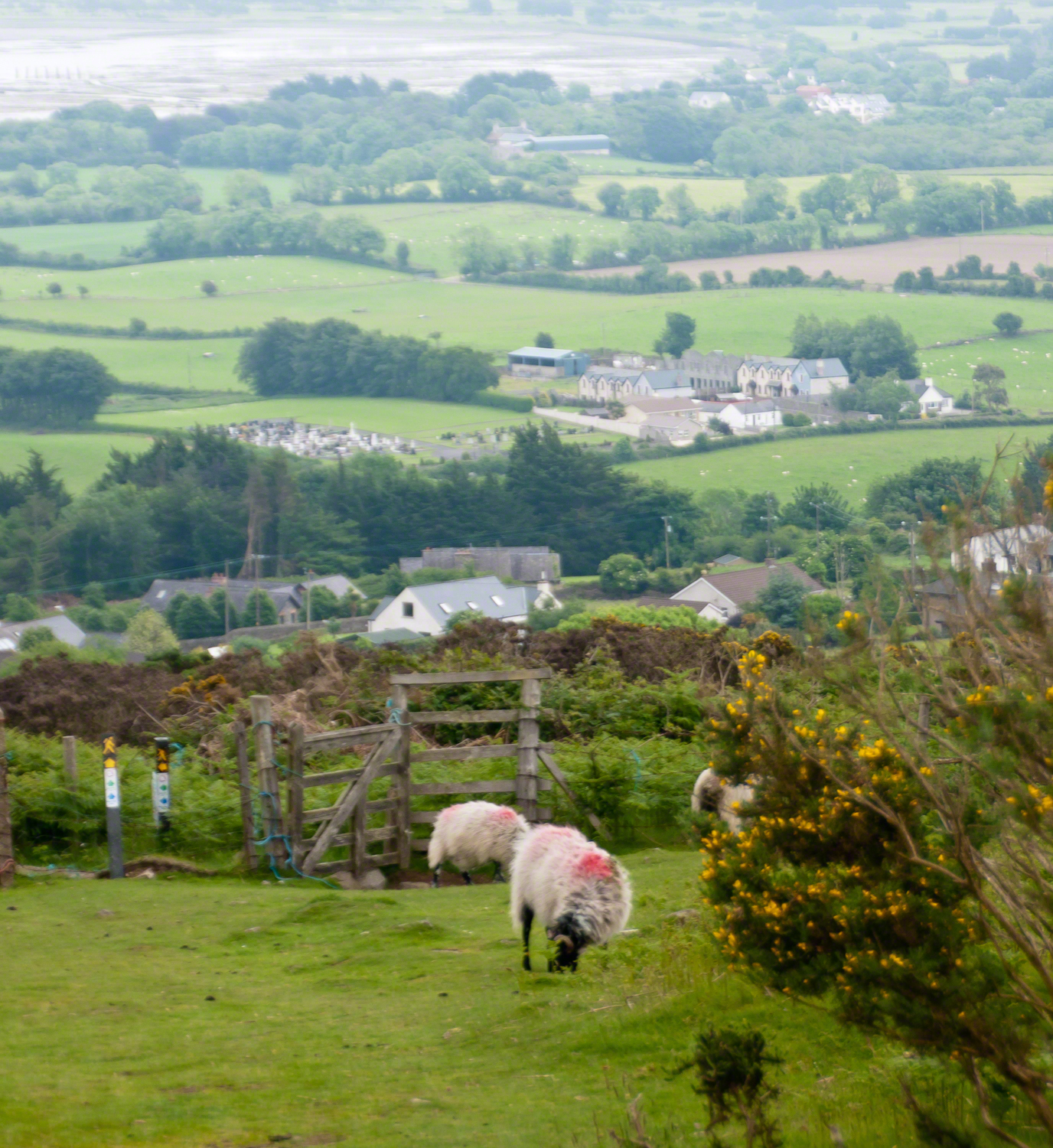
The Tail Way descends from Goliyn Pass to the northeast, passing among commons grazing. I attempted to identify the breed of this ram, but gave up. I can say sheep on the Cooley Peninsula are primarily bred for meat and there are black faced breeds known for meat production.
The flocks of County Louth commonly carry paint brands to identify ownership. Paint branding lessens wool value. This is less of an issue if the livestock are primarily raised for meat.
in spite of it all a plan was arrived at after the vote from the back of the room a man called out
….you know the type…
THIS WILL BE OUR PLAN UNTIL WE FIND OUT WHAT IT IS.
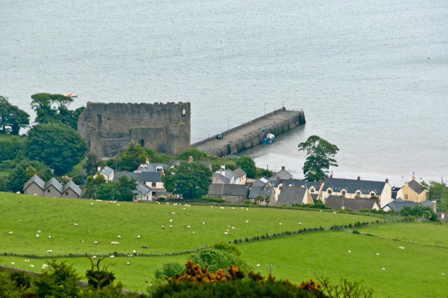
The ancient portion of Carlingford. I called the top of the castle “battlements” in the loose sense, as the ruin now longer has a walkway.
II
my son John and I have a photo of him at 5 years washing dishes standing on a chair up to his elbows in rubber gloves the caption reads “Two Men On Their Own.”
i had agreed to accept a divorce from helen only if john was left with me
one night in particular stands out from that time i did not sleep for planning what john and I would do
Unbranded, perfect white marks this lamb among an extensive fern bed. Tain Way steepens on approaching Carlingford. Below is the residential Carlingford, the Greenore road running to the right. The large structure with two rows of dark windows is the Four Seasons Hotel where a substantial brunch is served Sundays.
III
seven years passed not a long time since then we’ve moved found another a better life
We descended below the ridge to pass into excellent pasturage. The growth of fern hides a lush grass pasture.
raising John alone was not part of the plan Its been just john and me helen gave birth to john to have a part of me in case of loss i felt the same way and she understood
a welcome feminine voice in our home “Little House on the Prairie” and “Little House in the Big Woods” twice.
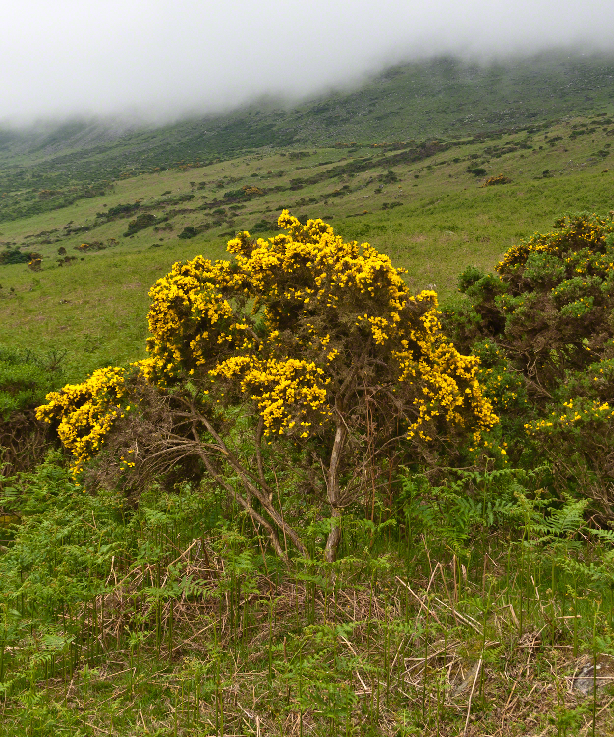
Plants and livestock on these slopes of Slieve Foy contend with adverse conditions in the form of a constant east wind. The stress is evident in the stressed trunk, although this species thrives in this environment, as seen in the strength of bloom and the yellow patches on the slopes, all of which are gorse. Gorse flowers are edible; the entire plant can be used as fodder when crushed to the consistency of moss. In Scotland there’s a museum with a roundish boulder called a Whin Stone.
V
Here is an excerpt from a newspaper article by Wilder called “HOME” that has an emotional resonance for me dated 1923 Wilder was in her 50’s.
Out in the meadow, I picked a wild sunflower, and as I looked into its golden heart, such a wave of homesickness came over me that I almost wept. I wanted Mother, with her gentle voice and quiet firmness; I longed to hear Father’s jolly songs and to see his twinkling blue eyes; I was lonesome for the sister with whom I used to play in the meadow picking daisies and wild sunflowers.
Across the years, the old home and its love called to me, and memories of sweet words of counsel came flooding back. I realize that’s all my life the teaching of these early days have influenced me, and the example set by Father and Mother has been something I have tried to follow, with failure here and there, with rebellion at times; but always coming back to it as the compass needle to the star.
So much depends upon the homemakers. I sometimes wonder if they are so busy now with other things that they are forgetting the importance of this special work. Especially did I wonder when reading recently that there was a great many child suicides in the United States during the last year. Not long ago we had never heard of such a thing in our own country, and I am sure there must be something wrong with the home of a child who commits suicide.
The trail detours around sheep pasture just before descending to the outskirts of Carlingford.
VI
we give so much to our children what’s left over though is ours
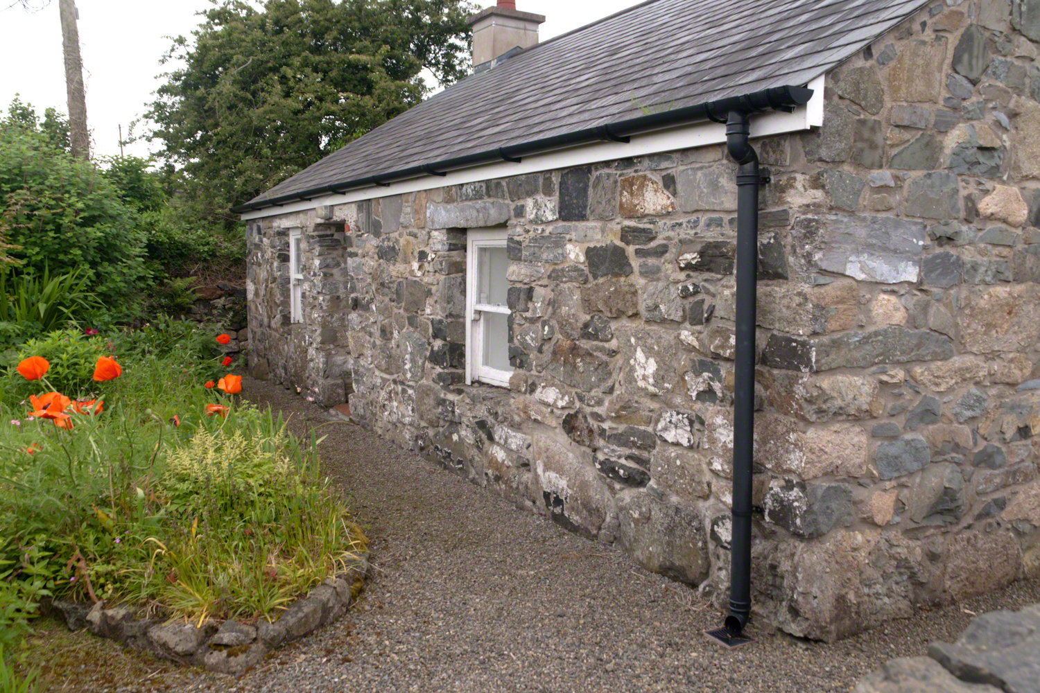
The first Carlingford home passed by the trail is a solid fieldstone home with a slate roof fronted by a natural garden featuring red poppies.
William Carlos Williams wrote it is difficult to get the news from poems yet men diet miserably every day for lack of what is found there
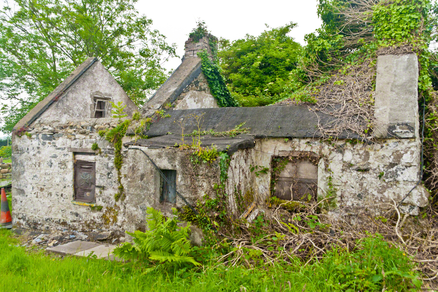
This ruin lies off the Tain Way as it descends through the outskirts of Carlingford town. Constructed of stones, mortar and what looks to be concrete. Long slate slabs protect the eves. It’s been abandoned for an age. What a story it must have, long slow and full of life.
it is not difficult to understand this to live it is another matter
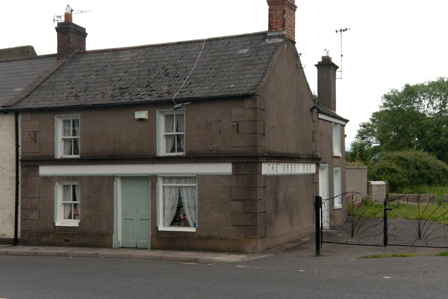
Named for the Carlingford Priory, a nearby ruin, the Abby Bar is located on Dundalk Street (R173), Liberties of Carlingford, Carlingford, Co. Louth, Ireland. Liberties of Carlingford might be called greater Carlingford in the USA.
you have to live it in order to have something left over
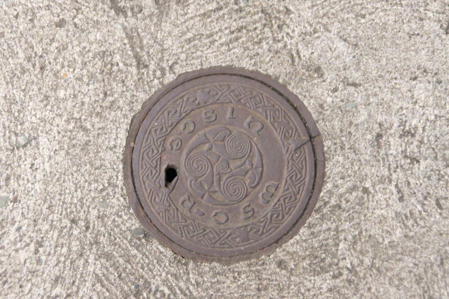
A metal cover, about 8 inches in diameter located in the sidewalk on the left side of The Abby Bar on Dundalk Street, Carlingford. The triple spiral triskelion symbol has become a Christian symbol of faith for Celtic Christians around the world, a visual representation of the Trinity (Father, Son, Holy Spirit) and eternity. In Ireland, the symbol acquired its Christian meaning prior to the 5th century. The triskelion predates Christina and even Celtic culture as petroglyphs of the astronomical calendar at the megalithic tomb Newgrange (3,200 BC). The symbol is associated with Neolithic cultures throughout Western Europe.
VII
never the less my emotional resonance in reading that piece “Home”
Caring touches to a well-tended home entrance along the Tain Way, Carlingford, County Louth, Ireland.
did not come from the sentiments Wilder so skillfully evoked though I shared them it was that sharp part
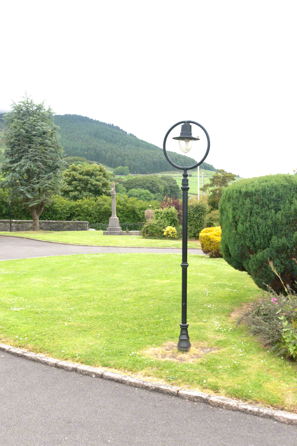
Lamp post on Church of Saint Michael grounds.
i did not agree with it lacking a reason and so must have re-read “Home” fifty times a hundred who knows
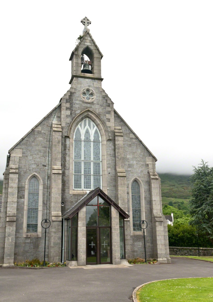
The Church of Saint Michael is a Roman Catholic Church on Dundalk Street (R173), Carlingford.
so committed to speak today and began to write something was bound to shake loose
then those lines form Deuteronomy gave themselves to me
Before you this day is set good and evil, life and death. Choose life, that both you and your descendants might live.
“Home” was a twist of these lines
as long ago as 1923 Wilder was experiencing our present contemplating the unthinkable
Wilder held her own experience as a shield and denied such a tragedy could ever touch her
for me the result is a beautiful poisoned apple innocently offered by a treasured friend
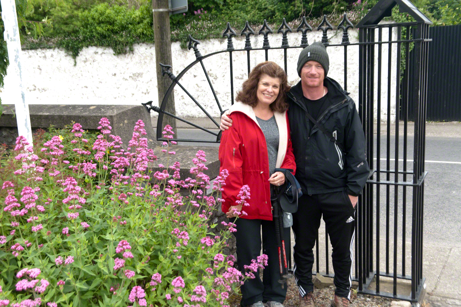
Pam Wills and Sean Mills on the grounds of the Church of Saint Michael, Dundalk Road (R176), Carlingford.
Imagine walking across the ranch house ruin towards where I described the former pond. Looking to the east and north from the elevation you see this sight.
In the near distance a grass pasture slopes into Reavis Creek. The creek has flowing water in all but the longest dry seasons. By the way, the trail from Pine Creek is on the slopes of that conical feature in the distance, to the left.
Click any photograph for a larger version.
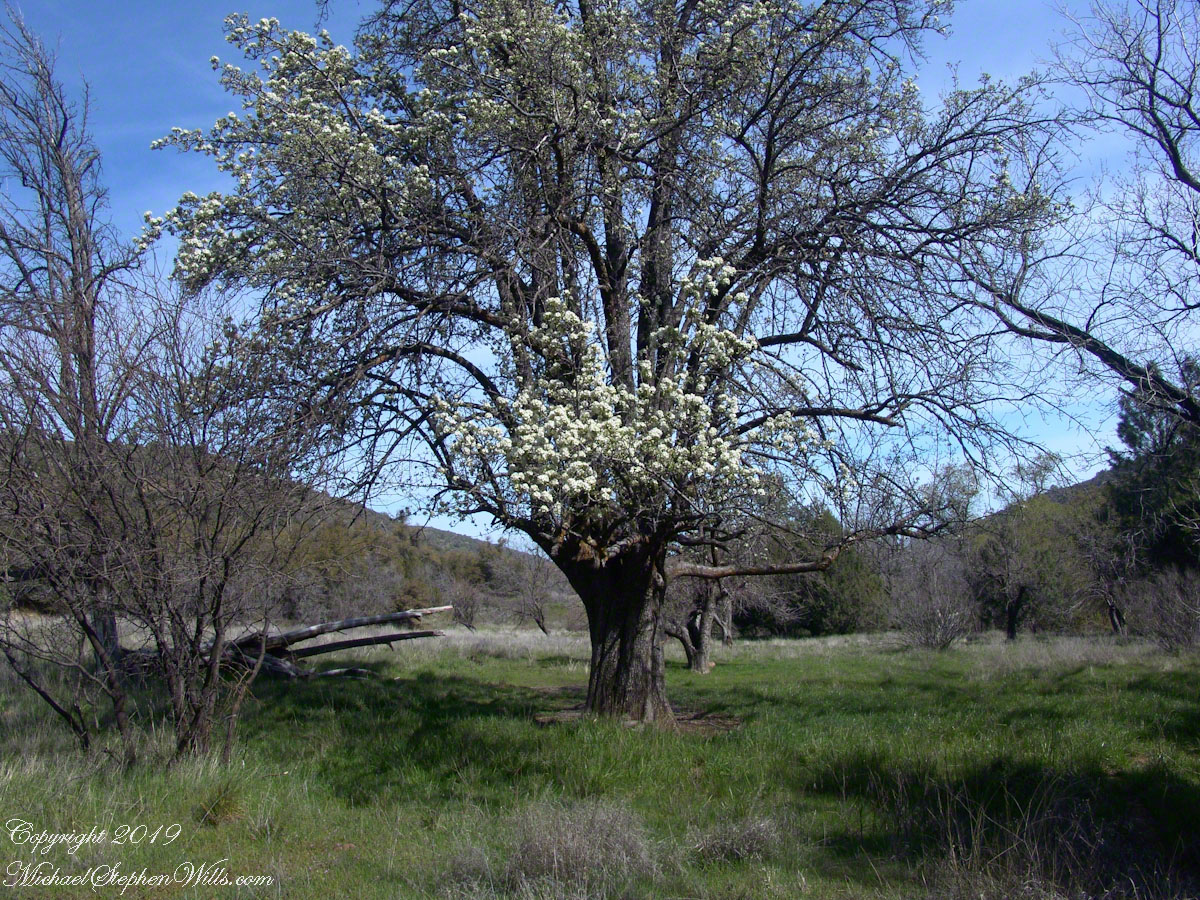
Looking from the former house site towards the Arizona Trail running beneath the distant red rock ridge. Not the fence rails on the left and apple trees in bloom.
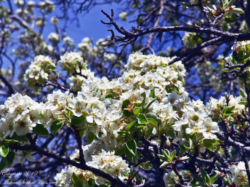
From the ruin, walk down the Arizona Trail, south, for a few hundred feet and turn left into the fields to encounter the same apple tree, and a close up of pure white apple blossoms.
Portrait of a Blooming Apple Tree
At Rest and History
This tree is an outlier of a thick stand of several hundred trees to the north. The Searcher and I rode into the middle of the grove for a rest and chat. The horses were allowed to graze in the abundant new grass brought on by the winter rains.
The Searcher told me the story of the valley and that it was a man named Clemans who planted 600+ apple trees, trees in bloom all around us. The Reavis Valley was long a site of agriculture, starting in the 19th century with Elisha Reavis, who passed away in 1896 and is buried on the slopes of White Mountain, and continued with a series of ranchers and entrepreneurs in the 20th: John Fraser, William Clemans, who planted the trees, and John A. “Hoolie” Bacon, then Bacon’s son-in-law Floyd Stone who sold the land to the U.S. Department of Agriculture in 1967.
We talked about some earthwork I noticed, in the southern part of the valley. It was part of a water system that diverted Reavis creek flow at the head of the valley to the ranch house. We decided that strange hexogonal structure on the elevation above the house ruin was the site of water storage. At that location the structure would provide a pressure feed for the house and much else.
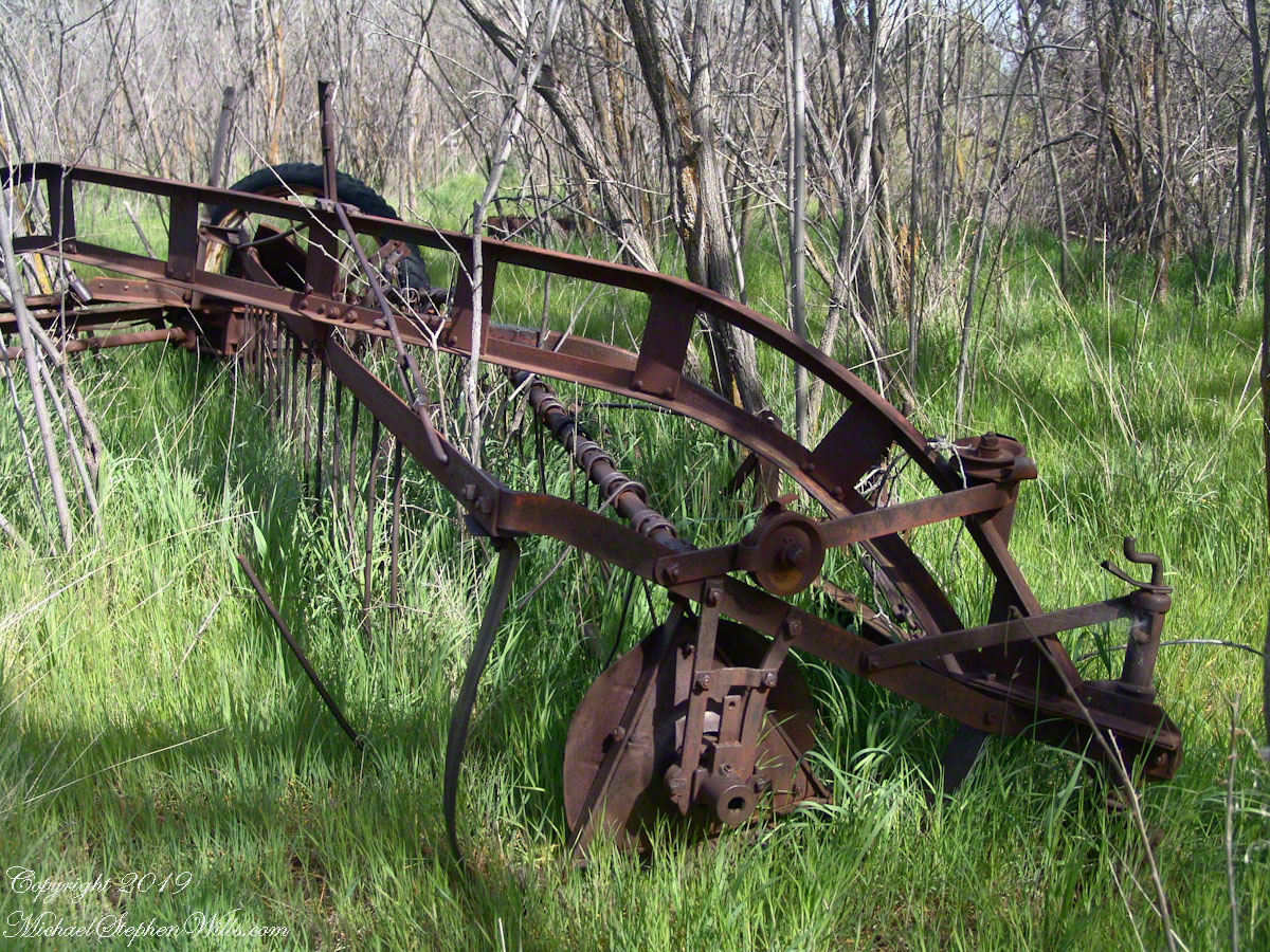
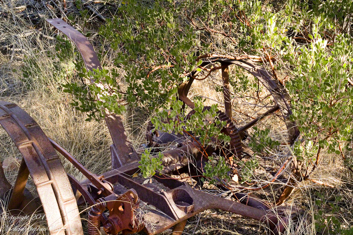
Abandoned Hay Rake
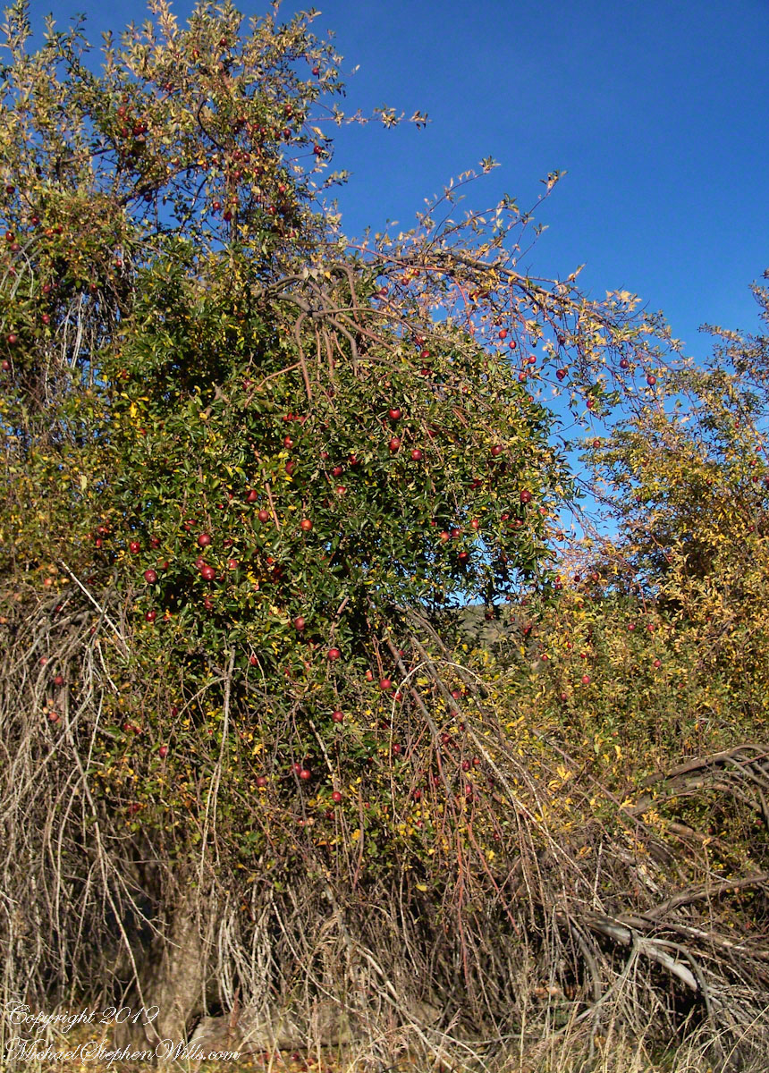
A mix of winter rains and fertile soil were exploited in the Reavis Valley for a handful of decades, the enterprise now is set aside. This abandoned hay rake and chassis, used to harvest grass in seasons past, is evidence of the work. The apple trees produce to this day without irrigation.
The Searcher touched upon the subject of the “Circlestone” ruin he mentioned on our morning ride. He had never been there, but mentioned some books on the subject. It is a wide circle of rough stone wall enclosing mysterious structures. At this point, I was hooked, and decided to check Circlestone on a later trip. Here are some photographs from one of those trips, in November 2006.
Reavis Ranch Apple Orchard Tree
Reavis Ranch Apples Yellow
Reavis Ranch Apples Red
In my next post The Searcher and I return to Pine Creek, Colorado gives me some trouble and we visit a stand of wild oats in the Reavis Gap.
Driving from the Petrified Forest National Park my son, Sean, and I arrived at Chinle, Arizona the evening of Monday, November 2, 2003. No time to rest or eat after checking into the Best Western he and I reached the White House overlook and trail head with the sun low in the sky, the sun sets 6:45 pm these last few days of Daylight Savings. The Navajo Reservation observes Daylight Savings, so the click jumps crossing the border from Arizona to Reservation.
I was 50 at the time and with Sean graduated from SUNY Maritime and fresh from a tour at sea we made good time to the canyon floor. I wanted to catch the White House in the setting sun.
One morning, 14 years later, I published a fine art photograph from that trip.
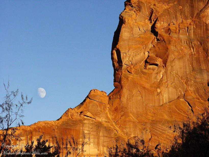
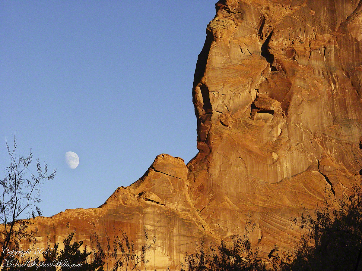
Looking along the canyon, over thick stands of Russian Olives, I caught the risen moon, in gibbous phase, against a mid-canyon freestanding fin of red sandstone of the southern canyon wall. Today, those trees are gone, removed as an invasive species.
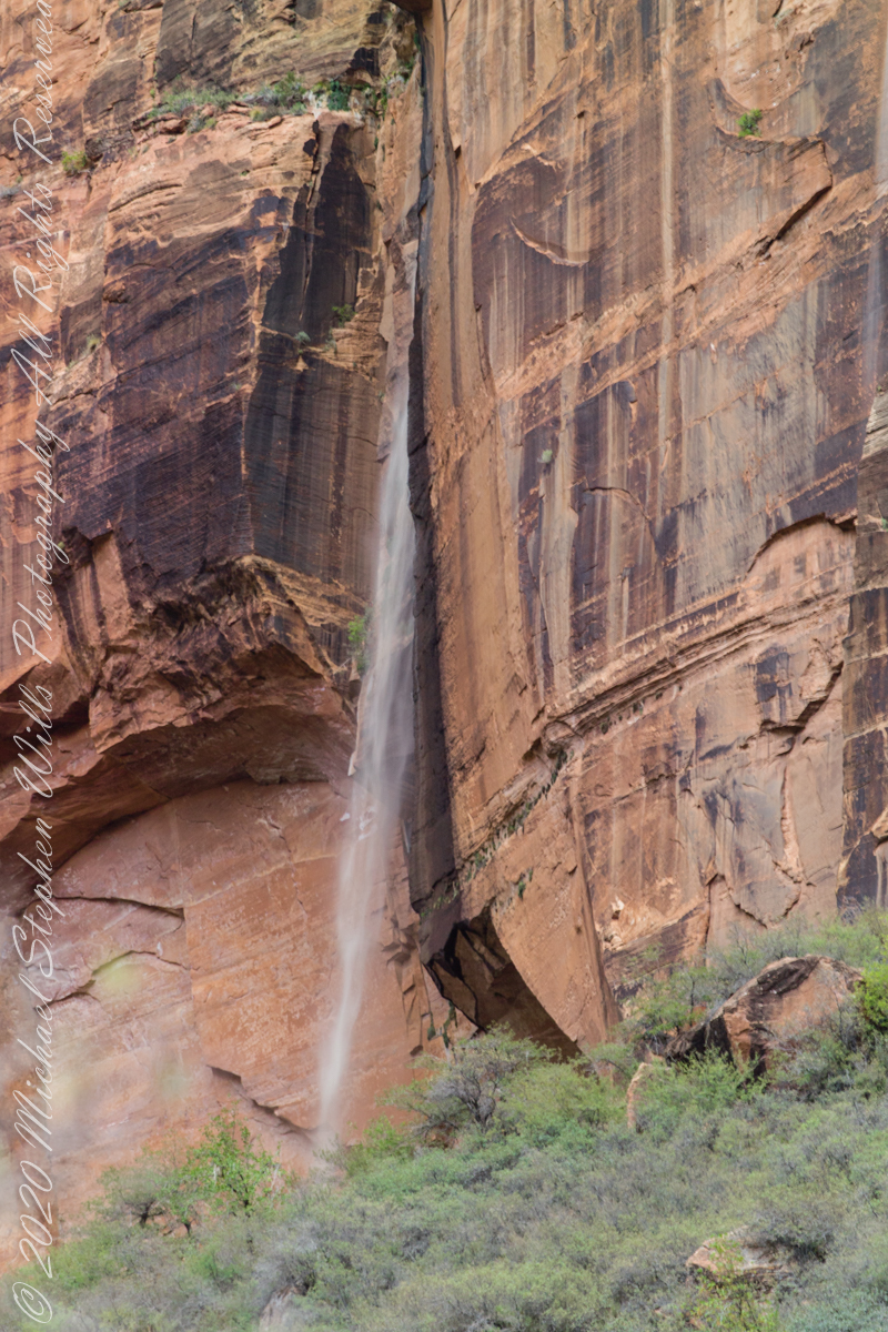
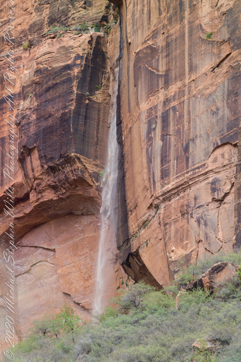
Rainwater from distant thunderstorms on the vast Colorado Plateau emerge from a cliff wall, Zion Canyon. The fall will last for a few hours, we bore lucky witness as do my images shared below.
1/15 sec at f/8.0 ISO 160
Captured with a Kodak DCS Pro SLE/c dslr and a Canon lens EF 200 mm 1:2.8 L II stabilized with the Manfrotto Studio Tripod model 475 and the 468 Hydrostatic ball head. I prefer the details of misting water at the widest lens aperture, focus is clear throughout the plane, excepting some foreground brush.
1/125 sec at f/2.8 ISO 160
Copyright 2021 Michael Stephen Wills All Rights Reserved
I am happy to share a breakthrough in my family research of our time in Western New Jersey, 225 years for my branch from the 1677 landing of the Kent on Rancocas Creek until my grandfather left for Asbury Park.
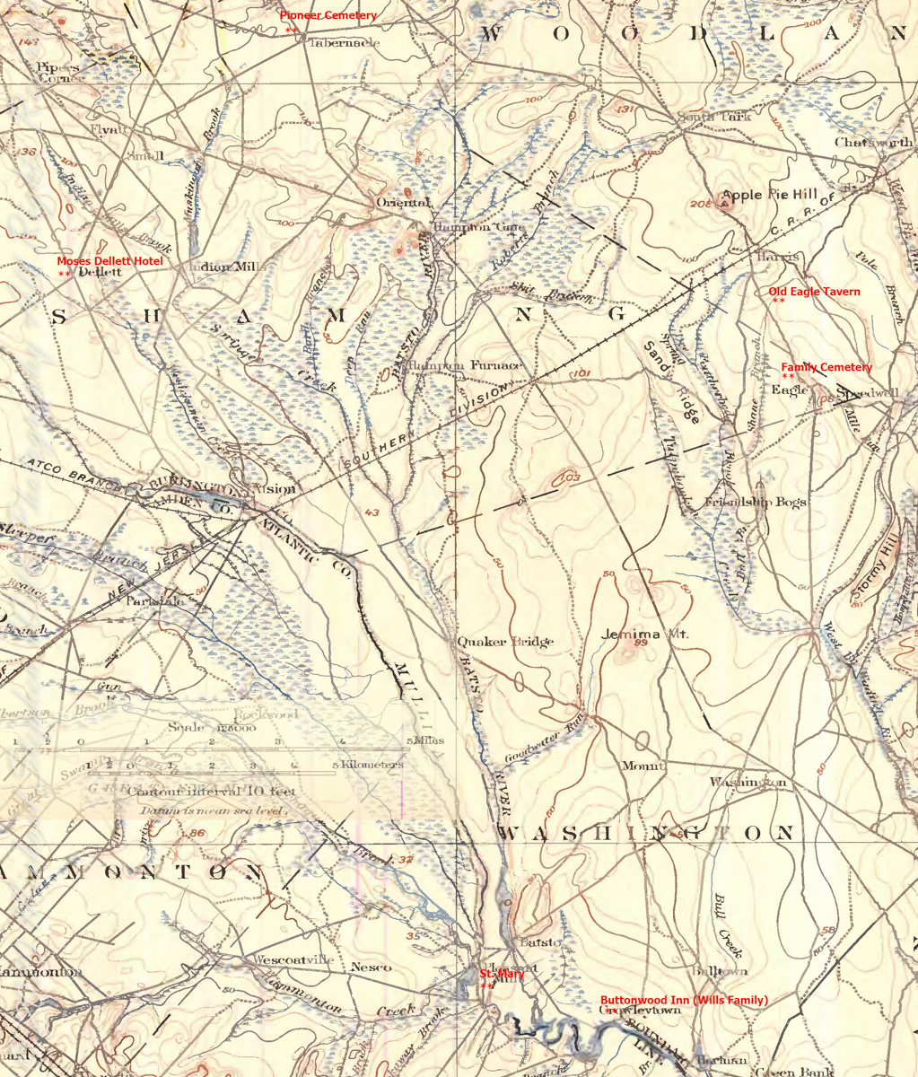
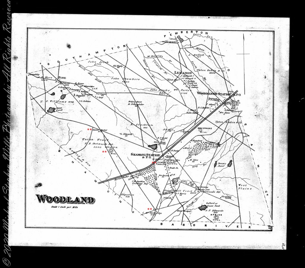
In this rectangle (10 miles by 15 miles) taken from the 1900 US Geological Survey, Rancocas Quadrangle, New Jersey topographic map is shown, upper right hand corner, Apple Pie Hill the starting point of this history where the author John McFee climbed the fire watchtower there, a view encompassing endless acres of pines. I learned an ancestor, third great-grandfather James McCambridge and his wife Mary owned the Old Eagle Tavern less than two miles south of there. The site is marked in red.
The Eagle Tavern existed for 28 years under various owners and names when James and Mary took over in 1926 serving a clientele, workers and visitors, from the struggling Speedwell Ironworks. Samuel Richards was a brother of Jessie Richards who owned the Batsto Ironworks and who provided the land for St. Mary of the Assumption (see my post Pineland Connections V). St. Mary’s is marked in red, bottom center. Samuel purchased Speedwell December 23, 1833 from Ann Randolph, made improvements and started operations without success before closing for good.
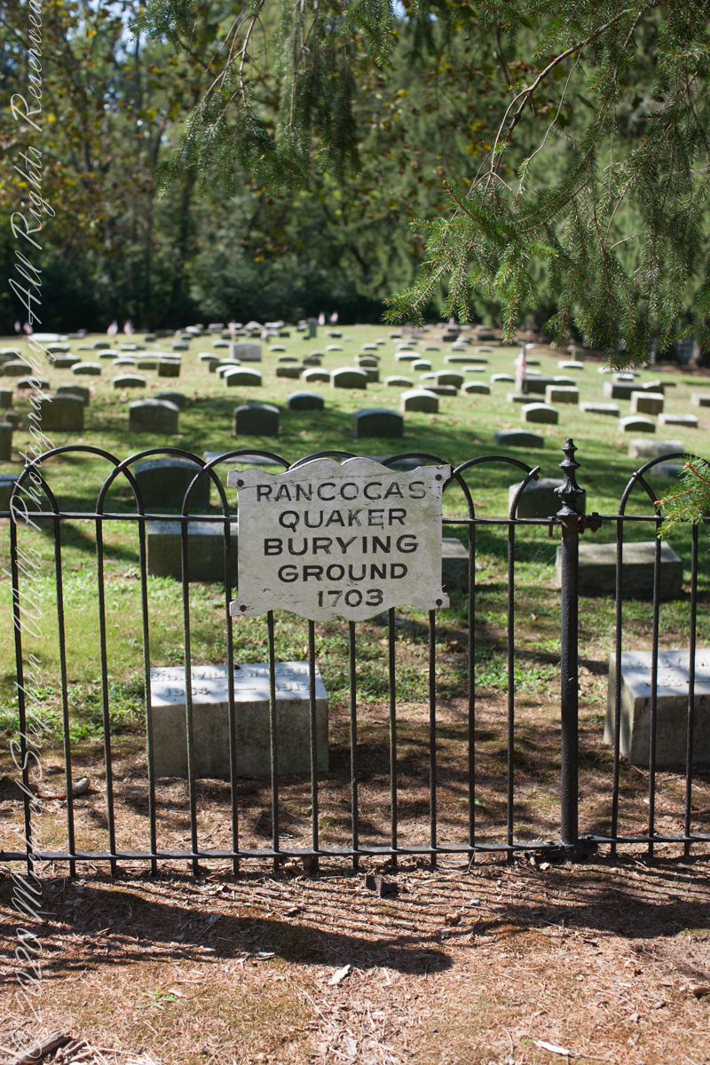
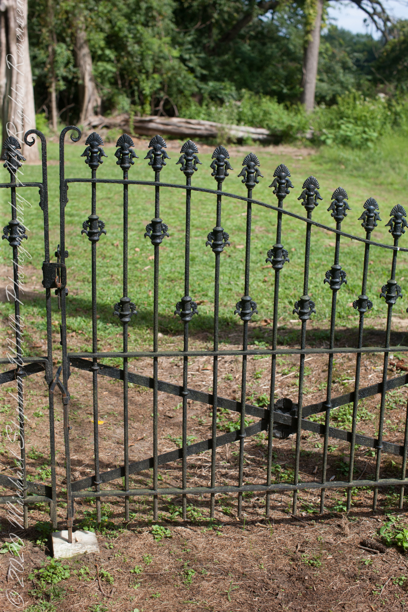
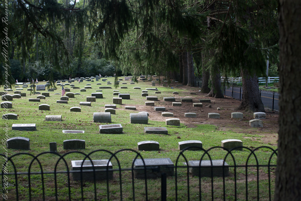
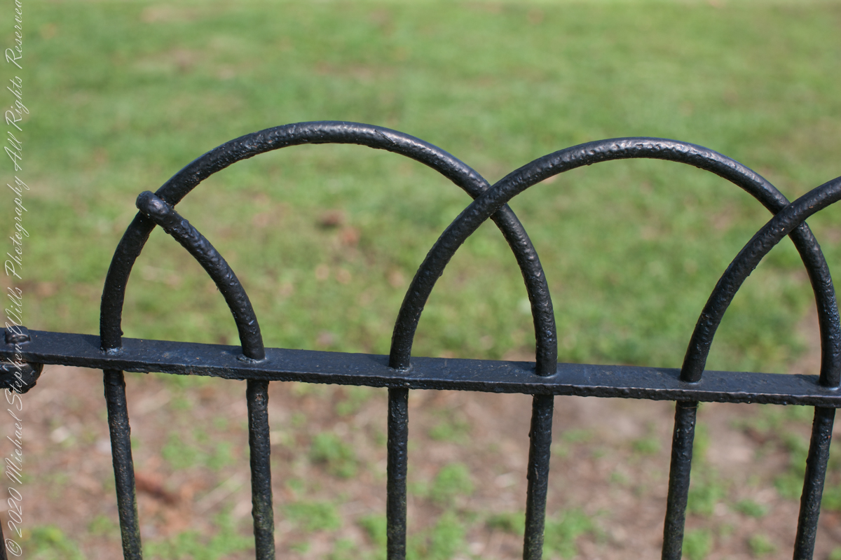
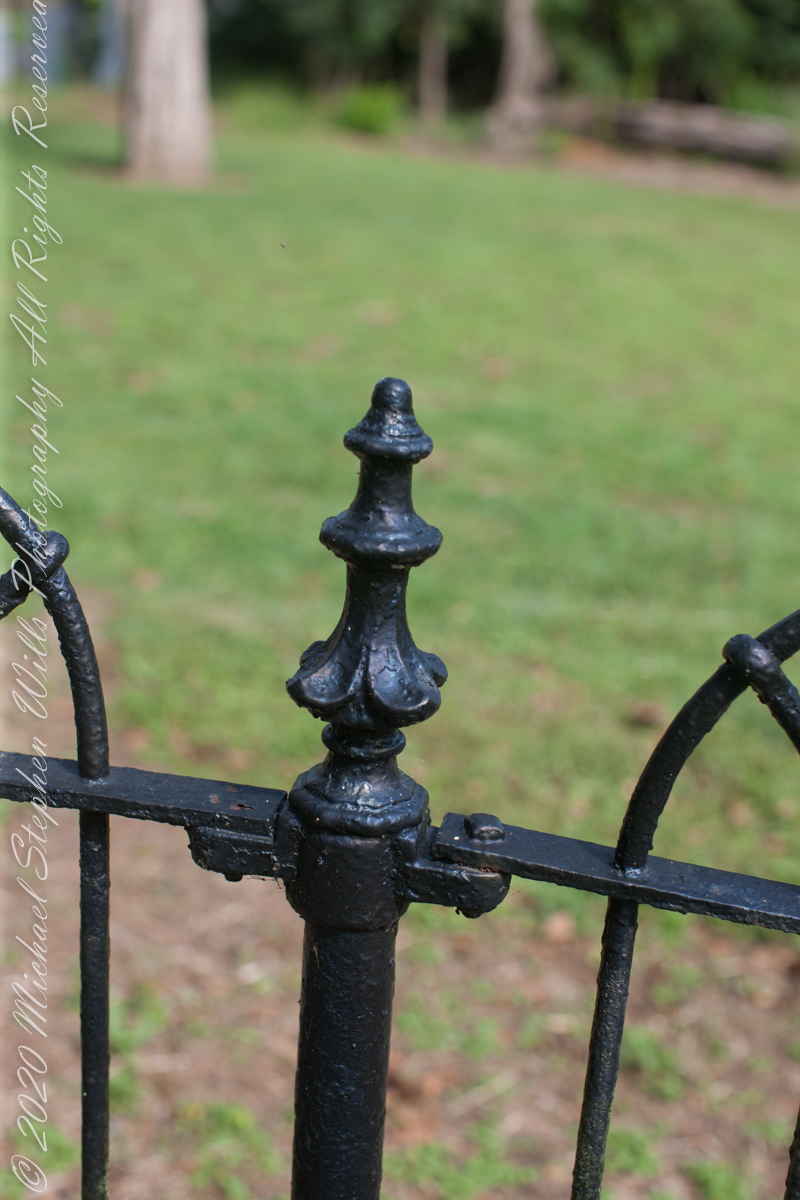
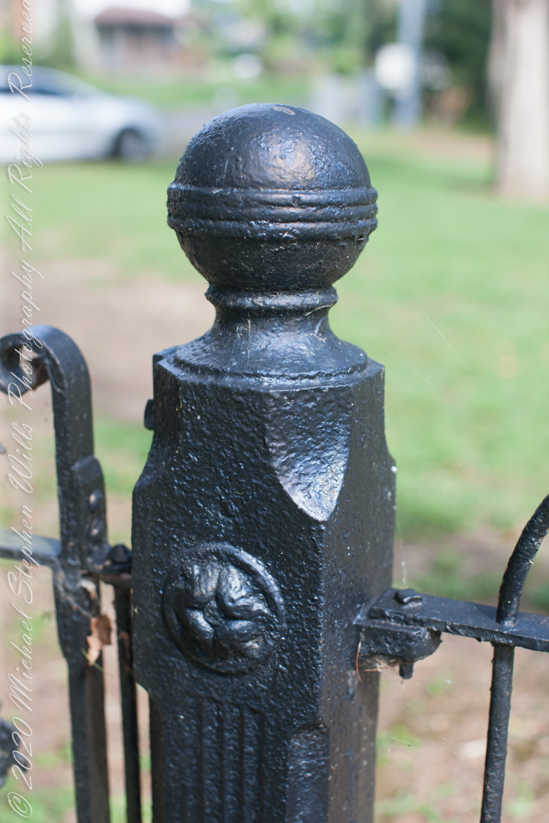
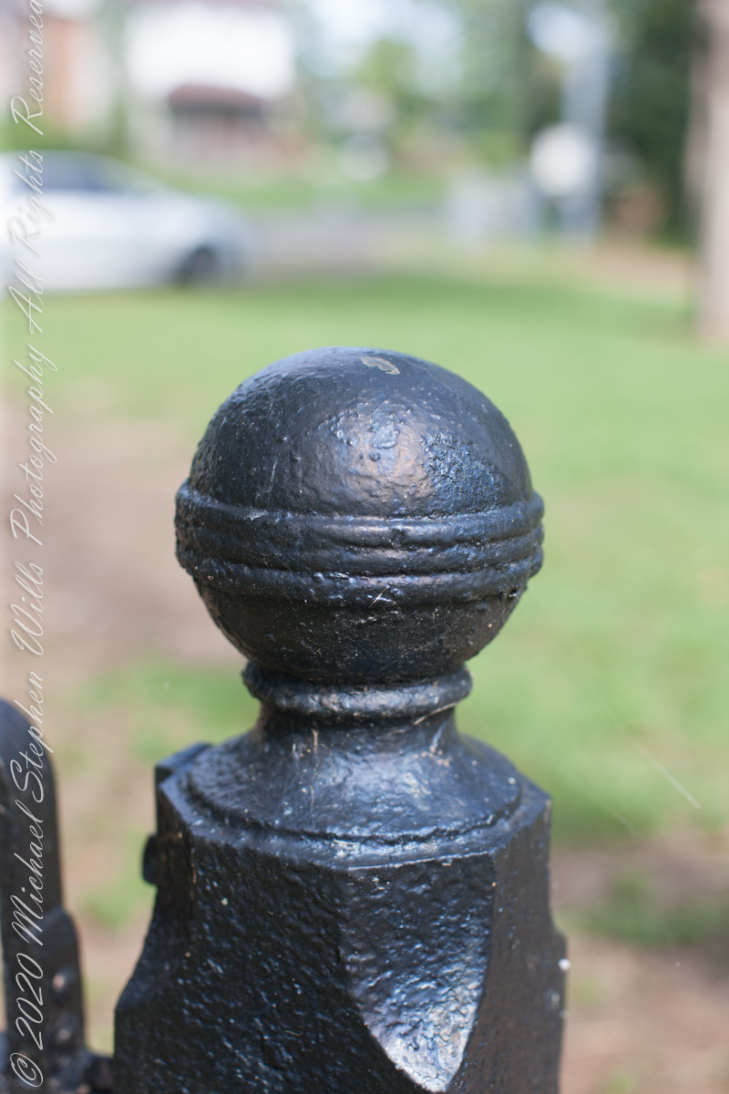
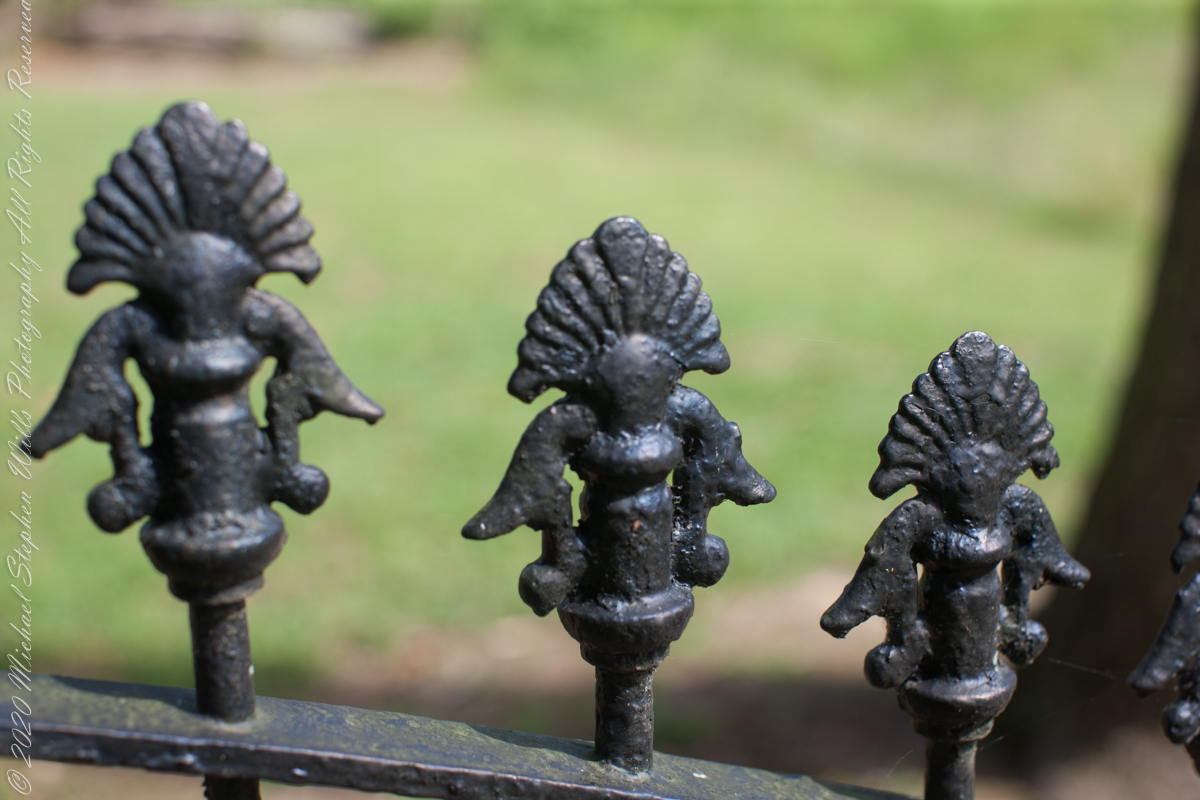
Entrance sign and overviewIron GateFence and burialsfilialIron fence postFilial of Iron Fence PostFilialThe Rancocas Quaker Burial Ground is surrounded by an iron fence, almost certainly of local origins. Here are my photographs of this exceptional ironwork.
On June 30, 1850, James McCambridge purchased Speedwell from the estate, eight years after Samuel’s passing, for $1,750. At this time he had accumulated over 2,000 acres. In this same year his son, James and wife Ann (Milley) (see my post Pineland connections VI) are listed on the US Census. The family lived either in the Eagle Hotel or close by raising nine (9) children: John (20), Mary Ann (16), James (15), Sarah Jane (14), my great grandmother Margaret (11), William (8), George (6), Edward (5) and Catherine (3). The younger James is employment was making charcoal for the ironworks, most likely for Atsion where Ann was employed. By the 1860 US Census Ann had passed away at the age of 50 and James (97) was living with the younger James and family.
Here is a land ownership map from 1876 on which I marked with red asterisks James McCambridge, Apple Pie Hill, and the Delletts, the family of the second greatgrandmother, Mary Dellett. Dellett landownership is also indicated on the rectangle topographic map.
Around the 1850 US census George and Mary Wills lost their two month old son, Charles (See my post Pineland Connections III) who is buried in a family cemetery, land owned by James McCambridge marked in red on the rectangle topographic map. Charles was my greatUncle.
George and Mary Wills, second greatgrandparents
Another breakthrough was identification of the Buttonwood Hill Tavern, Crowleytown as the hotel run by George Wills on the 1850 census. Marked in red on the rectangle topographic map. There was not yet a family union between McCambridge and Wills. That would come with great grandparents George Wills and Margaret McCambridge. The family connection at this time was their shared Roman Catholic faith and Saint Mary of the Assumption church.
I found this information in the book “Heart of the Pines, ghostly voices of the Pine Barrens” by John E. Pearce, Batsto Citizens Committee, 4110 Nesco Road, Hammonton, N.J. 08037-3814.
Copyright 2021 Michael Stephen Wills All Rights Reserved
Yesterday, I simultaneously published nine photographs on my ImageKind Ireland Gallery and Getty IStock (click the links to visit): nine views taken from the slopes of Slieve Gullion.
Sunday, May 25, 2014 was a happy day for Pam and I. It was the first full day of an eighteen (18) we filled with Ireland, travelling in a loop of the island following the coast from, naming the counties where we spent time on the ground, Louth, Armagh, Dublin, Meath, Wicklow, Cork, Kerry, Claire, Mayo, Antrim, Down and back to Louth. The counties of Northern Ireland are in italics. Indeed, at this time the politics allowed us to travel freely between the Republic and the North. That day, our morning was spent in Louth attending mass, enjoying our first meeting with the family over a substantial mid-day meal (click the link for my Facebook album of the meeting). We split off that afternoon to visit the home of my cousin, Mary and her husband Joseph in County Armagh, just over the border. When Joseph offered to drive us over to Slieve Gullion it was totally new to us, we had no conception of the place or what to expect.
It was such a gift, we are grateful to Joseph for this experience. Only in 2018 when, at 64 years of age and retired”, was I able to research the place and spend time developing the photographs for publication. Two of the photographs illustrate this posting, to view the others in my online gallery, click either photograph.
Slieve is the Irish language word for “mountain.” Slieve Gullion is a lone eminence, one remnant of volcanic eruptions about 60 million years ago during the rifting of continents that produced the Atlantic Ocean. Around the mountain is the Ring of Gullion, a string of hills, 26 miles by 11 miles, surrounding the mountain and formed from the ancient collapse of a volcanic caldera. The technical name for it is a Ring Dyke and it was the first of its kind to be recognized and mapped, well before the nature of the formation was understood of be volcanic. The name Gullion is derived, in one formulation, from the name of the metalsmith, Culann. In Irish Myth, Culann’s home and workshop was on the slope of Slieve Gullion. A wealthy and respected personage, Culann invited Conchobhar mac_Neasa, king of Ulster to feast. During his approach to the mountain, passing through the surrounding plain, the king stopped to watch boys play hurling. Among them was the future hero of Ulster, the young Sétanta. Impressed with Sétanta athletic abilities, the king invited him to join in the feasting at Culann and the boy promised to follow after the game. Later, while climbing the mountain to fulfill his promise Sétanta was attacked by the guard dog of Culann. The myth says the dog was killed by Sétanta in self-defense. Never the less, in compensation to Culann, Sétanta committed to rearing a replacement and to act as guard dog in the meantime. In this way he became known as Cu Culann, “the dog of Culann.” Click for more about Cu Culann.
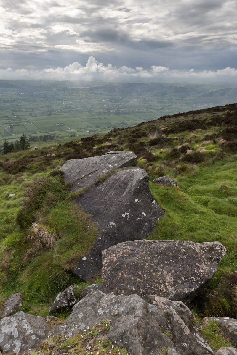
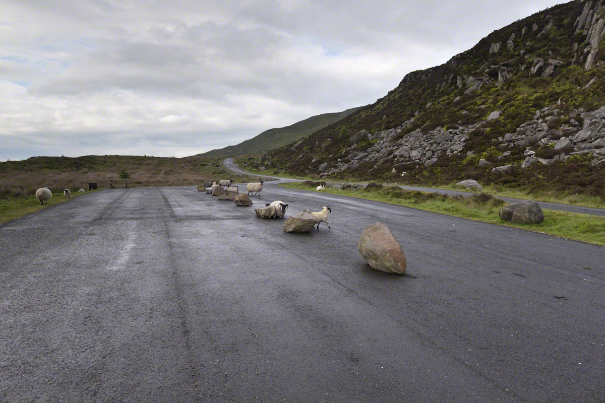
On the summit two cairns north and south of a small lake, tangible proofs of ancient peoples and beliefs. The north cairn is a more ancient passage grave, 90 feet wide, 16 feet high, the opening aligned with the setting sun on the winter solstice. The cairn north of the lake is less ancient containing two cist burials. For our visit Joseph drove us along the 8 mile drive. The following is an image of a viewing platform and the road. Just beyond, on the right, where the ridge meets the road, is the trail to the 1,880 foot summit of Slieve Gullion. Our arrival disturbed sheep resting on the asphalt. I’d have loved to spent a day climbing the summit, but it was not to be this trip.
The way is part of the Slieve Gullion Forest Park. Throughout are turnoffs to admire the view. It was during our frequent stops I pulled out the photography gear to grab the views. Here is one, looking southwest. For the other views, click either photograph to visit my Online Gallery of Ireland.
Copyright 2021 Michael Stephen Wills All Rights Reserved
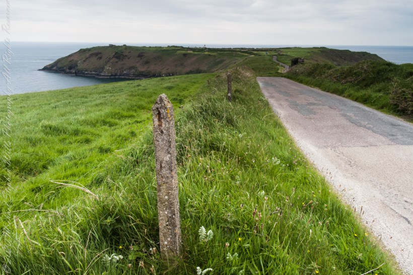
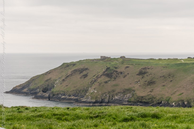
Our day of touring Kinsale and environs, the last day of May 2014, continues with our morning visit to the “Old Head of Kinsale.” Head is short for headland, a narrow strip of land projecting into the sea.
Road to the Old Head of Kinsale
Old Head of Kinsale
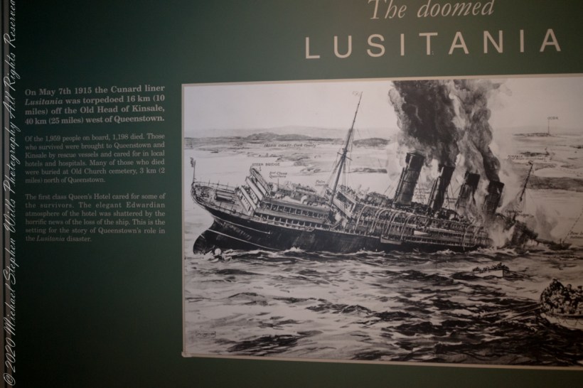
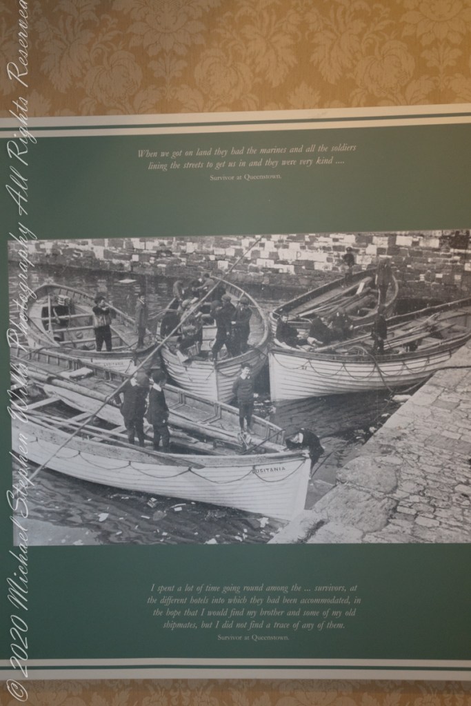
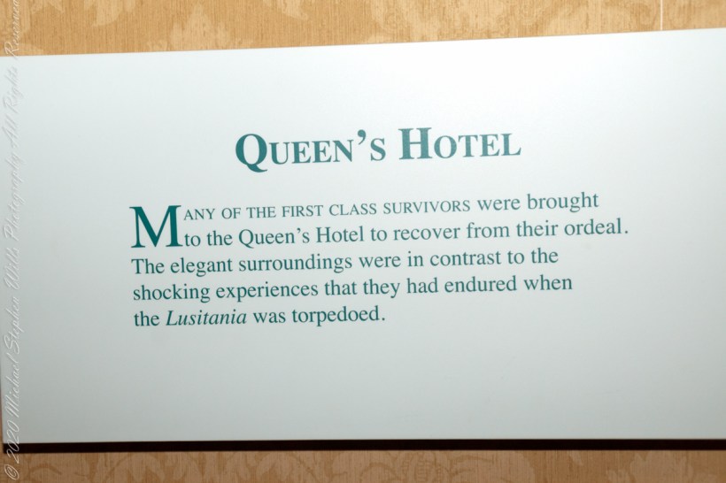
On May 7th, 1915 the Cunard liner Lusitania was torpedoed 16 km (10 miles) off the Old Head of Kinsale, 40 km (25 miles) west of Queenstown. Of the 1,959 people on board, 1,198 died. Those who survived were brought to Queenstown and Kinsale by rescue vessels and cared for in local hotels and hospitals. Many of those who died were buried at Old Church cemetery, 3 km (2 miles) north of Queenstown. The first class Queen’s Hotel cared for some of the survivors. The elegant Edwardian atmosphere of the hotel was shattered by the horrific news of the loss of the ship. This is the setting for the story of Queenstown’s role in the Lusitania disaster. –text from Cobh Heritage Center poster, see image below.
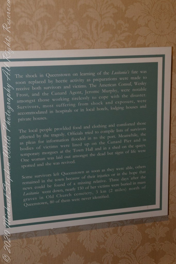
The Old Head is notable, in the contest of the Lusitania attack, for being the land closest to the incident. Cobh, then named “Queenstown”, was the focus of rescue operations. See text below, from a display of the Cobh Heritage Museum.
from Cobh Heritage Museum.
The Kinsale tower is just over nine meters high, with walls up to 80 cm thick. Records show a signal crew was in place in 1804 and the tower finished the following year, though severely affected by dampness. When Napoleon was defeated by Wellingtons forces at Waterloo, 1815. With the diminished threat these expensive installations were neglected. The 1899 Ordnance Survey map lists the site as being in ruins. During our 2014 visit the local community was renovating the tower and the work appears complete sometime before 2021.
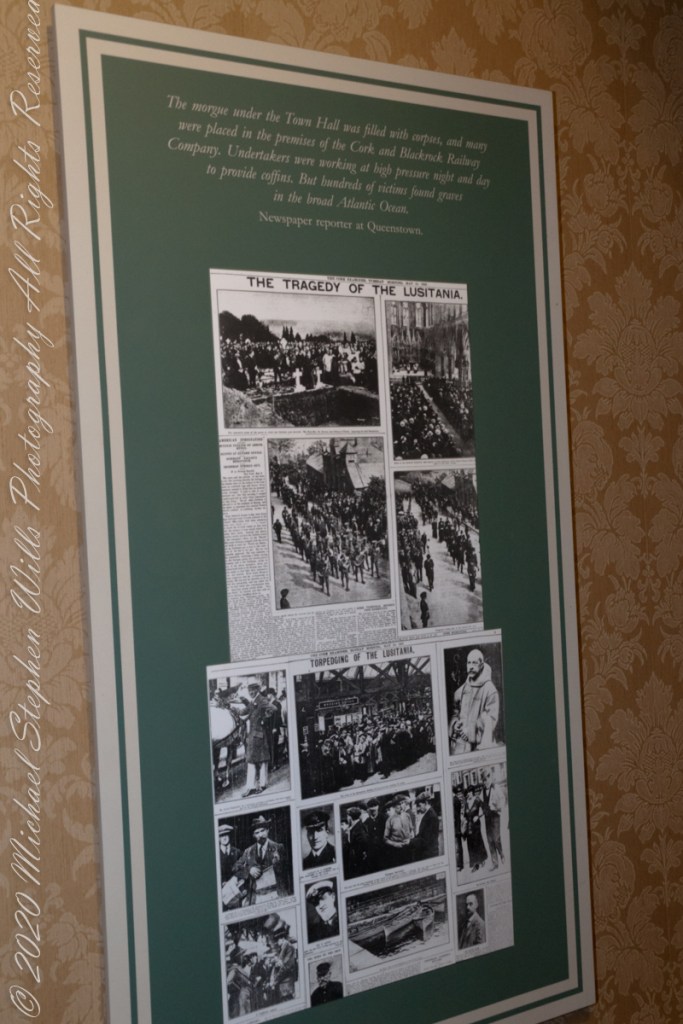
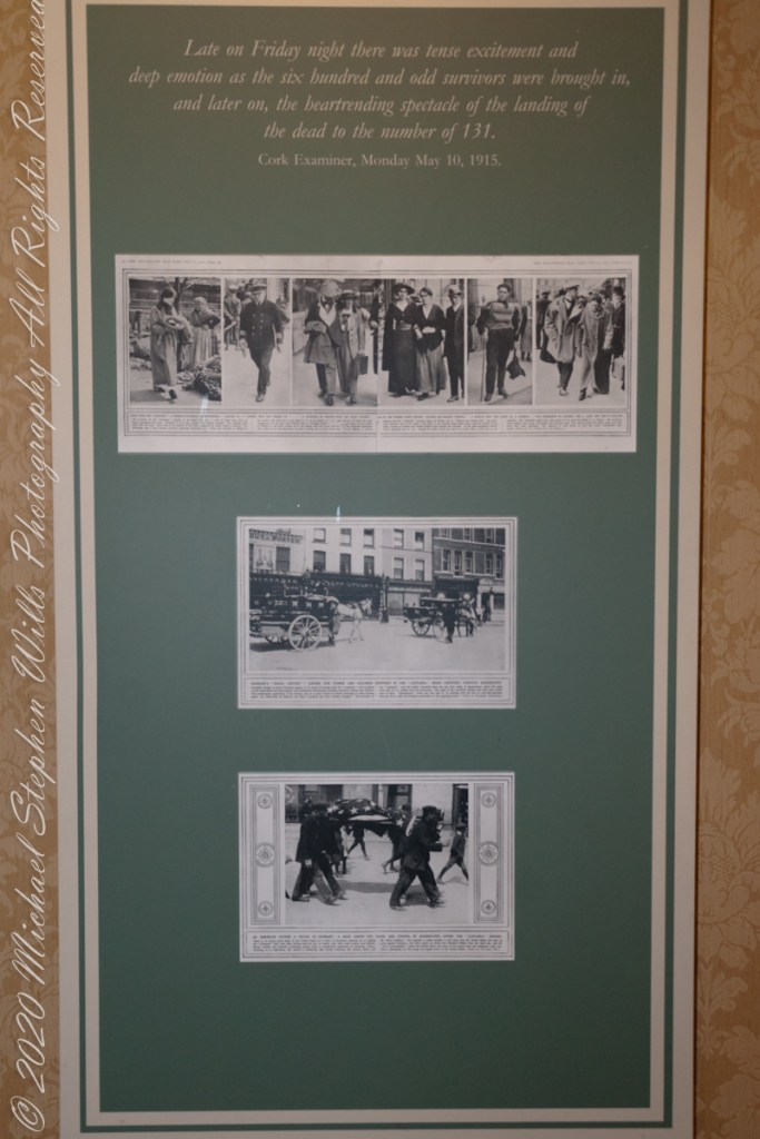
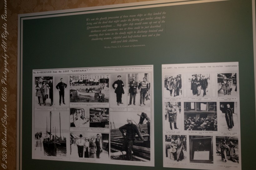
The morgue under the Town Hall was filled with corpses, and many were placed in the premises of the Cork and Blackstock Railway Company. Undertakers were working at high pressure night and day to provide coffins. But hundreds of victims found graves in the broad Atlantic Ocean. –Newspaper reporter at Queenstown. See images in the above gallery for more.
Cobh Heritage Center exhibit of survivor recovery, Queen’s Hotel
I did not see and/or recall much emphasis in the museum for pillorying Germany, after all a German U-boat was responsible. Curious, I did a Wikipedia search and found this text. The topic of Ireland, Germany and World War I is complicated.
On the afternoon of 7 May, a German U-boat torpedoed Lusitania 11 miles (18 km) off the southern coast of Ireland inside the declared war zone. A second internal explosion sank her in 18 minutes, killing 1,198 passengers and crew. The German government justified treating Lusitania as a naval vessel because she was carrying 173 tons of war munitions and ammunition, making her a legitimate military target, and they argued that British merchant ships had violated the cruiser rules from the very beginning of the war. The internationally recognized cruiser rules were obsolete by 1915; it had become more dangerous for submarines to surface and give warning with the introduction of Q-ships in 1915 by the Royal Navy, which were armed with concealed deck guns. The Germans argued that Lusitania was regularly transporting “war munitions”; she operated under the control of the Admiralty; she could be converted into an armed auxiliary cruiser to join the war; her identity had been disguised; and she flew no flags. They claimed that she was a non-neutral vessel in a declared war zone, with orders to evade capture and ram challenging submarines.
However, the ship was not armed for battle and was carrying thousands of civilian passengers, and the British government accused the Germans of breaching the cruiser rules. The sinking caused a storm of protest in the United States because 128 American citizens were among the dead. The sinking shifted public opinion in the United States against Germany and was one of the factors in the declaration of war nearly two years later. After the First World War, successive British governments maintained that there were no munitions on board Lusitania, and the Germans were not justified in treating the ship as a naval vessel. In 1982, the head of the Foreign Office’s American department finally admitted that, although no weapons were shipped, there is a large amount of ammunition in the wreck, some of which is highly dangerous and poses a safety risk to salvage teams.
T
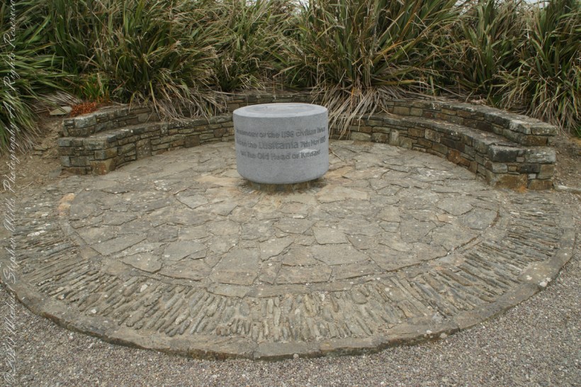
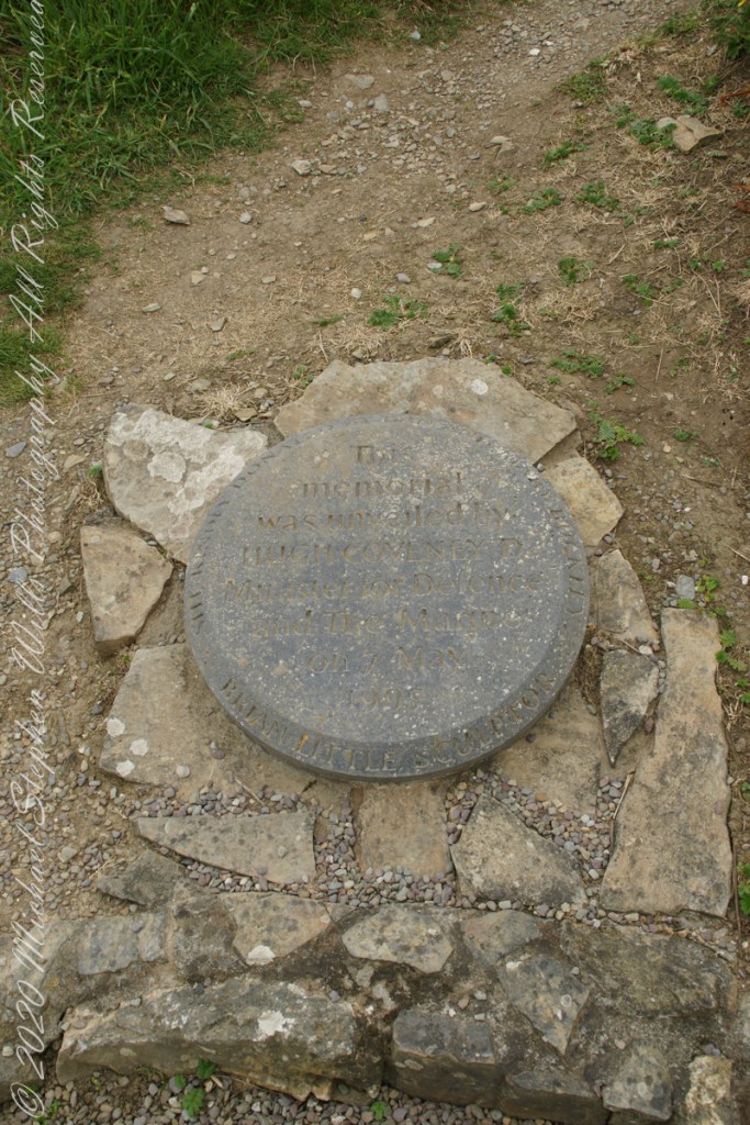
The original memorial to the Lusitania was unveiled on the 80th anniversary of the May 7th, 1915 sinking (May 7, 1995), Old Head of Kinsale, County Cork Ireland. The imemorial nscription reads “In memory of the 1198 civilian lives lost on the Lusitania 7th May 1915 off the Old Head of Kinsale.”
The inscription of the commemoration plaque accompanying the memorial reads, “This memorial was unveiled by Hugh Coveney D Minister of Defense and The Marine on 7 May 1995.” Around the edge of the medallion reads, “Brian Little Sculptor” “This (cannot read) donated by Lan and Mary Buckley”