A Visit to Salado Ruins

Happy April First “this post is no joke”

About 700 years ago, when the expansion of the Mongol empire was under way, on the other side of the planet people discovered a series of caves, formed in tuff, with a favorable location in a south facing cliff near water.  Tuff, a rock formed from volcanic ash, is hard, brittle and soluble in water.  From these properties this series of caves formed.  The southern exposure provided excellent climate control for people, like those we now call the Salado, who understood how to exploit the location.

They constructed from local materials (mud, plants and rock) rooms in the upper cave just far enough inside to be warmed by the winter sun and protected during the summer when the sun’s sky-path was higher.  Who knows how long the Salado lived in what must have been this paradise or why they left. 

Click me for an Arizona Gallery of Fine Art prints by Michael Stephen Wills
Rogers Canyon

In March 2006, after returning from a nine-day backpack trip to the remote eastern Superstition Wilderness I used a four-wheel vehicle to reach the Roger’s Trough trailhead for a day trip to this site in Roger’s Canyon.  The advantage of Roger’s Trough is the high elevation that leaves “just” about 1,100 feet of climbing (2,200 total) for the day.  As it happens, it is downhill to the ruins though there is plenty of ups and downs plus scrambling over rocks.

I started late morning and a returning party met me on the way out and warned against leaving packs unattended.  It seems they were victimized by pack rats.  My timing was lucky and I had the site to myself.

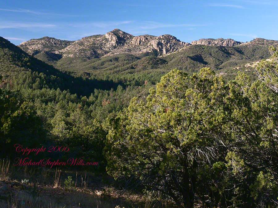
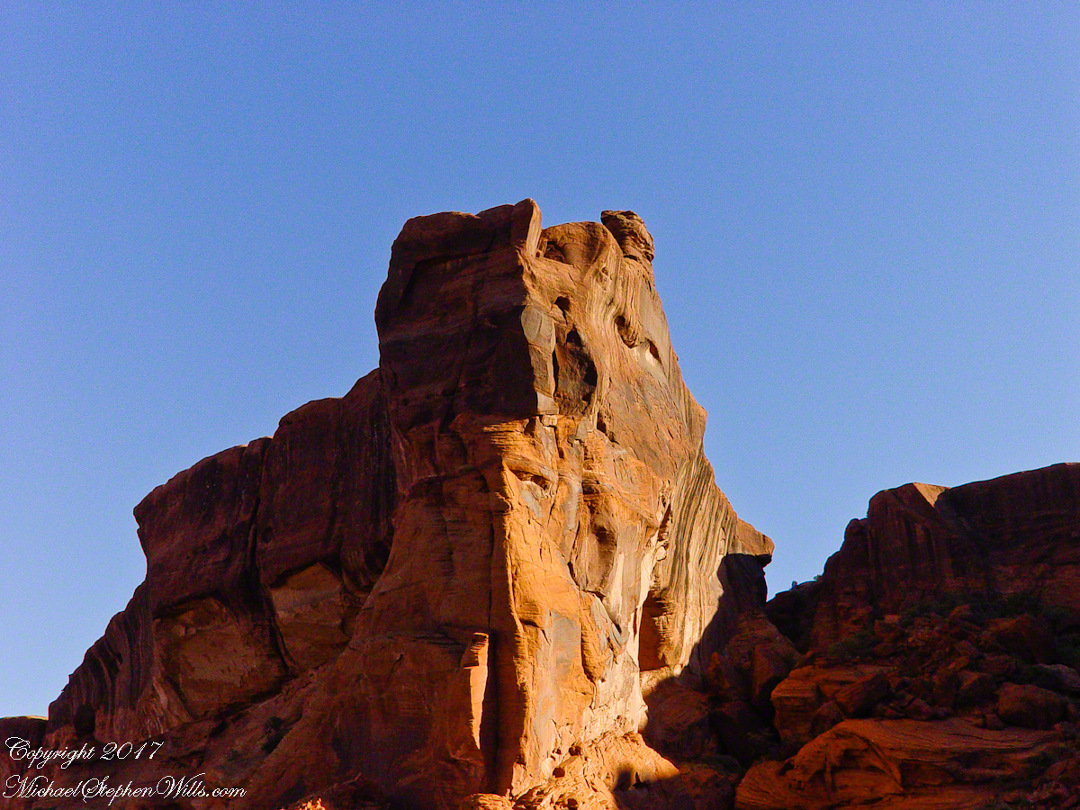
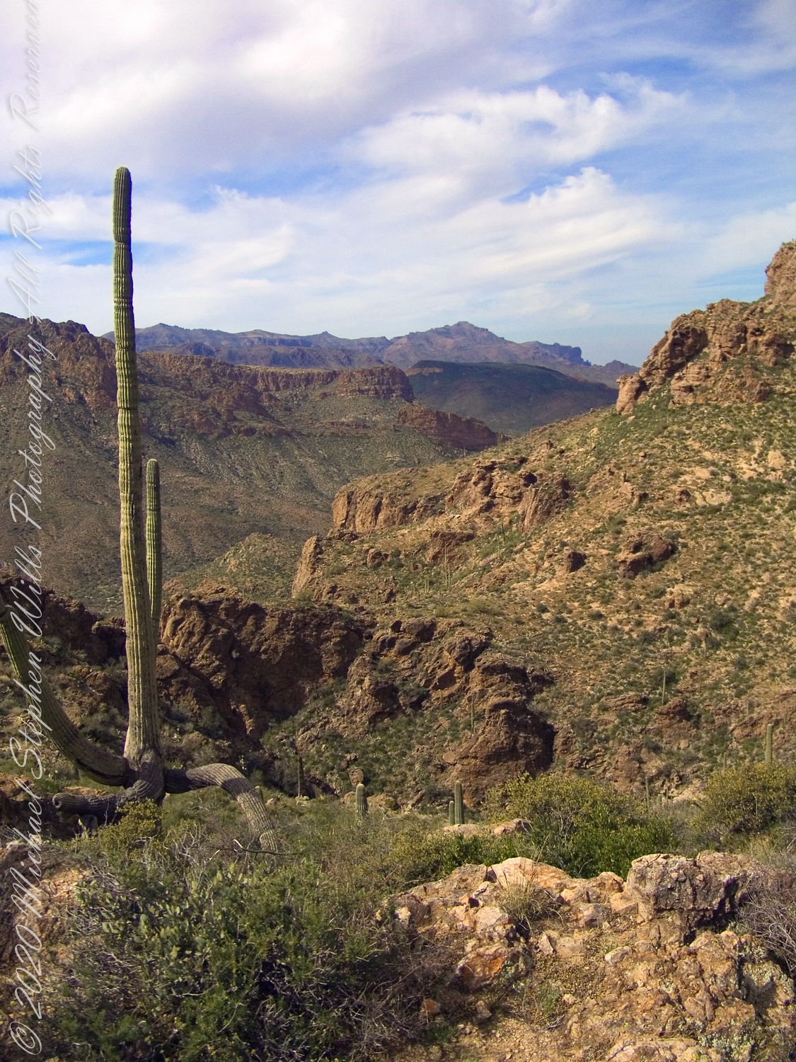
First (refer to the “Roger Canyon” photograph,  above) I climbed the cliff opposite from the ruins to set up a tripod an telephoto lens to shoot through the trees to capture the main building inside that very interesting looking tuff (see below).  That central column (to the right) divides the cave opening and there are views from inside, up and across the canyon.  In season, the cliffs are occupied by nesting birds and, higher up, there are fascinating caves in locations too high and steep to reach without the proper equipment.

As it is, climbing into the upper cave requires an exposed rock scramble.  By “exposed” I mean the climber is exposed to falling.  That is an intact wooden lintel of the visible structure opening and the larger structure, to the right, has curved walls.

Salado Cave Ruin

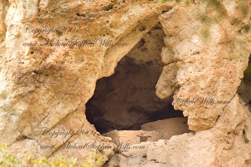
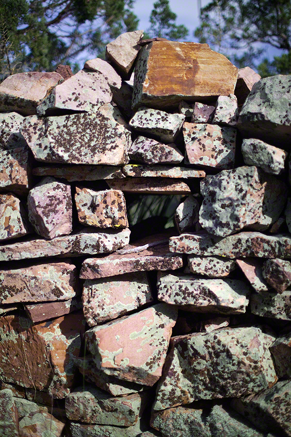
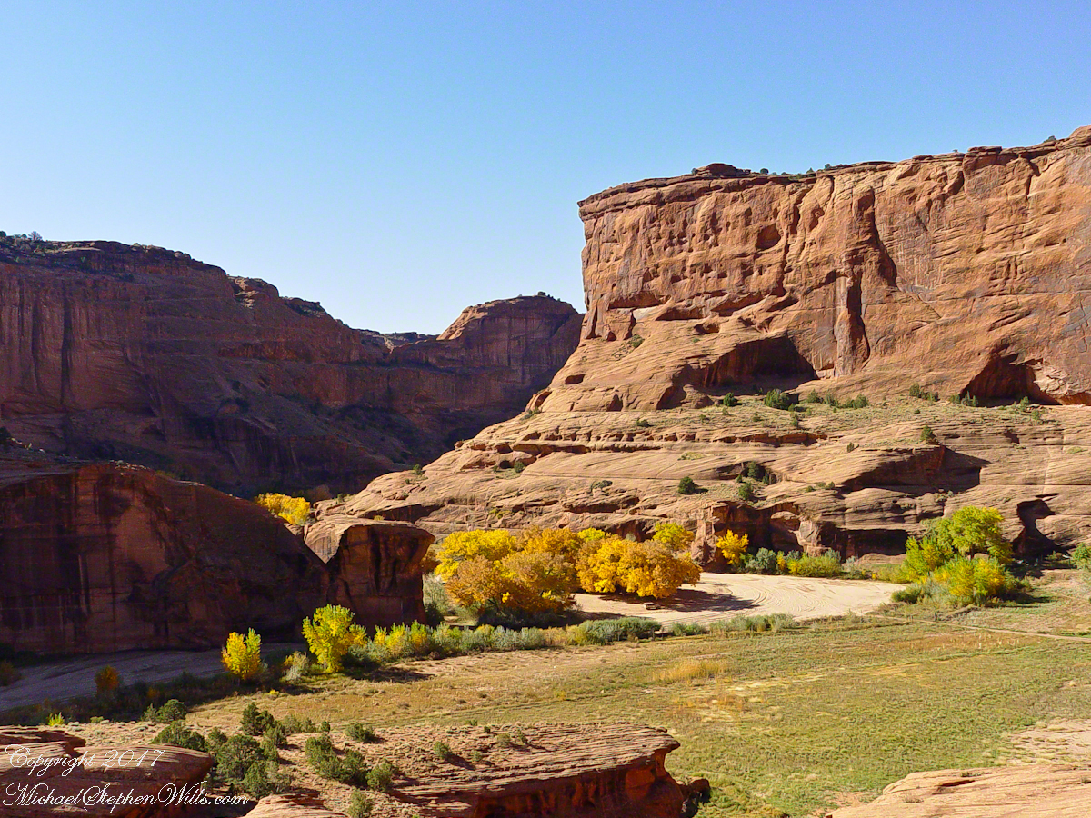
I then explored in and around the site.  The location of a lower cave made it useful for storage, it was walled off and the sturdy structure still stands today.  By the way, I inverted this view for artistic purposes.

Lower Storage Room

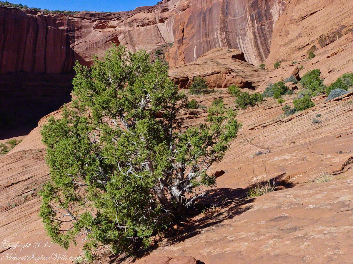
A lower cave is opened and accessible.  Looking out, I felt the original inhabitants were with me and then a raven started calling over and over and over.

Lower Cave

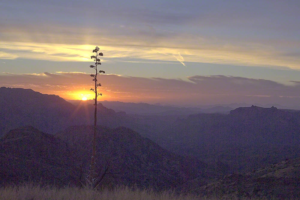
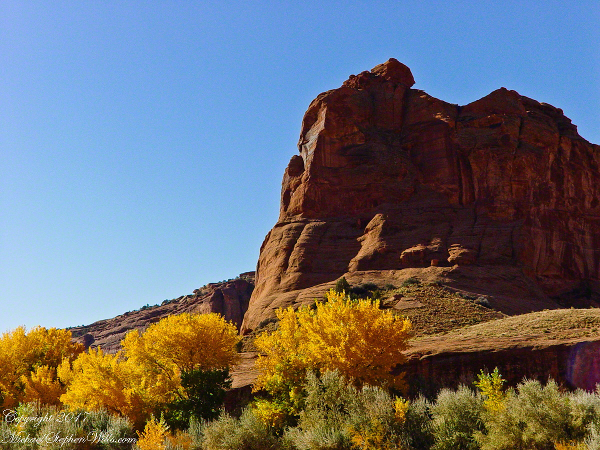
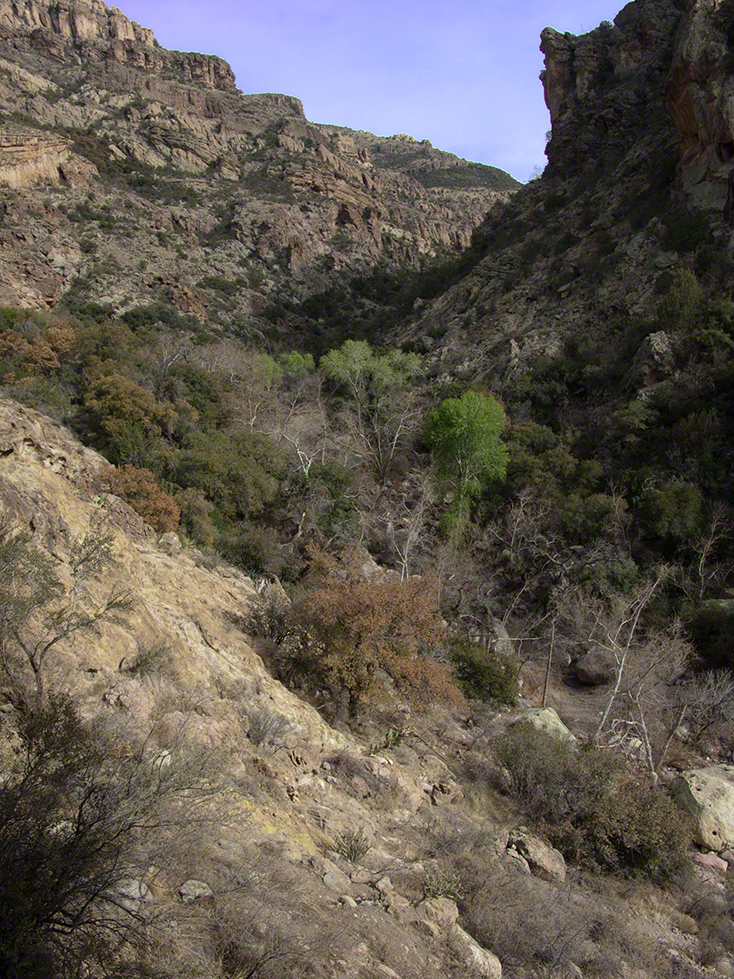
I was so fascinated by the possibilities of the site that time got away from me until this incessant cawing of a raven made me notice the lengthening cliff shadows.  Here is a view (see below) of my way home, back up Rogers Canyon.  My last shot before packing up.  It took just over two hours to get out, at a steady pace.  It was twilight as I approached the Rogers Trough trail head.

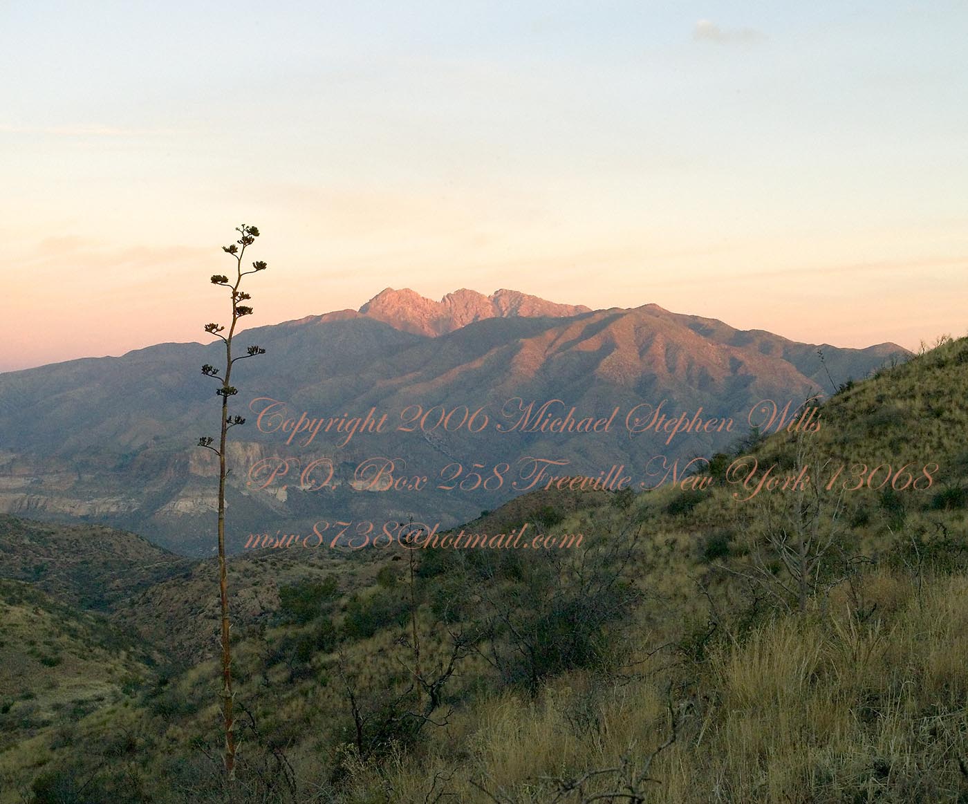
By the way, my posting before this one (“Finding Circlestone”) includes a shot of White Mountain.  In that view, these ruins are on the other side of White Mountain.

View up Rogers Canyon from the Ruins

Copyright 2023 Michael Stephen Wills All Rights Reserved

Finding Circlestone

Ancient Ruins

The Searcher’s Tale

Click me for an Arizona Gallery of Fine Art prints by Michael Stephen Wills

I first learned about Circlestone from stories The Searcher told during my first backpack into the eastern Superstition Mountains, on the Tule trail, April 2005.  I described this in “Riding from Pine Creek to the Reavis Valley” where the Searcher described a stone circle, overgrown with Alligator Juniper, on the slopes of Mound Mountain.  He pointed south toward a peak and foothills that rose from the valley floor and said, “follow the fire trail east from the southern Reavis Ranch valley.”  There were strange happenings associated with Circlestone (as he called it) and he’d never taken the time to go there.  “There is a book full of stories.”  I eventually sought out Circlestone on the web and in books, but after I found it on my own using only the Searcher’s directions and advice from friends met on the way.

Sunset from Castle Dome

Backpacking with my sister

In 2006 I explored Circlestone twice along with my sister, Diane, who accompanied me.  First for nine days early March 2006 using the Reavis Ranch trail from the north and the second for five days in November 2006, coming us the same trail from the south.  Our first trip was Diane’s first “real” backpack adventure and we took it slow with a camp at Castle Dome where there are flat areas and exceptional views.  Above, is the sunset from our second night (I camped the first night next to the car…we took it very, very sloooowwww).

Four Peaks Sunrise

Castle Dome

Then, there was morning of our third day.  Here is the Four Peaks Wilderness in the first rays of dawn.  These are green, rolling foothills of grass, low shrubs and a few juniper.  If you know where to look, there’s an unmarked trail to Reavis Falls (the highest waterfall in Arizona).  I found the trail and visited the falls on a later trip.

Castle Dome Sunrise

After enjoying the Four Peaks, you turn around and see Castle Dome in the morning light, as in this photograph.  Remember the same of the “dome”, because it is visible from the ultimate view from Circlestone.

Reavis Valley and White Mountain from the trail to Circlestone

The Trail to Circlestone

Our camp was in the Reavis Valley, one of the first sites along the creek coming from the north.  There were fantastic rock formations across the creek.  Not far from there, the land falls away into steepness and then Reavis Falls.   The Searcher told me about going that way, once.  There is no trail down to the falls overlook and deep canyon carved by the water.

This photograph, above, is from a lovely forest of pinyon trees that grow along the trail to Circlestone (described by the Searcher as rising from the southern Reavis Valley).  You can see the valley, just to the right, and a longer and steeper valley that rises from it up to White Mountain.  That way is the southern legs of Reavis Trail.  I have a movie clip from this same spot of the pinyons moving in the breeze and may post it at a later time.

All of the trail to Circlestone is a climb.  You pass over “Whiskey Spring”, named for a still kept there in the 1800’s and over a steep defile gouged from the rock.  The trail is well marked and I am told that, sometimes, there is no cairn marking the trail to Circlestone.  If you are desperate to get there, look-up some excellent hiking directions available on the web.  I have even found the circle on GoogleEarth, since I know where to look.  If you like a challenge and the adventure,  go from the directions the Searcher gave me.

Four Peaks from Circlestone

From the fire line trail, the unmarked branch to Circlestone climbs steeply and follows a ridge through Alligator juniper, punctuated by stalks of century plant, to a broad way that rises to Circlestone as though to a monument overgrown by the same juniper.

My Circlestone Mystery

There was an unusual experience on our first trip, on this portion of the trail.  We were winding through the Juniper and, as it happened, Diane fell behind.  After awhile I missed her and waited and, after a minute, went back to look for her.  I found Diane sobbing uncontrollably, deep in grief over our father who passed away eleven years before.  We talked about it until she felt better.  She said it was as though a door opened and she could feel out father.  What makes this exceptional is Diane is not given to anything like this and I ascribe her deep grief to the nature of the site.  It is a mystery to this day.

At Circlestone, that first trip, we explored and experienced the site.  You cannot see the entire wall at any point and need to wander through and over it, being careful not to disturb anything.  Here and there, in the outer wall, are openings like the one in this photograph.

Site-Hole in the Circlestone Wall

At Circlestone

I call it a site hole because, on your knees, it is possible to look through and see the distant view through the trees.  As you can see, the stones are a striking red color with green lichen growing thick.

On the second trip in November, knowing the way and having great weather, I brought my cameras to capture the exceptional views, one of which is above.  I’d dearly love to come back to camp just below the ruin and do some work in the evening and morning light.  For now, I can enjoy those views from Castle Dome.

Three Horsemen and Castle Dome

Can you see the dome in the middle distance.  I did a portrait of three horsemen who road up to Circlestone in November.  We came to know them pretty well, that afternoon and the following morning down in the valley.

Three Horsemen

I carted up a tripod, so you can see Diane and I in the same spot.

Mike and Diane at Circlestone
Copyright 2023 Michael Stephen Wills, All Rights Reserved

Homecoming Remembered

In town for a University of Arizona event I gazed from the Marriott before dawn to remember painting “A” mountain with the Sophos service club a half century ago. The tradition continues.

The view to the southwest includes University Neighborhood, downtown Tucson skyscrapers, “A” Mountain (painted red, white and blue November 2010), Tucson Mountains.

Click me for an Arizona Gallery of Fine Art prints by Michael Stephen Wills

Copyright 2023 All Rights Reserved Michael Stephen Wills

Cochise Stronghold and Moon

at dawn

Interstate 10 between Benson and Wilcox ascends through a field of enormous, eroded granite boulders. Off to the west are the Dragoon Mountains, otherwise known as “Cochise Stronghold.” This rugged area served as a natural fortress and hideout for Apache Indians of the Chiricahua clan led by Cochise. He was born in this Dragoon Mountains about 1815. From 1869 to 1872 the Cochise band battled the U.S. Calvary because of the handling of an incident at Apache Pass about 30 miles east of here. It is believed that Cochise was buried somewhere in the Stronghold.

Click me for an Arizona Gallery of Fine Art prints by Michael Stephen Wills

Informative sign at campsite

One April morning, very early, on the road to Cochise Stronghold. We stopped everything for me to unload the equipment to capture a gibbous moon low in the west, grazing a hoodoo ridge of Cochise Stronghold of the Dragoon Mountains. Near Dragoon, Cochise County, Arizona

Copyright 2023 Michael Stephen Wills All Rights Reserved

Saguaro Sky

dramatic skies from Saguaro National Park

November is a special time for the ranges and basins of southern Arizona deserts.  Climb a bajada of foothills, face west and wait for the sunset.  That is what I did this day, November 3, 2005.  East of Tucson the Saguaro National Monument at the foot of the Rincon Mountain Wilderness is where I parked, unpacked the photo gear and climbed the side of the Tanque Verde Ridge for a favorable view.  Weather was pushing high level moisture from the west, clouds were developing.

You see here a shot from that session.  In the distance, looking across Tanque Verde, are the Santa Catalina mountains.  Months since the last rainfall, the giant Saguaros are using internal moisture reserves drawn up from a shallow root system, the flesh is less plump, the supporting structure of the ribs, always evident, are more pronounced.  The last light catches these ribs in relief against a dramatic sky.

Click this link or the photograph for my Online gallery of this offering
Saguaro Sunset -- CLICK ME!!!!
Copyright 2023 Michael Stephen Wills All Rights Reserved

Oak Creek Reflections

early one still morning

The fault of Oak Creek changes direction, here it turns east/west through Schnebly Hill Formation red sandstone for which Sedona is famous.

West Fork (108) Trail, Sedona, Yavapai County, Arizona

“Hello” from Oak Creek Canyon, “Photo by Pam Wills”

Click this link for my Fine Art Photography gallery. You can find Oak Creek Mandala in the Arizona gallery.  The gallery description gives more information about the site.

Click this link for another Arizona post, “Cochise Dawn.”

Sandstone Gallery

early one still morning

The fault of Oak Creek changes direction, here it forms a north/south gallery through Schnebly Hill Formation red sandstone for which Sedona is famous.

West Fork (108) Trail, Sedona, Yavapai County, Arizona

“Hello” from Oak Creek Canyon, “Photo by Pam Wills”

Click this link for my Fine Art Photography gallery. You can find Oak Creek Mandala in the Arizona gallery.  The gallery description gives more information about the site.

Click this link for another Arizona post, “Cochise Dawn.”

Portrait of a Navajo Guide

In November 2004, a visit to Canyon de Chelly with guide Hadley Tsosie revealed ancient petroglyphs and ruins, highlighting Navajo culture and the canyon’s unique beauty.

On November 3, 2004 my son, Sean, and I made our way to Chinle, Arizona on the Navajo Reservation at the mouth of Canyon de Chelly.

The next day, driving a rented 4 wheel drive, we arrived at the visitor center, at dawn, and there met Hadley Tsosie who worked as a guide. This is how you do it, if learning about the Canyon is your goal. It is possible to walk, unaccompanied, into the canyon to view the “White House” and this I highly recommend. Tourists can also drive around the rim to various overlooks. This is what most people do.

The canyon is still farmed and the tribe only allows visitors when accompanied by a guide. Only Diné (Navajo) are certified as guides. They know the rights of way and the preferences of the landowners.

We negotiated with Hadley to take us for half a day for our interest in petroglyphs and ruins. It is important to start early when the sun is low in the sky, when directly overhead the details of ruins and petroglyphs are washed out by the light. Catching the late afternoon/evening sun is also an approach that requires detailed knowledge of the route, taking into account the time of year.

Hadley was an excellent choice, though he was our only option on that day. He was fluent in Navajo beliefs, the lore of the canyon and generous in sharing what he knew.

Here is Hadley, approximately 6.2 miles into the canyon with the “Ledge Ruin” behind. We arrived at the junction just in time, before the sun was high enough to wash out the ruin. It is slow going into the canyon what with the deep sand and water that must be negotiated. Hadley did the driving and was expert. We passed other parties bogged down in the wet sand. I do not believe it was luck that kept us moving . We stopped many times to talk and admire the petroglyphs and pictographs.

Petroglyphs are symbols incised, or cut, into the surface (the name means petro, “rock”, glyph, “symbol”). In the desert climate of the southwestern USA a thin, dark pigment forms on rock surfaces of overhanging cliffs. The pigment forms from infrequent precipitation, in the form of water, flowing downward over the surface or even dew. The high heat of the desert drives a chemical reaction between water, clays, iron and manganese oxide to form a coating on the rock surface. The dark coating, called “desert varnish”, contrasts with the underlying rock. When it is scraped away a line forms. Many of the petroglyphs were of this form. Others were carved into the rock itself, more time consuming and durable. No one knows when the petroglyphs were made, they were always there are respected. People have inhabited Canyon de Chelly for over a thousand years.
The word pictograph has a different meaning when used to describe prehistoric art. The earliest writing were symbols incised in wet clay, then allowed to harden. The pictographs we viewed was prehistoric art, mostly white pigment on the red rock, outlines of hands. There were also kokopelli, the outline of a flute player and jagged lines, symbolizing, Peter told us, lightening.

In November the cottonwoods were in fall foliage, a brilliant yellow under a cloudless sky. The sun is lower in the south and rises later. The Navajo Reservation follows daylight savings time, unlike Arizona. This November morning the sun rose around 7:45 am, so if you are not an early riser this time of year is an excellent choice for a Canyon de Chelly tour.

Click for the next posting in this series, “Junction Ruin Musings”

Enter your email to receive notification of future postings. I will not sell or share your email address.

Canyon of Music, Wind, Light

there if you want to see it

Canyon de Chelly View
Looking southwest from the Canyon de Chelly visitor center toward the eastern escarpment of Black Mesa of the Hopis.

The village of Chinle is a “census designate place”, in other words it only exists because people live there, it was not formally recorded in “official” records. On the Navajo reservation, people lived here beyond recorded time. It is called in their language “flowing out”, where live giving water flows out from the canyons.

There is a fine Best Western in Chinle, better than most of that brand and the only choice for mile and miles and miles.

Navajo Hogan
This is a cribbed log hogan. The domed earthen roof keeps the interior cool in hot weather and, along with a fire, warm in the winter. The Navajo hogan entrance faces east.

In Junction Ruin Musings, the previous post, a ruin from the Anasazi people was contemplated. Above is a traditional Navajo dwelling from a later, more secure, time.

Ramadan for shade
A good place to cook, read and sleep in hot weather. The entrance faces east and, for this one, the view was superb.

Ouch!!
Ouch!! Everywhere in the southwest, watch where you tread.

Click for my OnLine Gallery of Arizona photography
Pictographs Canyon De Chelly

Music

A Native American, seeing the flute playing Kokopelli, hears in the mind the sonorous melodies of their native flutes carried in as if on the wind. The hands waving in rhythm, “Here we are.”

Clan Sign Petroglyph
Canyon de Chelly symbol carved into red sandstone cliff representing a clan sign.

I recall our guide, Peter, describes this as a scorpion.

Desert Varnish Petroglyph
Canyon de Chelly petroglyph, desert varnish over red sandstone. Image is dated by representation of horses, brought by europeans.

The feeling of movement and the story invoked viewing this drawing etched carefully on the rock demonstrates we are in the presence of an accomplished artist. The story of the times for us to learn from.

Raven Woman
Red sandstone formation on ridgeline, north side of Canyon de Chelly is remember by the Navajo for the story of the Raven Woman.

A Navajo woman, fleeing Apache captors, flew over this cliff, or seemed to. Survival depended on knowing how to run over slickrock without stumbling and to know where and how to disappear into the rocks.

South Cliffs below Junction
Canyon de Chelly below the first division into tow arms, the junction. This is looking south east. The cottonwoods are in autumn foliage.

Light

Click for my OnLine Gallery of Arizona photography

Juniper o Slickrock
Cahyon de Chelly is is possible here to climb out of the canyon over these lower slopes over what is called slickrock. In the foreground is a juniper tree.
Breadth, Light, Shadow
Canyon de Chelly vista from a slickrock ledge
Beetle on Slickrock
A two inch dung beetle crawls up sandstone slickrock, the origin of this stone apparent from the visible sand granules within an apparent clay matrix. The stone grain, described as cross bedded, suggests this was a former dune of wind blown sand composed of remnants of the Ancestral Rock Mountains.

Wind

Click for the first posting of this series, “Portrait of a Navajo Guide”.

Click for the next posting in this series, “Moon Fin”

Copyright 2022 Michael Stephen Wills Photography

World at our Feet

On Peter’s Mesa

View North / Northwest from Peter’s Mesa. At our feet is a mature Saguaro Cactus towering over Charlebois Canyon, to the right Black Mountain. Bluff Spring Mountain, middle distance, then Black Top Mesa. Flatiron Peak, of the famed Superstition Mountain, is in distance. Photographed from Peter’s Trail on a March afternoon 2008. Superstition Wilderness, Tonto National Forest, Arizona

Bluff Spring Mountain, middle distance, then Black Top Mesa. Flatiron Peak, of the famed Superstition Mountain, is in distance. Photographed from Peter’s Trail on a March afternoon 2008. Superstition Wilderness, Tonto National Forest, Arizona

Click Me for the first post of this series, “Bluff Spring Mountain.

Copyright 2022 Michael Stephen Wills All Rights Reserved