These photographs are a continuation of blogs from two days’ exploration of Finger Rock Canyon of the Santa Catalina Mountains, southern Arizona. Here we explore the nature of the Saguaro blossom.
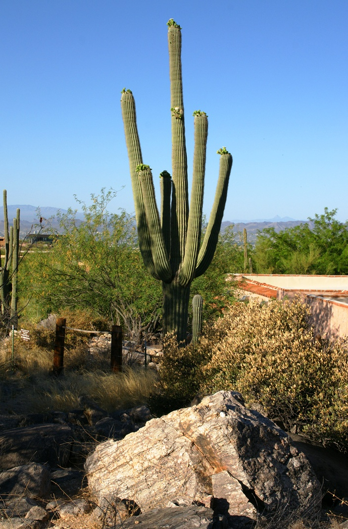
Saguaro flowers start as buds on the tip of the cactus body or arm. The specimen in the photograph below, growing in the yard of a foothills home on the border of federal land, is over 30 feet tall and, at the end of April 2011, buds are sprouting from every tip. Look closely for opening buds and full saguaro blossoms.
Flower buds grow only from some tips and around the center, along the sides, not from the point at the very end of the tip, from which the limb grows.
These buds first appeared mid-April and are here shown in the latter stages of maturity, prior to opening. Sometimes, the base of an arm weakens and the arm lowers close to the ground while remaining healthy. While descending the canyon I noticed this had happened to the arm of a particularly large specimen, an arm in full flower. This and the following photographs are from that arm.
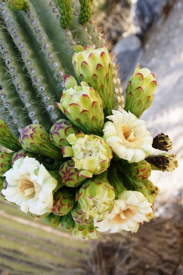
I have read that each flower opens in the cool of the night and lasts only until the following afternoon. Here is a fully blossomed flower with a pair of opening buds.
And more, from a different view of the same arm.
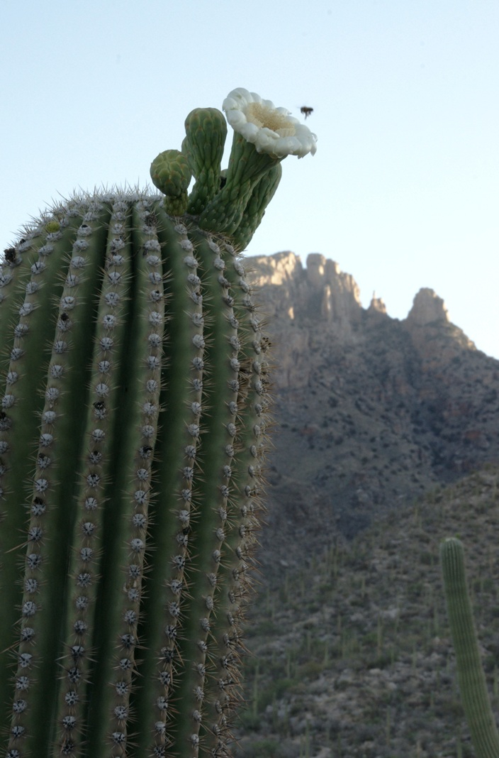
A saguaro flower in full bloom, having opened the previous night. This flower will last a single day. It will wilt in the heat of a single afternoon and close. In this brief time, flying animals will pollinate it. You can see numerous honey bees on the flowers, in a previous blog, “Saguaro Flowers in Finger Rock Canyon.”
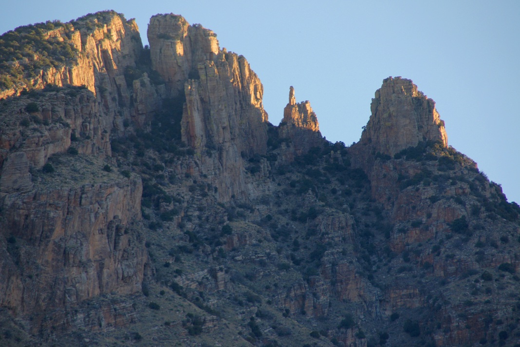
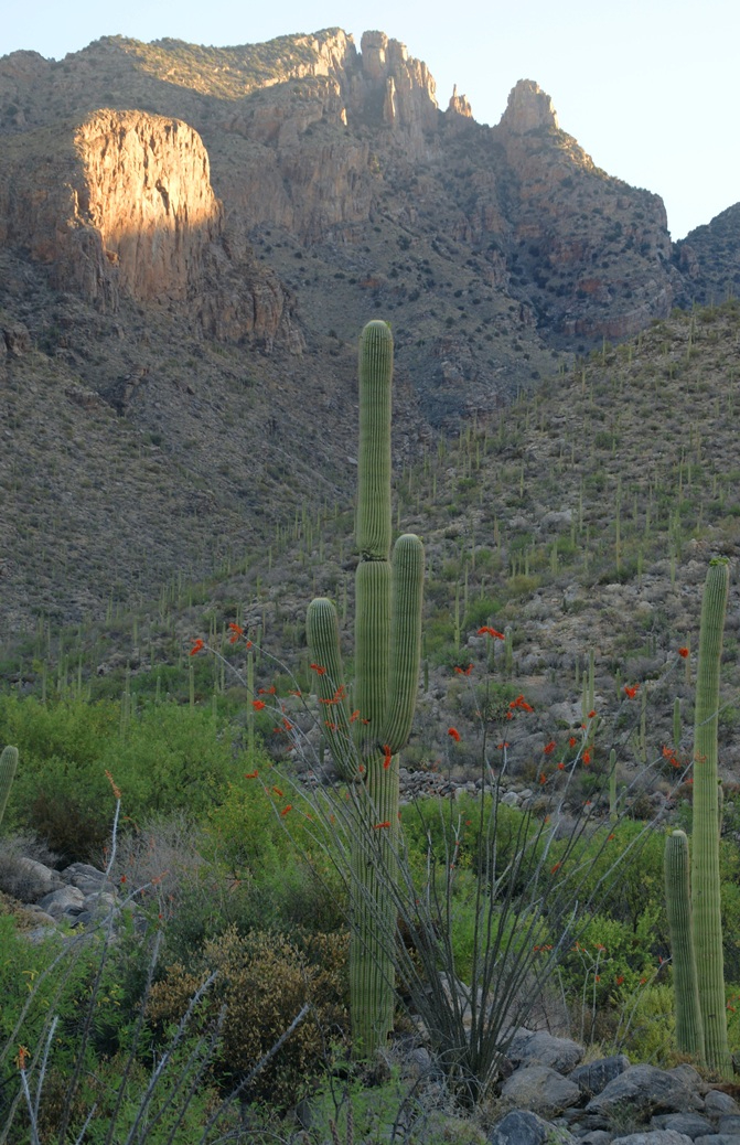
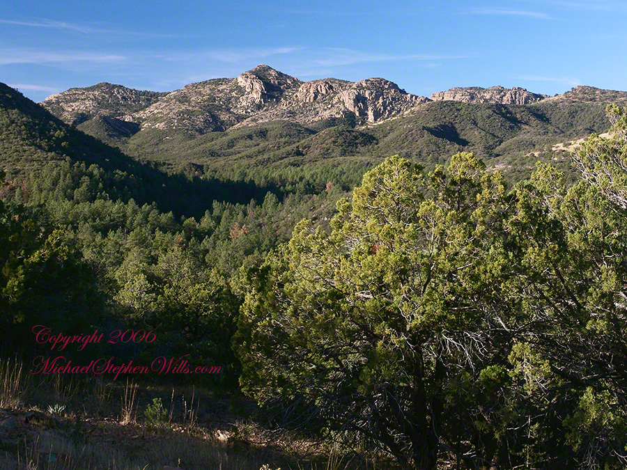
The perfection of April in Tucson is nowhere better than mornings spent in Finger Rock Canyon of the Catalina Mountains. Oriented on a north/south axis, the eastern cliffs shed a long shadow well past 9:30 am. For early risers such as me, this means no hat and cool hiking to the canyon head: the trail hugs the eastern cliffs.
These three shots were taken 5:30 – 6:00 am mountain time (Arizona does not follow daylight savings time except on the Navajo Reservation).
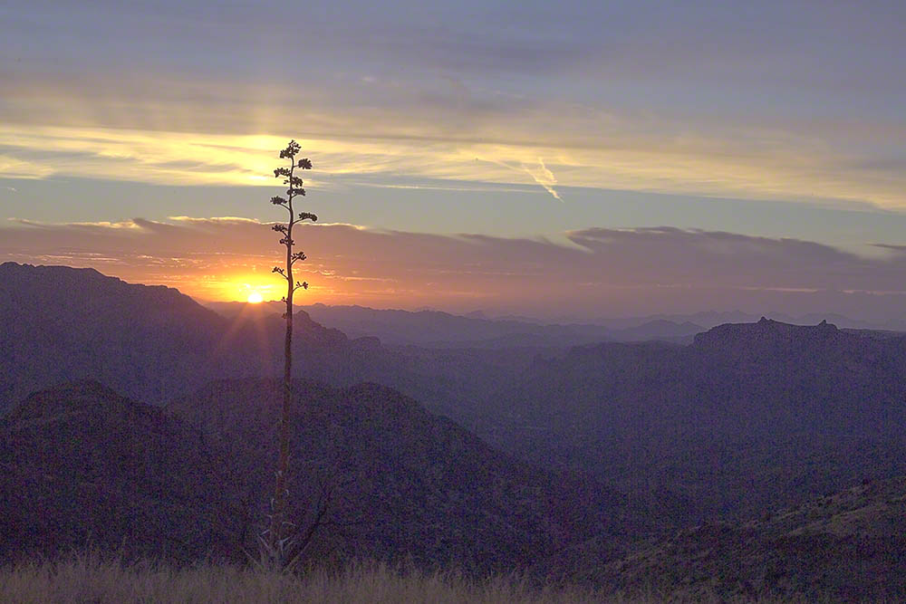
I first learned about Circlestone from stories The Searcher told during my first backpack into the eastern Superstition Mountains, on the Tule trail, April 2005. I described this in “Riding from Pine Creek to the Reavis Valley” where the Searcher described a stone circle, overgrown with Alligator Juniper, on the slopes of Mound Mountain. He pointed south toward a peak and foothills that rose from the valley floor and said, “follow the fire trail east from the southern Reavis Ranch valley.” There were strange happenings associated with Circlestone (as he called it) and he’d never taken the time to go there. “There is a book full of stories.” I eventually sought out Circlestone on the web and in books, but after I found it on my own using only the Searcher’s directions and advice from friends met on the way.
Sunset from Castle Dome
Backpacking with my sister
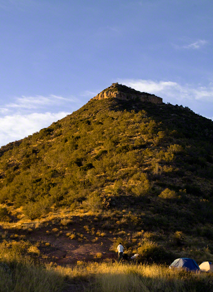
In 2006 I explored Circlestone twice along with my sister, Diane, who accompanied me. First for nine days early March 2006 using the Reavis Ranch trail from the north and the second for five days in November 2006, coming us the same trail from the south. Our first trip was Diane’s first “real” backpack adventure and we took it slow with a camp at Castle Dome where there are flat areas and exceptional views. Above, is the sunset from our second night (I camped the first night next to the car…we took it very, very sloooowwww).
Four Peaks Sunrise
Castle Dome
Then, there was morning of our third day. Here is the Four Peaks Wilderness in the first rays of dawn. These are green, rolling foothills of grass, low shrubs and a few juniper. If you know where to look, there’s an unmarked trail to Reavis Falls (the highest waterfall in Arizona). I found the trail and visited the falls on a later trip.
Castle Dome Sunrise
After enjoying the Four Peaks, you turn around and see Castle Dome in the morning light, as in this photograph. Remember the same of the “dome”, because it is visible from the ultimate view from Circlestone.
Reavis Valley and White Mountain from the trail to Circlestone
The Trail to Circlestone
Our camp was in the Reavis Valley, one of the first sites along the creek coming from the north. There were fantastic rock formations across the creek. Not far from there, the land falls away into steepness and then Reavis Falls. The Searcher told me about going that way, once. There is no trail down to the falls overlook and deep canyon carved by the water.
This photograph, above, is from a lovely forest of pinyon trees that grow along the trail to Circlestone (described by the Searcher as rising from the southern Reavis Valley). You can see the valley, just to the right, and a longer and steeper valley that rises from it up to White Mountain. That way is the southern legs of Reavis Trail. I have a movie clip from this same spot of the pinyons moving in the breeze and may post it at a later time.
All of the trail to Circlestone is a climb. You pass over “Whiskey Spring”, named for a still kept there in the 1800’s and over a steep defile gouged from the rock. The trail is well marked and I am told that, sometimes, there is no cairn marking the trail to Circlestone. If you are desperate to get there, look-up some excellent hiking directions available on the web. I have even found the circle on GoogleEarth, since I know where to look. If you like a challenge and the adventure, go from the directions the Searcher gave me.
Four Peaks from Circlestone
From the fire line trail, the unmarked branch to Circlestone climbs steeply and follows a ridge through Alligator juniper, punctuated by stalks of century plant, to a broad way that rises to Circlestone as though to a monument overgrown by the same juniper.
My Circlestone Mystery
There was an unusual experience on our first trip, on this portion of the trail. We were winding through the Juniper and, as it happened, Diane fell behind. After awhile I missed her and waited and, after a minute, went back to look for her. I found Diane sobbing uncontrollably, deep in grief over our father who passed away eleven years before. We talked about it until she felt better. She said it was as though a door opened and she could feel out father. What makes this exceptional is Diane is not given to anything like this and I ascribe her deep grief to the nature of the site. It is a mystery to this day.
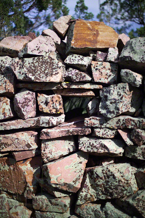
At Circlestone, that first trip, we explored and experienced the site. You cannot see the entire wall at any point and need to wander through and over it, being careful not to disturb anything. Here and there, in the outer wall, are openings like the one in this photograph.
Site-Hole in the Circlestone Wall
At Circlestone
I call it a site hole because, on your knees, it is possible to look through and see the distant view through the trees. As you can see, the stones are a striking red color with green lichen growing thick.
On the second trip in November, knowing the way and having great weather, I brought my cameras to capture the exceptional views, one of which is above. I’d dearly love to come back to camp just below the ruin and do some work in the evening and morning light. For now, I can enjoy those views from Castle Dome.
Three Horsemen and Castle Dome
Can you see the dome in the middle distance. I did a portrait of three horsemen who road up to Circlestone in November. We came to know them pretty well, that afternoon and the following morning down in the valley.
Three Horsemen
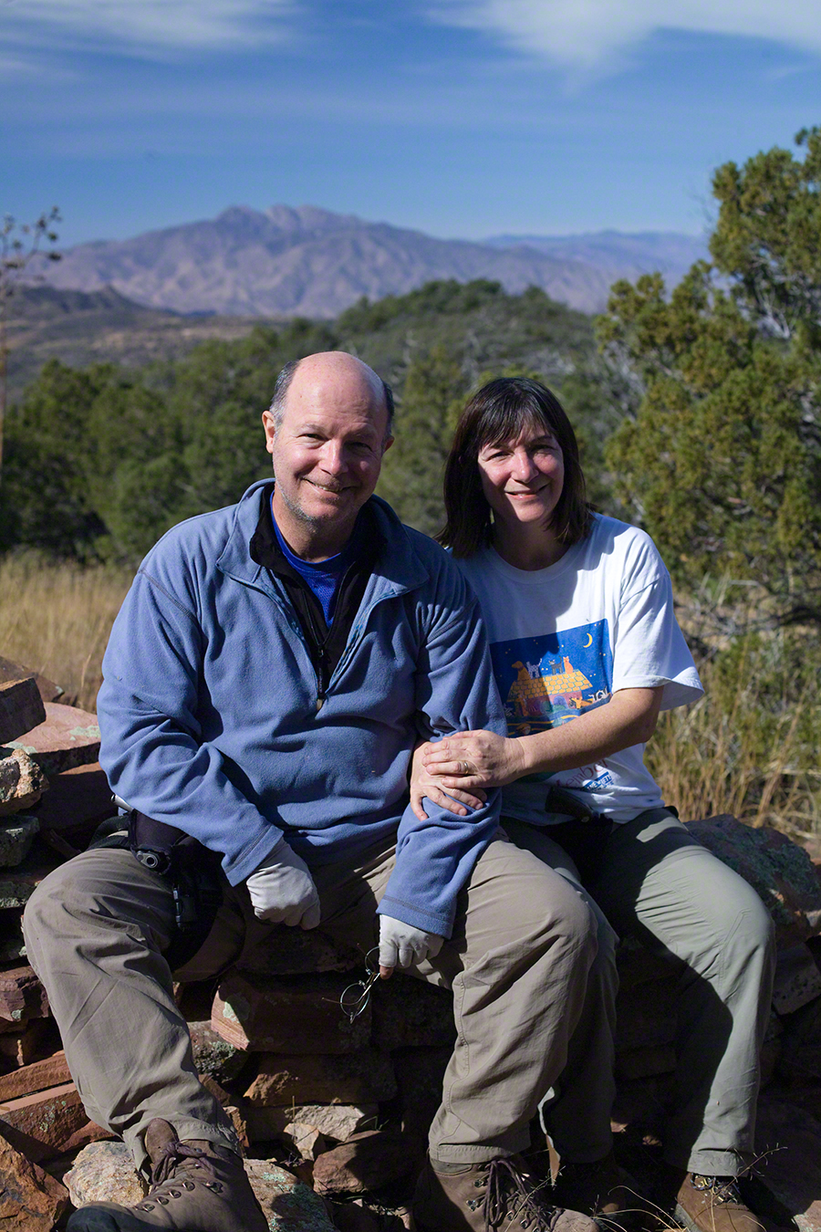
I carted up a tripod, so you can see Diane and I in the same spot.
Mike and Diane at Circlestone
Copyright 2023 Michael Stephen Wills, All Rights Reserved
Thank You for exploring with me the South Rim trail of Taughannock Falls State Park on this first day of Spring 2023.
Photographs with video from this walk, with nature sounds and music in 4K HD
Click photograph for a larger view. To do this from WordPress Reader, you need to first click the title of this post to open a new page.
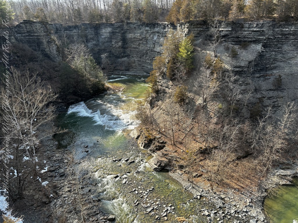
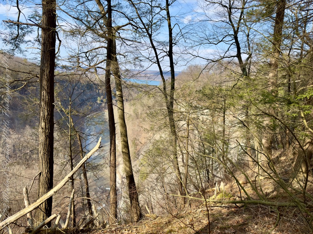
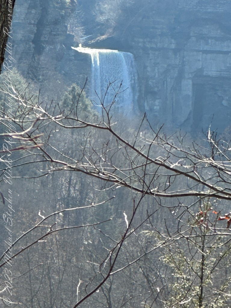
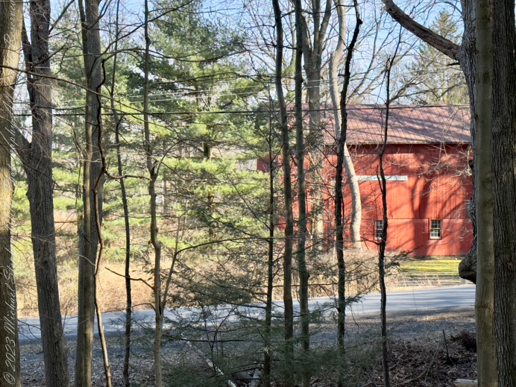
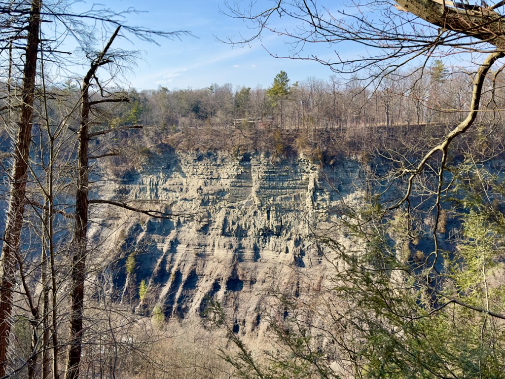
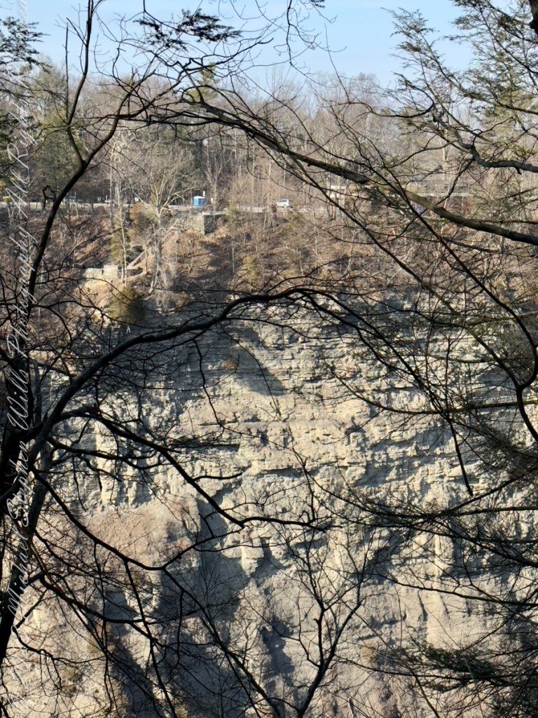
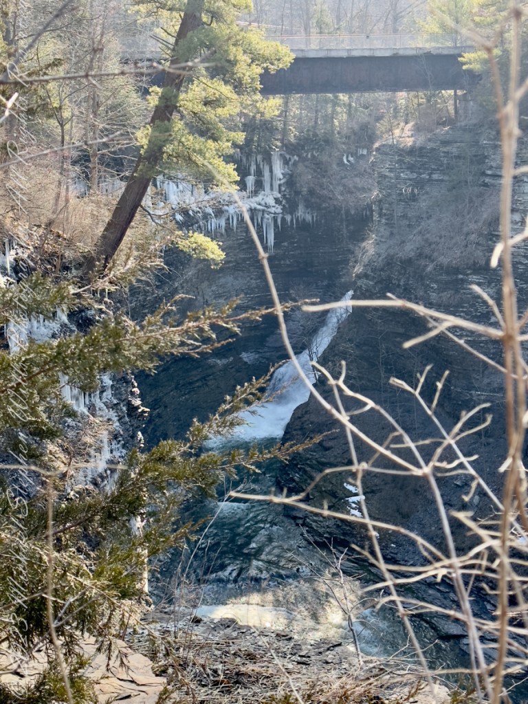
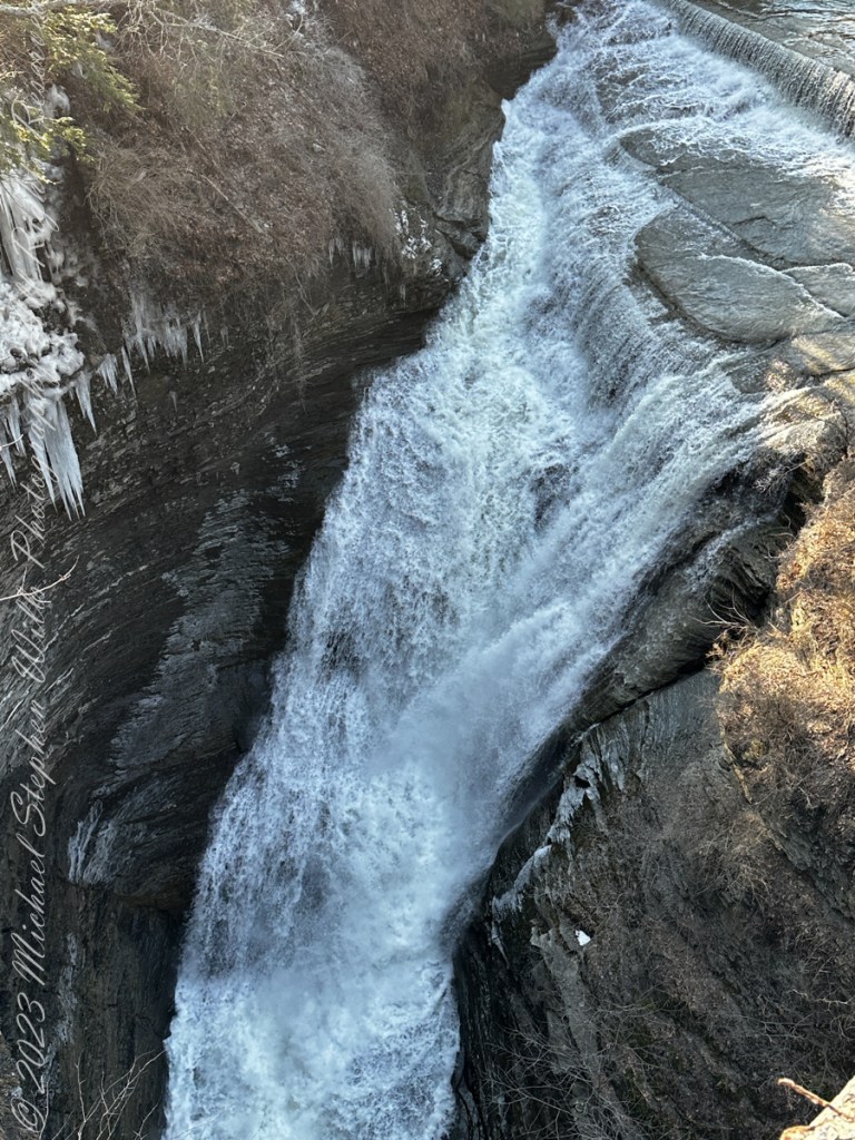
Here, before the epynmous creek flows over the falls, glacial outflow carved this deep canyon through relatively soft sedimentary rock. Distant Lake ViewThe place for rest and wonderLooking into the gorgeSouth Rim view of fallsTaughannock creek below the fallsRed Barn on Gorge Road, off South Rim rial.Perched on the north rim of the gorge, the Visitor Center for the Falls Overlook is visible before trees leaf out.On spring’s first day Taughannock Creek is full beneath the old railroad bridge, now a connector between South and North Rim Trails.The creek here plunges into the chasm below a former railroad bridge. Gorge from Railroad Bridge Walkway
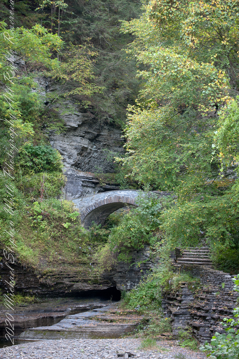
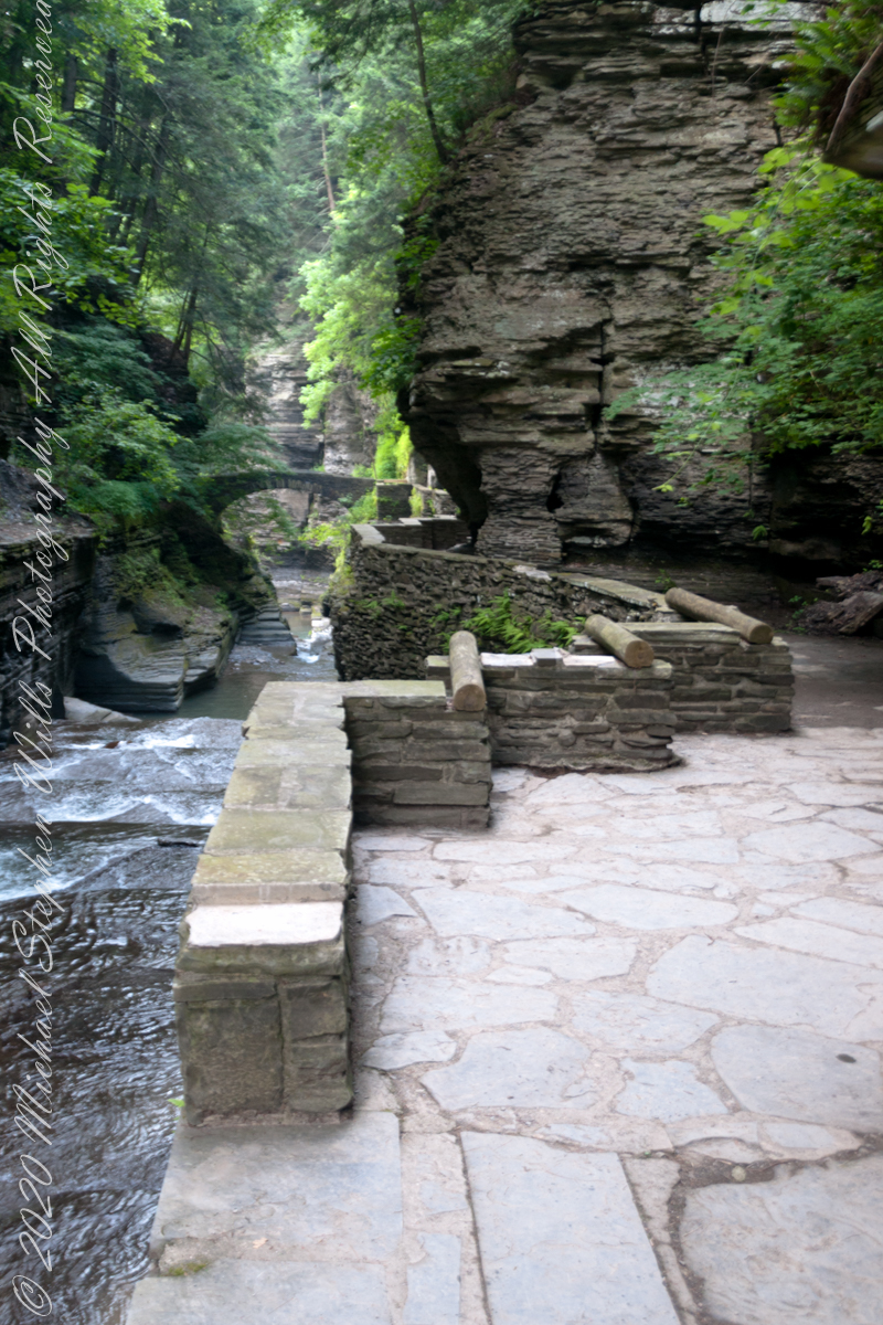
Looking back after crossing the Gallery Footbridge we are rewarded with this view, providing a better understanding of the site. It is evening on a mid-September evening, Robert H. Treman Park, Ithaca, Tompkins County, New York Copyright 2023 All Rights Reserved Michael Stephen Wills
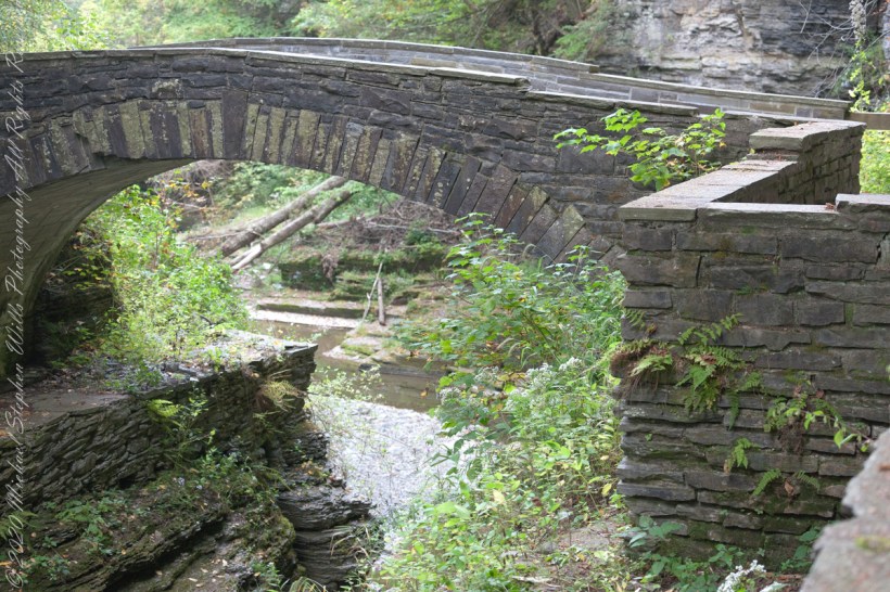
Here we are on the Gorge Trail of Treman State Park. My readers have seen this marvelous stone bridge from a distance. Here it is on the west side, facing east/northeast and looking down into the gorge. It is evening on a mid-September evening, Robert H. Treman Park, Ithaca, Tompkins County, New York Copyright 2023 […]
Here we are on the Gorge Trail of Treman State Park. My readers have seen this marvelous stone bridge from a distance. Here it is on the west side, facing east/northeast and looking down into the gorge.
Spanning the eastern side of the gallery entrance of the gorge.
It is evening on a mid-September evening, Robert H. Treman Park, Ithaca, Tompkins County, New York
Copyright 2023 All Rights Reserved Michael Stephen Wills
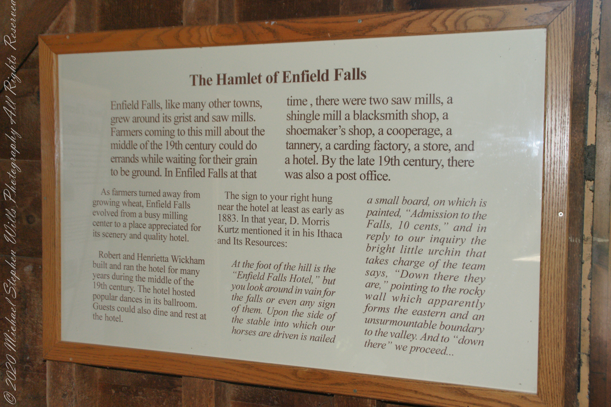
“Enfield Falls, like many other towns, grew around its grist and sawmills. Farmers coming to this mill about the middle of the 19th century could do errands while waiting for their grain to be ground. In Enfield Falls at that time, there were two sawmills, a shingle mill, cooperage, tannery, carding factory, store and hotel. By the late 19th century there was also a post office.”
“As farmers turned asway from growing wheat, Enfield Falls evolved from a busy milling center to a place appreciated for scenery and a quality hotel. Robert and Henrietta Wickham build and ran the hotel for many years during the middle of the 19th century. The hotel hosted popular dances in its ballroom. Guests could also dine and rest at the hotel.”
This placard from the Mill Museum at Treman Park is the source of much of today’s information. I used italics and quotes to attribute this source.
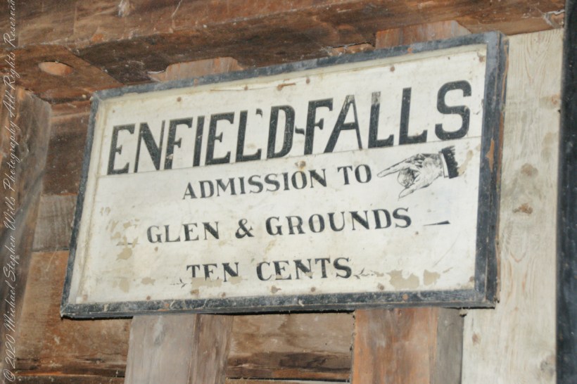
The sign in the heading of this post “hung near the hotel at least as early as 1883. In that year, D. Morris Kurtz mentioned it in his “Ithaca and Its Resources”: “At the foot of the hill is the Enfield Falls Hotel, but you look around in vain for the falls or even any sign of them. Upon the side of the stable into which our horses are driven is nailed a small board, on which is painted ‘Admission to the Falls, 10 cents.’ In reply to our inquiry the bright little urchin that takes charge of the team says, ‘Down there they are,’ pointing to the rocky wall which apparently forms the eastern and an unsurmountable boundary to the valley. And to ‘down there’ we proceed……“
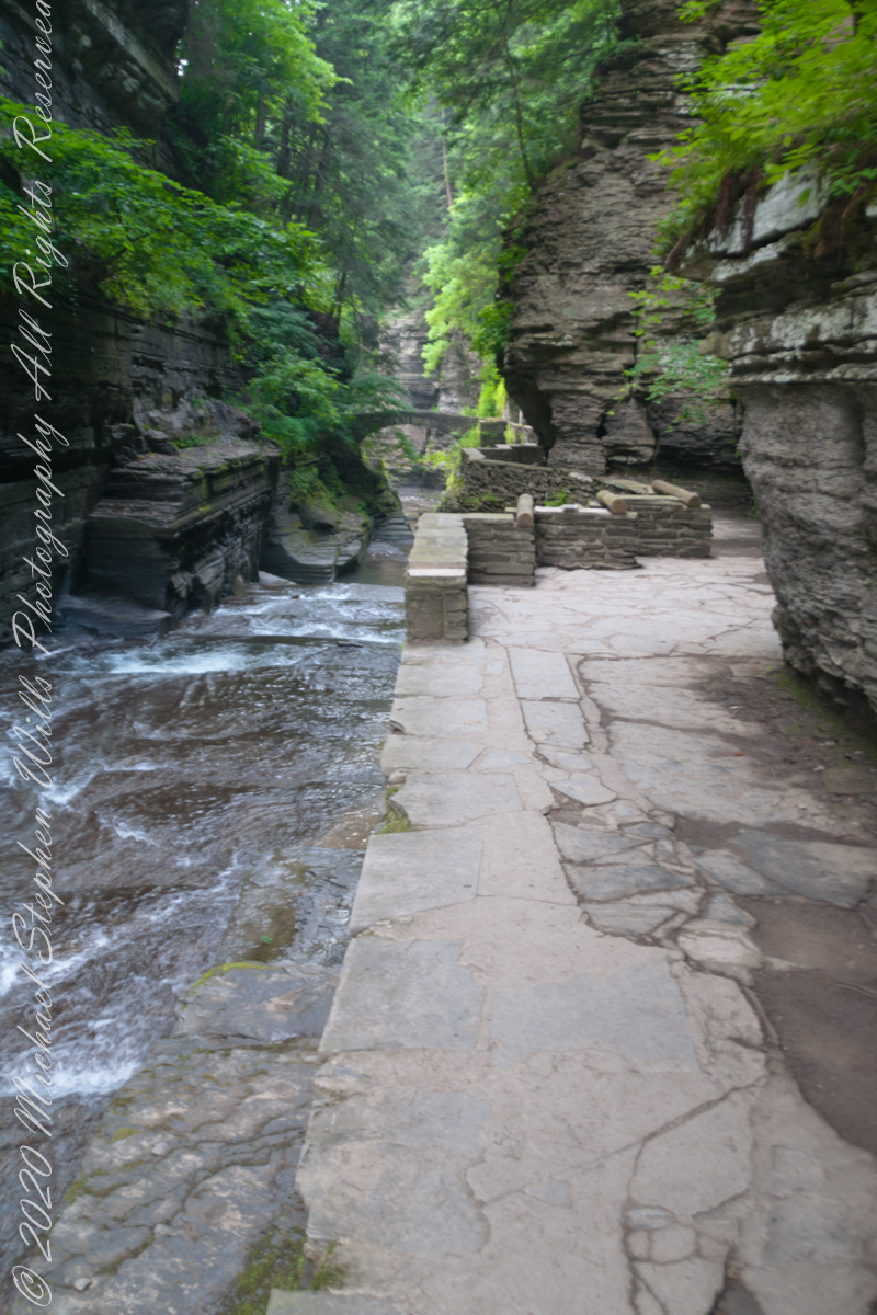
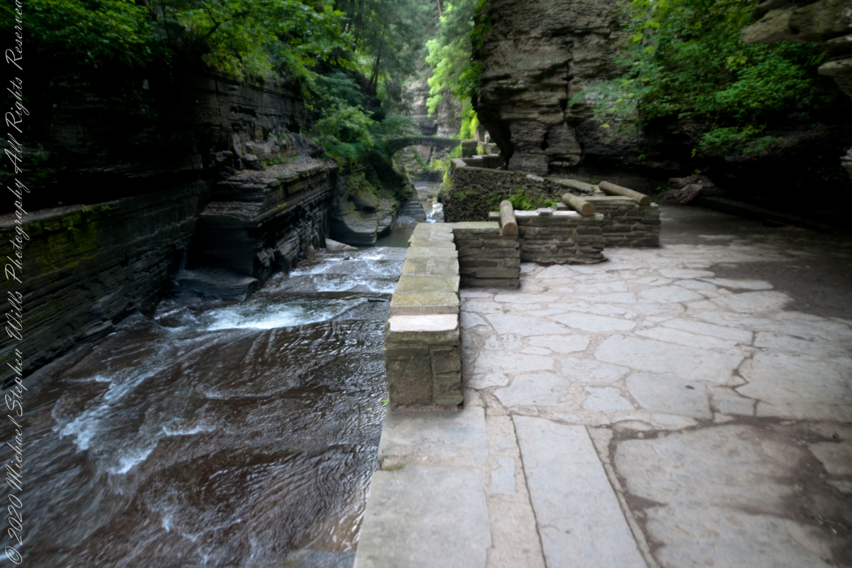
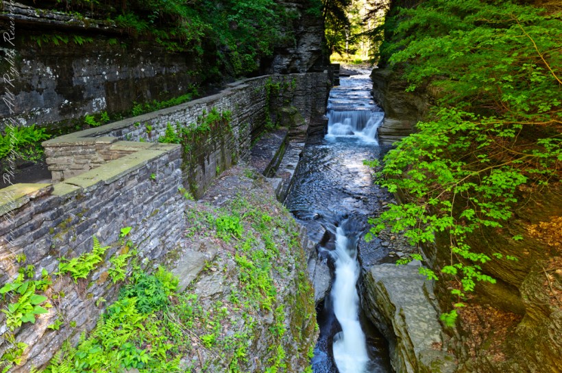
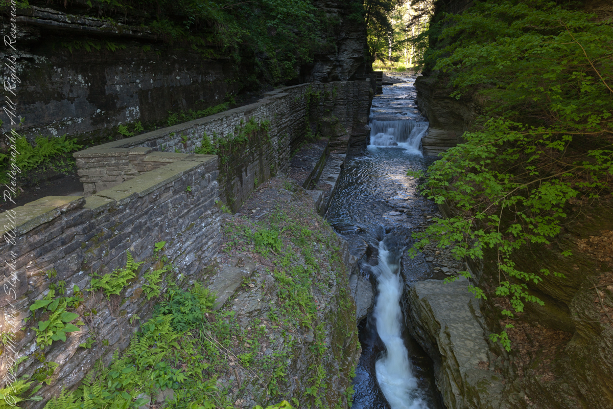
Treman Gorge Trail from the Old Mill enters a narrow gallery looking here southeast along Enfield Creek, passing over a stone footbridge. This was the control point in the 19th century for collecting the ten cent admission fee. Here are some photographs of the entrance as it exists today. The retaining wall, footpath and stone bridge were constructed in the 1930’s by the Civilian Conservation Corps. The site was far rougher for those earlier visitors.
The Gorge Trail next to Enfield Creek on a midsummer morning. Robert H. Treman State Park, Ithaca, Tompkins County, New YorkThis walkway, retaining wall, path, stone bridge were built by the Civilian Conservation Corps, “Roosevelt’s Tree Army,” during the Great Depression in the 1930’s. The north side is sedimentary rock worn through over the ages by what we call Enfield Creek today.
Photograph captured on a midsummer morning. Robert H. Treman State Park, Ithaca, Tompkins County, New York
Copyright 2023 All Rights Reserved Michael Stephen Wills
Can you see the small difference between yesterday and today’s take on Devil’s Kitchen? Is the change and improvement, degradation or no difference? User Response Requested: respond in comments.
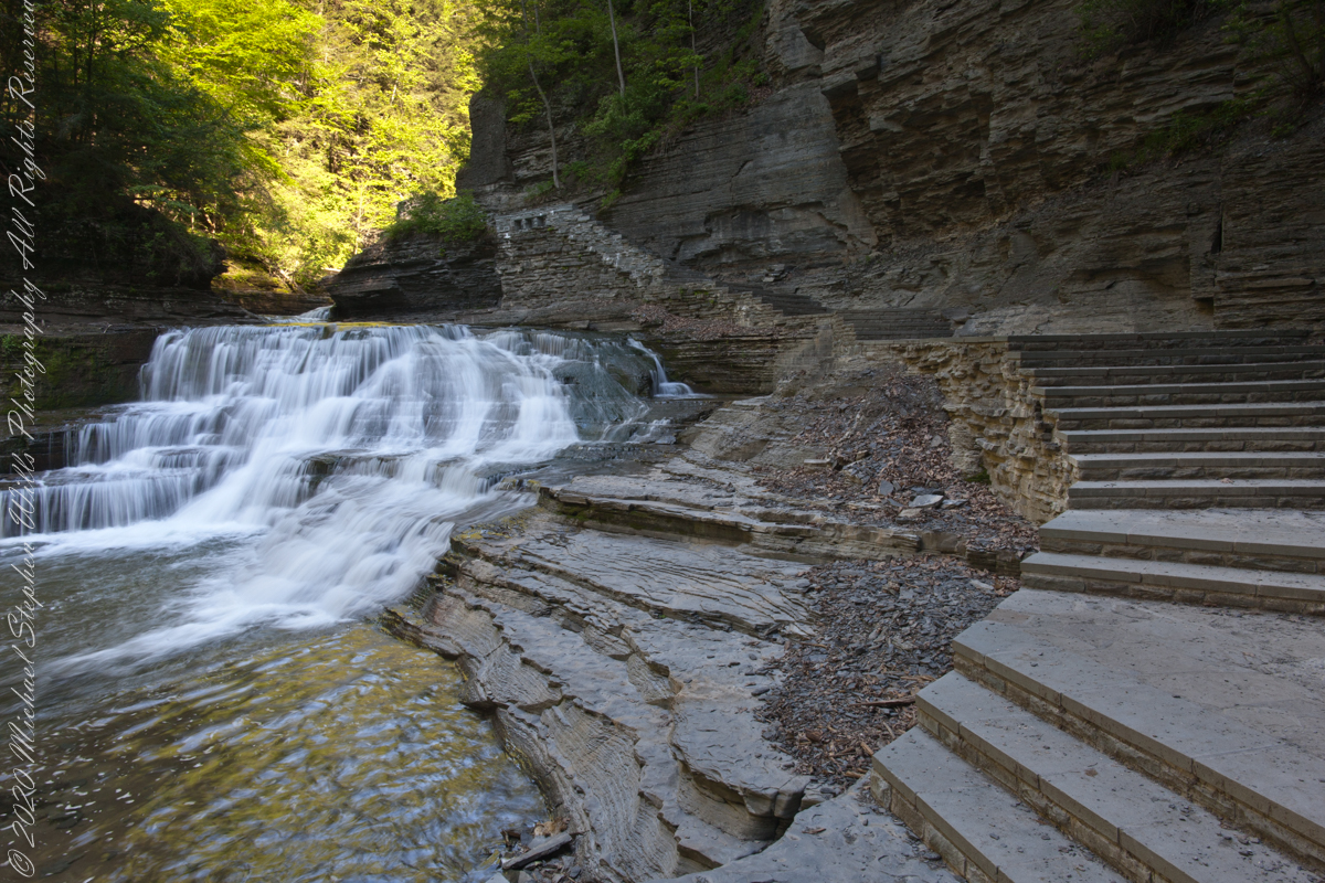
Aptly named Devil’s Kitchen is where Enfield Creek passes over these 20 foot falls before the Lucifer Falls 115 foot rock face cascade. Captured on a Memorial Day morning. Robert H. Treman State Park, Ithaca, Tompkins County, New York.
Here they are side by side.
YesterdayToday
It is 9:00am on a Memorial Daty morning Robert H. Treman Park, Ithaca, Tompkins County, Ithaca, New York,
Copyright 2023 All Rights Reserved Michael Stephen Wills
Aptly named Devil’s Kitchen is where Enfield Creek passes over these 20 foot falls before the Lucifer Falls 115 foot rock face cascade. We are occasionally appalled by families and adventure seekers climbing over these falls, wading in the water downstream and other insanities happening next to a waterfall so dangerous it is named after the Prince of Darkness and this very location “his” kitchen.
I am not one to talk, though. One winter on this very spot when the Gorge Trail was closed for winter, black ice brought me down almost into the water. All for a winter scene (photograph) of this marvel. Thankfully, I am wiser for the experience.
It is 9:00 am on a Memorial Daty morning Robert H. Treman Park, Ithaca, Tompkins County, Ithaca, New York,
Copyright 2023 All Rights Reserved Michael Stephen Wills
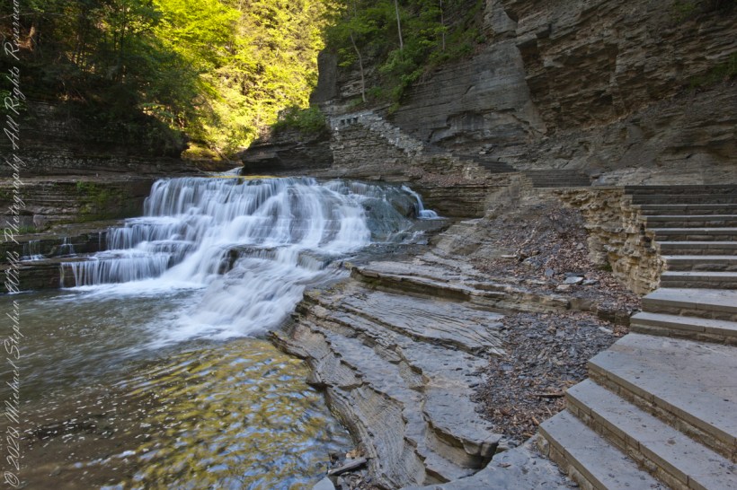
View shared by generations of newlyweds standing on a stone bridge across Enfield Creek. This is another version, taken a few years later and earlier in the season, Memorial Day morning.
Here is an image having me rethinking my conclusions. Here, I combined two images and worked hours to make many adjustments. The resulting Tiff is four times the filesize of the Raw file from yesterday.
Here they are side by side. In this case IMHO the extra disk space and time are worth it.
It is 8:30 am on a Memorial Daty morning Robert H. Treman Park, Ithaca, Tompkins County, Ithaca, New York,
P.S. I mistakenly published this post with a repetition of III in the title. Today, I changed it to “IV.”
Copyright 2023 All Rights Reserved Michael Stephen Wills