Glacial Echoes: Dryden Lake Park’s Mirror-Calm Morning in Upstate New York

Morning clouds hang over Dryden Lake as hills kindle first color; reflections hold breath while a lone walker reads the valley’s glacial and human-written past.

He came to the water before the people woke, the road a still ribbon of cold tar snaking beneath the low hills. Mattocks of cloud hung over the valley and the lake took in the sky like a mirror dropped yet not broken. The trees were beginning to color. A patient fire working from within the leaves. He parked where the grass ran down to the shore and stood a long while without moving. Birds made small sounds in the reeds. Somewhere a single truck labored up the grade and was gone. The surface held the hills with a steadiness the hills themselves could not keep. He thought how the quiet of a place can be the loudest thing it owns.

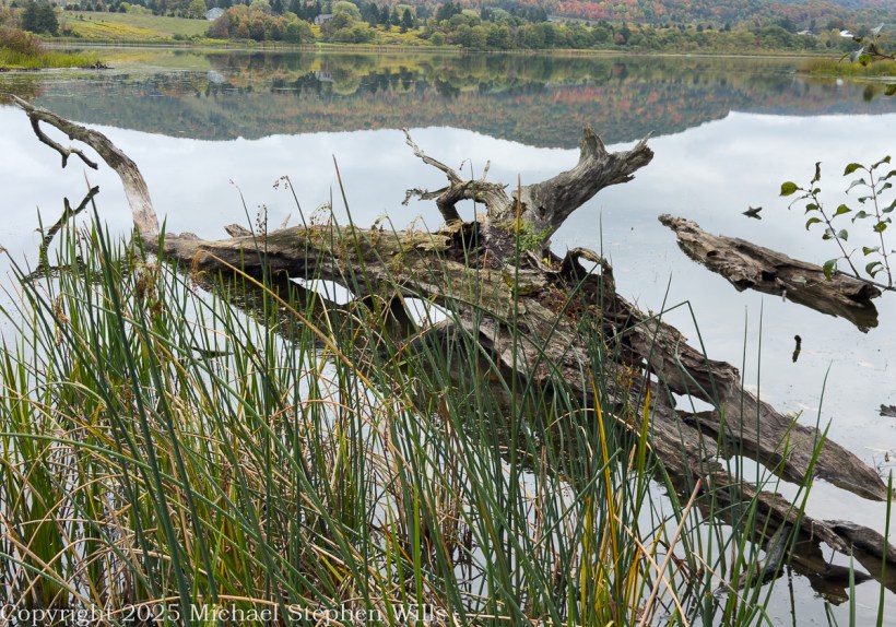
He went along the margin along the damp sedges where old drift lay silvered and light as bones. A drowned trunk angled from the shallows. The lake was old in the way of things made by ice and time. A kettle in the outwash of the last glacier, some men said, a bowl left when the buried ice eased away. He pictured the ice receding into the valley heads, the meltwaters choked with gravel, a hand larger than memory scribing the floor of this country. The earth never told it plain but the lay of it was witness enough. Across later centuries men cribbed a dam across the outlet and drew the water to a shape that pleased them and served their work.

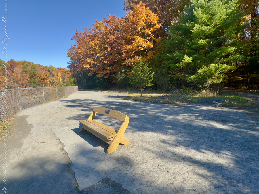
A trail ran the length of the water on the old rail bed. The ties were long gone and the iron and cinders buried under years of leaf fall and gravel. He had walked it as a boy beside his father and now he walked it alone. Benches stood at half-mile intervals like waystations in a country of small pilgrimages. The signs told what once was here and what remains. They had renamed the path for a townman who argued it into being after the railroad had passed from the world and the right-of-way grew up with sumac and rumor. It was an easy trail and he carried nothing. His hands hung at his sides as if the day might place something in them when it was ready.
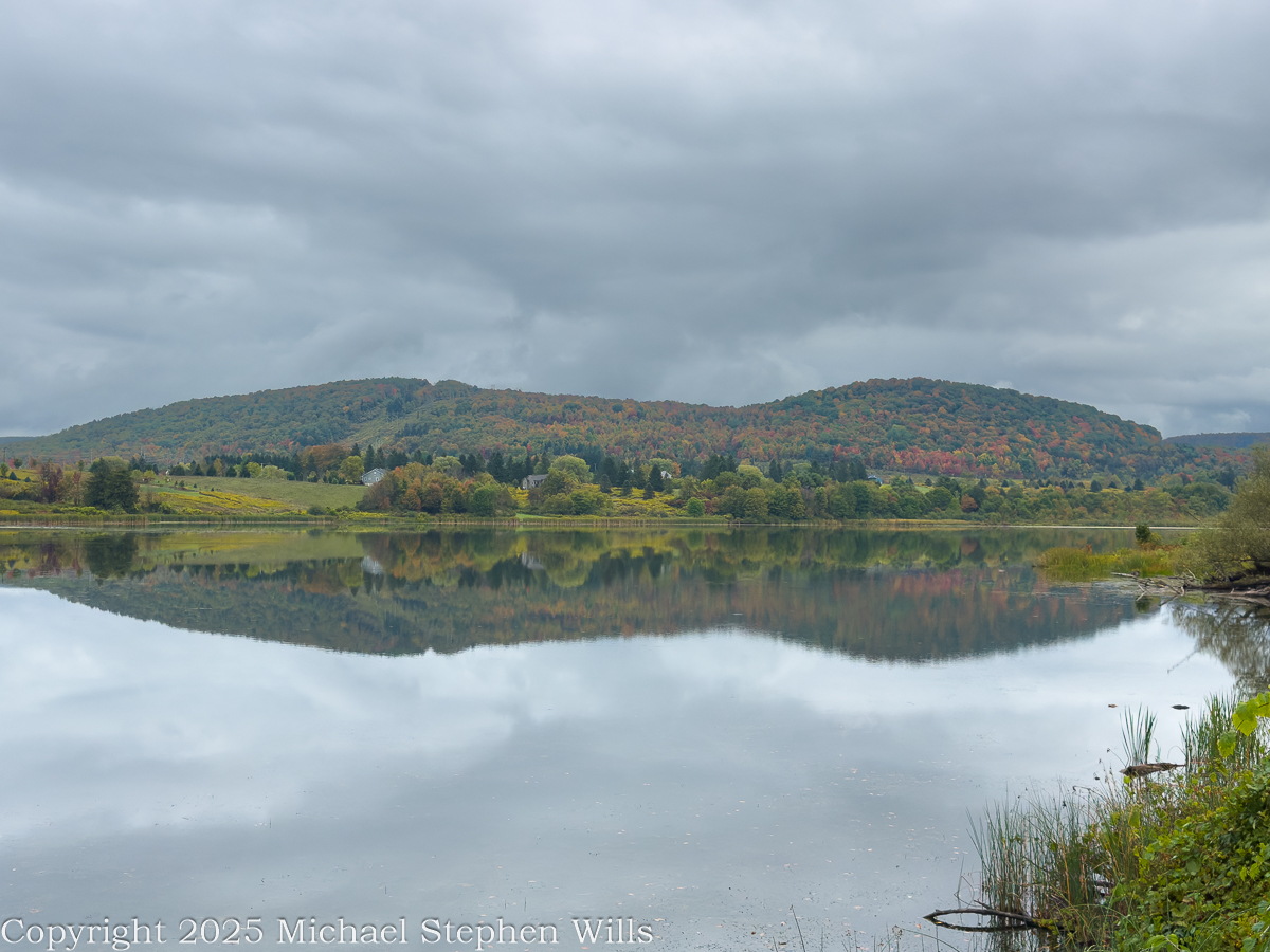
In another era the lake was a workshop. Men whipsawed timber in the wet air and fed small mills with the grove’s dark boards. Winter flowed over the flats, and they built icehouses and set the blocks within like blue stone, an industry that died when cold could be called from a switch. The hills have learned to forget the noise of it, though on certain mornings the fog takes a shape and you could believe rising from the ponded sawdust and the lading of sleds. He thought of the labor of those gone hands and of how work is a scripture every place keeps in its own tongue.

Before any of that, the ground here was a summer camp. People came with the season and went with it, laying their fires in the lee of the knoll and taking fish where the cattails thin. He could feel them in the open places, not as ghosts but as the first understanding the land ever had of itself. The words used for them now are museum words, yet the wind still crosses the water as it did and empties the same smell of iron and leaf into the lungs of whoever stands to breathe.

The town took its name from a poet long dead, a scholar’s choosing in the years after the war for independence when this tract of country was parceled out to soldiers of that same war. Virgil lay to the east as if they were shelving Latin across a map. The creek that bears that name threads the villages and finds Fall Creek at Freeville, and the combined waters go their own slow way toward Cayuga where the glacial hand scooped deeper yet. He said these names under his breath and they tasted of chalk and river stone.
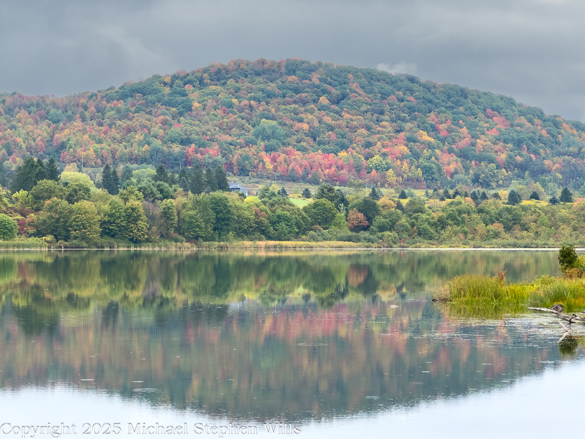
A kingfisher rattled across the cove. The fish rose in rings that spread and vanished like time seen from above. Out on the water an old man pushed a skiff with an electric motor that hummed like a trapped bee, for the lake allows no gas engines now. The wildlife area ran around the shore in a ragged collar of field and wetland and alder, near two hundred acres under the state’s keeping, and the lake itself a little over a hundred. He watched the man aim for the lily line and thought how rules arise from the wish that a thing endure, though nothing does. Still we make the rules and we keep them as if the earth were listening.

Wind came down the slope with a smell of rain. He turned back and the hills lay again in the water, entire, and for a moment he could not tell which world had claim to the other. He thought of the rails pulled up and the mills gone to weeds and of the icehouses fallen into their own shadows and he thought of the people before all that and of the long winter pressing its thumb into the land and lifting it away. He thought of his father walking the rail bed beside him a lifetime ago and saying nothing. There are places where the past crowds close and will not be argued with. He stood until the first drops dimpled the surface and the reflection shattered and reformed. A train no longer runs here. The only sound was the soft percussion of rain on water and the slow turning of the earth beneath both. He put his hand to the damp trunk of a fallen tree and felt the grain and the coolness and the old patient labor of rot. Then he went up from the reeds, his pockets full of acorns, and out to the road where his truck waited and the day, austere and sufficient, came along with him.

References

Geological History and Glacial Formation of the Finger Lakes

Jim Schug Trail

The Dryden Lake area in the 19th century

Indian Campsite on west side of Dryden Lake

Dryden New York (wikipedia)

Dryden Lake (New York State DEC)
Geohydrology, Water Quality, and Simulation of Groundwater Flow in the Stratified-Drift Aquifer System in Virgil Creek and Dryden Lake Valleys, Town of Dryden, Tompkins County, New York

Enter your email to receive notification of future postings. I will not sell or share your email address.

Carved by Time: Exploring the Virgin River and Cross-Bedded Sandstone in Zion’s Narrows

A quiet moment along the Virgin River reveals the artistry of nature—where water, stone, and time shape Zion’s majestic Narrows in subtle, surprising ways.

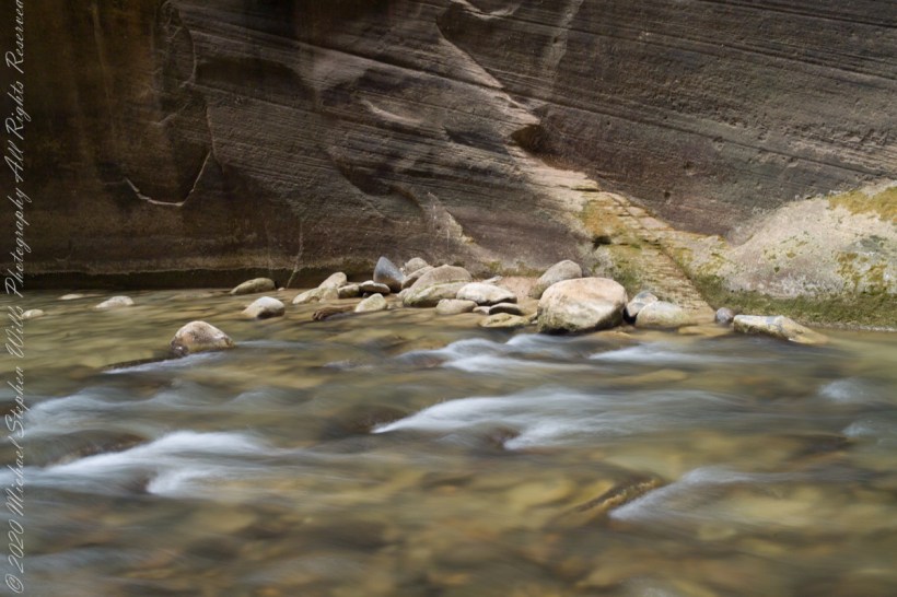
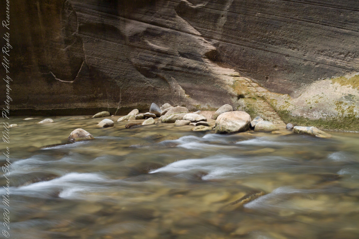
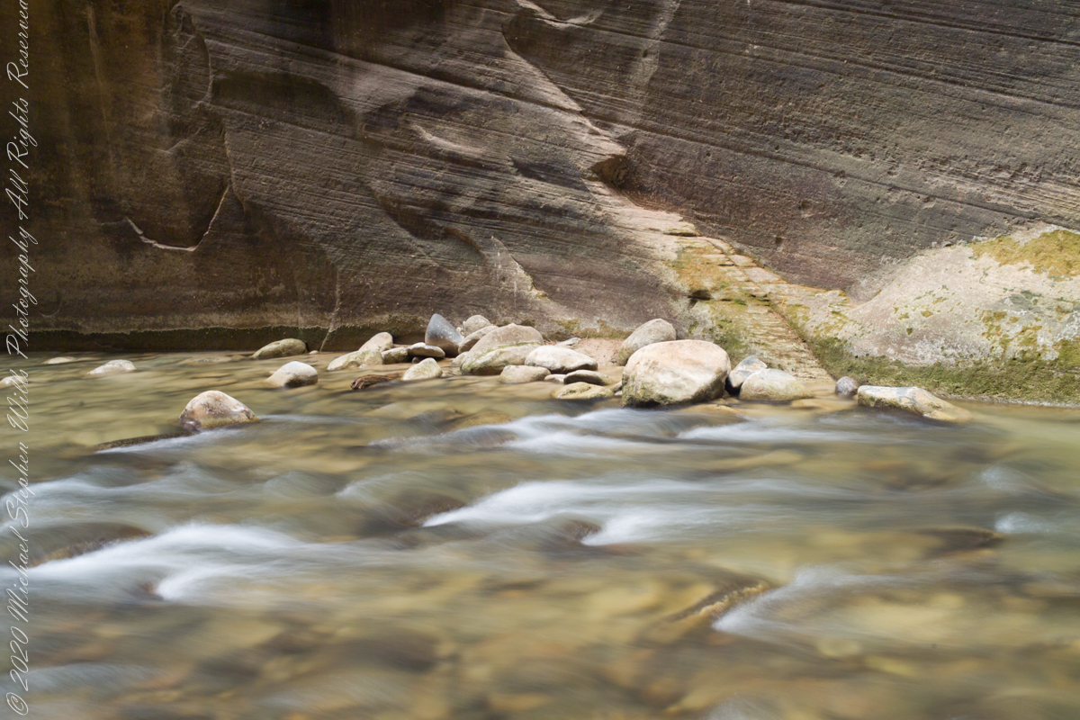
In Zion National Park, where towering sandstone cliffs rise from the desert floor, the Virgin River weaves a persistent and graceful thread through deep canyons carved over millennia. The river is the creative force behind Zion’s signature landscape, sculpting stone with a patient hand. Among its greatest achievements is the Narrows—a sinuous gorge where water and light perform a timeless duet. The two photographs shown here draw us into an intimate corner of that realm, where water flows past a rock face marked by both subtlety and drama.

At first glance, what stands out is the unusual structure on the wall behind the river—a feature that at a distance could easily be mistaken for a man-made stairway. But closer observation reveals this to be a natural element, the result of erosion acting upon cross-bedded Navajo Sandstone. The texture and linearity of these formations are remnants of ancient sand dunes hardened into rock nearly 190 million years ago, during the Jurassic period. What looks like precision carving is, in fact, the legacy of sedimentation, lithification, and the scouring action of water over time.

In the first photograph, the scene is bathed in soft, diffused light, lending a quiet tone to the flowing water and the weathered rock face. The surface of the Virgin River becomes a silky sheet, its motion captured with long exposure so that it seems to glide effortlessly past the cluster of smooth stones in the foreground. Here is a deep calm—the kind that can be heard in the hush of water over stone and felt in the breathless silence of a canyon morning.

Click each photo for a larger view

The second photograph, taken under brighter conditions, reveals the same scene with different character. The increase in light clarifies the water’s transparency, the greens of moss and lichen on the wall, and the golden tones of the sandstone. What you see is a pattern formed by layers of wind-blown sand, once part of vast dunes, now standing as a stone ledger of time. The river, its bed visible beneath the shallow flow, seems to read this text as it passes—century by century, pebble by pebble.

The Virgin River begins high in Southwestern Utah, at the Navajo Reservoir in the Dixie National Forest north of Zion National Park and travels over 160 miles to join the Colorado River, carving through layers of sedimentary rock as it descends. In the Narrows, the canyon walls rise up to a thousand feet while the corridor narrows to just 20–30 feet across in places. The intimacy of the Narrows contrasts with the vast openness elsewhere in Zion, enclosing the traveler in a world of water and stone, shadow and echo.

Walking the Narrows means walking in the river itself—an experience that engages body and spirit alike. The water is rarely still, and neither is the trail. Slippery rocks and ever-shifting current demand attention and balance. Yet, this very immersion invites a deeper kind of awareness. You are observing nature from within it, shaped by nature, and held by nature.

What the photos capture so eloquently is that Zion is a place where the work of nature can appear deliberate, even architectural. The illusion of stairways in the sandstone, carved not by hands but by wind, gravity, and time, is a reminder of how little separates the human sense of design from the forms nature produces. We recognize rhythm and repetition, elevation and flow, and are drawn to interpret meaning from these patterns.

But perhaps the meaning lies not in what we impose, but in what we receive. The Virgin River’s passage through this sculpted corridor teaches patience, resilience, and the beauty of gradual transformation. Its waters do not fight the rock; they yield, swirl, and persist—until the rock, by degrees, gives way. What results is a landscape both eternal and ever-changing.

Zion’s grandeur is easy to admire its many amazing overlooks, but its soul is found in quiet places like this—where sandstone walls, smoothed by water and time, speak not in shouts but in whispers. Here, beside a seeming stairway that leads nowhere and everywhere, we come face to face with the artistry of the Earth.

Enter your email to receive notification of future postings. I will not sell or share your email address.

Exploring Sipapu Bridge: A Scenic Descent

Experience the thrill of descending into Utah’s White Canyon—slickrock trails, driftwood ladders, and stunning views await at Sipapu Bridge in Natural Bridges Monument.

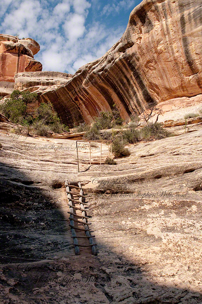
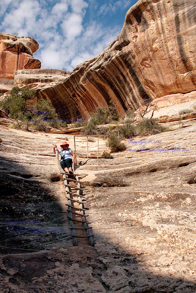
The final descent into White Canyon to view Sipapu Bridge, Natural Bridges National Monument near Blanding, Utah

Final Step

Here is a photograph of the final stage of our descent into White Canyon. Here the trail traverseed a type of sandstone called “Slickrock.” For Pam and I the surface was like sandpaper and, for the right type of shoes, provides great traction.

That day I wore Lowe hiking boots with a harder sole and these could slip at times. I’d recommend a different shoe for the trail, but my boots come over the ankle and provide great support. Plus, the canyon bottom is sandy, so high boots prevent sand from falling into the shoe. A perfect choice for this trip is a high boot that provides support, with a softer sole on a hard and light shank (to protect you against sharp rocks).

What is Slickrock?

Slickrock was named by the first settlers and explorers who discovered their iron shod horses lost footing on the steep slopes of this sandstone.

This was another feature of Pam and my descent into White Canyon. The sandstone weathers in a way that produces steep slopes over which the trail must pass and the traveler navigate. I chose this image as a Fine Art print (part of a series featuring Natural Bridges National Monument) because this part of the trial is strange and beautiful.
The hard rock cliffs are resistant to wear and, in this climate, weather to provide rounded surfaces. The cliff face is scalloped and marked with desert varnish striations that “pop out” from the red rock. Then, there is the clear light and bright morning sky on a summer morning that promised thunderstorms.

Gratitude

Then, there are the personal memories of that iron railing drilled into the rock and that marvelous looking ladder created from driftwood found in the canyon.  That ladder is a work of art!!  The photograph does not reproduce the feeling Pam and I had at that point of the descent.  I needed to climb down the ladder backwards (facing out) and holding on .

We were both grateful to reach the sandy stream bed in White Canyon.

Enter your email to receive notification of future postings. I will not sell or share your email address.

On The Edge of Time Above Taughannock Gorge

Perched above Taughannock Gorge, a moss-covered ledge and cascading falls reveal ancient stories—where Devonian seas once flowed and time’s layers whisper through stone and water.

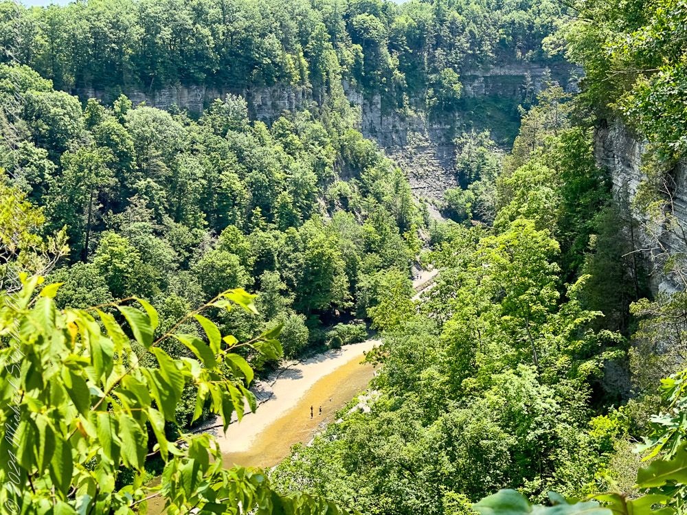
The morning sun had only just breached the rim of the gorge, sending long slants of golden light across the forest floor. Walking the South Rim Trail of Taughannock Falls State Park, I came upon a quiet, unassuming spot—just a few paces off the path—where the forest seemed to pause in reverence. What greeted me was a small marvel of persistence and time.

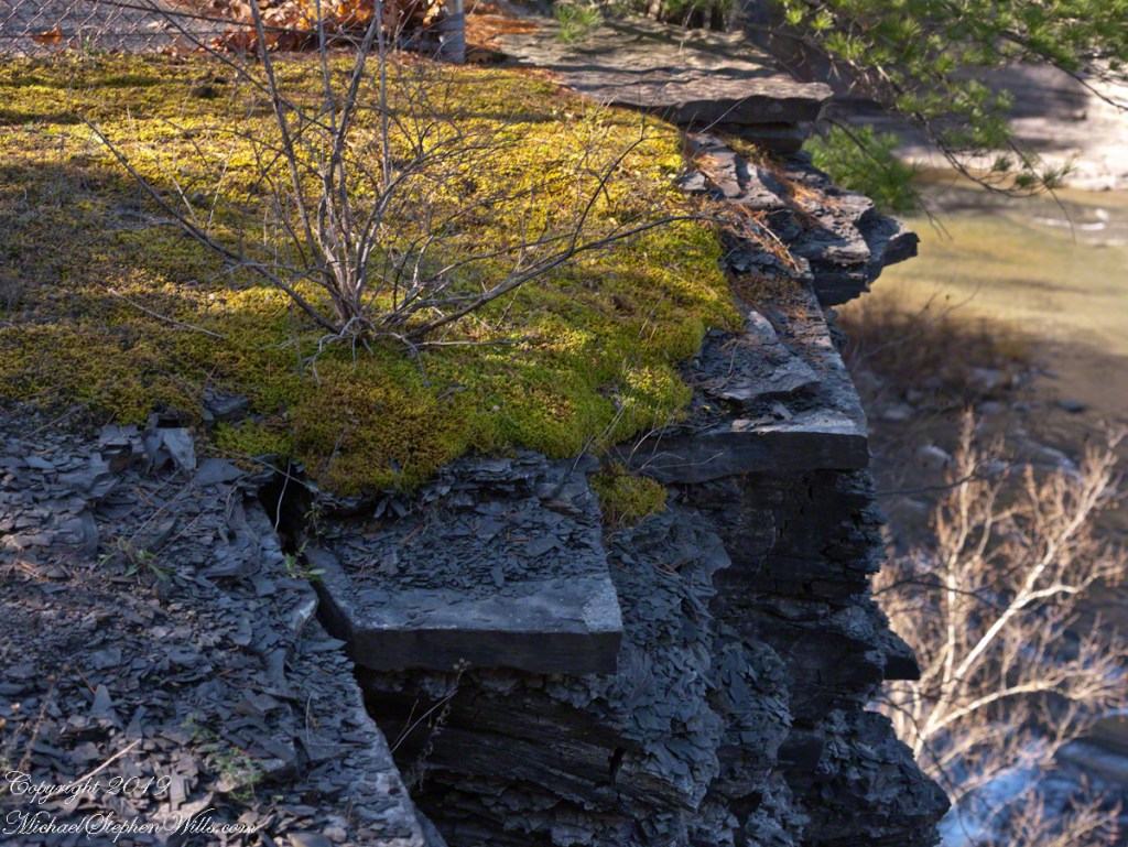
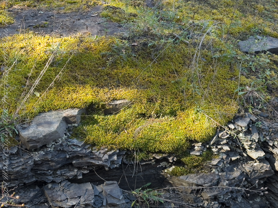
There, rooted precariously atop a slab of brittle shale, was a tenacious shrub rising from a bed of moss, its spindly frame etched in sharp contrast to the soft, green sprawl beneath it. The moss had taken hold on a shelf of rock cantilevered over the gorge like a green tongue of earth defying gravity. Cracks traced the shale’s surface like veins, silent records of the forces that shaped this place—heat, ice, pressure, time. Together, the moss and the bush formed an improbable community, surviving against odds, bound together by the thin soil cradled in stone.

This ledge, suspended over the abyss, seemed less a part of the earth than a question it asked—how much life can cling to the edge before the edge itself gives way?

Beneath this living fragment, the gorge dropped away. Layers upon layers of shale revealed themselves, stacked like a collapsed library of time. Here, the Devonian Period lies exposed to wind and rain, and to those willing to pause and wonder. Each stratum holds the fossil whisper of ancient seas, where trilobites scuttled and coral reefs once stood. This gorge was not carved quickly. It was not born of a moment, but of many—countless raindrops, millennia of ice melt, the slow, sure work of water over stone.

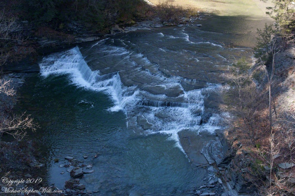
From this natural balcony, I looked out and down to the gorge floor where the creek shaped the land with an artist’s patient hand. The falls, seen from above, no longer thundered—they danced. Spread like the folds of a fan, water curled over smooth stone in steps of white silk. From here, the cascade looked deliberate, choreographed—an elemental performance halfway between gravity and grace.

How many times had this water flowed, reshaped, receded? How often had it carved these grooves, smoothed those ridges, erased the footprints of what came before? Looking at the exposed rock, one could trace the signature of ancient glaciers, feel the memory of long-gone floods. It was humbling—this intersection of change and continuity.

Above it all, the trees stood still. Pine and oak, rooted well back from the edge, offered a kind of sentinel presence. Their shadows stretched long and angled, tracing the contours of both earth and memory. For a moment, I let go of all thought and simply listened—to the murmur of wind through leaves, the faint rush of water far below, and the silence that presses in when the land itself seems to be remembering.

This spot—so easily missed by a hurried hiker—offered a parable of resilience and impermanence. The moss did not grow with certainty, nor the shrub reach with confidence. They survived on the edge because they adapted. They made do with less. They took root where others could not. There was no security in that place, only presence. Only the now.

And isn’t that a lesson worth carrying?

We so often seek stability, firm ground, a clear path. Yet, some of the most beautiful things live just beyond comfort—on ledges, in cracks, in the margins of the known. To pause here was to acknowledge that life thrives not only in sheltered valleys but also at the edge of what seems possible.

As I stepped back onto the trail and continued along the South Rim, the image of that mossy outcrop stayed with me. I carried it in my thoughts like a talisman—proof that even on the brink, life finds a way. And that from above, the most chaotic falls can appear as ordered motion, as a flow toward something larger.

Later, when the sun climbed higher and the light lost its slant, I would look back on this moment not as a spectacular highlight but as something more intimate: a quiet encounter with nature’s subtle artistry, its layered truths, and its enduring invitation to look closely, feel deeply, and walk softly.

For here, above the gorge, at the edge of earth and time, even a whisper leaves a mark.

Enter your email to receive notification of future postings. I will not sell or share your email address.

Dún Aonghasa Elegy

High above the Atlantic on Inishmore, Dun Aonghasa Elegy reflects on sky, stone, and memory in a timeless Irish landscape shaped by wind and will.

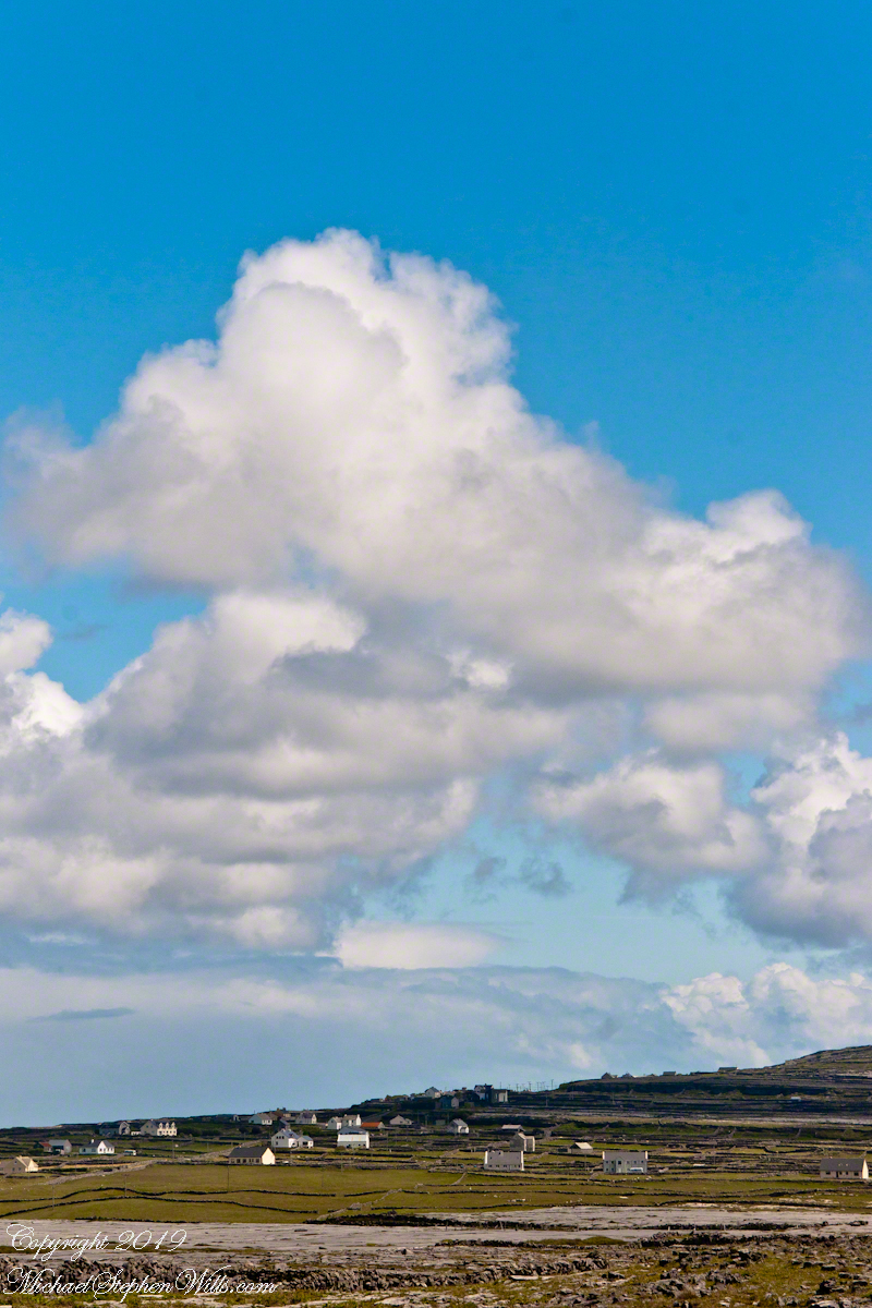
From the commanding location of Dún Aonghasa, looking northeast across Inishmore, the logic of the ancients becomes clear. No better vantage could be found—land unfurling like a hand toward Galway Bay, cottages nestled in green folds, clouds billowing above like sails caught mid-journey. A place of presence. A place of permanence.

Click the link for my Getty IStock photography of the Aran Islands

Perched high on the cliff’s edge, the fort behind, the Atlantic at the back, the wind carried stories—unwritten, unspoken, but felt in the bones. Below, stone walls divided the island into patterns of memory. Fields outlined in rock, laid long ago by hands familiar with hardship and patience. The sea’s pulse echoed faintly in the distance, as steady and unfathomable as time itself.

No words were needed in that moment. Just the hush of sky and stone. Cottages, bleached bright by limewash—kalsomine, the old name still whispered by some—stood resilient against the elements, each one a witness to generations. Each one seemed to carry a personal reverence, a tenderness carved into the landscape.

Paths led gently inland, where wind slowed and voices from distant homes rose faintly through the open air. Along those paths, the rhythm of island life could be read in hoof prints, scattered wool, and the sharp, clean edges of hand-cut stone. There, among the hedges of limestone and wild grass, the living and the lost felt close.

The cloud cover shifted constantly. Shadows passed like thoughts across the land. Toward the shore, the sky opened wide. A silence filled the lungs, as bracing and deep as the Atlantic itself. Time seemed to slow, the mind slipping into the rhythm of the land.

Limestone pavement, rough beneath the boots, told its own tale of erosion and survival. That the earth here could sustain even the most modest farming seemed improbable. Yet here it was: a testament to stubborn hope and quiet ingenuity. In that quiet, ancient energy rose—something older than the fort, older than language. A pulse shared with the rock and wind.

The fort eventually came back into view—perched as if grown from the cliff itself, curved walls enclosing nothing but air and sky. I perceived no defensive bluster, only presence. And what a view it commanded. On days like this, the clouds formed towering cathedrals overhead, white and gold in the sun. Below, the cottages and fields seemed miniature, perfect, enduring.

The wind played echoes of prayer, lullaby, and laughter mingled with the call of seabirds. The thought came that nothing here was ever truly lost—only layered. Generation upon generation, each leaving some trace: a stone placed just so, a wall mended one final time, a cottage roof patched for another winter.

Here, even the air speaks. It moves gently but insistently, brushing the cheeks and stirring something ancient within the chest. Beneath it, the island breathes: not loudly, not urgently, but with the slow, deep rhythm of the tides.

As the sun dipped slightly westward, light changed across the fields, cottages glowing warm against darkening green. The wind softened. The clouds drifted, still massive but no longer looming. Time to return. A glance back offered one last communion with sky, stone, and silence.

Inishmore, on that day had been absorbed. Understood not with the mind, but with something quieter. Something that listens without need for words.

Click me for the first post of this series, “Horse Trap on Inishmore.”

Enter your email to receive notification of future postings. I will not sell or share your email address.

A Whitewashed Memory on Inishmore

I reflect on traditional Aran cottages while journeying to Dún Aonghasa, emphasizing the beauty of simplicity and lasting memories.

It was the kind of overcast morning that seems to cradle the island in a blanket of mist, a gentle hush falling over the land as though even the Atlantic held its breath. Pam and I had arrived by ferry at Kilronan, the main settlement on Inishmore (Inis Mór), the largest of the Aran Islands nestled in Galway Bay. There, amid the bustle of arrivals and greetings, we found our driver—a wiry, weather-worn man with a soft brogue and kind eyes—and his horse trap, a simple two-wheeled carriage with room enough for three and the sounds of hooves to accompany our journey.

We set out up Cottage Road, the stone-paved track winding westward from the harbor. The sea fell away behind us as we climbed, a gray shimmer stretching to the hazy outline of Connemara’s mountains on the far side of the bay. Our destination was the dramatic cliffside ringfort of Dún Aonghasa, a place older than memory. But it was the unexpected moments in between—the ones not printed in guidebooks—that linger longest in the mind.

As we rounded a bend flanked by low stone walls, wildflowers blooming defiantly in the cracks, our driver pulled the reins gently and pointed with his crop.

“There,” he said, nodding ahead, “is a fine example of a traditional Aran cottage.”

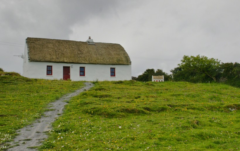
And there it was—a vision from another time. The thatched roof curved softly like a that blanket itself, straw golden against the brooding sky. The walls were whitewashed to a perfect matte sheen, gleaming in spite of the cloud cover. A crimson door and two window frames punctuated the front façade like punctuation in a poem. Just to its right, set further back on the hill, stood a tiny replica of the same cottage, identical in every feature. I blinked, half believing it was an illusion.

Click the link for my Getty IStock photography of the Aran Islands
This thatched cottage with matching child’s playhouse is on Cottage Road out of Kilronan Village on the Aran island, Inishmore, County Galway, Ireland.

We only stopped briefly—it was a private residence—but the sight of it left a kind of imprint. I turned in the trap seat to keep it in view as long as I could. The cottage was perfectly placed, facing Galway Bay with a commanding view. I imagined the light pouring across the line of mountains, catching the glint of sea and sky.

“There’s a name for that finish,” I said, recalling something I’d read, “whitewash, or lime paint.”

Our driver nodded. “That’s the old way. Made from slaked lime. We’d call it ‘whitening’ when I was a lad.”

Whitewash differs from paint in the most elemental of ways. It becomes part of the stone, absorbed into the very surface. Like a memory of bone. And yet, it requires care. Apply it to a wall not properly cleaned or moistened, and it flakes, pulls away like a broken promise. But done right, it lasts, breathes with the building.

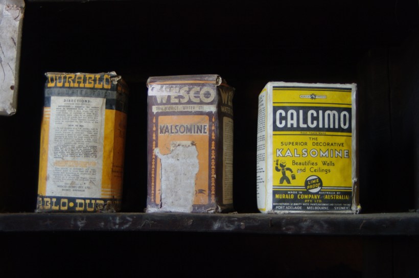
Upon our return, researching “whitewash,” if found this photograph from the Yarloop railway workshops Yarloop, Western Australia. There, on a shelf, where three old boxes sat like relics: DURABLO, WESCO, and CALCIMO. All contained kalsomine—the powdered form of lime paint. CALCIMO promised to “beautify walls and ceilings” and was proudly marked “LIME PROOF.” There was something quietly heroic in that. Lime-proof, as though against time itself.

Yarloop railway workshops Yarloop, Western Australia Kalsomine, wall ceiling plaster powder. Source: Wikipedia article on White Wash. Author: https://commons.wikimedia.org/wiki/User:Gnangarra

Looking at the box of Calcimo, a product of the Murabo Company of Australia, I was struck by how far the tradition had traveled. From island cottages in the Atlantic to distant corners of the Southern Hemisphere, the language of whitewash—of simplicity and purity—had touched the world.

We returned by the same road, past that same cottage, the small one still keeping watch beside it like a child beside a parent. And I knew then that the islands hadn’t just given me sights—they had offered stories, silent ones written in thatch and stone, in lime and wind.

Sources for this post: search wikipedia for “White Wash”. White wash photo author: Wikipedia commons user Gnangarra

Click me for the first post of this series, “Horse Trap on Inishmore.”

Enter your email to receive notification of future postings. I will not sell or share your email address.

Monument Valley’s Big Indian: Navajo Wisdom and the Geology of Time

Monument Valley, or Tsé Biiʼ Ndzisgaii, embodies a profound connection between the Diné people and the land, contrasting imposed names with cultural significance and sacred narratives.

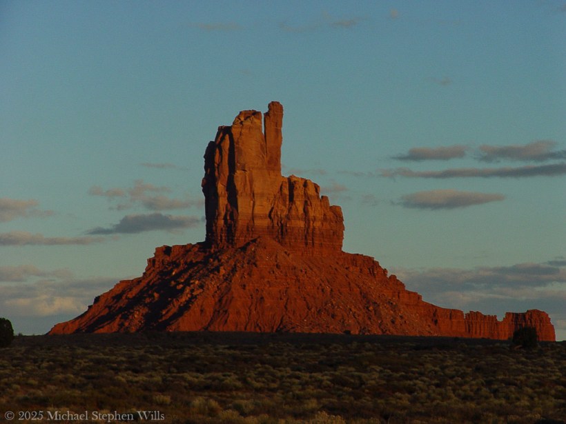
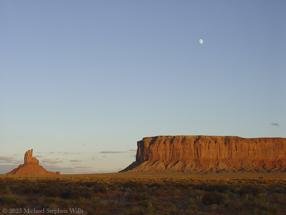
In the golden hush of this November sunset, Monument Valley stretches before us – an endless desert plain punctuated by towering red rock sentinels. The sky is vast and translucent blue, as a pale three-quarter moon rises silently above a solitary spire of sandstone. That spire is known on maps as Big Indian, a stone pillar glowing russet in the low sun. It stands apart from the mesas, its silhouette uncanny against the evening sky. In this serene moment, the land feels alive with presence. And the name “Big Indian” lingers in the air, raising quiet questions about what we call this place – and what it truly is.

From a distance, the spire does suggest a figure: tourists are told to squint, tilt their heads, and “see” the profile of a Native face gazing outward. One can imagine the first person to name it must’ve been a bored prospector, half-delirious from the heat after a lunch of canned beans, declaring: “I swear that rock looks like Uncle Joe in a feathered headdress.” And so the name stuck – a geological Rorschach test gone slightly colonial.

These whimsical titles – Totem Pole, Stagecoach, Big Indian – come not from the land, but from a long habit of outsiders labeling what they didn’t fully understand. “Big Indian” is particularly layered. The term “Indian” itself was born from Columbus’s navigational misfire, mistaking the Caribbean for Asia and its people for “Indios.” The Diné, the people who have lived here for centuries, never called themselves that. So this towering formation now bears the echo of a 15th-century directional blunder —like a name tag on the Sphinx that reads “Buckeye” because someone once thought Egypt was in Ohio. It’s a reminder: names given in haste can cling for centuries, even when they miss the mark entirely.

But beyond the names imposed by mapmakers, the spire simply is, in all its silent grandeur. In Diné lands, this valley has a different name: Tsé Biiʼ Ndzisgaii, often translated as Valley of the Rocks. In the Navajo tongue the name literally evokes “rock within white streaks around” – referring to the light bands of sediment that ring the red buttes​. Those pale streaks wrap the spire like faded paint, remnants of ancient layers of earth. Here the Diné language whispers a description born of the land itself, unlike the English names that often project an outsider’s story. Tsé Biiʼ Ndzisgaii speaks to the truth of the place: stone and light, strata and shadow. As the sun lowers, you can actually see those whitish bands catching the last glow, encircling the butte like old memory. The Diné name honors what the eye sees – the layered geology – rather than imposing an unrelated label. This spire and its neighbors were not built by human hands, though their sheer stature can feel like architecture of the gods. Millions of years of natural artistry shaped Monument Valley.

Long before any person walked here, this land was a low basin collecting sediments​. Layer upon layer of sand and silt hardened into rock, and a slow uplift in the earth heaved the basin into a plateau​. Wind and water became patient sculptors over the last 50 million years, carving the plateau and peeling away the softer material​. What remains today are the skeletal monuments of that erosion: buttes, mesas, and spires rising up to a thousand feet above the desert floor. Each is made of stratified stone – the broader bases of red shale and sandstone, and a cap of harder rock that resists the elements​. Big Indian’s sturdy pedestal and slender crest tell this story of layered resilience. In the red-orange rock, oxides of iron tint the cliffs a deep rust, while streaks of black manganese oxide – “desert varnish” – trace down their sides like natural paint​. Time and the elements have sculpted a masterpiece here.

Standing at its foot, one needs imagine the immeasurable ages of sun and storm that chiseled this lone tower from the earth. And yet, facts of geology alone fail to capture the spirit one feels in Tsé Biiʼ Ndzisgaii. The Diné know that spirit well – this valley is sacred to the Navajo Nation​. To them, these colossal rocks are alive with meaning. The people have lived and wandered among these mesas for centuries, blessing the land with their stories and prayers.

In Navajo cosmology, the landscape itself is imbued with life and purpose. The buttes are often seen as ancestors, guardians, or holy figures watching over the People. For example, the famous twin buttes called the Mittens are said to be a pair of spiritual beings – one male, one female – forever facing each other across the valley, protecting and balancing the land​. Another hulking mesa, Sentinel Mesa, is known as a “door post” of the valley, a guardian at the entrance​, paired with another butte as the opposite door post​. The valley, in the Diné way of seeing, resembles a great hogan, a home blessed by the gods: the mesas at its threshold are like the posts of a doorway, and a butte called The Hub is imagined as the central fire hearth of this immense home​.

In this way, the Diné landscape is a living, storied environment. Even the spindly formations carry sacred narrative. Seven miles southeast from Big Indian stand slender pinnacles known to the Navajo as Yei Bi Chei, named for the masked spiritual dancers who emerge on the last night of a winter healing ceremony​.

Each dawn, as the first light breaks over the mesas, it’s said the Navajo families come out of their hogans to greet the sun with prayers – their doorways always face the east to receive blessings of the day​. In the same way, the great stone hogan of Monument Valley opens eastward, with its door-post buttes and its eternal fireplace. In Diné worldview, earth and sky are intertwined with their lives; they speak of Mother Earth from whom they emerged and to whom they owe care​. Here in Monument Valley, it is possible to feel that harmony – the sense that every column of rock, every whispering juniper shrub, every beam of sunlight and moonrise is part of a whole living tapestry.

We watch as the moon climbs higher above the Big Indian spire, its silvery light softening the rock’s hard edges. This place has known many names and will outlast many more. The Paiute people who roamed here before called it “Valley Amid the Rocks” and wove myths of gods and giants into its features​. Later came the labels of explorers and filmmakers: Monument Valley, a monumental canvas for Western legends. And of course, the simplistic tag Big Indian for this lone rock – a name that says more about those who coined it than about the land itself.

Names, in the end, are stories we tell about the world. The colonial names imposed here are like brief echoes across the ages, while the Diné stories run deep as the red earth. The Diné prefer to call themselves Diné – meaning “the People”​– and they call this land by names that describe its true character. I imagine that to the People, this spire might be thought of not as an “Indian” at all, but perhaps as a sentinel or an old friend standing watch. Its Diné name, if it has one, would likely emerge from its form or its role in a story, spoken with reverence.

As dusk turns to twilight, an immense peace settles. The monolith before me is no longer just Big Indian on a map; it is an ancient entity shaped by time and honored by generations. In the silence, we can almost hear the land speaking in the old language – telling of how it was born from oceans and sand, how it saw the first people wander through, how it endures through centuries of memory. The rock shares with us a moment beyond names: just the whisper of wind, the glow of moon, and a feeling of connection and wonder. This is Monument Valley, Tsé Biiʼ Ndzisgaii, in all its truth. In this contemplative dusk, I bow to the tower of stone, misnamed yet never truly defined by that misnomer. It remains what it has always been – a creation of earth and spirit, a witness to history, a source of humble awe. Tuning to leave, I softly speak a word of thanks – Ahéheeʼ – grateful to have listened, if only briefly, to the sacred voice of the valley.


Bibliography

Encyclopædia Britannica – Tribal Nomenclature: American Indian, Native American, and First Nation ​britannica.com (origin of the term “Indian” as a colonial misnomer)

Navajo Nation Parks & Recreation – Monument Valley (Tsé Bii’ Ndzisgaii) ​navajonationparks.org​navajonationparks.org (official site detailing Monument Valley’s geology and formation)

Robert S. McPherson – Monument Valley. Utah History Encyclopedia​uen.org​uen.org (history, geology, and indigenous lore of Monument Valley)

Aztec Navajo County – Monument Valley PDF Guide ​aztecnm.com​aztecnm.com (descriptions of formations, including Navajo perspectives on their meanings and names)

Navajo Word of the Day – Tsé Biiʼ Ndzisgaii ​navajowotd.com (explanation of the Navajo name for Monument Valley, meaning “white streaks in the rocks”)

Enter your email to receive notification of future postings. I will not sell or share your email address.

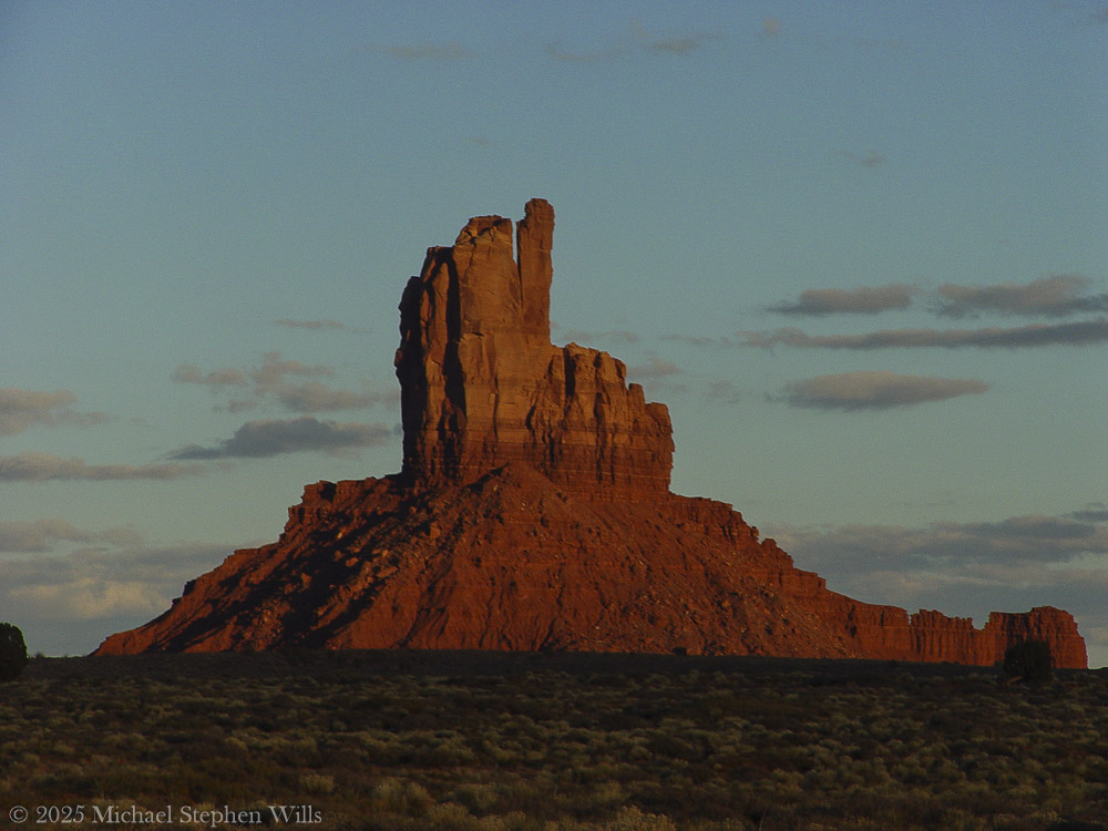
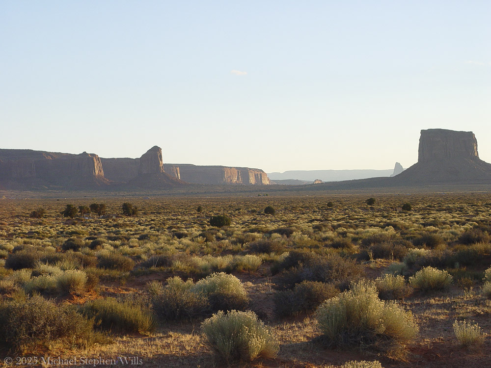
Guardians of the Plateau: Brigham’s Tomb, the Stagecoach, and the King on His Throne

Here is a journey to Brigham’s Tomb in Monument Valley, reflecting on the land’s timelessness, silent presence, and the profound connection between the observer and natural formations.

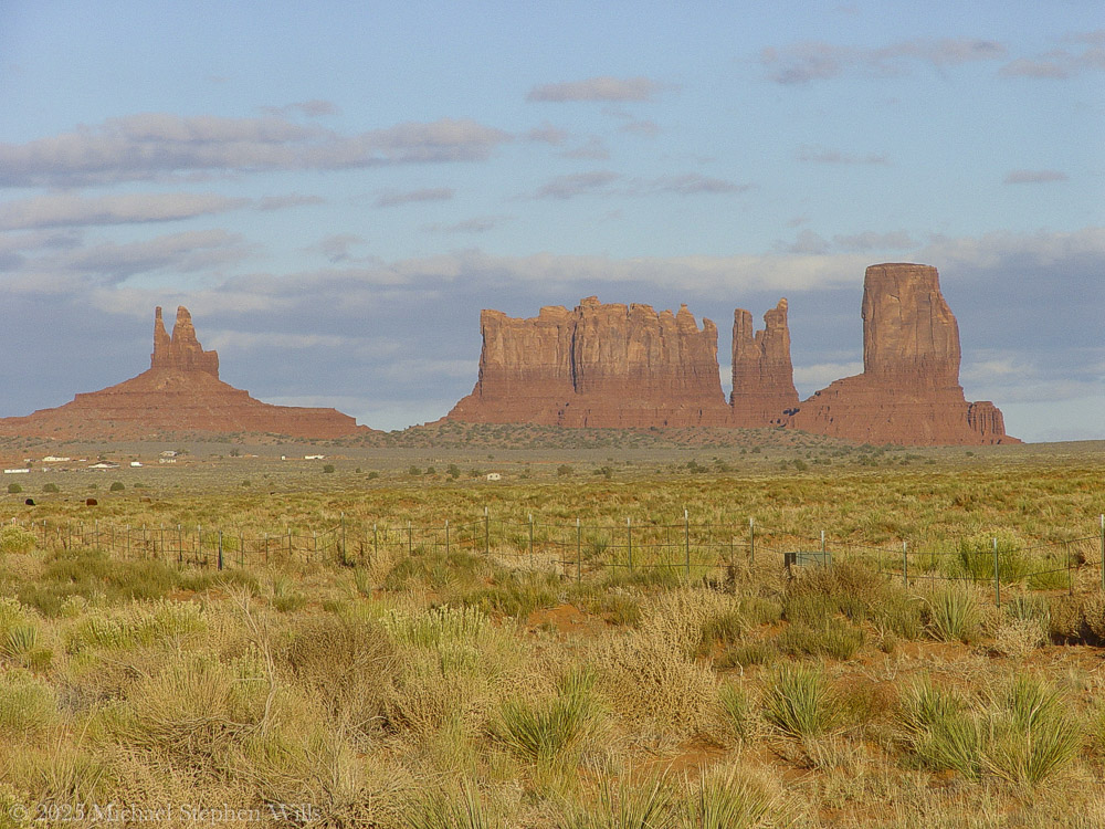
He did not come seeking answers, nor was he lost. The road had summoned him—as it had summoned others before him—and he followed its arc with the steadiness of one who does not hurry time. The sun was descending behind him, slow and inevitable, casting long golden blades across the plateau. That was how it wanted to be seen, and he did not interfere.

He had come this way before in dreams, further south where the great stone mittens reached into the sky. There, the land had risen in clarity, each formation distinct in its declaration. But now the evening had deepened, and the land changed its tongue. It spoke more slowly. With greater weight. And he listened.

The air was thin with silence. Even the wind moved differently here—more cautious, more reverent. And then the shapes came into view. Not suddenly, but as if they had always been there and were only now permitting themselves to be noticed.

Here stood Brigham’s Tomb.

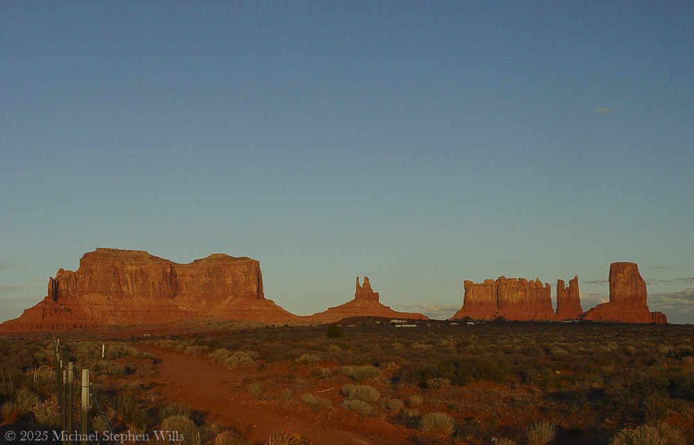
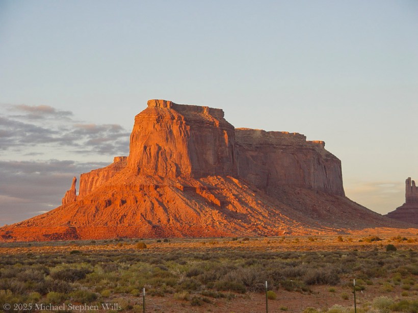
On the way to Monument Valley Tribal Park as the sunset for this view on Sullivan Road (Route 163). Navajo County, Arizona. Brigham’s Tomb. On the way to Monument Valley Tribal Park as the sunset for this view on Sullivan Road (Route 163). Navajo County, Arizona. Brighams Tomb is situated six miles (9.7 km) northeast of Oljato–Monument Valley, Utah, on Navajo Nation land. It is an iconic landform of Monument Valley and can be seen from Highway 163. Precipitation runoff from this landform’s slopes drains into the San Juan River drainage basin. Topographic relief is significant as the summit rises 1,000 feet (305 meters) above the surrounding terrain in 0.25 mile (0.4 km). The mountain’s name refers to Brigham Young, the first governor of the Utah Territory. This landform’s toponym was officially adopted/revised in 1988 by the United States Board on Geographic Names after having been officially named “Saddleback” from 1964 through 1987. Some older maps will still show the Saddleback name. Geology Brighams Tomb is composed of three principal strata. The bottom layer is slope-forming Organ Rock Shale, the next stratum is cliff-forming De Chelly Sandstone, and the upper layer is Moenkopi Formation capped by Shinarump Conglomerate. The rock ranges in age from Permian at the bottom to Late Triassic at the top. The buttes and mesas of Monument Valley are the result of the Organ Rock Shale being more easily eroded than the overlaying sandstone..

It rose alone, square and solemn, its flanks pressed by the last warmth of the day. The light traced every fracture, every line of sediment like the spine of something ancient and vast. It had no vanity. Its strength was in endurance, in the simplicity of mass. The world had spun uncounted times around this throne of stone, and still it stood—unmoved, unwitnessed except by sky and the slow-growing desert at its feet.

He paused there—not because he was uncertain, but because the monument required it. Some things must be received in silence.

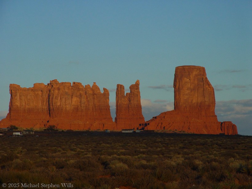
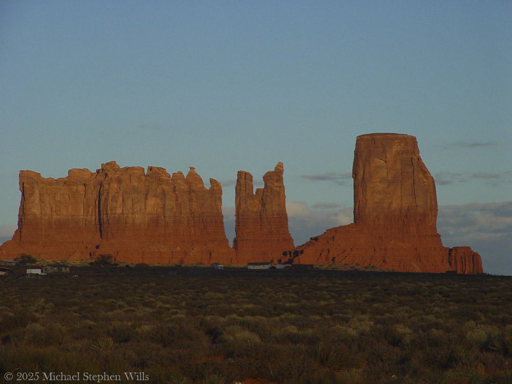
Their topographic relief is significant: Stagecoach rises 900 feet (274 meters) above the surrounding terrain in 0.35 mile (0.56 km), while King-on-his-Throne rises 565 feet (172 meters) in 0.2 mile (0.32 km). Each butte’s toponym has been officially adopted by the United States Board on Geographic Names—Stagecoach is named for its resemblance to a stagecoach, and King-on-his-Throne is said to resemble a monarch surveying his domain. Stagecoach’s first summit ascent was made in 1995 by John Middendorf, Carl Tobin, and Dan Langmade; King-on-his-Throne’s first was in 1967 by Fred Beckey, Marlene Dalluge, Joe Brown, and Don Liska.

To the southeast, past a stretch of ochre earth and sagebrush, rose two more forms. The King on His Throne, upright and proud, shaped as if he had emerged from the stone itself to bear witness. An artifact of erosion, also a sovereign presence—crowned in shadow and wind. There was no question of who he was. His seat was eternal, and no rider passed without first meeting his gaze.

Beside him stood The Stagecoach. Its resemblance to the name was almost too perfect, as if the form had stepped from the myth fully formed. But he knew better. It had not become a stagecoach. The coach had become it. The names were backwards, as names often are. The land had come first. All else was echo.

The giants stood together across the basin, their red-gold skin kindled in the last light. Their arrangement was no accident. One rose alone. Two more aside, bound by rhythm but not repetition. Together they formed a sequence—pause, proclamation, passage.

He walked the trail slowly, camera at his side but silent for a long while. There were things beyond framing. This was not a scene to be taken. It was a truth to be approached.

At the edge of the frame—a photograph not yet taken, but inevitable—the fence stretched taut across the scrub. Old wood. Rusted wire. Man’s line scratched against the land’s permanence. It held nothing. It said nothing. But it was there, and so he acknowledged it, as one acknowledges a child’s drawing pinned beside a mural.

Overhead, the sky was deepening into steel. But the earth still burned, even gently. The buttes and mesas were not dimmed by dusk. They only leaned inward, as if the heat of the day had carried them toward some great remembering.

He had seen many monuments in his life, but these were not monuments in the human sense. These were not built. They were born. They had no need for marble or inscription. Their gospel was in their silence, their liturgy the erosion of time itself.

He stood long, unmoving.

Not lost. Not searching. Just witnessing.

As the light slipped and the forms began to release their edges to shadow, he turned once—not away, but forward. The road still called. And the giants behind him did not diminish. They merely remained, as they always had, and always would.

Waiting.

Enter your email to receive notification of future postings. I will not sell or share your email address.

The Mesa Light Captured Them

A father and son journey to Eagle Mesa, experiencing its beauty and silence, reflecting on its history and significance within Navajo culture as the day fades.

They came north out of Chinle with the day already leaning west and the sun fallen low into the drag of horizon dust and the road ran flat and empty past rust hills and mesquite country until, turning into the sun at Mexican Water, after a long hour, at last they pulled into Kayenta where the streets lay quiet under the heavy sun and the windows of the store fronts cast their amber light out across the sand drifting across sidewalks and the wind stirred only faintly and then was still.

They left their bags in the room and turned north again without speaking. The son drove. A man, his father, sat quiet beside him and the sun slid low through the windshield and the sky was pale and cloudless and wide beyond reckoning.

The land began to rise and the road bent and climbed and fell again and then it came into view. Not slowly. Not like a curtain rising. It was simply there.

A shape in the far desert.

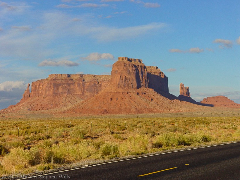
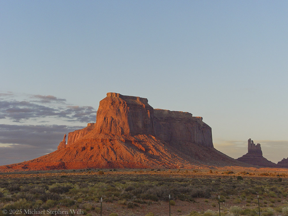
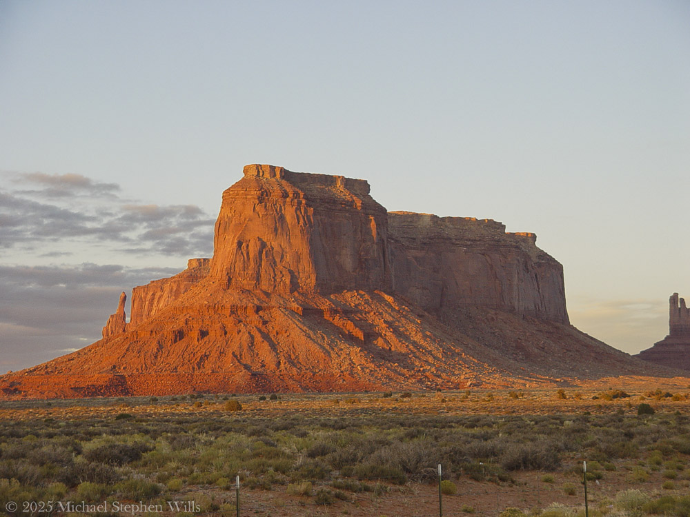
Like a ship that had grounded in a sea long vanished. A sheer mesa the color of blood and ochre and fire where the last of the day spilled westward and caught the rock face and made it burn.

He told the son to pull off. They stopped the car and got out and the sound of the engine fell away, the desert made no sound at all.

The man stood in the road and turned slowly. Eagle Mesa lay before him and the land stretched off in every direction and the fenceposts ran on into silence and the sky seemed to rest upon the buttes as if tired.

There were names for these places. Old names. Navajo names that spoke of eagles roosting and trees once there and water that came and went and did not come again. The mesa they called Wide Rock. The place where spirits go. He did not know the words but he knew the feeling.

On the way to Monument Valley Tribal Park as the sunset for this view on Sullivan Road (Route 163). Navajo County, Arizona. Eagle Mesa is situated 4.5 miles (7.2 km) northeast of Oljato–Monument Valley, Utah, on Navajo Nation land. It is an iconic landform of Monument Valley and can be seen from Highway 163.Precipitation runoff from this mesa’s slopes drains to Mitchell Butte Wash and Train Rock Wash which are both part of the San Juan River drainage basin. Topographic relief is significant as the summit rises 1,100 feet (335 meters) above surrounding terrain in 0.6 mile (1 km). The nearest higher neighbor is Brighams Tomb, 2.05 miles (3.30 km) to the east. This landform’s toponym has been officially adopted by the United States Board on Geographic Names. Navajo names for the mesa are “Wide Rock”, “Where the Eagles Roost”, “Water Basket Sits”, and “Trees Hanging from Surrounding Belt” because there were once numerous trees here. In Navajo mythology, Eagle Mesa is a place where spirits of the deceased may go. Eagle Rock Spire is a 300-ft tower on the northern tip of the mesa which requires class 5.9 climbing skill to reach the summit.Navajo names for this spire which resembles a perched eagle include “Eagle Alongside Mesa”, “Big Finger is Pointed”, and Tsé Łichii Dahazkani (Elevated Red Rock Sitting Up). The first ascent of the spire was made on April 23, 1970, by Fred Beckey and Eric Bjornstad. Geology Eagle Mesa is a mesa composed of three principal strata. The bottom layer is Organ Rock Shale, the next stratum is cliff-forming De Chelly Sandstone, and the upper layer is Moenkopi Formation capped by Shinarump Conglomerate. The rock ranges in age from Permian at the bottom to Late Triassic at the top. The buttes and mesas of Monument Valley are the result of the Organ Rock Shale being more easily eroded than the overlaying sandstone.

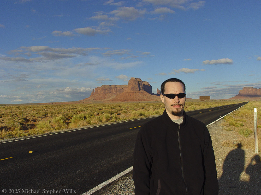
The son came and stood beside him and did not speak. The man lifted the camera and took a photograph and then another. The road behind them shimmered with the last heat of day. He took another picture his son, dressed in black, his arms at rest and the red mesa rising behind him and the shadows of their bodies cast long across the gravel and the shoulder of the road.

On the way to Monument Valley Tribal Park as the sunset for this view on Sullivan Road (Route 163). Behind Sean are the landforms Eagle Mesa and behind it Setting Hen, Bringham’s Tomb, to the right. Navajo County, Arizona

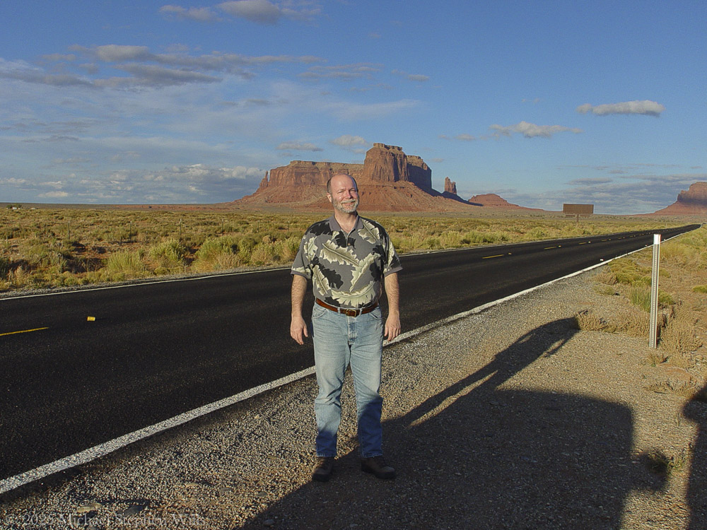
They took turns with the camera. The son caught him midstride and smiling lit by sunlight, the land stretching out all around. A man small in a world not made for men.

There was no sound but the click of the shutter and the dry whisper of wind among the sage.

On the way to Monument Valley Tribal Park as the sunset for this view on Sullivan Road (Route 163). Behind Mike are the landforms Eagle Mesa and behind it Setting Hen, Bringham’s Tomb to the right. Navajo County, Arizona

Later he would read that the rock was born of Organ Shale and De Chelly Sandstone and Moenkopi topped with Shinarump. He would know the spire they saw was first climbed by men named Beckey and Bjornstad and that it was called Tsé Łichii Dahazkani by those who’d named it before it ever had another name. He would know the mesa rose eleven hundred feet in less than a mile and that its runoff fed washes that fed rivers that fed nothing now.

But then he only stood and watched and knew it for what it was.

Not a monument to anything but time.

A stillness like prayer. A place that waits.

They lingered until the sun went and the sky turned iron blue and the shadows of the rock reached out across the valley floor and touched them where they stood. Then they climbed back in the car and drove south again and the road unwound behind them black and a single star above and the silence of the place held on inside them long after the valley was gone.

Enter your email to receive notification of future postings. I will not sell or share your email address.

Taughannock Falls State Park: A Geological and Ecological Marvel

Taughannock Falls, a majestic 215-foot waterfall, showcases nature’s beauty and power, intertwining geological history with vibrant ecosystems in New York.


Introduction
Nestled in the heart of the Finger Lakes region of New York, Taughannock Falls stands as a testament to the delicate balance of power and beauty in nature. This iconic waterfall plunges 215 feet—one of the tallest single-drop waterfalls east of the Rocky Mountains—into a gorge whose story is written in stone. The park surrounding this natural wonder offers a symphony of sights, from towering cliffs to lush greenery, inviting visitors to explore its ancient secrets and vibrant life.

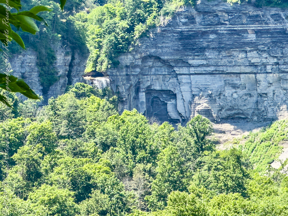
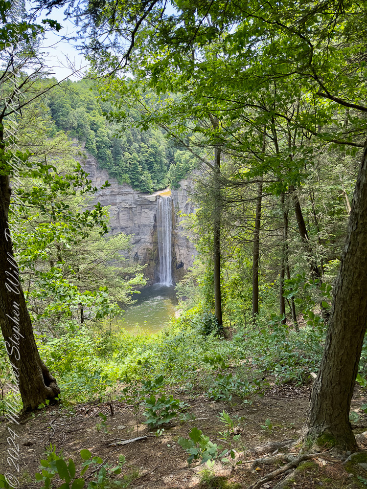
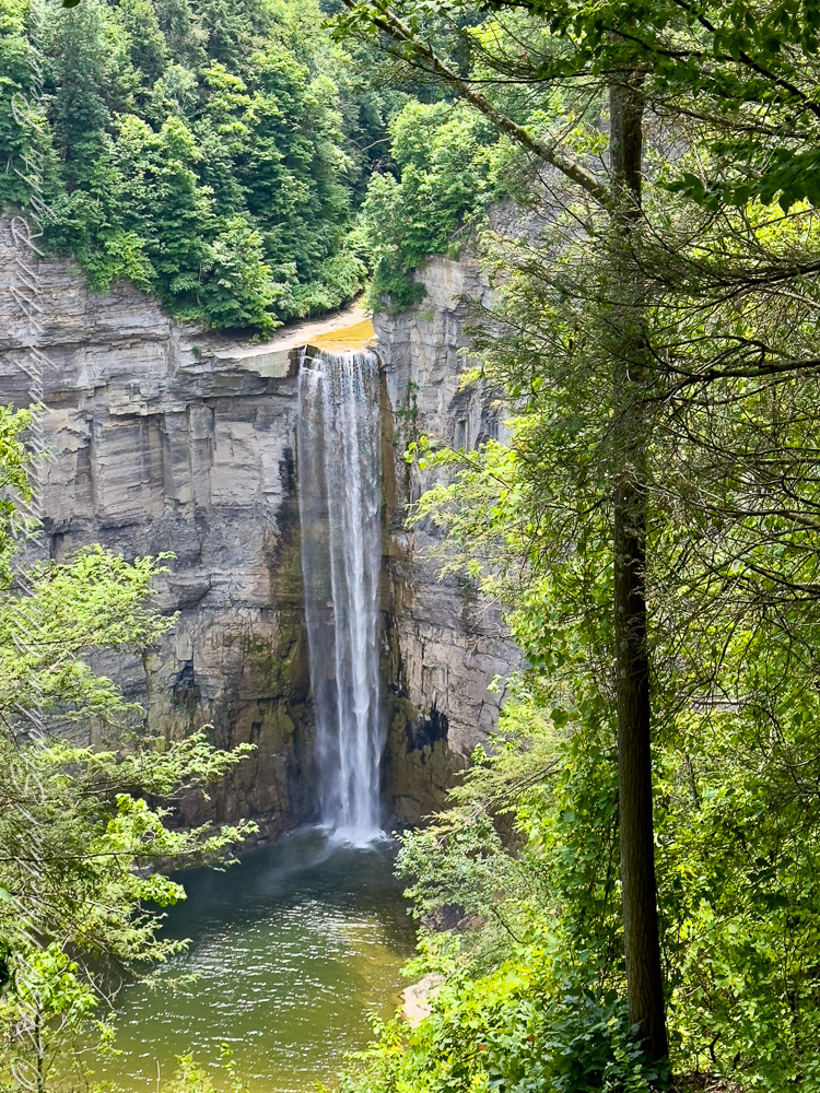
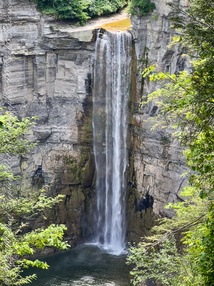
View of taughannock Falls from the South Rim Trail. Taughannock Falls New York State Park, Trumansburg, Tompkins County, Finger Lakes Region

A Story Written in Stone
The rocks of Taughannock Falls tell a story that stretches back 380 million years to the Devonian Period, a time when the region was submerged beneath a shallow inland sea. Layer upon layer of shale, sandstone, and limestone formed as sediment settled to the ocean floor, preserving the fossils of marine life that once thrived here. These rocks have endured the passage of eons, but the gorge itself is a far more recent creation.

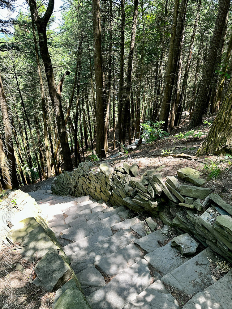
Limestone Steps on the South Rim Trail descend to the gorge floor.

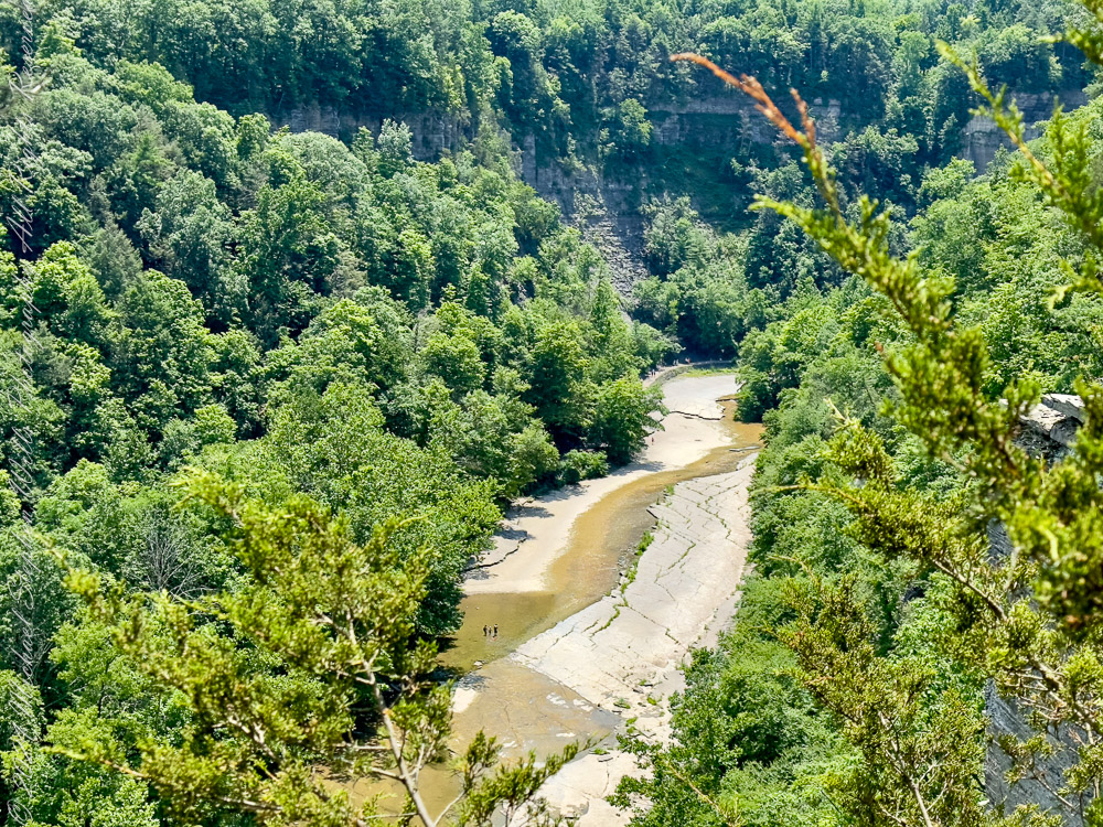
It was the retreat of the mighty Laurentide Ice Sheet, approximately 10,000 years ago, that set the stage for Taughannock’s grandeur. As glaciers melted, torrents of water carved the U-shaped valleys that now cradle the Finger Lakes. Taughannock Creek, a tributary of Cayuga Lake, began its work, etching its path through ancient rock, sculpting the gorge we see today. In just 10,000 years—a fleeting moment in geological time—the relentless force of water carved its way 3/4 of a mile upstream, creating the awe-inspiring chasm and waterfall that continue to evolve even now.

Taughannock Creek carved this landscape over thousands of years.

The Gorge’s Living Tapestry
Beyond its geological wonders, Taughannock Falls State Park bursts with life. Along the North and South Rim Trails, Eastern Hemlocks (Tsuga canadensis) stand tall, their evergreen branches weaving shadows that dance across stone stairways and forest floors. These silent sentinels are habitats for myriad creatures and protectors of the delicate ecosystem.

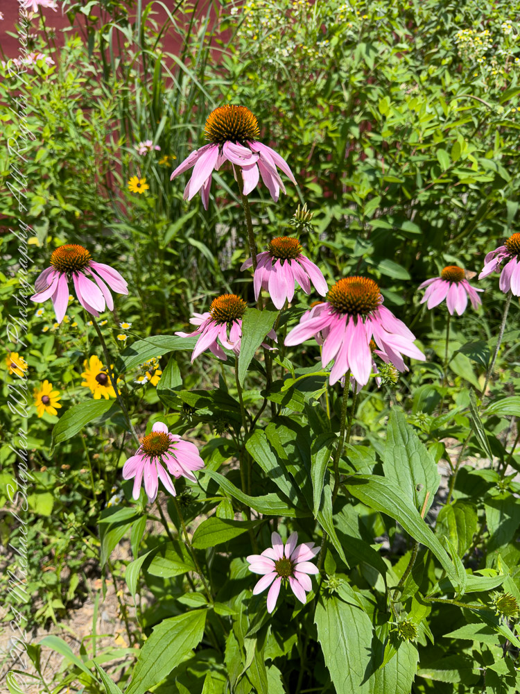
Wildflowers were planted by park staff at the Falls Overlook. The bright yellow of Black-eyed Susans (Rudbeckia hirta) and the vibrant purple of Coneflowers (Echinacea purpurea) attract bees and butterflies, their nectar fueling the intricate web of life that thrives here. Along the trail, on the forest floor, mosses and ferns cling to rocks, softening the edges of the gorge with their verdant touch.

Cone Flowers
Cone Flowers gone to seed
From a walk around Taughannock Falls State Park “Rim Trails” October 22nd, 2024. Trumansburg, Tompkins County, Finger Lakes Region, New York State.

The Fall’s Eternal Dance
At the heart of the park is the waterfall itself, its roar both a hymn and a whisper of time’s passage. The view from the North Rim Trail reveals the waterfall framed by steep cliffs, their striations like pages in a book written by water, wind, and time. The plunge pool below, shimmering in sunlight, seems almost sacred—a place where the forces of nature meet in harmony.

Viewed from the North Rim Trail on a summer morning. Taughannock Falls New York State Park, Trumansburg, Tompkins County, Finger Lakes Region

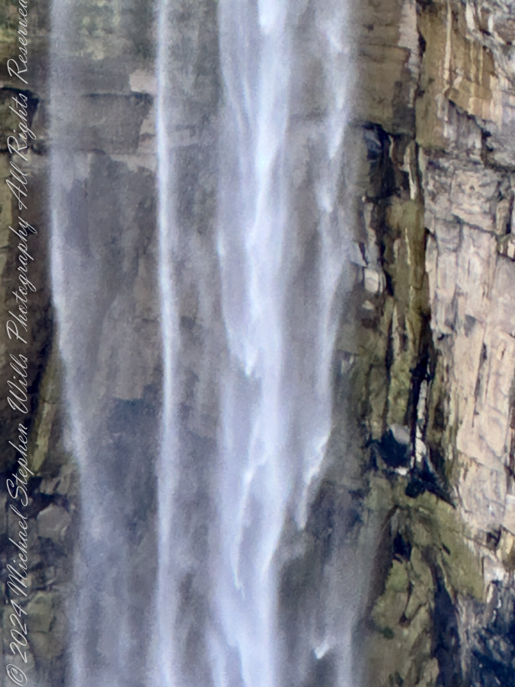
Even as we marvel at its beauty, the falls are a reminder of the earth’s constant transformation. Each drop of water that cascades down the cliff face carries away tiny fragments of rock, continuing the slow, deliberate work of reshaping the land. What we witness today is but one moment in an ongoing process—a fleeting glimpse of a masterpiece in progress.

A Place of Wonder
To stand at the edge of Taughannock Falls is to feel both small and connected. The cliffs, formed over hundreds of millions of years, whisper of ancient seas and forgotten worlds. The gorge, carved in the blink of an eye by geological standards, speaks to the power of water and time. And the vibrant life that fills the park reminds us of nature’s resilience and beauty.

As the sun filters through the trees, illuminating the mist that rises from the falls, it’s easy to believe that this place holds magic. Perhaps it’s in the way the water sparkles like diamonds in the sunlight or the way the breeze carries the scent of pine and earth. Or maybe it’s in the knowledge that here, in this park, we are witnesses to a story billions of years in the making.

Conclusion
Taughannock Falls State Park is a place of wonder where geology, ecology, and history converge. It invites us to reflect on the immense forces that shape our world and to cherish the fleeting beauty of each moment. Whether you come to marvel at the towering waterfall, walk among the hemlocks, or simply stand in awe of the gorge, Taughannock Falls leaves an indelible mark on the heart—a reminder of nature’s power, resilience, and enduring grace.

Enter your email to receive notification of future postings. I will not sell or share your email address.