In more recent centuries Loughcrew became the seat of a branch of the Norman-Irish Plunkett family, whose most famous member became the martyred St Oliver Plunkett. The family church stands in the grounds of Loughcrew Gardens. With its barren isolated location, Sliabh na Caillí became a critical meeting point throughout the Penal Laws for Roman Catholics. Even though the woods are now gone an excellent example of a Mass Rock can still be seen on the top of Sliabh na Caillí today. The Plunketts were involved in running the Irish Confederacy of the 1640s and were dispossessed in the Cromwellian Settlement of 1652. Their estate at Loughcrew was assigned by Sir William Petty to the Napier Family c.1655. The Napiers are descended from Sir Robert Napier who was Chief Baron of the Exchequer of Ireland in 1593.
Cairnbane East in Ireland, part of the Loughcrew Cairns complex, combines historical significance and folklore, particularly about a witch shaping these megalithic structures.
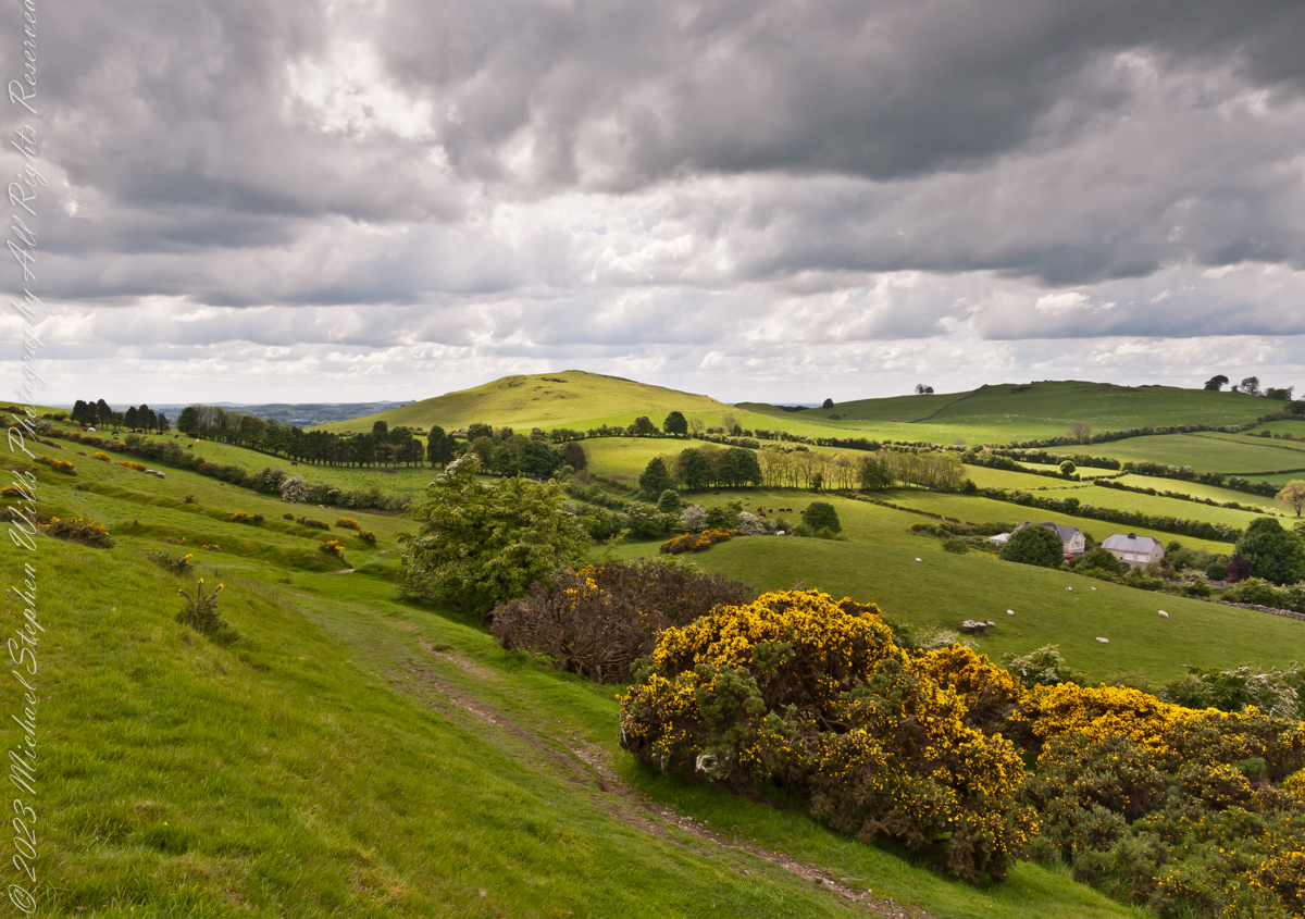
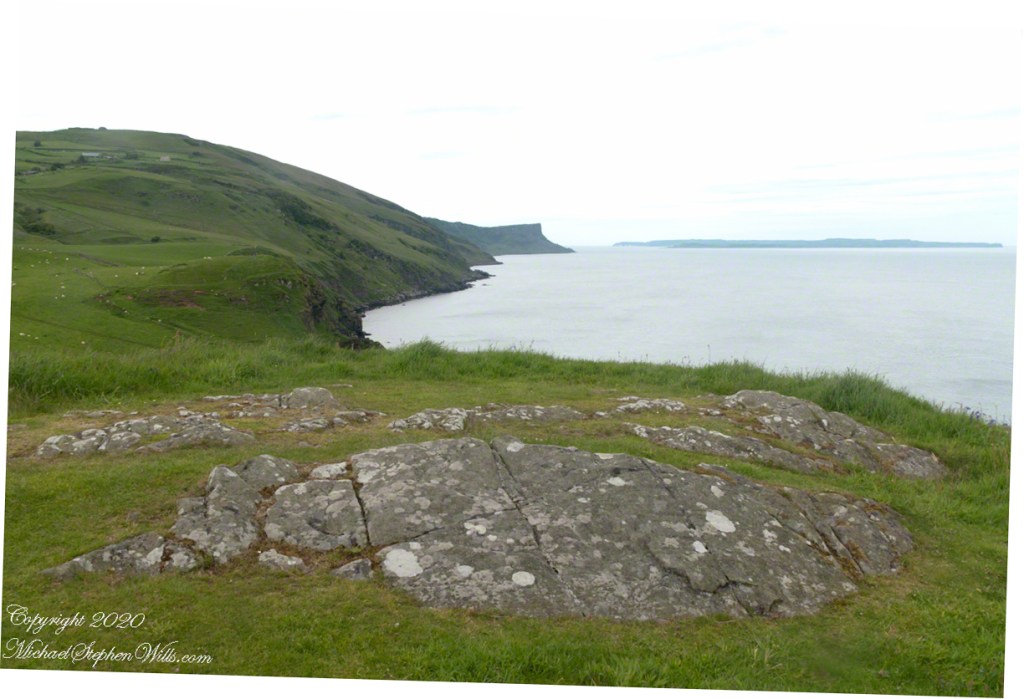
Here we are looking south, southwest from the north side of Slieve na Calliagh (aka Cairnbane East) toward Cairnbane West. Flowering yellow whin bush is in foreground, white flowering hawthorn trees in distance.
Cairnbane East hill is topped by a fine and accessible passage tomb, Cairn T.
Cairnbane East of the Loughcrew Cairns, known colloquially as “Hag’s Mountain,” nestled amidst the rolling hills of County Meath, Ireland, is a site of profound antiquity that beckons the curious traveler with its enigmatic charm. In this beguiling corner of the world, where history and folklore converge like two ethereal streams, the Loughcrew hills with their cairns rise, sentinels of a bygone age, each with its own tale to tell. But it is the myth of the witch, the “Hag of Loughcrew,” that lend a haunting aura to these ancient megalithic structures, invoking a world where magic and reality danced together in a mesmerizing waltz.
The Loughcrew Cairns
The Loughcrew Cairns, those hallowed remnants of an era long past, are monuments that defy the erosion of time. Constructed during the Neolithic period, they bear witness to the ingenuity of ancient minds and the profound spiritual significance these structures held. These tombs, hewn from the earth and stone, were not mere resting places for the departed, but sacred vessels of cosmic alignment, paying homage to the celestial dance of the heavens.
The Witch’s Role
One of the most enduring legends surrounding Hag’s Mountain is the story of a powerful witch who was said to have constructed the cairns. Cairn T includes a kerbstone known as “the hag’s chair.” According to folklore, this enigmatic figure, known as the “Hag of Loughcrew” or the “Cailleach,” commanded supernatural abilities and controlled the forces of nature. The Cailleach, which translates as ‘old woman’, ‘hag’, and ‘veiled one’, exists in both Irish and Scottish Gaelic, and is an expression of the hag or crone archetype found throughout world cultures. Related words include the Gaelic caileag and the Irish cailín (‘young woman, girl, colleen’), the diminutive of caile ‘woman’, and the Lowland Scots carline/carlin (‘old woman, witch’). The Cailleach is associated with winter, and it is believed that she uses her staff to create the winter snows. In some folk tales it is said that she carried massive stones from distant quarries to build the cairns, working tirelessly through the night and completing tasks that would have been impossible for ordinary mortals.
In these legends the Cailleach’s role in the construction of the cairns is believed to explain their precision and alignment with celestial events. The Cailleach used her magical powers to ensure that the cairns’ passageways perfectly aligned with the sun’s rays during the equinoxes, illuminating the inner chambers in a spectacular display of light and shadow.
Conclusion
Slieve na Calliagh weaves a tapestry where history’s threads intertwine with the shimmering strands of folklore. In its stony silence, it echoes the time when myths and reality were inseparable, when the land bore witness to the otherworldly. As we wander amidst the Loughcrew Cairns, gazing upon the ancient stones, we become travelers in a world where the mystical and the corporeal coalesce, and the stories of the witch endure as whispers in the wind, carried through the ages.
Copyright 2023 Michael Stephen Wills All Rights Reserved
On a May afternoon my dear wife, Pam, and I climbed to the summit of in Irish “Sliabh na Caillí” anglicized as “Slieve na Calliagh” translated to the english language as “Hag’s Mountain”, the site of 5000+ year old megalithic monuments. Here you are looking to the northeast with a collapsed tomb to the right foreground. In closeup is a curbstone, one of many laid side to side to form the outer tomb margin. In the middle distance is a hill with additional megalithic ruins, not visible.
Megalithic is an architectural style used throughout the world, between 6,000 and 4,000 years ago in the Neolithic and Bronze Ages. Megalithic ruins are scattered throughout the island and County Meath is especially noted for them.
We stand in Corstown townland, the townlands of Ballinvally is to your left, ahead and to the right is Patrickstown, all in County Meath, Ireland.
Copyright 2023 Michael Stephen Wills All Rights Reserved
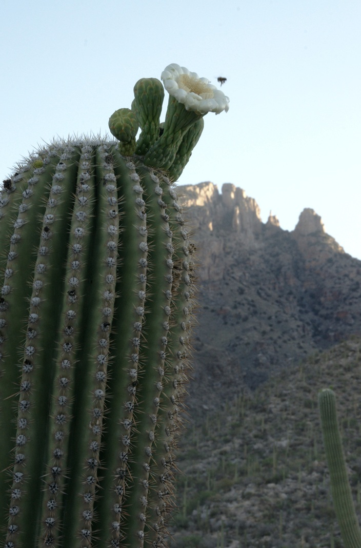
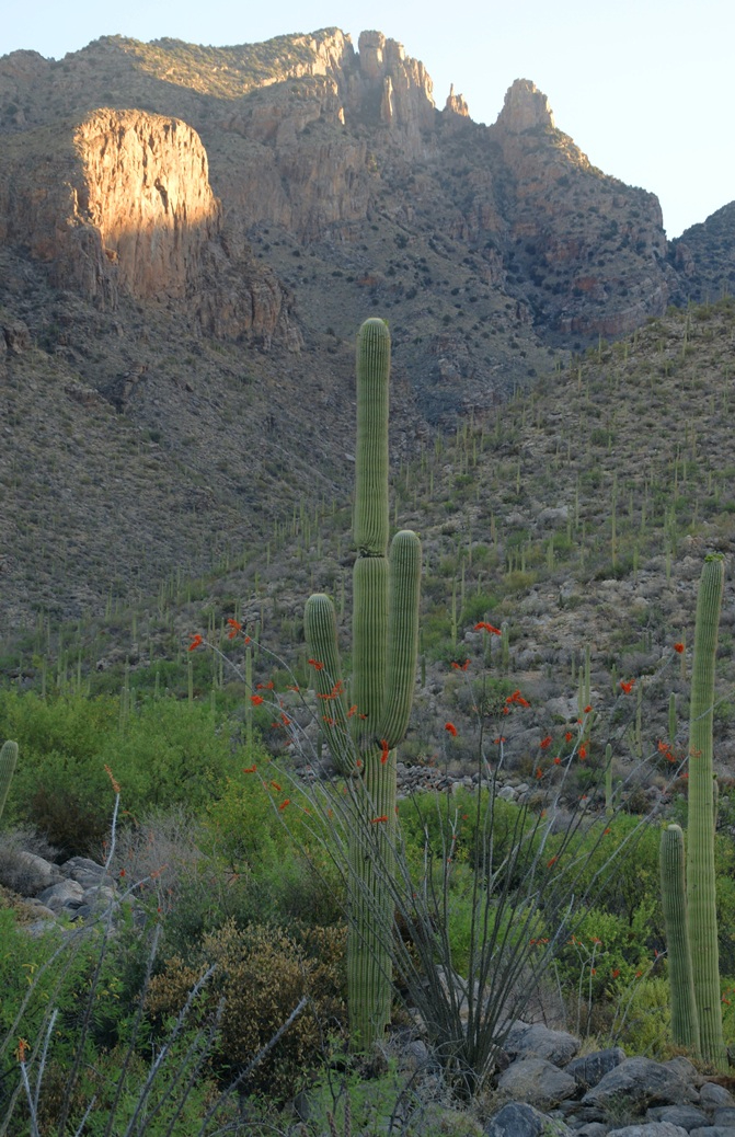
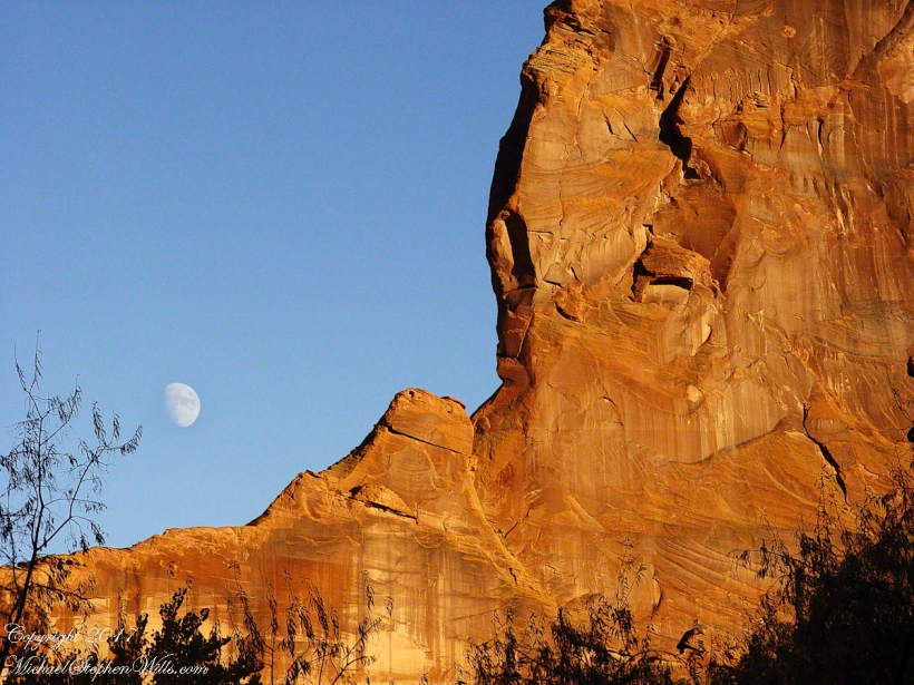
The perfection of April in Tucson is nowhere better than mornings spent in Finger Rock Canyon of the Catalina Mountains. Oriented on a north/south axis, the eastern cliffs shed a long shadow well past 9:30 am. For early risers such as me, this means no hat and cool hiking to the canyon head: the trail hugs the eastern cliffs.
These three shots were taken 5:30 – 6:00 am mountain time (Arizona does not follow daylight savings time except on the Navajo Reservation).
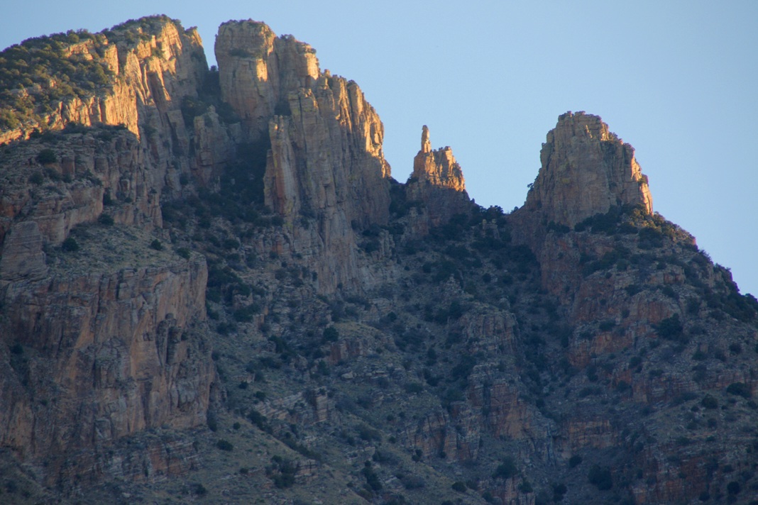
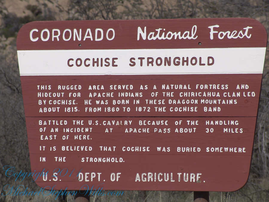
Interstate 10 between Benson and Wilcox ascends through a field of enormous, eroded granite boulders. Off to the west are the Dragoon Mountains, otherwise known as “Cochise Stronghold.” This rugged area served as a natural fortress and hideout for Apache Indians of the Chiricahua clan led by Cochise. He was born in this Dragoon Mountains about 1815. From 1869 to 1872 the Cochise band battled the U.S. Calvary because of the handling of an incident at Apache Pass about 30 miles east of here. It is believed that Cochise was buried somewhere in the Stronghold.
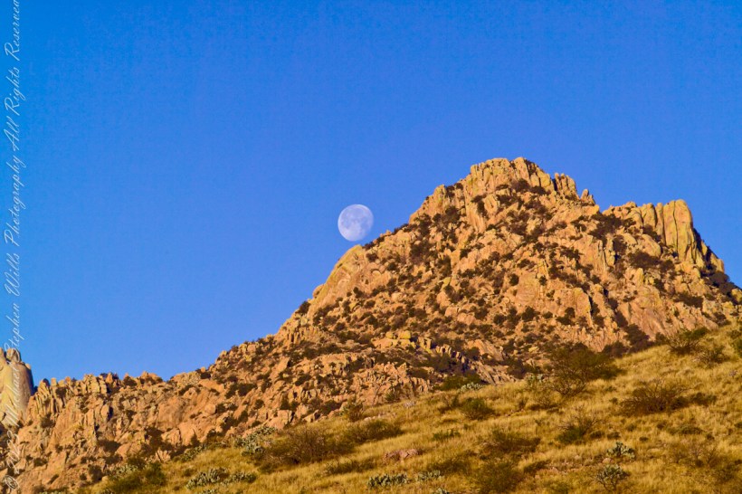
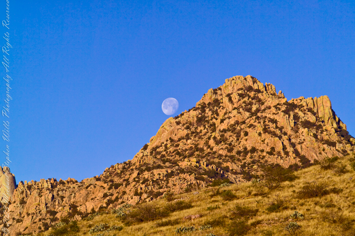
One April morning, very early, on the road to Cochise Stronghold. We stopped everything for me to unload the equipment to capture a gibbous moon low in the west, grazing a hoodoo ridge of Cochise Stronghold of the Dragoon Mountains. Near Dragoon, Cochise County, Arizona
Copyright 2023 Michael Stephen Wills All Rights Reserved
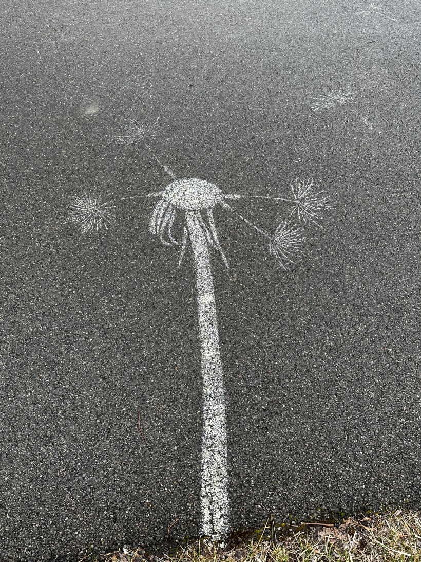
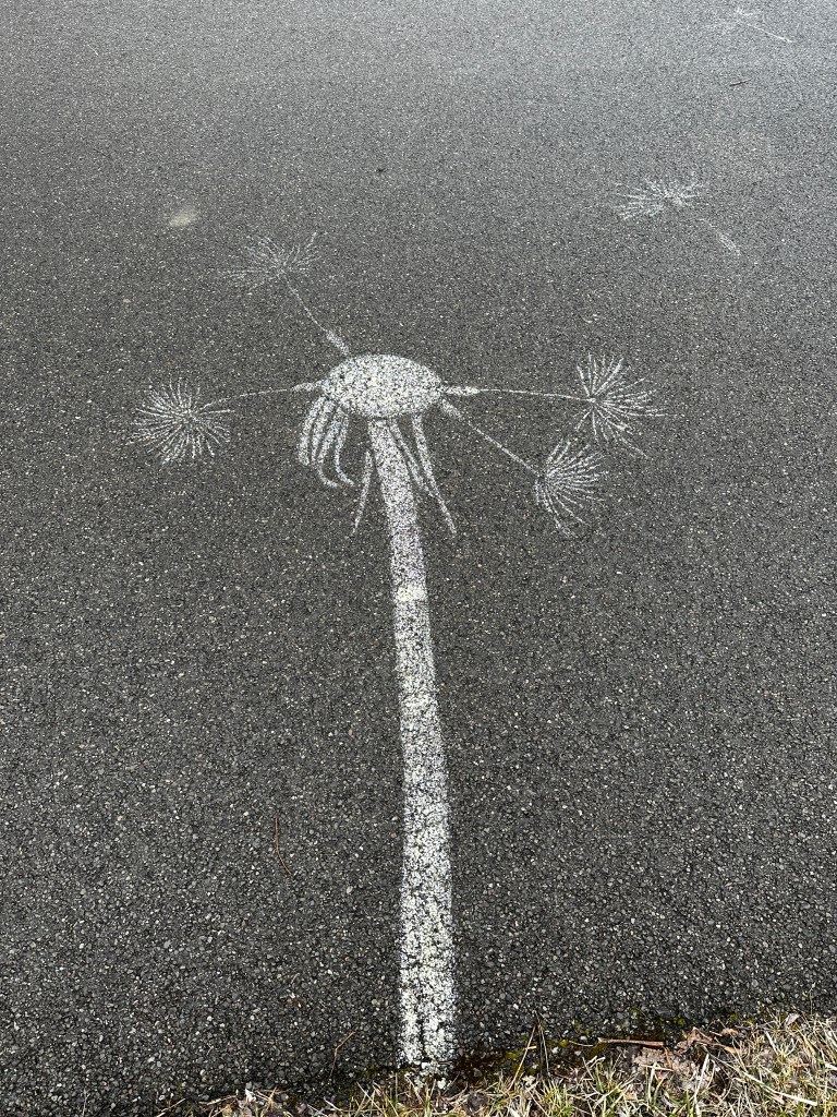
Stenciled on asphalt pavement along the Cayuga Lake Inlet, the white paint delimits dandelion flower stalk and seedhead, mostly denuded, with floating seeds held aloft by the pappus.
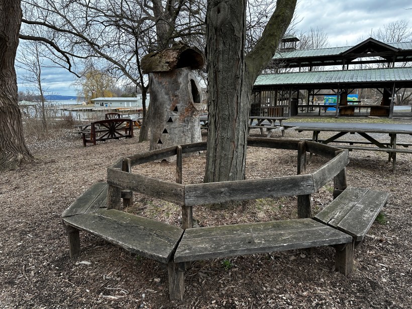
A circular bench that has seen better days, a hollowed out tree trunk repurposed as a children’s playgound house, picnic benches and, in background, a portion of the Farmer’s Market pavilion, to the right is Johnson Boatyard, Cayuga Inlet and lake. This is the Steamboat Landing, historically the southern port on Cayuga Lake. The entire area is long overdue for a facelift.
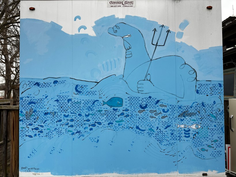
Painted on the side of restroom building, various shades of blue, black outlines, something or other holding a trident surrounded by fanciful fish.
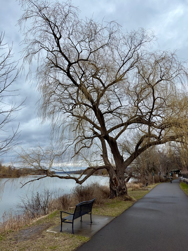
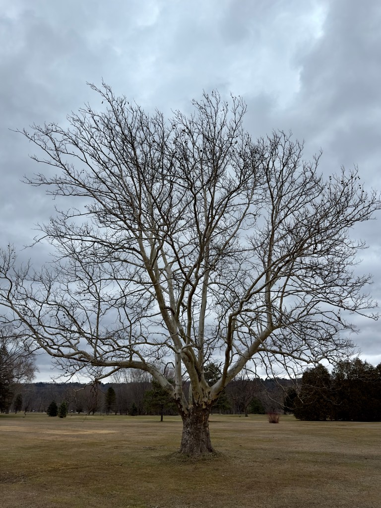
On the trail to Lighthouse Point, this tree is in fine winter form on this early spring afternoon in March. Newman Municipal Golf Course
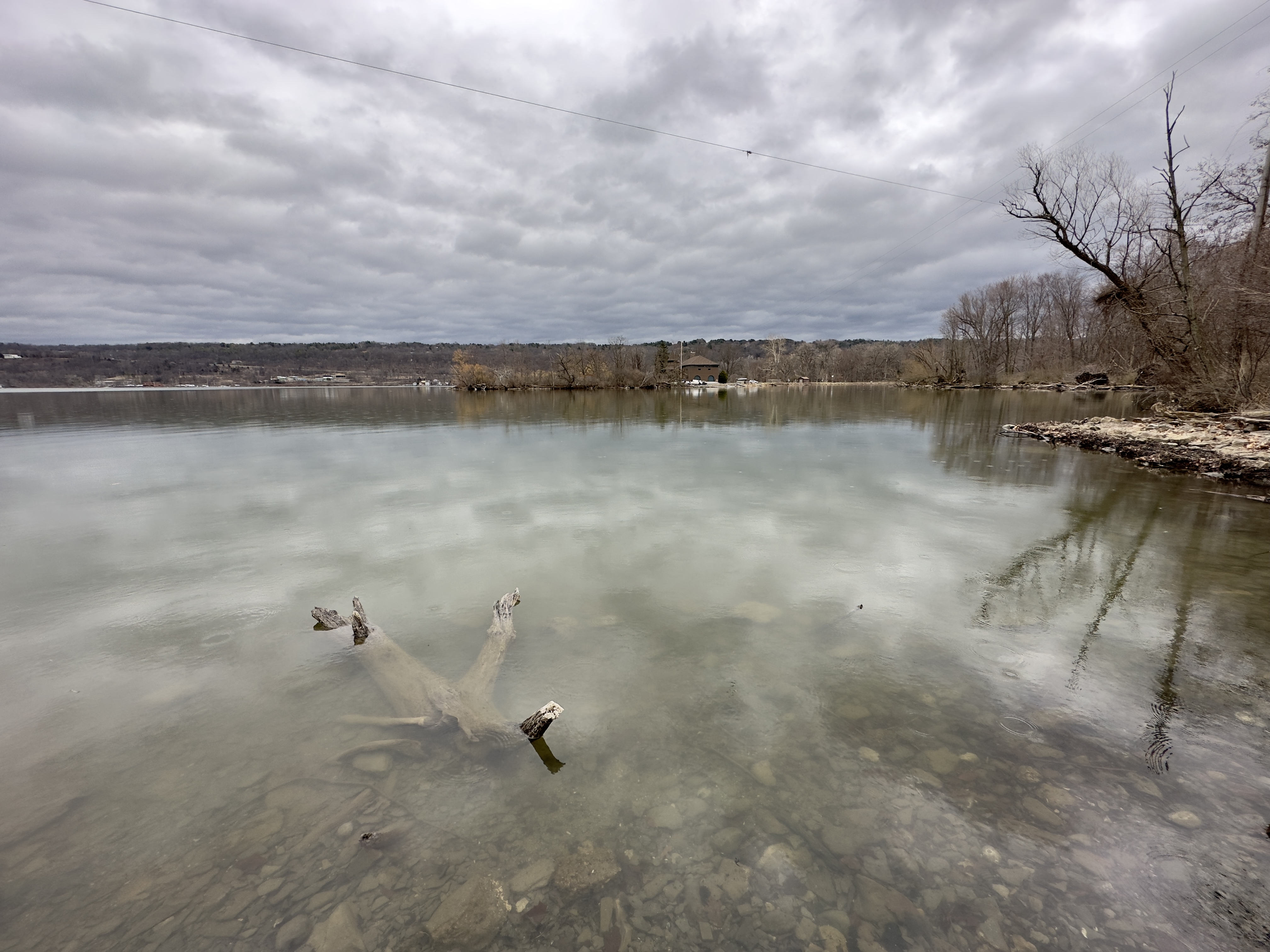
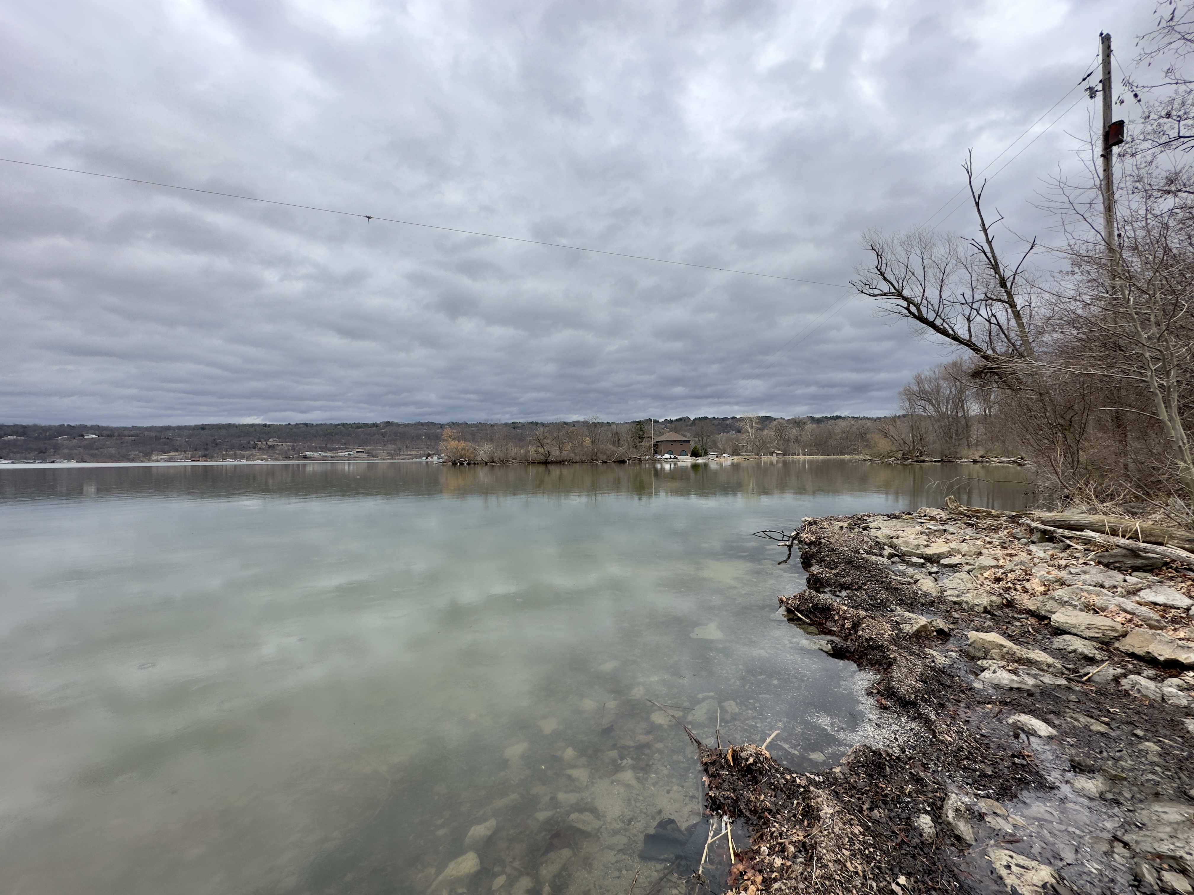
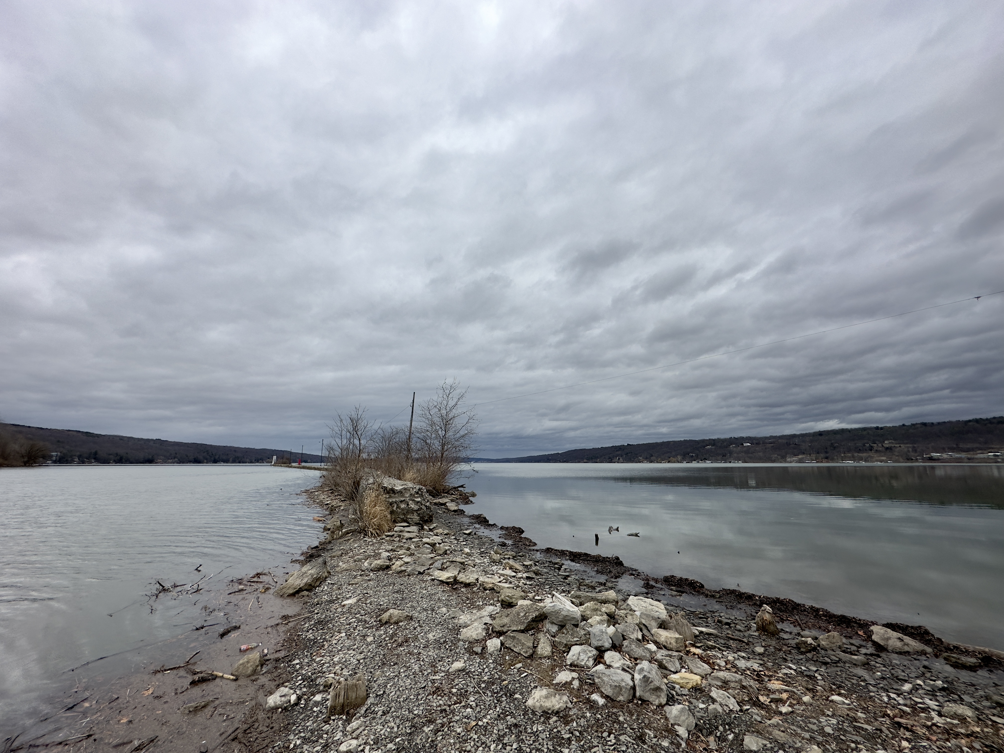
Cayuga Lake Views from Lighthouse Point
Copyright 2023 Michael Stephen Wills All Rights Reserved
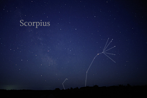
Some nights I travel to the farthest reaches of the universe right from my backyard. Here is a guide to the spring night sky for those of you in the northern hemisphere. Even sunbathing we are time travelling, bathed in starlite over 8 minutes old. Time taken by sunlight to reach Earth = (150,000,000/3,00,000) seconds = 500 seconds = 8 minutes 20 seconds).
Twenty million years ago a then nonexistent earth-bound human civilization could recognize none of the prominent stars of the constellation Scorpius (The Scorpion) as these, compared to our 4.6 billion year old star, lit up less than 12 million years ago. The brightest star, Alpha Scorpii AKA Antares, is a red giant destined to burst into a supernova bright as the full moon within two million years. Will the human race be around to witness it?
Such as it is, The Scorpion was traced out by the Babylonian astronomers around 8 BCE following even more ancient Sumerian traditions naming Alpha Scorpii “The Heart of the Scorpion.”
I first became aware of Antares March 2009 during a stay on Cocoa Beach. Setting the room clock to a 5 am alarm to view the sunrise. As I sat listening to the surf, Antares glowed dark red in the south. It is the reddish tint star in the following illustration.
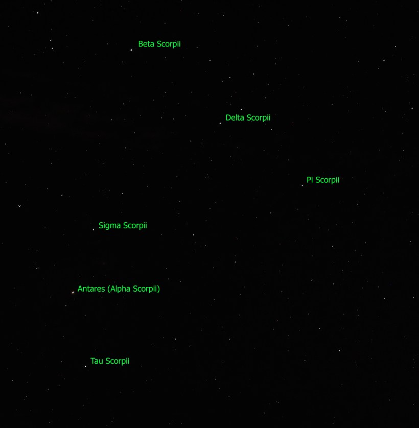
Here is a photograph of Antares, the reddish dot in center, along with the 6 of the 18 Scorpius bright stars. For this shot a Canon EOS 5D Mark IV dlsr had mounted a Canon lens EF 70-300 f4-5.6L IS USM set to 70 mm focal length, 1600 ISO. Exposure was “bulb,” meaning when the shutter button is pressed and held the shutter remains open: for this exposure this was for approximately 10 seconds. The equipment was held steady on a Manfrotto BeFree Carbon Fiber tripod. As the Earth continued to turn, the resulting star images are smeared a bit.
Bracketing Antares, the Scorpion Heart are “The Arteries” Theta and Tau. About those Greek letters, these designate relative brightness of each star respective of the others in the constellation. “Alpha” the first letter of the Greek alphabet is the brightest. Here are the other letters listed, with the alphabetic order in brackets Beta(2), Delta(4), Pi(16), Sigma(18), Tau(19). Ancient Greek built on the traditions of the Mesopotamians (Babylonian and Sumerian) and were in turn used for modern stellar nomenclature, including the tracings of sky images, the constellations.
The position of a relatively minor star, Tau, near Antares elevates it to the important function of an artery. The stars themselves run against their brightness hierarchy placement: The star Delta Scorpii, after having been a stable 2.3 magnitude star, flared in July 2000 to 1.9 in a matter of weeks. It has since become a variable star fluctuating between 2.0 and 1.6. This means that at its brightest it is the second brightest star in Scorpius.
Copyright 2023 Michael Stephen Wills All Rights Reserved
“Cornell Botanic Gardens is a living museum with a mature botanic garden and arboretum—part of what makes Cornell one of the most beautiful campuses anywhere. We steward over 3,600 acres of biologically diverse landscapes that represent the full range of ecological communities found in the Finger Lakes region.” — from their web site
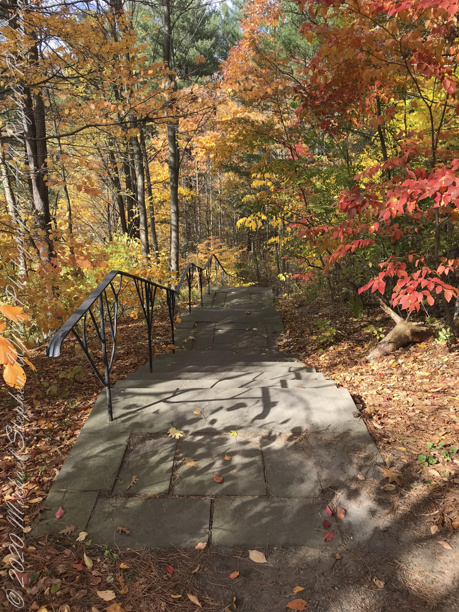
Pam and I need venture no farther than across the valley, from West to East Hill, for an experience of autumn in all its glory. These IPhone 7 photographs and videos are from a recent visit.
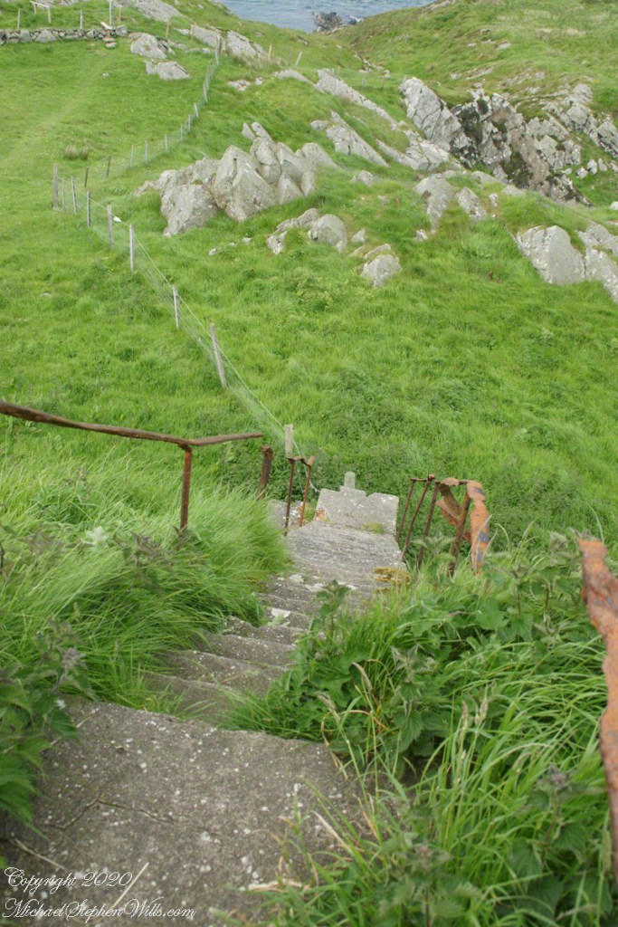
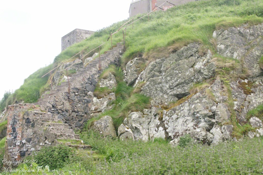
We took in the artistry of the railing, the stone steps, gentle curves.
De Courcey Stairs
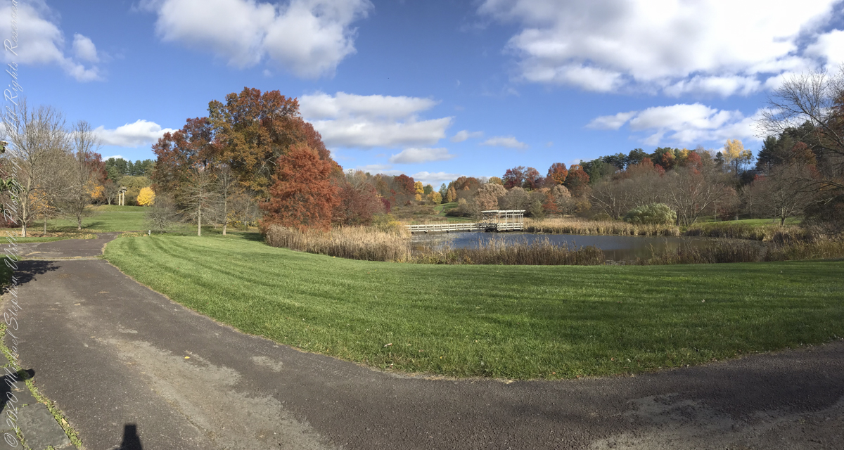
Buena Vistas
Granite boulders harvested for a Holocaust Memorial by Andy GoldsworthySculpture GardenArt Work
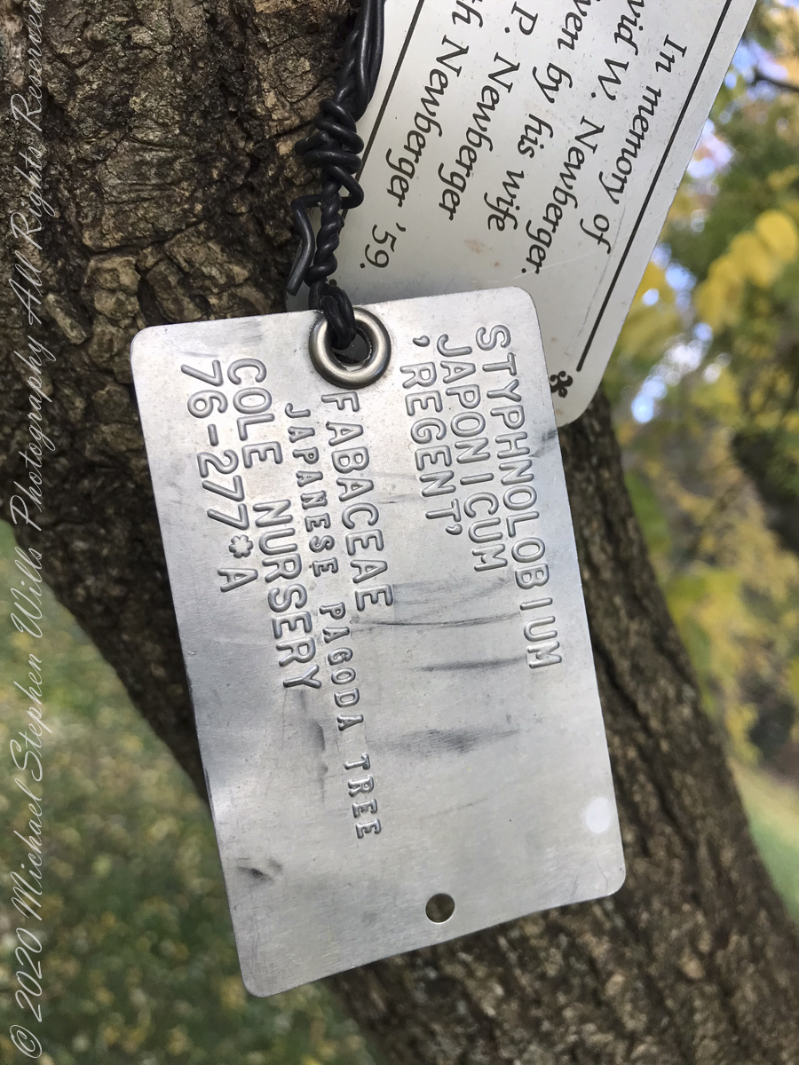
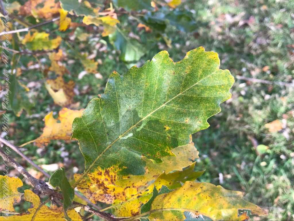
I marveled at the absence of Gypsy Moth egg masses on the Oak trunks, in spite of evident though modest leaf damage.
Labeled Diversity, specimens from the Oak Collection
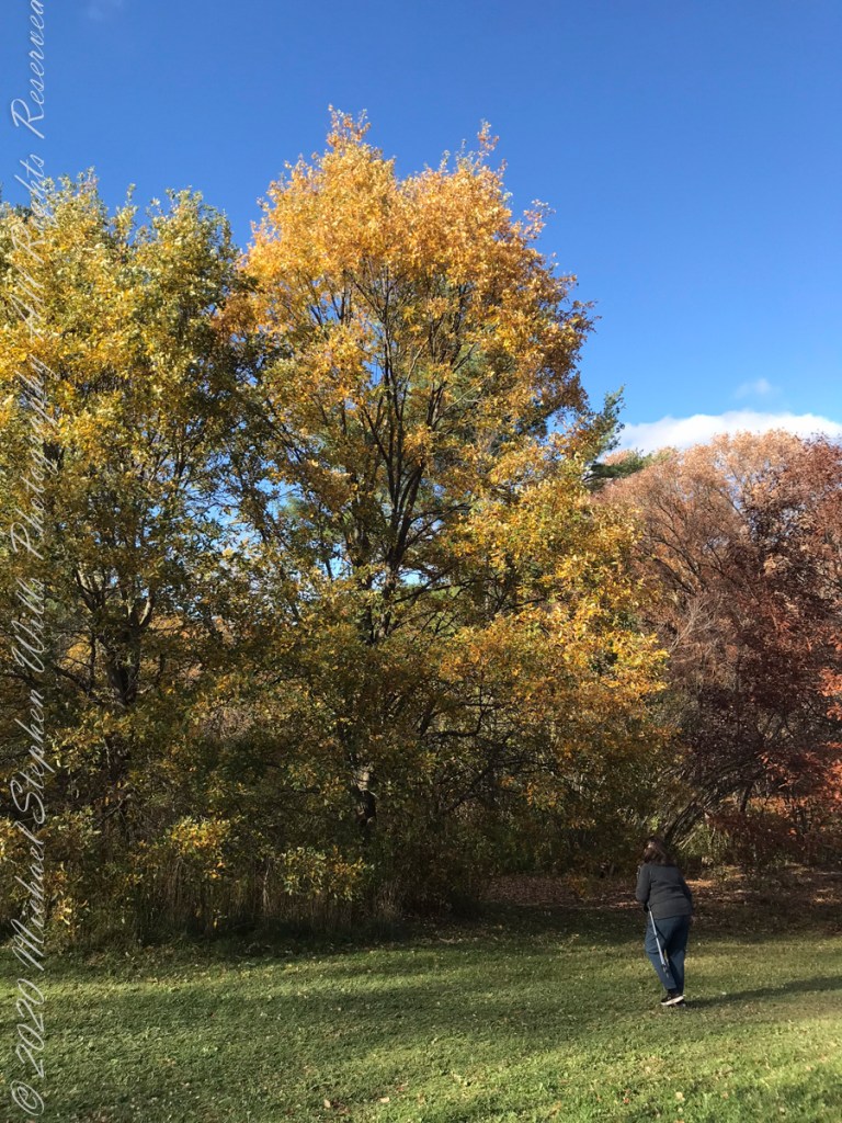
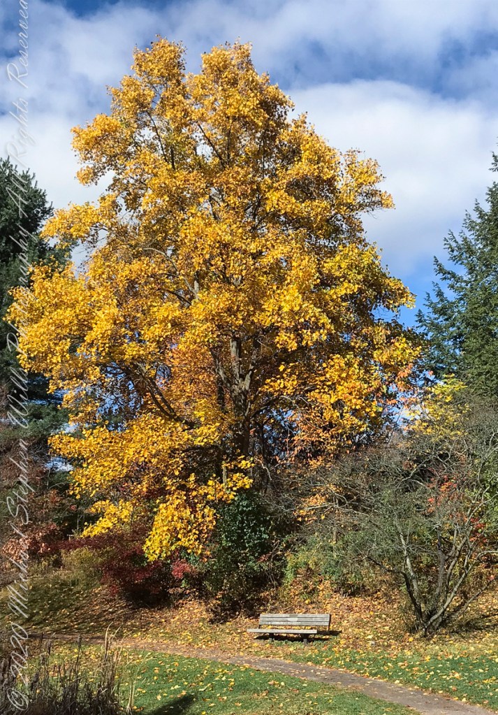
Respite BenchEncircledGrand OakStriking GroupAncient Red Oak Silhouette
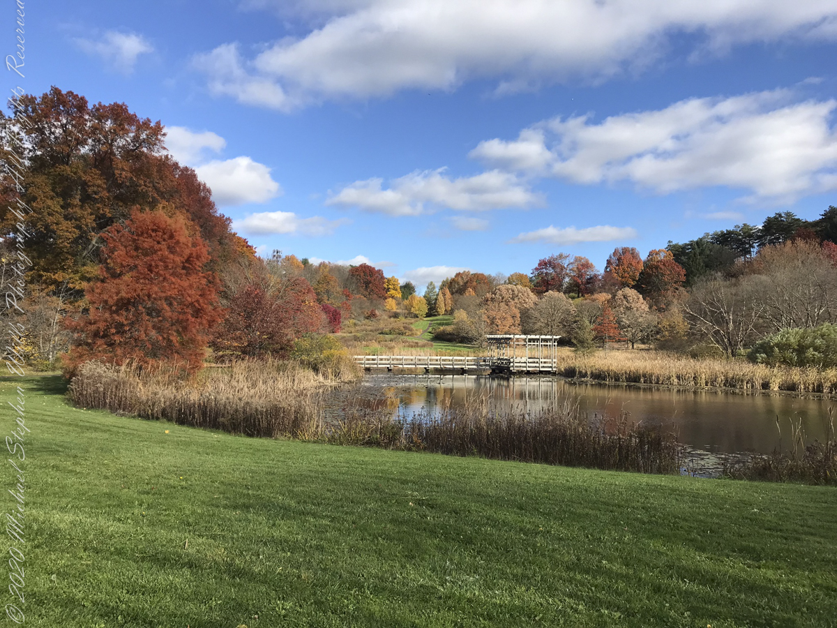
Houston Pond is visible in several of the “Buena Vista” images…..
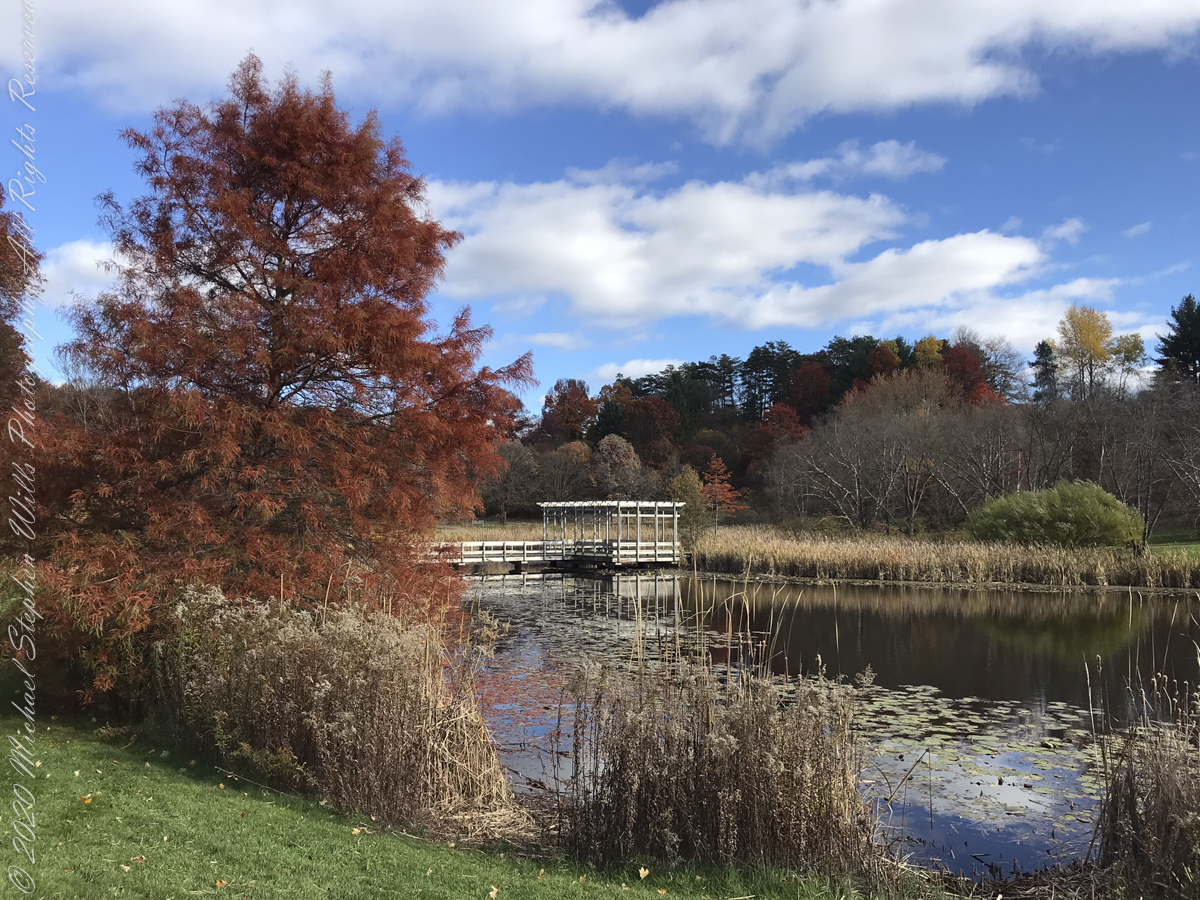
Houston Pond
Houston Pond reflections from the pavilion
Another version of reflections from Houston Pond taken from pavilion
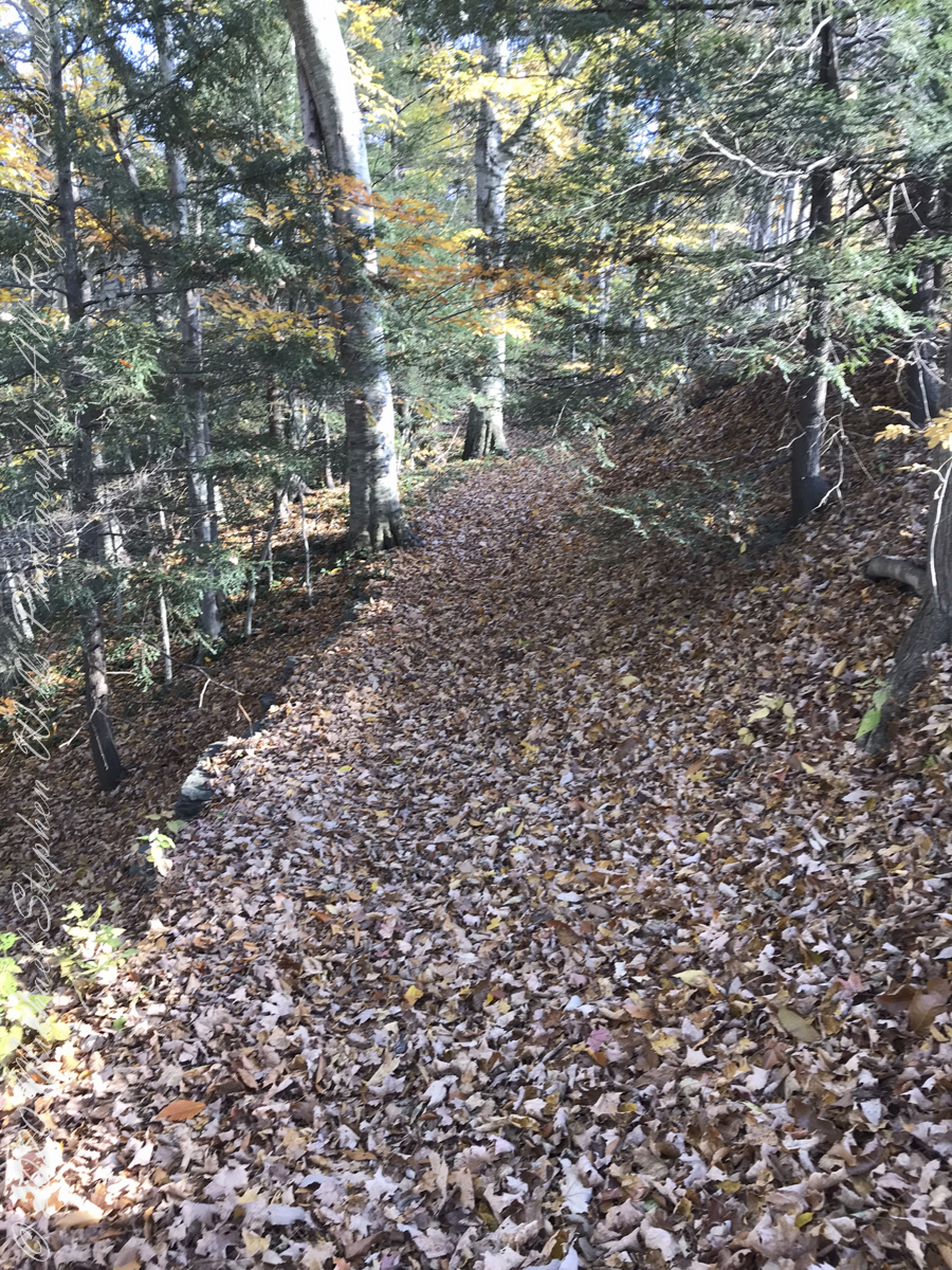
Johnson Trail
“No Place Like Home” — Back on West Hill, our Japanese Maple was waiting for us.
Copyright 2022 Michael Stephen Wills All Rights Reserved
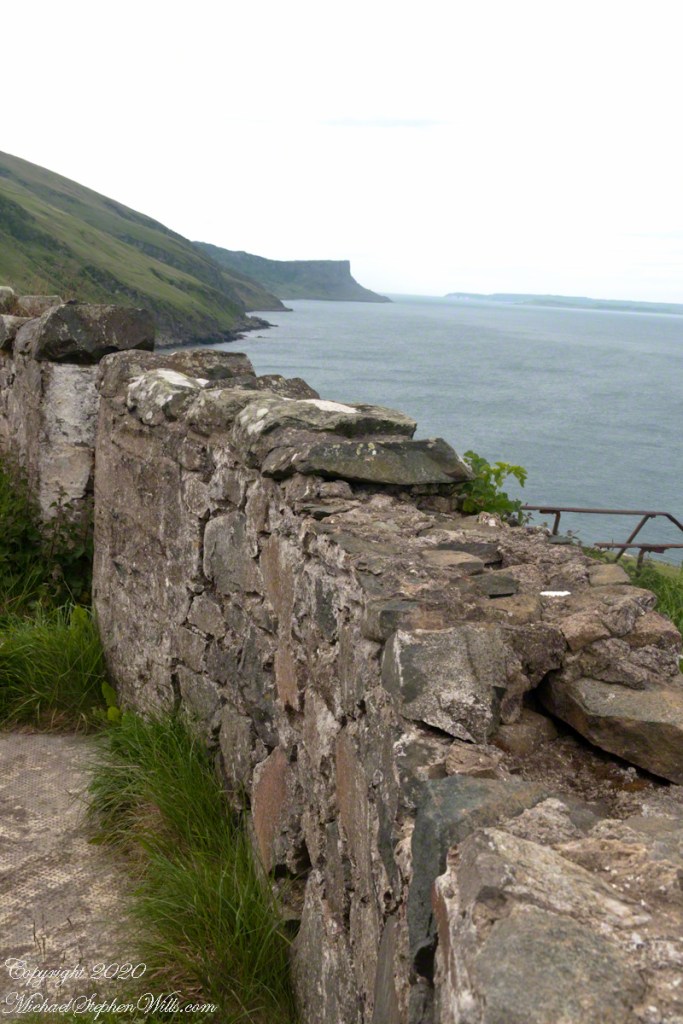
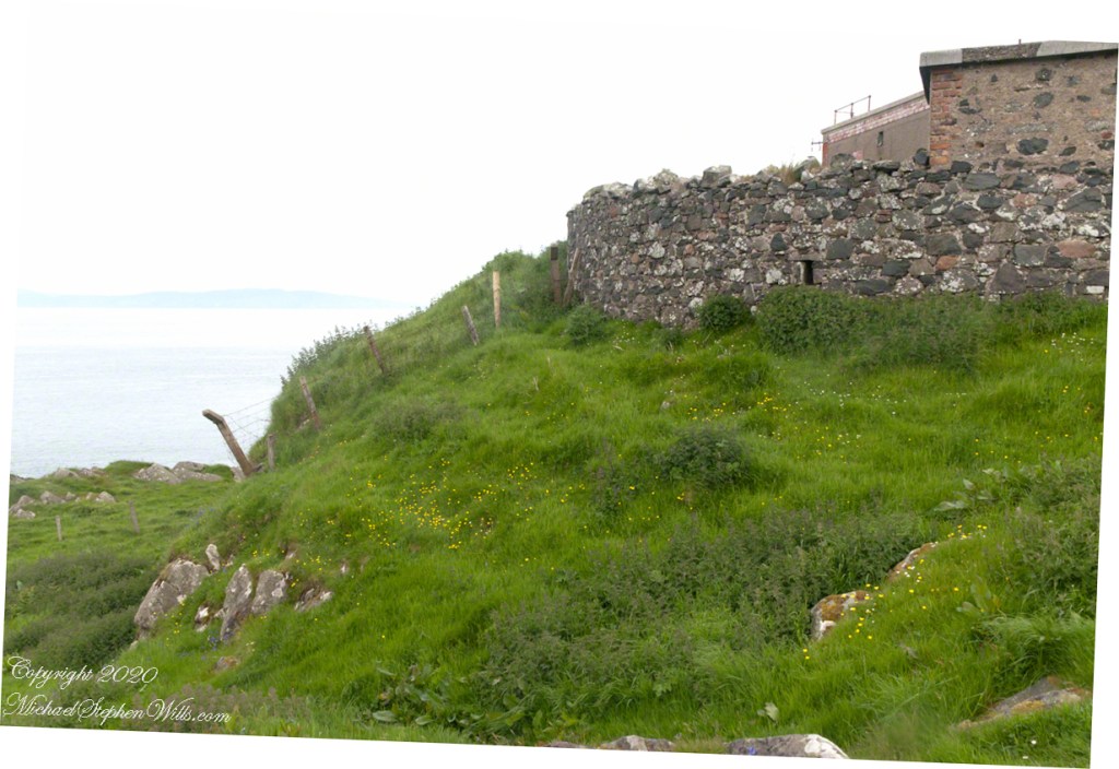
Weathered masonry at the height of Torr Head was there to serve the custom house and as support for a spotting station where ships transiting the Strait of Moyle (Irish Sruth na Maoile), the 12 miles of water to the Mull of Kintyre.
Lloyd’s of London, vitally interested in the appearance of ships’ progress crossing the oceans, had notice of passage via semaphore (and, later, Marconi’s “wireless”). Destination ports were copied in.