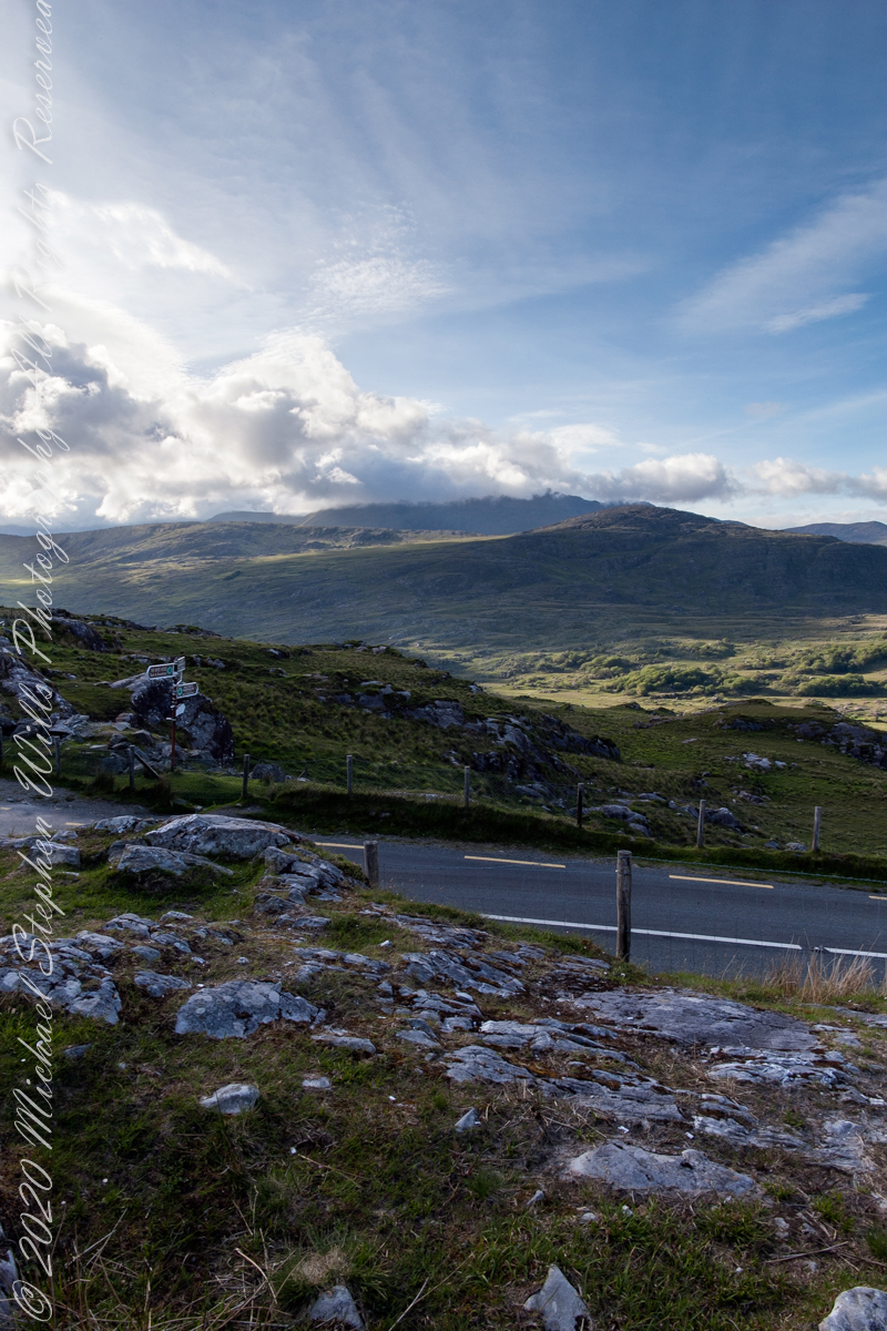
Here we are standing in Moll’s Gap, looking northwest into Black Valley, a place so remote it was among the last, on the island itself (“mainland”) to be electrified or connected to telephone networks.
Beneath our feet are the slopes of Derrygarriff (in Irish Doire Gharbh) of the Mangerton range. Across the way is Crossderry peak of the Dunkerron mountains, the townland is named for the peak. Black Valley, now a southerly route to the Gap of Dunloe well known to certain hikers and cyclists, is beyond the far mountains.
Click pic for larger view in a new browser tab. If you are in WordPress Reader, open the post to use this feature.
Copyright 2021 Michael Stephen Wills All Rights Reserved
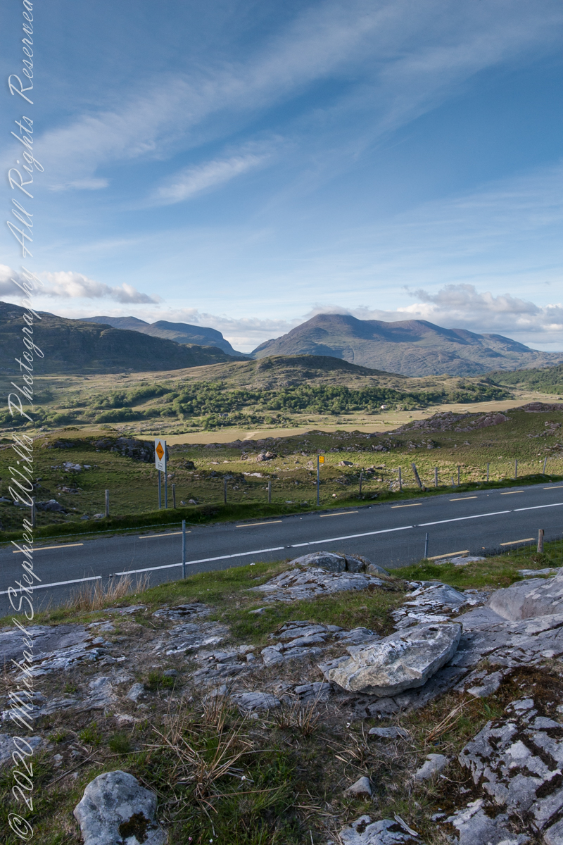
Here we are, on the road from Kenmare to Killarney, N71, part of the Ring of Kerry around the Iveragh Peninsula. The spot is the mountain pass Moll’s Gap, also known in the Irish language as Céim an Daimh (meaning, Gap of the Ox). In the Nineteenth Century a woman named Moll Kissane ran a public house here, operating illegally.
The mountain of this townland, named Eirk (also known as Adhard) , is composed of a fine grained sandstone found in a wide swath from North America’s northeastern coast, Greenland, Ireland, Great Britain — lands formerly part of the same ancient continent.
Click pic for larger view in a new browser tab. If you are in WordPress Reader, open the post to use this feature.
Iveragh Peninsula, Eirk townland, County Kerry, Republic of Ireland.
Copyright 2021 Michael Stephen Wills All Rights Reserved
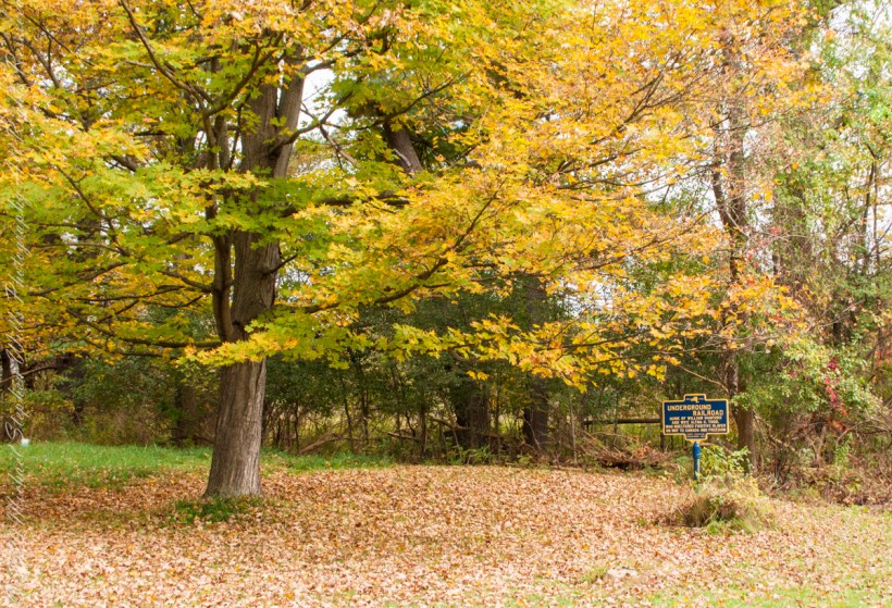
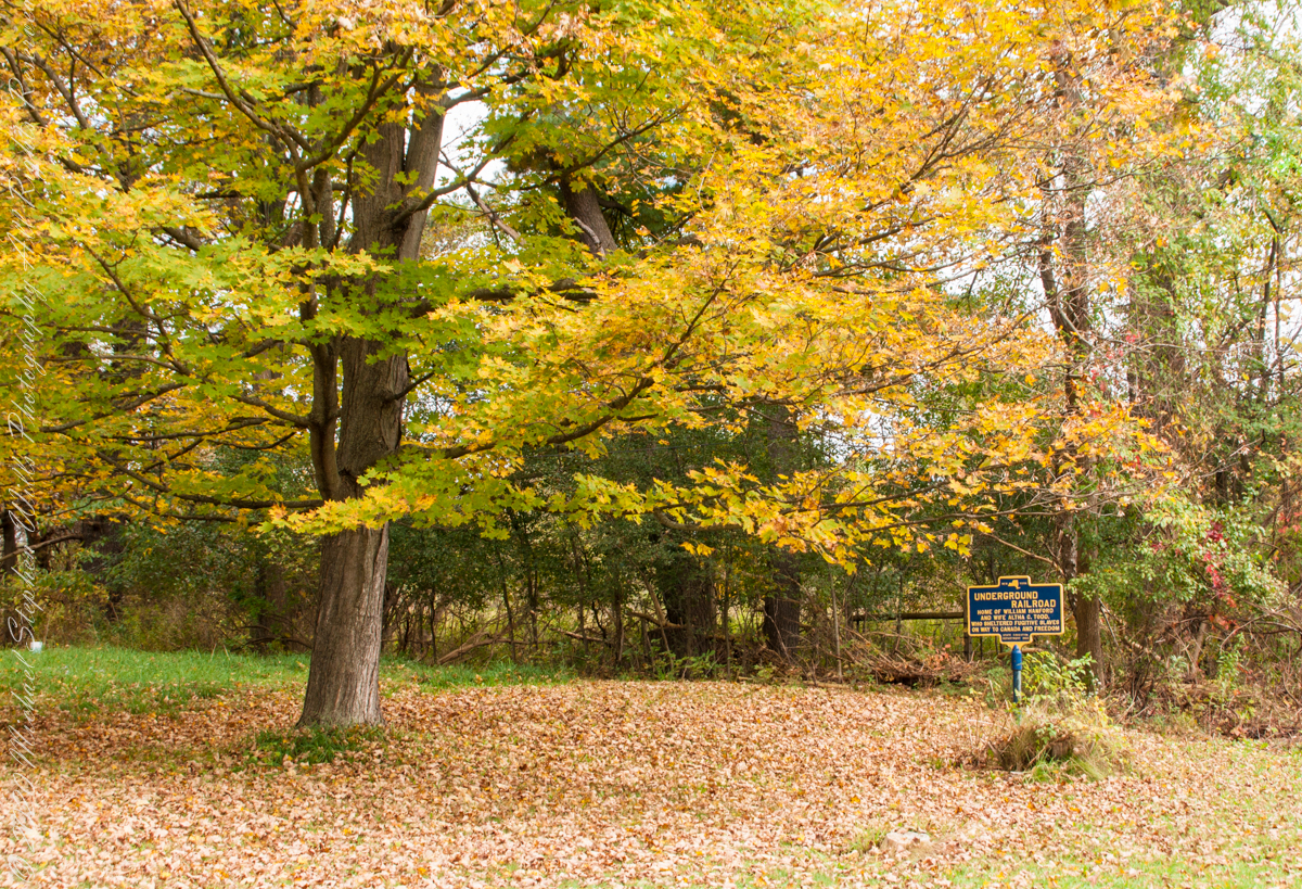
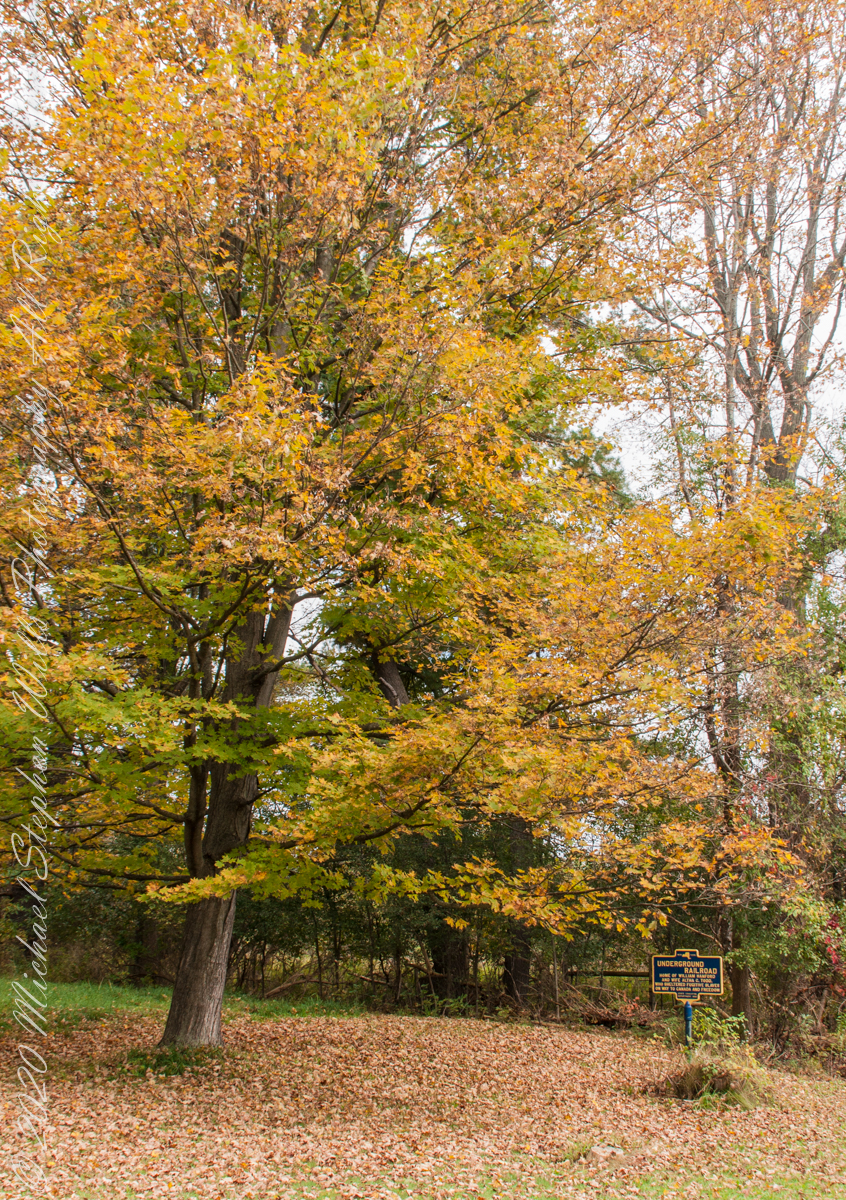
We have often travelled Lower Creek Road as an alternate route to visit my son and his family who live in Freeville, a village named for the activity of the Underground Railroad. After noticing this sign in passing for years, this week we stopped on a glorious autumn morning to capture it. I had packed the Sony Alpha 700 dslr for just such an opportunity.
Just off the road, under a maple tree in full autumn color (yellow), ground covered with fallen leaves (brown) on a fine early October morning, the sign reads, “New York, UNDERGROUND RAILROAD, HOME OF WILLIAM HANFORD AND WIFE ALTHA C. TODD, WHO SHELTERED FUGITIVE SLAVES ON THE WAY TO CANADA AND FREEDOM, STATE EDUCATION DEPARTMENT 1932”. These dark blue background, bright yellow letter signed are found throughout this region and much appreciated.
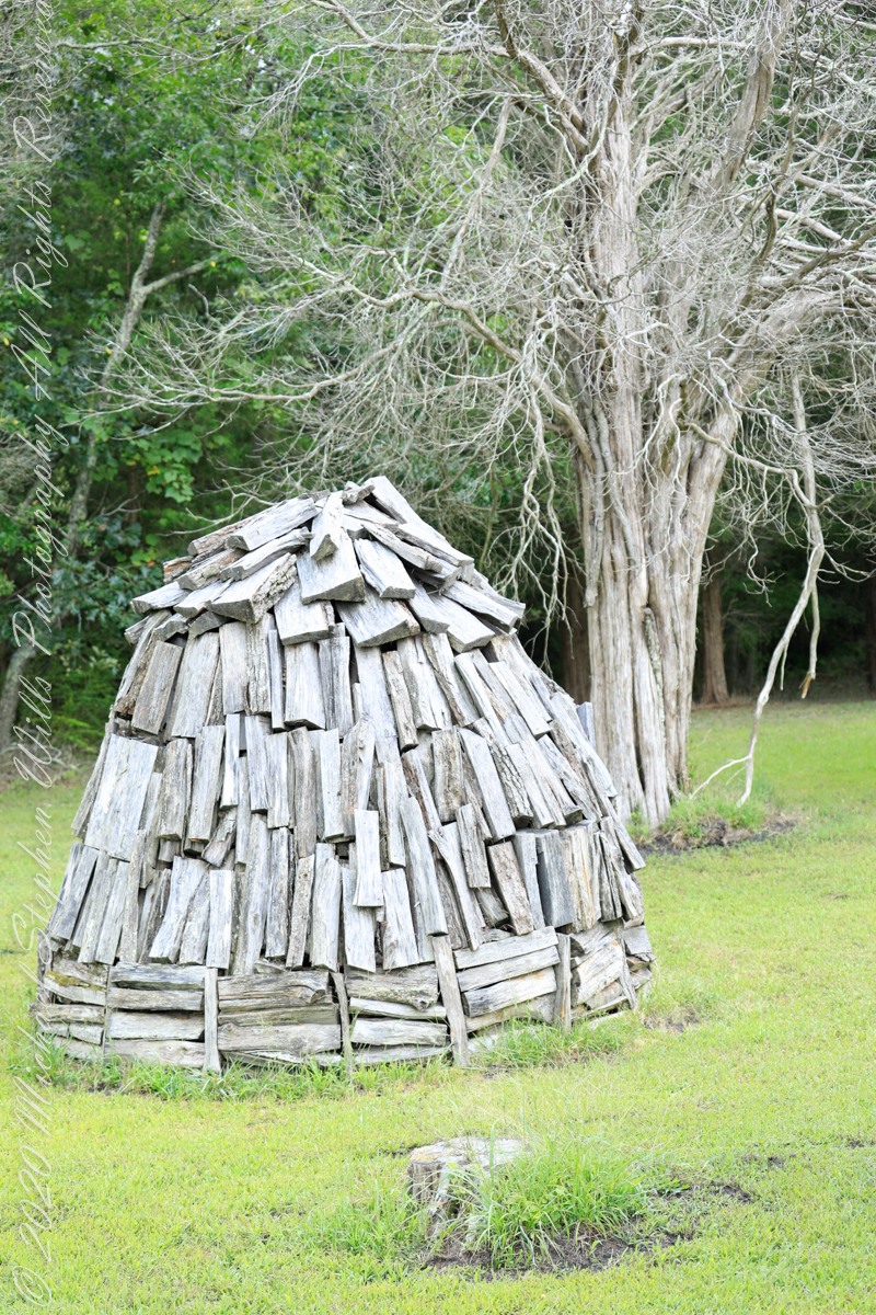
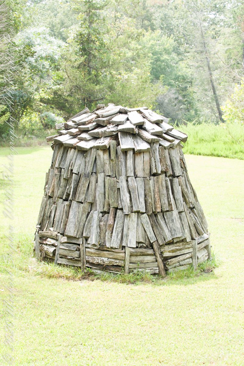
Here my exploration of Wharton State Forest, Pitch Pine Forest III, branches to the genealogical exploration of this landscape as my sister, Theresa and I, proceed along the humped, pitted sand road Goodwater through the wilderness to emerge in Batsto Village, a recreation of lives that touched my great great grandparents, James and Ann McCambridge among them. Ann saved money earned as a cook for Atsion furnace, the historical site at the start of the road to Quaker Bridge. Her husband James worked as a collier, supplying fuel for the iron furnaces at Atsion and Batsto, among other enterprises. During our Batsto Village visit we found these reproductions of charcoal clamps.
A charcoal clamp (a word derived from Dutch for “heap’) is build around a chimney formed from the wood and covered with materials such as earth to control air flow.One the burn was started, the process was watched closely. The person in charge was called a collier.
Since earliest times charcoal was used for cooking and heating. It was the best heat source for metal furnaces. Entire deforested regions are attributed to the demand for charcoal. Thomas Jefferson experimented with charcoal clamp designs, modifying air flow from the base.
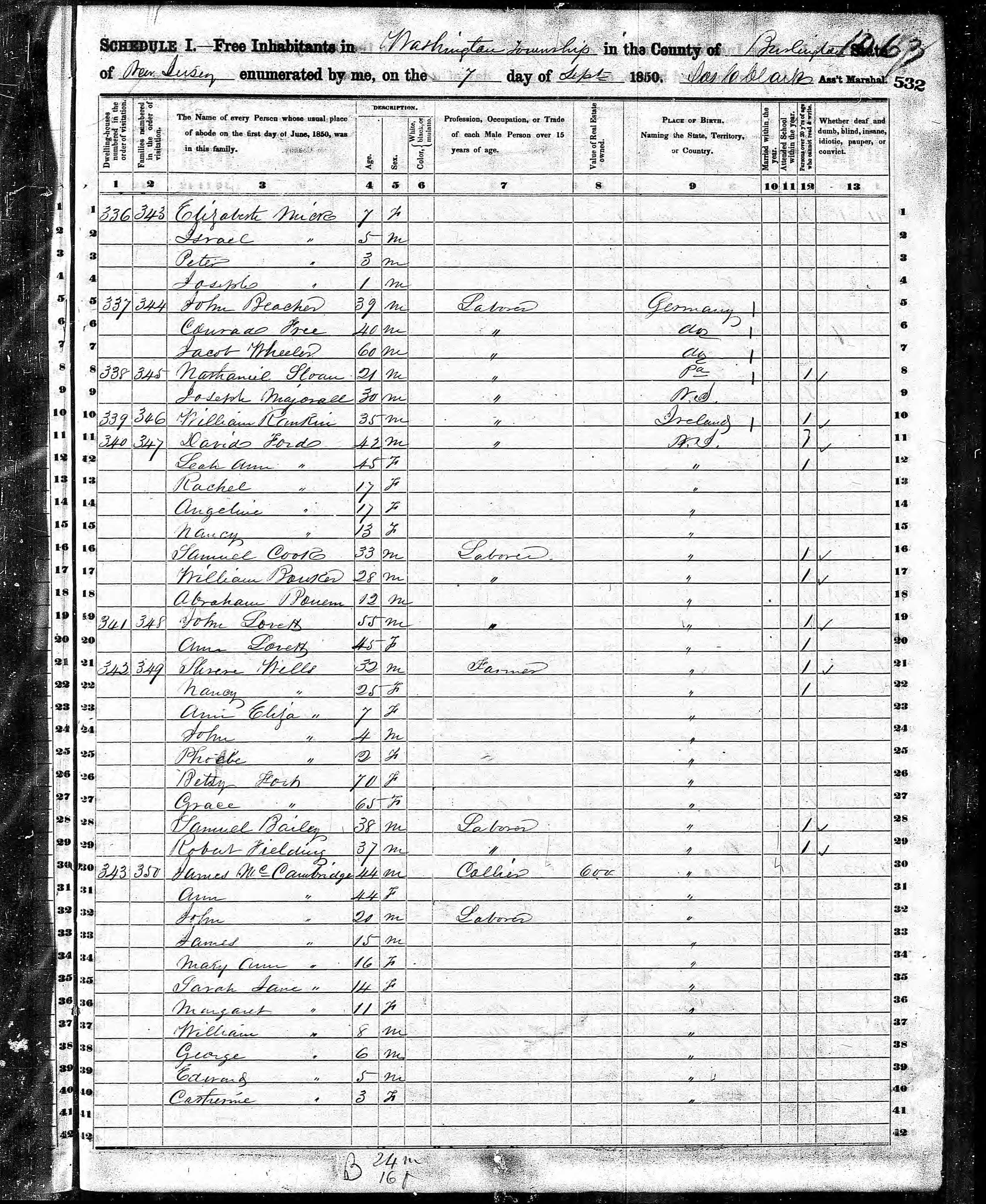
James and Ann lived on the land that provided a livelihood, enough to support themselves and nine (9) children. From September 7, 1850 is the US Census for this family of my second great grandparents. Great Grandmother Margaret was 11 years. James is listed as a Collier, the value of Real Estate owned was 6,000 (a fortune for the time).
Leaving the jeep on the west side of Quaker Bridge, I walked over to inspect the structure and poke around the other side, carrying a Canon 5d Mark IV (camera body) / EF 70 – 300 mm f/4-5.6 L IMS (lens), shooting as I walked. My sister Theresa and Maxie, a little white dog, lagged behind taking in the surroundings. Here they are, in shadow, on the west side.
Click pic for larger view in a new browser tab. If you are in WordPress Reader, open the post to use this feature.
My work on the east side was shared in previous posts, “Pinelands Connections VIII,”I and II “Around Quaker Bridge,” and I and II “Pitch Pine Forest,” work interrupted by the sound of an approaching engine, a Humvee came into view. I waved my arm up and down, a sign to slow down, pulling alongside the driver looked up with dead eyes, no element of recognition of a fellow human, as I explained my sister was on the bridge. A stink of unfamiliar hydrocarbons, diesel fuel?, rose through the heat as they pulled forward with no acknowledgement of my request. Thankfully they slowed down as Theresa, Max in her arms, said, “hi.”
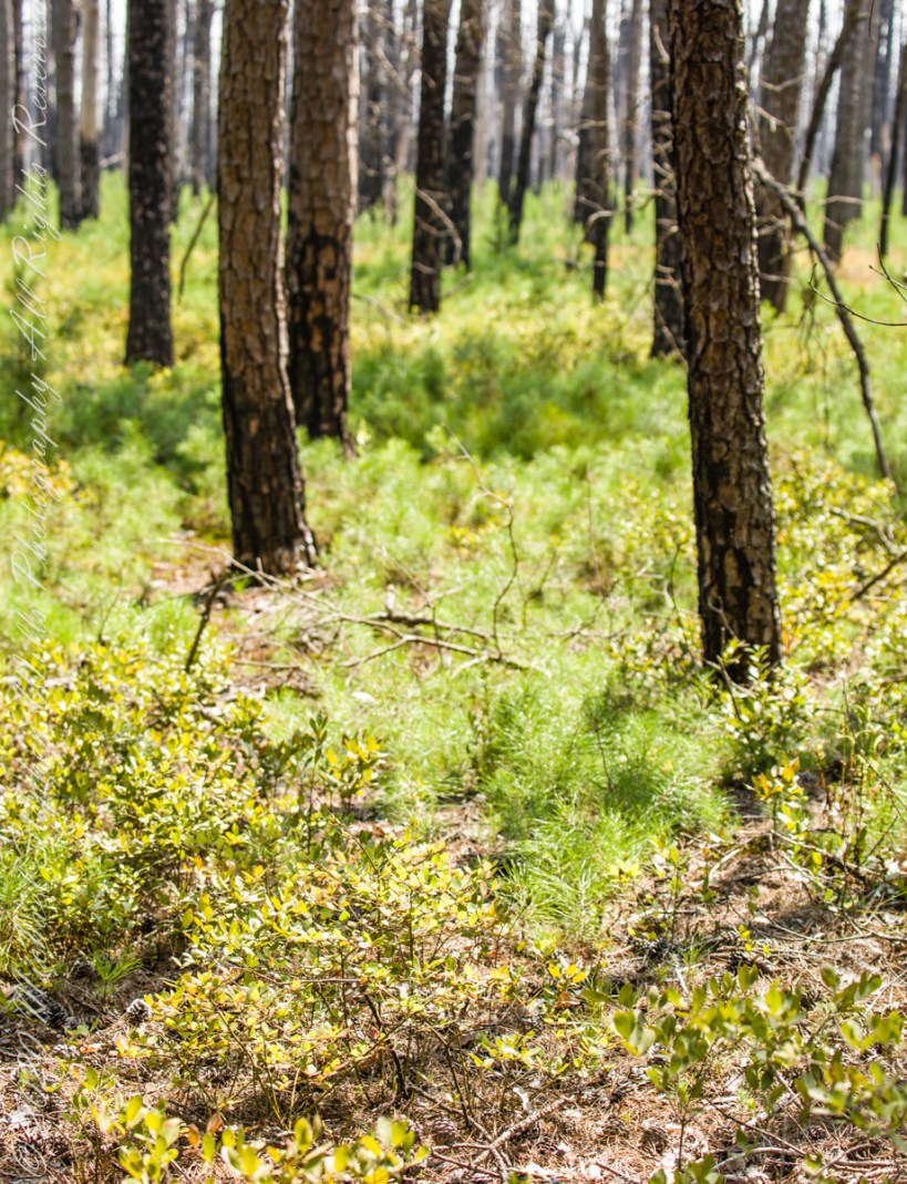
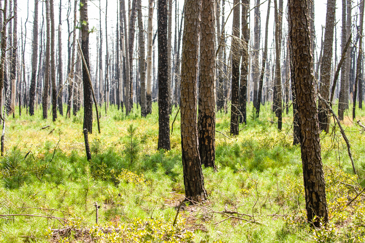
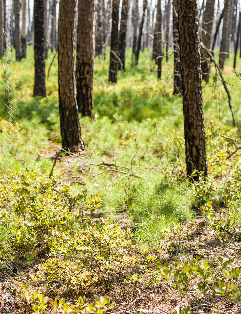
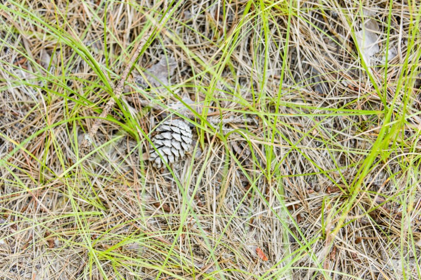
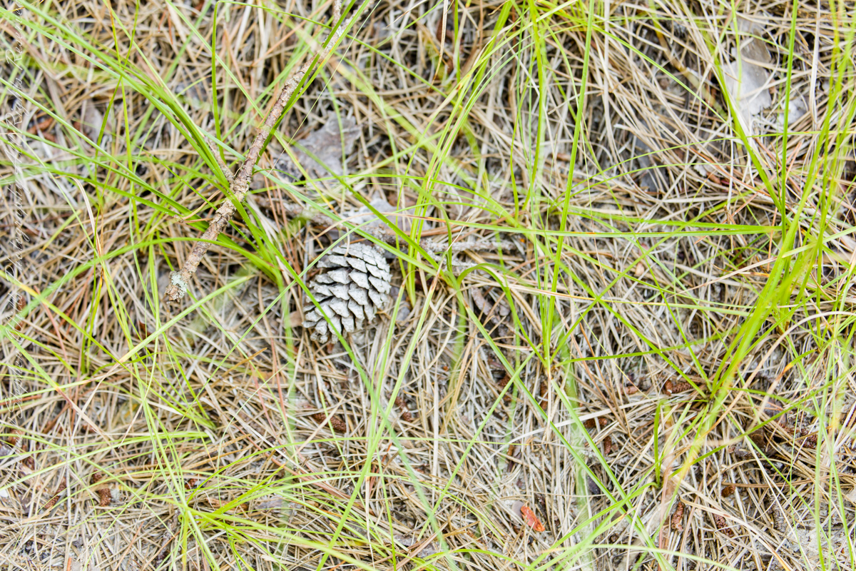
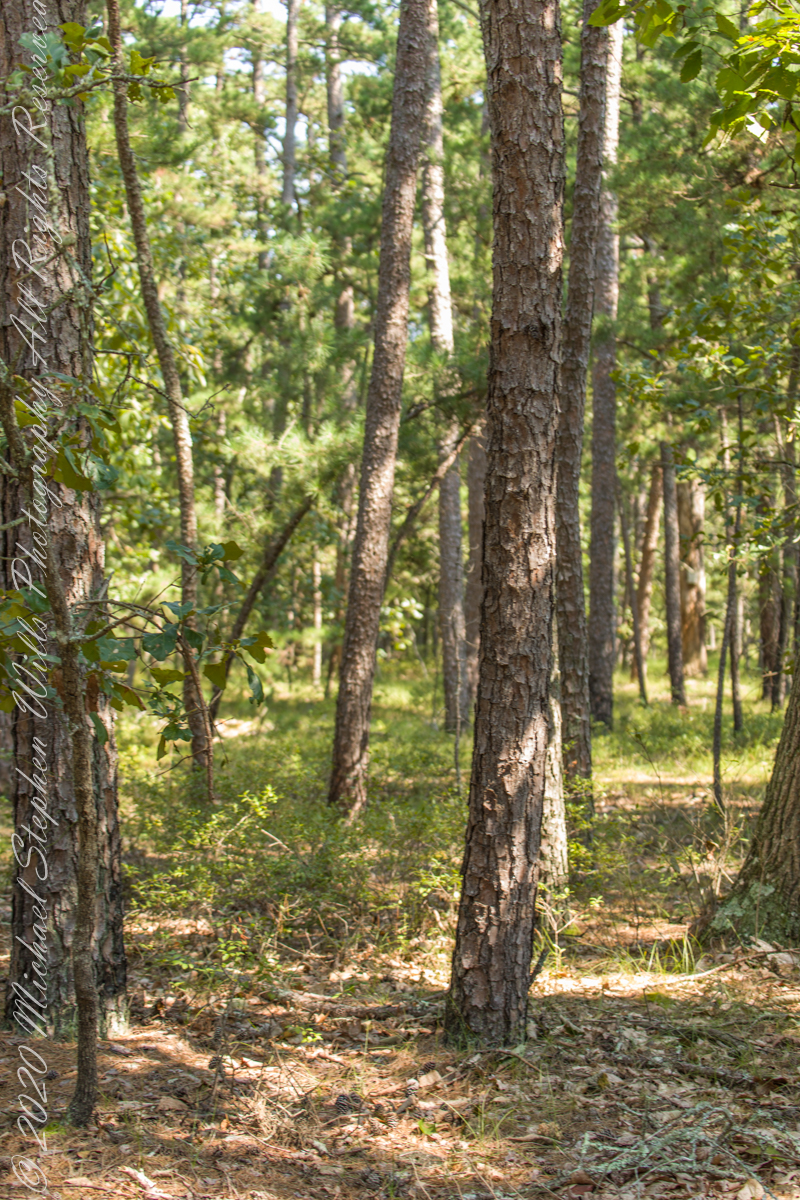
Multiple roads converge from all directions on Quaker Bridge, using GoogleMaps (surprising these unimproved, “jeep” sand roads were listed) I chose Goodwater Road as a route to Batsto Village, on the southern side of Wharton State Forest. The 6.1 mile road follows the east bank of Mullica River at a distance, a very rough passage through ancient Pitch Pine forest. Here are photographs of the enormous capacity of the pines to regrow after fire. Note a thick seeding growth among the mature pine trunks, lower portions fire blackened.
Copyright 2021 Michael Stephen Wills All Rights Reserved
In this Part 03, some contemporaneous people are introduced, more information on the environment provided, some previous residents named and imagined.
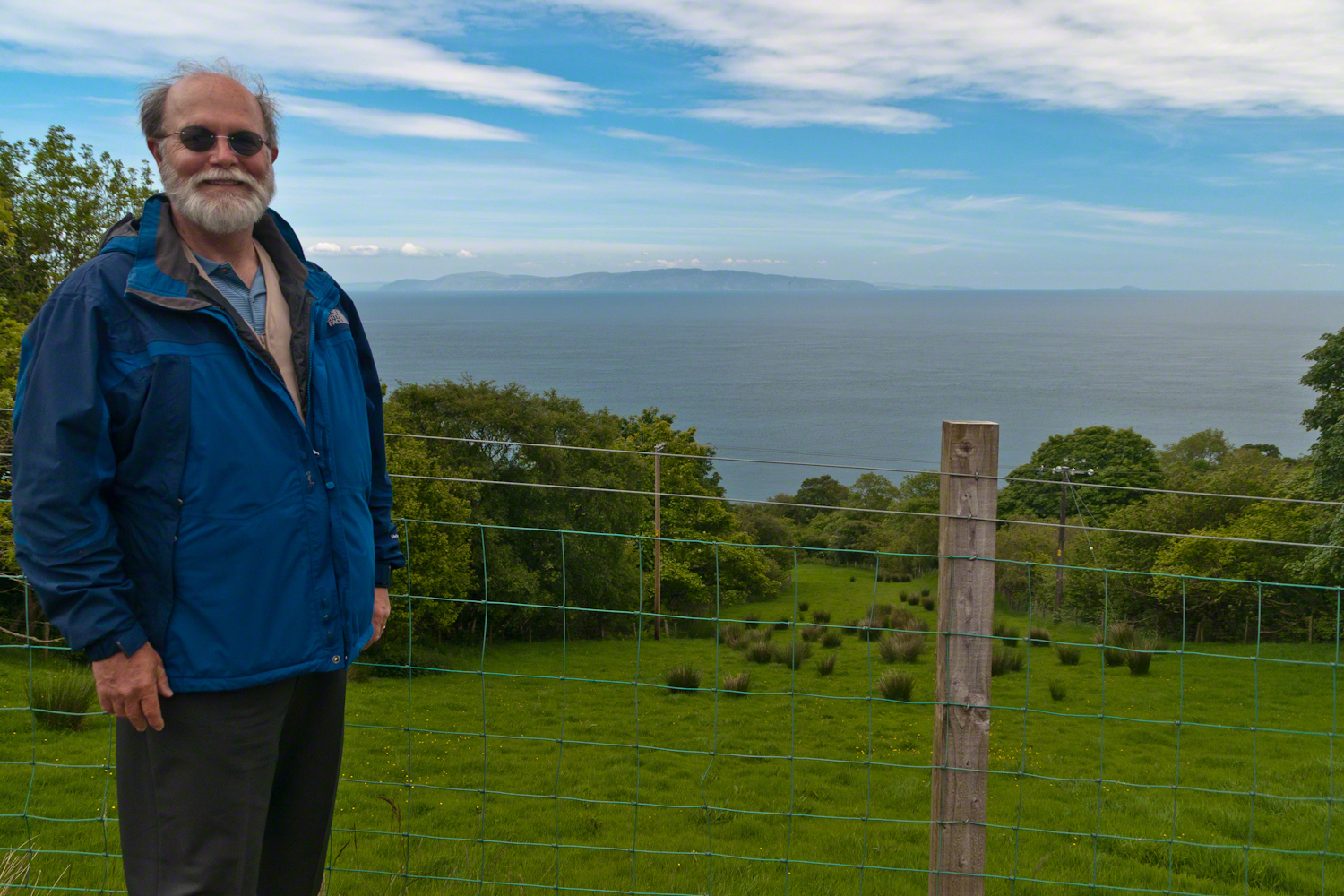
On the way to Torr Head we stopped at this spot in Coolranny Townland to take in this view of the Irish Sea. The land overlooks Loughan Bay toward the Mull of Kintyre and Sanda Island, Scotland. County Antrim, Northern Ireland. Coolranny borders Loughan Townland on the east.
To understand the full beauty of a place, it is necessary to live it, to experience the seasons, approach the land from different aspects; pass the same place many time, noticing overlooked features, enjoying old favorites. We did our best in this single day and took the exploration of this Antrim County coast slow, savoring all the views we noticed as this is a once in a lifetime experience. Imagine our amazement to find Scotland so close at hand. In the past, on a fine day the trip across the North Channel, up eastern Kintyre peninsula shores to Campbeltown at the head of Campbeltown Loch, was easier than a land crossing to a closer town.
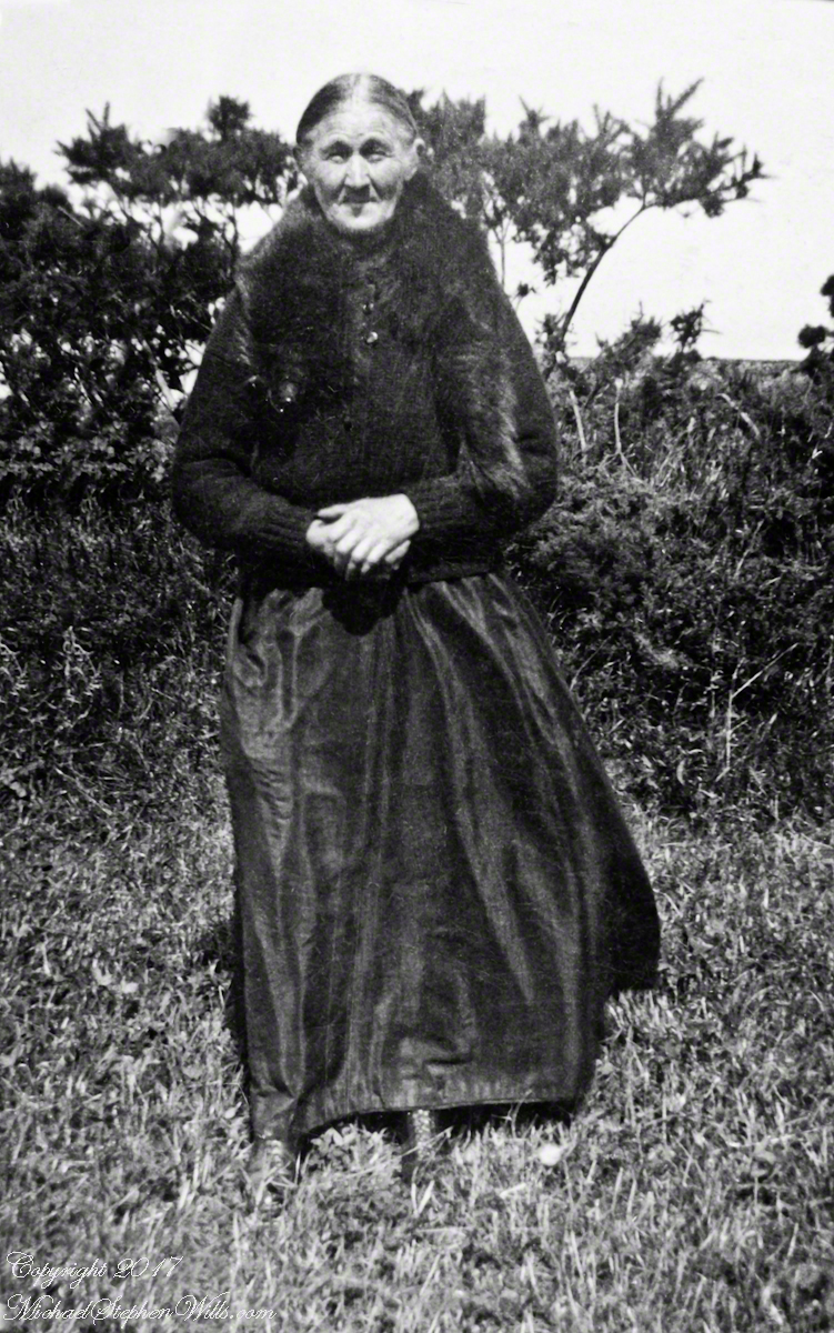
I picked Campbeltown because my great great grandfather, a sea captain, emigrated from Scotland to County Louth where my great grandmother, Anne Campbell, married John Mills. In this way Captain Campbell escaped persecution for his Roman Catholic faith.
Late in her life, Anne Mills posed for this portrait. I can tell great grandmother Mills is facing north from these clues:
— the press of the eternal east wind on her dress, against her left left and flowing away from the right.
— the sun shadow on her cheek. It was around noon. With the sun, at this latitude, in the south the shadow from her right cheekbone is darker than the left.
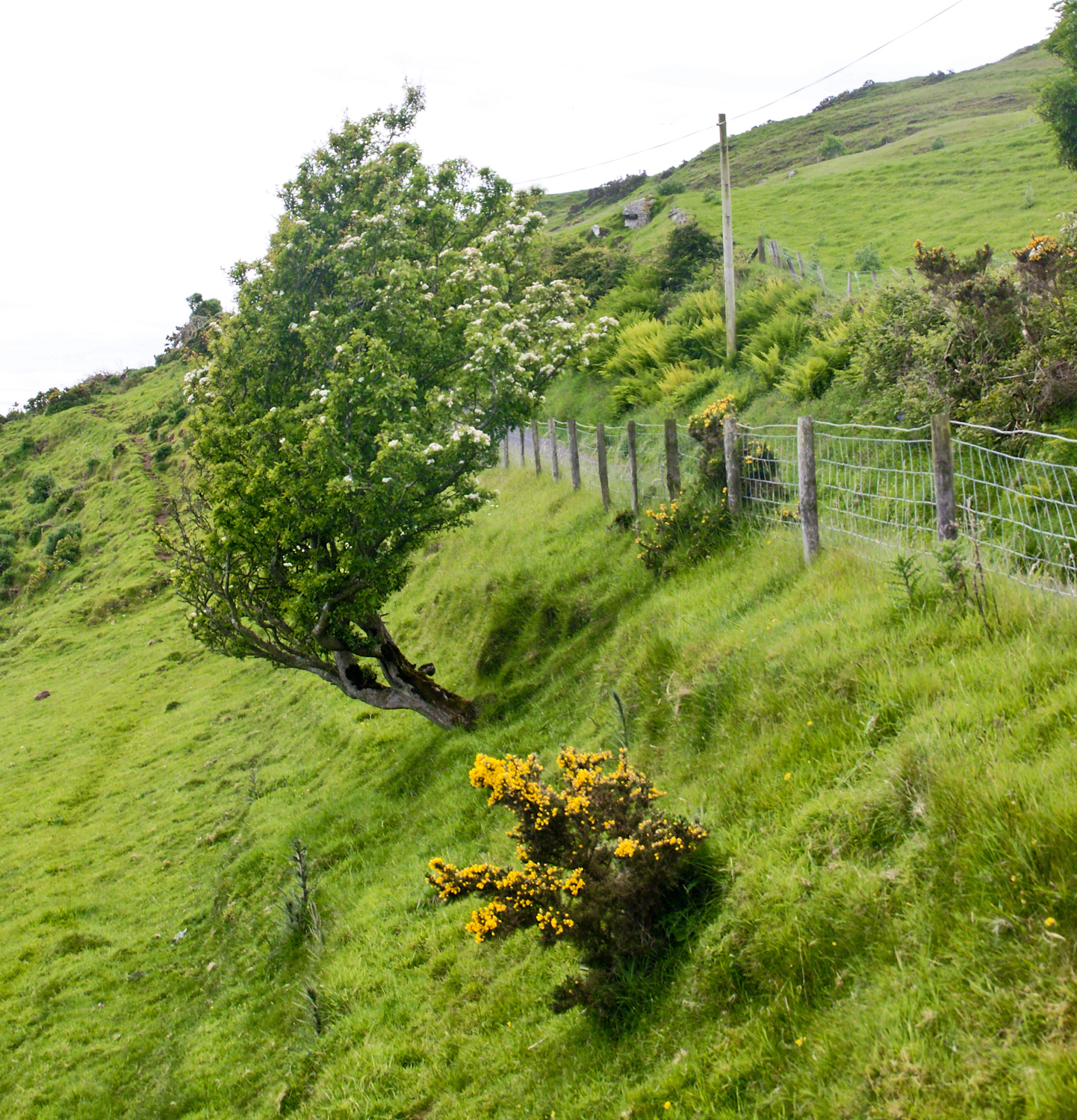
Rowan Tree directional growth from a constant east wind, County Antrim on the Torr Road nort of Cushenden.
A few miles before Loughan Bay, at Coolranny, are informative placards describing the area. I thought the white flowering trees, or shrubs, on the slopes were Hawthorn. On revisiting my capture of the placards I learned these are a different plant named Rowan Tree, aka Mountain-ash. This wind stressed specimen is an typical example of Rowans on this coast, stunted and little more than a bush. This individual is slanted westward from a constant and stiff east wind, as with Anne Mills’ portrait. Residents, past and present, of this coast know this damp, persistent wind well. Note the lack of blossoms on the east side, blossoms that ripen to small dark red fruit called poms (also called rowans). The leaves turn red in the fall. More time, for the fruit to form and leaves to turn, was necessary for me to be certain my identification of this, as a Rowan, is correct.
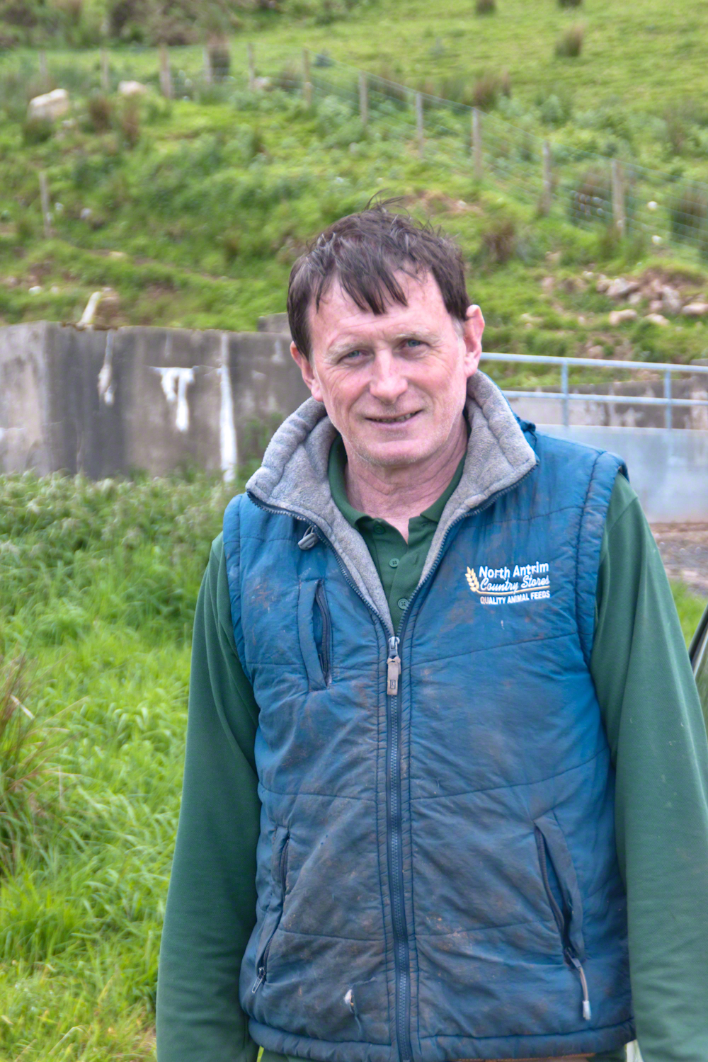
We parked on a turnout above the Loughan Cottages, near this farmer’s sheep pen. He drove up in a huge tractor and conversed with Pam while I was below shooting the cottages. He made a good impression.
On this day, Friday, June 6, 2014 I did two rounds of shooting the cottages. The first, handheld, with a Sony Alpha 700. Upon returning to the car for the Canon, Pam was talking to a friendly sheep farmer who pulled up in a large tractor pulling a tank. It turned out we parked below the turnout for his sheep enclosure built on the hill west of Torr Road. His flocks grazed the surrounding land. He and I talked, too briefly, about the hard lives of the people who lived here.
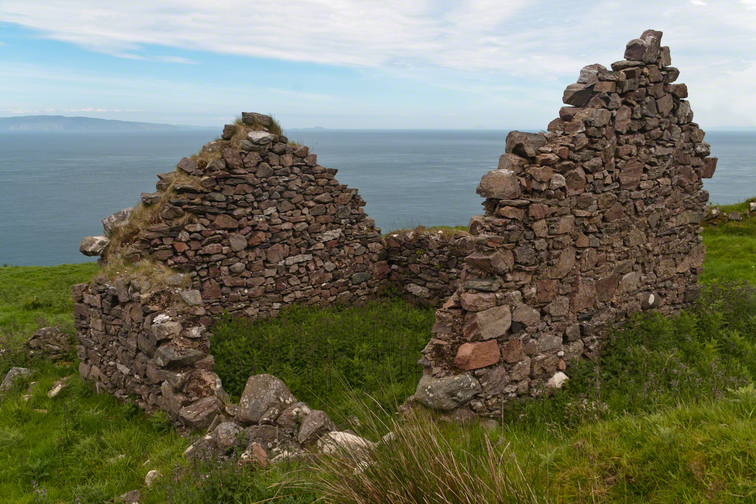
The Coolraney placard, up the road, claimed the cottages were deserted in the 19th century. I found evidence, in the 1901 Irish Census, of three Roman Catholic families, 19 men, women, children, living on Loughan Townland. In Part 02 of this series, setting the stage, Loughan is sized at 112 acres, a single photograph captures Loughan entire. These families had nowhere else to live, in Loughan, other than the cottages.
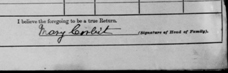
The smallest, and poorest, the poorest of the poor, family was 32 year old Mary Corbit and her two children, 10 year old Mary and Robert, 2 years. The Corbit family lived in a one room, stone walled, house with a wood or thatch roof. Unlike the other families they had no outbuildings, structures to house livestock or to support a farm operation. The house owner was Marj Delargy.
Here is a single room house among the ruins, four low walls, the east/west with intact gables, the stones collected from the hillside. The west wall higher up the slope, the floor now thick with fern.
Little Mary most certainly took care of Robert for part of the day. Did Mary, with Robert along, gather rowans, and other forage?
A thick growth of ferns, grass on the gable was once a home with a view of Scotland’s Mull of Kintyre 12 miles across the Irish Sea. The Isle of Sanda just visible on the right of the far gable. Alisa Crag just visible in the distance, to the left of the nearest gable.
Mary Corbit: head of household, occupation laborer. There is a footnote to Mary’s “Marriage” entry as Married, “husband at sea.” The “C” of her census signature exactly like my mother signed her name Catherine.
Mary Corbit and her children were not listed in Loughan Townland for the 1911 Census.
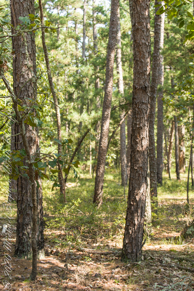
Multiple trails lead from where Quaker Bridge crosses the Mullica River. These are from a handheld Canon 5d Mark IV with the Canon EF 70 – 300 mm f/4.0-5.6 ISM lens.
Click pic for larger view in a new browser tab. If you are in WordPress Reader, open the post to use this feature.
70 mm, ISO 200 , 1/40 sec at f / 4.5
lll
Copyright 2021 Michael Stephen Wills All Rights Reserved
Another aspect of the gradual 1/2 mile inclined path to the central ring of the prehistoric Dun Aonghasa ruins of County Galway, Ireland.
The view north, northwest from this way to Dun Aonghasa (Dun Aengus). In early June, looking across wildflowers, karst landscape, walled fields, farms, the North Atlantic Ocean, coast of Connemara and the 12 Bens (12 Pins) mountains.
Note the doorway (with long lintel) in the surrounding wall, to left of center in middle distance.
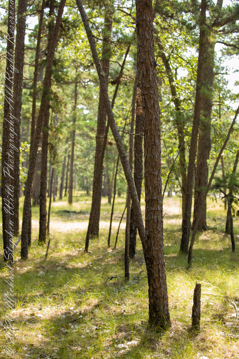
Multiple trails lead from where Quaker Bridge crosses the Mullica River. These are from a handheld Canon 5d Mark IV with the Canon EF 70 – 300 mm f/4.0-5.6 ISM lens.
Click pic for larger view in a new browser tab. If you are in WordPress Reader, open the post to use this feature.
70 mm, ISO 200 , 1/60 sec at f / 4.0
lll
70 mm, ISO 200 , 1/80 sec at f / 4.0
Copyright 2021 Michael Stephen Wills All Rights Reserved
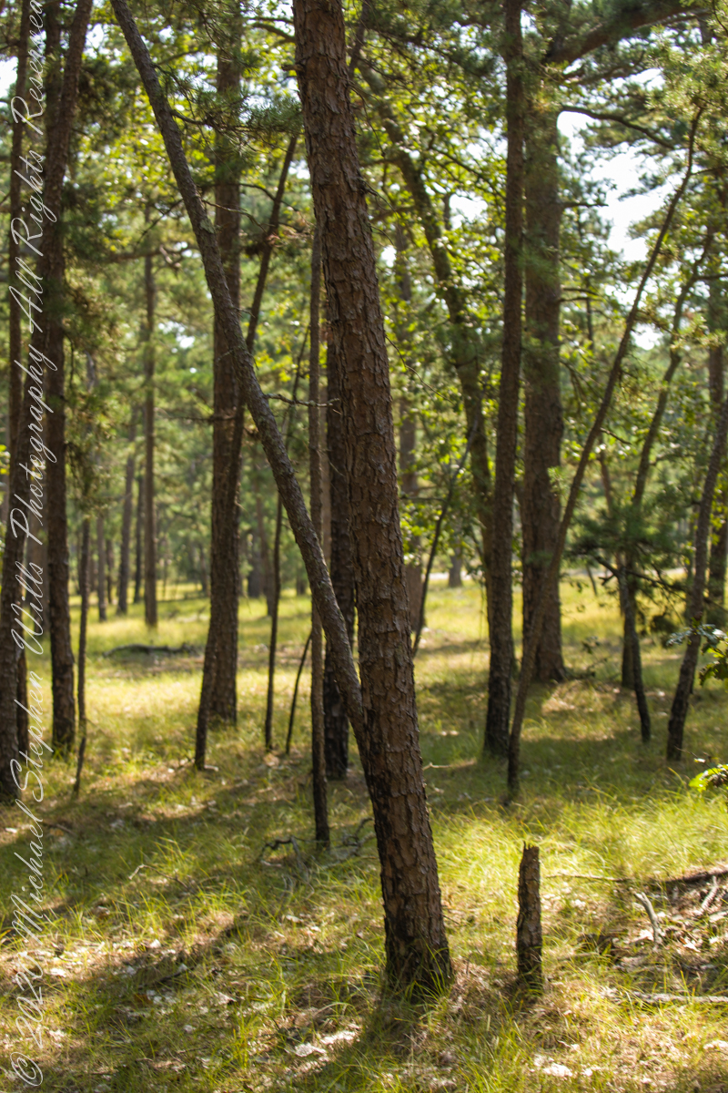
Multiple trails lead from where Quaker Bridge crosses the Mullica River. These are from a handheld Canon 5d Mark IV with the Canon EF 70 – 300 mm f/4.0-5.6 ISM lens.
Click pic for larger view in a new browser tab. If you are in WordPress Reader, open the post to use this feature.
70 mm, ISO 200 , 1/80 sec at f / 4.5
lll
70 mm, ISO 200 , 1/80 sec at f / 4.5
Copyright 2021 Michael Stephen Wills All Rights Reserved