Introduction to the Loughan an Lochan Ruins

Romance of Ruins

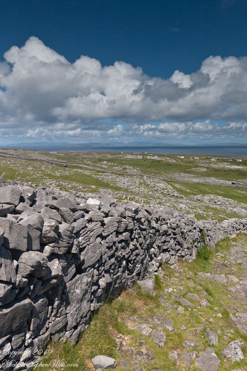
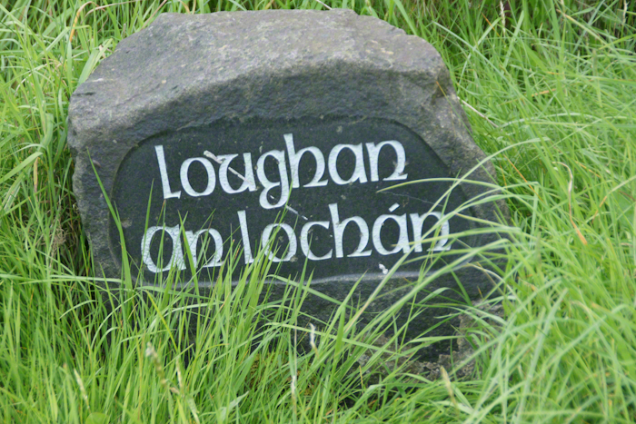
Here is a photograph from our day touring the Glens of Antrim.  While making our way up the coast to Torr Head a group of stone walls resolved into ruins. A cluster of cottages on grassy slopes above the Irish sea above Loughan Bay.  This is the townland of Loughan.  Along the road are wonderful signs providing in handsome carved letters the place name in english and gaelic.  Here a signed only provided a gaelic name: “Loughan an Lochan”…near enough to meaning “Loughan Bay” in English.  The bay is a shallow scallop shaped indentation of the coast, a margin of narrow sand strand.

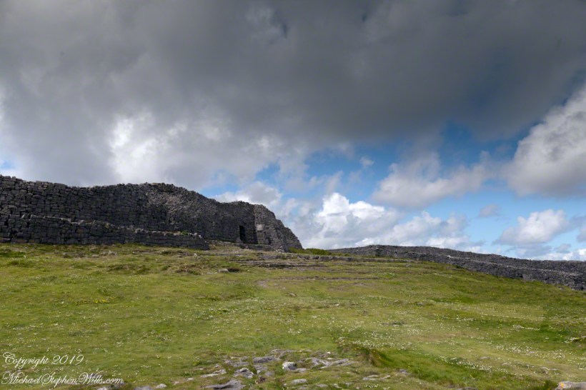
Ruins are spread across the slope.  Immediately before the views are traces of a foundation above the grass.  Beyond the top of a gable, an entire gable to the left.  On the far ridge, just visible, is an entire structure with doorways, gables, walls.

Across the Irish Sea, 13 miles distant, is the Mull of Kintyre.  In faint outline, rising above the horizon, find the highlands of Islay more than 30 miles.  Both are tips of peninsulas jutting from Scotland.

Click pic for larger view in a new browser tab. If you are in WordPress Reader, open the post to use this feature.

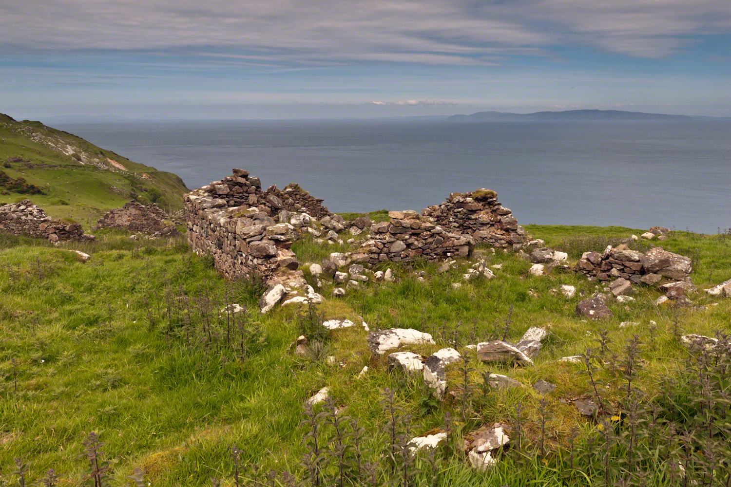
The ruins lead to curiosity over who live here?  What were their lives like?  Why did they leave?

Want more? Click the link for my Ireland Gallery

Enter your email to receive notification of future postings. I will not sell or share your email address.

Like a Dandelion

and a shifting of crops to (human) wheat from (cow) corn

Wednesday, June 15th, we were on a turn to heat and humidity with this day of light breeze, temperature in the 70s making hiking around Tremen Park a joy.

These snapshots, taken on the fly with an IPhone 7, are the high points.

The first is a dandelion look alike with yellow flowers, petals shaped like teeth, though on a long hard stem and multiple flowers on a stalk. Known as meadow hawkweed, yellow hawkweed, field hawkweed, king devil, yellow paintbrush, devil’s paintbrush, yellow devil, yellow fox-and-cubs, and yellow king-devil with two scientific names: Pilosella caespitosa and Hieracium caespitosum.

Click photograph for a larger view. To do this from WordPress Reader, you need to first click the title of this post to open a new page.

Click for slideshow.

Copyright 2022 All Rights Reserved Michael Stephen Wills

A Brief Happy Movie on the Solstice

a gorge walk

Walking around Taughannock Falls New York State Park on the solstice of 2019 starting from the Black Diamond trail head on Jackson Road, down the South Rim trail, up the North Rim Trail. We had a great deal of rain this week and the water filled the falls the full channel width.

The header photograph is a waterfall of Fillmore Glen, also in the Finger Lakes.

For a full screen view, click on the UTube icon, lower right of the video panel. The resolution is not very good so I also posted the source videos.

The movie is from the following videos and photos from my IPhone. The quality is better than the compilation video. I uploaded the following videos directly to WordPress. I was not able to get the “full view” icon to work on my browser. Enjoy

View of the upper gorge, above the falls, from the South Rim
View into the gorge from the South Rim
Distant view of Taughannock Falls from the South Rim
Click on any of the photographs for a larger view.
The stair down from the gorge South Rim
View of the forest of the South Rim
The stairs up to the North Rim of the gorge
View of the forest of the North Rim

A turkey vulture soars by towards the end of the following.

View of gorge from the North Rim
View into the gorge from the North Rim
Taughannock Falls and “Ant People” from the overlook
Taughannock Falls from the North Rim
Copyright 2019 All Rights Reserved Michael Stephen Wills

Island Shrine

part of the Irish landscape

A roadside shrine on Cottage Road, Inishmore. The faith brought by the saints has deep roots here.

A large crucifix set with wet stone walls with cut flowers. The walls are the native limestone.

It is a spring (early June) afternoon and there are fern and wildflowers. The white flowers are Greater Burnet saxifrage (Scientific Name: Pimpinella major).

Click Me for Getty IStock photography of the Aran Islands

The existing dry stone wall was interrupted by the shrine. In the distance are dry stone walls around fields, a stone shed, feeding horses and the sea, being Galway Bay, storm clouds with distant rain.

Aran Islands, County Galway, Ireland.

Click me for the first post of this series, “Horse Trap on Inishmore.”

References: search google “Wet Stone”

Copyright 2022 Michael Stephen Wills All Rights Reserved

The Waterlily Genus Nymphaea

Congrats to all fathers and grandfathers, Happy Fathers Day

The McKee informative placard divides the Genus Nymphaea into “Hardy” and “Tropical” waterlilies. “Hardy” being plants native to temperate climates, such as New York State. I do not have photos of these from McKee. Nor are there examples of Lotus.

What I have is an abundance of the “tropical” varieties.

The family Nymphaeaceae, of which the genus Nymphaea is a part, is thought to be the most basic of all the Angiosperms. A minute flower of the Nymphaea type was found in early Cretaceous deposits in Portugal, dating early waterlilies to at least 115-125 million years ago.

Angiosperm,” the word referring to all flowering plants, is composed to two greek words angio-. meaning enclosed, and -sperm, meaning seed. “DNA studies indicate the Nymphaeaceae separated from the rest of the angiosperm family tree…..before the separation of the monocots and dicots.” – see reference.

Click me for wonderful sculpture at McKee Gardens

Reference: The Botanical Garden, Volume II, by Roger Phillips and Martyn Rix, Firefly Books, pp 382-383

Copyright 2022 Michael Stephen Wills All Rights Reserved

Inishmore Slideshow

An Aran Island Revel

Imagine yourselves in an open cart exploring the island. Here are the photographs from my Inishmore exploration posts. Enjoy!!

Click for another great Island post, “Inisheer Welcomes the 2014 Gaeltacht Irish Football Champions.”

Cliff Edge II

Flowers on the edge

From the commanding location of Dun Aonghasa, looking northeast across Inishmore island, we can understand why the ancient builders chose this location.

We also see the transition from exposed limestone to the fields built literally from the ground up (see my post “The How of Soil”).  For a closer view of island houses see my posts “Settled In” and “Cottage Road Cottage.”

The field walls are described in my posts, “What is a rock, what is a stone?” and “Stone on Stone.”

Click the photograph for a larger view.  Enjoy!!

Click the link for my Getty IStock photography of the Aran Islands

Breaking waves, turquoise sea below the dramatic cliffs of the ancient fort Dun Aonghasa (Dun Aengus),

in the distance the karst landscape of Inishmore with clouds of an approaching storm over Galway Bay.

Sea Campion (scientific name: Silene uniflora) (irish name: Coireán mara) clings to the edge.

Inishmore, Aran Islands, County Galway, Ireland.

Click me for the first post of this series, “Horse Trap on Inishmore.”

Copyright 2022 Michael Stephen Wills All Rights Reserved

Stone on Stone

Wide enough

Enjoying travel on a horse trap, a type of carriage, on Inishmore (Inis Mór), the largest Aran Island in Galway Bay we headed up Cottage Road from Kilronan, the main island settlement.  It was there we embarked from the Doolin ferry, hired the driver, his horse drawn trap.  Our destination an iron age fort, Dun Aengus (Dún Aonghasa, the Irish language name) and the sights along the way.

The feeling of this blurry photograph is too good to let lie.  I just kept snapping away from the moving carriage, here we are descending a hill and moving a bit faster, the elevation provides this view of Galway Bay, Connemara and the Twelve Pins beyond.

Click the link for my Getty IStock photography of the Aran Islands

There’s a gate in the cow field, though some fields with cows were gateless. There is a simple answer to the mystery. At one point our driver stopped by his field and and demonstrated how the wall is pulled down to make an opening, the rocks stacked to make this easy. When the cows are in, the rocks go back up, a matter of 10 minutes or so to make a cow-width passage.

Click me for the first post of this series, “Horse Trap on Inishmore.”

Copyright 2022 Michael Stephen Wills All Rights Reserved

Settled In

Inishmore Cottage among fields

An island cottage among fields along the Galway Bay coast, the twelve pins of Connemara beyond.

Click the link for my Getty IStock photography of the Aran Islands

Notice the playhouse, a replica of the larger cottage.

Click me for the next post of this series, “Stiffed.”

Click me for the first post of this series, “Horse Trap on Inishmore.”

Copyright 2022 Michael Stephen Wills All Rights Reserved

The How of Soil

Time and Hands

From the heights of Dun Aonghasa the karst, a type of limestone, of Inishmore falls away for the sight of the twelve pins against Galway Bay.  These unworked, barren slopes have a pale green covering growing seemingly on air.  

Click the link for my Getty IStock photography of the Aran Islands

On approach to Dun Aonghasa, Cottage Road dips closer to the road for this view of a field with enough dense grass for five cows to feed, the rest on the cushioning green. Where did this come from?

The answer is simple hard work, hundreds, a thousand years of hauling seaweed and sand, mixing it on the barren limestone, allowing the rot of time to work. Hold it down with roots, till and refresh.

Click me for the first post of this series, “Horse Trap on Inishmore.”

Copyright 2022 Michael Stephen Wills All Rights Reserved