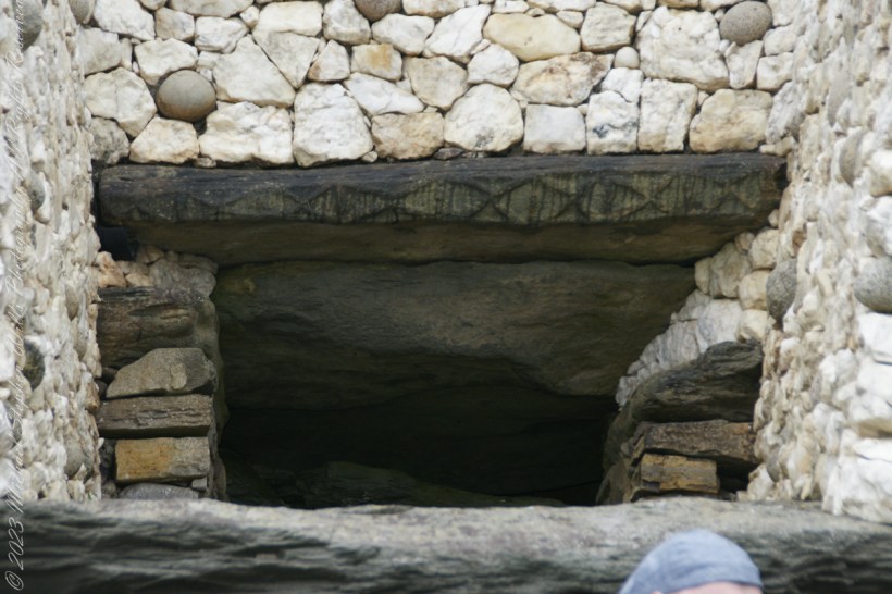
Step into the ancient world of Neolithic monuments and discover the astounding astronomical knowledge of our ancestors. Explore the Newgrange Lightbox in Ireland and similar marvels across Europe, revealing a deep connection between ancient peoples and the cosmos. Join me in unveiling these architectural wonders.
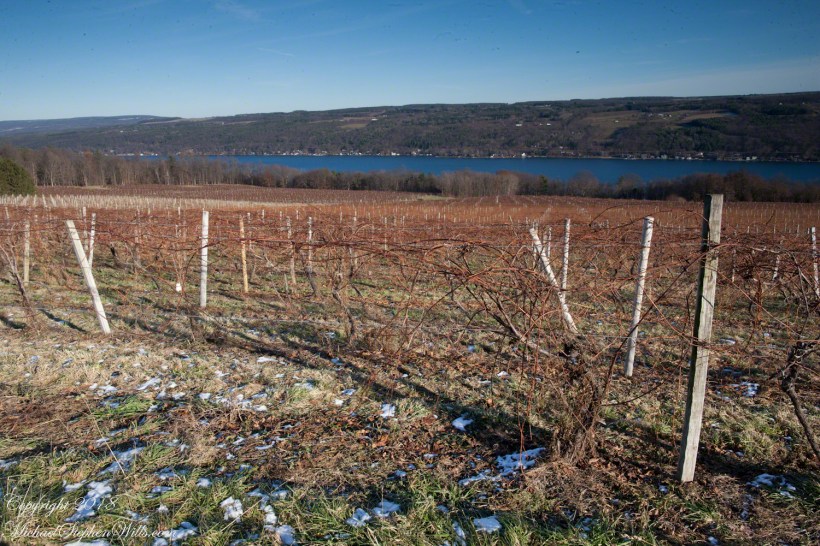
Pam and the author visited Dr. Frank Winery on Keuka Lake’s west side, observing how local environment and genetics, particularly epigenetics, influence vine growth. The west side has more sunlight exposure, due to geological conditions creating a microclimate favorable to the vines.
Join me in exploring the depths of “Hamlet,” where the phrase “revisits thus the glimpses of the moon” unveils a world where the supernatural meets the mysterious moonlight. Let’s unravel this imagery together, reflecting on life’s transient beauty, seeking understanding, and contemplating the cycles of change under the moon’s spell.
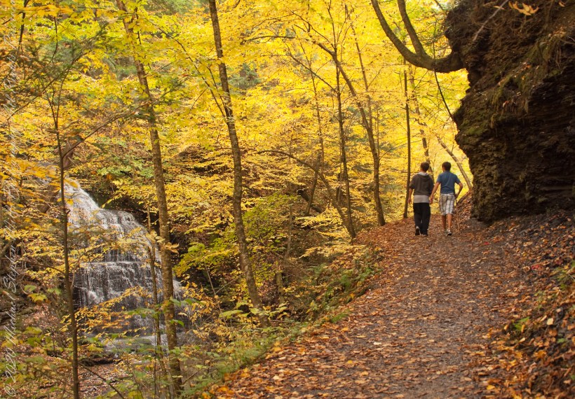
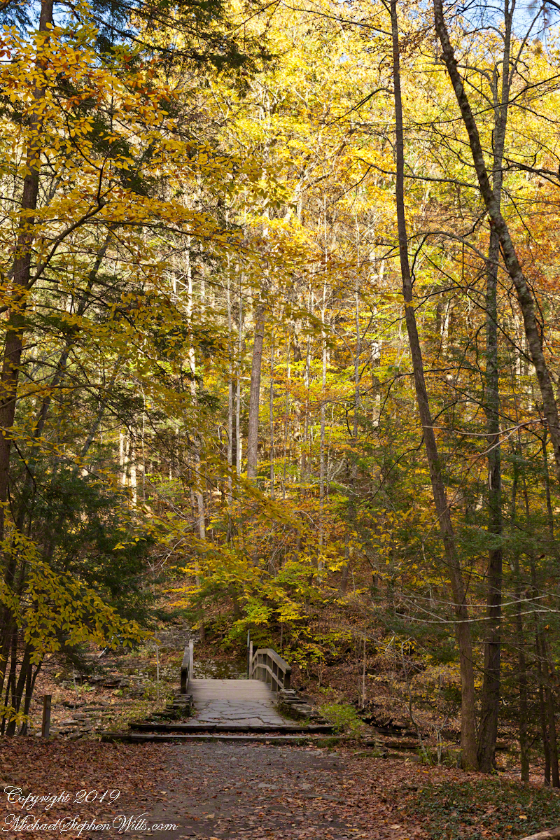
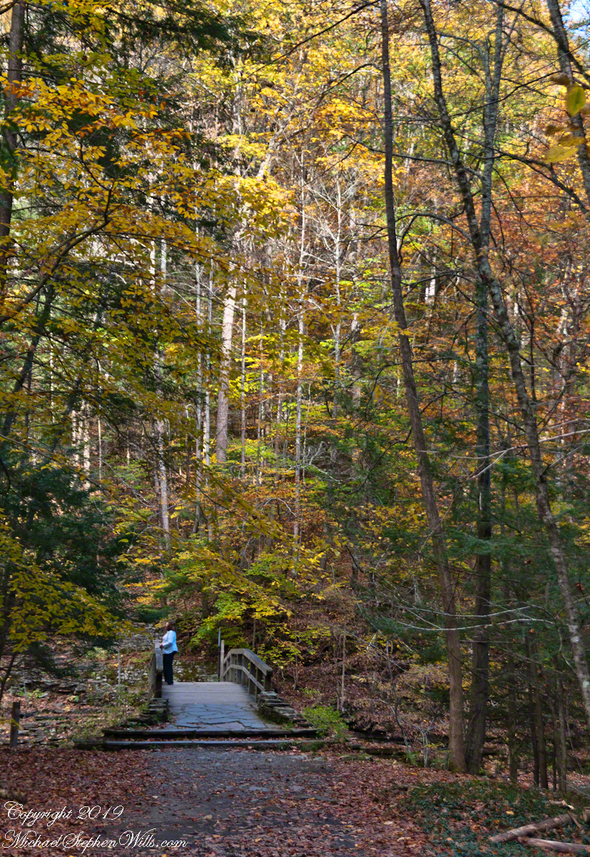
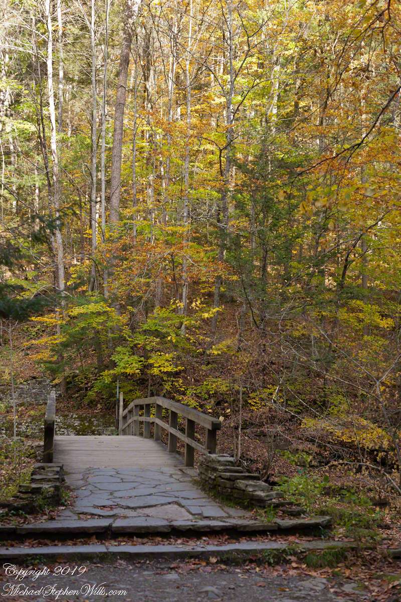
Fillmore Glen State Park in Moravia, New York, offers a changing landscape that serves as a living canvas, with the ironically named Dry Creek feeding its lush greenery. The ebb and flow of water from the creek creates a dynamic setting. Seasons dramatically alter the scenery, from tranquil springs to vibrantly colored autumns, beautifully captured through fine art photography.
Ithaca’s bedrock, formed 370 million years ago, deeply influences its landscape, neutralizes rainwater’s acidity, and carries a story of Earth’s resilience and transformation.
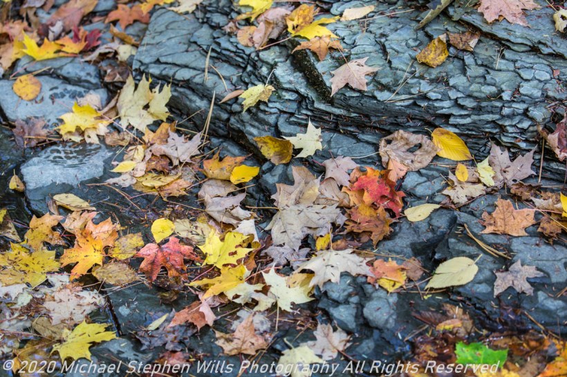
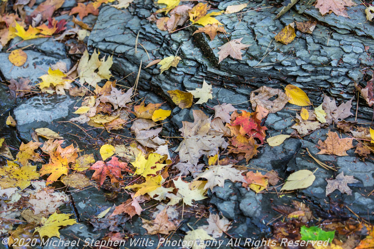
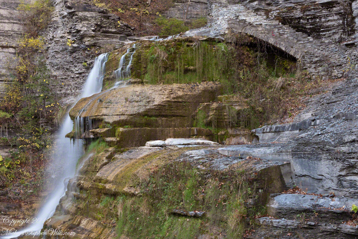
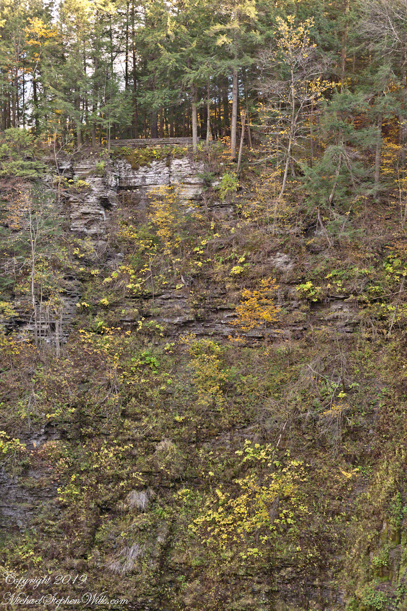
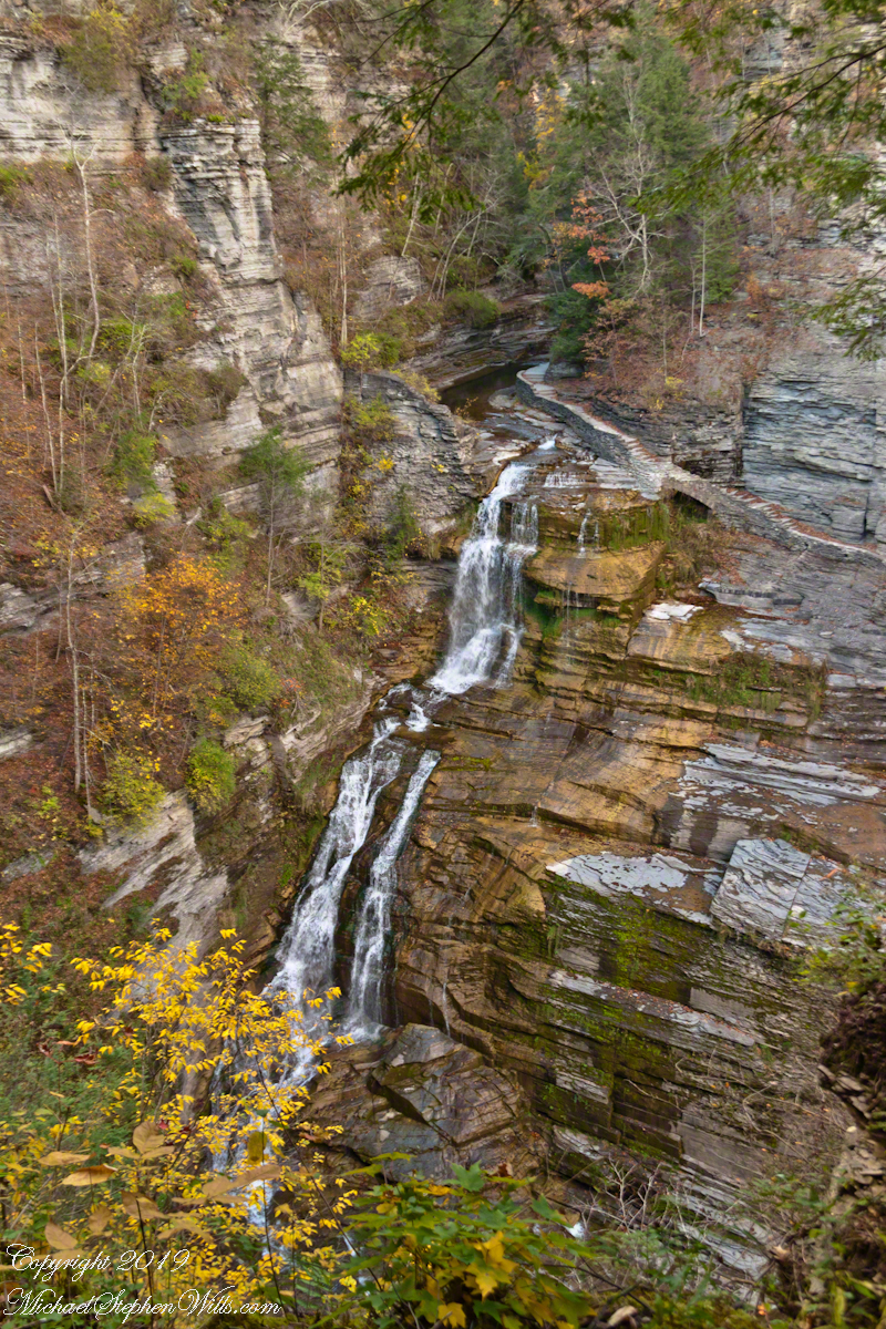
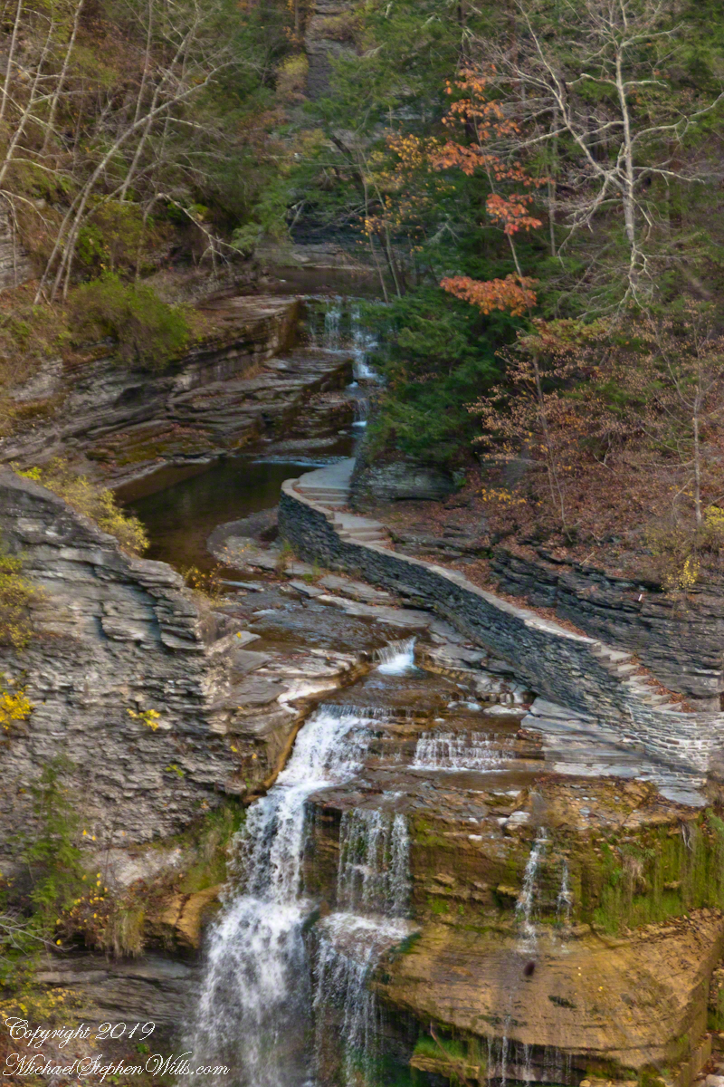
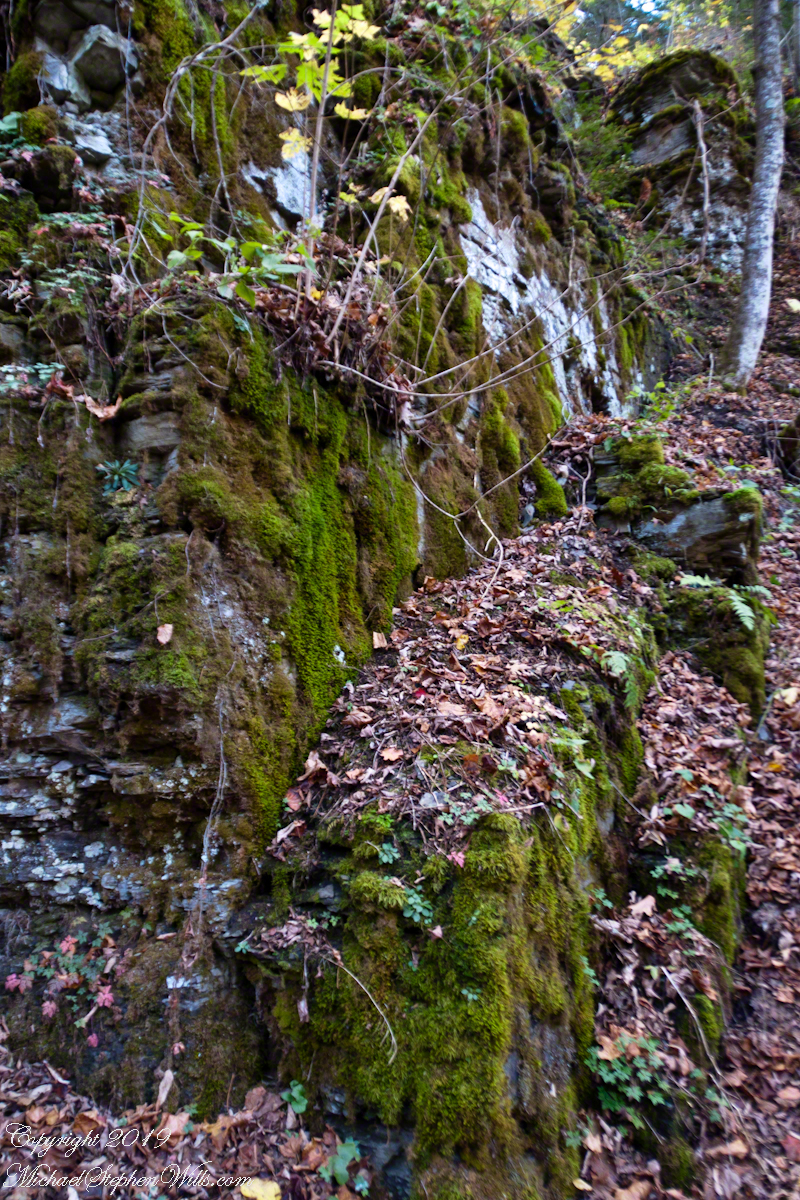
In Ithaca, New York, the story of the land is deeply rooted in its geology. Beneath the vibrant autumn leaves and along the path of Lick Creek lies a bedrock formed 370 million years ago. This ancient foundation, once the sediment of a vast inland sea, now forms the solid base upon which the city stands.
The bedrock here is a silent witness to Earth’s long history. Originating in the Devonian period, it marks a time when vast seas covered much of the Earth’s surface. Within these ancient waters, life flourished, leaving behind sediments that, over eons, transformed into the layered rock beneath Ithaca.
These layers are more than just historical records; they actively shape the landscape. The bedrock influences soil composition, affects plant growth, and directs the flow of streams. Lick Creek, with its clear waters, is one such stream that interacts intimately with this bedrock.
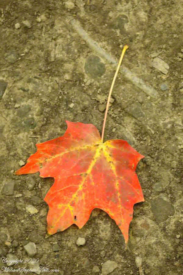
In autumn, the beauty of this interaction is vividly displayed. The red and yellow maple leaves create a striking contrast against the grey-blue backdrop of the bedrock, a blend of the vibrant present with the ancient past. These fallen leaves, over time, decompose and enrich the soil, continuing a cycle of life that this bedrock has supported for millions of years.
This bedrock also plays a crucial role in water chemistry. As acidic rainwater percolates through it, a remarkable transformation occurs. The bedrock naturally neutralizes the acidity of the rainwater. By the time the water emerges as streams, it is buffered to a neutral pH. This process is vital for maintaining the ecological balance of the area. The streams that flow out, including Lick Creek, support diverse ecosystems thanks to this natural filtration process.
Click photograph for larger view. Use combination keys to enlarge/reduce: Ctrl+ (Control / Plus) and Ctrl- (Control / Minus)
The bedrock on which Lick Creek flows formed 370 million years ago from sediment of a vast inland sea, making a soothing grey-blue backdrop to this year’s autumn foliage.
The neutral pH water is crucial for the flora and fauna of Ithaca. It sustains the forests, the wildlife, and the natural beauty that defines the region. This water, once acid rain, purified by the ancient bedrock, now nurtures life in its journey.
In Ithaca, the bedrock is a testament to the enduring nature of our planet. It reminds us of the continuous cycle of transformation that defines the Earth. The contrast of the autumn leaves against the bedrock is not just a scene of ephemeral beauty; it symbolizes the dynamic interplay between the living and the geological, between the present and the deep past.
The bedrock of Ithaca, with its ability to neutralize acidic water, highlights the interconnectedness of natural processes. It shows how the Earth self-regulates and sustains life in intricate ways. As the buffered, neutral pH water of Lick Creek flows over this bedrock, it carries with it the story of a planet that is constantly renewing and sustaining itself.
In this landscape, the past is not just a memory; it is an active participant in the present. The bedrock, the autumn leaves, and the flowing streams tell a story of resilience, continuity, and the beauty of nature’s balance. This is the legacy of Ithaca’s bedrock, a legacy of endurance, transformation, and life.
In November 2003, my son Sean and I journeyed up Route 191 from Petrified Forest National Park, arriving in Chinle on a crisp autumn afternoon. My photography equipment at the time was modest: a Sony Point and Shoot 5 MP camera with filters, a purse-like over-the-shoulder bag, and a basic tripod from Kmart.
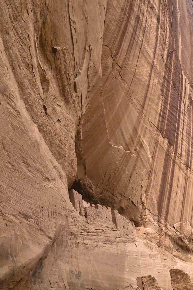
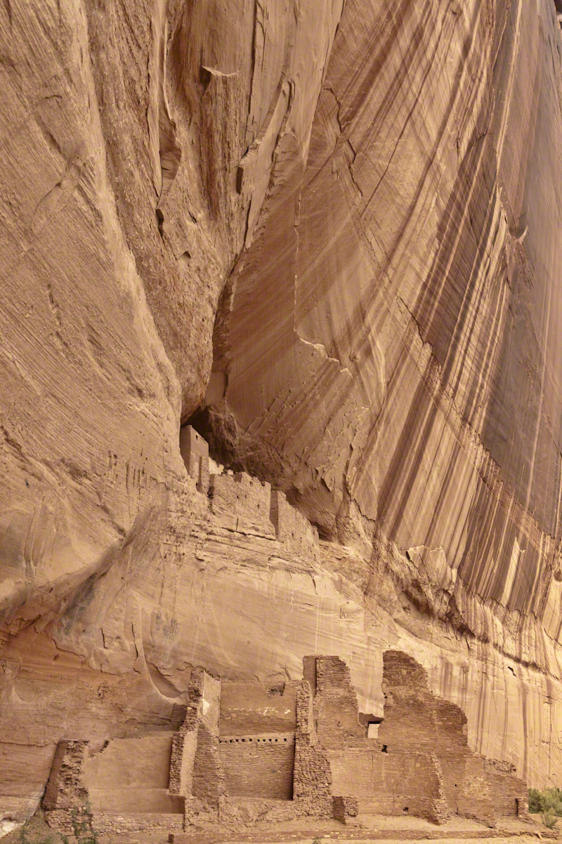
We reached the White House trailhead in Canyon de Chelly and began our hike. The trail was quiet, and as the sun set at 5:20 pm, we found ourselves virtually alone. A dense growth of Russian Olive trees dominated the wash at that time. In the dimming light, I captured a distant shot of the White House Ruin, whitewashed, set against the backdrop of autumn-hued Russian Olive foliage. Nearby, a grove of Cottonwoods, still green, stood near the canyon wall.
By the time Pam and I returned in July 2008, four years and nine months later, the landscape had changed. The invasive Russian Olives had been removed, and the White House Ruin was no longer painted white.
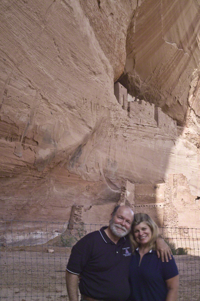
The same Route 191 that Sean and I had taken in 2003 led us through the Four Corners region of Northern Arizona. Pam and I had traveled from Colorado, arriving in the late afternoon. This time, the Navajo Reservation’s adherence to daylight savings time meant the sun wouldn’t set until 8:33 pm. My aim was to photograph the White House Ruin that I had missed years earlier.
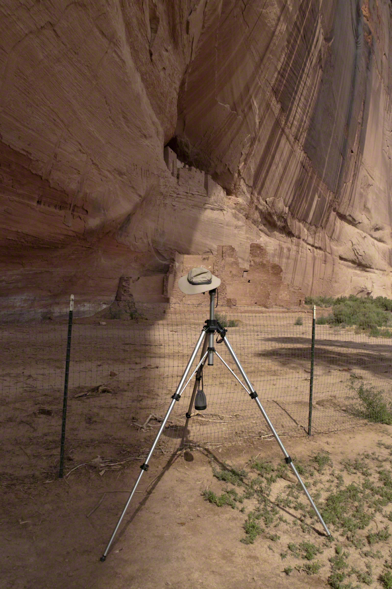
That July day the sun set 8:33 pm as the Navajo Reservation observes daylight savings time. My goal was to photograph the White House Ruin I missed in 2003. We arrived at the trail head. My photography kit was expanded from 2003, now included a Kodak DSC Pro slr/C, the “C” meaning “Canon” lens mounting, a Sony 700 alpha slr (I only use a variable lens), Manfrotto tripod with hydrostatic ball head, and the backpack style Lowe camera case. With the tripod it is over 25 pounds.
With this on my back I was prepared to boogie down the trail. At the height of tourist season there were many more people at the trailhead. Pam, being a friendly person, started a conversation while I ploughed ahead along the flat canyon rim. It is solid red sandstone, beautiful, generally level with enough unevenness to require attention. When Pam saw how far ahead I was she tried to catch up, tripped, fell hard.
I backtracked to Pam and we decided what to do. She thought, maybe, the fall broke a rib. We decided to proceed and descended, slowly, together. Here we are in front of the ruin. The sun, low in the sky, is moving below the south canyon wall. This is a perfect time, and I used both cameras.
The sweep of cliff and desert varnish was my intent to capture. Here it is through the Canon 50 mm lens.
The Malloryville eskers near Freeville, New York, highlight the region’s glacial history and contribute significantly to biodiversity and local ecology.
Walking here, I enjoy telling the grandchildren of the immense, mile-high ice sheet that once covered this land 10,000 years ago, creating these hills and hollows.
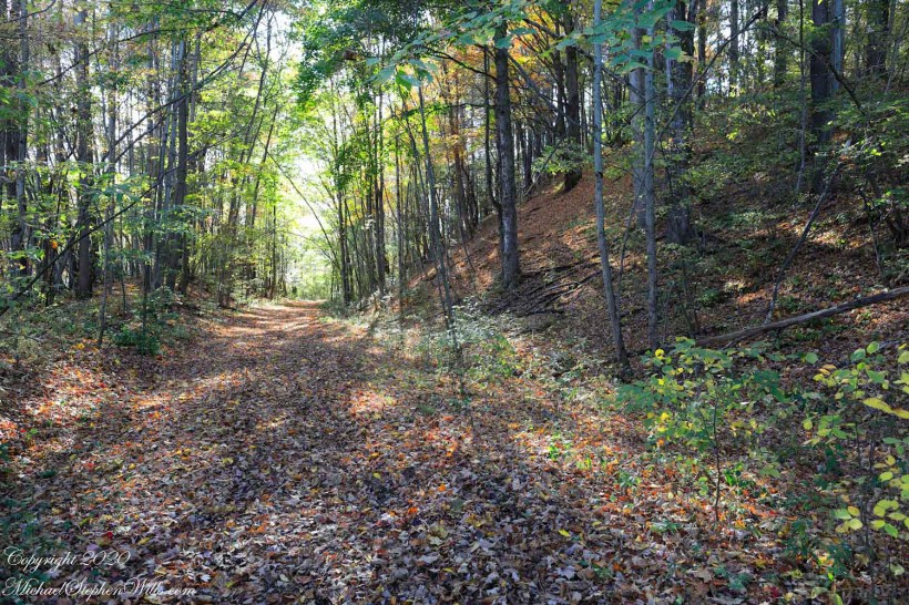
A forested path set among the glacially formed terrain of the O.D. von Engeln Malloryville Preserve near Freeville, New York.
Eskers are geological features that tell a rich tale of the glacial history of an area. In the landscape near Freeville, New York, the eskers of Malloryville stand as prominent reminders of the last Ice Age and the profound effects glaciers have had on the North American terrain. These elongated ridges, composed primarily of sand and gravel, not only offer a visual spectacle but also provide crucial insights into the glacial processes that shaped the region.
Eskers are formed by the deposition of sediment from meltwater rivers flowing on the surface of or within glaciers. As these glaciers recede, the sediment accumulates in the paths previously carved by the meltwater streams, eventually forming ridges. The Malloryville eskers are particularly notable for their well-preserved structure, giving geologists and enthusiasts alike a clear vision of the patterns of glacial meltwater flow from thousands of years ago.
Located just a few miles from Freeville, the Malloryville eskers are an intriguing natural attraction. The topography of the area, largely shaped by the Laurentide Ice Sheet during the last glacial maximum, is characterized by various glacial features, but the eskers are undeniably some of the most distinct. Their serpentine-like appearance, weaving through the landscape, immediately captures one’s attention and beckons further exploration.
From an ecological perspective, the eskers of Malloryville contribute to the area’s biodiversity. The unique microenvironments created by these ridges offer habitats that differ from the surrounding landscape. This differentiation allows for a variety of plant species to thrive, some of which are specially adapted to the well-drained soils of the eskers. Additionally, these ridges act as corridors for wildlife, facilitating movement and offering vantage points for species like deer and birds of prey.
Historically, the eskers near Freeville have also had an impact on human activity. Native American communities, recognizing the strategic advantage of these high grounds, are known to have used them as pathways or even settlement sites. In more recent history, the gravel and sand composition of the eskers have made them targets for mining activities. While this has led to the alteration or destruction of some sections, it has also highlighted the importance of preserving these unique geological features for future generations.
Efforts to study and preserve the Malloryville eskers have grown in recent years. Local educational institutions, in collaboration with geological societies, have undertaken detailed studies to understand the formation and significance of these features better. Such initiatives not only contribute to the scientific understanding of glacial processes but also raise awareness about the importance of conserving unique geological formations. Given the potential impacts of climate change on glacial landscapes worldwide, the eskers serve as a poignant reminder of the dynamic nature of our planet and the traces left behind by the ebb and flow of ice ages.
In conclusion, the eskers of Malloryville near Freeville, New York, stand as testaments to the glacial history of the region. These winding ridges, with their intricate patterns and rich ecological contributions, weave a story of natural processes that have spanned millennia. They remind us of the ever-changing nature of our planet and underscore the importance of understanding and preserving its geological wonders. Whether one views them with the eyes of a scientist, historian, or nature enthusiast, the Malloryville eskers offer a captivating glimpse into the ancient forces that have shaped the world around us.
Copyright 2020 Michael Stephen Wills All Rights Reserved
Pam and I visited Treman for our last visit of 2017. It was a bright, warm October afternoon. Here is a slide show of our experience, the details shared in recent postings. Enjoy!!
Click photograph for a larger view. To do this from WordPress Reader, you need to first click the title of this post to open a new page.
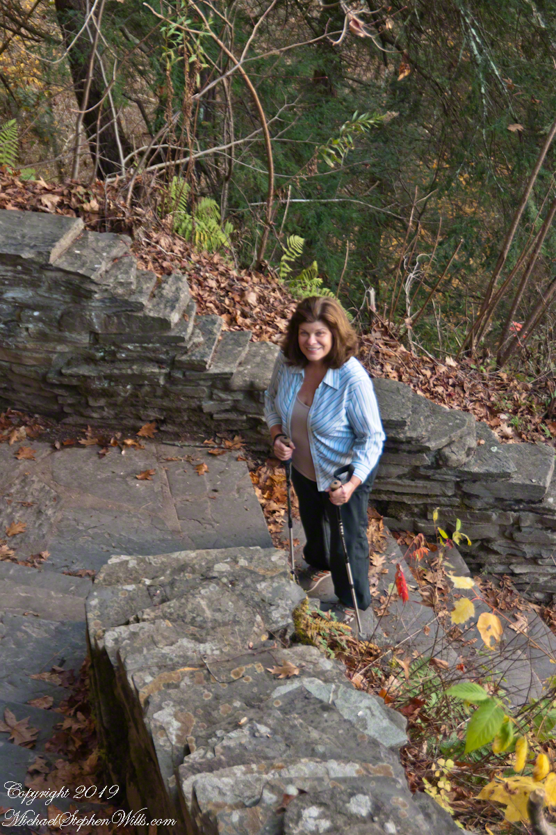
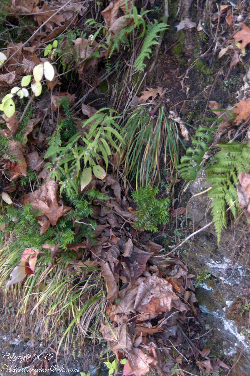
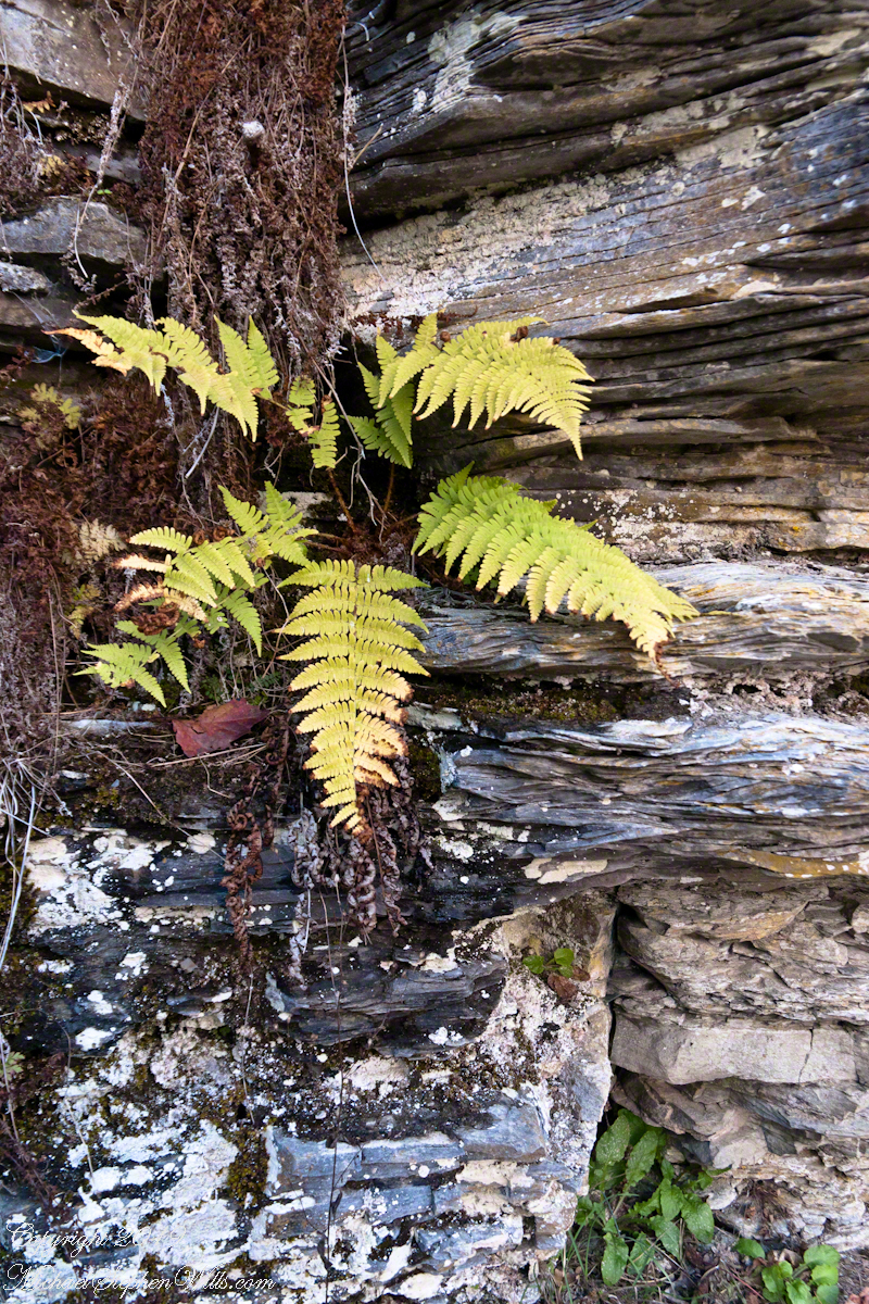
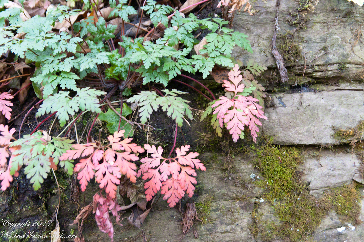
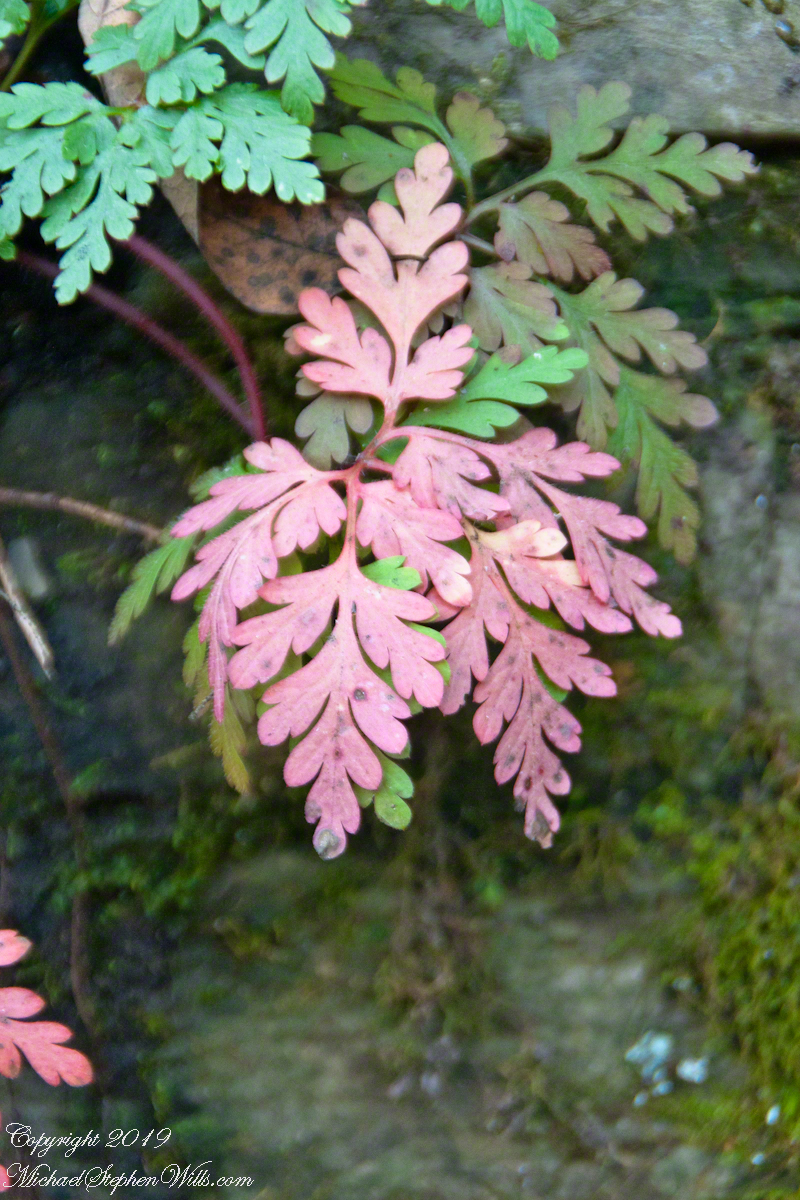
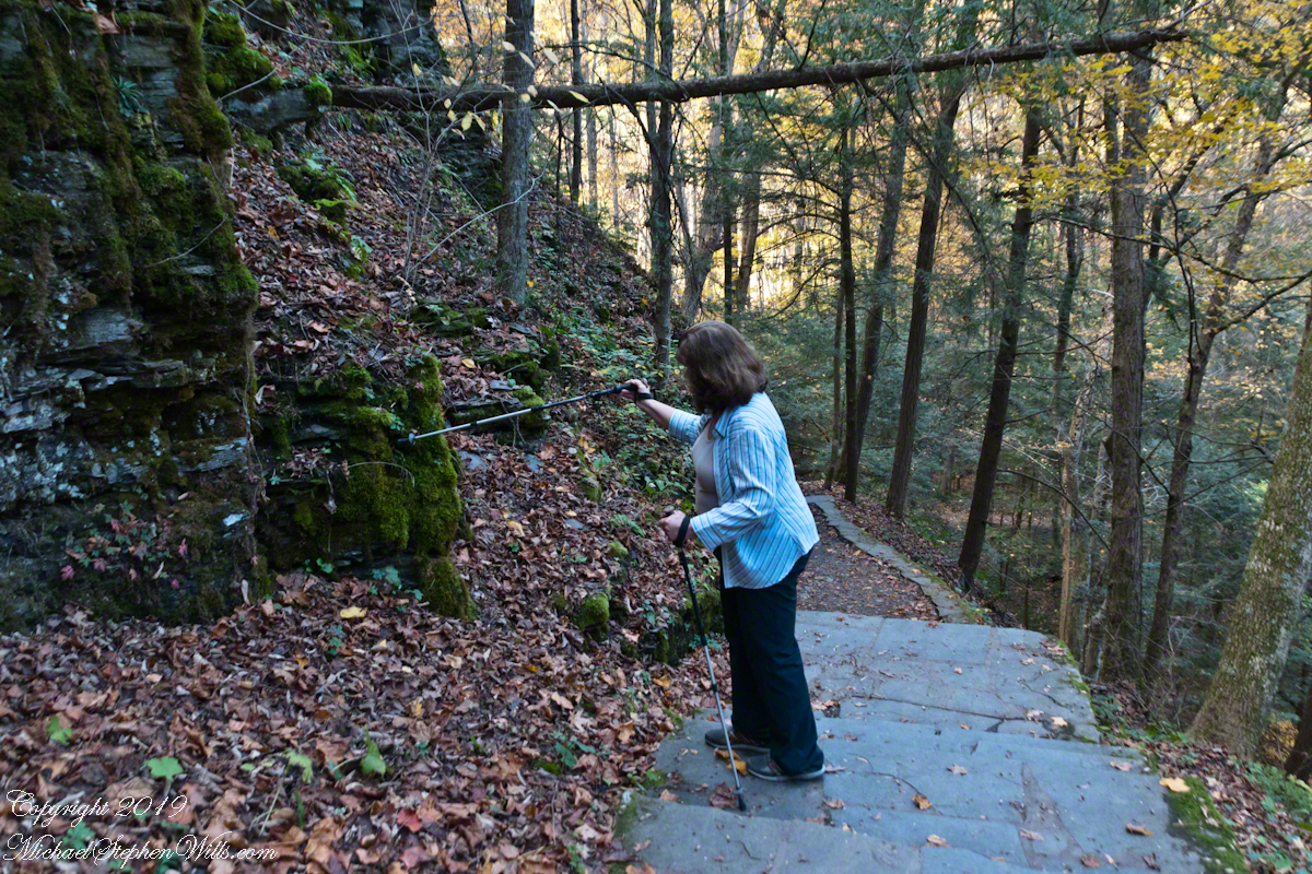
Brink of Lucifer FallsLucifer Falls Overlook from the Gorge TrailLucifer Falls from Rim Trail OverlookLucifer Falls from Rim Trail OverlookPam on the Cliff StaircaseUnidentified TreeLuficer Falls Overlook, northeastCliff Stair Wall, autumn with hemlockCliff Stair Wall, autumn with fern generationsCliff Stair Wall, autumn Geranium and mossesThis geranium species (scientific name Geranium robertianum) are also called “Herb-Robert” for a reputed ability to ward off disease and, in the Scottish Highlands, “red-shanks” for the deep red color of the stalks, seen in this photograph. Robert H. Treman New York State Park. Source, “How to Know the Wildflowers” by Mrs. William Star Dana, 1989, Houghton Mifflin, Boston.Pam examines the mossCliff Stair Wall, autumn MossAutumn foot BridgeWoman on Footbridge, ContemplationOver the bridge
In November the gorge is closed for the winter due to dangerous conditions under the steep, crumbling walls. Robert H. Treman New York State Park.
Copyright 2019 All Rights Reserved Michael Stephen Wills
In my Homecoming Parade 2003, I described my initial reconnection with the University of Arizona (U of A) as a 1975 graduate and alumnus. This personal project of involvement with U of A and Arizona continued through 2011 with annual autumn trips to coincide with Homecoming. The travel was as a CALS (College of Agriculture and Life Sciences) Alumni Board of Directors member, a primary responsibility was raising funds for scholarships.
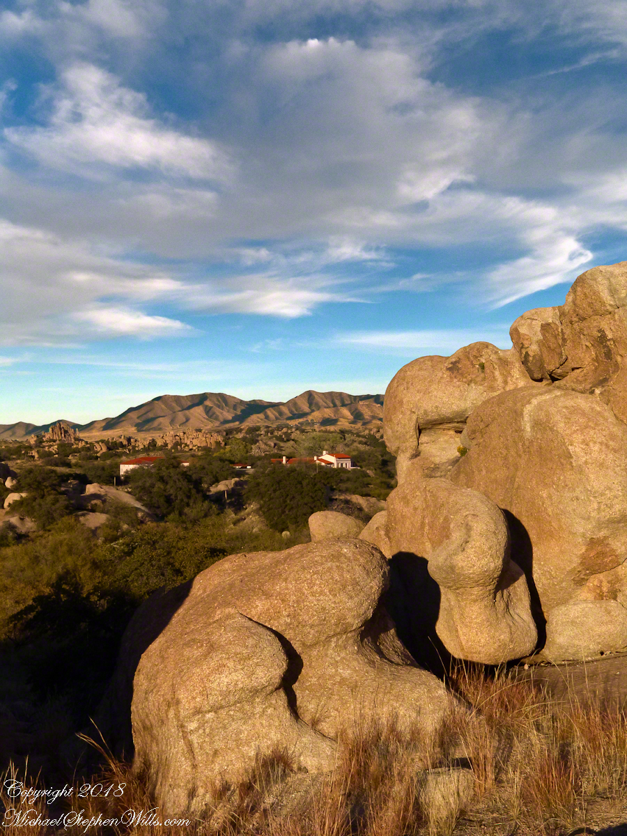
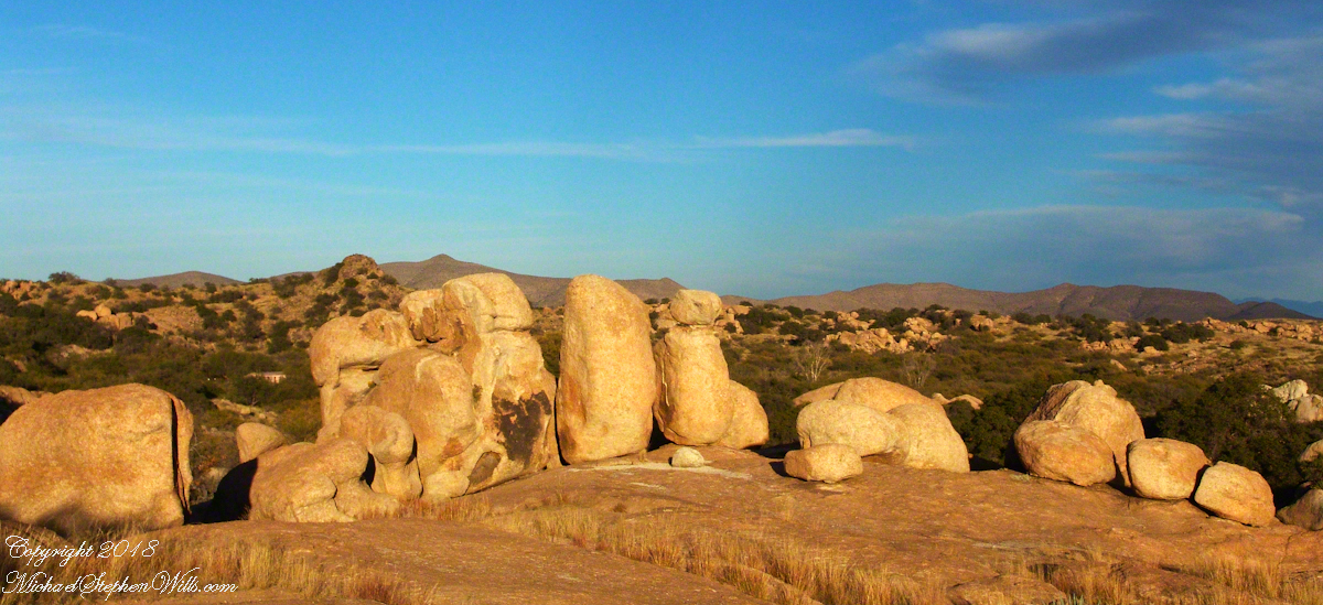
The Amerind Foundation and weathered boulders of Texas Canyon granite. Beyond are the Dragoon Mountains
I met, Linda Kelly, the owner of the Triangle T Guest Ranch, while camping in the Chiricahua Mountains. I arrived a week before homecoming to photograph the landscape, nature and rock formations of the Chiricahua National Monument. Click this link for my Arizona Online gallery, including some work from that time. Linda and a friend were visiting that day and we struck up a conversation about the area and her Triangle T Guest ranch. The next day I was scheduled to guest lecture a class at the U of A, as an alumnus of CALS. The ranch was on the way and I needed a place to stay, so Linda gave me directions and I checked in.
She gave me a tour of the incredible weather granite rock formations of Texas Canyon and, meanwhile, shared stories of the history of Texas Canyon. It is appropriate for the Amerind Foundation to be here (see first photograph), the winter camp of an Apache tribe for generations.
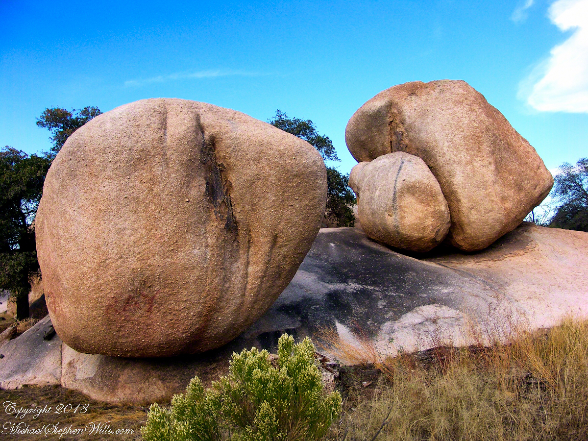
Weathered granite boulders greet visitors to the Triangle T Ranch.
That night, my request was for a room storied to be haunted by a spirit they call “Grandma,” as in when her footsteps wake you from a sound sleep you say, “It’s all right, Grandmother.” She woke me that night, footsteps in the dark, hollow on the wood floor, the room filled with a hard cold. I talked to her, without a response, while swinging my legs out of bed to reach the gas heater in the wall. I turned on the heat and the sound of expanding metal heat fins lulled me to sleep.
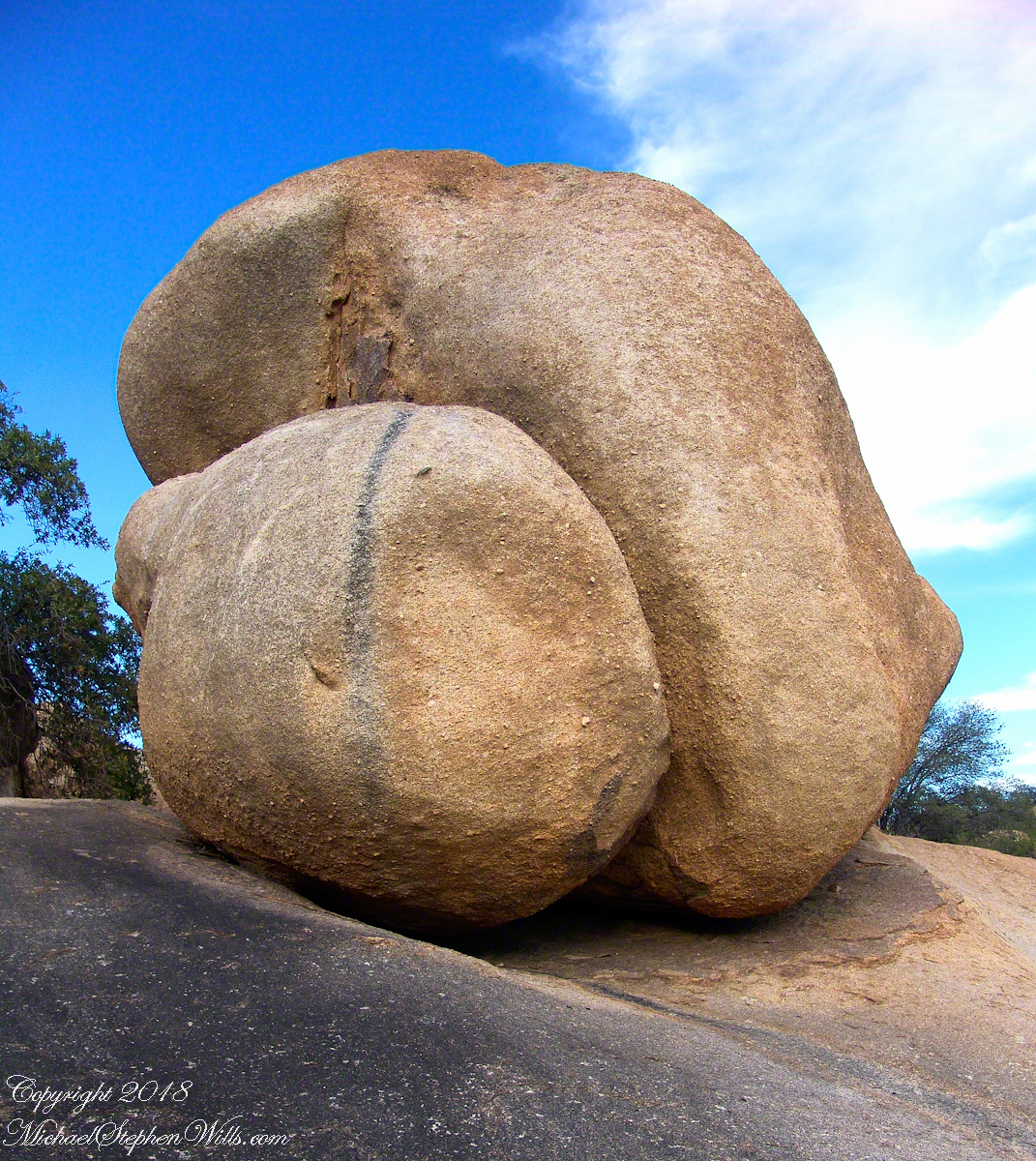
I call this pair, “Father and Son.” The restaurant is built around a round boulder.
It made a good story for the students. They were surprised I could fall back asleep, but after all I had to be there the following morning.
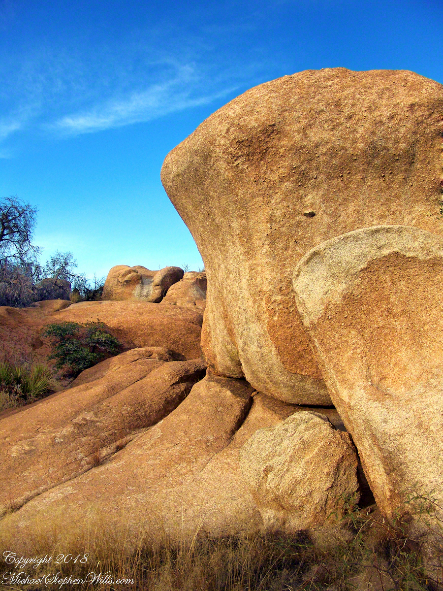
Your imagination roams among the natural forms.
I gave Linda a few of my photographs from that day and we made arrangements for the Triangle T to supply a two night package for the CALS “Dean’s Almost World Famous Burrito Breakfast” silent auction during 2008 homecoming.
A tableau of figures keep silent watch with the ghosts of Texas Canyon.
Copyright 2023 Michael Stephen Wills All Rights Reserved