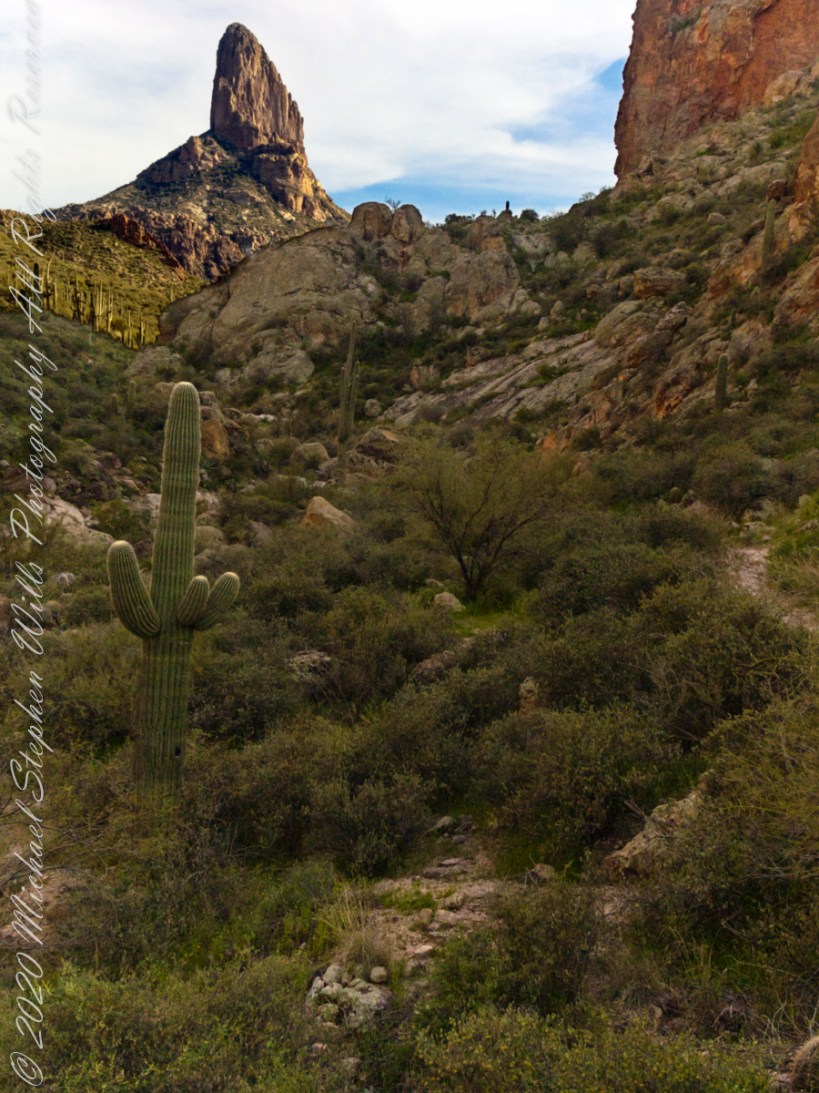
Our eleven-mile trek from Apache Junction ended here between Black Top Mesa and Palamino Mountain. Peralta trail winds up the ridge to right with Weaver’s Needle beyond in the setting sun.
Deep shade combined with the distant sunlit needle made for a difficult photographic capture. In fact, this picture needed significant work in Photoshop. I wore the 8 megapixel Sony F828 to capture the handheld shots of this series. A few days later I dropped the camera while riding Colorado, rendering it inoperable. This was when I acquired my Sony Alpha 700 during downtime in Phoenix. Later, the F828 was repaired at Sony and is still operable.
Click me for more information about this camera.
Copyright 2022 Michael Stephen Wills All Rights Reserved
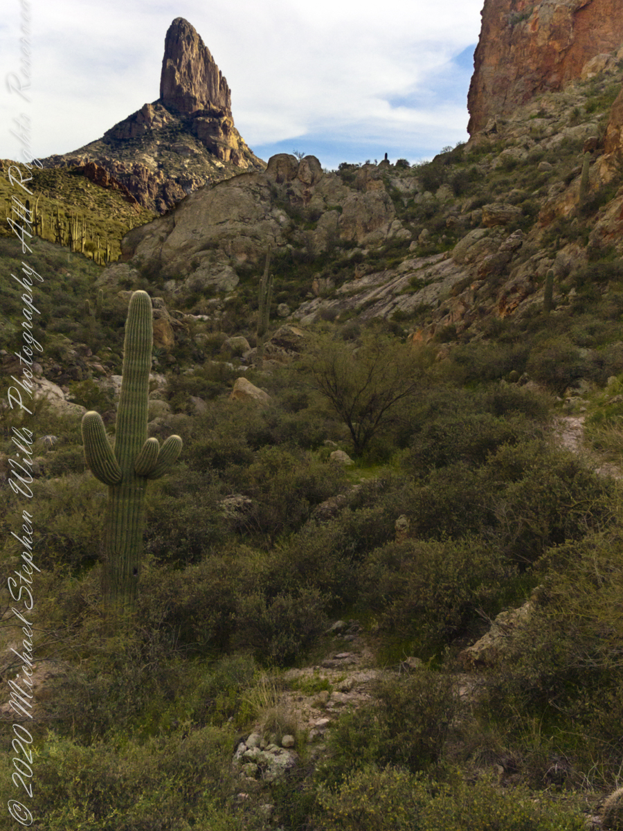
The end of a day trekking to East Boulder Canyon at the foot of Weaver’s Needle, Superstition Wilderness. I had a light pack with the camera equipment and supplies packed in on horseback.
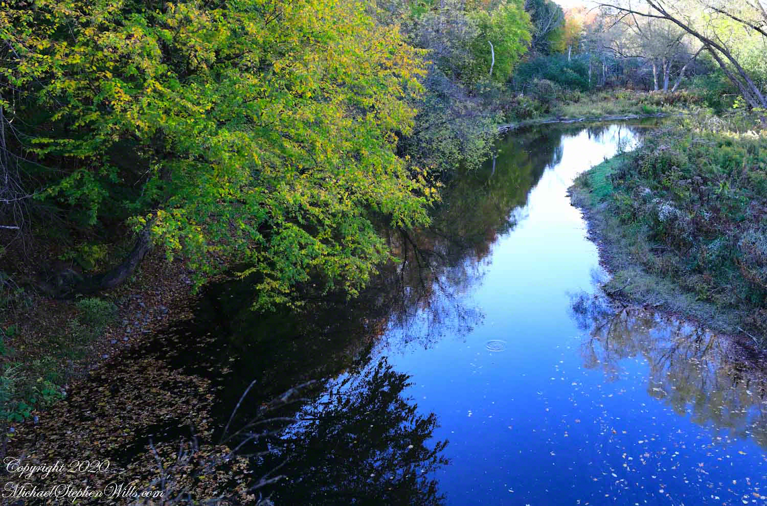
Fall Creek meanders through the esker fields of the Malloryville Preserve. Here is the view from an abandoned railroad bridge. A major watercourse of the Finger Lakes, throughout the 19th century Fall Creek provided water power for local industry: grain grinding mills, cooperage and furniture. Here the stream bed is wide, flow slow and pacific for a mirrored surface, the effect broken by a single drop from an overhanging tree or, maybe, a fin’s flash.
Pam and I visited Malloryville last weekend to enjoy a “socially distanced” walk with family.
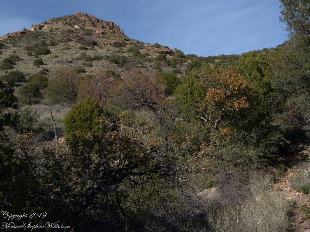
Nugget and Colorado had eaten their fill of the rich early spring grass of the apple orchard, The Searcher pulled together the pair for the return to Pine Creek. Perched on Colorado, the lead held by The Searcher, I listened as he shared survival facts remembered from Peter Bigfoot’s desert survival course. The Reavis Mountain School of Self Reliance, founded 1979, is along same Reavis Gap Trail (#117) we traversed. After descending to Pine Creek and up to Reavis Gap (where I first met The Searcher), it descends to meet Campaign Creek where the survival school is located.
He pointed out on the many flowering Century Plant stalks along the trail. “These are great to roast when young, just as the stalk starts to bud from the center, before it starts to lengthen.” By the time the stalk flowers, as in the following photograph, it is quite tough.
Agave flower spike against the dawn in the nameless canyon west of Two Bar Mountain, Superstition Wilderness, Arizona.
At the base of boulders, shaded from the sun, the ridgeline fern takes hold. Surviving on seasonal water seepage, it dries out during dry spells to later revive and reproduce via spores. As I recall, the dry or fresh form is useful as an analgesic.
An absolute necessity for bushwacking (walking off the path), a pair of rattlesnake proof boots were worn on every expedition. These rose to mid-calf with a layer of lexan, the same as used for bullet proof glass.
Swept from the Saddle
We passed the time in this way, me holding on to the saddle horn bouncing and shifting as Colorado negotiated the rough and steep path down to Pine Creek where the vegetation changed from very sparse to the thick growth you saw in my post “A Peaceful Day at Pine Creek”. On the east side of Pine Creek a trail, unmarked on the maps, follows the creek bed uphill north towards Mound Mountain. In 50 feet or so we passed the side trail to my campsite, our destination was The Searcher’s campsite. I was not paying near enough attention to the surroundings when I looked up to see an Arizona Oak limb headed to my chest. With no time or space to negotiate the obstacle I was left to grab hold and hang on to be swept from the saddle. The branch held my bulk for, at most, a second before giving way.
In bending flexibly before breaking the live Oak wood and centuries of soil underneath the trees softened my fall enough so I was badly shaken and unhurt. Falling a foot or so in any direction would have resulted in serious injury or instant death. Colorado stopped, looking briefly back as I slowly came to my feet. After taking account and letting the circumstance wash over me, I got up and proceeded slowly while we both contemplated my miraculous survival.
Bear Shelter
I now took up the rear as in a few hundred yards the valley wall rose on both sides of the Creek to form a short, narrow pass. The walls fell away just as quickly, the valley floor leveled out and we came to The Searcher’s camp. The bear shelter stood out right away. This was a ten foot high teepee of 4 – 6 inch diameter tree trunks tied with rope, within was a hammock . The three foot wide opening left only one unprotected side while he slept, offering some protection from the all too common roaming bears, most commonly from September to November when mazanita fruit ripens.
Well stocked in every respect, for a wilderness camp. In the following years of roaming the wilderness the camps of other horse people were similar in this way: stoves, comfortable cots, radios, pots and pans all fit into panniers. As a noun pannier is seldom used in the singular because there are always two, one on each side of the horse for balance. I sat on the wide top of one enjoying a cold beer pulled from a bed of ice.
We discussed the benefits and drawback of horses for exploration. I required a gallon and a half of water daily and in the desert wilderness provided for storage of three days, 4 and a half gallons. At 8 pounds each, that is 36 pounds!! Starting out, my pack weighted 90 pounds with a camera and tripod.
There are benefits to having a mode of transport that thinks for itself and drawbacks. Each individual has its own personality and horses do try to get away with what they can. It is wise to limit your dependence on a horse until you know each other well. In retrospect, I was “out on a limb” riding Colorado modified by being led by someone the horse knew well.
It was soon time for me to head back to camp. We set the agenda for the next day, an early start for the hike out. Colorado was to be fully loaded so my riding was not an option, just as well. It was possible to lighten my pack to almost nothing and I looked forward to that.
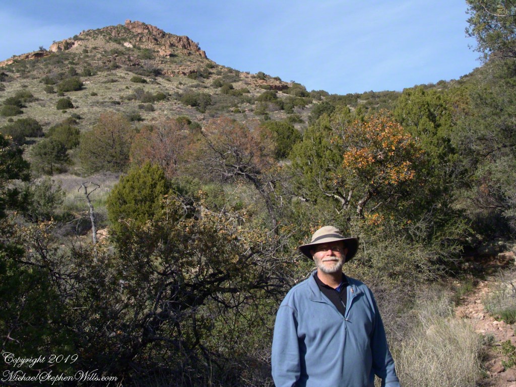
I took some time before dinner to set up the tripod for a self-portrait on my last full day in Pine Creek. The view is northeast from the Arizona Trail near my camp, the ridge overlooks Reavis Gap. I did a version of the view with and without me.
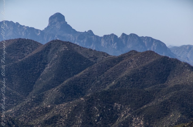
“When George J. Roskruge created the official map of Pima County in 1893, he named the range after James Quinlin, who had opened a stagecoach station in the nearby town of Quinlin in 1884.” — Wikipedia article for “Quinlan Mountains.”
Kitt Peak is the highest point of the Quinlan Mountains, one of a series of ranges starting near the border with Mexico, the Baboquivari Mountains. Pan Tak pass separates Coyote Mountains from the Quinlans. Farther north there is even the Roskruge Mountains and a range named for a silver mine, the Silver Bells. Roskruge originally named “Kit’s Peak” for his sister, Phillippa, married to William F. Kitt. The peak was renamed to Kitt Peak William’s request.
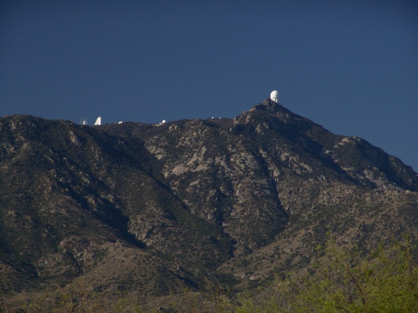
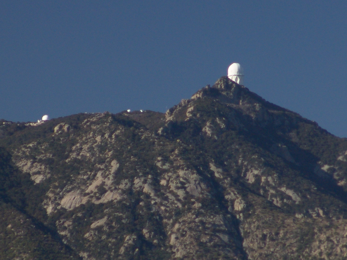
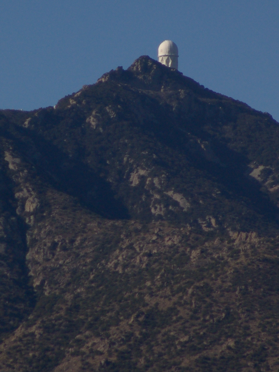
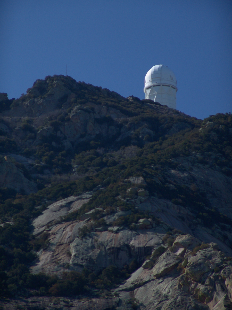
Here we see a dramatic view of Quinlan Ridge with Kitt Peak observatories, taken from the access road Arizona Routh 386. The instruments I recognize are, from left to right, McMath-Pierce Solar Telescope (second in line) and, on the end, Mayall Telescope.
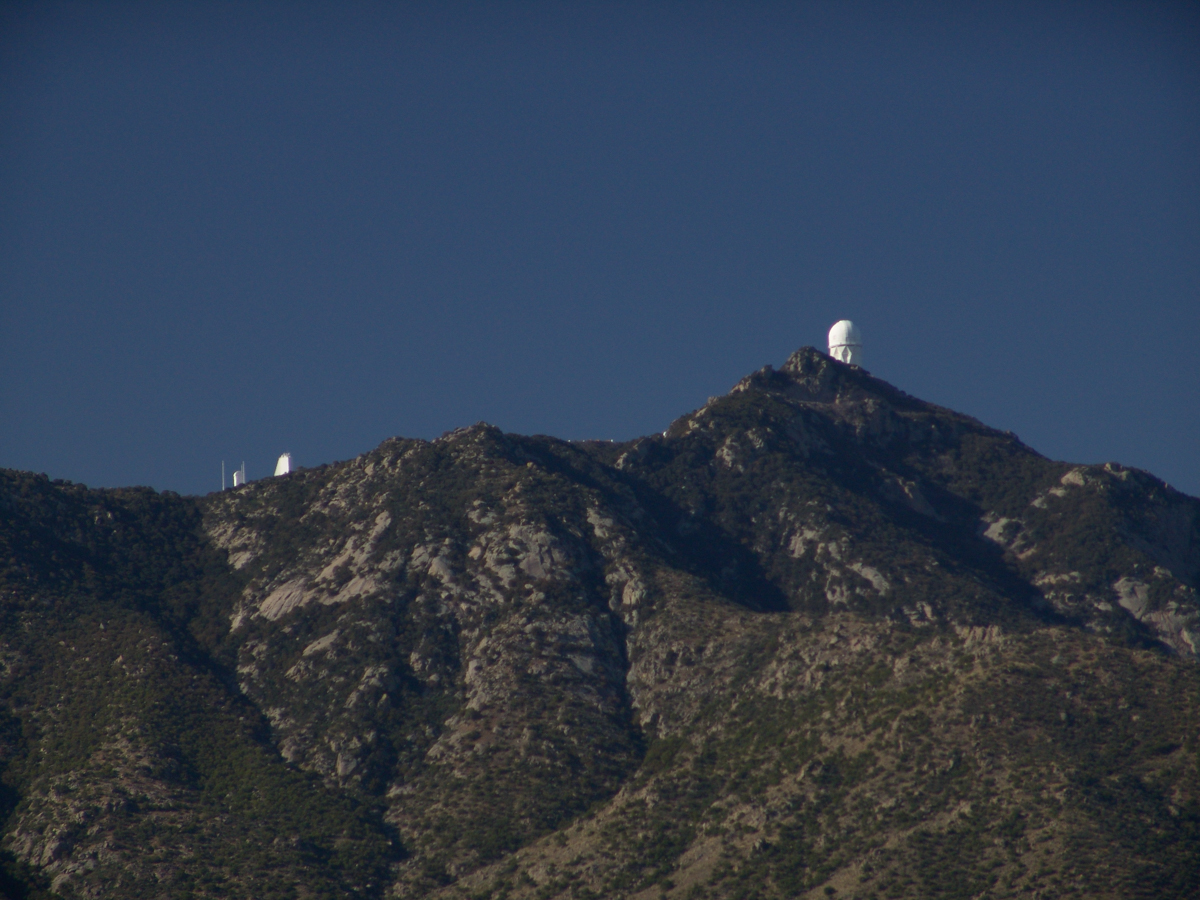
And more views as I progressed toward the top.
.
The dramatic peaks are hypothesized to be igneous intrusions into metamorphic rock, these are called “Sky Islands” for the environments supported on them, radically different from surrounding lowlands. Kitt Peak is known for the stands of Manzanita Bushes
A mature Manzanita growing along the Miller Trail of the Rincon Mountain Wilderness. There is an enlargement of the flowers, to the right.
Copyright 2022 Michael Stephen Wills All Rights Reserved
The Contreras fire threatening Kitt Peak last month brought to mind a spring visit of mine to the National Observatory.
From downtown Tucson get onto Interstate 10, heading “east” toward El Paso. East in quotations as the road only turns east after the fork for Interstate 19, headed south past San Xavier del Bac mission and Nogales at the Mexican border. A few miles down I19, well before the mission, a turnoff for Arizona route 86, a road you’ll follow the better part of 36 miles, passing the Tucson Mountains on the right. Most days, the Mayall Telescope of Kitt Peak shines bright white ahead, as it did the right after dawn on Wednesday, April 20, 2005.
At some point R86 enters the 4,453.307 square mile extent Tohono O’odham Nation Reservation, you pass the town Three Points where Arizona route 286 heads south to Sasabe and the Mexican border. The next turn south is the Kitt Peak access road, Arizona route 386. On that Wednesday I was so early the gate to the peak was locked, so I pulled off the road and waited. It is a lonely place on the route for migrants from Mexico. I wandered off the road, into a wash (dry, sandy stream bed), to relieve myself, where junk from migrants was scattered around. Back in the car a helicopter approached with a black SUV. A big guy got out, walking by into the wash: the border patrol.
Here is a photograph from that day of Baboquivari Peak taken from Kitt Peak’
Baboquivari Peak is the most sacred place to the Tohono O’odham people. It is the center of the Tohono O’odham cosmology and the home of the creator, I’itoi. According to tribal legend, he resides in a cave below the base of the mountain. This mountain is regarded by the O’odham nation as the navel of the world – a place where the earth opened, and the people emerged after the great flood. Baboquivari Peak is also sometimes referred to as I’Itoi Mountain. In the native O’odham language, it is referred to as Waw Kiwulik, meaning “narrow about the middle”. The O’odham people believe that he watches over their people to this day. — Wikipedia
Baboquivari Peak was mentioned in the journals of Jesuit missionary Padre Kino, who made many expeditions into this region of the Sonoran Desert, beginning in 1699, establishing Spanish Missions in the area. — Wikipedia
Kitt Peak is in the sacred precinct of Baboquivari, the land just below the peak is the “Gardens of the Sacred Tohono O’odham Spirit I’itoi.” The month of my visit, the O’odham nation brought legal suit against Kitt Peak to halt construction of new telescopes in the garden. The issue was settled out of court.
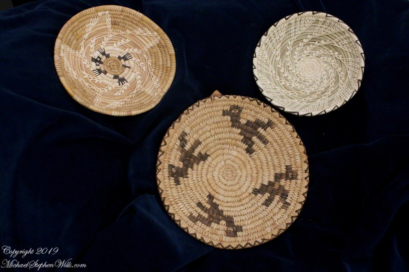
About the header photograph: From the bottom clockwise. Birds by Anmelia Juan of Geawuk (Kitt Peak 1972) – I purchased this from the Kitt Peak gift shop during my first visit; Turtle by Olvera and Simon Valenquela (Saguaro National Monument 2005); Stars by Simon Valenzuela for his daughter Pasquala Valenquela 16th Birthday (2018). Simon is of the Pascua Yaqui tribe who Learned basketmaking from his wife’s family.
Copyright 2022 Michael Stephen Wills All Rights Reserved
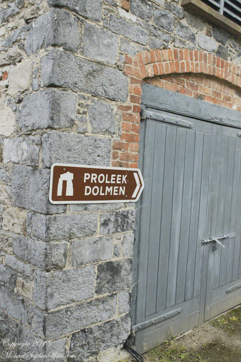
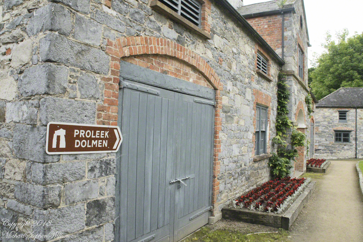
I have an update to my post “Proleek, Grandfather McCardle’s home” where we explored the site of the boyhood home of my grandfather, Peter McCardle, on great grandfather James McCardle’s Proleek farm. April 2018 an email arrived from the brother of the owner of the house across the road. He recognized the property from the blog photography and reached out to introduce himself and share information. His own genealogical research suggested we shared a great aunt. We now work together to define this connection.
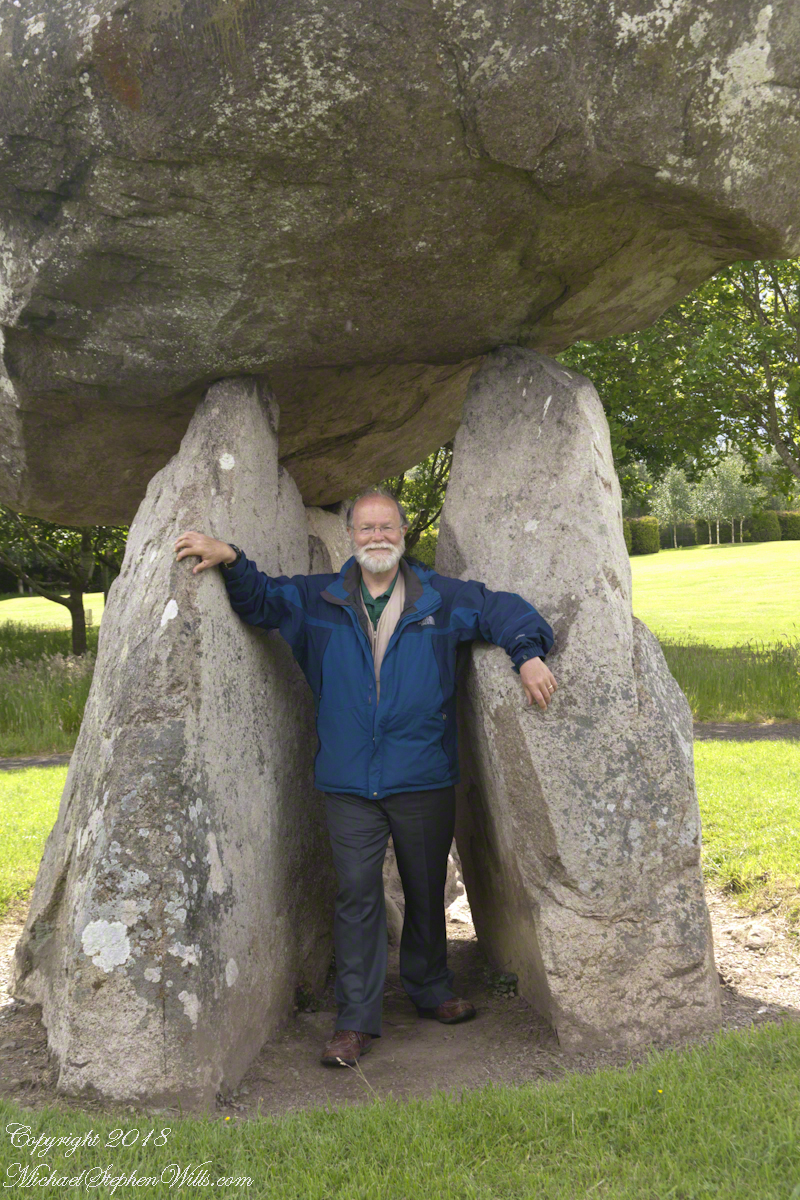
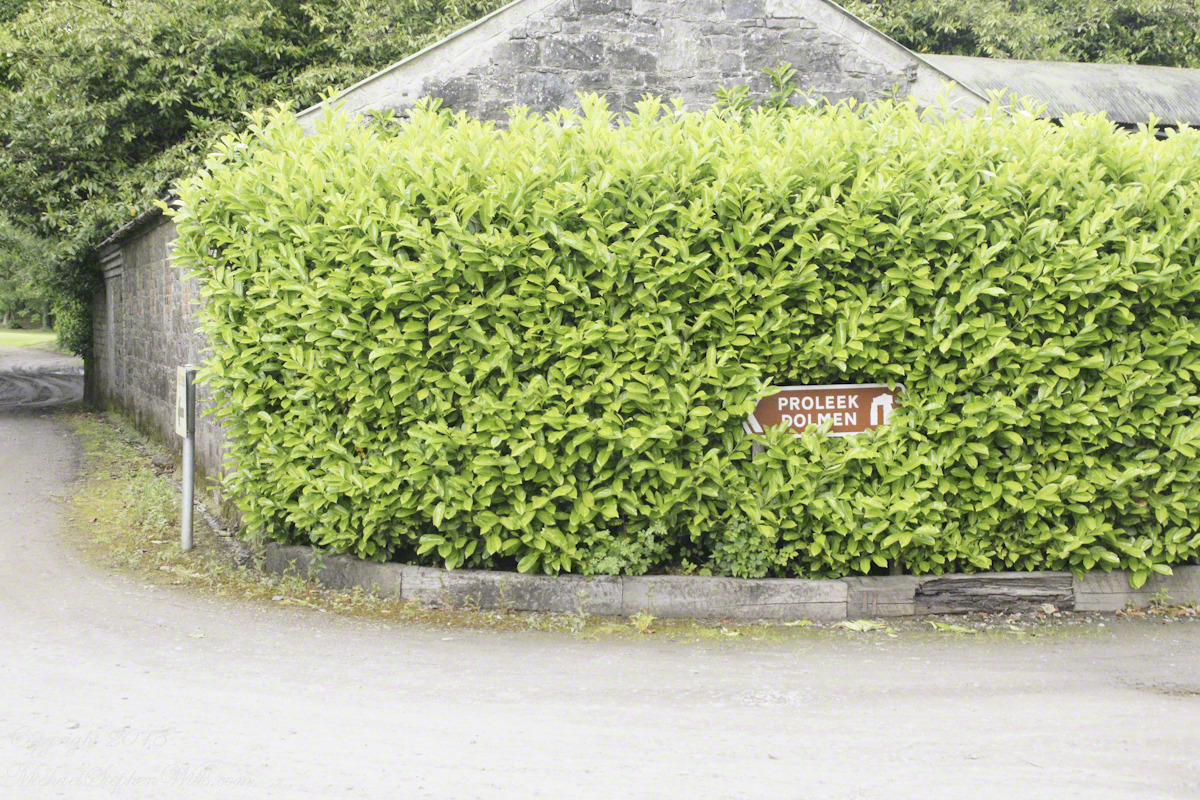
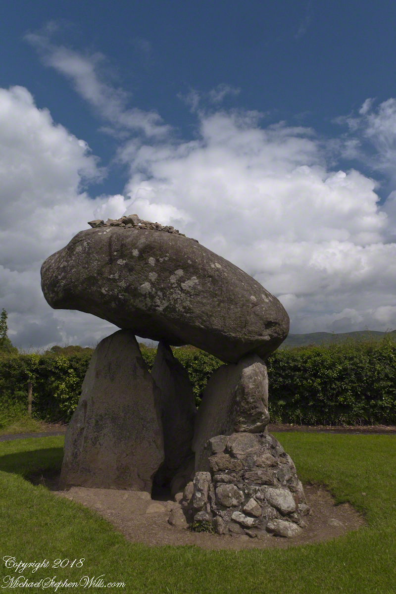
Our tour of Ireland was bookended by a visit to the farm site and, located little more than a kilometer away, a 5,000+ year old portal tomb, the last site Pam and I visited. We parked at the hotel / golf course built around the monuments. There is no fee to visit the site, number 476 on the list of Republic of Ireland National Monuments (Irish: Séadchomhartha Náisiúnta), protected at the level of guardianship by the National Monuments Act of 1930. The townland is named after the dolmen. The anglicized “Proleek” is derived from the Irish for “bruising rock”, as in a millstone. The grave is attributed in folklore to the resting place of the Scotch Giant, Para Buidhe More Mahac Seoidin, who came to challenge Fin Mac Coole.
Click photograph to view my Ireland gallery
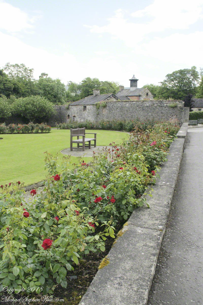
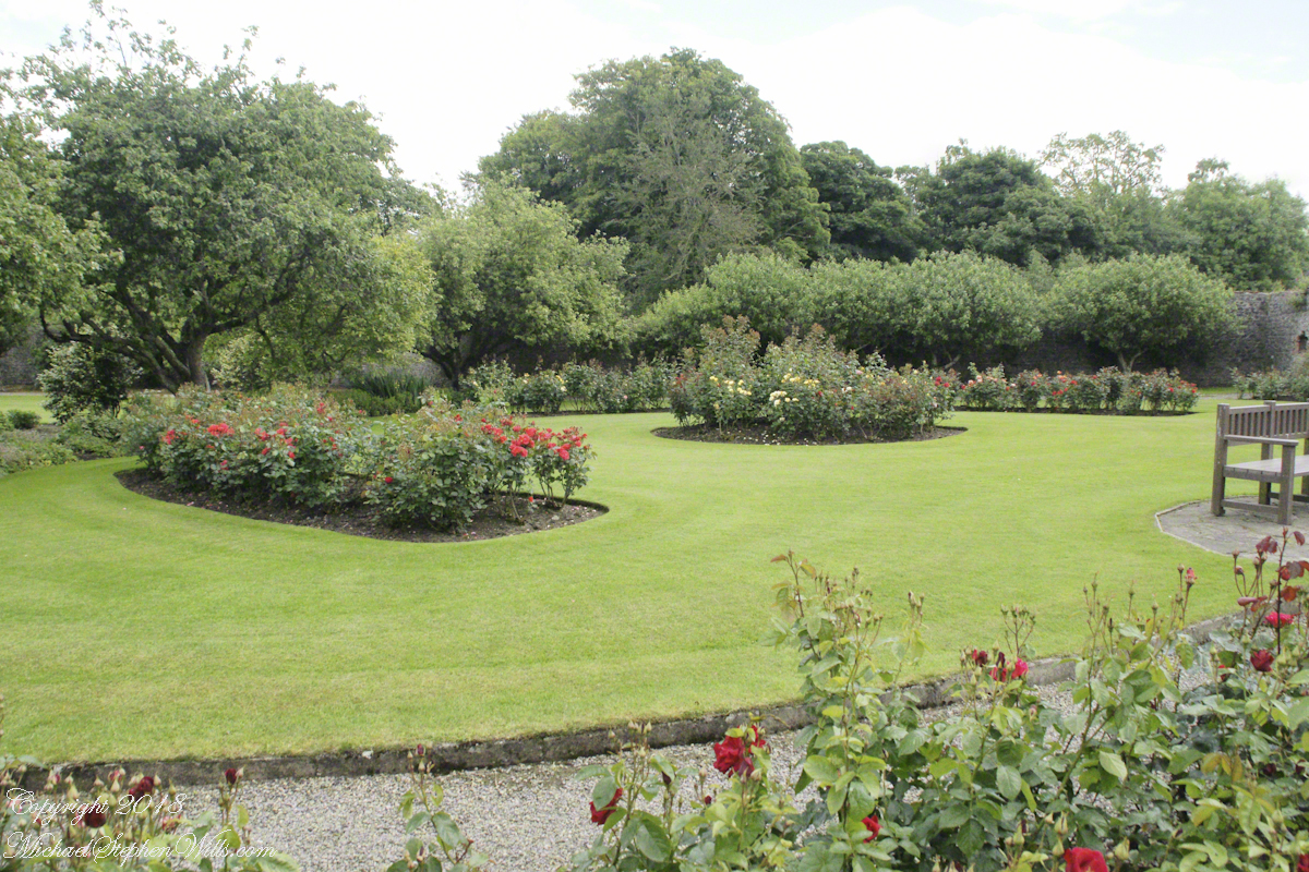
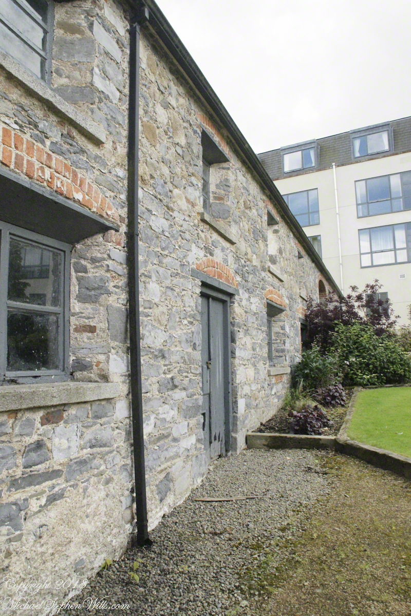
Ballymascanlon House Hotel is on the R173, on the left heading from the M1 towards Jenkinstown. Path to the monument is marked here and there and requires attention. It helps to understand the general location of the monument on the property. The parking lot and hotel are on the southern end, the monument is on the north end.
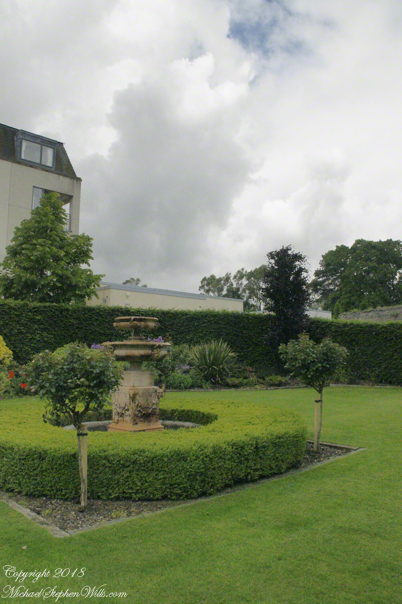
The path leads through the hotel grounds….
….and golf course…
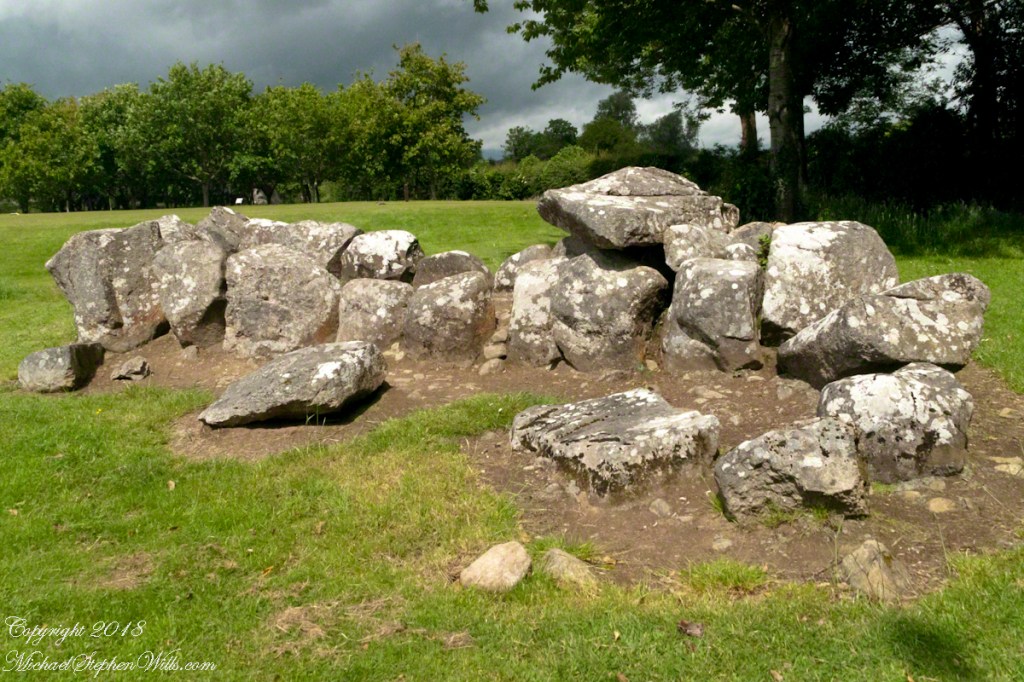
…and you first encounter the megalithic Gallery Grave of a type named “wedge shaped.”
Click any of the following photographs to view my Ireland gallery
The 22 foot long tomb gallery supported stories of a giant burial. Pam poses for a sense of scale.
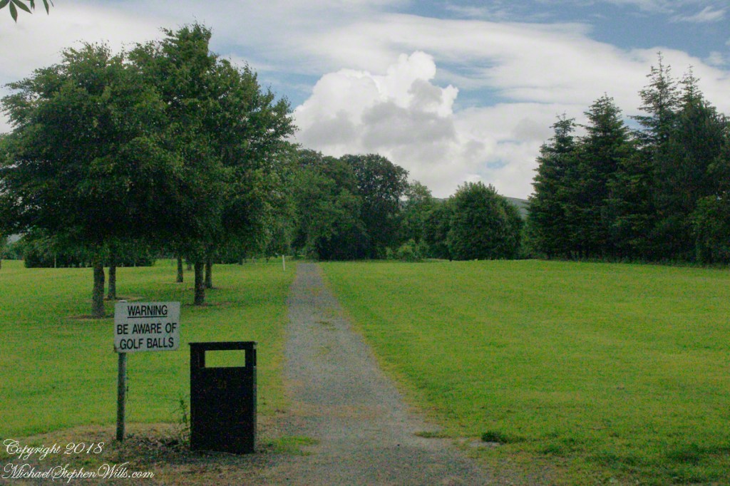
These are the only ancient monuments in Ireland were a stray golf ball may be encountered.
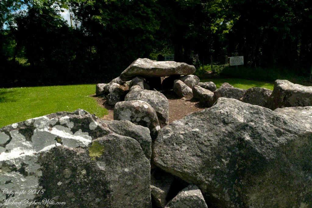
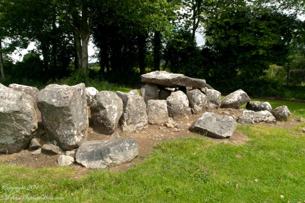
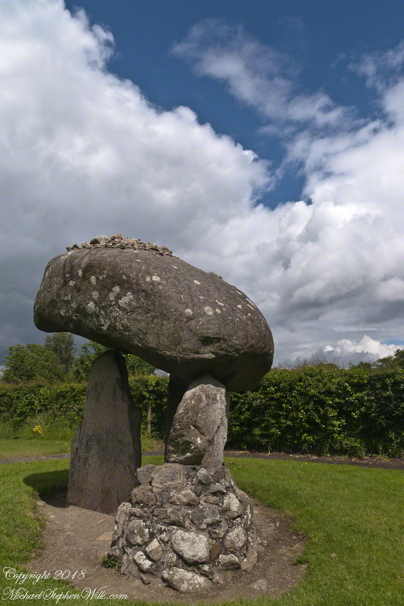
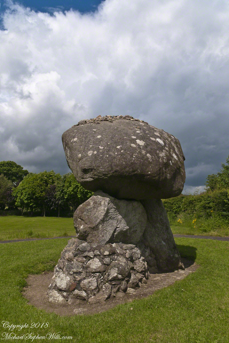
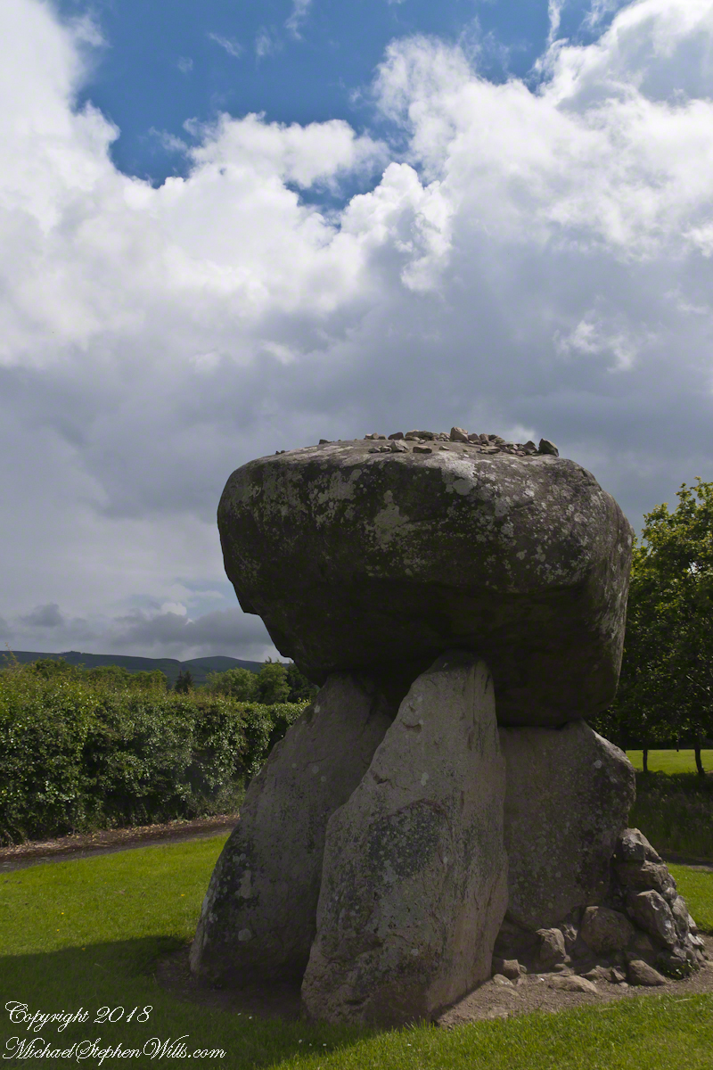
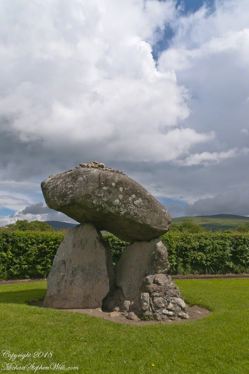
A short way ahead is the dolmen, or portal tomb. The informational placard is in English and Gaelic. There is an illustration of the stones covered with earth with a stone façade.
Some describe the formation as a giant mushroom with warts. The posting feature image is of the same aspect as the next photograph, with me for scale.
Click any of the following photographs to view my Ireland gallery
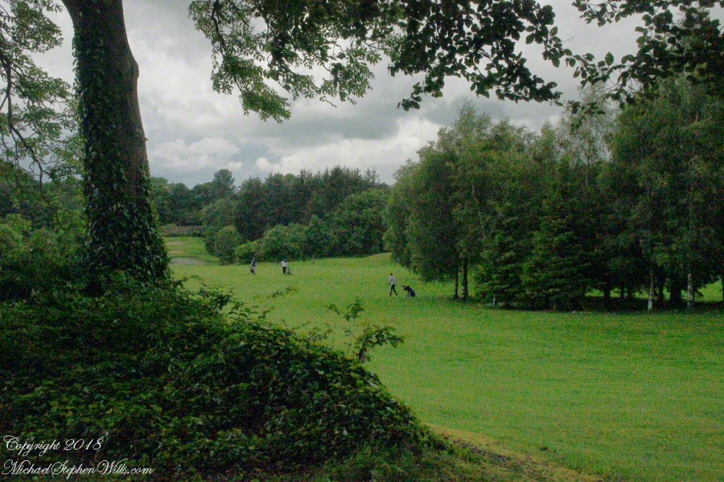
We are surrounded on three sides by the golf course. The “entrance” to the tomb, through the two upright portal stones, faces northwest toward Slieve Gullion, a mountain with its own Neolithic burial site next to a lake on the summit. The mountain and the flat land, such as Proleek township, feature in the story of how the Irish hero Cú Chulainn came by his name. To learn more, click this link for “On the Tain Way” the first of my posting that includes some stories of the hero.
The fifth hole.
We had a beautiful day, so I took time to capture all aspects. The hedge is the northern property border.
The “warts” are stones. There is a local saying that success in placing three stones on top will give a wish or lead to marriage within the year.
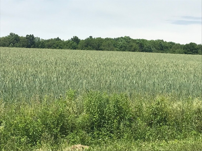
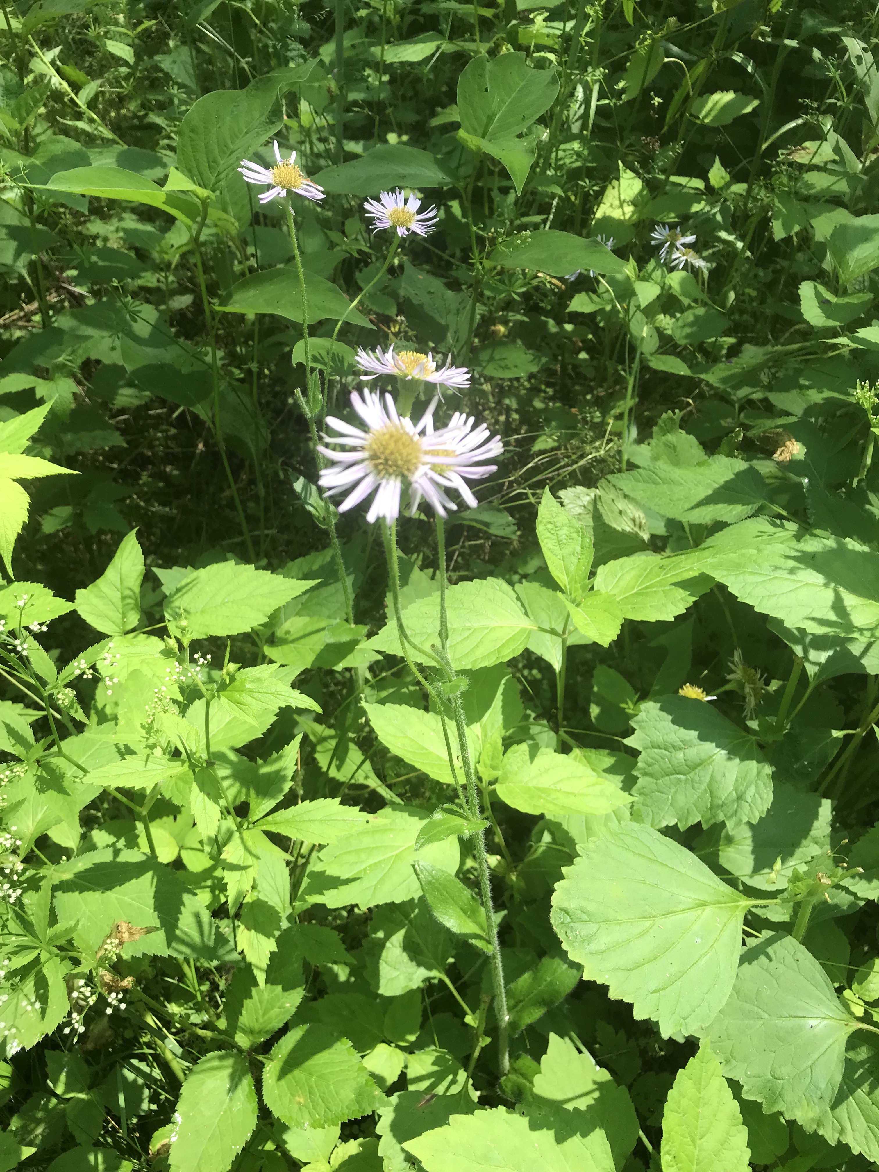
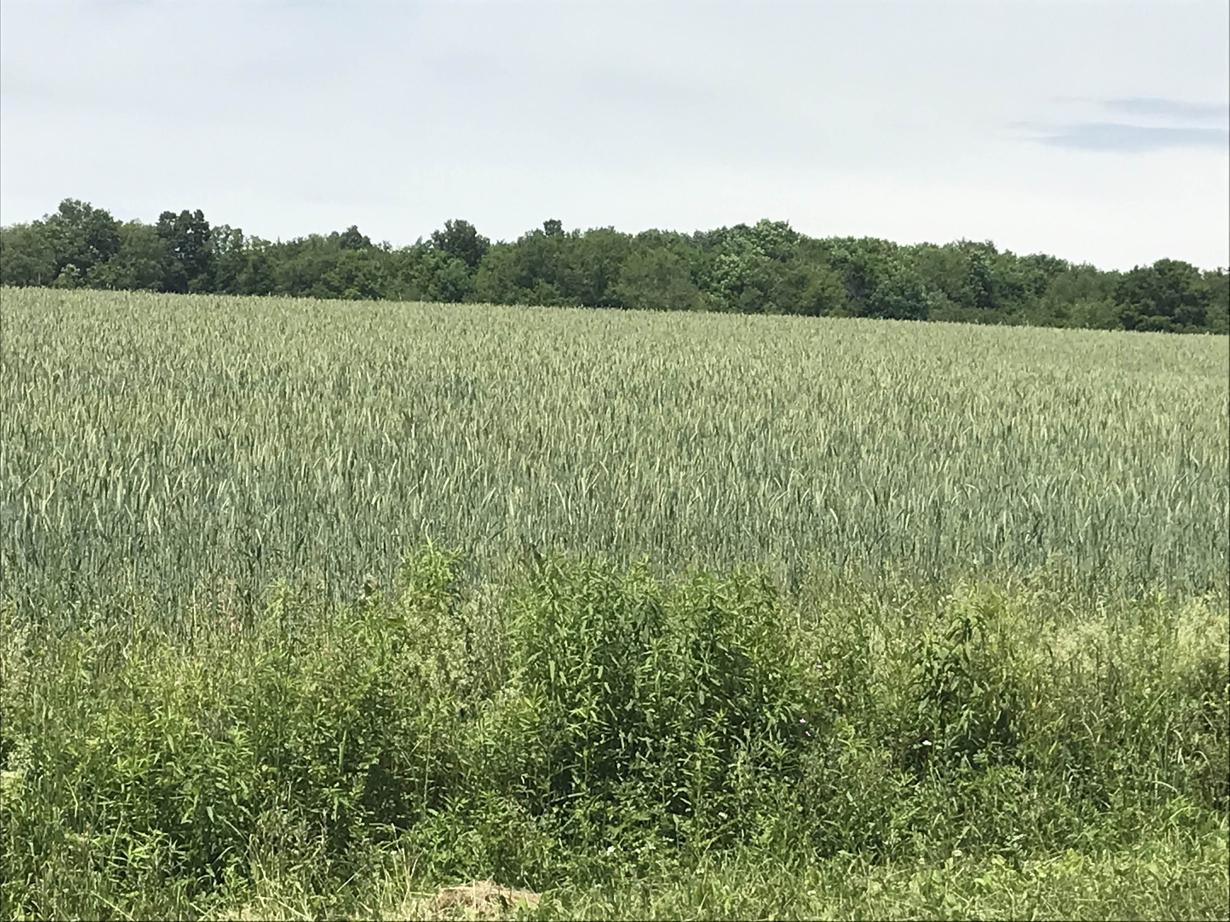
Wednesday, June 15th, we were on a turn to heat and humidity with this day of light breeze, temperature in the 70s making hiking around Tremen Park a joy.
These snapshots, taken on the fly with an IPhone 7, are the high points.
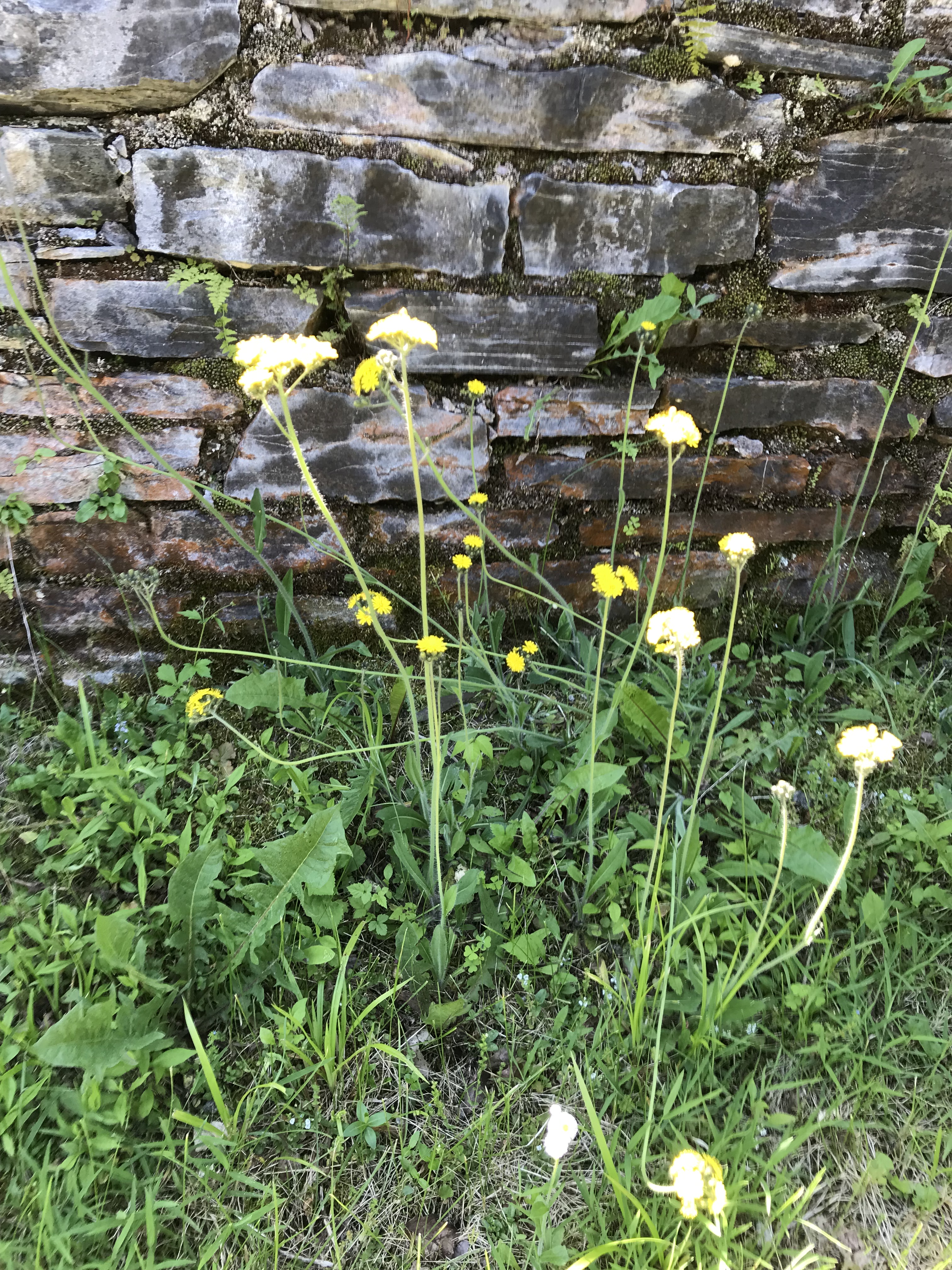
The first is a dandelion look alike with yellow flowers, petals shaped like teeth, though on a long hard stem and multiple flowers on a stalk. Known as meadow hawkweed, yellow hawkweed, field hawkweed, king devil, yellow paintbrush, devil’s paintbrush, yellow devil, yellow fox-and-cubs, and yellow king-devil with two scientific names: Pilosella caespitosa and Hieracium caespitosum.
Click photograph for a larger view. To do this from WordPress Reader, you need to first click the title of this post to open a new page.
Pilosella caespitosa
Click for slideshow.
Copyright 2022 All Rights Reserved Michael Stephen Wills
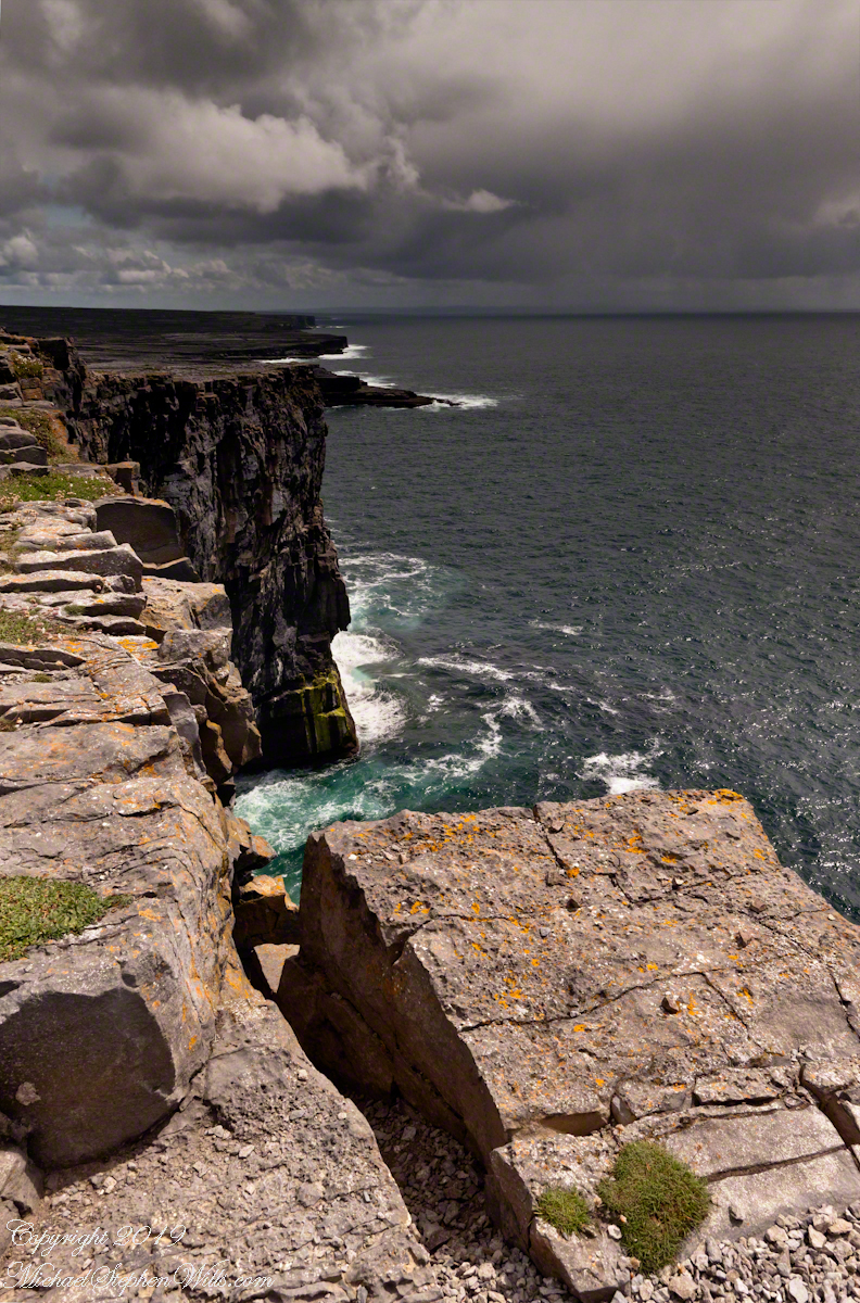
From the commanding location of Dun Aonghasa, looking northeast across Inishmore island, we can understand why the ancient builders chose this location.
We also see the transition from exposed limestone to the fields built literally from the ground up (see my post “The How of Soil”). For a closer view of island houses see my posts “Settled In” and “Cottage Road Cottage.”