The Superstition Wilderness was born from volcanic eruption and in some places (Peters Mesa) the earth still rumbles.
Here in Reavis Canyon it is the huge spring runoff that builds the environment, grinding and scouring the canyon. In my chapter The Mouth of Reavis Canyon is the story of this aspect of the canyon.
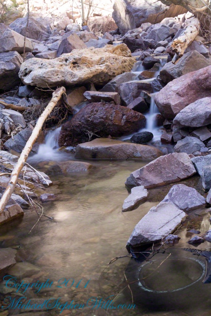
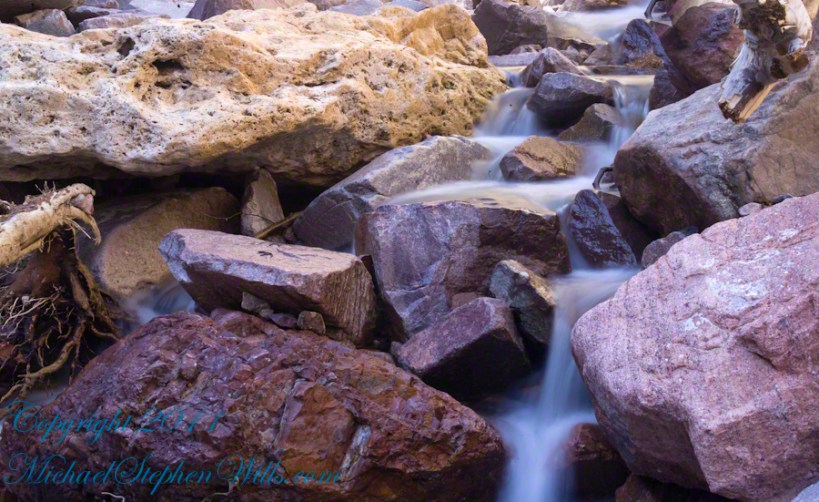
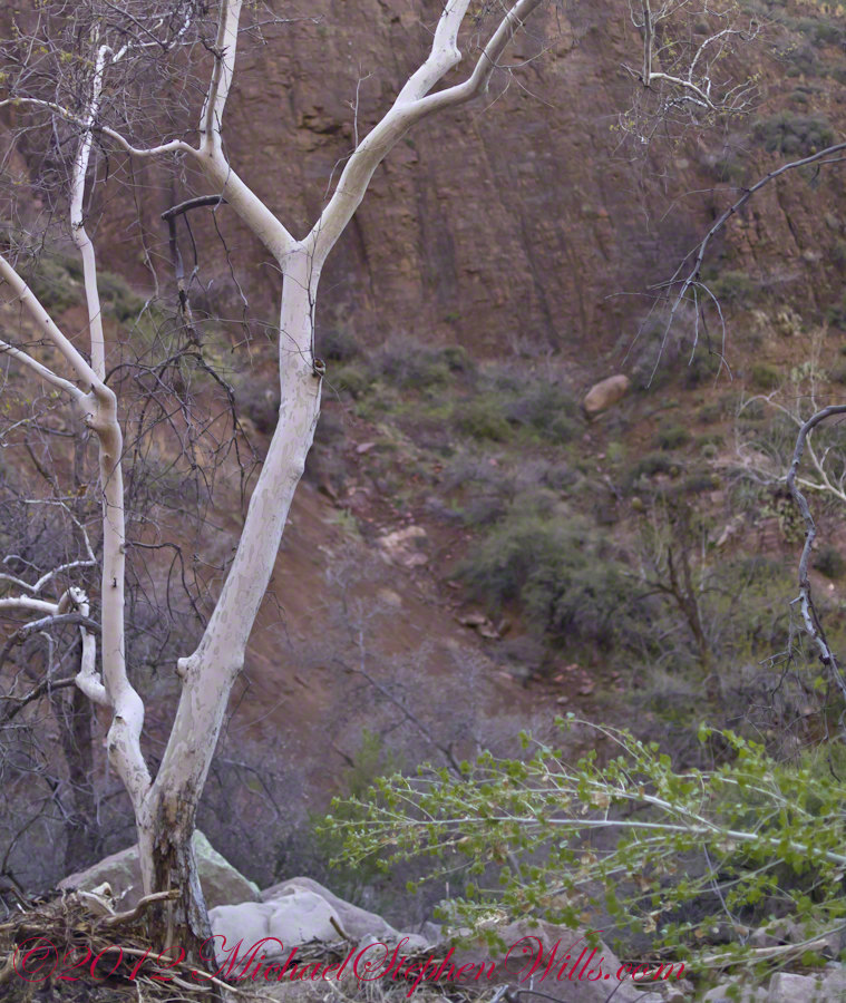
The history of this spot is written on these volcanic and igneous rocks and boulders, the uprooted tree roots and fresh water.
The tire must have washed down from Reavis Ranch.
A Canyon of Wonder and Beauty
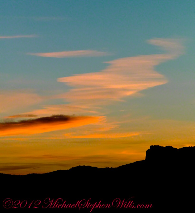
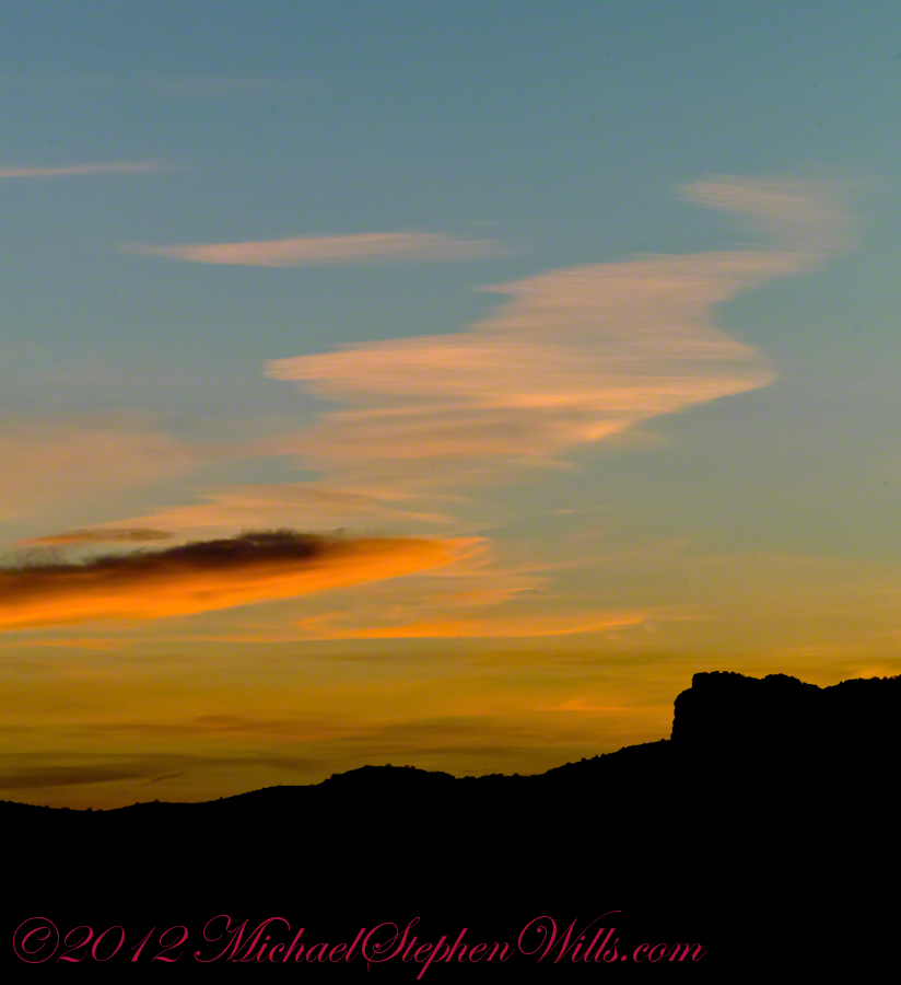
In this chapter I present, in the header, the lovely dawn sky of that day, and a tiny corner of a rock jumble in Reavis Creek. There is a large format version of the sky in my previous post, “The Mouth of Reavis Canyon.”
Rivulets and Rocks
Copyright 2023 Michael Stephen Wills All Rights Reserved
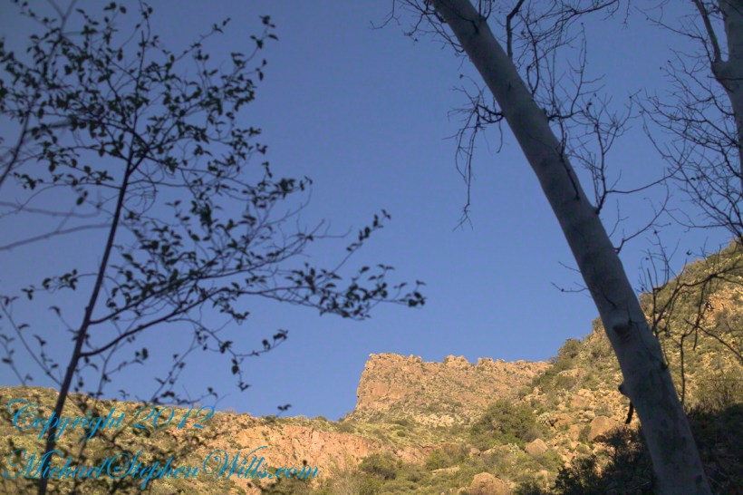
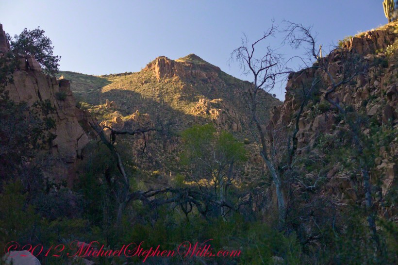
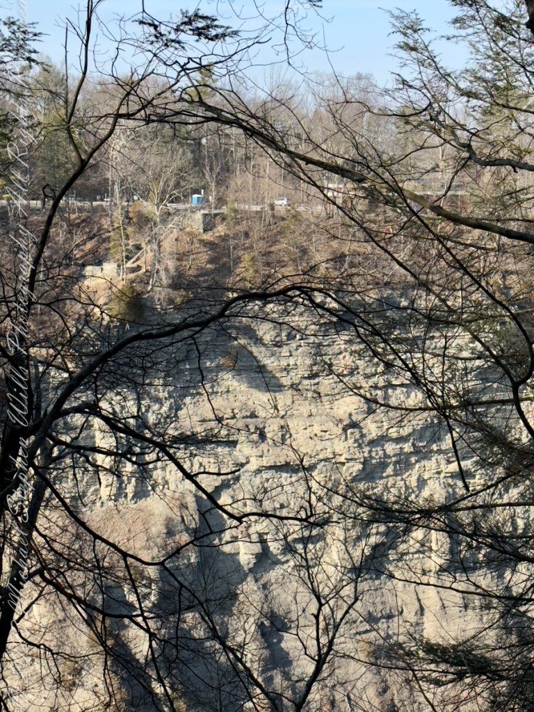
Here is the same view, in daylight. As I hiked toward the canyon mouth below Reavis Falls, looking up I saw this prominant cliff against the sky.
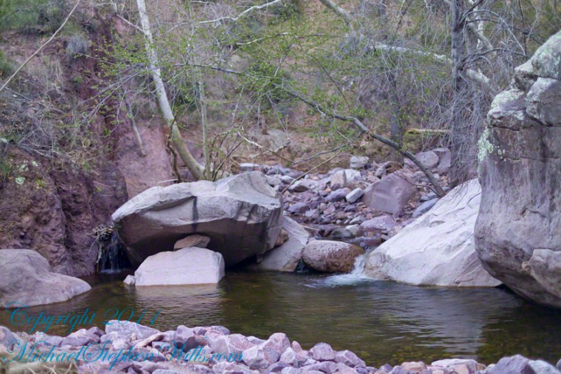
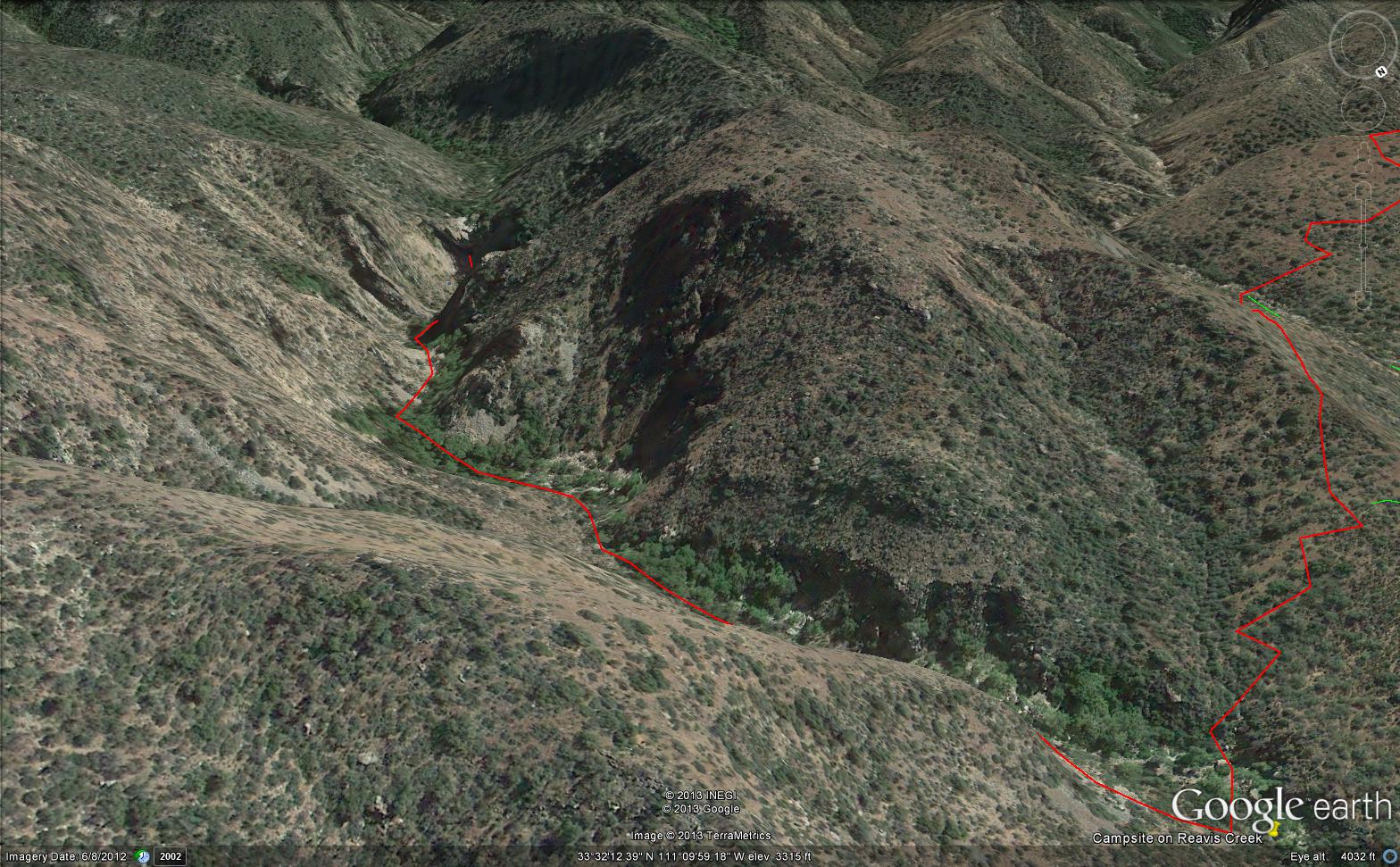
Here is the path I took toward the falls. The campsite is to the lower right, the falls are toward the center and left. My approach to the camp is on the right, moving toward the top. For another view of this location see Reavis Canyon Camp.
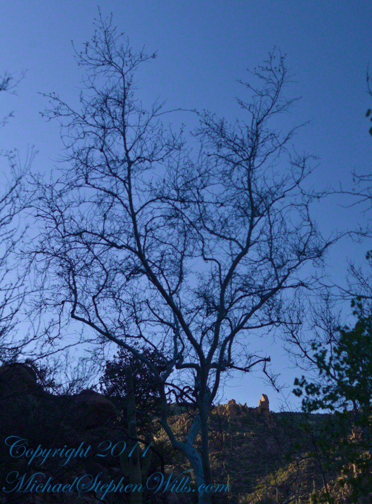
The mouth of Reavis Canyon below the falls is choked with vegetation and infallen rocks and boulders. The far slopes are thick with the poles of young saguaros. There are hoodoos, as well. In the photograph, below, one hoodoo is catching morning light. See the chapters Hoodoos on the Descent to Reavis Falls and Cedar Basin Hoodoos for more views of the hoodoos around Reavis Falls.
Hoodoos visible from the mouth of Reavis Canyon below the falls. Look toward the far slope.
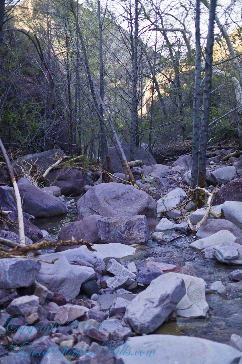
Flood damage in Reavis Canyon below the falls. Note the scouring at the base of these trees and the broken limbs. This is NOT a place to be in spring thaw.
Massive spring flooding scours the canyon floor.
Flood damage in Reavis Canyon below the falls.
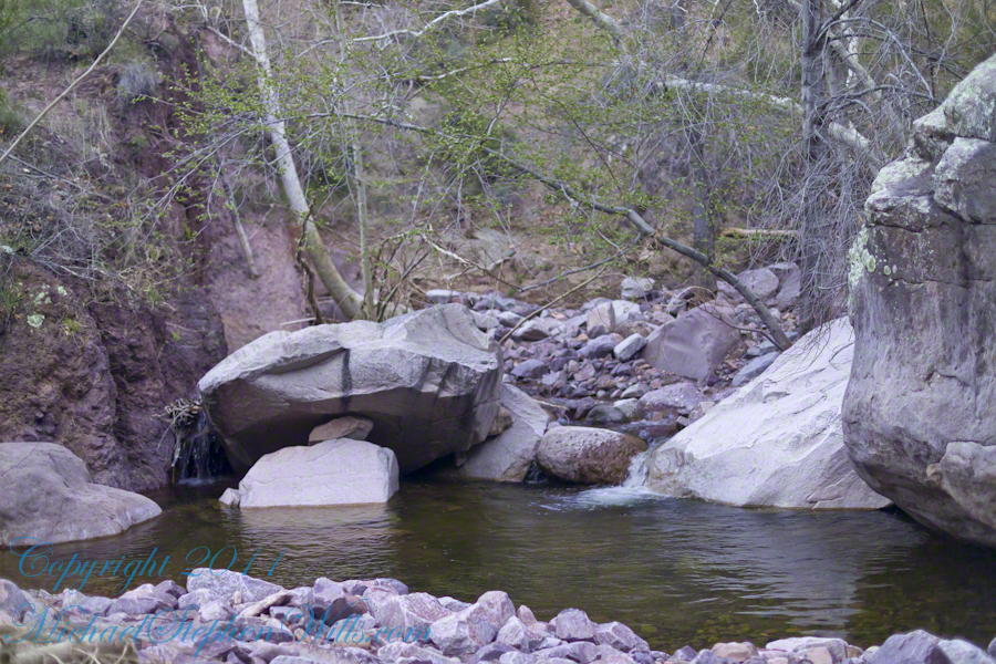
There is beauty to be found, as well. Freshly fallen rough rocks contrast with water smoothed boulders and the water surface.
Copyright 2023 Michael Stephen Wills All Rights Reserved
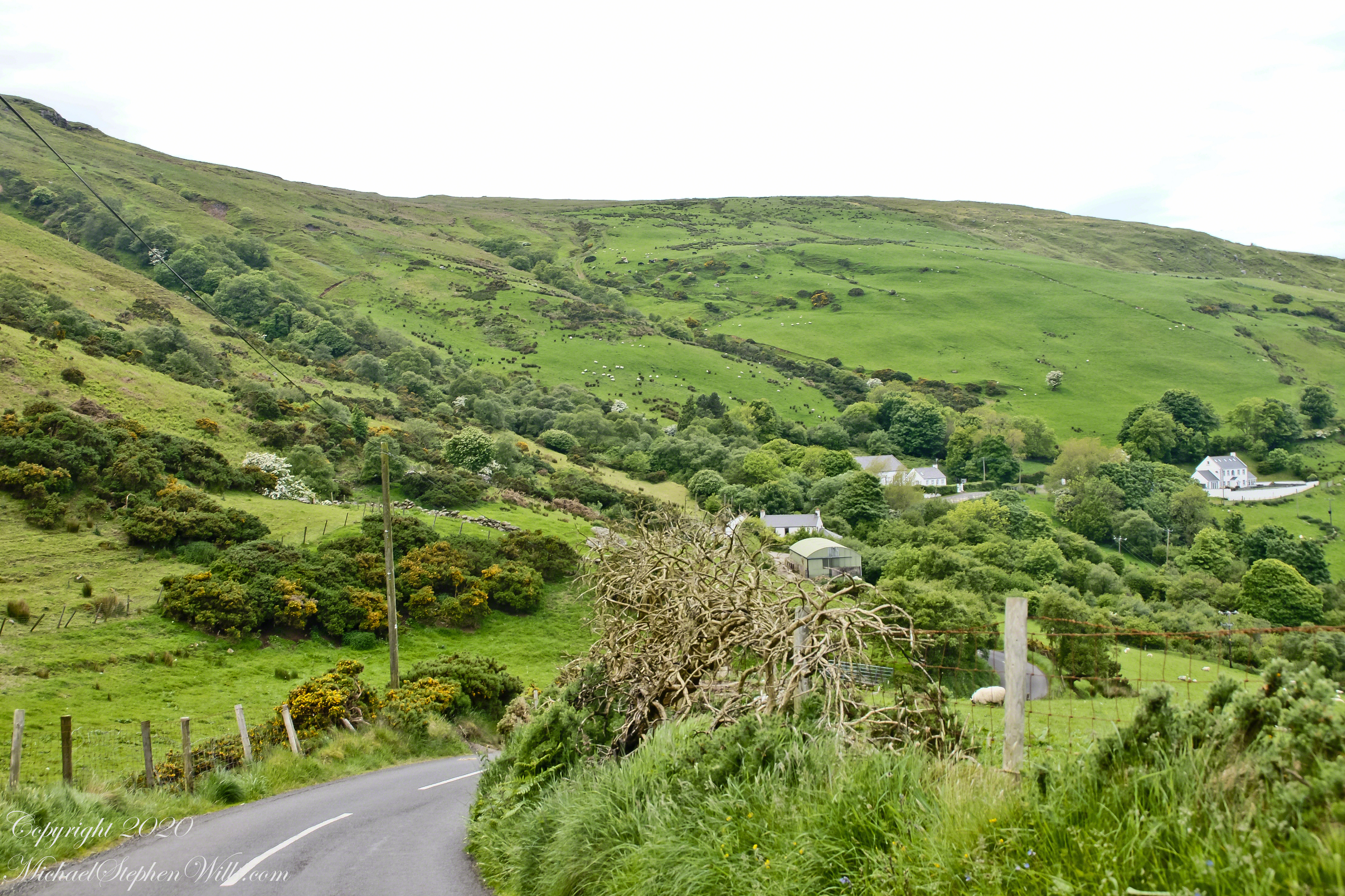
This photograph from the bottom of the Torr Road hill takes in Coolranny Townland. a slice of land running from the ridge to Loughan Bay. We see a number of hawthorne trees in flower, yellow flowering Whin Bush, houses and the Roman Catholic church Saint Mary’s Star of the Sea.
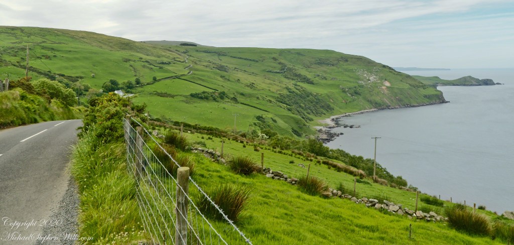
Tor in Irish is a steep rocky height. Likewise, Corr means odd, uneven, rounder, convex, curved, peaked, projecting, smooth. Combined Torcorr is the townland where we stopped on the Torr Road, halted by our wonder at this sight. In the distance, Torr Head projects into North Channel, the closest land to Scotland. Following the coast, the cliffs in front of Torr Head is home to numerous sea birds. The curved bay is named Loughan, the rocky sand beach are ruins of cottages emptied by Irish emigration. The white building is Saint Mary’s Star of the Sea Roman Catholic Church. County Antrim, Northern Ireland.
View of Coolranny townland with Saint Mary’s Star of the Sean Roman Catholic Church from Torcorr townland, Torr Road . County Antrim, Northern Ireland.
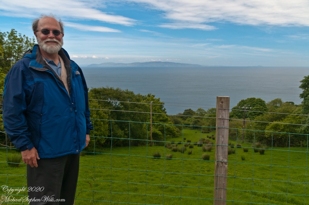
The photograph of the header, taken by Pam, is from either Coolranny or Loughan Townland, looking across a sheep pasture, the North Channel of the Irish Sea toward the Mull of Kintyre, Scotland just twelve miles distant.
Here is a slideshow of this post’s images. To visit from WordPress Reader, you need to first click the title of this post to open a new page.
Tor in Irish is a steep rocky height. Likewise, Corr means odd, uneven, rounder, convex, curved, peaked, projecting, smooth. Combined Torcorr is the townland where we stopped on the Torr Road, halted by our wonder at this sight. In the distance, Torr Head projects into North Channel, the closest land to Scotland. Following the coast, the cliffs in front of Torr Head is home to numerous sea birds. The curved bay is named Loughan, the rocky sand beach are ruins of cottages emptied by Irish emigration. The white building is Saint Mary’s Star of the Sea Roman Catholic Church. County Antrim, Northern Ireland.View of Coolranny townland with Saint Mary’s Star of the Sean Roman Catholic Church from Torcorr townland, Torr Road . County Antrim, Northern Ireland.On the way to Torr Head we stopped at this spot in Coolranny Townland to take in this view of the Irish Sea. The land overlooks Loughan Bay toward the Mull of Kintyre and Sanda Island, Scotland. County Antrim, Northern Ireland.
Copyright 2023 All Rights Reserved Michael Stephen Wills
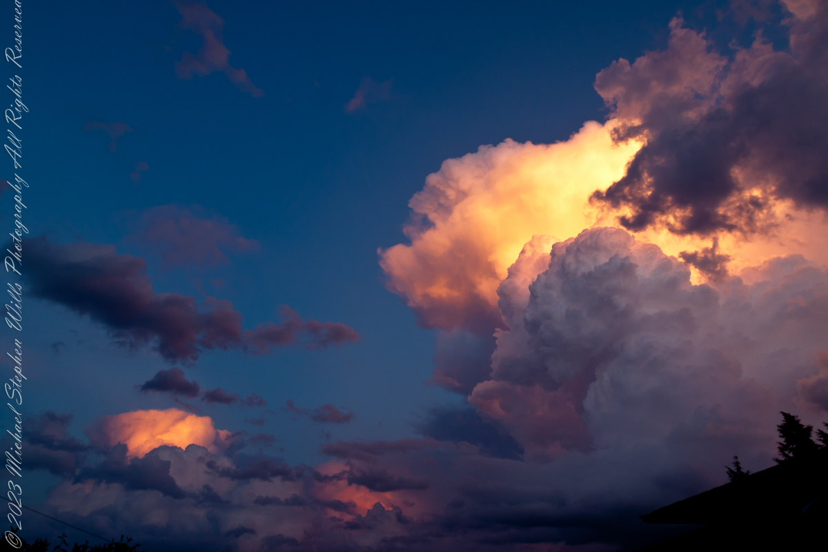
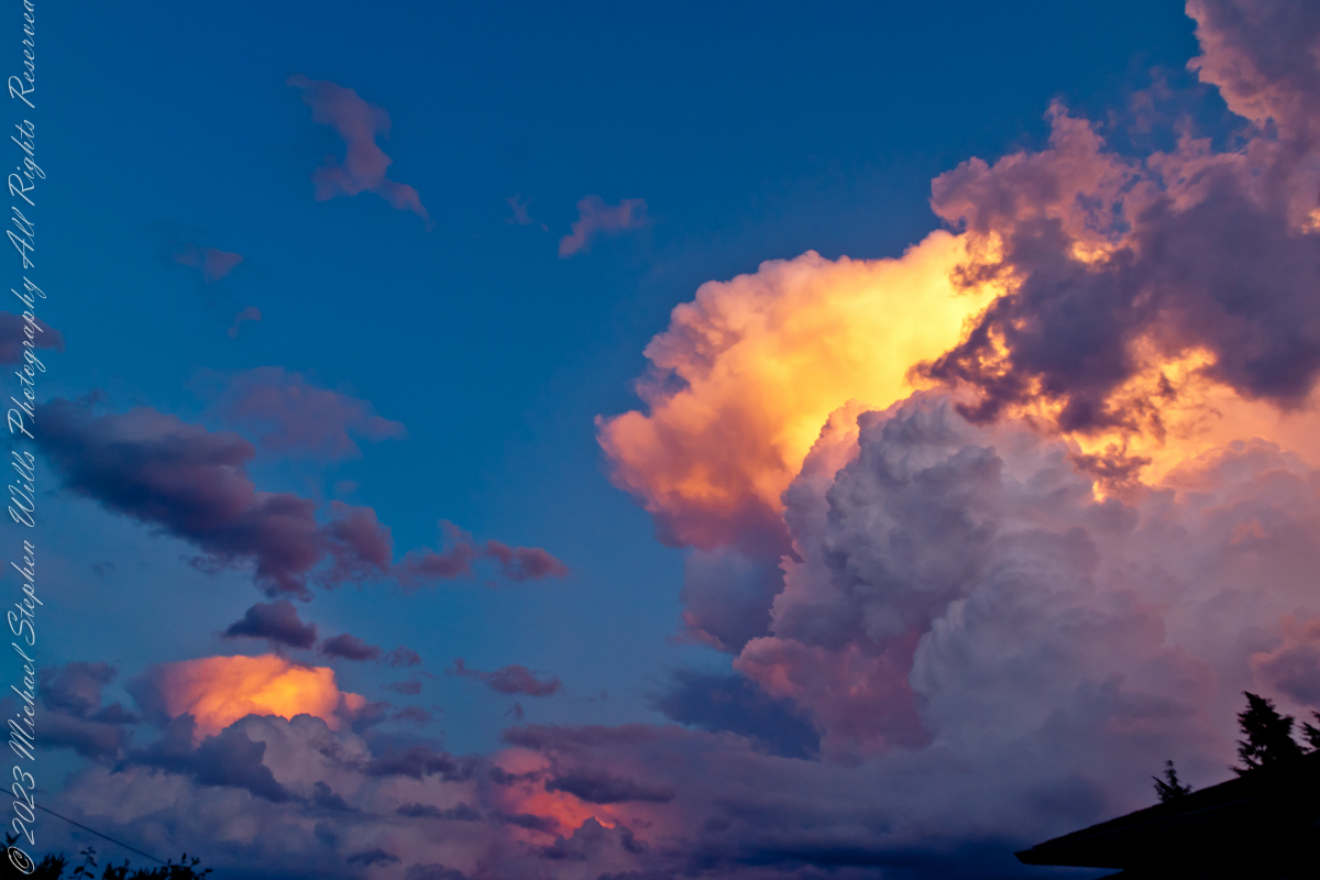
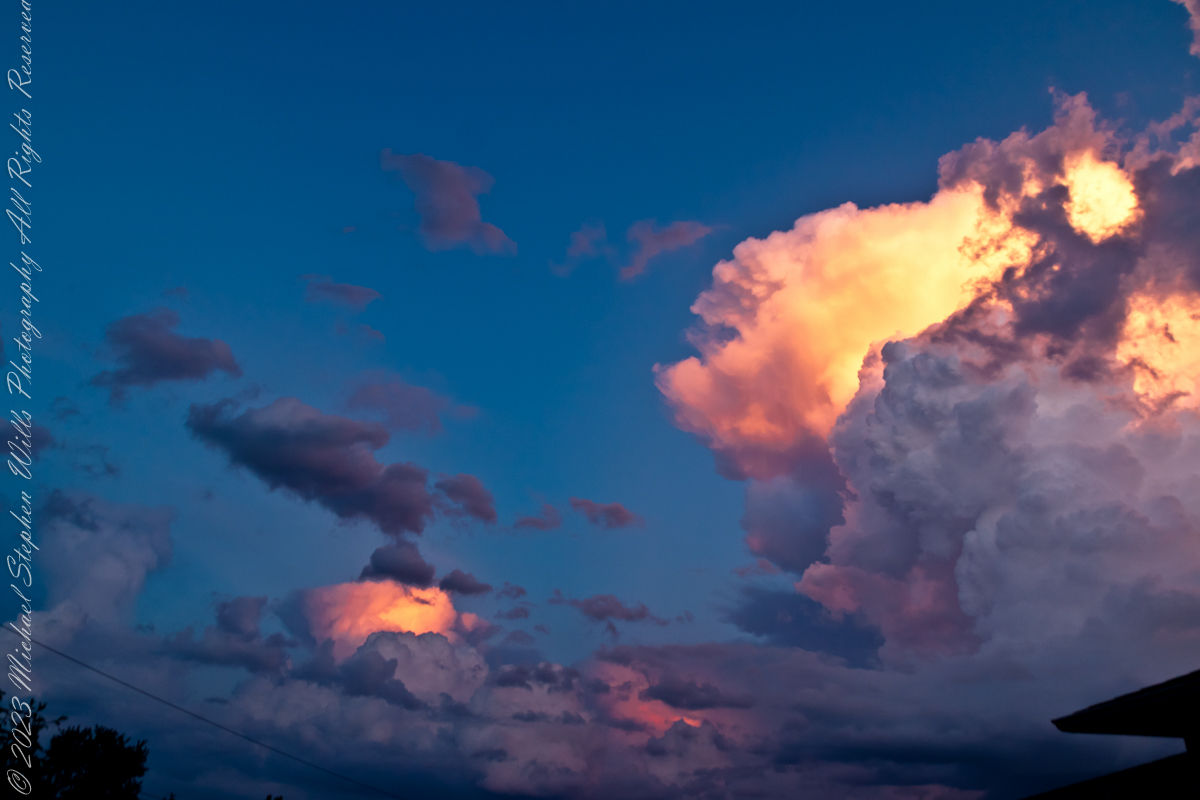
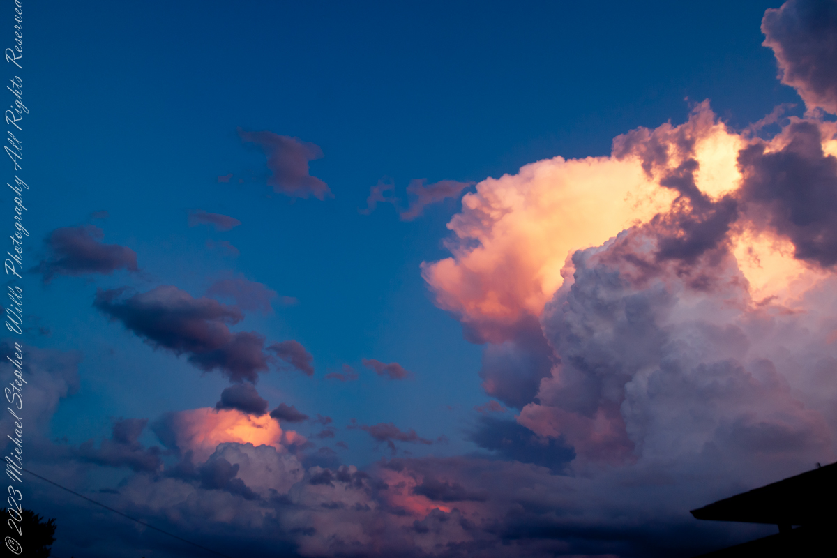
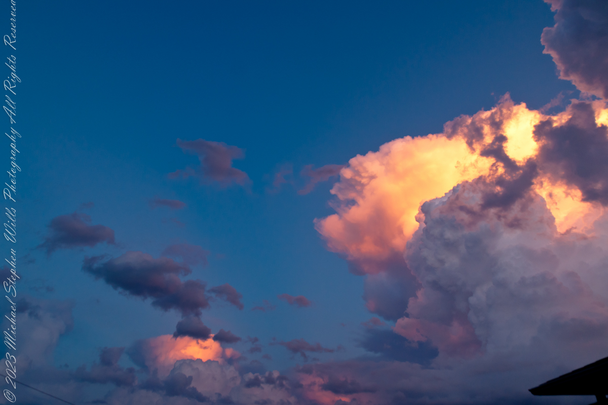
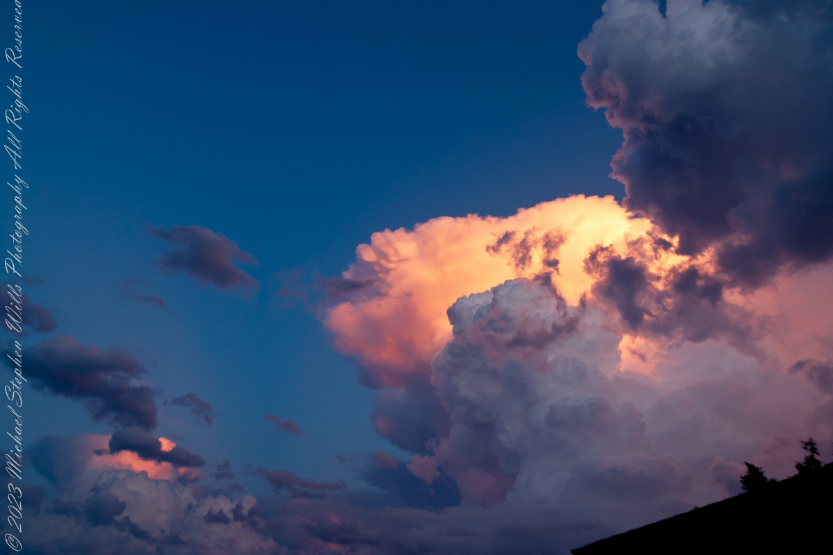
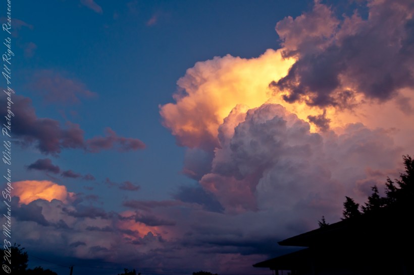
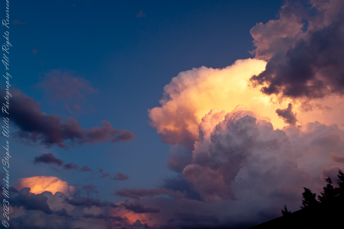
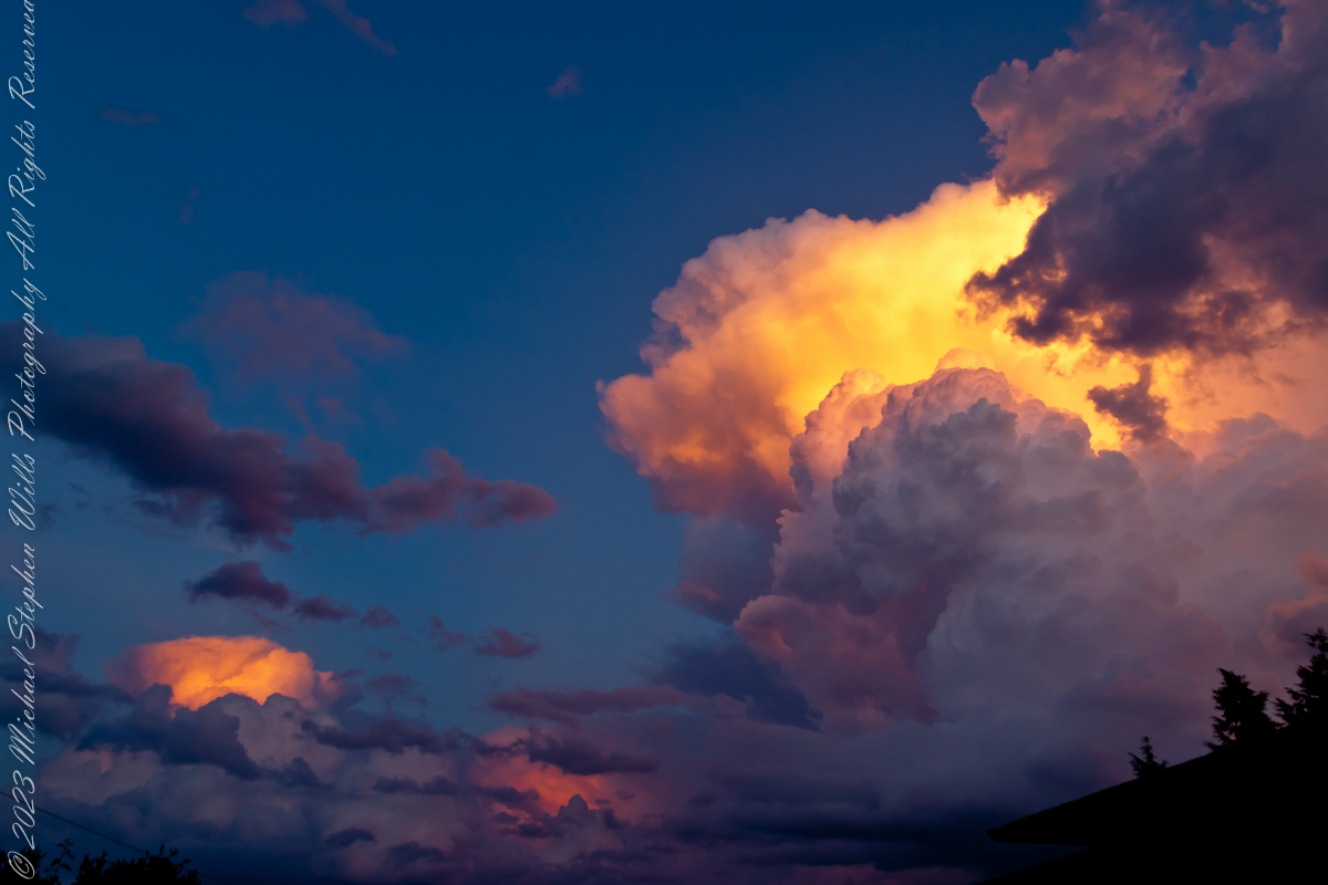
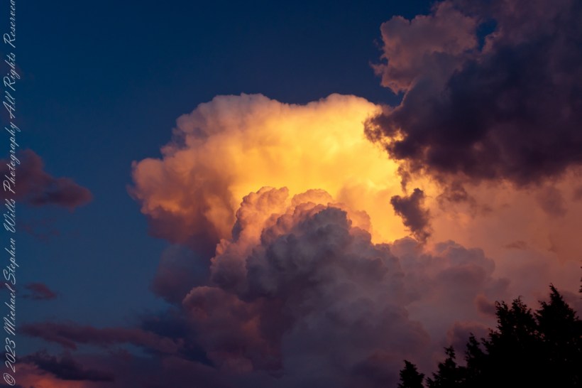
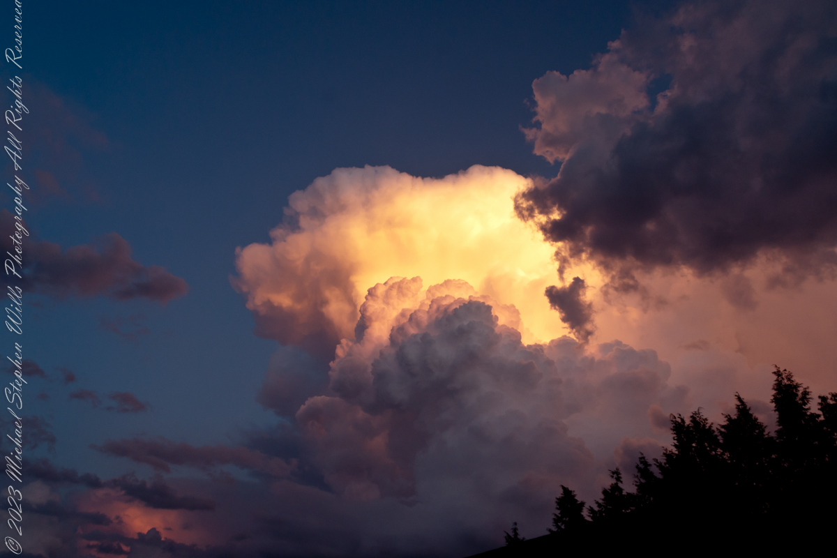
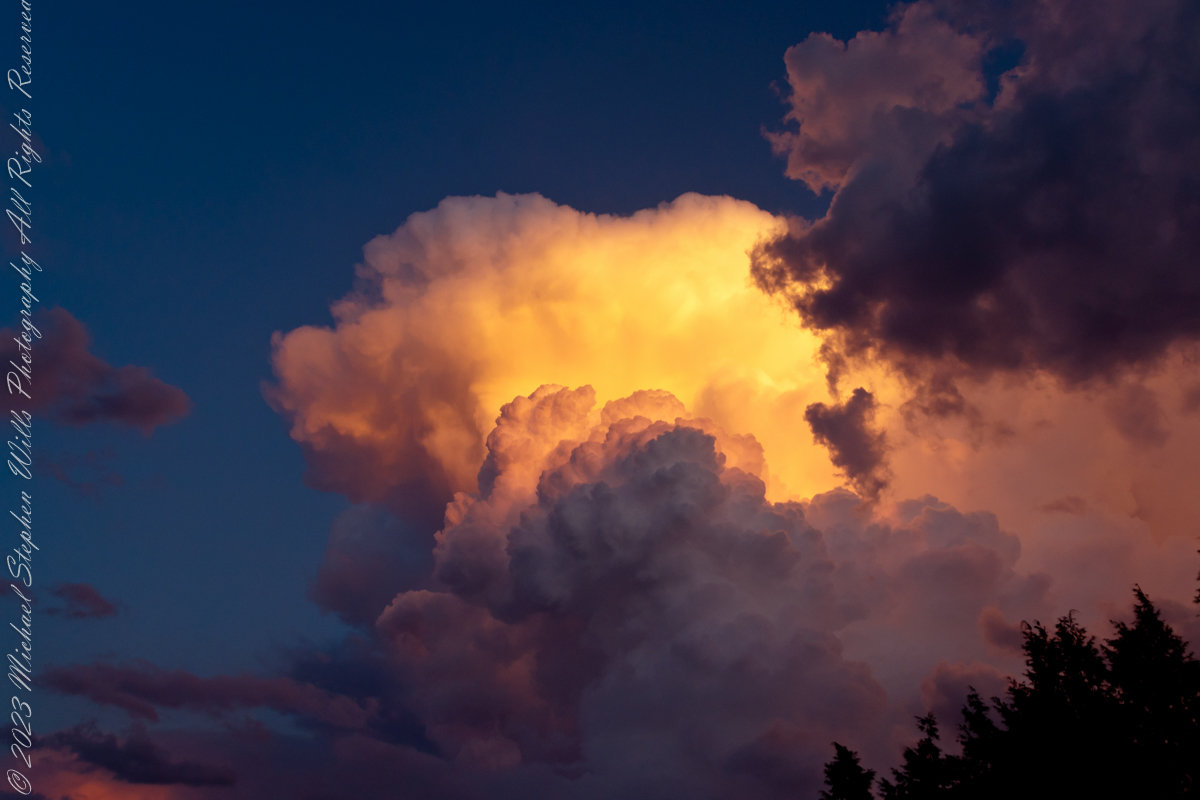
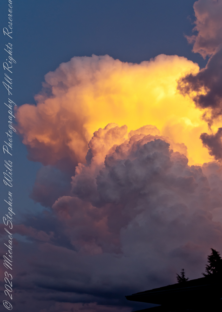
The combination of water vapor in all its forms and the sun dipping below the horizon combined to form these magical images.
Maxfield Parrish refined his art to duplicate these effects in oil.
Parrish’s art is characterized by vibrant colors; the color Parrish blue was named after him. He achieved such luminous color through glazing. This process involves applying layers of translucent paint and oil medium (glazes) over a base rendering. Parrish usually used a blue and white monochromatic underpainting.
His paintings/illustrations were unique in that they depicted a highly idealized fantasy world that was accessible to the public. Although you will rarely see a glimpse of that color in reality, he was and still is linked with a particularly bright shade of blue that coated the skies of his landscapes. And it was not an easy task for him to complete. He invented a time-consuming process that involved a cobalt blue base and white undercoating, which he then coated with a series of thin alternating coatings of oil and varnish. When exposed to ultraviolet light, the resins he employed, known as Damar, fluoresce a shade of yellow-green, giving the painted sky its distinctive turquoise tint.
Reference: “Maxfield Parrish” from Wikipedia
Copyright 2023 Michael Stephen Wills All Rights Reserved
Cumulonimbus (from Latin cumulus ‘heaped’, and nimbus ‘rainstorm’) is a dense, towering vertical cloud, typically forming from water vapor condensing in the lower troposphere that builds upward carried by powerful buoyant air currents.
Above the lower portions of the cumulonimbus the water vapor becomes ice crystals, such as snow and graupel, the interaction of which can lead to hail and to lightning formation, respectively. When occurring as a thunderstorm these clouds may be referred to as thunderheads. Cumulonimbus can form alone, in clusters, or along squall lines.
Graupel also called soft hail, hominy snow, or snow pellets, is precipitation that forms when supercooled water droplets in air are collected and freeze on falling snowflakes, forming 2–5 mm (0.08–0.20 in) balls of crisp, opaque rime.
Graupel is distinct from hail and ice pellets in both formation and appearance. However, both hail and graupel are common in thunderstorms with cumulonimbus clouds, though graupel also falls in winter storms, and at higher elevations as well.
These clouds can produce lightning and other dangerous severe weather, such as tornadoes, hazardous winds, and large hailstones. Cumulonimbus progresses from overdeveloped cumulus congestus clouds and may further develop as part of a supercell. Cumulonimbus is abbreviated Cb.
Reference: “Cumulonumbus Cloud” and “Graupel” from Wikipedia
Copyright 2023 Michael Stephen Wills All Rights Reserved
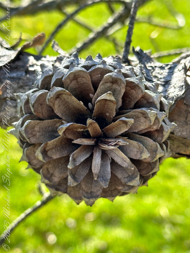
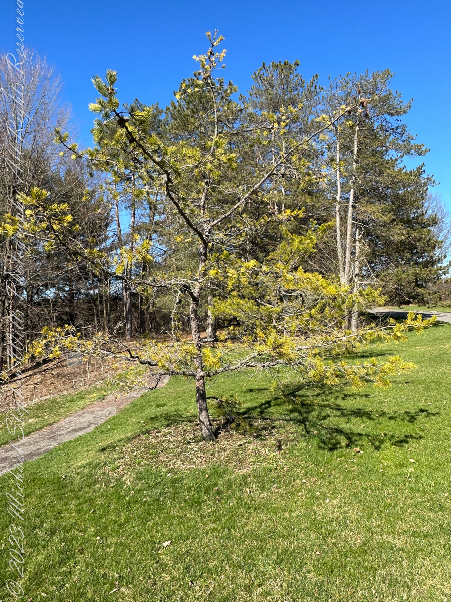
Pam and I ambled around the Arboretum for our Easter 2023 outing. Found here growing outside native range, being the Appalachian Mountains from Georgia to southern Pennsylvania, the Table Mountain Pine is named after the landform, not a particular mountain.
All photography using the IPhone 14 ProMax triple camera, raw format, edited on the phone.
Its pinecones drew me to this scraggly, ungainly, poorly formed tree. All general mankind finds useful in the, scientific name, Pinus pungens, otherwise known as Hickory Pine, Prickly Pine and Mountain Pine, is to grind it up for pulp or chop it for tinder.
Last of the Mohicans
That said, the final scene of the 1992 film The Last of the Mohicans takes place in a nice Pinus pungens stand on a rocky mountaintop in North Carolina.
Personality
The tree has personality. Pinus pungens is the Lonesome Pine of the 1908 novel The Trail of the Lonesome Pine by John Fox, and popularized in the Laurel and Hardy film Way out West: “On the Blue Ridge Mountains of Virginia On the Trail of the Lonesome Pine” Several “Lonesome Pine” hiking trails have been waymarked in the Blue Ridge Mountains and elsewhere in the Appalachians.
Pinecone Bud
Pinus pungens prefers dry conditions and is mostly found on rocky slopes, favoring higher elevations, from 300–1,760 meters (980–5,770 ft) altitude. It commonly grows as single scattered trees or small groves, not in large forests like most other pines, and needs periodic disturbances for seedling establishment. The three tallest known ones are in Paris Mountain State Park, South Carolina; they are 26.85 to 29.96 meters (88 ft 1 in to 98 ft 4 in) tall.
Reference: “Pinus pungens” Wikipedia.
Copyright 2023 Michael Stephen Wills All Rights Reserved
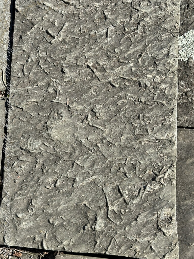
Pam and I ambled around the Arboretum for our Easter 2023 outing. A type of sandstone popular with Cornell monument builders, called “Lenroc” after a mansion build by Cornell’s founder, was used for these benches built into the hillside of the FR Newman Arboretum. The views are more interesting than the bench, the arch of stone in midground in one photo.
All photography using the IPhone 14 ProMax triple camera, raw format, edited on the phone.
The stone is mined locally from surrounding hills. Calling it “Lenroc” (Cornell spelled backward) is a misnomer as the stone is mined widely throughout the region.
Feldspathic Greywacke
“Bluestone from Pennsylvania and New York is a sandstone defined as feldspathic greywacke. The sand-sized grains from which bluestone is constituted were deposited in the Catskill Delta during the Middle to Upper Devonian Period of the Paleozoic Era, approximately 370 to 345 million years ago…..
Glacial Landscape on an early spring day, Easter 2023
Textures
…The Catskill Delta was created from runoff from the Acadian Mountains (“Ancestral Appalachians”). This delta ran in a narrow band from southwest to northeast and today provides the bluestone quarried from the Catskill Mountains and Northeastern Pennsylvania. The term “bluestone” is derived from a deep-blue-colored sandstone first found in Ulster County, New York.”
You can feel the origin of this bluestone from these macros of two pavers from a monument bench.
Reference: “Bluestone” Wikipedia.
Copyright 2023 Michael Stephen Wills All Rights Reserved
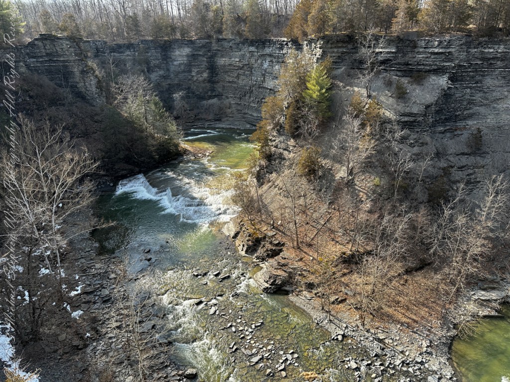
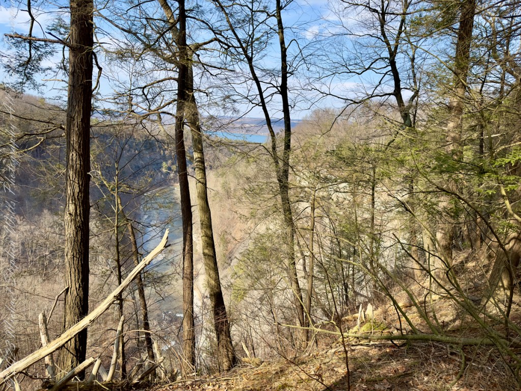
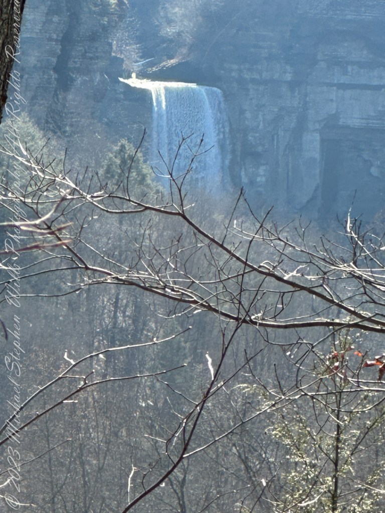
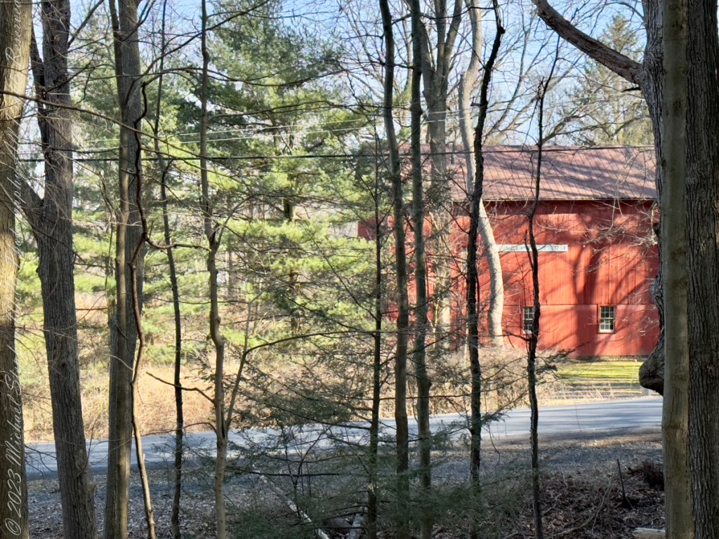
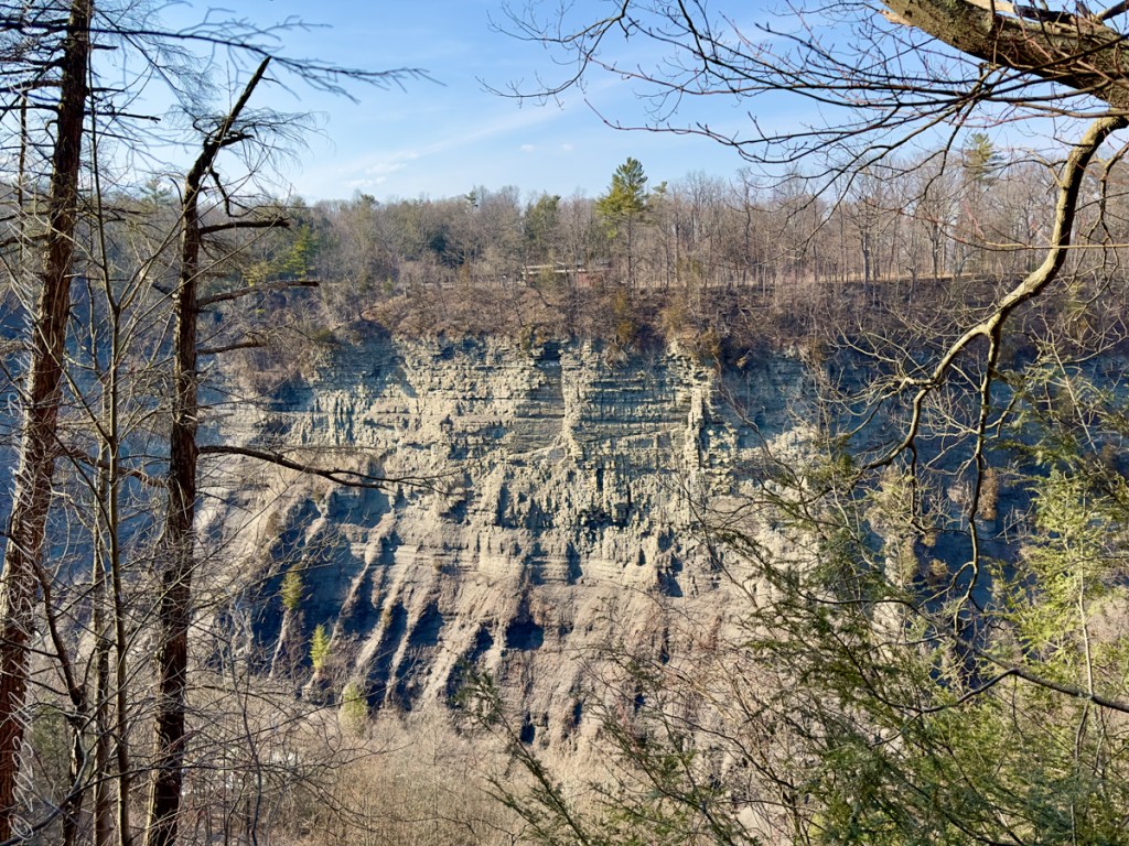
Thank You for exploring with me the South Rim trail of Taughannock Falls State Park on this first day of Spring 2023.
Photographs with video from this walk, with nature sounds and music in 4K HD
Click photograph for a larger view. To do this from WordPress Reader, you need to first click the title of this post to open a new page.
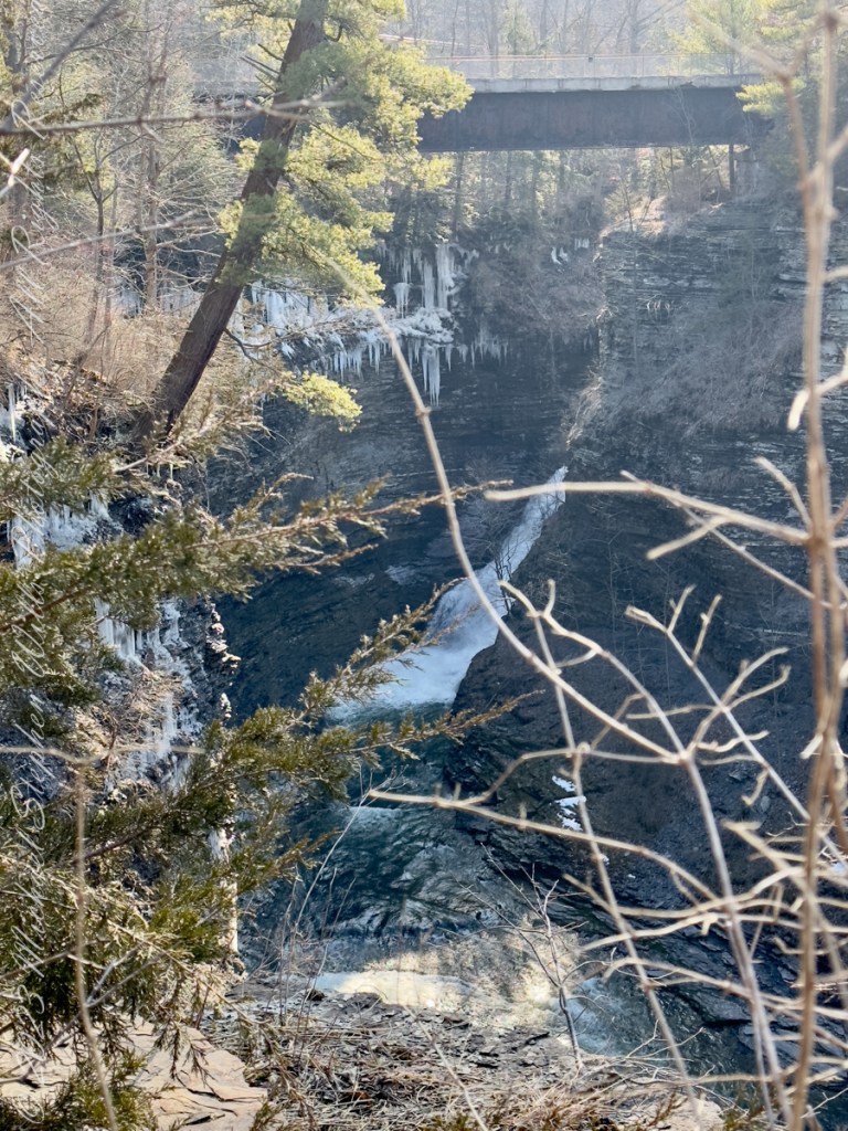
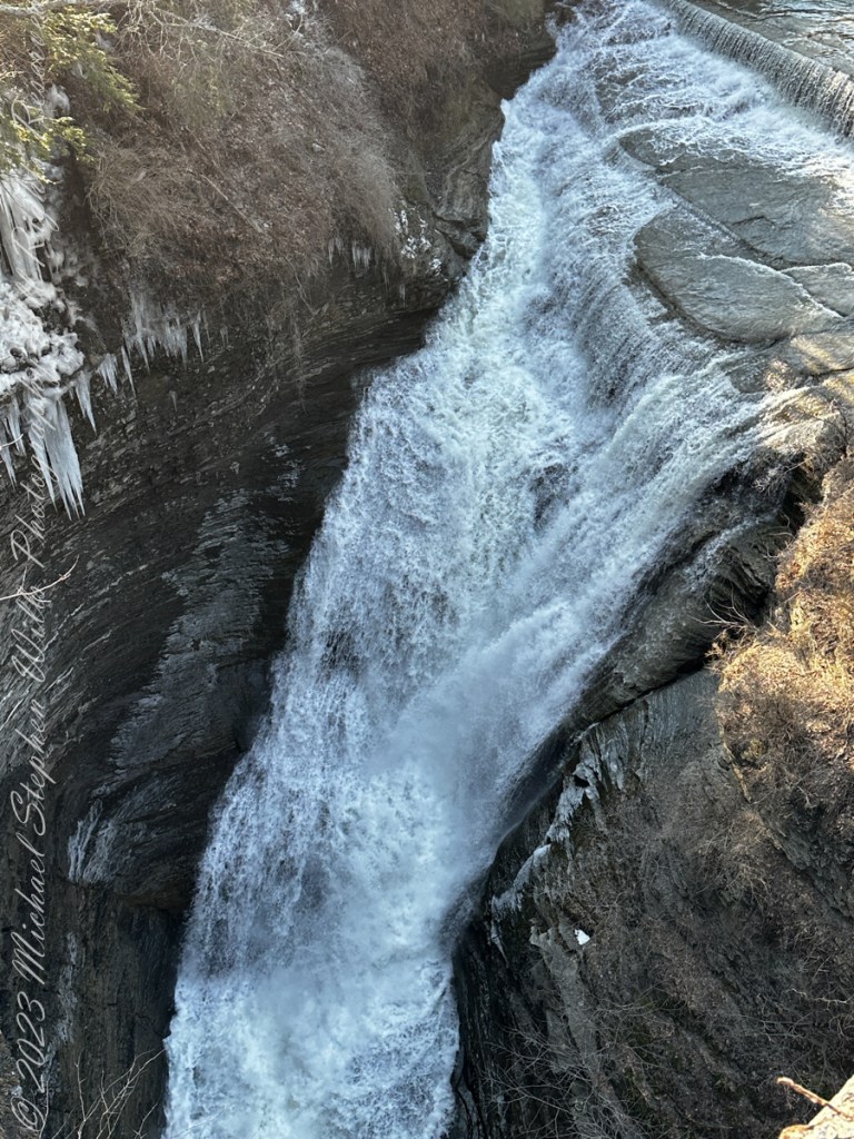
Here, before the epynmous creek flows over the falls, glacial outflow carved this deep canyon through relatively soft sedimentary rock. Distant Lake ViewThe place for rest and wonderLooking into the gorgeSouth Rim view of fallsTaughannock creek below the fallsRed Barn on Gorge Road, off South Rim rial.Perched on the north rim of the gorge, the Visitor Center for the Falls Overlook is visible before trees leaf out.On spring’s first day Taughannock Creek is full beneath the old railroad bridge, now a connector between South and North Rim Trails.The creek here plunges into the chasm below a former railroad bridge. Gorge from Railroad Bridge Walkway