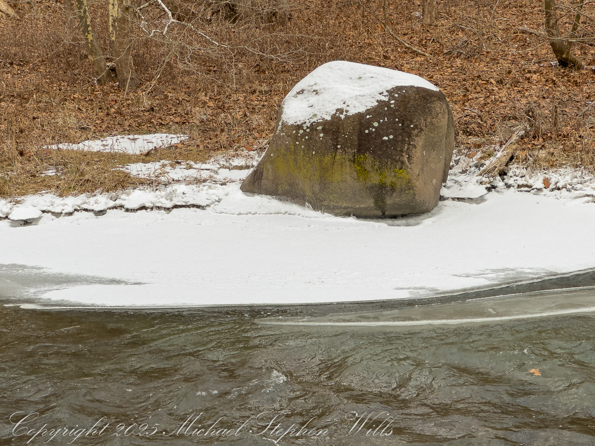
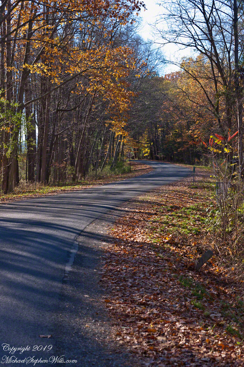
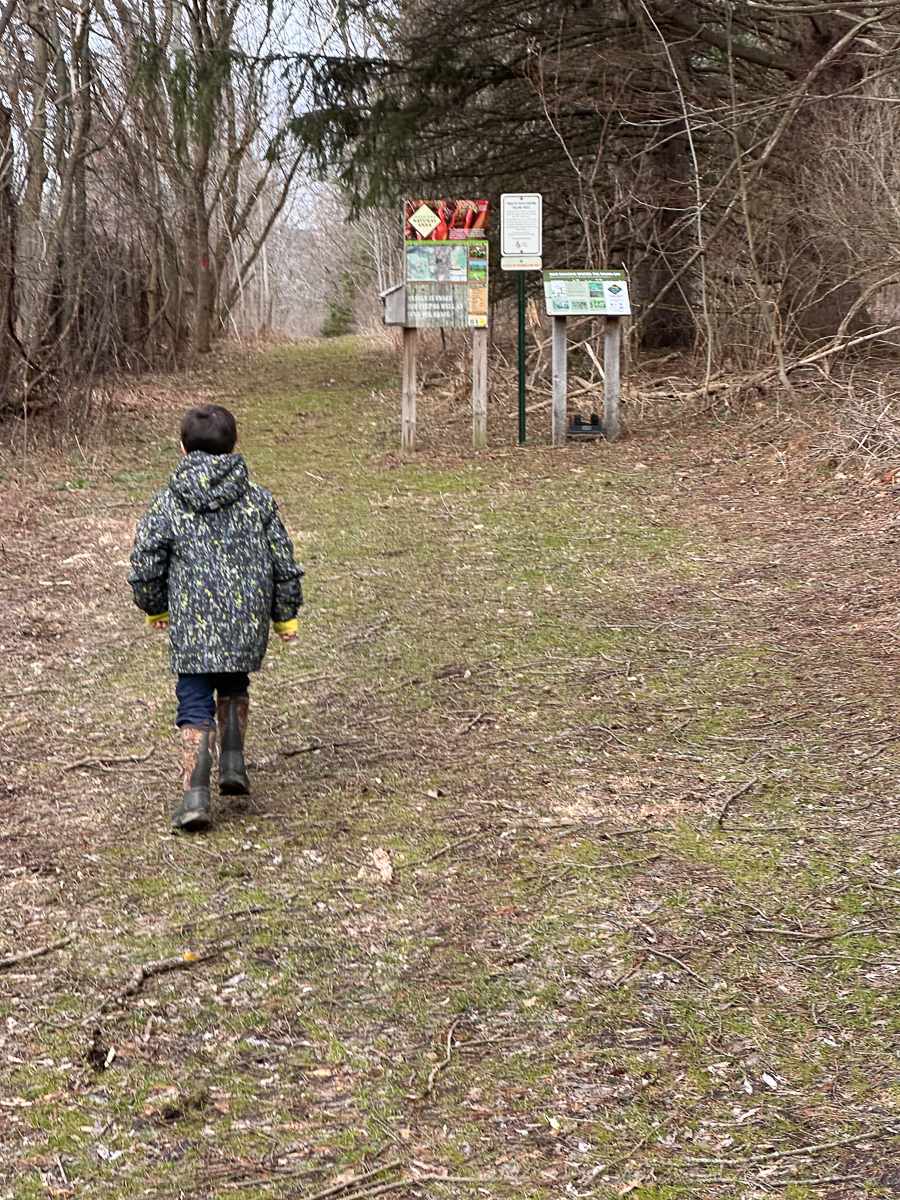
The path into McLean Bogs begins without ceremony, a narrowing of the world. The road falls away, the trees gather closer, and the ground softens underfoot, remembering water. You arrive at a threshold. The air seems altered, quieter, carrying a faint mineral stillness, as though the glacier that shaped this place has not entirely withdrawn its presence.
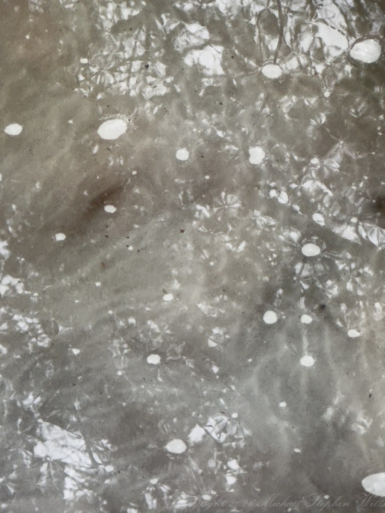
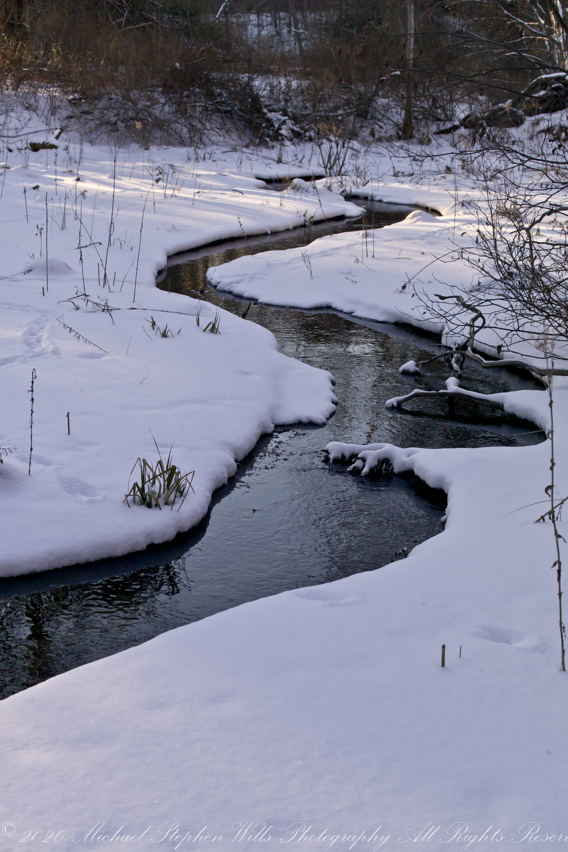
The pond holds the sky with patient fidelity. Its surface is dark, reflective, contemplative—mirroring a band of bare trees and the pale sweep of early-spring cloud. Nothing disturbs it. No wind, no bird, no ripple of urgency. It is the kind of water that asks nothing of you except attention. And in giving it, you feel the pace of your own thoughts begin to slow, as if they too must match the bog’s ancient tempo.
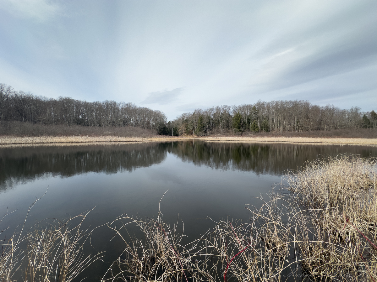
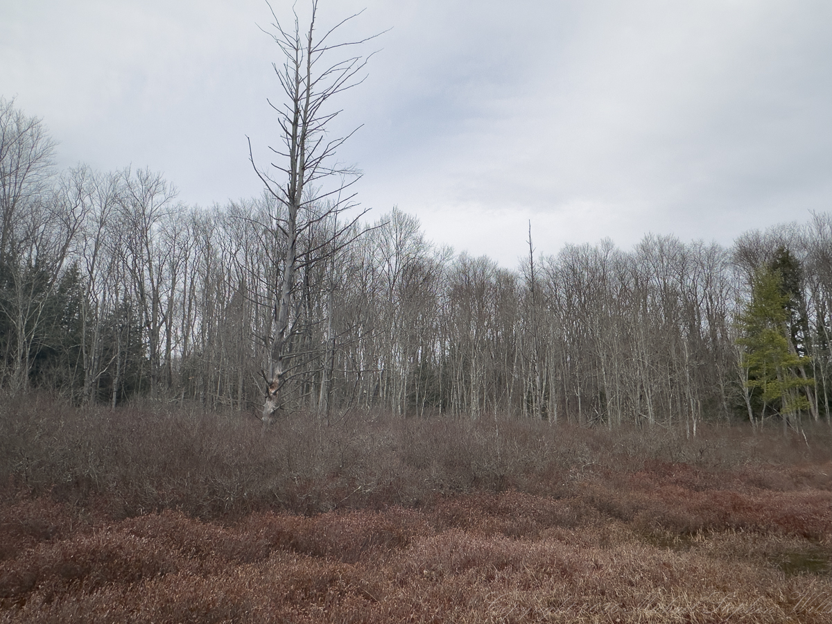
At the edge, grasses stand in muted gold, last year’s growth bowed but not broken. They frame the water as do an unfinished sentence. You can imagine how, in another month, this quiet will be interrupted by green—by the rising insistence of life. But today, the landscape is held in suspension, between endings and beginnings.
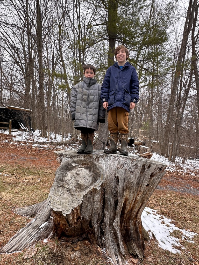
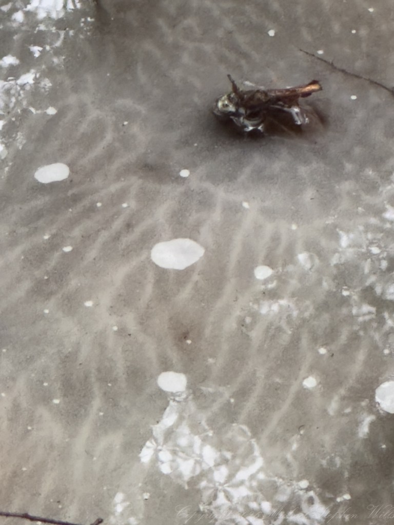
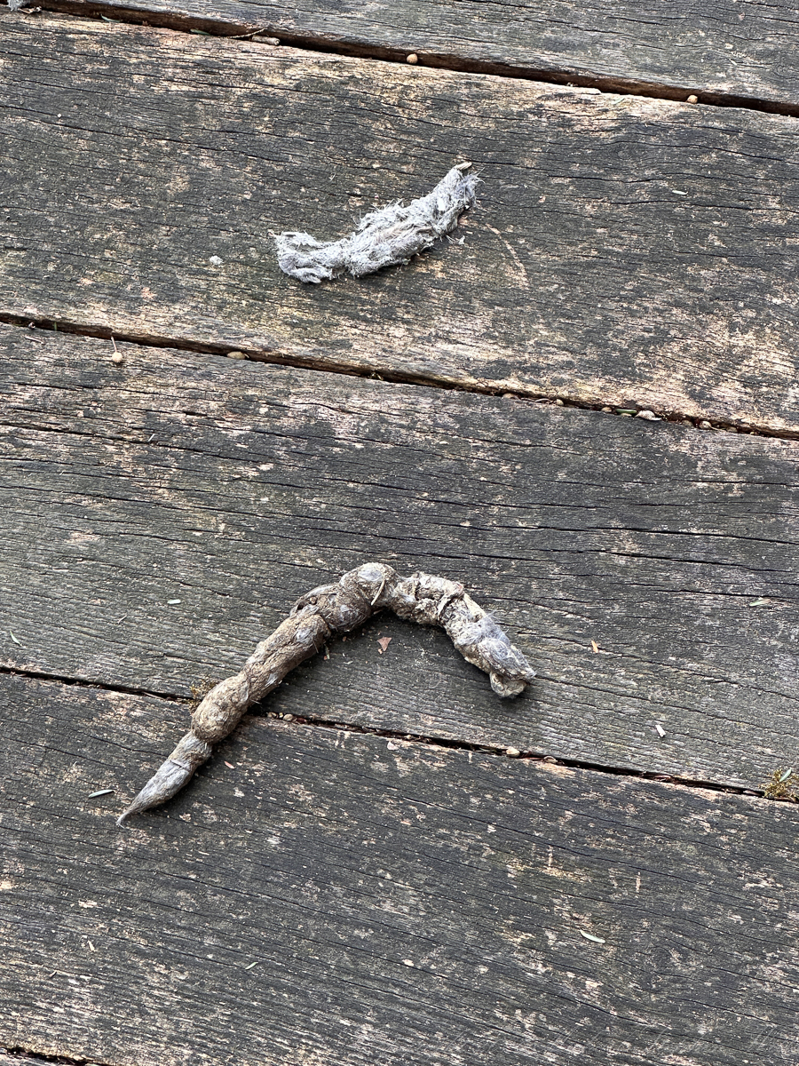
On the boardwalk, my grandsons, Sam and Rory, find what the place offers most readily: evidence. A small gray pellet of fur and bone delicately assembled and then discarded. Nearby, a twisting length of scat, marked with the unmistakable language of survival. These are not the symbols we teach in books, but they are legible all the same. The boys lean close, curious, unbothered by what adults might turn away from. To them, this is not unpleasant—it is a clue, a message left behind by an unseen life moving through the same narrow corridors of forest and marsh.
There is something honest in that exchange. The bog does not disguise itself. It offers no curated beauty, no ornamental flourish. What it gives instead is continuity—the quiet assurance that life persists in forms both delicate and stark. And the children, without pretense, receive it as it is.
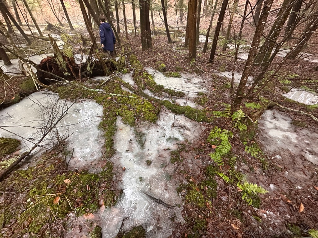
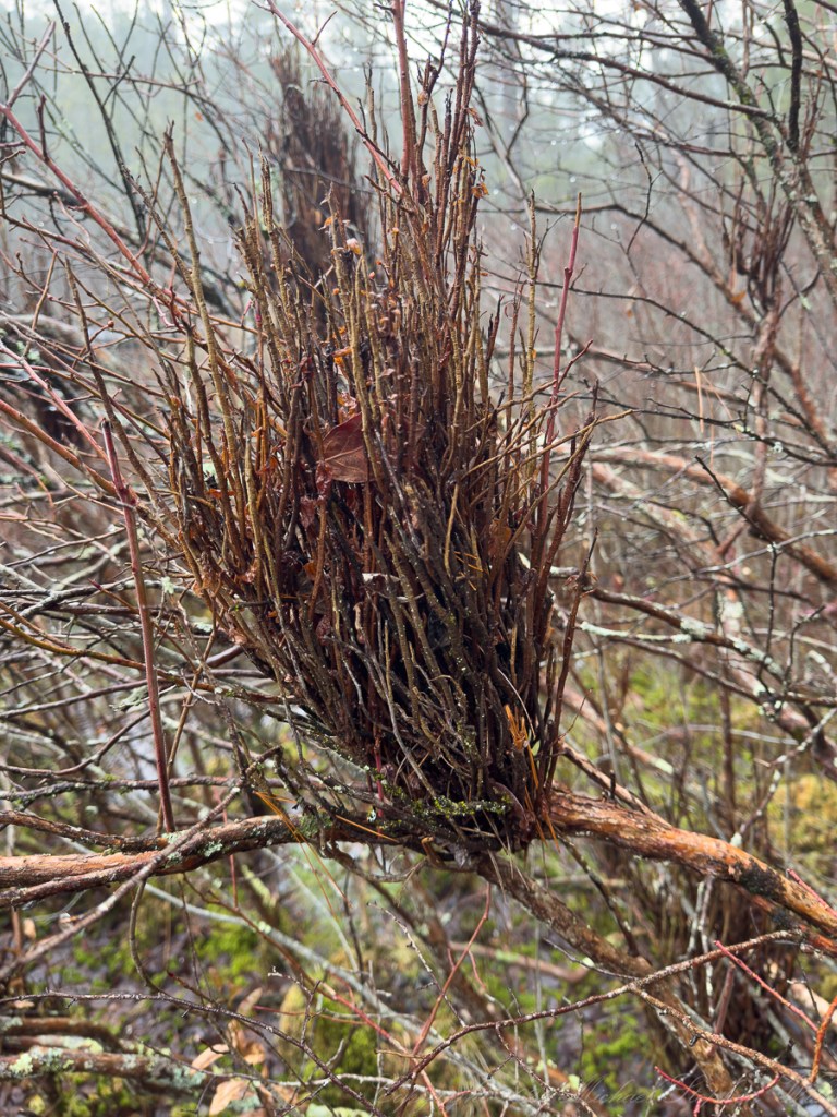
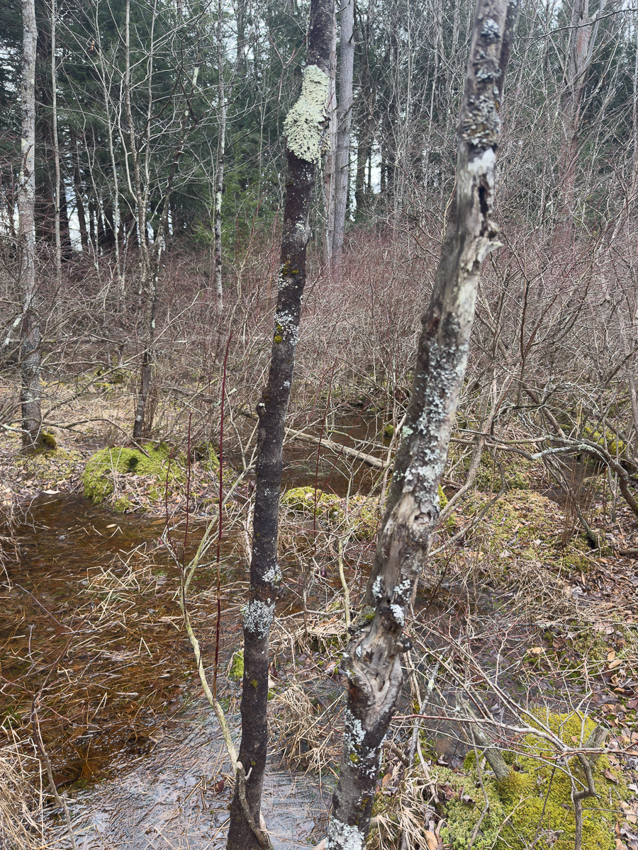
Deeper in the woods, a small structure of branches rises against the trunk of a tree, a lean-to, improvised and incomplete. Its architecture is simple, almost instinctive, a tentative answer to the question of shelter. Sam and Rory stand before it, boots sunk slightly in the soft ground, their bodies close together in that unconscious gesture of kinship. One leans into the other, not for support exactly, but for connection.
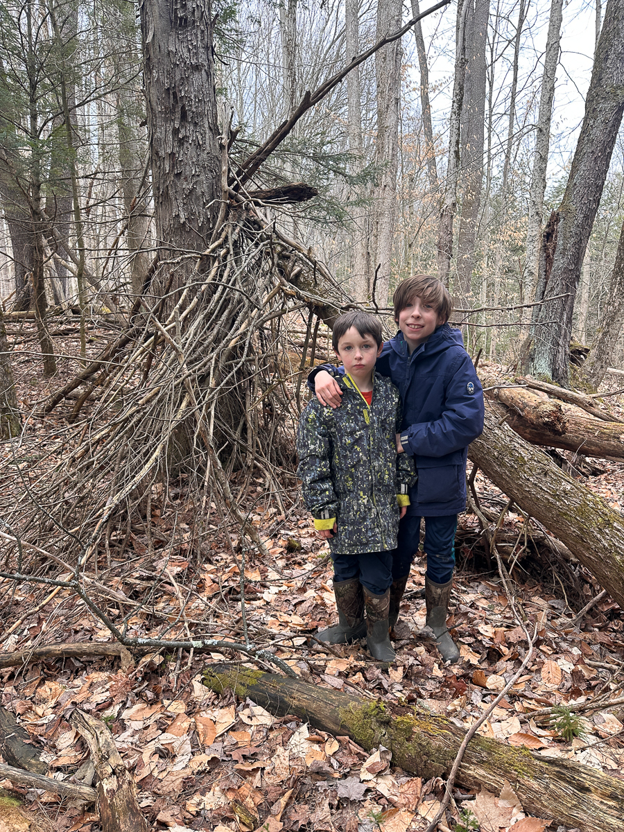
Behind them, the forest extends in gray and brown, a lattice of trunks and fallen limbs. It is not the lush abundance of summer, but something more revealing—a stripped-down anatomy of place. Here you see the bones of the landscape, the structure beneath the surface. And in that exposure, there is a different kind of beauty, one relies on form, on persistence, on time itself.
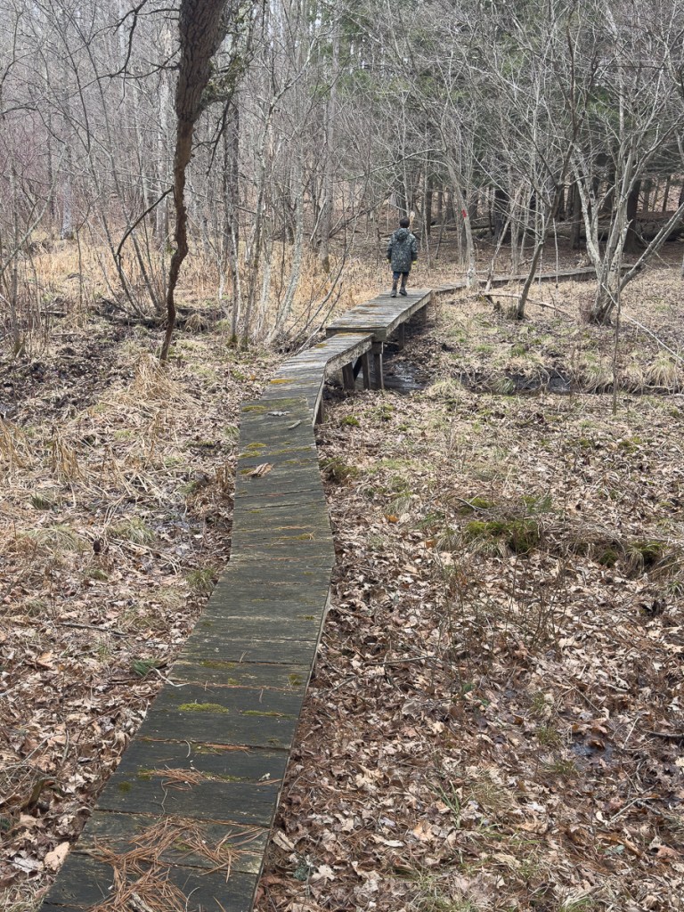
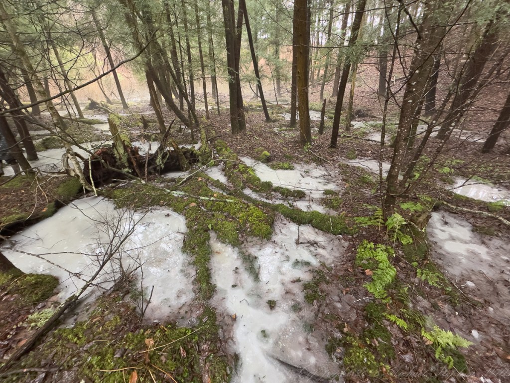
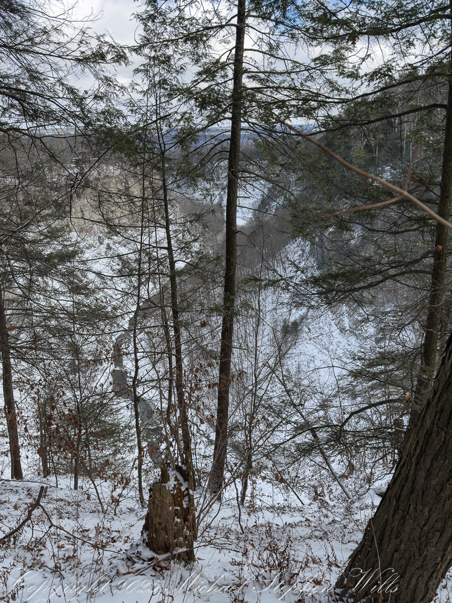
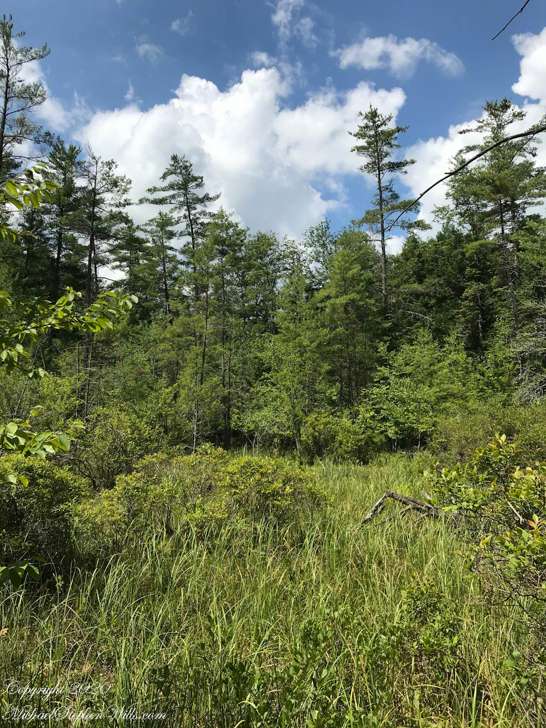
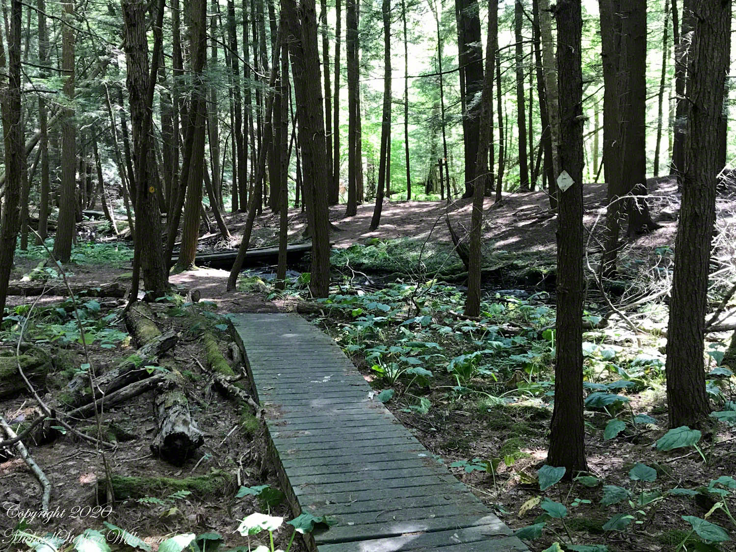
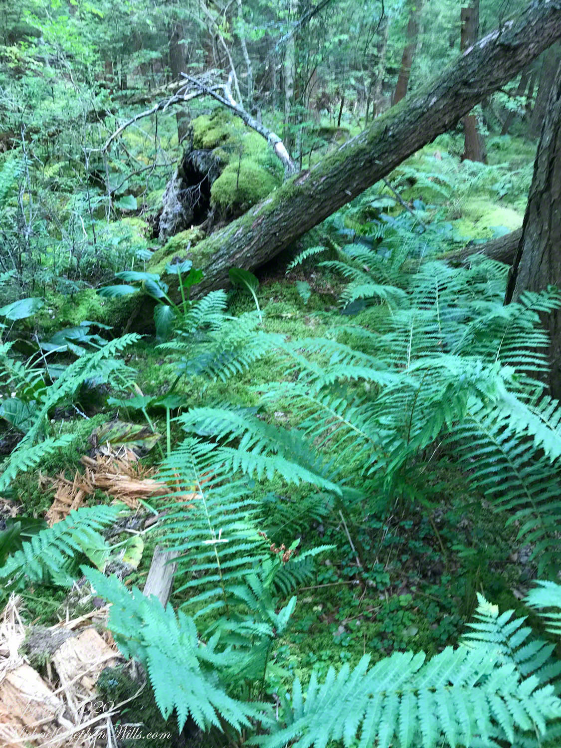
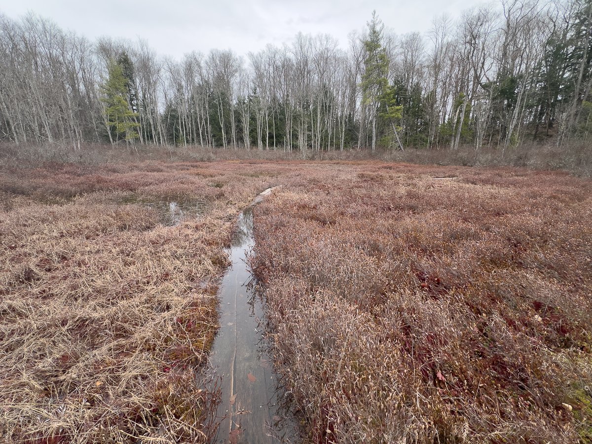
The boardwalk carries you out into the open bog, where the ground gives way to water and moss. It is a narrow path, elevated just enough to allow passage, and it bends gently, as though respecting the terrain rather than imposing upon it. Rory walks ahead, small against the expanse, following the curve without question. There is trust in that movement—the simple faith that the path will hold, that it leads somewhere worth going.
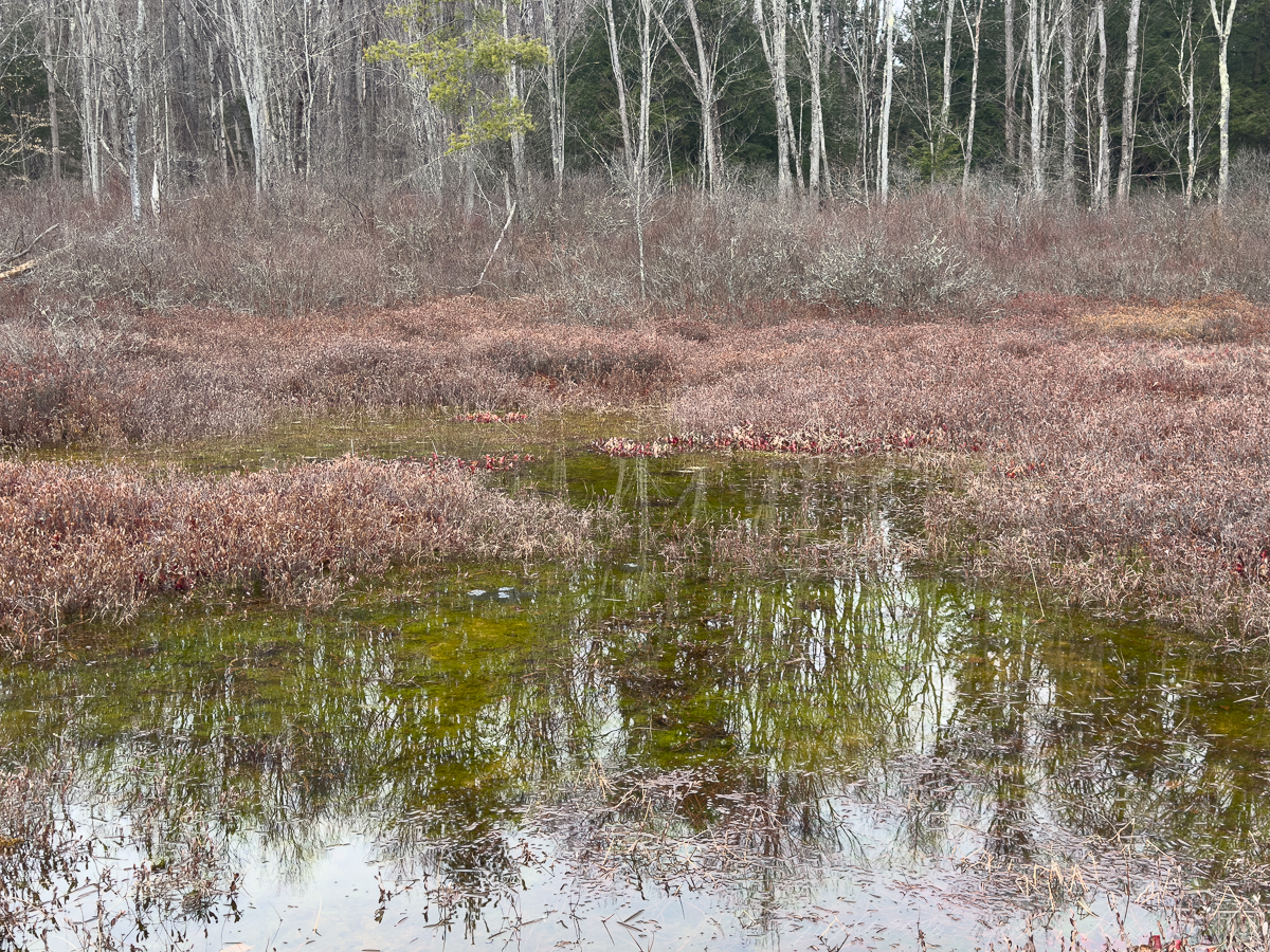
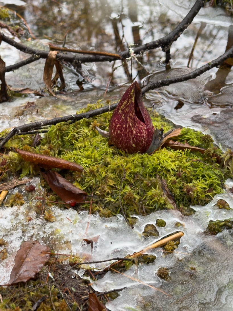
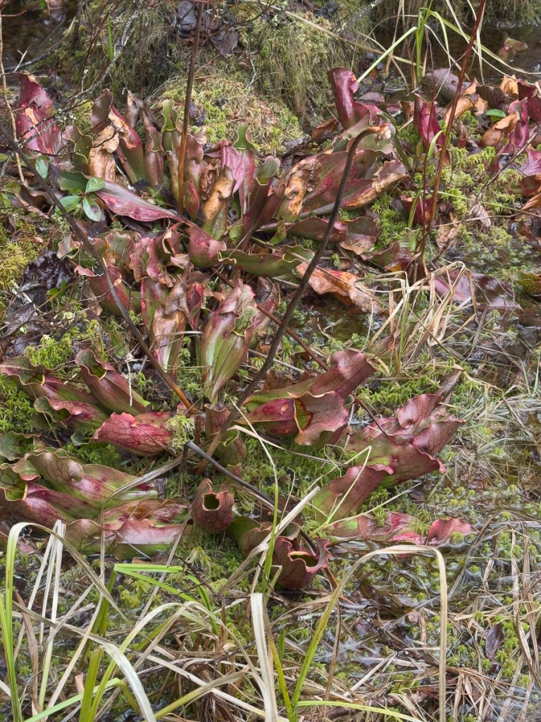
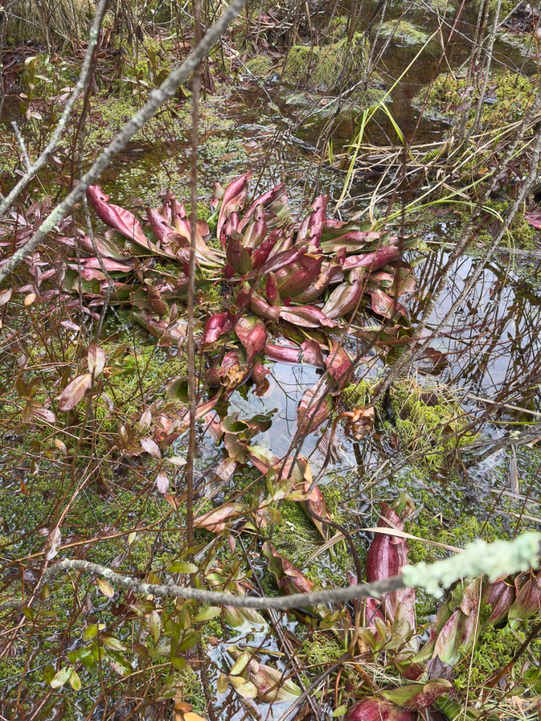
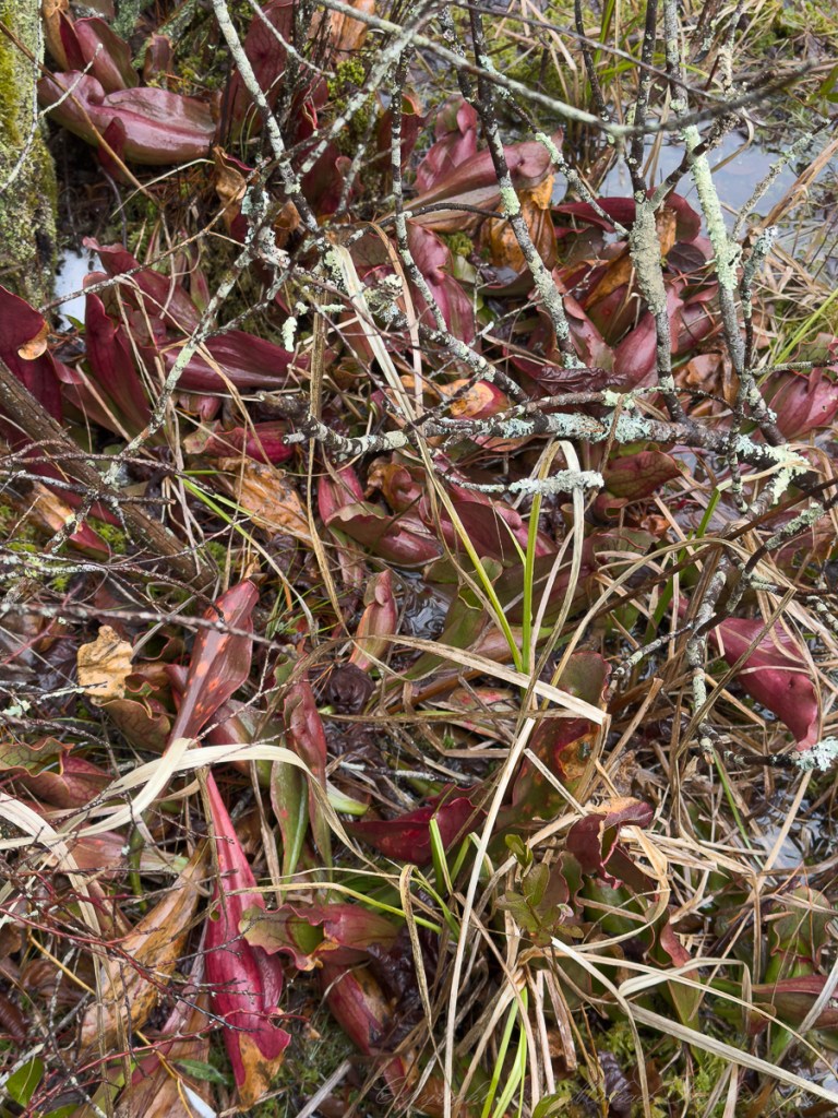
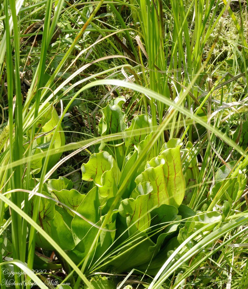
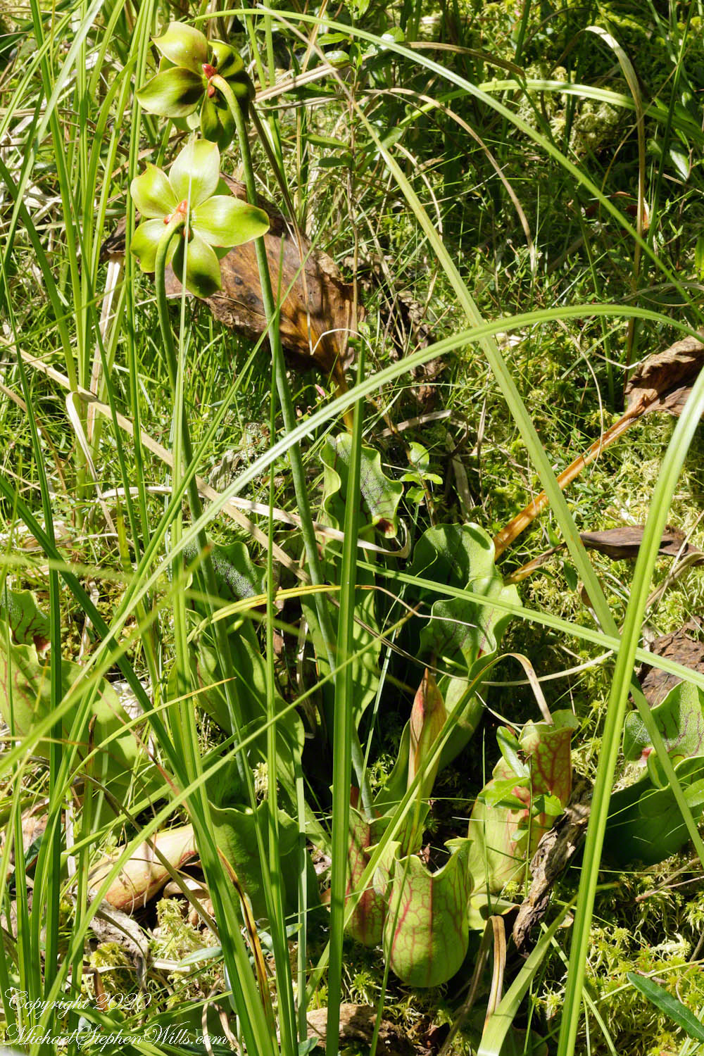
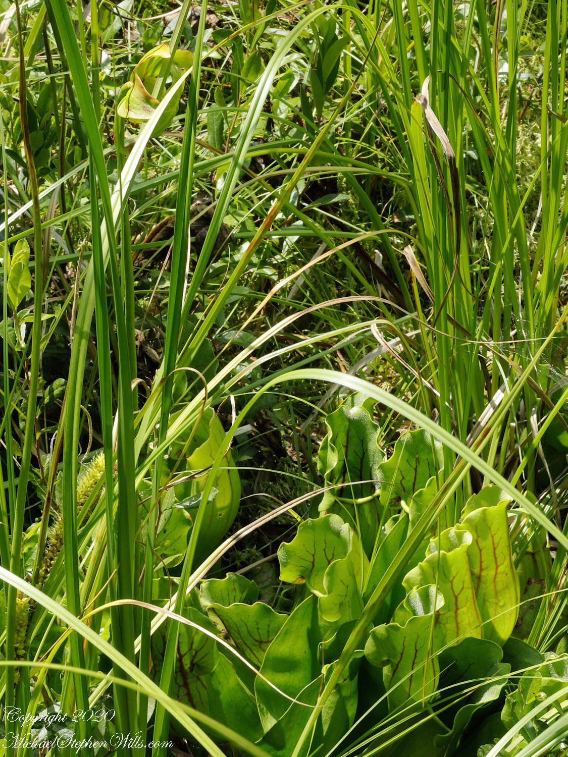
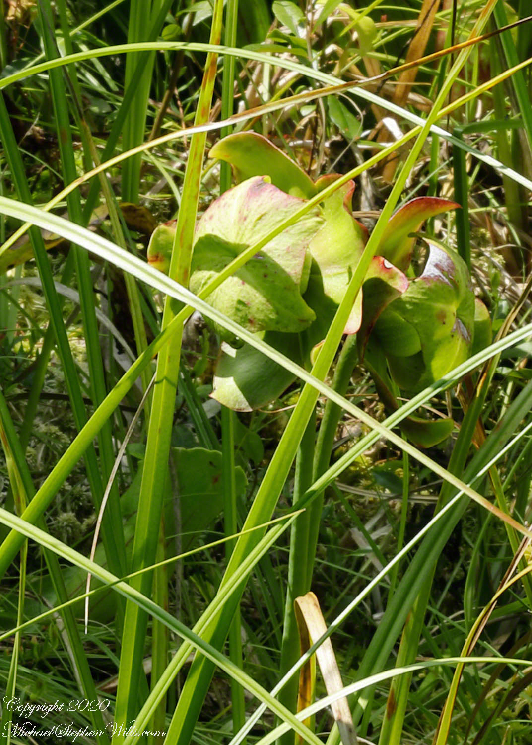
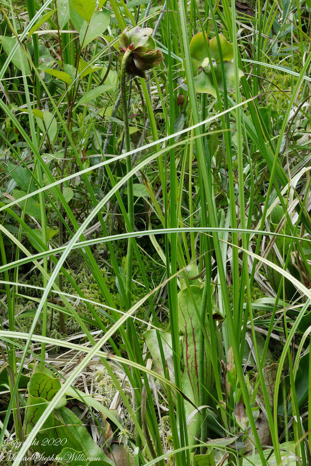
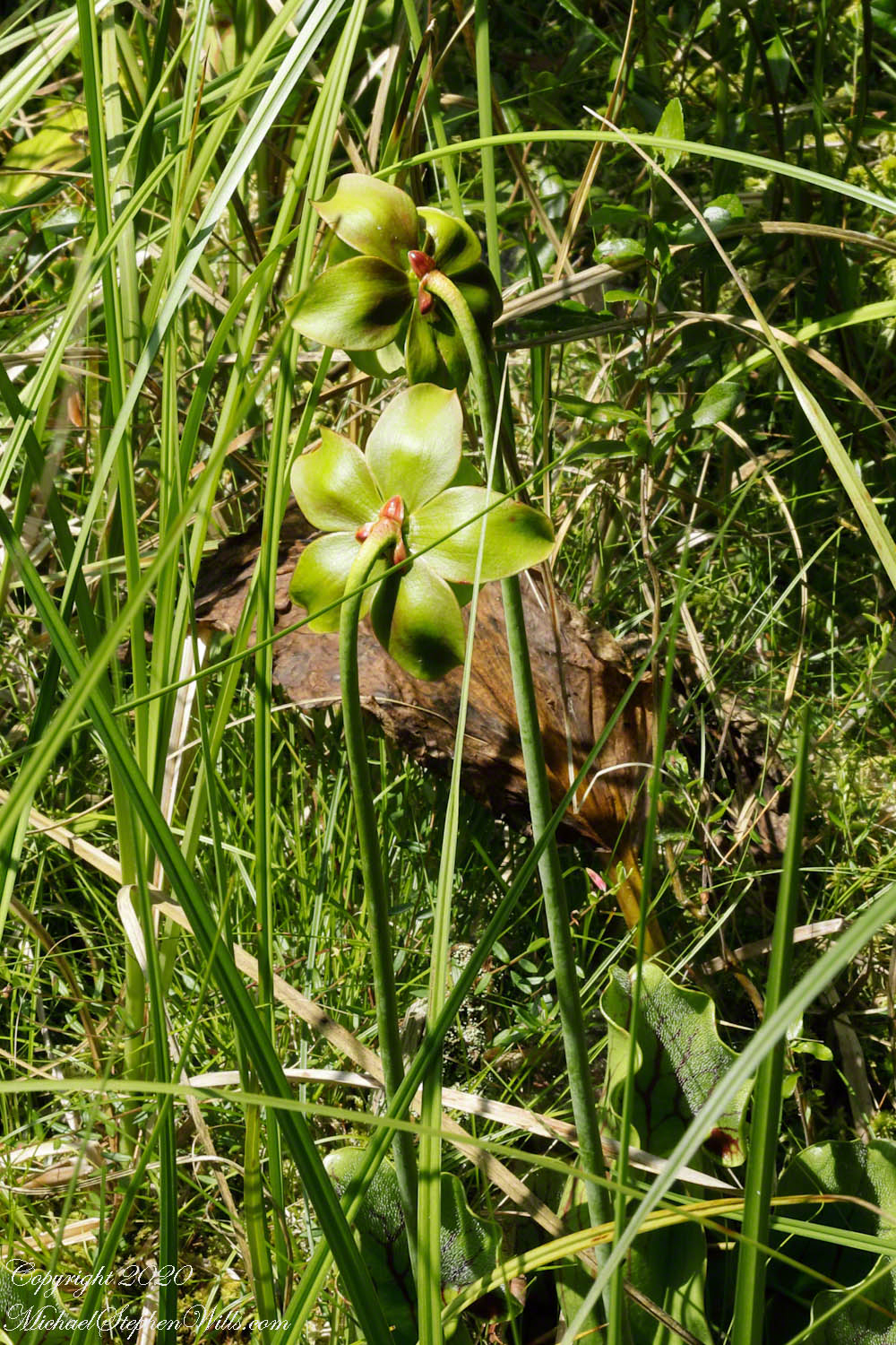
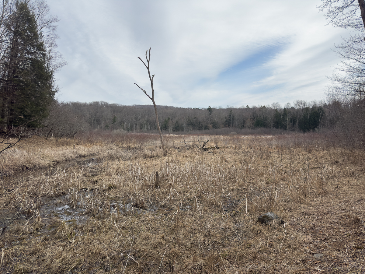
Around you, the bog stretches in subtle variation. Patches of standing water reflect a green that seems almost improbable in this season, the work of mosses and algae that thrive where others cannot. The vegetation is low, dense, textured—a mosaic rather than a meadow. And here and there, like small embers against the muted field, the pitchers rise.
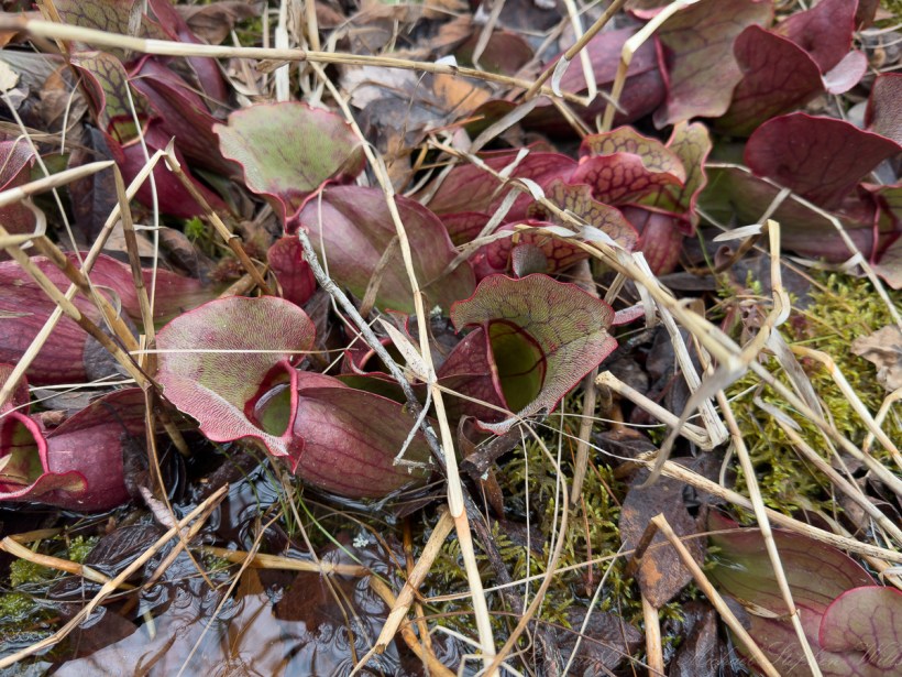
The pitcher plants are both beautiful and unsettling. Their deep red forms, veined with intricate patterns, hold themselves open to the world. They are vessels, yes, and thresholds, invitations with consequence. Insects, drawn by color or scent, enter and do not leave. It is easy to think of them as passive, but they are anything but. They are active participants in the exchange of life, taking what the poor soil cannot provide.
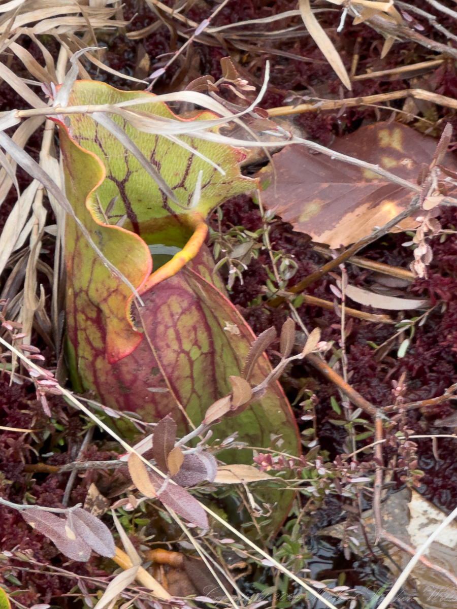
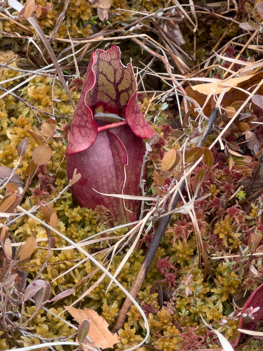
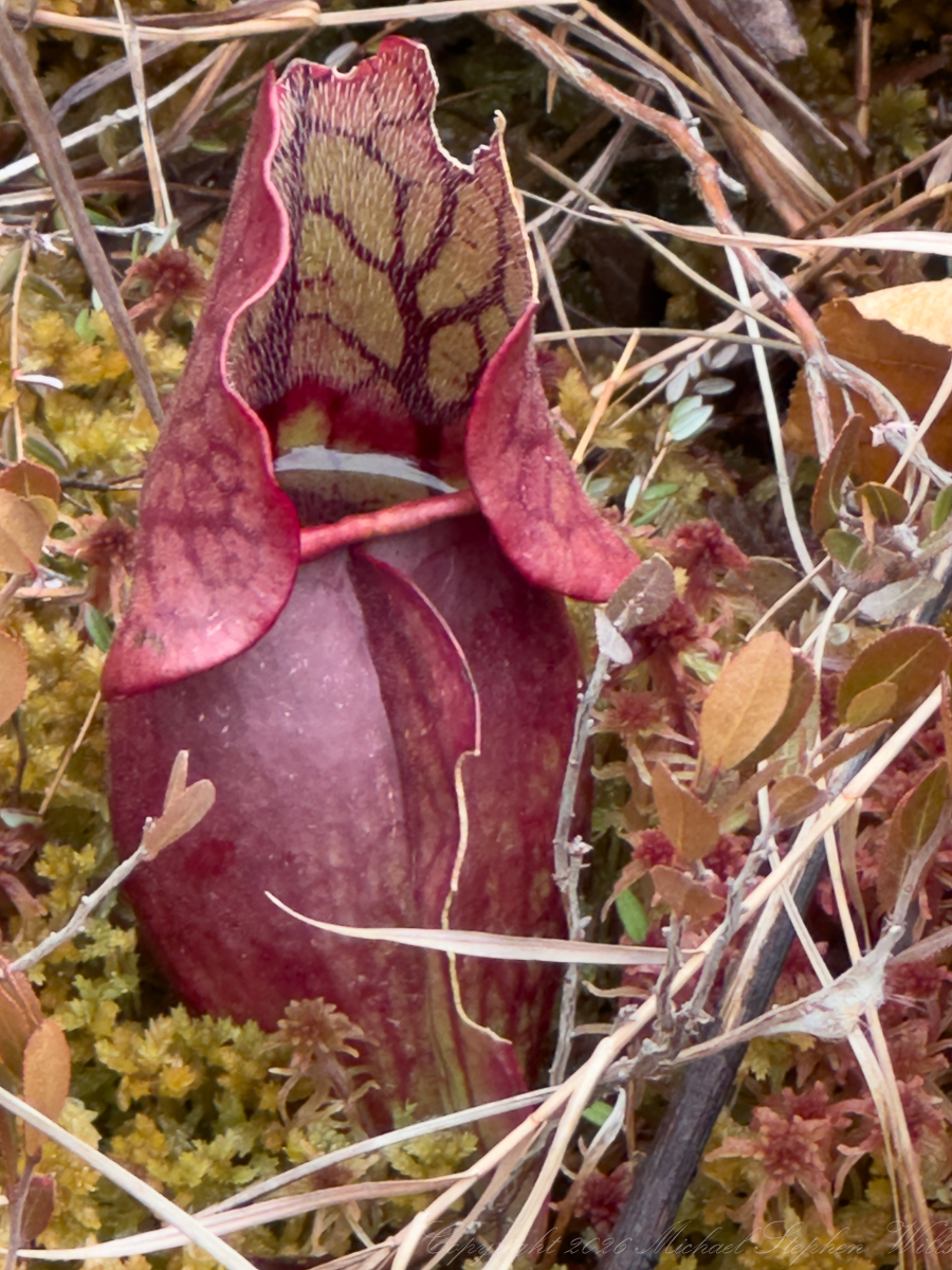
You kneel to look more closely, drawn in despite yourself. The interior of the pitcher is a map of intention—every line, every curve serving a purpose. And yet, there is an elegance to it, a precision that feels almost artistic. It is not cruelty, exactly, but necessity rendered with a kind of quiet grace.
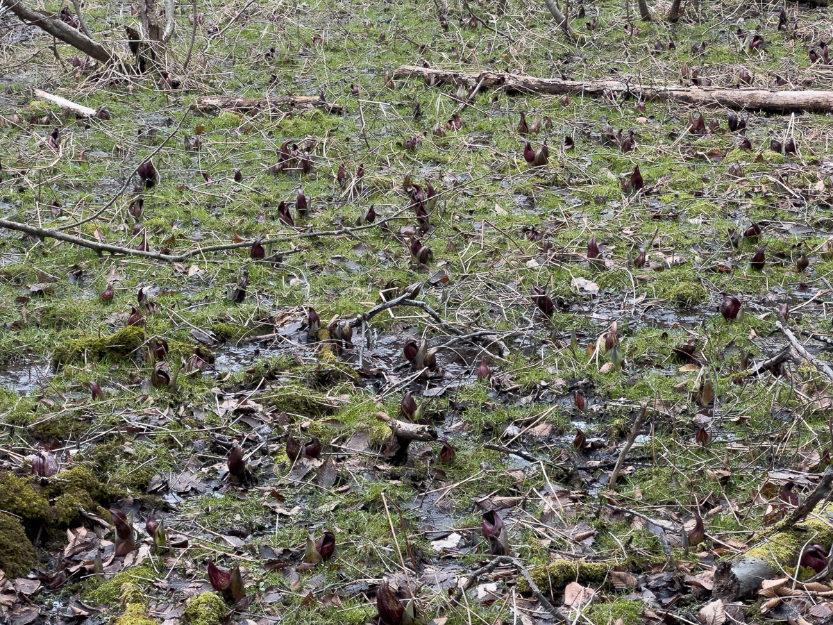
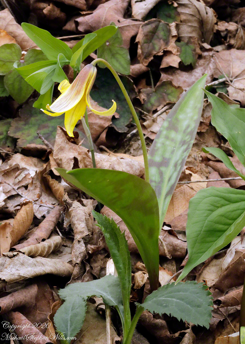
Elsewhere, the first signs of skunk cabbage emerge, their dark, curved forms pushing through saturated ground. They are early risers, indifferent to cold, generating their own heat to break through frost. They do not wait for spring; they create their own version of it. Scattered across the forest floor, they resemble a field of small, listening shapes—each one a declaration that life does not always arrive gently.
And so you move through the bog as a participant in its slow unfolding. Sam and Rory run ahead, then return, their boots muddy, their hands full of nothing in particular. They do not need to name what they have seen. The experience is enough.
As we return to the preserve edge, this sign stands—formal, declarative, assigning significance in the language of designation: Registered Natural Landmark. This place is important, rare, worthy of protection. But the words feel almost secondary after what you have just walked through.
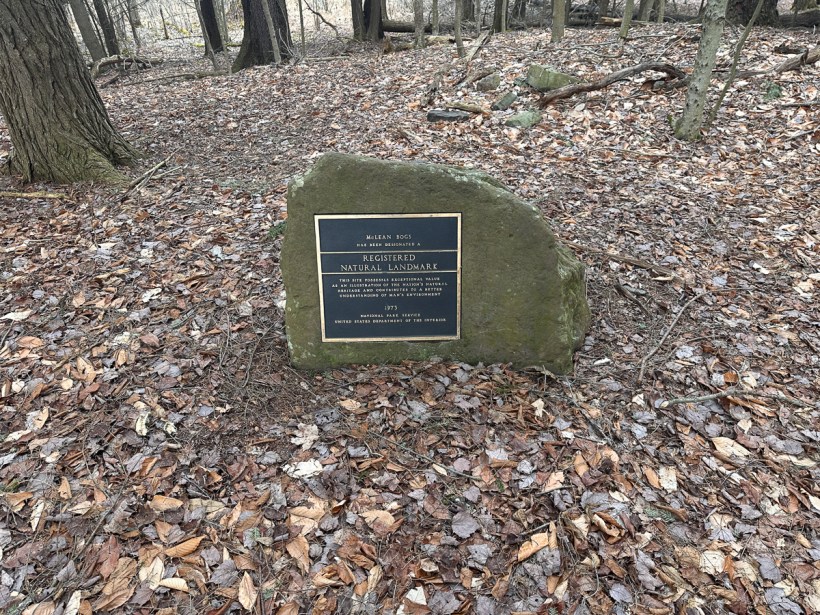
This site possesses exceptional value as an illustration of the nation’s natural heritage and contributes to a better understanding of man’s environment.
National Park Service, United States Department of the Interior 1973.
Because the true measure of McLean Bogs is not in its classification, but in its effect. It changes the rhythm of your thinking. It draws your attention downward—to the ground beneath your feet, to the subtle movements of water and growth, to the quiet negotiations of life that continues with or without witnesses.
And perhaps that is what Thoreau meant, though he said it more simply: that heaven is not only above us, distant and abstract, but also here, immediate and tangible, woven into the fabric of the earth itself.
In the bog, that idea does not feel like metaphor. It feels like observation.
Enter your email to receive notification of future postings. I will not sell or share your email address.
Copyright 2026 All Rights Reserved Michael Stephen Wills